
After spending the night in Roseburg (post), we were finally headed to the Cow Creek Trail. There wasn’t much recent information online regarding trail conditions. The trail is an additional hike in the back of William L. Sullivan’s “100 Hikes/Travel Guide Southern Oregon”. It also doesn’t help that the Forest Service websites have been undergoing an update and trail information is basically non-existent at this point. VanMarmot’s Travels has the best write up on the trail, but his visit was back in 2018. There were a couple of brief write ups from 2023 & 2024 from outings that didn’t provide details, nor did they appear to have hiked the entire 6-mile trail.
Located about an hour SE of Roseburg, the Cow Creek Trailhead is not identified on Google Maps but there is a pit toilet and room for a number of cars.


The trail begins next to the East Fork Cow Creek next to a small memorial plaque.


The trail was pretty overgrown which was fine except for the fact that the previous day’s rain was still sitting on the leaves which quickly soaked us.

The trail climbed a bit and swung around a ridge leaving the East Fork Cow Creek drainage and entering the South Fork Cow Creek drainage.


Madia along the trail.

Madrone along the trail.
The trail then descended to the first of several bridgeless crossings of the South Fork Cow Creek.


We had brought our water shoes for the fords which we changed into even though our feet were damp from the wet vegetation anyway.

Shortly after crossing the creek we entered the 2021 Wildcat Fire scar which burned almost down to the creek.


Another overgrown section of the trail.


The first tricky obstacle we had to get through.


There were some big trees along the trail.
About a mile from the trailhead we came to the second ford of the creek. At this point we’d left the fire scar behind.

The trail is straight ahead on the far side.
We came to the third ford less than a quarter mile from the second.


Wildflowers in the trail.
The trail became even more overgrown beyond the third crossing.


Columbine and blowdown along the trail.


Twinflower

The trail here was completely covered by salal.

Rhododendron above the trail.


Pond along the trail.
The trail had climbed above the creek which helped with the amount of brush along the trail, but it presented new challenges with downed trees.


Wintergreen

Anemones

This section of downed trees required crawling under a few and over others.

I had gotten ahead of Heather and at approximately the 2.75-mile mark I came to a pair of large, downed trees that had caused a small slide on the far side of them. These could not be ducked under and in order to get over them I had to go between the two by bracing my left foot on the upper tree and then hoisting myself over the large lower tree.

I paused on the far side assessing the trail ahead while realizing that Heather’s legs aren’t long enough to make it over this obstacle as I did. Going below the trees wasn’t an option due to their length and the steepness of the hillside, and going around above them would have led through the small slide which didn’t seem like a safe choice. Then I looked back and realized that getting back over these trees from the side I was on was going to be even harder than getting over had been due to the angle of the trees. While there were no other visible obstacles ahead along the small portion of trail I could see I knew I was still over 3-miles from the upper end at Railroad Gap with no idea what the conditions ahead were. I decided to call it and work on figuring out a way back over the trees.
I was barely able to get my leg high enough onto the tree to pull myself over using the bark of the tree for a grip (good thing it didn’t come off). A couple of minutes later I met up with Heather and let her know about the obstacle ahead and we headed back to the car. While it was a little disappointing to turn back we would at least be getting home earlier than we’d expected.
We skipped the water shoes on the way back since fording the creek couldn’t add any more water to our shoes/socks and just enjoyed the scenery along the trail.

Pink pyrola

Northern phlox

Snail

Another look at the first major obstacle.

Pinesap

Tiger lily

Coral root dressed as vanilla leaf.


Since we had ended the hike early we decided to stop at the Cow Creek Falls Trail which we’d passed on the drive to this trailhead. Located across form the entrance to the Devil’s Flat Campground we parked near old Devil’s Flat Guard Station.

We followed a pointer for the Cow Creek Falls Trail to complete a 0.4-mile loop passing above Cow Creek Gorge.


Devil’s Flat Guard Station

Cow Creek Falls Trail


Tiger lilies
We came to an unsigned fork near a footbridge and correctly chose to turn left.

The right-hand fork just led back up to Cow Creek Road according to the GPS.

We had to keep an eye out for poison oak along this trail.

Cow Creek Gorge
 Cow Creek Gorge


Stable from the trail.
 Prince’s pine

Stonecrop
The loop led back up the Devil’s Flat near the old stable.


From the stables we followed a road back to our car near the Guard Station.


My 5.5-mile track at Cow Creek and our hike at Cow Creek Gorge.
The Cow Creek Trail was beautiful so it’s unfortunate that we weren’t able to hike the whole thing, but we enjoyed the portion that we could. Maybe the trail will see some maintenance, but that is becoming harder and harder with budget cuts and now the current administrations staffing cuts. Combine that with the possibility of public lands being sold off and the outlook is a little bleak. Knowing that things don’t last forever is one of the reasons that we have been trying to visit as many different trails as possible while we can. The other thing we can do is let our representatives know how important it is to keep our recreational lands open to the public. Happy Trails!
Flickr: Cow Creek Trail and Gorge

 Cow Creek Bridge at the Cow Creek Trailhead.
 Garbage can at the trailhead.

 Penstemon along the trail.
 Geese on the river.
 Cliff swallows
 Moth mullein
 Hawk
Hawk Showy milkweed
 Prickly pear cactus
 Heading into a brushy area.
 Rose
Rose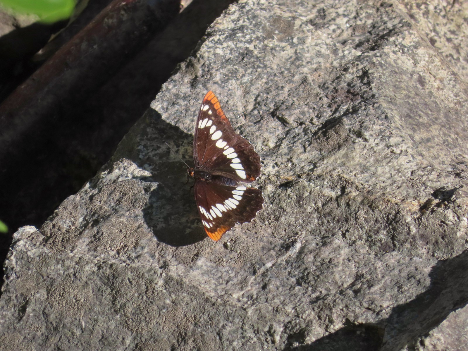 Lorquin’s admiral
 Can you spot the snake?
 The snake heading off the rocks into the brush.
 I cleared this section of trail.
 Sumac along the trail.
 The only marker that Sullivan mentioned along the trail was this pillar on the right at the 2.8-mile mark.
 Painted lady
 St. John’s wort and poison ivy.
 Skullcap
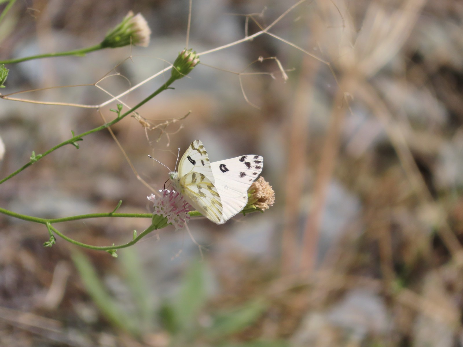 Becker’s white
 Our first view of the Snake River.
 One of several reminders of the mining town at Eureka Bar in the early 1900’s.
 The Mountain Chief Mine across the Imnaha River.
 The Snake River
 Chuckar in the brush across the Imnaha River.
 Eureka Bar
 Skipper on common bugloss.
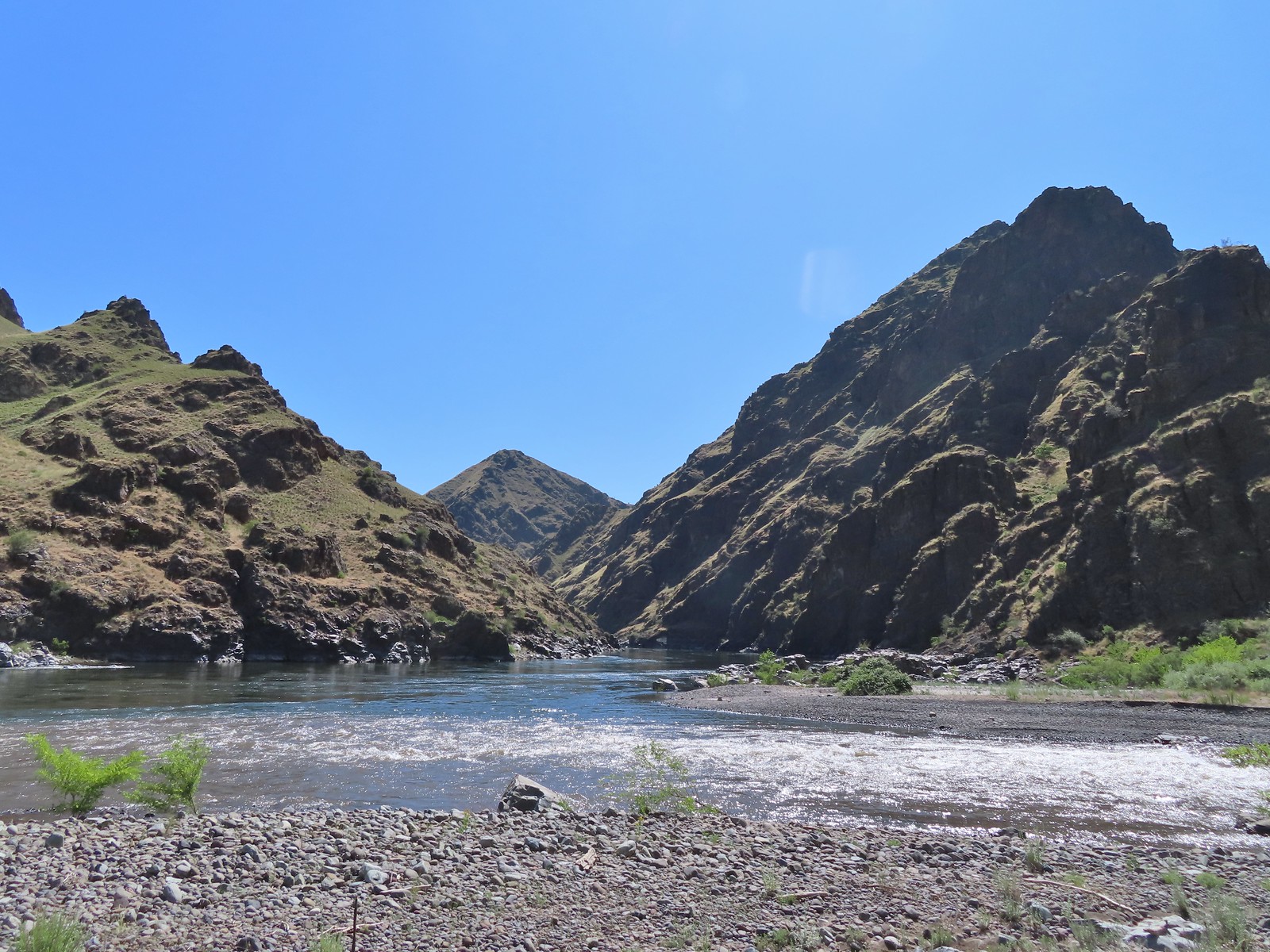 Imnaha River emptying into the Snake.
 Blanketflower
 Bindweed
 Sagebrush mariposa lily
 Another sagebrush mariposa lily
 Fleabane
 Stones where the gold processing mill was going to be.
 Long-leaved ground-cherry (Physalis longifolia)
 Orange globe-mallow
 Orange globe-mallow
 Our turnaround point.
 Another mariposa lily
 Ruins at Eureka Bar.
 Common merganser
 A prickly pear cactus near Eureka Bar.
 Green cricket on poison ivy.
 Lazuli bunting
 Mourning cloak

 We missed all of these prickly pear cacti on the first pass.
 Arriving back at Dug Bar Road.
