For our day trips we try and keep our driving time time to trailheads under 3 hours (preferably two and a half or less). The one exception to that is Mount Adams which sits right around that 3 hour mark from Salem. Due to the distance we don’t get there as much as we’d like but we’d put it on this years schedule. We’ve been turning more to Matt Reeder’s guidebooks and hike #16 his “Off the Beaten Trail (2nd edition) was the hike that we’d originally planned on. While doing some research on the Riley Camp Trail I learned of a use trail not far from the that trail’s junction with the Pacific Crest Trail that led to Crystal Lake so we decided to extend his suggested hike a bit.
A very favorable forecast, sunny skies with a high in the low 50s, provided a green light for our plans and we made the long drive to the Riley Camp Trailhead. The Riley Camp Trail (Trail 64) on the opposite side of FR 23.
A short distance up the trail we stopped to fill out a day use permit (free) and review the wilderness map on the signboard.
Trail 64 led gradually uphill through a nice forest.
A little over one and a quarter mile from the trailhead we came to a signed junction with the Riley South Trail (Trail 64A).
We stayed left on the Riley Camp Trail which almost immediately entered the Mount Adams Wilderness.
We weren’t aware that the Forest Service was employing wilderness greeters.
May I see your self-issued permit?
We had started to notice a fair number of mosquitos near the junction and were forced to turn to the Deet. We’d been pretty luck so far this year at avoiding the little blood suckers but not on this day. While they weren’t anywhere near as bad as we’ve had them before they were persistent between the Riley South junction and the end of the Riley Camp Trail at the PCT. With the bugs after us we kept a decent pace as the trail continued it’s gradual climb through the forest. The trail was in pretty good shape with just a few downed trees to step over/under.
First look at Mt. Adams through the trees.
Near the 2.7 mile mark the trail briefly entered a 2015 fire scar.
Luna Lake
Aster
We left the fire scar behind as the trail turned north passing by a series of ponds/lakes (mosquito breeding grounds).
More Mt. Adams.
Paintbrush and lupine
Beyond the mosquito birthing centers the trail began to curve back to the east and entered Riley Creek Meadows.
Sub-alpine mariposa lily
Riley Creek along the trail.
Just over 4.5 miles from the trailhead we crossed Riley Creek. Riley Creek at the crossing.
Beyond the crossing the trail made a final 0.3 mile climb to the PCT. A trail sign up ahead at the junction.
We turned right on the PCT which brought us back to Riley Creek after 0.2 miles. PCT marker on the tree.
Riley Creek below the PCT crossing.
We detoured briefly upstream to revisit our dinner spot during an overnight trip in 2017 (post).
White mountain heather
A nice paintbrush
After the short detour we continued south on the PCT to Burnt Rock (just under half a mile from Riley Creek). Mt. Adams behind us as we headed south.
Sheep Lake
Mt. Rainier behind a line of clouds.
Burnt Rock behind the snags left over from the 2012 Cascade Creek Fire.
Alpine false dandelion
Grouse
Near Burnt Rock we looked for a user trail heading toward the mountain and took a left onto it once we spotted it.
It was another half mile to Crystal Lake. The use trail was fairly easy to follow. It did steepen just before the lake.
Hummingbird visiting paint.
Mountain heather
On the final pitch.
Mt. Rainier and Goat Rocks
Phlox
Almost there.
Not Crystal Lake, just a pretty little tarn nearby.
Fortunately mosquitos weren’t an issue up here so we were able to relax and spend a good deal of time exploring around the lake and a little beyond. Mt. Rainier
Just a bit of snow left around 6300′.
The little tarn we’d passed.
While not big Crystal Lake was deep.
View down from the rocky ridge on the south side of the lake.
The rocky ridge along the south side of the lake.
We continued a tenth of a mile beyond the lake for a dramatic view of Mt. Adams.
We could hear a waterfall below on Riley Creek.
Zoomed in on the waterfall below.
Crystal Lake from above.
Mt. Rainier with Goat Rocks to the right.
Mt. Rainier
Some of Goat Rocks.
Golden-mantled grounds squirrel
After a good break we headed back down past the lake and back to the PCT.
Getting ready to drop down.
Clark’s nutcrackers
Butterfly on mountain heather.
Saxifrage
Violet
Alpine speedwell
A checkerspot
A crescent
Mountain bluebird
Northern flicker
I’m guessing a warbler of some sort. We saw quite a few of these little yellow birds but had a hard time actually getting a photo.
We turned right on the PCT and followed it back to the Riley Camp Trail and then followed that trail back to our car. Mt. Adams from the PCT.
Adams Glacier
Riley Creek at the PCT crossing.
Wildflowers along the PCT.
Bee on valerian
Butterfly on valerian
Another butterfly on valerian
Looking back at Mt. Adams from the Riley Camp Trail.
Passing through Riley Creek Meadows.
Gentian
We only saw a couple of beargrass blooms.
Pollinators on fleabane.
False hellebore
Luna Lake and Mt. Adams from the trail.
The mosquitos remained a nuisance as we made our way back to the car so we kept a brisk pace. When we arrived back at the car there was a family preparing to set off for an overnight stay. They had an extra half of a pizza due to getting a free pie after the pizzeria initially made the wrong one. They offered us the extra since they couldn’t take it with them and we gladly accepted. Lunch was solved and dinner wound up also being solved when my parents took us and our Son (who was visiting for our Nephew Tyler’s 4th birthday party) out to Gilgamesh Brewing’s The Woods. It was a great ending to the day.
Our hike to Crystal Lake came in at 12.6 miles with approximately 2900′ in cumulative elevation gain. While I typically don’t share tracks for off trail hikes this one is listed on several prominent hiking websites so am including it below. If you do visit please be respectful, tread lightly, and Leave No Trace. Happy Trails!
For the second set of hikes during our weekend near Glide, OR we had a pair of short waterfall hikes planned which we hoped would be less eventful than our hikes had been the day before. We started our morning by heading east on Highway 138 to the recently reopened (following the 2020 Archie Creek Fire) Fall Creek Falls Trailhead. This is one of three stops that make up Sullivan’s featured hike #2, Fall Creek Falls edition 4.2 “100 Hikes/Travel Guide Southern Oregon & Northern California”. We had visited Susan Creek Falls in June this year before this trail reopened (post). The third hike to Fern Falls is still inaccessible due to still being under a closure order from the fire.
From the small parking area the trail immediately crosses the creek on a footbridge.
The trail passed between some interesting rock formation in the first third of a mile.
Scarlet monkeyflower
The terrain opened up a bit as we neared the waterfall.
The trail first passes near the splash pool of the lower tier before switchbacking uphill to a viewpoint of the upper tier.
Heading for the viewpoint.
The upper tier from the viewpoint.
Our 6am start allowed us to have the trail and falls to ourselves which was nice because it is a popular trail. (There was a couple sleeping on the pavement in the parking lot surrounded by empty Mike’s Hard Lemonade bottles. To their credit they did pack everything into their car when they left.)
After returning to the car we drove to the Wolf Creek Falls Trailhead along Little River Road. The 1.2 mile trail here is part of featured hike #3 – Little River Waterfalls in Sullivan’s book and is overseen by the BLM and begins with a crossing of the Little River on an arched footbridge.
The forest along the trail combined with Wolf Creek made this our favorite scenery of the weekend. It was a perfect mix of forest, creek, and rock formations.
Wolf Creek Falls solidified this as our favorite hike of the weekend. The trail first passes above a lower fall then leads to a viewpoint above that cascade and of the larger 70′ fall at trails end. First good view of the lower fall from the trail. The upper fall was visible but somewhat blocked by trees.
We really liked how the water curved and narrowed as it cascaded down.
The pool appeared to be extremely deep.
After a nice break admiring the upper fall we headed back and I detoured downhill on a use trail to get a closer look at the lower falls.
Even though it was still early (we were at the falls a little after 8am) we were surprised no one had been on the trail. There hadn’t been any cars at the trailhead either time we’d driven by the day before either which we found a bit odd considering how nice the trail and waterfall were. We did finally encounter a couple of other hikers as we made our way back to the car. This had been a perfect hike to end our trip on. The two hikes combined for just 4.5 miles and 630′ of elevation gain, which was about all my feet could take, and we were able to make it home before noon giving us plenty of time to unpack and get ready for the work week ahead. Happy Trails!
We’ve unfortunately entered fire season which means we are keeping a close eye on current and new fires as well as any associated closures. At the time of writing the Cedar Creek Fire has closed the Waldo Lake Wilderness, part of the Three Sisters Wilderness as well as some of the surrounding forest and other fires have closed part of the Diamond Peak Wilderness. We had reservations at the Ideyld Lodge for August 6th and luckily our planned hikes for the weekend were not impacted by any of the current wildfires so we left Salem a little before 5am and headed south on I-5.
Like our earlier trips south this year we were continuing to work on checking off featured hikes from William L. Sullivan’s “100 Hikes/Travel Guide Southern Oregon & Northern California” guidebook (post). This time we planned on completing hike #3 – Little River Waterfalls (edition 4.2) as well as another waterfall from hike #2 – Fall Creek Falls. Due to those hikes combining for just 8 miles of hiking we had also planned to add Hemlock Lake (hike #103) onto Saturday’s outing. Sullivan’s Little River Waterfalls hike includes three stops to visit four waterfalls: Wolf Creek, Grotto, Yasko, and Hemlock Falls. The last two both starting from the Lake in the Woods Campground. The Hemlock Creek Trail also begins at this campground and climbs up to the Yellow Jacket Loop Trail which is the trail that Sullivan has you take for his Hemlock Lake hike. We planned on parking at the campground and taking all three of the trails and then time permitting stopping at Grotto Falls on our way to the lodge.
We arrived at the campground and couldn’t tell exactly where the day use area was (we missed the small sign) and wound up driving around the lake through the campground. Instead of trying to figure out where the day use area was (It was immediately to the right as you start counter-clockwise around the loop.) we exited the campground and turned right (east) on FR 27 for a tenth of a mile to FR 421 where we turned right for another tenth of a mile to a pull out where the Hemlock Creek Trail crossed the road. Hemlock Creek Trail heading uphill toward Hemlock Lake.
Trail sign for the Hemlock Creek Trail heading down to Lake in the Woods from FR 421.
We opted to do the two short trails to the waterfalls first hoping for less crowds (spoiler alert we saw no one) and hiked a tenth of a mile down to the campground round where we turned right. Hemlock Creek Trail at Lake in the Woods Campground.
Lake in the Woods (a 4 acre man made lake).
We exited the campground and crossed FR 27 to a hiker symbol marking the start of the Yasko Falls Trail.
The trail led gradually down hill for three quarters of a mile to Yasko Falls.
Ghost plant
We had heard this particular waterfall was one that was best viewed when the water flow wasn’t too strong which is one reason that we’d chosen August for a waterfall trip. The other reason was mosquitos are reportedly bad here and fierce at Hemlock Lake earlier in the year, in particular July. The 50′ waterfall did not disappoint and we spent some time admiring the cascade before returning to the campground.
A rare photo of me for scale.
At the campground we turned right following the path we’d driven earlier and now spotting the day use sign. We mistook this for another campsite having not noticed the small sign on the tree.
A tenth of a mile from the day use area we left the road and turned onto the Hemlock Falls Trail.
This half mile trail descended 300′ to Hemlock Falls.
We again returned to the campground and completed the loop around Lake in the Woods then took the Hemlock Creek Trail back up to FR 421 and continued on uphill. We both noticed that the sign said Hemlock Lake was 4 miles away. Sullivan’s map showed that it was 3 miles from Lake in the Woods to the Yellow Jacket Loop which raised the question was the hike going to be 2 miles longer than we’d expected or did the 4 miles include some of the Yellow Jacket Loop? Based on the mileage in Sullivan’s book I had come up with 16.6 miles so an extra two miles would be pushing us close to 19 (we always find reasons to wander).
Sleepy bee
Same mileage on the sign on the other side of FR 421. The fact that Road 2759 showed 2 miles when Sullivan had 1.5 on his map was a pretty good indicator that we were in for more than 16.6 miles.
The Hemlock Creek Trail climbed at a reasonable grade through a nice forest and passed several waterfalls. While the falls were partly visible from the trail, use trails led steeply downhill to better views. Gluttons for punishment that we are we took advantage of these trails to visit the falls.
Tributary Falls (unofficial name) was just below a footbridge approximately a half mile from FR 421.
Middle Hemlock Falls was just two tenths of a mile further along.
Small cascade below Middle Hemlock Falls.
Leopard lily
Another drop with no way to get a view of the fall from above.
Typical use trail.
A small slide that was fully visible from the trail.
Clover Falls was a quarter mile above Middle Hemlock Falls.
Clover Falls
More leopard lilies
Moth hanging out around the falls.
Use trail to Clover Falls.
Heather coming up from the falls through a huckleberry bush that I may have been using for snacks.
All of these falls were before the trail reached Road 2759. Beyond Clover Falls the hillside steepened and the trail veered away from the creek as it climbed via a series of switchbacks to the road crossing. Skunk cabbage leaves in a wet area.
Curious stellar’s jay.
FR 2759.
The trail leveled out quite a bit on the other side of the road crossing Hemlock Creek a couple of times on footbridges. Again with the 2 miles.
A much more reserved Hemlock Creek.
More snacks
Frog
We started to encounter some open meadows as we neared the junction with the Yellow Jacket Loop Trail.
Coneflower and paintbrush
Fleabane
The wildflowers were already on the way out but on the positive side we didn’t have much trouble at all with mosquitos.
At the junction, which was only marked by a post we turned right. Hemlock Lake was to the left but Sullivan’s hike description called for doing the loop counter-clockwise. He typically has a reason for the direction he suggests so we’ve learned to stick with his recommendations.
The trail passed through a couple of meadows where pollinators were busy visiting the remaining flowers.
Busy bee
A lone columbine
Dragonfly
Mountain owl’s clover
Damselfly
Bee on rainiera
Butterfly on hyssop
Oregon checkermallow
Coneflower
Fleabane and paintbrush
Brief forested section.
Hedgenettle
Northern phlox
Flat Rock beyond a meadow.
Large boykina
From the junction it was a mile to the Flat Rock Trail where a three quarter mile detour led up to a viewpoint atop Flat Rock. Heather had been feeling a little “off” since a little before reaching the Yellow Jacket Loop so as we were climbing up from the meadows she decided to skip the out-and-back and instead would continue on the loop and I could catch up to her after visiting the viewpoint. I went on ahead and turned right at the signed junction.
After dropping a bit to a saddle the Flat Rock Trail leveled off which meant that the 500 plus foot climb that was needed to reach the top was all going to be packed into the last quarter mile or so. There was an opening at the saddle where Diamond Peak (post) was visible through a bit of haze.
The all too familiar Summer “smoke” filter on the mountains.
The trail was a bit overgrown in places.
Starting to climb.
The climb was indeed fairly steep and it was probably a good thing Heather decided to skip it, although that decision had other repercussions. While the view from Flat Rock was pretty nice it wasn’t as nice as the view above nearby Twin Lakes had been when we visited in June (post). Heading out to the viewpoint.
Hemlock Lake from Flat Rock with Mt. Bailey (post) and the spire of Mt. Thielsen (post) in the distance.
Quartz Mountain in the foreground with Hillman Peak and The Watchman (Crater Lake Rim) in the distance.
Diamond Peak in the distance to the right and the smoke plume from the Cedar Creek Fire center-right.
Smoke from the Cedar Creek Fire 😦
I returned to the Yellow Jacket Loop Trail and turned right and started to play catch-up with Heather. Beyond the Flat Rock Trail the loop passed through more meadows and some forest that had been impacted by the 2021 Smith Fire.
Parnassian on hyssop
Grand collomia
Swallowtail on hyssop.
Just over three quarters of a mile from the Flat Rock Trail I came to a sign for the Cavitt Mountain Tie Trail which didn’t show up on the GPS map or on Sullivan’s map.
Heather had placed an arrow using sticks to show that she had turned left here sticking to the Yellow Jacket Loop and I followed. A tenth of a mile later the trail came to a viewpoint at an old roadbed. Mt. Bailey and Quartz Mountain.
Quartz Mountain
If Sullivan’s map hadn’t indicated that the trail followed a roadbed for a short distance I might not have known that this had once been a road.
Union Peak. To the left is Highrock Mountain and to the right of Highrock Mountain are the Rabbit Ears (post), a rock outcrop sticking up over a ridge.
The end of the old road section.
The only blooming lupine I saw all day.
I still hadn’t caught up with Heather when I came to a lone post which caused me to stop and ponder our decision to split up. I had realized we’d made the mistake of not setting a meet point where she would stop and wait for me, or I her if I somehow wound up in front of her. At this unsigned post the trail appeared to go straight but the maps showed the trail veering to the left. I looked for an arrow or even footprints to indicate which way Heather had gone. She also carries a GPS and had Sullivan’s map and hike description so I thought there was a good chance she went the right way, but it was a confusing enough junction that going straight wasn’t out of the question. The actual trail to the left was very overgrown here and hard to pick out at first glance.
The map showed FR 625 in the direction of the right hand fork and it also showed the trail nearly touching that road two time further along the ridge it was on so I decided that even if she had taken a wrong turn here she would hop back onto the trail at one of those other two points so I went left and kept my eyes out for her.
The first convergence with FR 625.
Signpost at the second meeting.
The further I went the more concerned I became because I knew she hadn’t been feeling great when we split up and I had been moving at a crisp pace and had expected to catch up to her by now. I talked myself into think she might have started feeling better and with the trail being more level and starting to go downhill she may have been moving faster than I’d expected and I wasn’t sure quite how long my detour up to Flat Rock had taken. I continued on passing a sign for the Snowbird Shelter Trail and coming to Dead Cow Lake where I optimistically thought she might be waiting. There were a lot of different types of signs along the loop.
Dead Cow Lake turned out to be a bust, not only was Heather not there but the lake was more of a slime filled pool. At least from what could be seen from the trail, there wasn’t any visible way to the lake itself.
Monkshood
It was a little under a mile from Dead Cow Lake to the next trail junction where I thought I might find her. This end of the loop was steeper than the other which made doing the loop counter-clockwise the better option. I was moving rather quickly now and not stopping for much but I did pause for these sugar sticks.
When I didn’t find Heather at the next junction another possible scenario popped into my head. The right fork led 0.8 mile to a picnic area near the Hemlock Lake boat ramp and I suddenly wondered if Heather thought I had planned to loop around Hemlock Lake that way.
That hadn’t been the plan but now I couldn’t remember if we had really discussed that part. The left fork led back to the Hemlock Creek Trail in 0.7 miles and had been my intended route. I decided to go that way hoping that Heather hadn’t gone to the picnic area and was waiting there for me (if only we had agreed on a meet point). The trail never got very close to the lake.
I passed the day use parking area looking for any sign of Heather but didn’t see her and then didn’t find her at the junction with the Hemlock Creek Trail. Signboard at the Hemlock Lake Day Use Area.
Loop complete, no Heather.
Again not having set a meeting spot meant that I didn’t know for sure if she was somehow still ahead of me or if she was at the picnic area or if I had somehow passed her without knowing it. I decided my only choice was to double time it down the Hemlock Creek Trail and if she wasn’t at the car I would leave a note and drive up to Hemlock Lake to search the picnic area and campground for her. I half jogged half double timed it down to FR 2759 and was pretty sure she wasn’t in front of me as I crossed that road. My suspicion was confirmed when I ran into a trail crew near Clover Falls and asked if they’d seen a woman go by. (These were the only other people I’d seen on trail all day.) That cinched it so I jogged the majority of the way down to the car. I wrote two notes letting her know that I was driving up to look for her and to stay there if she happened to come down behind me as I would come back if I didn’t find her at Hemlock Lake. I stuck the notes on a tree limb near the trail sign and under a rock in the fire pit near where we’d parked and drove up to the boat ramp. No one there had seen her so I drove through the campground to the day use parking area. As I stepped out of the car I spotted her coming up from the trailhead signboard where she had just left a note for me.
It turned out that she had indeed gone right at the unmarked post and gotten on FR 625. She realized her mistake pretty quickly and turned around but we’d timed it just right and I had passed her during that time. Fortunately she took several breaks thinking that there was a chance I might still be behind her so she was just getting ready to head down the Hemlock Creek Trail when I pulled up, prayers answered. The whole debacle was a good reminder of how important it is to make clear plans before splitting up.
Despite the anxious ending it had been a nice hike but it was too long, especially if you’re jogging a good portion of the final 3.5 miles. My hike wound up being 18.2 miles with over 3700′ of elevation gain. Heather’s was a bit shorter having skipped Flat Rock and the return trip on the Hemlock Creek Trail.
Deryl’s track
So how do you follow something like that up? With another hike of course. It was just after 4pm and since Grotto Falls was on the way and only about half a mile round trip we detoured to that trailhead. We were mostly motivated by the thought of not making the drive the next day so we could get home a little earlier.
There were two other cars at this trailhead and we set off behind a family with a couple of youngsters. The trailhead is right after crossing Emile Creek.
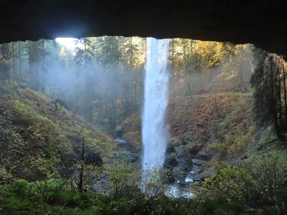
The setting for Grotto Falls was impressive. There wasn’t a lot of water flowing in the creek this time of year but there was enough and we were treated to a pair of small rainbows which added to the beauty.
The trail lead behind the falls giving us a chance to cool off in the water.
Cave behind the falls.
This was a perfect short hike to end the day on allowing us to relax a bit. We returned to the car and drove to the Idleyld Lodge and checked in. Then Heather ran across the street Idleyld Trading Post where she picked up some tasty post hike burritos. The historic lodge narrowly escaped the 2020 Archie Creek Fire and recently changed owners. It was obvious that the new owners had been putting a lot of work into the lodge and the room was quite comfy. What wasn’t were all the blisters on my feet, apparently jogging downhill at the end of an 18 mile hike isn’t something that they appreciated. In any event the day had ended on a high note. Happy Trails!
The Central Cascade Wilderness Permit system has been in place for 2 years now and for the second year in a row we gambled early and secured permits in April for a weekend backpacking trip. For the second year in a row weather prompted us to leave the purchased permits unused. Last September it was an early snow storm and this year it was a heat wave accompanied by the threat of thunderstorms. We had planned on hiking around Three Fingered Jack but after checking the forecast the morning of our departure we went to Plan B. The combination of nearly 90 degree temperatures (with an overnight low pushing 70) on trails that are 95% exposed due to passing through the 2008 B & B fire scar and the possibility of thunderstorms throughout the entire weekend just didn’t sound appealing.
We had gotten up at 4am and most of our packing already done but we needed somewhere to go. It needed to be nearby so we could get onto the trail early and short enough that we wouldn’t be out as the day warmed up. As I was trying to come up with ideas Alsea Falls came to mind. We had hiked to the falls in December 2011 (post) and had wanted to see them again when there was less water as the volume in December had been too much to see. With 3.5 miles round trip to visit both Alsea and Green Peak Falls this fit the criteria nicely and it would give us time to make a quick stop at E.E. Wilson Wildlife Area if we felt like it on the way back home.
We were the first car at the Alsea Falls Day-Use/Picnic Area and after paying the $5 fee (In 2012 we avoided this fee by parking along Miller Road which lengthened the hike.) we set off following pointers for Alsea Falls.
We stayed left here following the pointer. We later crossed the bridge on the way to Green Peak Falls.
A quarter mile from the trailhead we came to the top of Alsea Falls. The trail continued downhill providing a few different vantage points of the falls.
Heather in front of the falls.
December 2012
After checking out the falls from several spots we headed back up to the bridge and crossed the river. Looking down river from the bridge.
On the far side of the bridge we turned left following the pointer for McBee Park and Green Peak Falls.
We followed trail pointers to stay on the correct path which brought us to a road near McBee Park (Privately owned by Hull-Oaks Lumber Company).
Fireweed
We turned off the main gravel road at another sign for Green Peak Falls. Here a spur road led through a large campsite to a trail.
Green Peak Falls
Green Peak falls in December 2012.
It was interesting to see how differently the lower water levels affected the visuals of the two falls. For Alsea Falls less water allowed us to see more of the bedrock and gave the falls a little more definition and character. Green Peak on the other hand just had less water, it was still a nice waterfall but it wasn’t the thundering cascade that we’d experienced in 2012.
On the way back we crossed the river at McBee Park and explored one of the empty sites there.
Covered picnic table.
The table is one solid plank.
Instead of back tracking through the park to the trail and returning the way we’d come we decided to road walk back to the Alsea Falls Picnic Area. Sign for McBee Park along South Fork Road.
Trail down to the picnic area along South Fork Road.
This wound up being a 3.3 mile hike which was just what we were looking for. It had been warm when we started at 6:15am and it was already noticeably warmer when we got back to the car at 8am. It was still early enough though that we did decide to stop on our way home and finally check out the E. E. Wilson Wildlife Area.
The area, located just north of Corvallis, is one of several Oregon Department of Fish and Wildlife managed areas that requires a $10/day parking perming ($30 for an annual permit). Hiking options are limited here with just a 1.5 mile Interpretive Trail to a fishing pond and a 1.7 mile out-and-back to Coffin Butte. The $10 price tag for such sort hikes had kept us away but we had come into possession of an annual permit (They come with certain hunting and/or fishing licenses.) which eliminated that obstacle.
We parked at the Camp Adair Trailhead and promptly forgot to put the permit on the dashboard. Instead we got out, threw our packs on (we looked crazy for a 1.5 interpretive loop but we wanted the water that was in them), and started checking out the pheasants being raised in nearby cages.
Silver pheasant
After looking at the birds we walked through the Camp Adair Memorial Garden. Camp Adair was established approximately 6 months after Pearl Harbor and housed up to 40,000 personnel at a time comprising four infantry divisions.
Red-breasted sapsucker
Parking for the fishing pond is located on the opposite side of the memorial and at that parking lot we turned left on a road passing through a gate to a signboard.
We followed this road 0.2 miles to a “T” where we turned left.
Less than 100 yards later we came to a sign for the Fishing Pond on our right at another road junction.
We made it about a tenth of a mile up this road before I thought to ask Heather if she had put the permit on the dashboard since I’d completely forgotten about it. She had forgotten too so I left my pack with her at a bench and jogged back to the car, put the permit in the window, and (mostly) jogged back to her. We then continued on to the Fishing Pond. Bunnies in the grass near one of the benches.
Coffin Butte on the other side of Highway 99.
Turkey vulture
Wetlands on the other side of the pond.
Great blue heron
After walking a little way up along the western side of the pond we backtracked and started around the southern end where we picked up the continuation of the Interpretive Loop. The loop trail to the right.
Skipper
The loop passed through some wetlands before entering a series of fields and finally arriving back at the road.
Tadpole
We stayed left at any junction like this.
Dragon fly
Bindweed
Arriving back at the road.
We took a left on the road and retraced our steps to the memorial and then back to our car. Between our wandering and my return trip to the car to put the permit out I managed to turn this into a 2.8 mile outing but it should have been closer to 1.5. We still managed to be done just after 10am which was a good thing because it was already pushing 80 degrees. These two short hikes turned out to be a great option given the circumstances. Unfortunately as I write this several fires are burning in Northern California and the Oregon Cascades with more red flag warnings for lighting through Monday. Hopefully things won’t get too bad and we pray for the firefighters as they do their best to keep things in check. Happy Trails!
The late snow melt in in SW Washington had prompted us to push a planned hike to Silver Star Mountain at the end of June to next year but when we found ourselves in need of a substitute for another hike we took the opportunity to pull it back into this year. This would be our fourth visit to Silver Star Mountain having previously taken Ed’s Trail in 2013 (post), the Bluff Mountain Trail in 2015 (post), and the Grouse Vista Trail in 2019 (post). Those hikes had taken place on July 1st, June 27th, and June 24th respectively so this was a later visit for us, but we knew that the late snow melt had delayed the wildflower display so we still expected to get to experience that.
Our inspiration for this visit came from Matt Reeder’s “Off the Beaten Trail” (2nd edition) which was printed in 2019. Reeder calls the hike to Silver Star Mountain via the Starway Trail as “by far the most difficult….”. He also mentions that the last two miles of driving on FR 41 to reach the trailhead are “potholed and rocky” while the Forest Service states “Trailhead is best accessed by high clearance vehicles due to rough road conditions.” The Washington Trail Association also mentions that “…most of the roads accessing the trailhead have been severely degraded…” This last description was probably the most accurate description of what we encountered for the final 3 miles on FR 41. The road didn’t have pot holes, it had craters. Our Outback scrapped the ground twice emerging from said craters and I can’t imagine how a low clearance vehicle could make it given the current condition of the road. In fact there was a sign at the Sunset Falls Campground with slash going through a low clearance vehicle. We parked at a pullout near a gate at the FR 41/FR 4107 junction. Reeder mentions that you can drive 4107 approximately a half mile to the start of the actual Starway Trail at Copper Creek but if the gate gets closed your stuck. Looking at the gate we weren’t sure if it even still closed but we were more than done with driving at that point.
We headed down this one lane road approximately a half mile to a small parking area near a bridge over Copper Creek.
It was an overcast morning which was a welcome sight for this hike. Reeder had recommended not attempting this hike on warmer days due to the steepness of the climbs. The forecast for Silver Star was for a high in the low 60’s with partly sunny skies. We hopped that by the time we reached Silver Star we’d be greeted by those partly sunny skies, but the low 60’s temperatures were what we were really after. Beyond Copper Creek the trail followed an old road bed as it gradually climbed for a little over a quarter of a mile to a fork. Overgrown roadbed that is now the Starway Trail.
The fork with the Starway Trail to the right.
The trail began to steepen here but didn’t really pick up steam until reaching a couple of switchbacks 0.4 miles from the fork.
Scouler’s bluebells
Beardstongue
Paintbrush
Taken from the first switchback this gives a little reference for how steep the trail was.
The switchbacks only lasted a tenth of a mile and then the trail shot almost directly uphill. The grade varied between steep and really steep for three quarters of a mile where it finally leveled out for a bit on a bench along the ridge we had been following. Pictures never do justice to just how steep trails are.
Almost to the bench.
Level trail!
A section of trail on the bench passed through a carpet of foam flower. We’d never seen so much of that flower in one area.
Inside out flower
For about a half mile the trail avoided any overly steep climbing and then it once again headed uphill in earnest. The trail starting to steepen again.
Every website I checked agreed with Reeder that the Starway Trail didn’t see a lot of use. They all mention the steepness of the trail and that the trail was faint and could be difficult to follow. After having hiked the trail we can confirm the steepness but it appears that someone or some agency has put a good deal of work into improving the trail. We had no trouble following the tread and there were a couple of places where a series of short switchbacks appear to have replaced sections that went straight uphill. The first set of what appeared to be fairly recently built switchbacks.
At the top of the switchbacks the trail emerged in a small meadow where it once again leveled out. Approaching the little meadow.
A little bit of blue overhead through the fog.
Tiger lily
Paintbrush
Wood rose
Thimbleberry
I had gotten to this level section first and looked for a place to sit down and wait for Heather but the meadow was too wet so I found a log in the trees at the far end and had a seat. Into the trees to look for a log.
For a little over a half mile the trail climbed gradually alternating between forest and small meadows before arriving at its high point just below the wildflower covered Point 3977. Along the way we emerged from the clouds and got our first glimpses of Silver Star Mountain and Mt. St. Helens.
Silver Star Mountain
Bunchberry
Our first view of Mt. St. Helens
Zoomed in on Mt. St. Helens.
Arriving below Point 3977.
Point 3977
Pollinator on catchfly
The pink vetch was very bright.
Silver Star Mountain from the trail below Point 3977.
Rose
Wildflowers on Point 3977.
Bluebells of Scotland
Sub alpine mariposa lily
Checkerspot on Oregon sunshine
Lots of purple larkspur amid the other flowers.
A few columbine were hiding in the mix.
Violet
We surprised a fellow hiker as he rounded Point 3977 from the other side. He said he hadn’t expected to run into anyone on the Starway Trail. He’d started at the Ed’s Trail Trailhead and was doing a big loop using the Starway Trail and then road walking FR 41 & 4109 back to his car. He climbed up Point 3977 and we continued on planning to do that same thing on our way back. On the far side (south) of the point the Starway Trail suddenly dropped heading steeply downhill through a meadow. Starting down.
Looking back up.
For nearly the next three quarters of a mile the trail alternated between steep descents and more gradual downhills losing a little more than 500′ in the process. Then the trail shot back uphill gaining over 300′ in the next 0.3 miles before arriving at a junction with the Bluff Mountain Trail. Stars on the trees marked the Starway Trail at times.
Pinesap emerging from the ground.
A cairn at the end of this brief level section marked the start of another steep descent. By this time we’d lost enough elevation to be back in the clouds.
Part of the elevation loss was to drop below some interesting rock outcrops.
Fully back in the fog.
Time to climb again.
Big root balls.
Trail sign near the Bluff Mountain Trail junction.
Final pitch to the Bluff Mountain Trail.
On the Bluff Mountain Trail at the junction.
We turned right on the Bluff Mountain Trail which steadily climbed for nearly three quarters of a mile to a fork.
Lots of nice wildflowers along the Bluff Mountain Trail.
Another checkerspot
Paintbrush
Penstemon
We just couldn’t quite shake the fog.
First sighting of Mt. Rainier.
Mt. St. Helens to the left with Mt. Rainier to the right.
Coiled lousewort
Lupine
Getting closer to Silver Star.
Crab spider on fleabane
Spirea along the trail.
Bistort and mountain goldenbanner
First Mt. Adams sighting.
A crescent on bistort.
Penstemon
Wallflower with beetle.
Passing below Silver Star Mountain.
Mt. Hood
Rock arch below Silver Star’s summit.
At the fork we turned uphill to the left leaving the Bluff Mountain Trail.
This short connector trail climbed 0.1 miles to an old roadbed.
Fading avalanche lily.
The old roadbed.
We turned left and followed the roadbed 0.2 miles to a saddle. The summit to the left with Mt. Adams in the distance.
Mt. Hood to the right at the saddle.
We headed for the summit to start and met a couple with a cute puppy named Hazel, the same name as our cat that we’d lost a year ago nearly to the day (post). The puppy even shared similar colored fur to our Hazel’s.
The view from the summit was a good one on this day. The clouds were low enough that we could see all five of the Cascade volcanoes: St. Helens, Rainier, Adams, Hood and Jefferson. Mt. St. Helens, Mt. Rainier, and Mt. Adams.
Goat Rocks (between Mt. Rainier and Mt. Adams)
Mt. Hood and Mt. Jefferson
Mt. Jefferson. If you enlarge and look closely you can also make out Three Fingered Jack and the North Sister to the far right.
Swallowtail
Sturgeon Rock
Wildflowers at the summit.
Bug at the summit.
After a nice break at the summit we dropped back down to the saddle then climbed to the southern high point just to say we did. Point 3977 is the the island surrounded by clouds.
There was a lot of butterfly action here.
After tagging the southern point we headed back the way we’d come. The only beargrass bloom we saw all day.
As we were passing below Silver Star we kept our eyes out for our favorite trail animals, pikas. We’d heard a few from the summit and we were rewarded with spotting one of the little rock rabbits in a talus slope. The talus slope.
Pikas are not easy to spot.
On alert.
As always we kept our eyes out for other things we’d missed on the first pass. Orange agoseris
Ladybug
Making the steep climb back up to Point 3977.
We did wind up making the short climb to the top of Point 3977 even though the clouds had risen enough to effectively block most of the views. Looking toward Mt. St. Helens and Mt. Rainier.
Looking toward Silver Star.
The views weren’t great but the wildflowers were. Possibly a Native American vision quest pit.
Bluebells of Scotland with at least three visible insects.
Some bright paintbrush.
Larkspur
A brief appearance by Silver Star’s summit.
After a short break on Point 3977 we began the relentless descent to Copper Creek. The long steep descent was not a friend to the knees but we managed to make it down in one piece. Just before reaching the bridge we passed just the second hiker on the Starway Trail for the day.
Sorry knees.
Mock orange
A little blue sky in the afternoon.
We walked back up FR 4107 to our car and began the tedious drive back down FR 41 and made our way safely home. Salmonberries along FR 4107. I may have eaten a few as well as some red huckleberries along the lower portion of the Starway Trail.
Both of those berry types are too sour for Heather who prefers thimbleberries but alas those were only beginning to show signs of ripening.
Looking back at the hillside the Starway Trail climbs from FR 4107.
In my research I’ve seen several different distances listed for this hike. In Reeder’s book he lists the hike to Silver Star as 10.2 miles. Our GPS units recorded 11 miles though. Some of that may be due to going to both ends of Silver Star and some additional distance may be due to the newer switchbacks (assuming they really are new). Regardless of the actual distance I think everyone agrees that the total elevation gain is right around 4200′.
I’m not sure we could have asked for a better day to do this hike on. We got some big views and lots of wildflowers while the temperature remained mild thanks to the low clouds and we saw our first pika of the year. I don’t know that either one of us would ever want to try that drive again but the hike itself was worth the effort. Happy Trails!
Our first night in the small town of Wallowa had been great. Our room at the Mingo Motel was extremely comfortable and we’d gotten ice cream sundaes from the Little Bear Drive-In. We were also conveniently located less than 10 miles from the Bear Creek Trailhead which was our destination for Thursday’s planned hike. This meant we could get an even earlier start in order to avoid as much heat as possible. A quick check of the forecast the night before had shown that it was again going to be in the 90’s in Wallowa and it also showed that there was another slight chance for thunderstorms Friday morning when we were hoping to do our final hike of the trip at the Wallowa Homeland. As we set off from the Bear Creek Trailhead a little after 5:30am we left open the option of doing that last hike when we got back to Wallowa if we felt up to it. The Bear Creek Trail at the trailhead.
This was a fairly straight forward hike following the Bear Creek Trail 4.6 miles to a junction with the Goat Creek Trail then continuing another three quarters of a mile to the Bear Creek Guard Station. The relatively level trail crosses Bear Creek a quarter mile from the trailhead.
Footbridge over Bear Creek.
Milk-vetch
Mountain lady-slippers
Bug on a thimbleberry leaf.
There were a couple of ups and downs where the trail got above Bear Creek.
Baker Gulch
Cliffs on the opposite side of Bear Creek.
Trail sign marking the junction with the Goat Creek Trail. By this time we had crossed into the Eagle Cap Wilderness but there hadn’t been any signs
indicating that.
Prairie smoke a.k.a. old mans whiskers
A fleabane
The Bear Creek Trail crossing Goat Creek.
Footbridge over Goat Creek.
Goat Creek
The unmarked but obvious spur trail to the (locked) Bear Creek Guard Station on the right.
We took a brief break at the Guard Station and headed back. On the way back we spotted a new to us (at least we think) flower. Moneses uniflora – one-flowered moneses
We also spotted several bugs and insects. Hairstreak
Crab spider
Moth
Swallowtail on a bog orchid
Lorquin’s admiral
A fritillary butterfly with some sort of spider on the underside of a leaf below to the right.
The 10.8 mile hike here only gained 900′ of elevation, by far the least amount of any of our hikes during the trip. The lack of elevation gain combined with the cool morning temperatures allowed us to move at a quicker pace completing the hike under 5 hours and 15 minutes.
On our way back we had decided that we would indeed do the Wallowa Homeland hike today too instead of risking having to skip it if thunderstorms did develop in the morning. As convenient as our motel had been for the Bear Creek hike it was even more so for the Wallowa Homeland which started just a couple of blocks from the Mingo Motel at the Nez Perce Visitor Center. First time we’ve started a hike from a motel room.
Passing the Visitor Center on 2nd Street.
From the Visitor Center we turned north on Storie Street and followed it nearly 3 blocks to a dirt path that crossed rail road tracks then crossed the Wallowa River on a bridge with interpretive signs.
The trail here is on land purchased in 1997 & 2000 but that is also the former site of the Nez Perce’s Winter camp. In one of the more shameful events in U.S. History the Army ordered the Wallowa Band of Nez Perce to leave their home and relocate. This led to a 6 month saga that saw the Nez Perce attempt to flee to safety in Canada with the Army in pursuit for over 1100 miles. Ultimately they were capture or dispersed and their homeland lost. We were visiting a week before the 30th annual Tamkaliks Celebration.
Dance arbor
After crossing the bridge we turned left on a gravel road heading toward the basalt cliffs of Tick Hill (an unsettling name but we did not actually see any ticks during this hike).
We followed the road as it bent to the right below the cliffs for half a mile where a trail pointer sent us climbing uphill via a series of switchbacks.
Marmot
Approaching the pointer uphill.
While it was still before noon it was heating up fast and the exposed hillside allowed the Sun to beat down on us. We distracted ourselves by looking at the different wildflowers that were still blooming amid the tall grasses. Scarlet gilia
Dustymaidens
Skullcap
Heading up Tick Hill
Yarrow
Lupine
Mock orange and wild rose
Dragon fly
Moth mullien
Blanket flower
Checker-mallow and vetch
The Wallowas from the trail.
Sagebrush mariposa lily
After a steep half mile climb the trail leveled out a bit. We turned left at a post and descended slightly to a viewpoint next to a scraggly juniper tree.
A buckwheat
The Wallowa River and dance arbor from the viewpoint.
The Wallowa Mountians
We returned to the trail which continued to be level for 400 more feet before heading uphill again for a third of a mile to a junction with a spur trail to a gazebo. Heading back to the post from the viewpoint.
About a quarter mile from the post we crossed this road leading to some radio towers.
Elkhorn clarkia
The gazebo ahead.
Shade!
Plaque near the gazebo.
View from the gazebo.
From left to right: Point Joseph, Hurricane Point, Ruby Peak, and Sawtooth Peak.
We cooled off in the shade of the gazebo before continuing on.
From the gazebo the trail descended slowly recrossing the road after 0.2 miles and passing by the radio towers. At the junction with the spur trail to the gazebo. We came up from the left and continued on to the right.
Recrossing the road.
Western meadowlark
Heading toward the radio tower.
A fleabane
There were several plaques along this stretch.
Various wildflowers
Cinquefoil
Lots of blanket flower.
Sticky geranium
A little over three quarters of a mile from the gazebo the trail turned steeply downhill descending via another series of switchbacks.
Grand collomia
Scarlet gilia
The last line is great advice.
At the bottom of the switchbacks we turned left on a road bed following the Wallowa River.
Swallowtail
Dragon fly
Bachelor buttons
Swallowtail on hyssop.
Wallowa River
Goldenrod
We followed this road half a mile to the gravel road we’d been on earlier.
We retraced our steps back to the Mingo Motel completing a 4.5 mile lollipop hike with 600′ of elevation gain.
It was now a little after 2pm so after cleaning up and cooling down we headed back to the Little Bear Drive In for burgers, tots, and milkshakes. It was a good ending to what was overall an excellent trip (abdominal pain aside). With all our planned hikes completed we got a really early start on our drive back to Salem on Friday and made it home before Noon giving us plenty of time to unpack and relax. Happy Trails!
No Summer trip to Eastern Oregon is complete without at least one thunder storm and ours came early Wednesday morning. When we awoke at 4am in La Grande one was passing overhead nearby. I pulled up the weather forecast for the hike we had planned that day and much like the forecast had been for Mt. Ireland on Saturday there was a slight chance of a thunder storm. We packed up and headed for the Rock Springs Trailhead which was between La Grande where we had been staying and Wallowa where we had reservations for the next two nights. We were following the storm as it passed over the Wallowas but it stayed ahead of us and things looked pretty good when we parked along the shoulder of FR 62 where the Rock Springs Trail headed downhill toward the confluence of the Minam and Little Minam Rivers. We parked about 200′ north of the actual trailhead per a suggestion by Sullivan in his guidebook.
The Rock Springs Trail at FR 62.
The trail loses approximately 2500′ in the first 3.5 miles, sometimes steeply, passing viewpoints at the 0.7 and 2.0 mile marks. There were views along other stretches of trail though as the trail alternated between open wildflower filled hillsides and forest. It was the least maintained trail that we were on all week with quite a bit of grass and brush encroaching on the trail. It was also the only trail on which we encountered multiple ticks, about a half dozen, during the trip. (The only other tick we saw all week was one on my pants at Mt. Ireland on the first day (post). The trail passed a large rock field just below FR 62 and then entered the Eagle Cap Wilderness.
Lupine
Coralroot
The edge of the storm clouds.
Scarlet gilia along the trail.
Oregon sunshine and tapertip onion
Nettle-leaf giant hyssop
View from the trail before the first “viewpoint”.
Oregon checker-mallow
Assorted wildflowers
Blue sky following the storm clouds.
Scabland penstemon
Penstemon near the first “viewpoint”.
Yarrow
Douglas dustymaiden
Looking back from the viewpoint.
Buckwheat
The Point Prominence Lookout atop the high point to the left.
Ballhead sandwort
Heather coming down from the viewpoint.
Blowdown over the trail.
Nookta rose
Wood rose
View to the SE deeper into the Wallowas.
Mountain parnassian?
Back in the trees.
Some pale columbine. At first we thought it might be yellow columbine but it definitely had a red tint.
Thimbleberry crowding the trail. The storm had left a lot of water on the vegetation which in turn wound up on our legs and shoes.
Heading down into the valley.
Elkhorn clarkia
Approaching the second viewpoint.
Backbone Ridge which separates the Minam and Little Minam Rivers. We had crossed over that ridge further south on Tuesday when we took the Horse Ranch Trail from Moss Springs to the Minam River (post).
Grand collomia
Prairie smoke
Mock orange along the trail.
Twin flower and foam flower
Sign marking the junction of the Rock Springs and Little Minam Trails.
Possibly a wasp of some sort near the junction.
We turned left at the junction and descended another tenth of a mile where we spotted the first of several structures that used to be part of a lodge. The first cabin ruin.
Almost looks okay from this angle.
Not so good from this angle.
The lodge was at the edge of this meadow.
The lodge
The fireplace seems to have held up well.
This cabin didn’t hold up.
Beyond the lodge several faint trails led off into the meadow.
The map in Sullivan’s book appeared to show the main trail turning left after passing the lodge with a spur continuing straight to the Little Minam River and a drinking hole for horses.
We had intended on taking the left hand fork but we wound up at the watering hole instead. Wildflowers near the watering hole.
The Little Minam River. We couldn’t quite see the confluence of the two rivers from here despite being very close.
We headed north using our GPS units in an attempt to locate the actual trail which should take us to a dangerous ford three quarters of a mile from the old lodge. After a bit of searching we picked up the faint trail.
The dangerous ford.
According to Sullivan, horses are able to cross later in the Summer but hikers should follow the Little Minam Trail south to the Horse Ranch Trail and cross the Minam on the footbridge that we had crossed on near Red’s Horse Ranch.
We sat on the rocks along the Minam for a bit before heading back.
On the way back it was a little easier to follow the faint trail which led us to some campsites above the old lodge. Here we tried looking for horse hoof prints to stick to the trail.
Butterfly on yarrow.
We think this was the trail.
The campsites where we picked up the Rock Springs Trail again.
We made the 2500′ climb back up, watching for things we missed (and ticks) as we went. Lorquin’s admiral
Looking across the gully we could see the trail cut climbing up the far hillside.
Pincushion plant
Resting moth
A plane taking off from Minam Lodge.
A popular thistle.
A skipper of some sort.
We both missed this yellow columbine on the way down.
View from the upper viewpoint on the way back up.
A final view from the Rock Springs Trail.
The cloud cover that moved in turned out to be a blessing as it kept the temperature reasonable as we made the long climb back up.
Our hike here came in just a tad over 9 miles to go with the 2500′ of elevation gain.
The ticks had been a bit of a distraction but the views had been good and there were a lot of wildflowers along the way. At the end of the day it was our least favorite hike of the trip but there was still plenty to enjoy. From the trailhead we drove to Wallow and checked into the Mingo Motel which turned out to be a surprisingly nice room. Happy Trails!
I’d spent all of Monday hiking with abdominal pain so I was very happy to wake up Tuesday feeling fine. On tap for today was the highest elevation hike in the Wallows for this trip (Mt. Ireland on Saturday (post) was higher but that peak is part of the Elkhorns.) and we weren’t sure how much snow we might encounter. We did have our microspikes with us just in case.
The Elk Creek Trail (Trail 1944) leads from this trailhead to 7848′ Burger Pass near the 4.5 mile mark then down to Burger Meadows and eventually on to the Minam River. Sullivan’s featured hike is to Burger Pass which was our goal for the day but we had also left open the possibility of visiting the meadows if conditions were good.
At the 0.7 mile mark the trail briefly followed an old road bed to an old clearcut.
Trail sign in the old clearcut.
Sullivan describes the second mile of this trail as one of the dustiest in Oregon but on this morning there was enough moisture in the ground to keep the dust at a minimum.
Rock Creek Butte (post) in the Elkhorns from the clearcut.
The trail climbed steeply following an old roadbed out of the clearcut following a ridge before leaving the ridge and bending SE near the 2 mile mark.
Shortly after leaving the ridge we encountered the largest obstacle on the way to the pass.
The Elkhorns in the distance.
The trail made a long switchback and entered the Eagle Cap Wilderness as it rounded the same ridge that we’d been following earlier. Granite at the switchback.
Entering the wilderness (photo from the way back).
The trail then traversed a granite hillside to a large slide below Burger Butte. Valerian along the trail.
View from the trail.
Burger Butte
Rosy paintbrush
Tributary of Middle Fork Catherine Creek.
Looking down the creek over the slide.
Yellow columbine
After reentering the forest we began to encounter the first patches of snow. The snow began around 7200′.
Snow over the Elk Creek Trail.
China Cap from the trail.
The trail crossed another tributary of Middle Fork Catherine Creek below a beautiful pair of cascades.
Small meadow below the trail.
Approximately 3.5 miles from the trailhead we came to an unsigned junction with the China Ridge Trail. The China Ridge Trail joining from the left.
We stayed on the Elk Creek Trail as it climbed for another scenic mile to the pass below Burger Butte.
The Elkhorns to the right beyond Burger Butte.
Lyall’s Rockcress
The few patches of snow were just melted enough to allow us to avoid having to walk over them.
Burger Pass
The view from Burger Pass was great. There was a large snow patch over the trail but it was fairly level and soft so it didn’t require the microspikes. Burger Butte from the pass.
Looking deeper into the Wallowas.
The snow patch below Burger Butte.
I decided to go ahead and attempt the 350′ descent to Burger Meadows while Heather opted to stay at the pass. From Burger Pass the Elk Creek Trail descends three quarters a mile to a junction with the Sand Pass Trail.
There were several patches of snow and some downed trees to navigate but I soon found myself at the junction.
I turned right on the Sand Pass Trail to see more of the meadows.
The Sand Pass Trail can be seen climbing out of the basin in the sandy gap to the center left.
Meadow lookout.
View from the meadow.
Buttercups were about the only flowers blooming in the wet meadow.
The rocks along the ridge were really interesting.
Marmot? in the meadow.
I followed the trail about four tenths of a mile before stopping at Elk Creek where a large snow drift lingered on the far side.
I climbed back up to Burger Pass and once Heather got my attention we started back down arriving at the car a little before 12:30pm. Golden mantled ground squirrel watching us from the granite.
Butterfly
Mountain heather
Mushrooms near the Middle Fork Catherine Creek cascades.
Jacob’s ladder
Penstemon
Mushroom
Pacific coralroot
Including my visit to the meadows this was a 11.5 mile, 2800′ elevation gain hike which turned out to be our favorite of the trip (Mt. Ireland (post) being a close second.)
We picked up a late lunch/early dinner from Yia Yia Nikki’s which turned out to be a wonderful choice on what was the hottest day of the week. We packed up as much as possible that night in preparation of moving from La Grande to Wallowa for the next two nights. Happy Trails!
Following a great first two days of hikes (Mt. Ireland & Catherine Creek Meadows) on our visit to Eastern Oregon Monday’s hike was set to be the longest in the trip, a visit to the Minam River via the Moss Springs Trailhead. We’d set our alarm for 4am in order to try and get as much hiking done during the cooler morning hours as possible. We’d left our motel at 5am and I started having abdominal pain as we drove to the trailhead. We think it was a side effect of my having preemptively taken some over the counter heartburn medication the previous nights since we had been eating richer foods than we typically do. Whatever the cause the my stomach seemed constantly cramped which was affecting my lower back and hips as well. I hoped that whatever was ailing me would subside soon as we set off on the Horse Ranch Trail (Trail 1908).
The trail descended from the trailhead 1.4 miles to a bridge over Horseshoe Creek. Going downhill was particularly painful for me as my cramped muscles protested each time I stepped down.
Scarlet gilia along the trail.
Tapertip onion
Scarlet gilia
Lewis flax, we were hoping to see it opened up on the way back up to the car but somehow we both completely missed it.
Arrowleaf groundsel
Bog orchid
False sunflowers
Paintbrush
Sticky geranium
Footbridge over Horseshoe Creek.
Horseshoe Creek
Shortly after crossing Horseshoe Creek the trail came close to the Little Minam River.
The trail gradually descended along the river for approximately three miles to a bridge crossing it.
Spotted coralroot
Mountain lady slipper
Little Minam River
Coral fungus
Huckleberry Creek
Bridge across the Little Minam River.
Little Minam River
I had been forced to take a number of breaks due to the abdominal discomfort including several bouts of dry heaves. Other than my core though I felt good and being just a tad stubborn we continued on from the bridge. On the far side of the bridge we stayed left at a junction with the Jim White Ridge Trail.
The Horse Ranch Trail briefly descended then climbed to a pass a little over 2 miles from the river crossing.
The only area that we encountered showing signs of having burned in the not too distant past.
Elkhorn clarkia
Junction with the Little Minam Trail (left) just below the pass.
At the pass the trail turned left and began to descend along a ridge.
Soon the trail left the ridge and began a steep descent to a meadow along the Minam River. The meadow from the trail.
Arriving at the meadow.
The U.S.F.S. owned Red’s Horse Ranch is located in the meadow. This historic ranch was acquired by the Forest Service in 1994 and still has a caretaker. Due to how I was feeling we didn’t actually visit the ranch but instead continued past it to the Minam River where we crossed on another bridge and took a long break across the river from the ranch.
Horses at Red’s Horse Ranch.
Minam River
I was hoping the long break would finally help my stomach relax but alas it wasn’t to be; so after our break we began the 8 mile trek back up to the car. We stopped at a spring on the way up to the pass to top off our water. For whatever reason I felt way better going uphill than I had downhill or even on level trail which was nice. Landing strip near Red’s Horse Ranch.
The pain was back as we descended from the pass but alleviated again every time we climbed. It was the first time I was happy to be climbing on a trail. We missed the flax on the way back up to the car but we did spot several white mariposa lilies which we hadn’t noticed that morning as well as a large patch of broomrape. Pink pyrola
Little Minam River
Coral fungus
We saw a bunch of these black moths? but they seldom sat still long enough to get a photo.
An Orobanche
Penstemon
Butterfly
White mariposa lily
Large-flower triteleia
Arriving back at the trailhead.
We arrived back at the car around 3:15pm after the long hike. It was a nice hike but admittedly my issues were a distraction for both of us which kept us from appreciating it as much as we should have.
Heather drove us back to La Grande where I tried taking a bath and eating half a sandwich was the only thing other than water and Gatorade that I’d had all day. Neither helped immediately so I laid down in bed and soon fell asleep. We kept the alarm set in hopes that I would be feeling better in the morning but if I didn’t we’d have to delay our planned hike to Burger Pass. Happy Trails!
We’d spent the night in Baker City following our hike to the Mt. Ireland Lookout (post). Our plan for the next six days was to do five more of the “featured hikes” (post) from Sullivan’s 3rd edition “100 Hikes/Travel Guide Eastern Oregon” then before heading home on Friday do the Wallowa Homeland hike which is featured in Sullivan’s most recent 2022 edition of “100 Hikes Eastern Oregon”. Because the hikes were spread out along the western and northern sides of the Wallowas we would be moving our base of operations a couple of times during the week starting with a move to La Grande for Sunday through Tuesday nights.
Sunday morning we packed everything up and headed for the North Fork Catherine Creek Trailhead. After navigating the pothole filled FR 7785 we pulled into the large trailhead parking area.
A $5 fee is required here and at several other trailheads we visited during the week. (An annual NW Forest Pass can be used instead.)
The trail doesn’t start at the parking area but rather another tenth of a mile up the road so we road walked to the official trailhead.
The trail initially climbs above the creek to an open hillside, that was putting on a pretty good wildflower display, before descending to a bridge a little after 1.5 miles. Lots of purple venus penstemon.
There were also some white scabland penstemon on the hillside.
Buckwheat
Venus penstemon
Lupine and stonecrop
Paintbrush
North Fork Catherine Creek
Douglas dustymaiden
Spreading dogbane
The trail crossed several side creeks, all of which were we were able to cross dry footed.
A brief stretch along North Fork Catherine Creek.
Queen’s cup
Another side creek.
Bog orchid
Spotted coralroot
A fleabane
One of the more interesting things we’ve witnessed was watching carpenter ants removing sawdust from a dead log and dropping it in a pile below.
They’re a little blurry but you can see the ants in the cracks where they would drop their sawdust. It was fascinating to watch and we paused for quite a while.
Columbine
Mountain lady slippers
Large-flower triteleia
Back above the creek.
The bridge over Catherine Creek.
Bluebells next to the bridge.
The trail climbed gradually for the next three and a half miles before reaching Catherine Creek Meadows.
Jim Creek, this was one of the trickier crossings.
Hound’s tongue
Nettle-leaf giant hyssop
One of several smaller meadows along the trail.
Jacob’s ladder
California corn lily and bluebells.
Boot Hill Creek was also tricky as it had taken over the trail.
A large patch of coralroot.
A few remaining balsamroot blooming above North Fork Catherine Creek.
Arriving at Catherine Creek Meadows.
Up until this point we had been very lucky this year with mosquitos but the meadows were very wet and the recent warm weather had the bugs out in decent numbers so we couldn’t linger in any one spot too long but we did take a short break at a campsite near a side creek.
All the black dots in the blue sky were gnats flying over the stream at the trail crossing.
Heart-leaved bittercress
Our goal for the day lay about a half mile away, an early 1900’s log cabin at the far end of the meadow. After our break we set off across the creek following what became an increasingly wet trail to a junction where we forked left.
Looking back at the sign post in the meadow marking the trail junction.
Another dry section of trail.
It wasn’t dry for long.
Yellow buttercups and pink elephant’s head.
Elephant’s head, one of our favorites.
Ladybug
Nearing the cabin.
Ground squirrel
Squatter running from the cabin.
We checked out the inside of the cabin before heading back.
It was only 9:45am when we started back so we took our time and kept an eye out for anything we’d missed on our first pass. Beetle
Another beetle and Nevada bitterroot.
Brunch
A comma of some sort.
Big mushroom
Something from the Lycaenidae family.
Coneflower
Swallow-tail on red clover.
Fritilary on clover
Mourning cloak perched overhead.
Lorquin’s admiral
A tortoiseshell
Skullcap, one of the hardest flowers to get a decent picture of for some reason.
Tapertip onion
Yarrow and other wildflowers up the hillside.
Our hike came in at 11.8 miles with approximately 1450′ of elevation gain.
From the trailhead we drove to La Grande and checked into our Motel, after hanging out at a park for about an hour because we’d arrived a bit too early, and then headed to Side A Brewing for an early dinner. It was going to be a warm week so we turned in early planning on another 4am wake-up the next morning to beat as much of the heat as we could. Happy Trails!