A storm system moved through Oregon a week ago followed by a few nice days and then another round of rain on Saturday. This was a much weaker system, and it had moved on by Sunday morning. I had few free hours at the beginning of the morning which was boosted by falling back an hour for Daylight Savings. Heather was walking with her friend Elizabeth so I would be on my own. I decided to head back to Willamette Mission State Park for the second time this year (9/1/25) and check out some of the equestrian trails.
With Daylight Savings moving Sunrise back up to 6:52am I was able to make the 25-minute drive and be there when it opened at 7am. I parked at the equestrian trailhead.

While there was no rain in the forecast patchy fog was, but it was supposed to burn off around 9am. I picked up the dirt equestrian trail from the trailhead and followed it across the paved bike path.


The route I’d planned would be a little over six miles with less than a half mile of that being on sections of trail that we’d hiked before. I followed the equestrian trail for a half mile before arriving at a signed junction.


It won’t be long and some of the trail in the park will be closed due to seasonal flooding.

Right after I took this picture a deer dashed out of the brush on the left, ran across the trail and vanished before I could take another photo.

I went left at this junction which was labeled “H North Loop Start” on the signboard map.

This 0.4-mile section of trail wound through the woods before arriving at a 4-way junction.


I turned right onto the paved path at this junction and followed it for a tenth of a mile to a 3-way junction.


I turned left at the 3-way junction and continued on the paved bike path for 0.6-miles. There was some blue-sky on my right and fog to my left.


American kestrel in the fog.


I left the paved path here and veered right to rejoin the equestrian trails and stayed right at the junction for just under a quarter mile to a junction with the South Hill Trail.


This section of trail crosses this high-water channel coming off of Windsor Island Slough meaning the south loops are sometimes cut off from the rest of the park.

The path passes close to the slough, but it was hard to see with the dense fog. There was a great blue heron on the far side, but the fog made it virtually impossible to photograph.

The South Hill Trail to the left.
I stayed straight saving the South Hill Trail for my loop back and continued another 0.4-miles to another junction.


I turned right at this junction in order to make the widest loop possible. The trail passed through an open bottomland then curved left at a pointer to pass through a short section of forest before making a brief climb to the edge of a filbert grove.


Northern flicker


The trail turned right here following a roadbed around the filbert trees.

This post is “L” on the park map.

A coyote trotted across the road in front of me but disappeared in the trees before I got the camera up.

At the far end of the trees was the “M” signpost.

I turned left continuing around the filberts until I came to post “N”.


Quail
At “N” the trail made a ninety-degree turn to the right along a barren field.

Looking back at the “N” post.

This was the least obvious section of trail over the whole hike.

The “patchy” fog was not letting up.

A covey of quail.
After passing post “O” the trail curved along Goose Lake which I detoured down to when the opportunity presented itself.


Goose Lake
There were a lot of birds around the lake including a couple of ducks, but with all the fog it was hard to get any photos.

Stellar’s jay
After checking out the lake I continued around the field until reaching post “P” at a junction.


Doves

I turned right at post “P” which put me on the South Hill Trail which led through the woods for almost a mile to complete the loop.


Squirrel

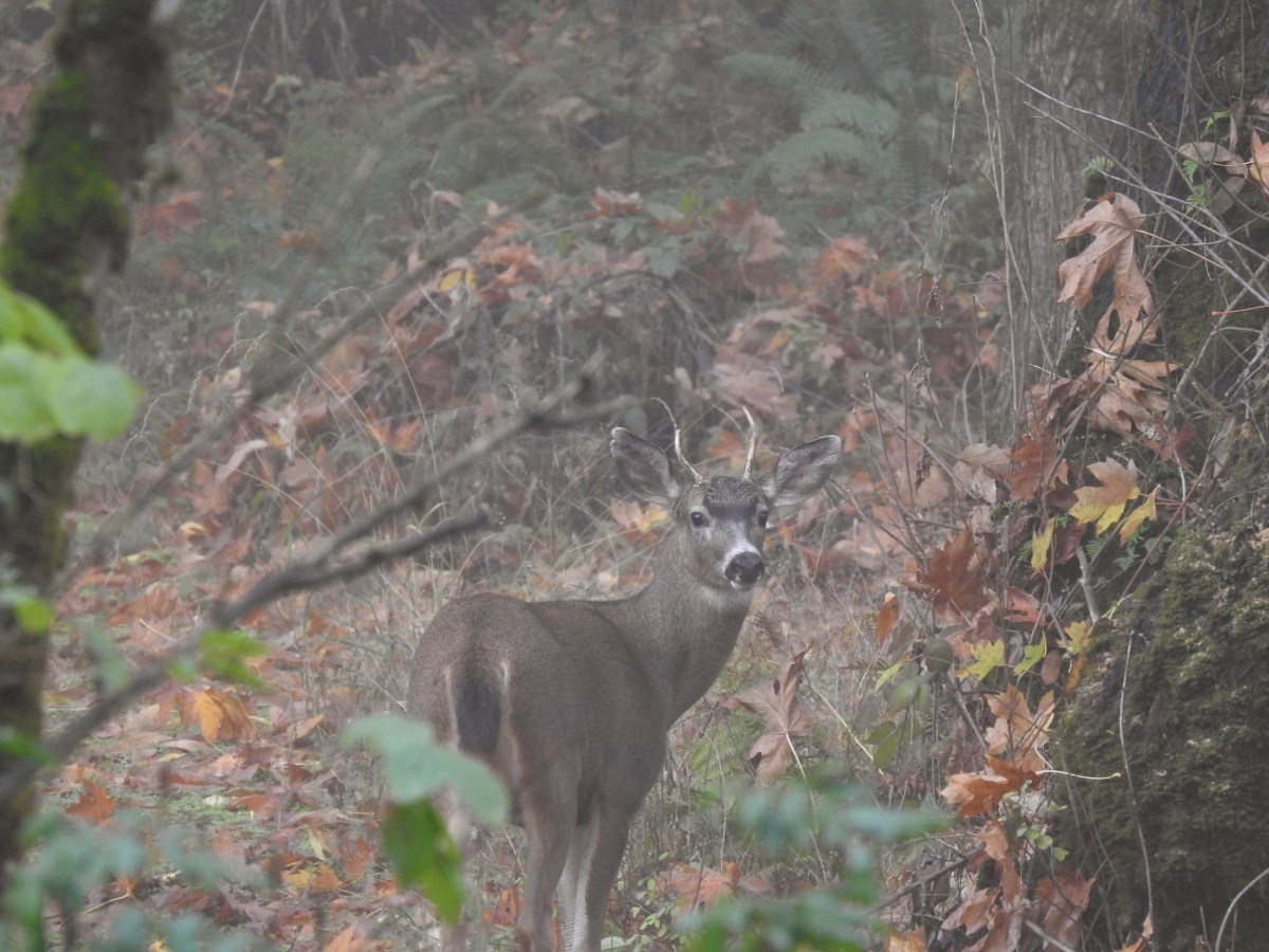
This little buck was slowly walking up the trail in front of me for a while before deciding to duck into the brush.


These were some cool mushrooms.


Completing the loop.
I turned right and recrossed the high-water channel then veered right on a narrow path that led me back to the paved bike path.


Starlings

I turned right on the bike path for a few steps then veered left onto the continuation of the equestrian trail.

I followed this section of the equestrian trail for 0.6-miles to the 4-way junction where I’d turned right onto the paved path earlier in the morning.


American kestrel

I turned right onto the paved path and followed it three-quarters of a mile back to the equestrian trailhead.


Self-heal

Two tenths of a mile after turning right I passed a junction with the bike path I had just crossed a little earlier.

The fence along the parking area just ahead.
My hike came in at 6.3-miles with minimal elevation gain.

The dotted line is today’s track. Dark blue is our 2019 track and the track to the left is from our Spring Valley Greenway hike in 2022.
This was a nice little outing despite the fog and some muddy tread. Hopefully it will be a little clearer next time I visit but I did get to see quite a bit of wildlife so I can’t complain. Happy Trails!
