
When I first planned out our trip to Enterprise it included five featured hikes that we’d yet to do: Buckhorn Lookout, Eureka Bar, Dug Bar, Hat Point, and Imnaha Falls. During the weeks leading up to this trip we removed Hat Point due to conflicting information on the status of Hat Point Road. Sullivan’s trail updates listed the road as closed until Summer 2023 and the Forest Service pages listed the Day Use Area as closed but the trailhead as open. I tried reaching out to the USFS for clarification, but they never responded so we swapped that hike with a planned 2024 visit to Hells Creek Reservoir and Dam (two featured hikes).
The next change came when we decided to try and combine Eureka Bar and Dug Bar into a single day versus an overnight stay at Dug Bar. The original plan was to do a 10-mile hike at Eureka Bar then drive to Dug Bar where we could tent camp and do an 8.6-mile hike to Deep Creek the next day before driving back to Enterprise. This was due to the reportedly poor road conditions between Imnaha and the Cow Creek Trailhead (Eureka Bar hike) and even worse road between the Cow Creek Trailhead to Dug Bar. These 15-mile and 11.4-mile stretches of road were said to take a full hour each to drive so why drive the first stretch twice if we didn’t have to. Re-reading the description of the Dug Bar hike in preperation for the trip caused me to rethink this plan since Sullivan’s description of the Dug Bar hike included a one-mile stretch of trail wading through patches of poison ivy. He listed a shorter 1.2-mile option stopping at a viewpoint after only 0.6 miles which sounded much more appealing. This would also be short enough to add to the 10ish miles at Eureka Bar and still be a manageable distance for a single day.
With the new plan in place we left Enterprise and headed for the Cow Creek Trailhead. The road was pretty much as advertised taking an hour to get between Imnaha and the trailhead. The first mile was by far the worst section, but the entire 15-miles were tedious.
 Cow Creek Bridge at the Cow Creek Trailhead.
 Garbage can at the trailhead.
Before we even set out we were having doubts about Dug Bar. When we arrived there was a herd of cows being driven down Dug Bar Road and a van with bicycles on the far side of the Imnaha River. Driving that road already wasn’t appealing and the idea of encountering cattle or cyclists didn’t make it any better. That was a problem for later though and we set off on a faint trail heading for a trail sign in the distance.

At the sign we turned right on the Imnaha Trail.

We followed this trail 4.2 miles to the Snake River at Eureka Bar. Sullivan mentioned stepping around poison ivy that, along with blackberry bushes, often crowded the trail. As it turned out the brush didn’t just crowd the trail, it had taken over the trail in places. We hacked our way through the non-poison ivy vegetation and relied on our long pants to keep the sea of poison ivy at bay.
 Penstemon along the trail.

 Geese on the river.
 Cliff swallows
 Moth mullein
 Hawk
Hawk
 Showy milkweed

 Prickly pear cactus
 Heading into a brushy area.

 Rose
Rose
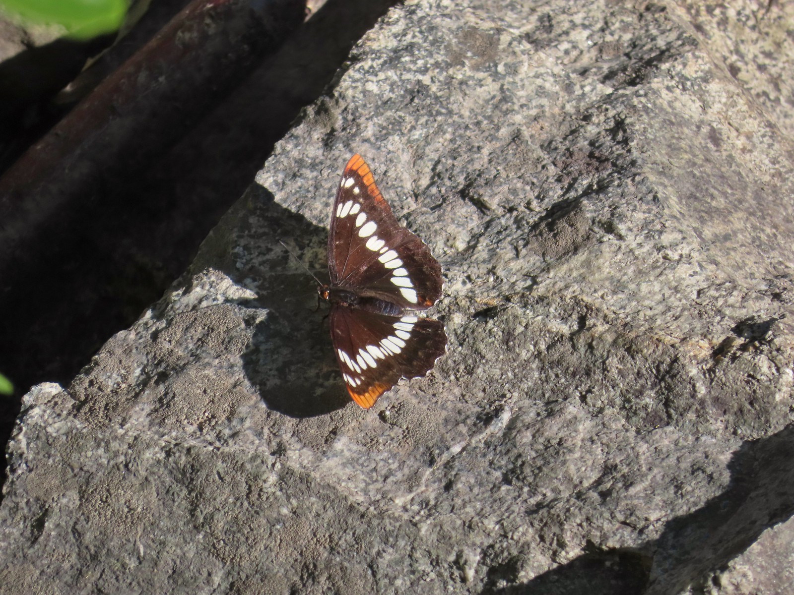 Lorquin’s admiral
We were on the lookout for rattlesnakes but didn’t see any (until one crossed the road on the drive back to Enterprise), but I did see three of what I believe were rubber boas.
 Can you spot the snake?
 The snake heading off the rocks into the brush.
While we fortunately didn’t encounter too many snakes there were hundreds of large crickets.

 I cleared this section of trail.

 Sumac along the trail.
 The only marker that Sullivan mentioned along the trail was this pillar on the right at the 2.8-mile mark.

 Painted lady
 St. John’s wort and poison ivy.
 Skullcap
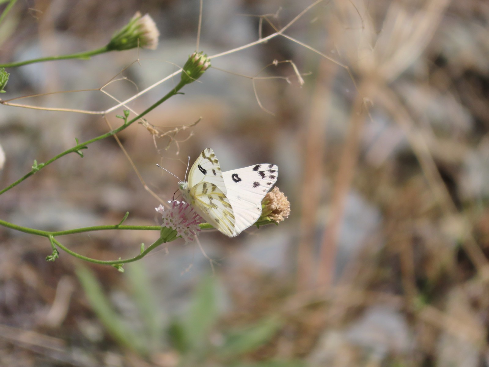 Becker’s white
 Our first view of the Snake River.

 One of several reminders of the mining town at Eureka Bar in the early 1900’s.

 The Mountain Chief Mine across the Imnaha River.
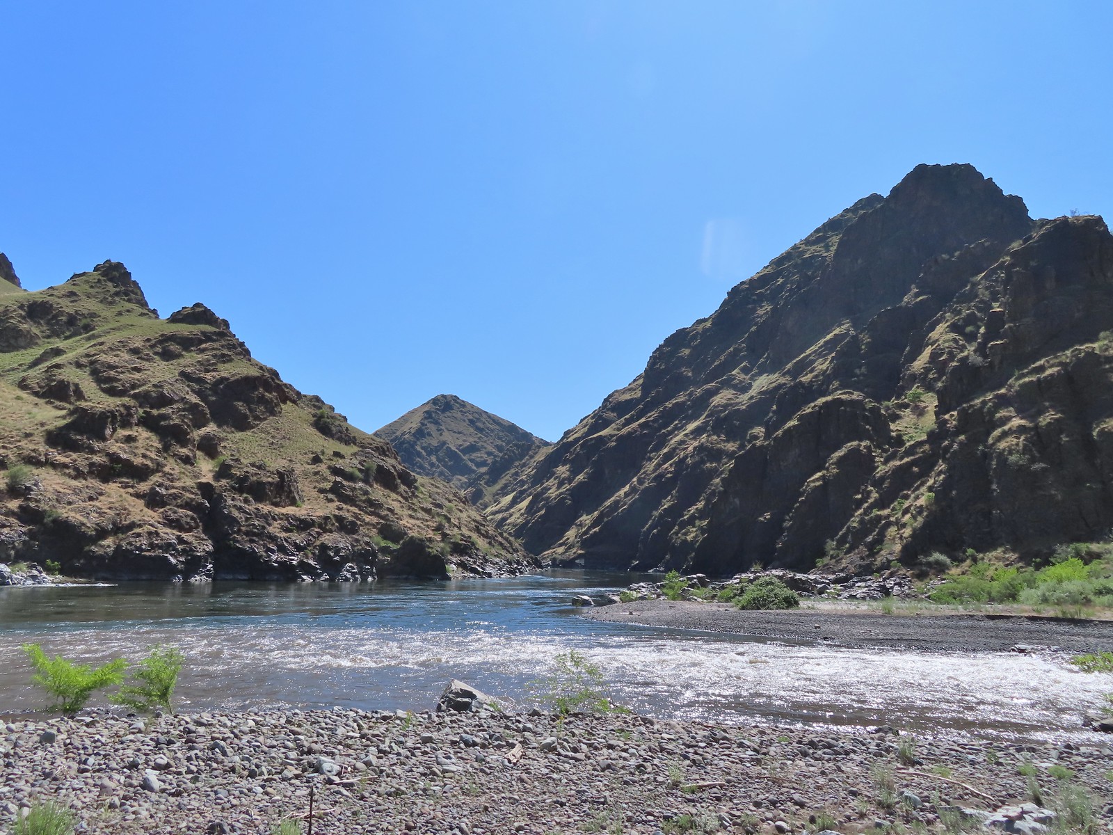
 The Snake River
 Chuckar in the brush across the Imnaha River.
 Eureka Bar
We followed the trail along the Snake River to a trail post near Eureka Creek. At one time 2000 people lived in this area but after a sternwheeler carrying machinery for a gold processing mill crashed and sank, investors pulled out and the town disappeared.
 Skipper on common bugloss.
 Imnaha River emptying into the Snake.
 Blanketflower

 Bindweed
 Sagebrush mariposa lily
 Another sagebrush mariposa lily
 Fleabane
 Stones where the gold processing mill was going to be.

 Long-leaved ground-cherry (Physalis longifolia)

 Orange globe-mallow
 Orange globe-mallow
 Our turnaround point.

 Another mariposa lily
 Ruins at Eureka Bar.

 Common merganser
We returned the way we’d come. It felt like there was somehow more poison ivy on the way back.
 A prickly pear cactus near Eureka Bar.
 Green cricket on poison ivy.
 Lazuli bunting
 Mourning cloak


 We missed all of these prickly pear cacti on the first pass.
 Arriving back at Dug Bar Road.
This hike ended up being 10.8 miles with 350′ of elevation gain.

On the way back to the trailhead we decided that we would not be doing Dug Bar on this day. It was already hot and we’d had enough of the poison ivy. It was also later than we’d expected due to slower hiking caused by the brushy trail. Sullivan had also removed Dug Bar from the featured hikes in his most recent “100 Hikes Eastern Oregon” guidebook so we could switch editions and not have to make it back in order to complete our 100 hike goal. Making that switch did mean that there were several other hikes that we’d done that were now no longer featured hikes and we’d have to add some new ones to our plans over the next year and a half to still be on track to finish by the end of 2024.
We wiped off our poles and clothes as best as we could and hoped that we had managed to avoid any exposure to the poison ivy. As of Monday the 19th we both seem to be in the clear. Happy Trails!
Flickr: Eureka Bar

7 replies on “Eureka Bar – 06/14/2023”
[…] ← Eureka Bar – 06/14/2023 […]
[…] it wouldn’t be another poison ivy filled hike like Wednesday’s hike at Eureka Bar (post) and that we would at least be able to make it to McGraw Creek which was 1.8 miles […]
[…] we’d decided that the featured hike at Dug Bar in Hells Canyon wasn’t going to happen (post). With us not willing to make the drive to that trailhead our quest to hike all 100 featured hikes […]
[…] was prompted by us not feeling comfortable with, or having the time to make, the drive to Dug Bar (post). Dug Bar had been removed as a featured hike in the newer 1st edition, along with a few others, so […]
[…] last year after deciding we weren’t willing to attempt the drive to Dug Bar in Hells Canyon (post). Sullivan had removed Dug Bar from the featured hikes along with six other hikes which we had […]
[…] #48 Eureka Bar – Hiked 6/14/2023 […]
[…] just 25.4 miles. We had driven the first 14 miles of this road for the featured Eureka Bar hike (post) and had zero interest in repeating those 14 miles, let alone another 11.4 that were said to be […]