
To finish off our Labor Day Weekend we chose a hike almost halfway between Burns and Salem, Fryrear Canyon. Managed by the BLM (Prineville District) as part of the Cline Buttes Recreation Area there isn’t a lot of information available online that I could find outside of an area closure map for nesting birds from February 1st through August 31st. (Please note that the trails shown on the linked map are a little bit different than what we found.)
The Fryrear Trailhead is located along Fryrear Road which runs between Highways 20 and 126. From Highway 20 the trailhead is on the right after 2.3 miles and from Highway 126 it is on the left after 3.2 miles.
 The trailhead has numerous parking spots for cars as well as a large horse trailhead, outhouse, and picnic tables.
 The big signboards unfortunately did not have a map or other information about the trail system though.
We headed East past a gate on a well established path with flagging.


 The North Sister behind us.
After a third of a mile we came to an unsigned “T” junction where we turned right.

We followed the path and flagging when there were forks for half a mile to the start of Fryrear Canyon.

 Signpost for the canyon ahead.
 This sign was just like the ones we’d seen Saturday at the Dry River Canyon (post).
We descended into the canyon and spent the next mile admiring the rock formations and various vegetation growing along the canyon floor.


 The canyon is home to some impressive ponderosa pines.

 Another ponderosa
 Looking up from below the ponderosa.
 Lichens


 Townsend’s solitaire
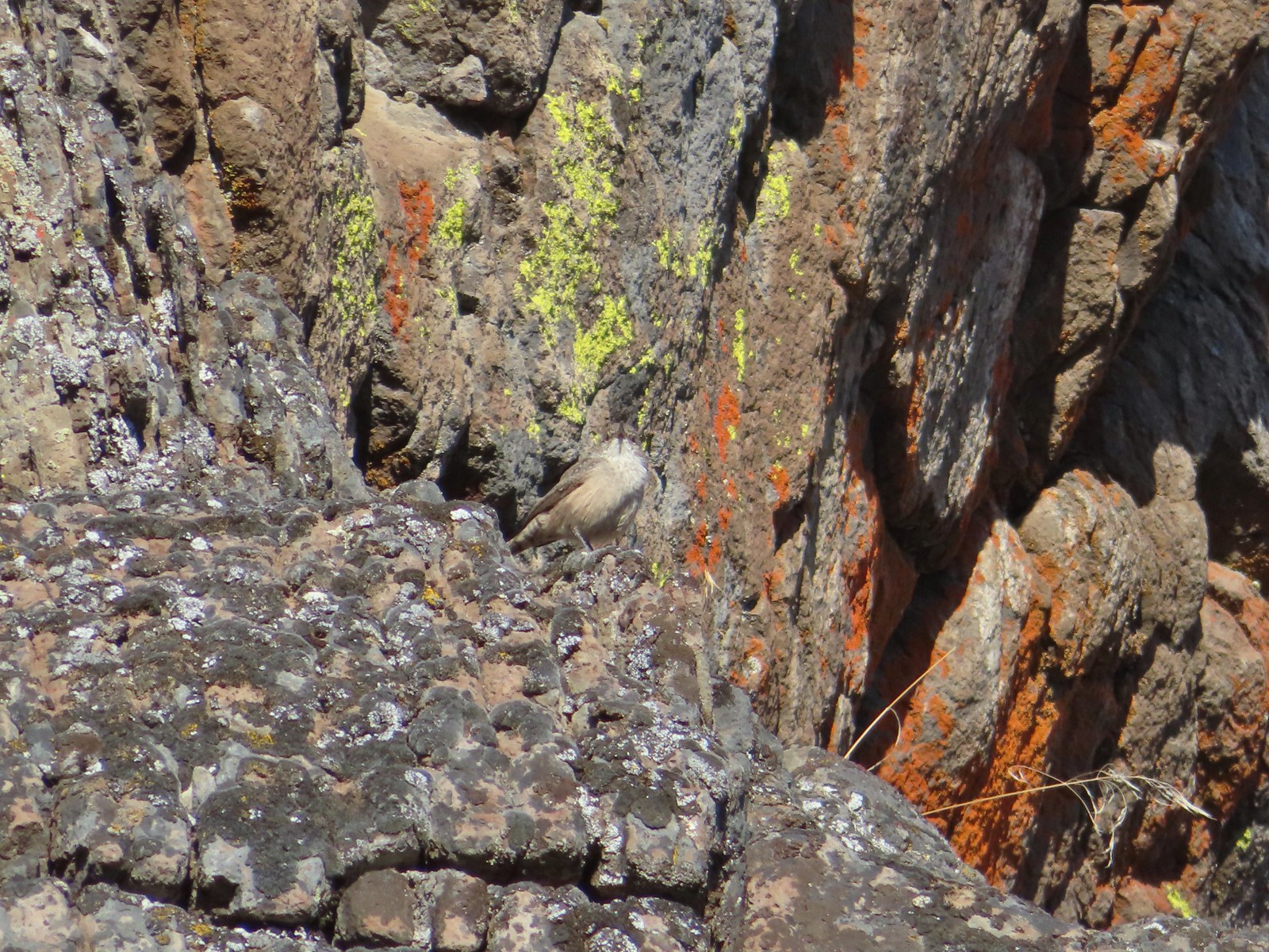
 Owl
Owl

 West wall
 East wall
 Wren
Wren
 Neat rock formation.
 Exiting Fryrear Canyon.
A short distance after leaving the canyon we arrived at a gate with a trail junction on the other side.

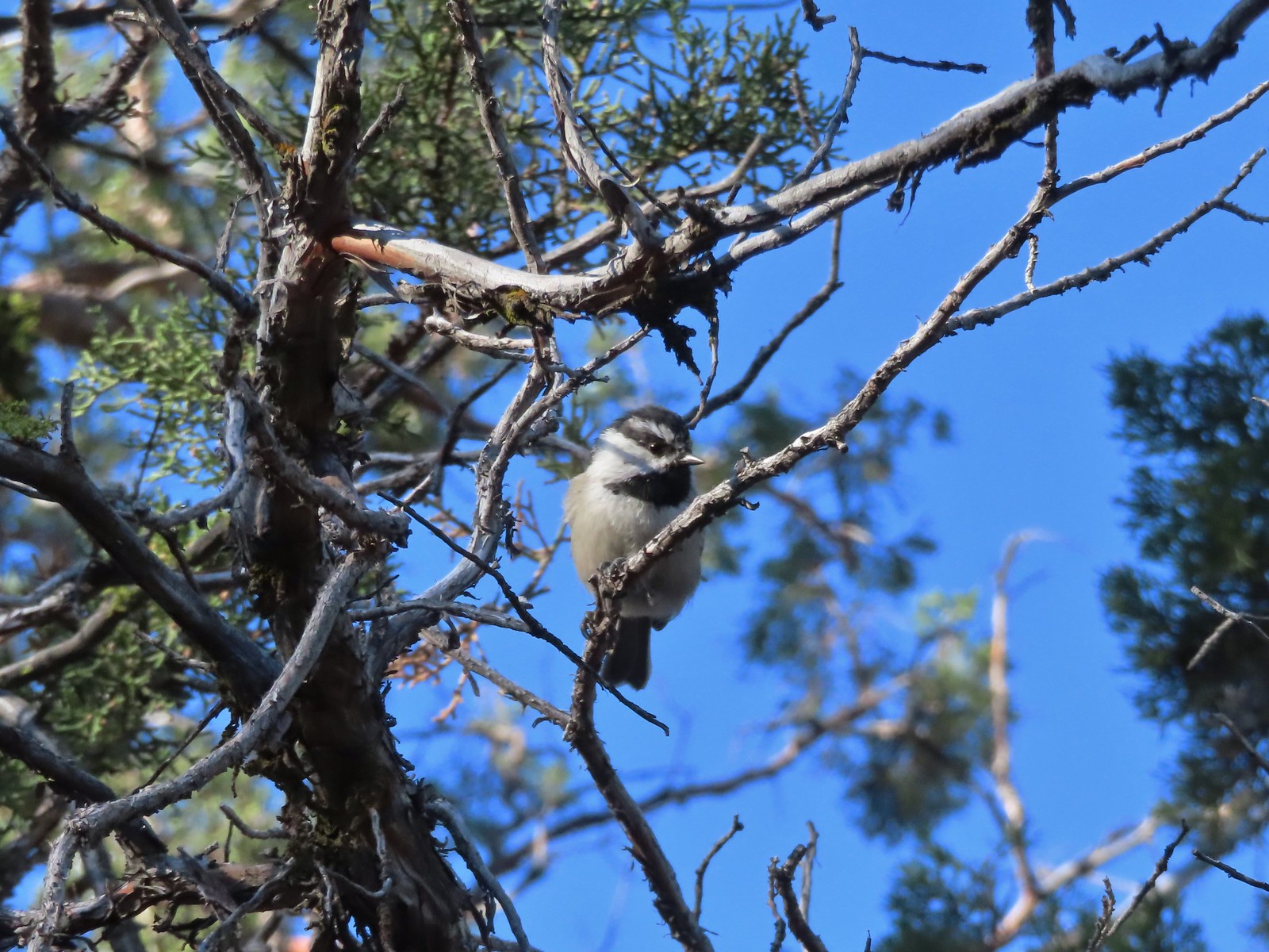 Several mountain chickadees came to investigate as we passed through the gate.
We turned left at the unsigned junction and climbed up a small hill gaining a view of the Three Sisters.


 Middle and North Sister
 Mountain bluebird
 South Sister
A little further along we gained a view of Mt. Jefferson (behind a few clouds).

 Mt. Jefferson
We stayed left at junctions to complete a loop.
 Broken Top and South Sister
 Broken Top behind some clouds.

 We turned right back onto the spur trail to the Fryrear Trailhead at the end of our loop.

 Stellars jay
The hike was 3.3-miles with 200′ of elevation gain.

We had a great time on this hike. Fryrear Canyon was absolutely wonderful. The rock formations and textures were very interesting and so was the vegetation along the canyon floor. Throw in some wildlife and mountain views and you have the makings of a great hike. Happy Trails!
Flickr: Fryrear Canyon
