
We used our second extended vacation of the year to continue our quest to complete 100 featured hikes from William L. Sullivan’s “100 Hikes/Travel Guide Eastern Oregon” edition 3rd edtion (post). Heading into 2023 we had done 79 out of the 100 featured hikes and had planned to check off five more on this trip to Enterprise, OR. On the way to Enterprise, a 7 1/2-hour drive from Salem, we stopped at Hat Rock State Park. We had originally planned for this stop to be a quick leg stretcher and just hike the mile loop passing Hat Rock, but a couple of late changes to our planned hikes for the remainder of the week reduced our milage so we extended our visit by hiking the Lewis and Clark Commemorative Trail to McNary Beach. This was not one of Sullivan’s featured hikes but the Lewis and Clark Trail is covered in his additional hikes under the Columbia River Railroad.
There are several large parking areas in the park and we wound up parking near the picnic area.

We took a paved trail on the opposite side of the parking lot from the picnic area which climbed up to another parking lot and trailhead.

 The parking area at the trailhead.
 Signboards at the trailhead.
 Trail map.
We headed counterclockwise on the loop which quickly brought us to Hat Rock.


The basalt feature is part of the Columbia Basalt eruptions, a series of lava flows that left basalt a mile thick in some places.

We continued on the loop detouring to a bench overlooking a pond.

Beyond the viewpoint the trail descended to a junction along the pond. Here we turned right which took us across a footbridge to a boat ramp.


 Lake Wallula from the footbridge.
We crossed the parking lot at the boat ramp to a continuation of the trail which led uphill to the Lewis and Clark Commemorative Trail.

 Eastern kingbird near the boat ramp.
 Post ahead marking the junction with the Lewis and Clark Trail. There is also a deer below the cliffs ahead.
 Zooming in on the doe.
We turned right on the Lewis and Clark Trail. The former railroad grade follows the shore of Lake Wallula on the Columbia River. The lake is created by the McNary Dam which was visible near the western end of the trail near McNary Beach.

 Lake Wallula
We followed the trail a total of 4.8 miles to McNary Beach where we took a short break at a shaded picnic table. While the scenery didn’t change much the views were good and there were lots of birds along the way filling the air with their songs.
 Raven with an egg it had snatched from some other bird.
 Broad-leaved pepperweed (invasive)
 Initially there were some houses on the left, but they gave way to the Wanaket Wildlife Area.
 Most of the balsamroot was long past done but a few late blooms remained.
 Dove
Dove
 A fleabane

 Swallow
 Patterns on Lake Wallula
 Western meadowlark signing from atop the cliffs.
 Sign for the Wanaket Wildlife Area
 Lark sparrow
 Box Canyon
 There were a couple of small hills but over all very little elevation gain.
 Another western meadowlark.
 Cormorant

 Mallard
 Showy milkweed and a bunch of bees.
 Trail sign near McNary Beach
 Our rest stop.
We returned to Hat Rock State Park the way we’d come.
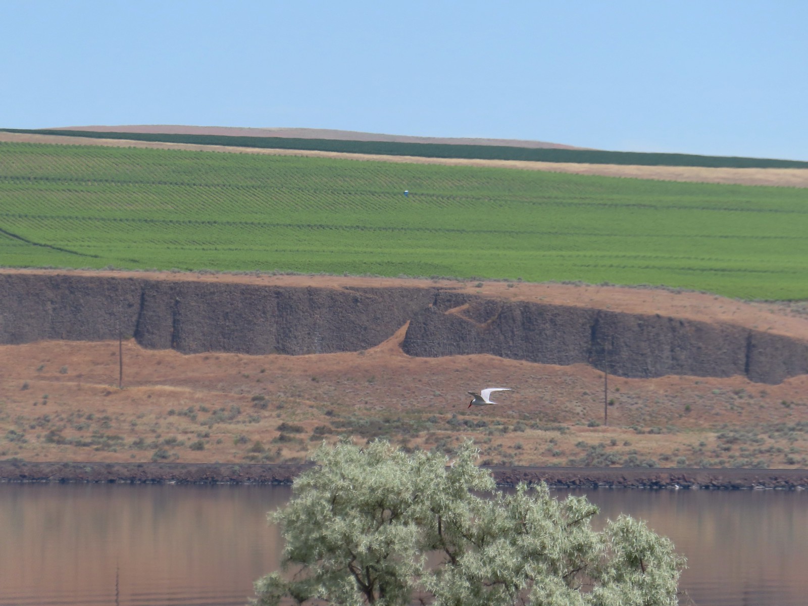 Caspian tern
 Hawk
Hawk
 Gray hairstreak on tall tumblemustard

 Becker’s white also on tall tumblemustard.
 Boat Rock to the left and behind Hat Rock from the Lewis and Clark Trail.
We recrossed the footbridge and followed the path along the pond to complete the loop back to the picnic area.


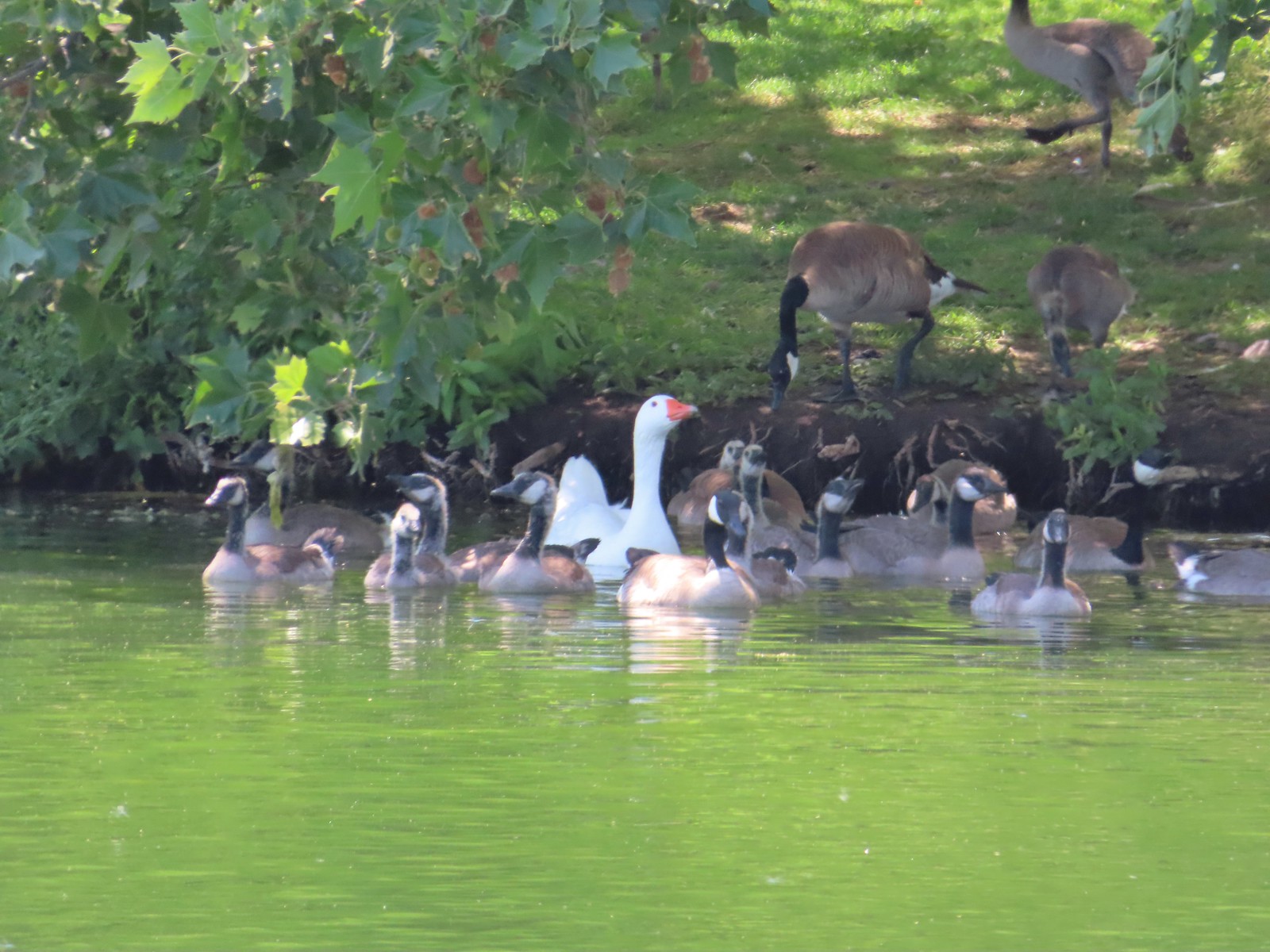 One of these is not like the others.

We ate lunch at a table in the picnic area before getting back in the car and driving to Enterprise. Our hike here came in at 10.9 miles with approximately 200′ of elevation gain.

The trail is mostly exposed to the Sun so it got a little warm but overall it was a pleasant hike. We only saw a hand full of others on the trails but there were plenty of people at Hat Rock Park itself and a fair number at McNary Beach. This was a good kick-off hike for our trip and we looked forward to more eastern Oregon scenery to come.
Two days after our visit (Tuesday 6/13) the Hat Rock Fire started near the SE corner of the park at the Highway 730/Highway 37 junction. Fortunately the fire spread away from the park. The fire is now 100% contained but it grew to over 16,800 acres before containment occurred. Happy (fire free) Trails!
Flickr: Hat Rock State Park
