We had spent Wednesday wading through poison ivy along the Imnaha River on our way to Eureka Bar (post). Thursday’s hike promised to involve a lot less poison ivy even though the trailhead was less than four miles as the crow flies from the Cow Creek Trailhead where we’d parked the day before. This was because we would be starting over 4000′ higher in elevation at Buckhorn Lookout.
Before we made it to the lookout we stopped to watch a small herd of elk cross the road and run up a hillside.

 At least one bull in the herd.
We parked at the lookout and checked out the view there first then walked back along the road 0.2-miles and turned right on Forest Road 780 for another 1.2-miles to a gate.
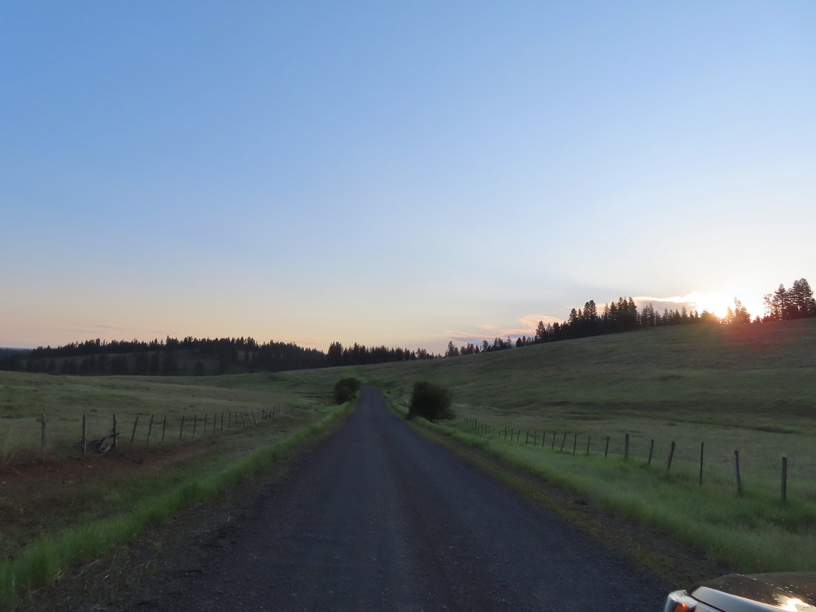
 Buckhorn Lookout


 Hells Canyon
 Tolmie’s onion
 Pale paintbrush

 Larkspur, lupine, and northern mules ears.
 Prairie smoke a.k.a. old man’s whiskers
 Purple sticky geranium
 Paintbrush
 Parsley, larkspur, large flower triteleia, and Tolmie’s onion
 Phlox
Phlox
 We could have driven the 1.2-miles on FR 780 to the gate but the road was not in good shape and after driving to Eureka Bar the day before we weren’t interested in another rough road.
 Mallow ninebark
 Arnica
 Large flower triteleia


 Gate at the end of the road.
 Marker for the Nez Perce – Nee-Mee-Poo National Historic Trail.
The trail followed an old roadbed downhill 7.6-miles to Eureka Bar, but our plan was to go just 3.6-miles to what Sullivan refers to as the “Eureka Viewpoint”. The entire route was lined with wildflowers. The mixture and types changed as we lost elevation, over 1780′ in all, to the viewpoint.


 Columbian lewisia

 Seven Devils in Idaho
 Lupine, yarrow, buckwheat, and scarlet gilia
 Scarlet gilia


 Elkhorn clarkia a.k.a. ragged robin
 Another impressive scarlet gilia.
 Paintbrush, lupine, phacelia, thistle, and scarlet gilia

 Penstemon
 A phlox
 Scabland penstemon
 Threadleaf phacelia
 Penstemon
 Paintbrush
 Lark sparrow
 Cedar waxwing
 Elkhorn clarkia
 Wallflower

 Skullcap
 Nettle-leaf giant hyssop
 Monkeyflower and some tiny white flowers near a seep.
 Buckwheat


 Mylitta crescent
 Rough eyelashweed
 Looking back up the trail.
 At Spain Saddle the road switched to the opposite side of the ridge.

 Bush penstemon

 Another type of penstemon
 White spiraea
 Manyflower tonella
 Owl’s clover
Six tenths of a mile from Spain Saddle we detoured left along a fence to a viewpoint.
 The viewpoint on the far side of the fence.

 Boat on the Snake River.
 Salsify
We continued on from the first viewpoint and wound up having to yield the trail to a few cows that were being herded up the trail. After the cowgirl convinced them it was safe to pass by us we resumed our downhill hike.

 Bindweed
 Thistle with bugs.
 Clouds moving in behind us.
 Prickly pear cactus
 The only poison ivy we saw all hike.
 Eureka Viewpoint ahead to the left.
 Hairy goldenaster
 Fleabane
 Eureka Viewpoint
 Looking back
 Looking down

 Clustered broomrape
The most exciting part of Eureka Viewpoint wasn’t the view. It was finding some prickly pear cactus in bloom.


As for the view the three small portions of the Snake River was visible below.


 A very small part of the river is visible to the left and more to right.


As we rested at the viewpoint we got to looking around and realized that there was a common nighthawk sleeping on a nearby fence post.


After a good break we began the long climb back to the lookout. The forecast had been for mostly sunny skies but it had grown increasingly hazy all day and there were now even more clouds converging overhead. It didn’t rain so the cloud cover was welcome as it kept the temperature from getting too high. The haze, which was smoke from wildfires was more problematic as it really hindered the views and by the time we’d reached the lookout we couldn’t see nearly as much as we had that morning.
 Here come the clouds.
 We spotted a rock arch on the way up that we’d missed earlier.
 A closer look at the arch.
 Common wood nymph
 Spotted towhee

 Northern flicker
 The only time we noticed the Imnaha River from the trail.

 Butterfly near the seep.
 Mountain parnassian on yarrow.
 A painted lady butterfly.
 Chipping sparrow
 We could actually smell a little smoke at times on the way back.
 Tiny trumpet
 Hound’s tongue and roses
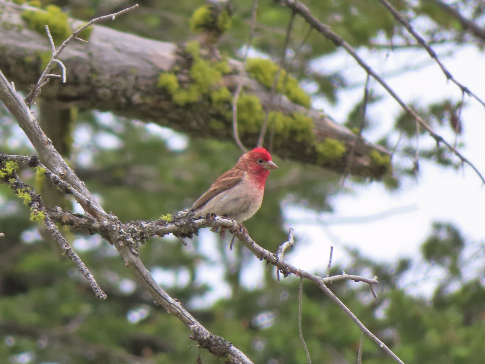 Cassin’s finch
 Western bluebird
 Western tanager
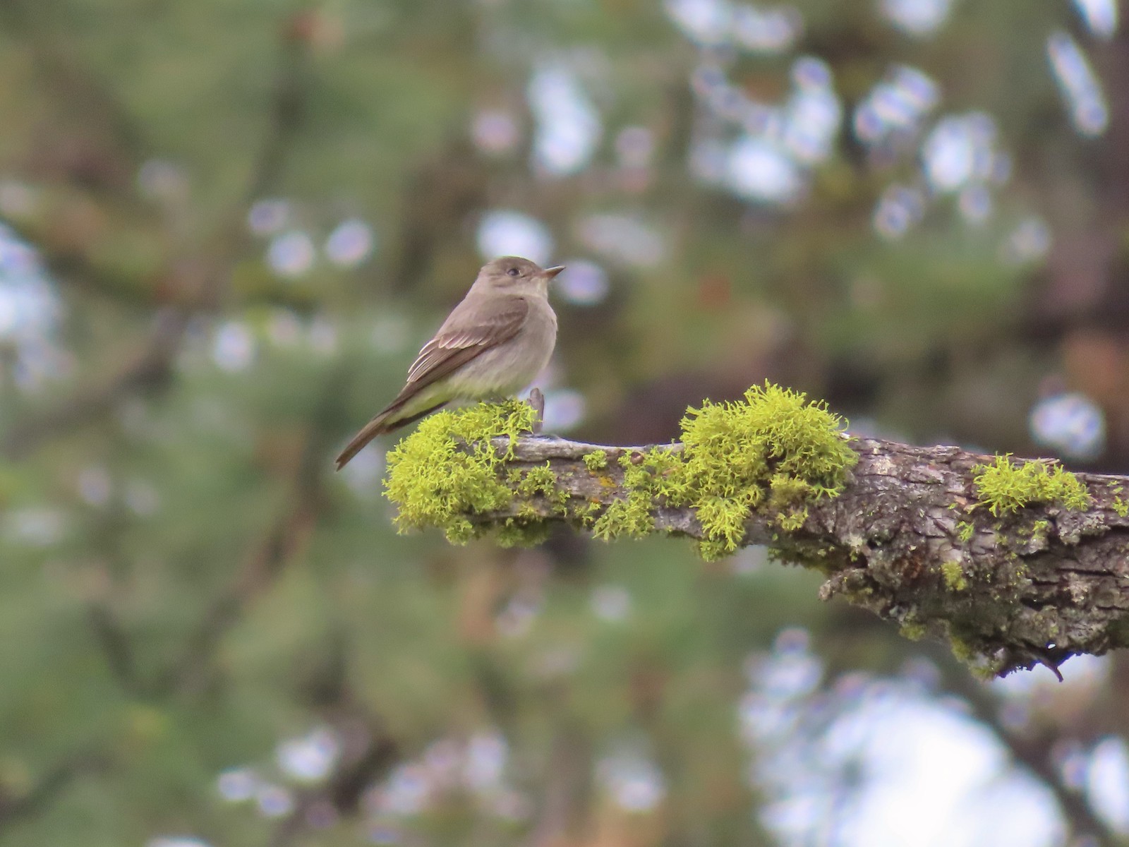 Western wood peewee
 Hairy Indian paintbrush
 Hoary balsamroot
 Mountain bluebird
 The view in the afternoon from the lookout.
This wound up being our favorite hike of the trip despite the views not being as clear as we would have liked, and is one we would certainly revisit given the chance. We’re pretty sure we saw at least 50 different species of wildflowers and the views were good even with the smoke and clouds. Round trip was 10.8 miles with almost 1800′ of elevation gain, almost entirely on the way back.

After driving back to Enterprise we cleaned up and headed to Terminal Gravity Brewing for a nice dinner with a view of the Wallowa Mountains. The next morning we would be leaving Enterprise and heading for Pendleton via the long way around the Wallowas so we could make three stops along the Snake River. Happy Trails!
Flickr: Buckhorn Lookout
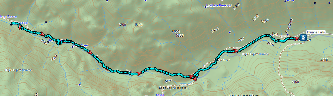
 Indian Crossing Trailhead
 Imnaha River at the trailhead.
 Jessica’s stickseed
 Hooked spur violet
 Woodland star
 Valerian
 Arnica

 Violets
 We passed a pack station in the forest on our right.
 Ballhead waterleaf
 Lupine along the trail
 Anemone
 Western meadowrue
 Paintbrush along the trail.
 Larkspur, lupine, and Jessica’s stickseed
 Chipmunk
 A nice patch of lupine.
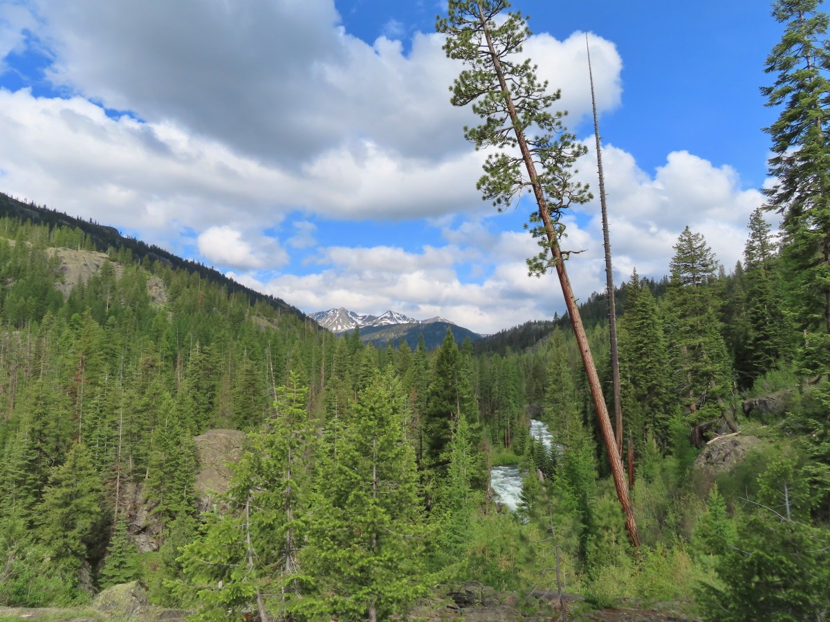
 Snow patches high up on the ridge.
 The Imnaha River below the trail.
 One of many small unnamed stream crossings.
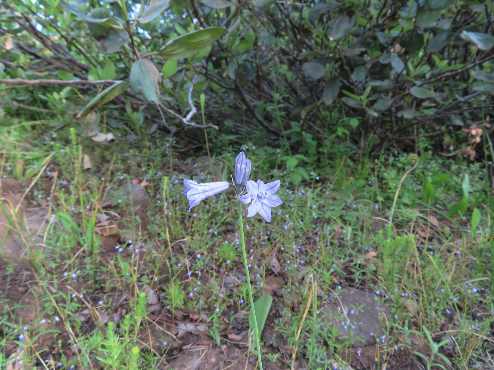 Large-flower triteleia
 A ponderosa pine that survived the fire.
 Robin
Robin One of several types of penstemon along the trail.
 We were just sure that there should be elk, deer, or a bear down along the river here.
 There were quite a few of these millipedes in the trail.
 In some cases the creeks had taken over the trail.
 Cinquefoil
 A brushy section of the trail.
 Tall bluebells
 Two-tailed tiger swallowtail


 Blue Hole, not exactly blue this time of year due to the amount of silty snowmelt water swelling the river.
 Wildflowers above the gorge.
 The Imnaha emerging from the gorge into Blue Hole.
 Arnica along the trail.
 Coming up on a small stand of aspen.
 A rockcress
 Juba skipper
 Roundleaf alumroot
 Painted lady on Oregon sunshine.
 Glacier carved rock outcrops provided some excellent views and good habitat for wildflowers.


 Scabland penstemon
 Paintbrush
 Not a flower but very colorful.
 Bush penstemon
 Western tanager
 Western blue clematis
 Brown creeper on a tree trunk.
 Left is Marble Mountain and to the right further back is Honeymoon Summit.
 Larkspur along the trail.
 Heartleaf springbeauty
 Another flooded section of a the trail.
 Western tiger swallowtails on chokecherry.
 Dreamy duskywing
 Threeleaf lewisia
 We were too late for the Brown’s peony blooms.
 Balsamroot and paintbrush
 On the opposite side, with a series of drops, is Rock Creek flowing into the Imnaha.
 The Imnaha River leaving the gorge.
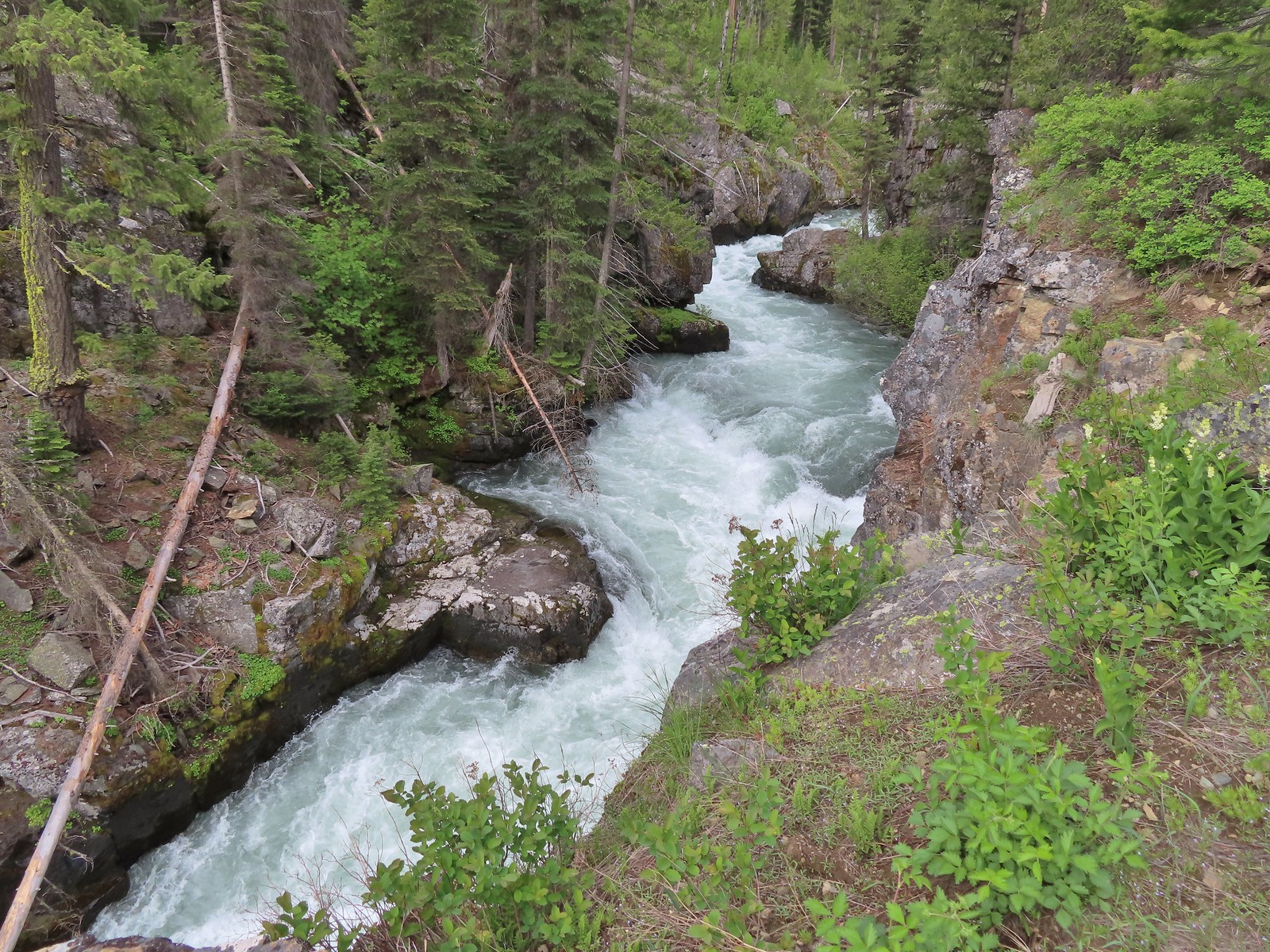
 Rock Creek cascading down through the forest.
 Another creek cascading down.
 Marble Mountain
 Twinberry honeysuckle
 Marsh violet
 Rock outcrop above Imnaha Falls
 I tried going down river first to see if I could get a view back up to the falls, but the water level was into the brush along the riverbank.
 The falls were just upriver from this bench with a couple of campsites.
 The gap in the outcrop.
 Imnaha Falls.
 Utah honeysuckle
 Bee on a dandelion
 Nettle-leaf giant hyssop
 Slender phlox
 Silverleaf phacelia
 Vetch
Vetch
 Osprey, the fishing here must have been good because we’d seen a bald eagle in this area in the morning.
 Fairy slipper
 Arriving back at the trailhead.