For the final hike of our week in Enterprise we had purchased tickets for the Wallowa Lake Tramway. The tram was built in 1970 as the steepest 4-person gondola in North America. It takes 15 minutes to travel the 1.83-miles from the 4450′ lower terminal to the 8150′ upper terminal.
The operating hours vary but the tram was running from 9am to 4:30pm so we had some extra time in the morning which we used to check out the Sugar Time Bakery in Enterprise before driving to the tram. We were a little early and did some wandering around Wallow Lake before the tram opened and then were the first riders of the morning.


 View after coming back down.
The ride provided some nice views. Fortunately for us it was the clearest morning that we’d experienced all week. When we arrived at the upper terminal we exited our gondola and prepared to set off on our hike.


 The tramway from the top.
We were continuing to check off featured hikes toward our goal of completing at least part of each of the 100 hikes featured in William L. Sullivans “100 Hikes Eastern Oregon” (post). He describes two options for hikes on Mount Howard – a 1.9-mile loop and a 5.5-mile hike that adds an out-and-back to a spring below nearby East Peak. Heather had opted for the 1.9-mile loop and I was going to try the longer hike so we split up and I headed for the Royal Purple Overlook.

 Pointer for the Royal Purple Overlook (right) and Summit Overlook (left).
 Penstemon
 Heading out to the Royal Purple Overlook.
 They do hold weddings up on the mountain.

 Lewis flax
 Mountain coyote mint
 The Hurwal Divide, Point Joseph and Ruby Peak from left to right.
 Pete’s Point, West Aneroid Peak, Eagle Cap the furthest away (post), and Craig Mountain.
 Closer look at Eagle Cap.
 Craig Mountain and the Matterhorn (post).
 East Peak
Heather arrived at the overlook just as I was ready to move on to the Summit Overlook. We took a minute to appreciate the view together and then I headed back to the loop.
 Pano that Heather took with her phone.
 Buckwheat
 Pointer for the Summit Overlook.
 View from the Summit Overlook. Heather is standing on the Royal Purple Overlook.
 Buek’s groundsel

 Point Joseph
 East Peak as I neared the Summit Overlook.

 The Seven Devils poking up above the smoke from Idaho.
 Seven Devils
 Mount Melissa to the left and East Peak straight ahead.
Sullivan’s 5.5-mile option included taking a short-cut near the Summit Overlook to link up with the trail leading to the spring. While the short-cut path was obvious it was also clear that the Forest Service doesn’t want people using it based on the sign asking people to stay on official trails and the wood placed over the start of the path.

As a compliance officer it’s my job to follow the rules and guidelines and that’s what I did here. It would add roughly half a mile to my hike, but I remained on the loop for another 0.2-miles dropping to a 4-way junction where I turned right.
 The 4-way junction.
 East Peak from the 4-way junction.
This trail was clearly less utilized than the Summit Loop and it dropped down a ridge before turning toward East Peak and traversing to a saddle below the Summit Overlook.


 Mountain bluebird

 Climbing to the saddle.
 The view from the saddle.
 Wood blocking the lower end of the “short-cut”.
From the saddle the trail climbed steeply through some trees gaining 200′ in 0.2-miles.

 Looking back at the Summit Overlook during one of my several breaks during the climb up.
The trail continued to climb, but a bit less steeply, for another 0.4-miles to a second saddle.
 There were a few obstacles to avoid along the climb as well.
Meanwhile Heather was admiring a spring along the Summit Loop.

 The Royal Purple Overlook from the trail.
 Up, up I go.
 Golden-mantled ground squirrel watching me navigate some blowdown.
 The views helped keep my mind off the climbing.
 The second saddle in sight.
 The angle was enough different from the saddle that I could see a couple of additional peaks.
 The Matterhorn on the left and now Sacajawea Peak behind the Hurwal Divide to the Matterhorns right.
 The saddle provided a brief level stretch before the trail launched steeply uphill again.

I was now in the Eagle Cap Wilderness. The trail gained nearly another 300′ over the next 0.4-miles where I arrived at a faint fork.

 East Peak
 Lots of buckwheat along this section.
 Buckwheat and lupine above the trail.
 The fork. According to Sullivan the righthand fork peters out in about 0.2-miles and then it’s possible to scramble up East Peak in another three quarters of a mile. I went left heading for the spring.
The trail lost just a little elevation then made a nearly level traverse below a tiny snow field to arrive at a series of springs.

 The McCully Creek Trail which we hiked a couple of days earlier (post) is on the far side of the near ridge.
 A phacelia
 Lyall’s Goldenweed
 Wallflower
 Looking back at the trail.
 Flowers near the springs.
 Shrubby cinquefoil surrounded by bistort and mountain death-camas.
 Mountain death-camas and bistort

 Looking up at the springs.
 Monkeyflower
I ventured past the first large spring and hiked to an open rocky ridge where I gained a view of Aneroid Mountain.
 There were several smaller streams below East Peak.
 Aneroid Mountain
 Ground squirrel
 View from my turn around point.
 Looking back at my route to the second saddle.


I headed back to the Summit Loop where I continued around the outer loop to the Valley Overlook.
 Dusty maidens near the springs.
 Heading down to the saddle.
 Cairn at the saddle.
 Milbert’s tortoiseshell
 Pale agoseris
 Climbing back up to the 4-way junction.
 Back on the Summit Loop.
 Crossing the service road coming up from McCully Creek.
 Mountain Heather
 Pointer for the Valley Overlook.
 Spur trail to the Valley Overlook.
 Flag at the Valley Overlook.
 Wallowa Lake below the Valley Overlook.
 Wallowa Lake
 East Peak peaking up over the trees.

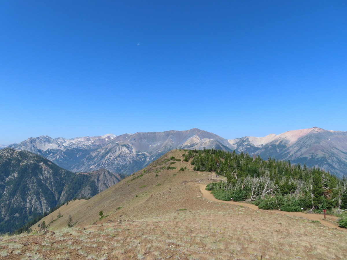
I returned to the loop and continued another half mile back to the upper terminal of the tramway.

 Wallowa Paintbrush
 The upper terminal.
It was hard not to stop and order some food from the Summit Grill since it smelled so good when I met back up with Heather, but we had a 6:30 hour drive home ahead of us so we simply hopped back on the tram for the 15-minute ride back down to the car.
 Apparently Heather was busy making a friend while I was visiting the springs even though she did not feed any animals.
My hike wound up being 6-miles with a little over 1200′ of elevation gain.
 The straight line is the tram ride.

The hiking portion highlighted.
This was a nice way to end our trip, but it would have been even nicer if we’d have felt like we had more time to just hang out up on the summit. Knowing that this had been the best day for the views helped us not wish we’d have scheduled this hike earlier in the week though.
We headed home through the smoke from the various fires and felt fortunate that we were able to get our six days of hiking in and check off half (6 of 12) of our remaining featured hikes putting us at 494/500. We’re still hoping to finish this year but given the fire situation that may be a longshot. Happy Trails!
Flickr: Mount Howard
