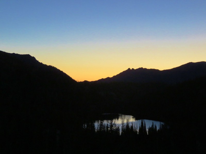
The fourth day of our backpacking trip began with a nice sunrise over Moccasin Lake.
Our plan for the day was to take our day packs and hike to the summit of Eagle Cap, then pack up camp and move to Horseshoe Lake for the final night of our trip.
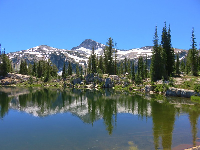
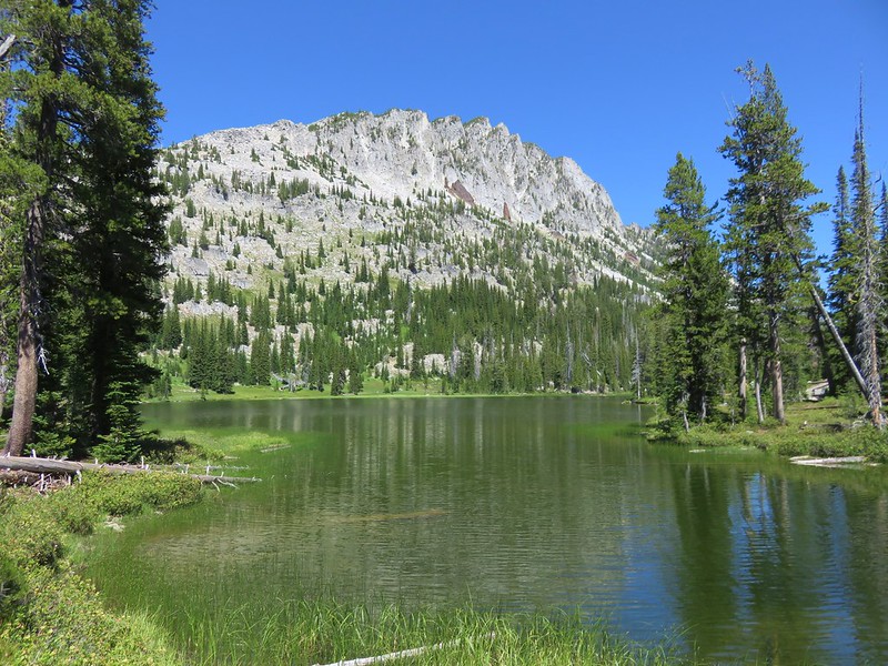
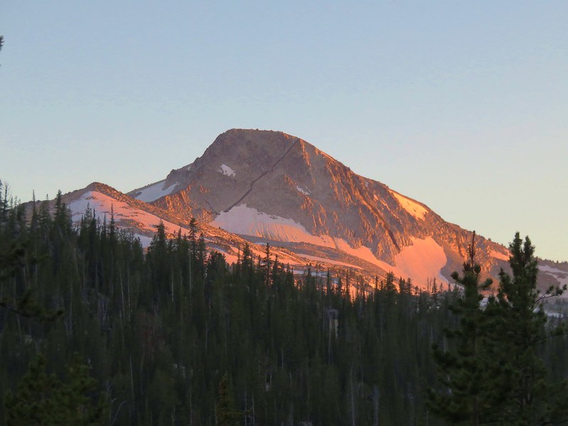
It had been rather breezy the day before and we were hoping that wouldn’t be the case today so that we could get catch some reflections of Eagle Cap in the lakes. A gentle breeze kept that from happening.
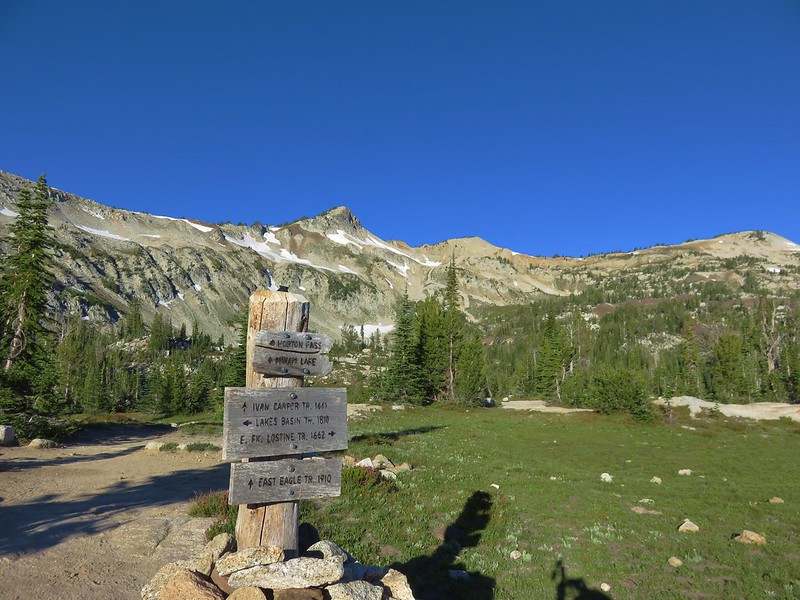
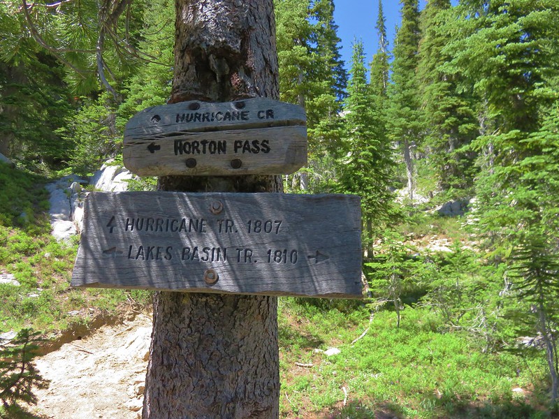
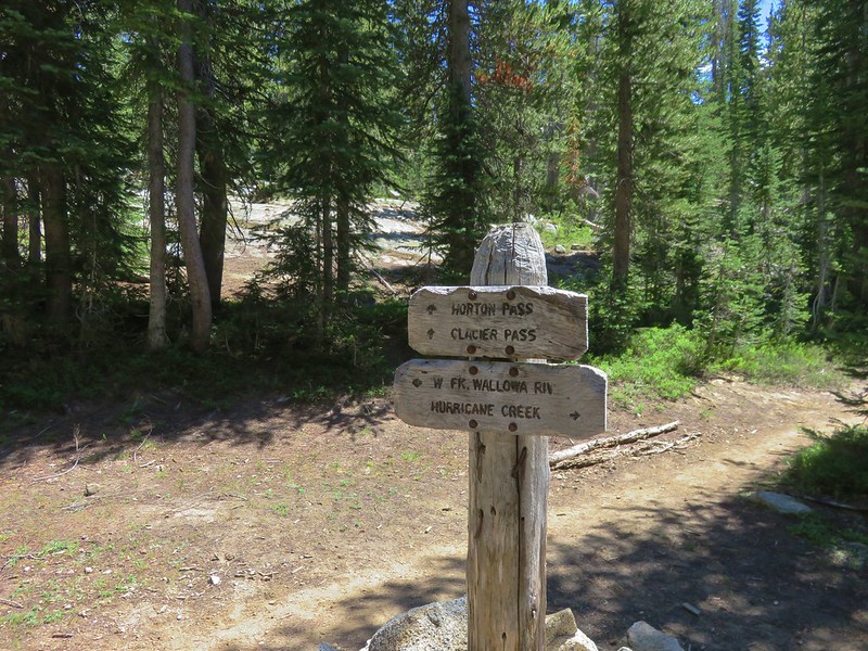
We hiked to the west end of Mirror Lake and followed signs toward Horton Pass at a 4-way trail junction.
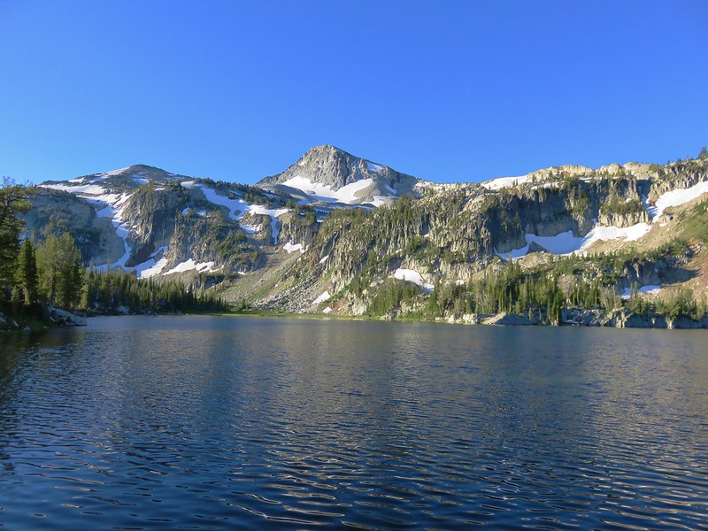
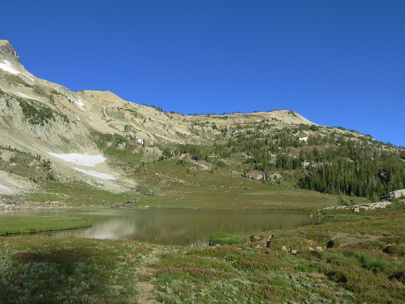
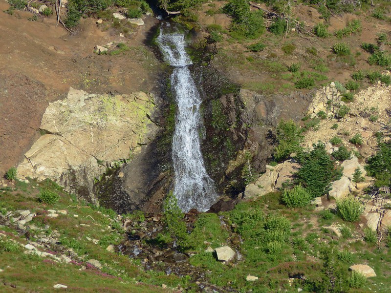
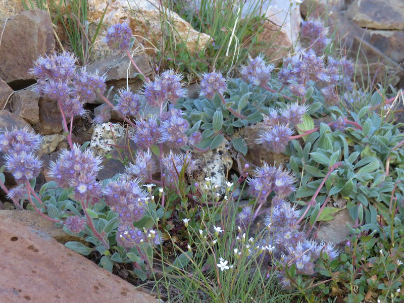
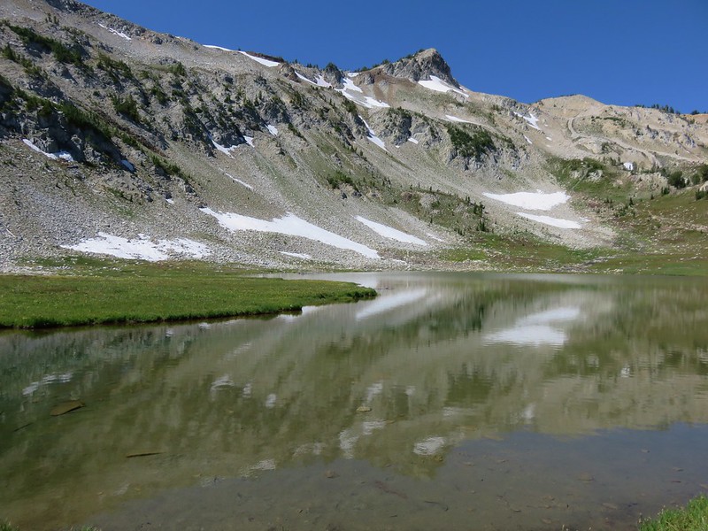
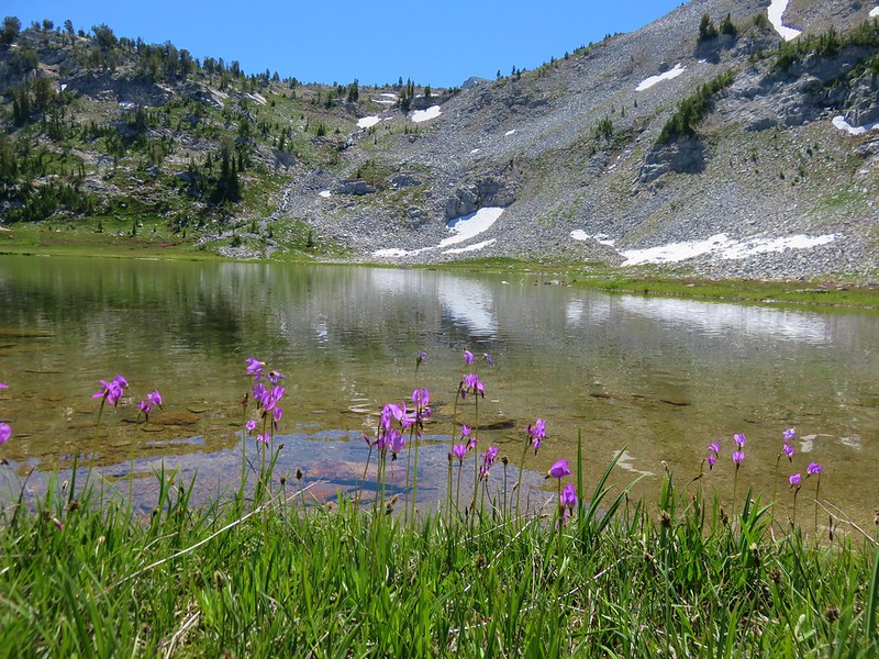
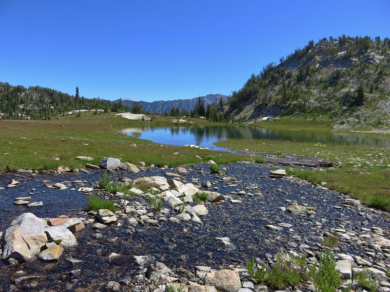
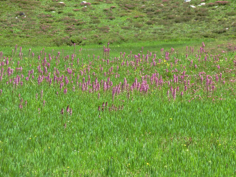
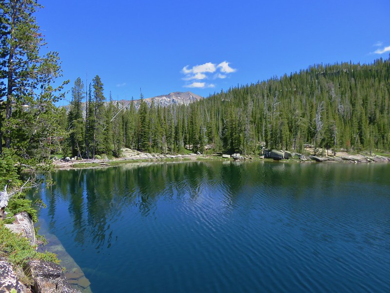
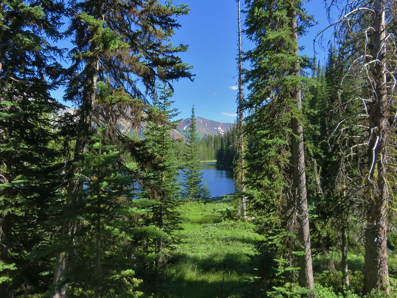
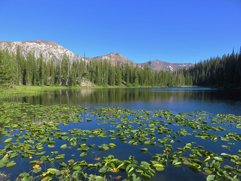
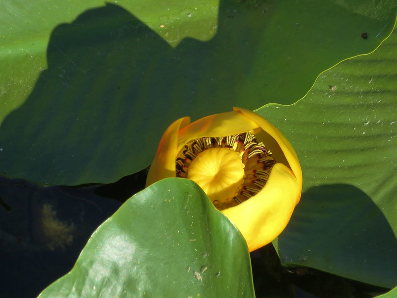
The trail took us past Upper Lake set in an alpine bowl surrounded by wildflowers and backed by a scenic waterfall on the far side of the valley.
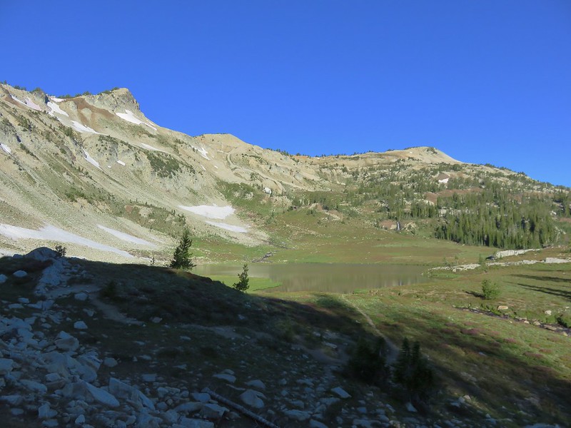
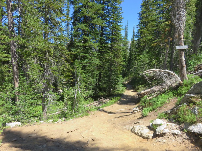
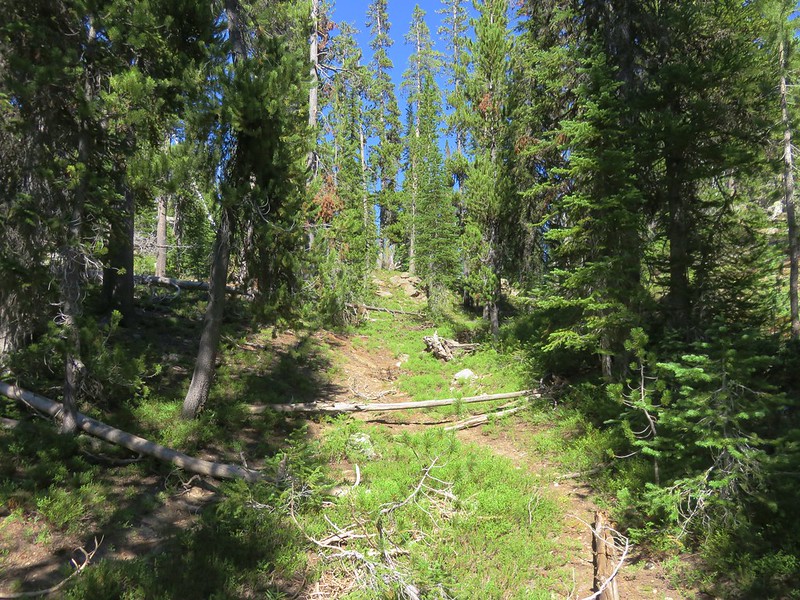
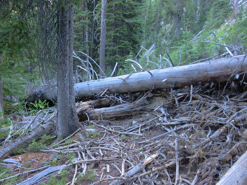
The trail climbed up from Upper Lake toward Eagle Cap.

We knew we would be encountering some patches of snow based on recent trip reports from Van Marmot and Born2BBrad over on Oregonhikers.org. We also knew that it would be fairly easy to avoid the snow which was good given our early start because the snow was still iced from the night before.
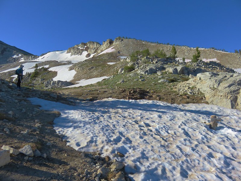
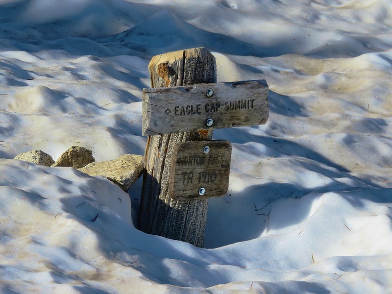
From the sign in the snow we had the choice of going right to Horton Pass and following the ridge from there or going left and making a steeper climb to a higher point on the same ridge. Looking at the trail up to Horton Pass it seemed to have not only more snow but it was on a steeper slope than staying left so we chose that route and climbed to the ridge where views opened up to the west.
To the NE lay the Lakes Basin and the Matterhorn.
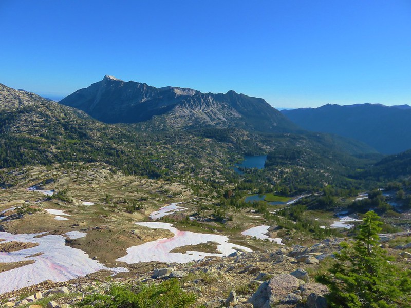
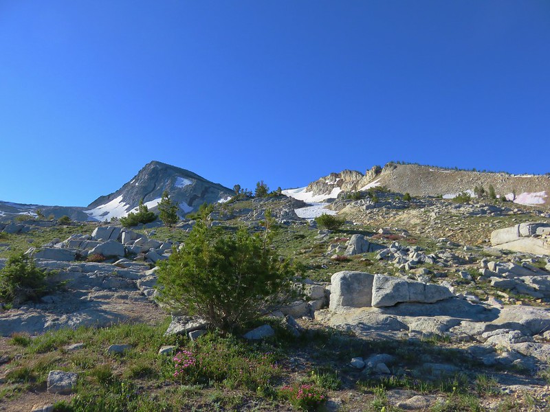
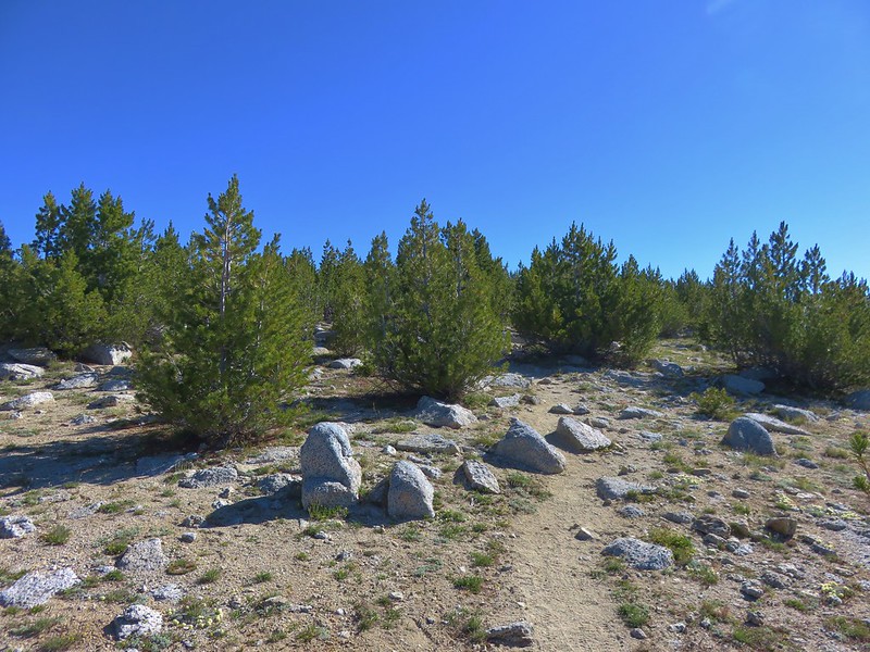
The west side of the ridge was covered in short trees and we passed through this forest of miniature trees to a saddle below Eagle Cap.

From the saddle we had a nice view down the East Lostine River valley to the east and across to Blue Lake to the west.

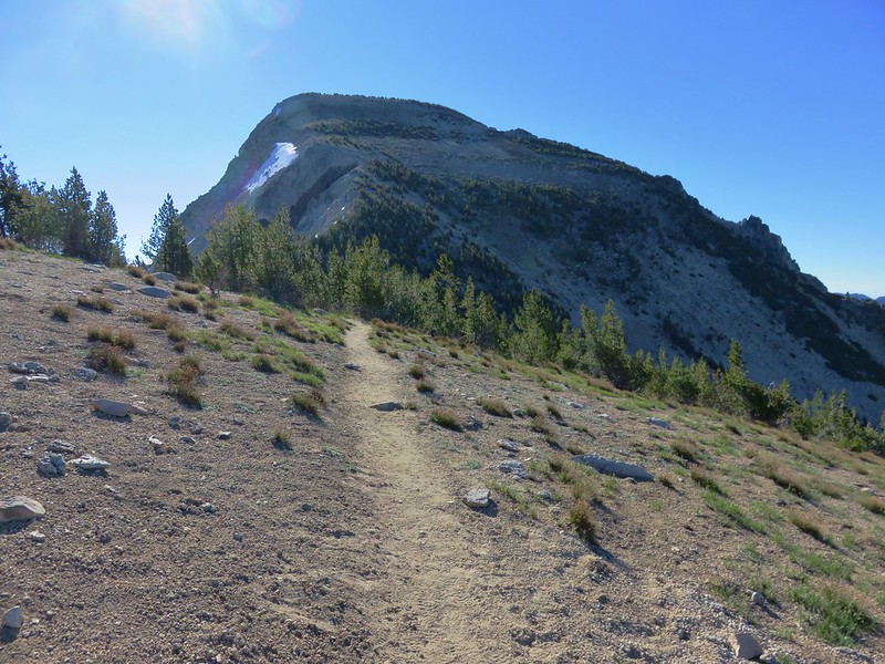
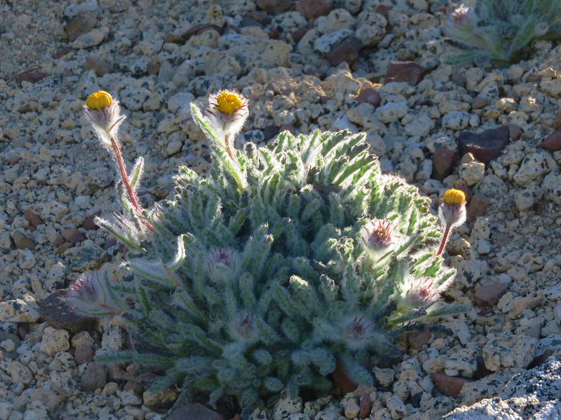
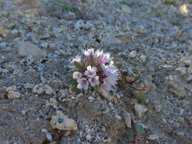
Beyond the saddle the trail climbed Eagle Cap in a series of long switchbacks. A few alpine flowers dotted the landscape.
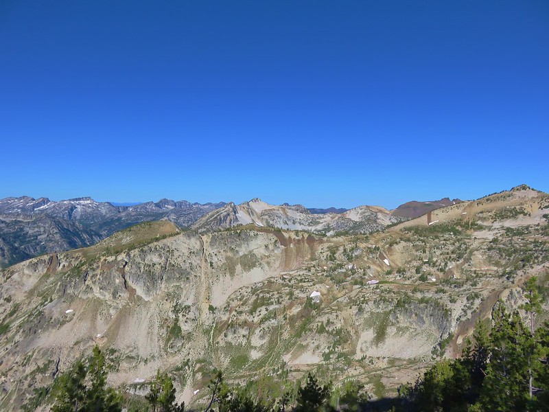
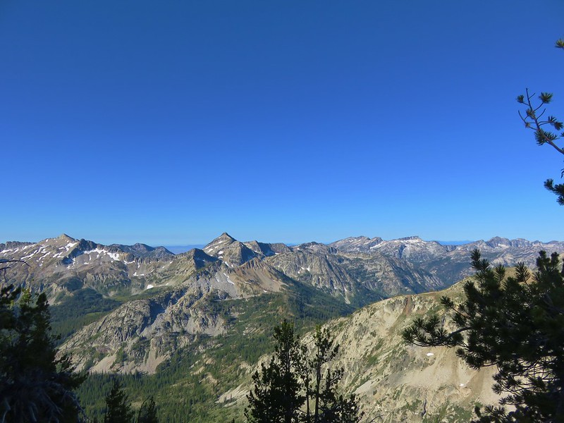
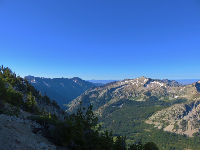
After passing through some whitebark pines we arrived at the broad summit of Eagle Cap.
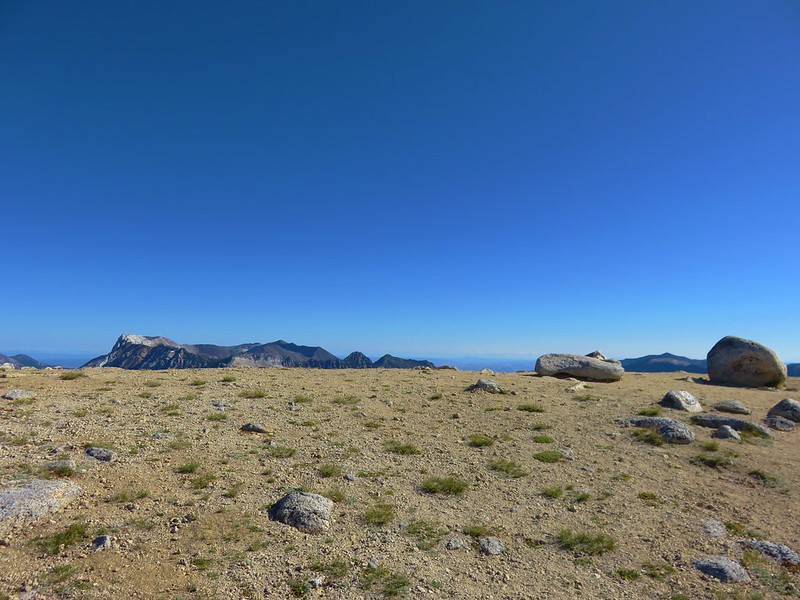
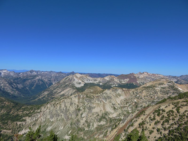
Although Eagle Cap is a few hundred feet shorter than the Matterhorn the sky was clearer than it had been two days earlier when we had been atop the other peak. The view was so huge it was hard to take everything in.
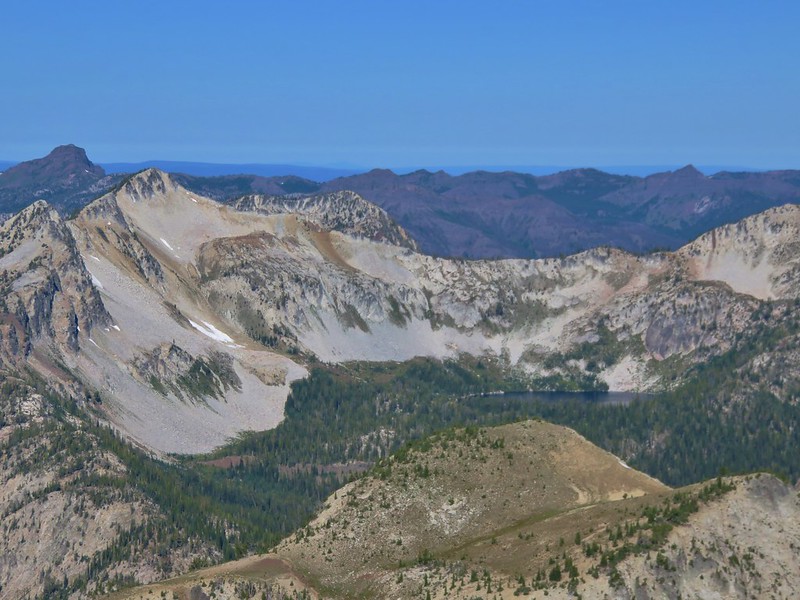
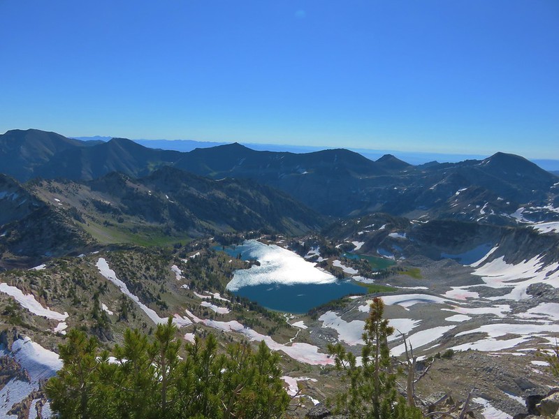
East Lostine River, the Matterhorn, and the Lakes Basin

Glacier Lake
Looking SW

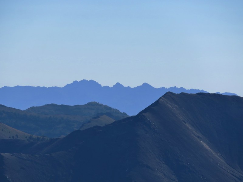
Seven Devils in Idaho
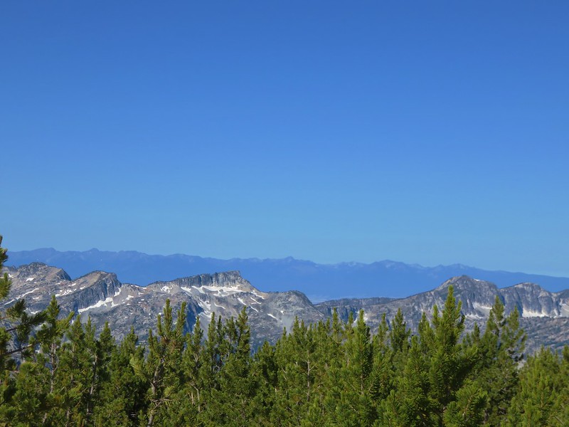
The Elkhorns
After having second breakfast on Eagle Cap we headed back down. On the way we ran into a couple from Portland who had camped near Upper Lake. They had seen a mountain goat run by their camp the day before and spotted a pair of wolves crossing a snowfield on the ridge above the lake as well. We passed several other hikers making their way up toward Eagle Cap making us glad we had started so early.
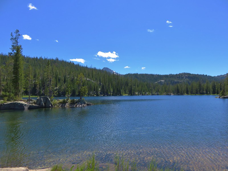
We stopped at Upper Lake to refill our water supply and decided to follow the trail around the lake thinking it would take us over to another trail that ran between Minam Pass and the 4-way junction at Mirror Lake.
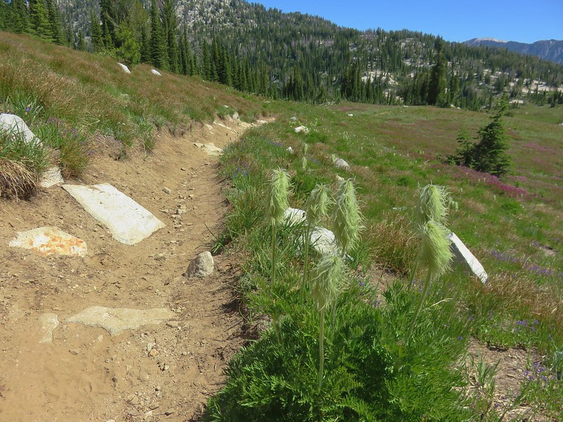
The trail petered out at the far end of the lake near it’s inlet stream. Instead of backtracking we decided to rock hop up the creek to the other trail.
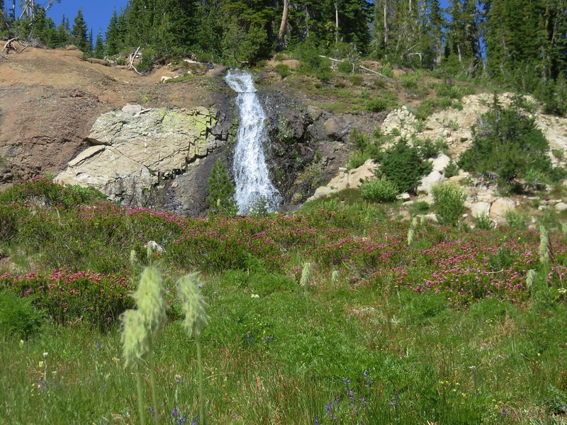
When we arrived at the other trail we found our first western pasque flower seed-heads.
We were also near the waterfall we had seen from across Upper Lake.
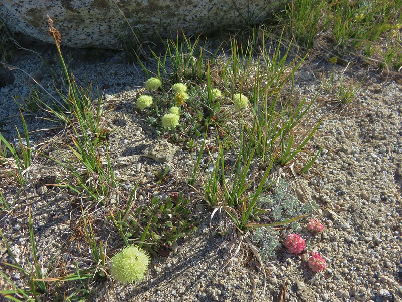
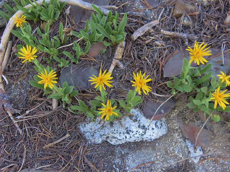
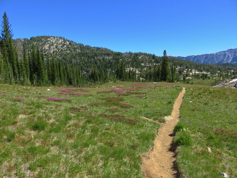
We followed the trail back down through some lovely wildflower meadows to the 4-way junction and then returned to our campsite to pack up.
From Mirror Lake we had the choice of going back past Moccasin Lake or taking a different trail past little Sunshine and Crescent Lake. The two routes rejoined at the NE end of Douglas Lake. Since we had already seen Moccasin Lake we decided to go by Sunshine Lake where we wound up getting our best reflection of Eagle Cap.
We passed a junction with the Hurricane Creek Trail after 1.1 miles and arrived at Crescent Lake after approximately another three quarter miles.
Douglas Lake was just on the other side of the trail from Crescent Lake.

We followed a pointer for the West Fork Wallowa River when we reached the trail junction at the end of Douglas Lake.
Shortly thereafter we came to another trail junction.
Here we faced another choice. Both forks would bring us to Horseshoe Lake, the left in 1.3 miles and the right in 1.5 miles passing Lee and Lily Lakes. We chose the longer route past the other two lakes and began descending toward Lee Lake.
After a brief stop at Lee Lake we continued past the aptly named Lily Lake.

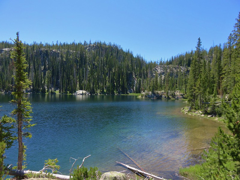
The trail passed by large Horseshoe Lake along the northern shore.


We were hoping to find a campsite at east end of Horseshoe Lake which would would leave us with a shorter hike on our final day but we were unable to find a suitable site at that end of the lake. After reaching the junction with the other fork of the Lakes Basin Trail and failing to have found a good campsite we decided to head back up the other fork to see if there were any decent sites along that trail.
We had been planning on visiting nearby Unit Lake after setting up camp and knew there was a campsite there, but the trail to that lake was no longer maintained and camping there would require hauling our packs down to the lake over a lot of blowdown which we preferred not to do. As luck would have it we found a suitable spot for our tent below the trail just opposite of the unmaintained trail to Unit Lake.
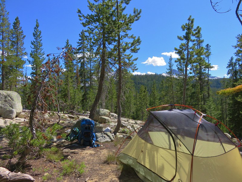
After getting settled we decided to take our chairs, dinner, and water filter with us to Unit Lake and spend our evening there. The trail had definitely not been maintained from quite some time and we were glad we had chosen not to try and do the trail with our full packs.
That being said we were glad we made the side trip down to the lake.
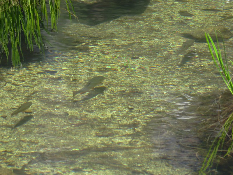
We were a little surprised when a Dad and four kids came crashing down the trail to fish for a little while but they soon departed and we had a little more solitude before returning to our tent and watching the sunset on Eagle Cap for the final time.
Happy Trails!
Flickr: https://www.flickr.com/photos/9319235@N02/albums/72157671183919842

9 replies on “Eagle Cap Wilderness Day 4 – Eagle Cap”
[…] After admiring the tower we continued on the road loop. When we came to a fork in the road we detoured left to a ridge end meadow with a view that included the Wallowa Mountains (post). […]
Thank you for posting these wonderful photos of places that I love, but haven’t been able to visit for many, many years. I always think of the Eagle Cap Wilderness Area as being “the home of my heart,” and your photos hellp me relive my vivid memories.
We’re happy to hear the photos help. We do try and capture as much of the experience as possible with a 📷.
[…] Cap (post) is the tallest hump in the […]
[…] Point, West Aneroid Peak, Eagle Cap the furthest away (post), and Craig […]
[…] views from the trail improved as we climbed above the falls. Eagle Cap (post) in the […]
[…] Eagle Cap (post) […]
[…] Cap (post) on the left, Galcier Peak at center, and Hawkins Point to the […]
[…] #60 Horseshoe Lake – Hiked 8/3/2016 & 8/04/2016 […]