Day 2 of our SE Oregon vacation was set to be more of a driving day as we headed from Bend to our next destination which we had originally intended to be Jordan Valley. Instead we ended the day in Caldwell, Idaho but we’ll get to that later.
When I was planning this trip I was looking for a hike between Bend and Jordan Valley to do along the way. We had done the Oregon Badlands twice (post post) and Pine Mountain (post) previously. These were the only hikes that were listed in our “100 Hikes/Travel Guide Eastern Oregon” guidebook but the travel guide for Burns pointed us toward the Malheur National Wildlife Refuge.
Having reopened after the occupation we were eager to visit the refuge and show our support for our Public Lands.
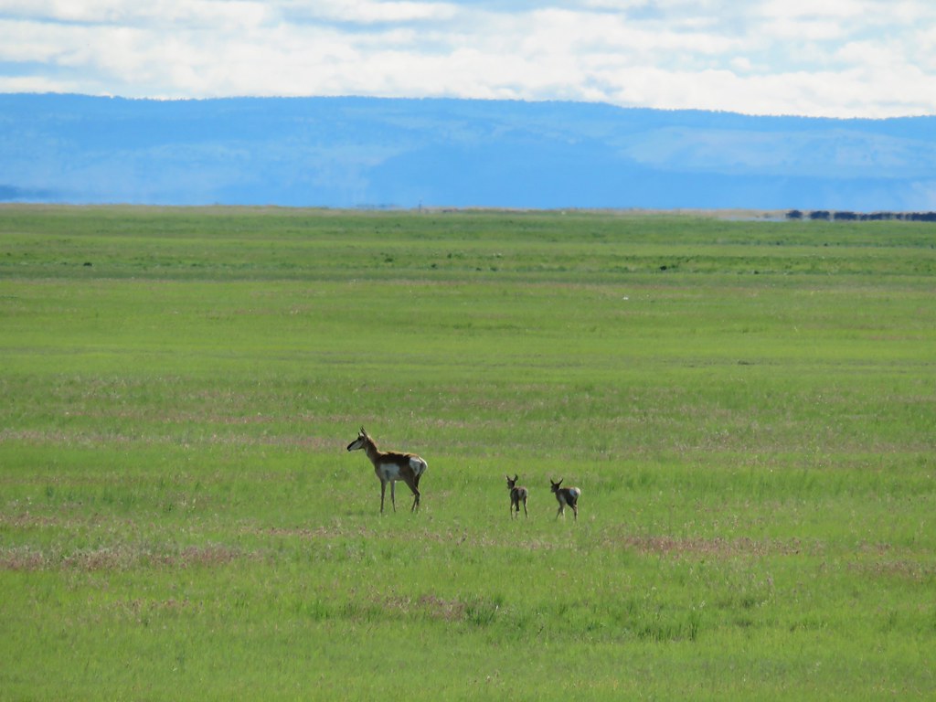
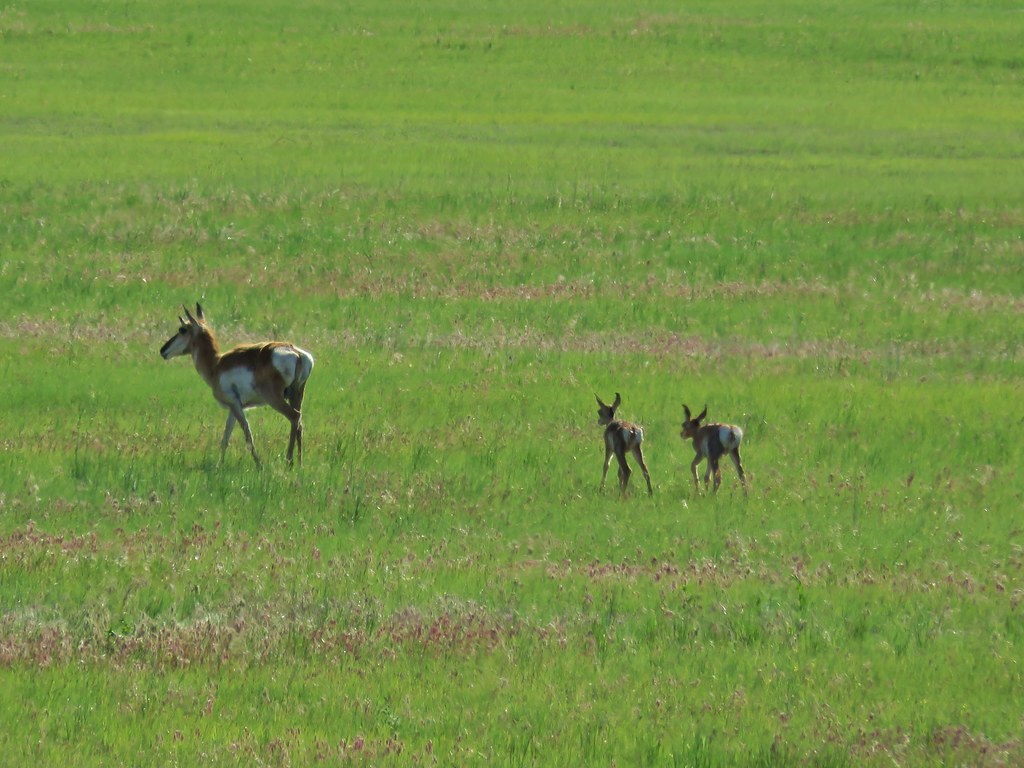
We left Bend bright and early and drove east on Highway 20 to Burns then followed signs to the refuge. We were quickly rewarded when we spotted a prong horn with two little ones in tow.
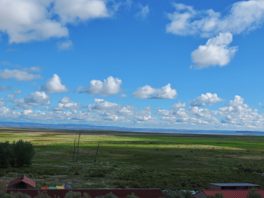
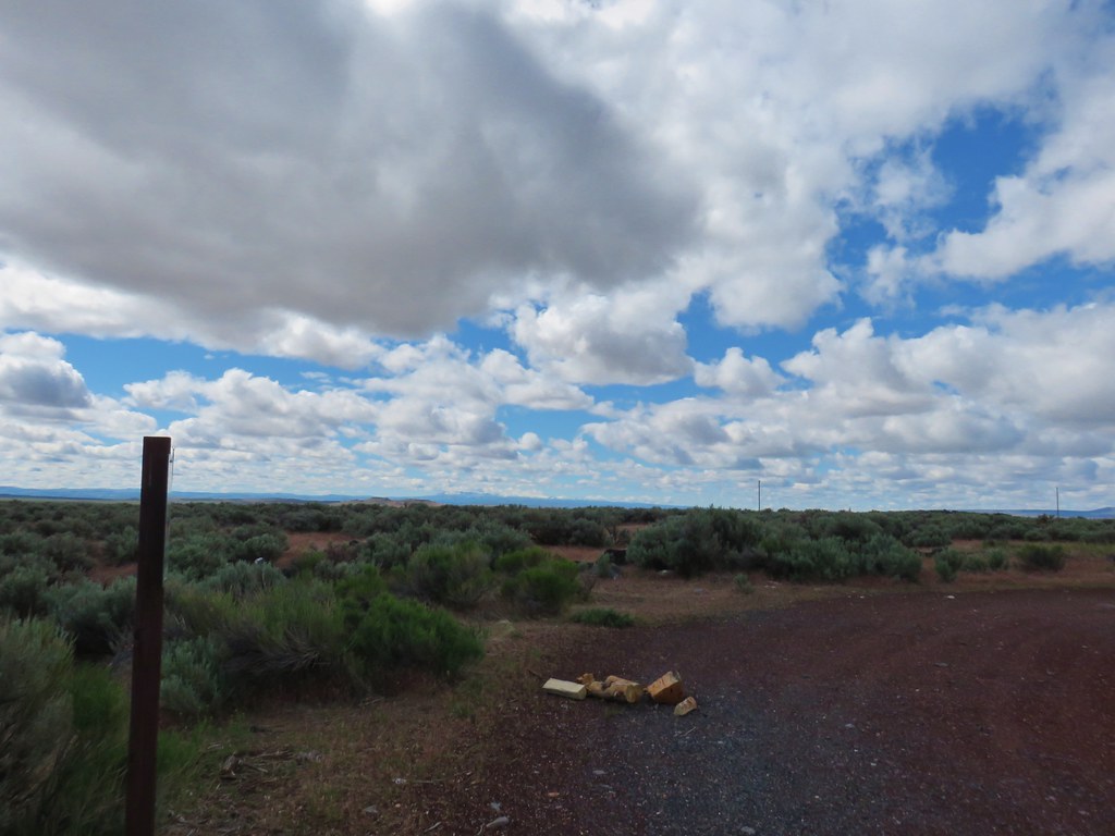
We suspended some of our usual rules for this trip such as taking some photos from the car of wildlife and having our driving time exceed our hiking time several of the days, but when you’re that far from home you have to be flexible. We did plan on doing a little hiking on our visit to the refuge though so we parked at the Overlook Trail just beyond the turnoff for the park headquarters.
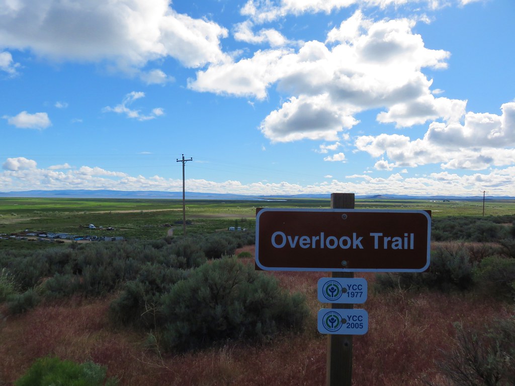
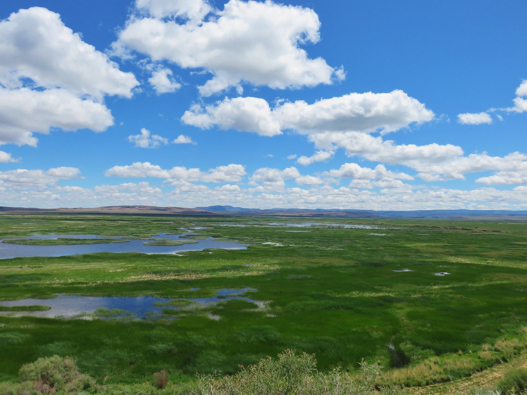
The headquarters lay a half mile below the overlook which looked out over Malheur Lake in the distance.
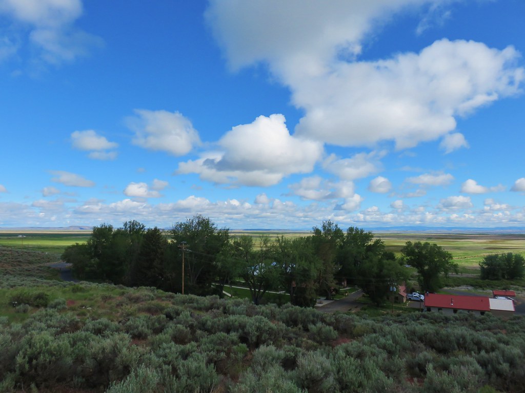
We followed the trail down to the headquarters.
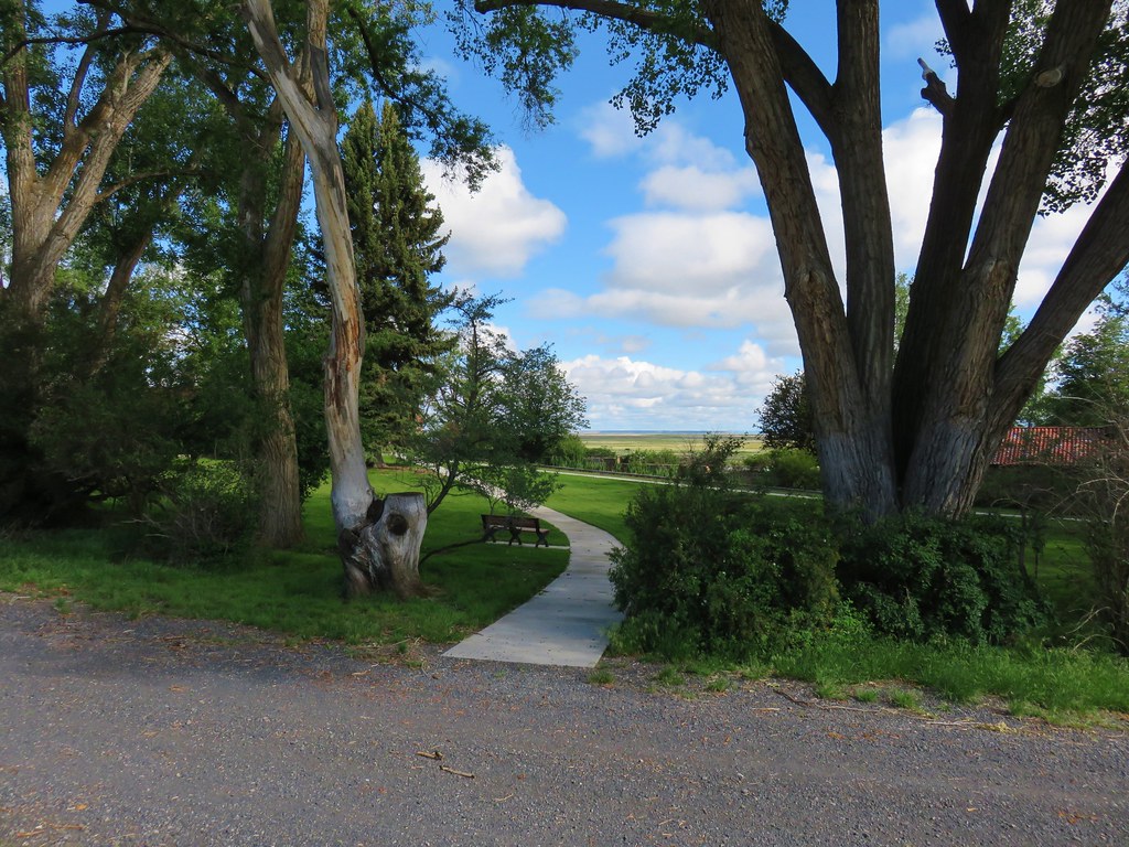
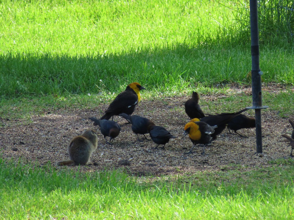
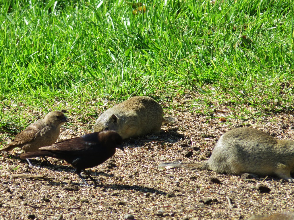
It was a beautiful morning and the headquarters was full of birds, ground squirrels and even a rabbit.
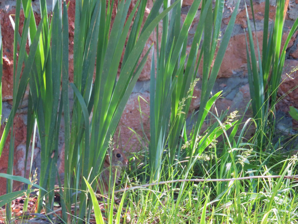 Rabbit behind the plants
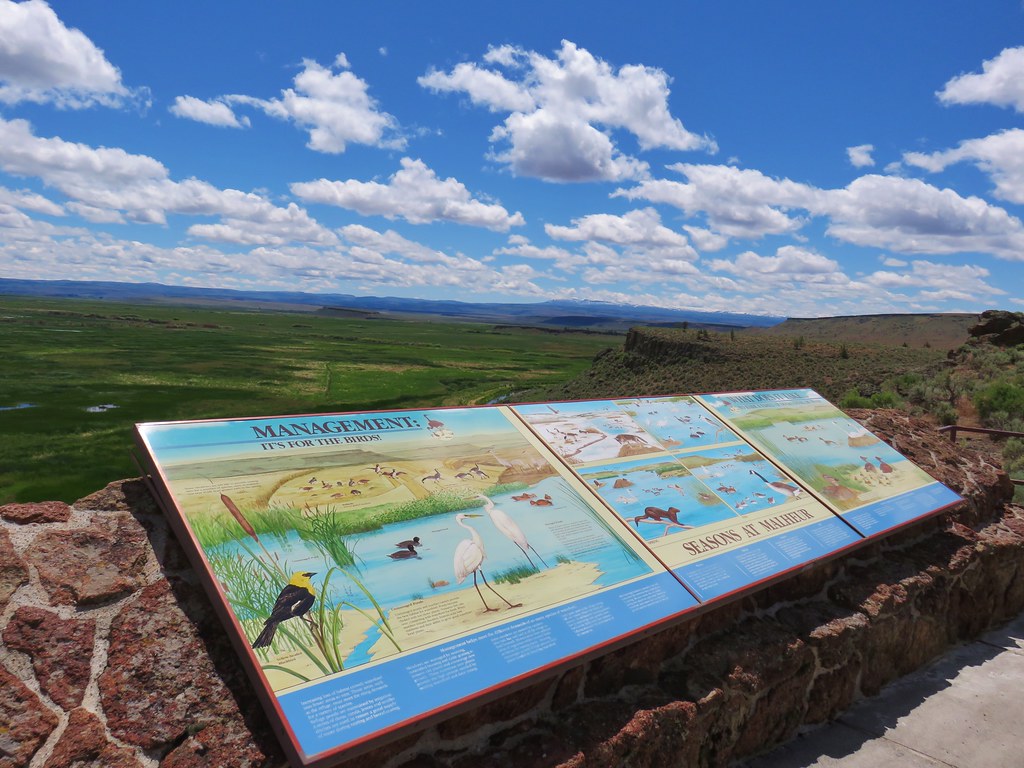
We stopped in the visitors center where a helpful volunteer gave us several brochures and told us about the 43 mile auto-tour as well as mentioning the Diamond Craters Outstanding Natural Area and the Peter French Round Barn State Heritage Site. These last two sites aren’t part of the refuge but they were along the route we’d be taking to Jordan Valley so she recommended we stop and check them out. After getting this helpful information we walked over to the Museum.


The small building held a wealth of information as well as displays of the birds, bats and many of the insects that can be seen at the refuge. We spent quite a while there before moving on to the short Marsh Trail.

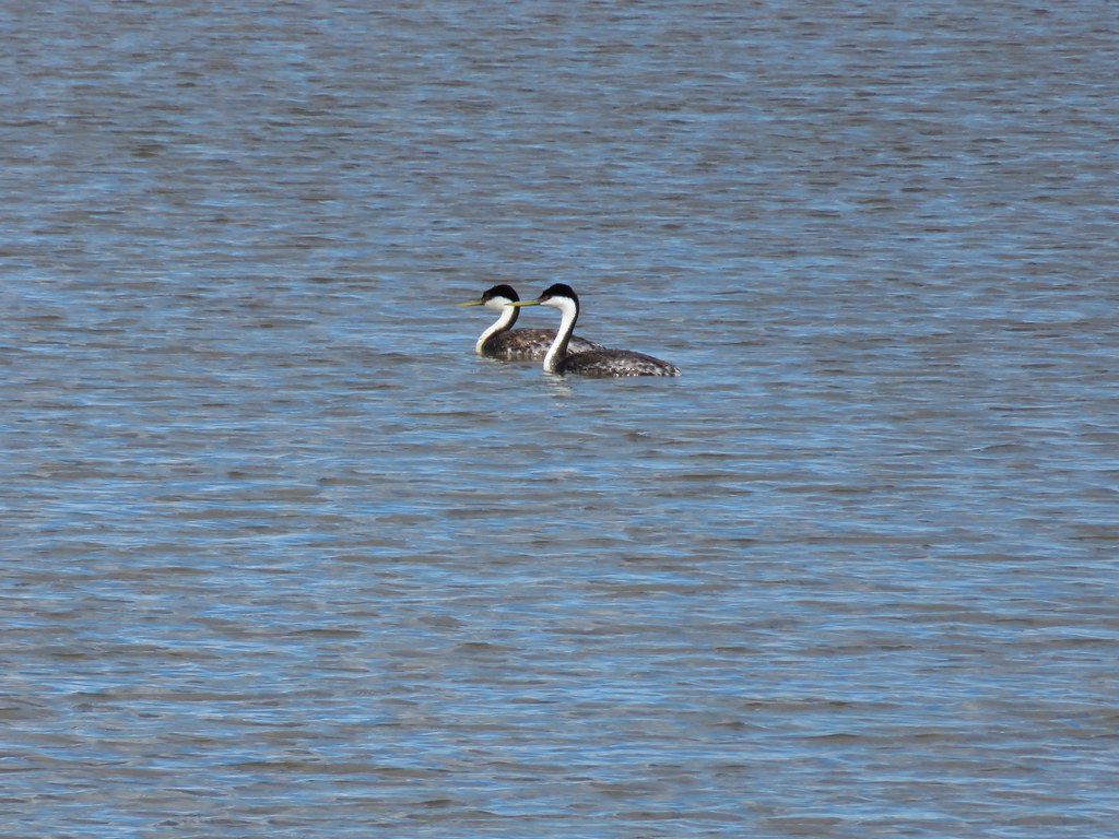
We stopped in the photo blind and even though there weren’t many birds on the water we did see a pair of horned grebes.

After completing the short loop we visited the gift shop. While we were inside I happened to look out the window and noticed something in the grass. I thought it was a cat but the fur didn’t look right, then it turned it’s head and I realized it was a great horned owl.
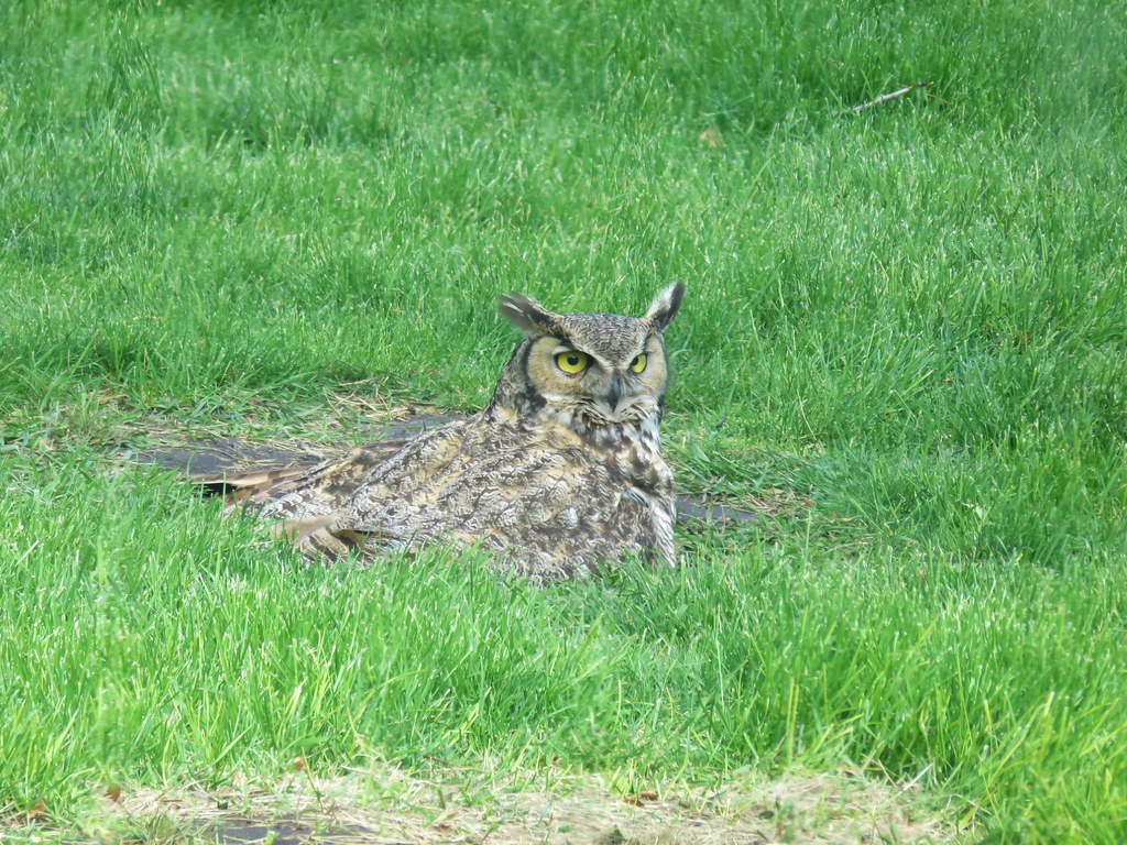
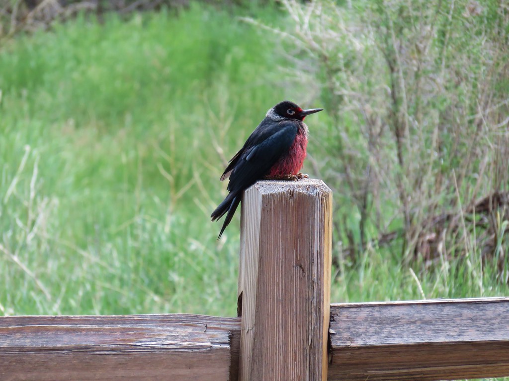
By the time I got Heather it had disappeared. From the gift shop we returned to the Overlook Trail and climbed back to our car. Before we reached the Overlook Trail though we spotted a Lewis’s Woodpecker sitting on a post.
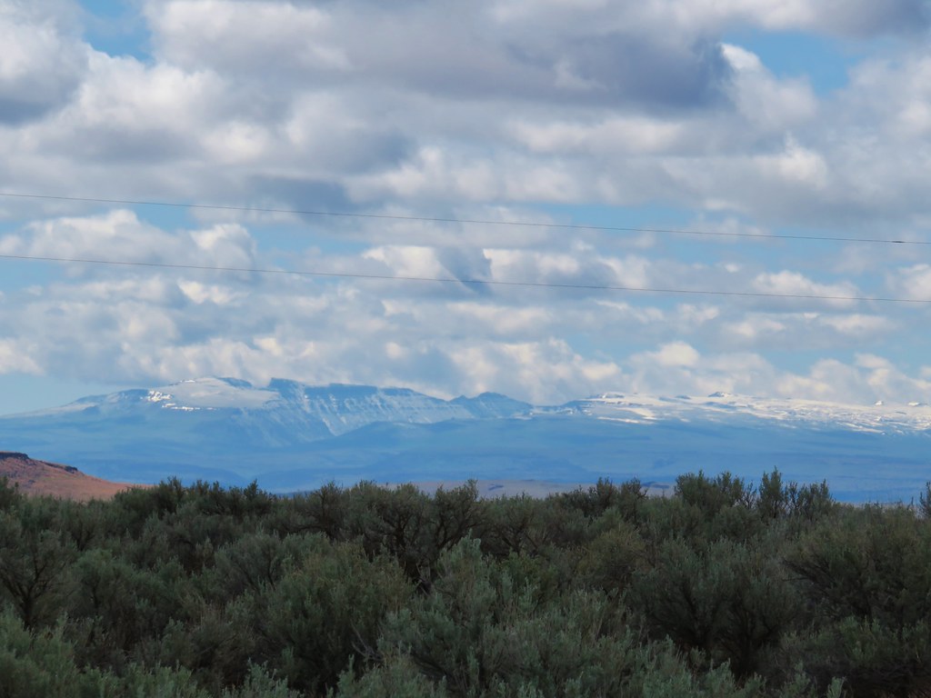
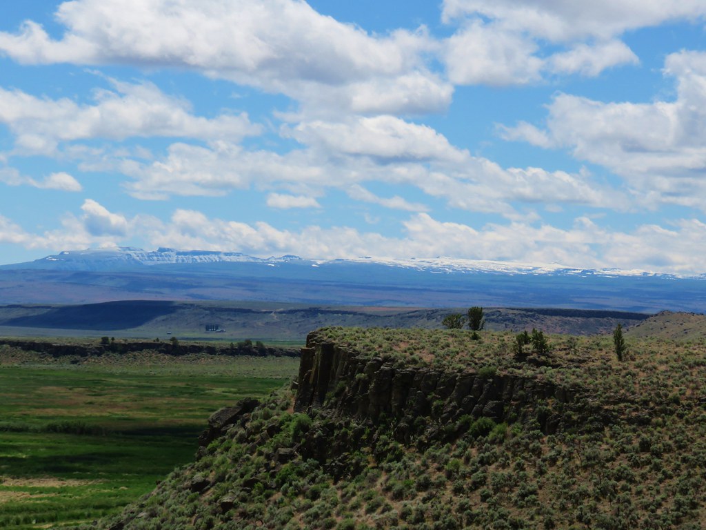
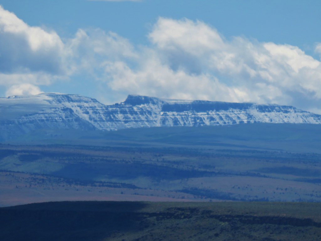
When we got back to where we had parked we noticed that we could see Steens Mountain off to the SE. This was our first time viewing the 50 mile long fault block mountain.
Based on the information given to us in the visitors center we decided to do part of the 42 mile auto tour. There are 19 “stops” along the route. We picked up the route from the Overlook Trail (which is stop 1) and started down the gravel road. Sign posts marked the suggested stops that corresponded with the brochure given to us at the headquarters.
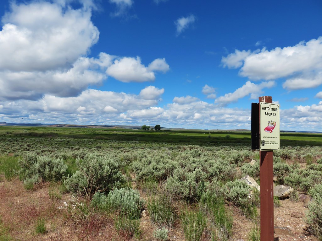 Stop 2 – Sod House Ranch
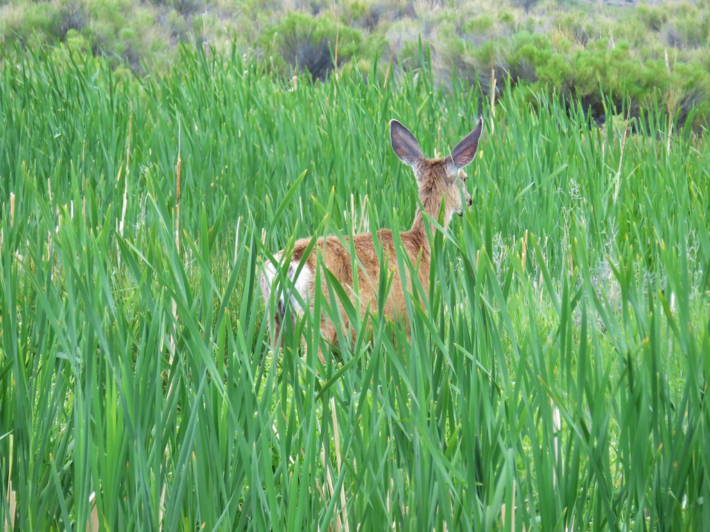
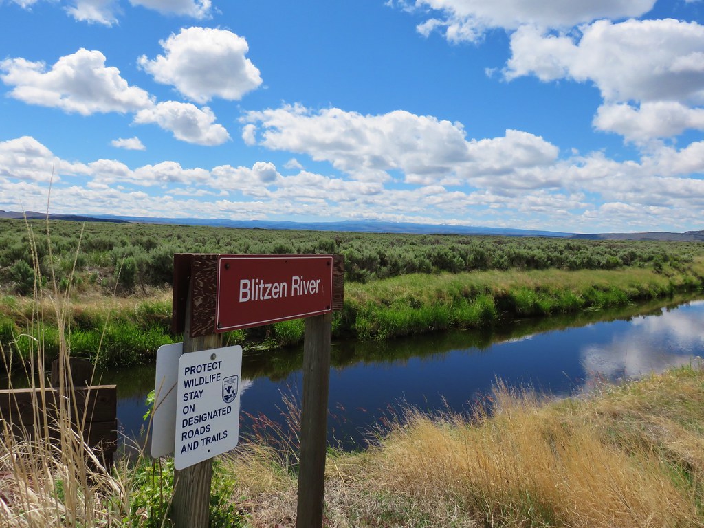
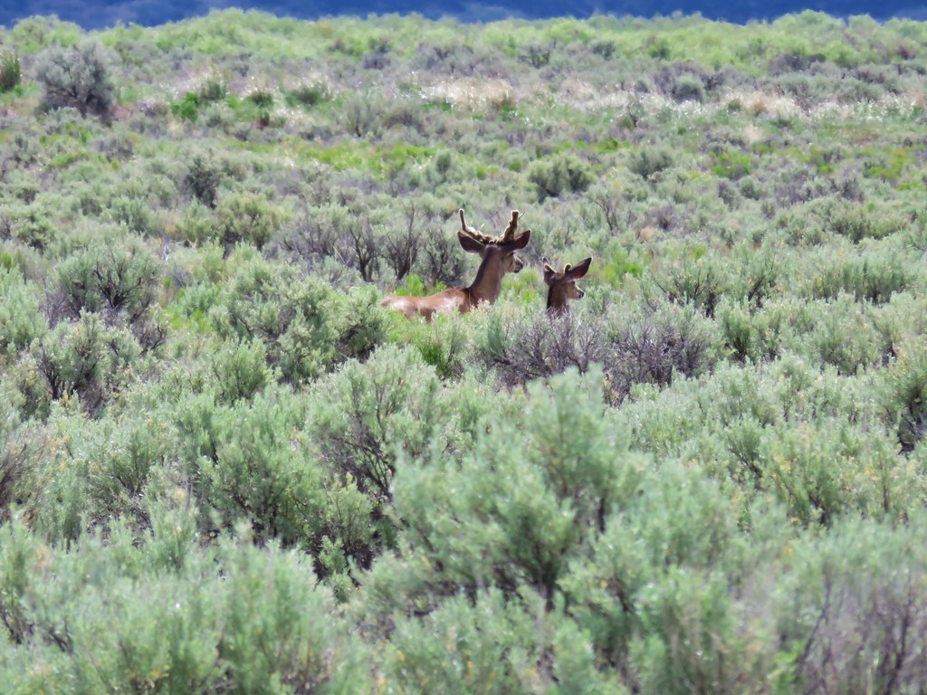
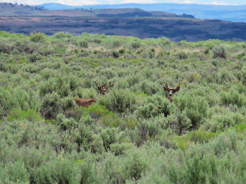
We followed the route for 15.8 miles passing stops 2-8. The wildlife were the stars of the drive though as we spotted various birds and several deer including three bucks near the crossing of the Blitzen River.
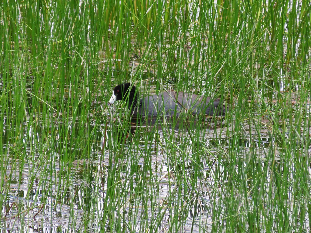 American Coot
 White Faced Ibis
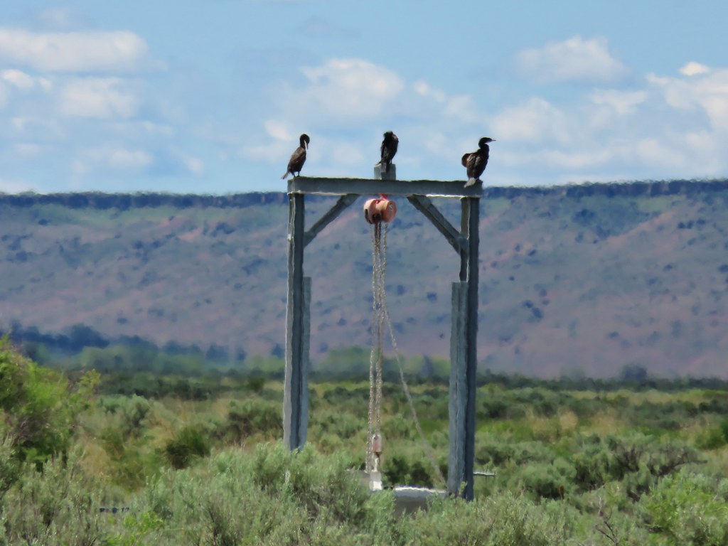 Cormorants
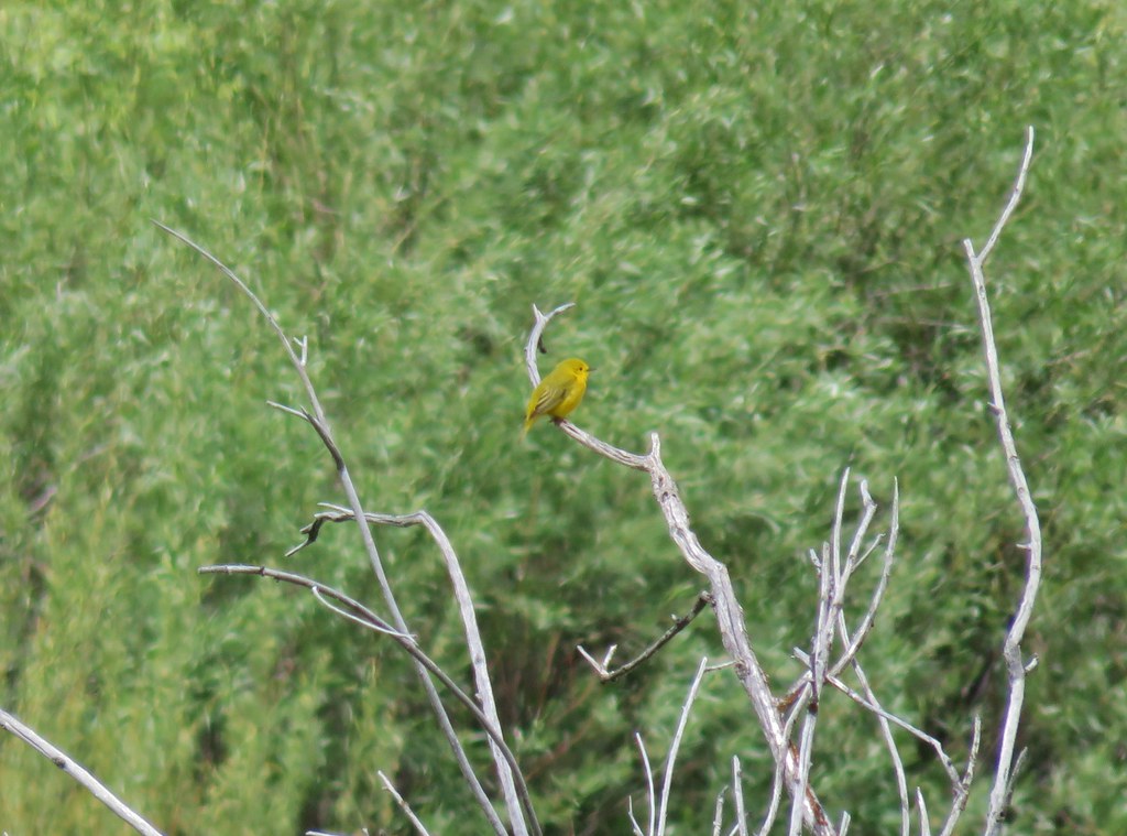 Yellow Warbler?
 Western Meadowlark
After stop 8 (Buena Vista Ponds) we turned right toward stop 9 which is the Buena Vista Overlook. Here there was an option to hike up to the overlook on a .3 mile trail.
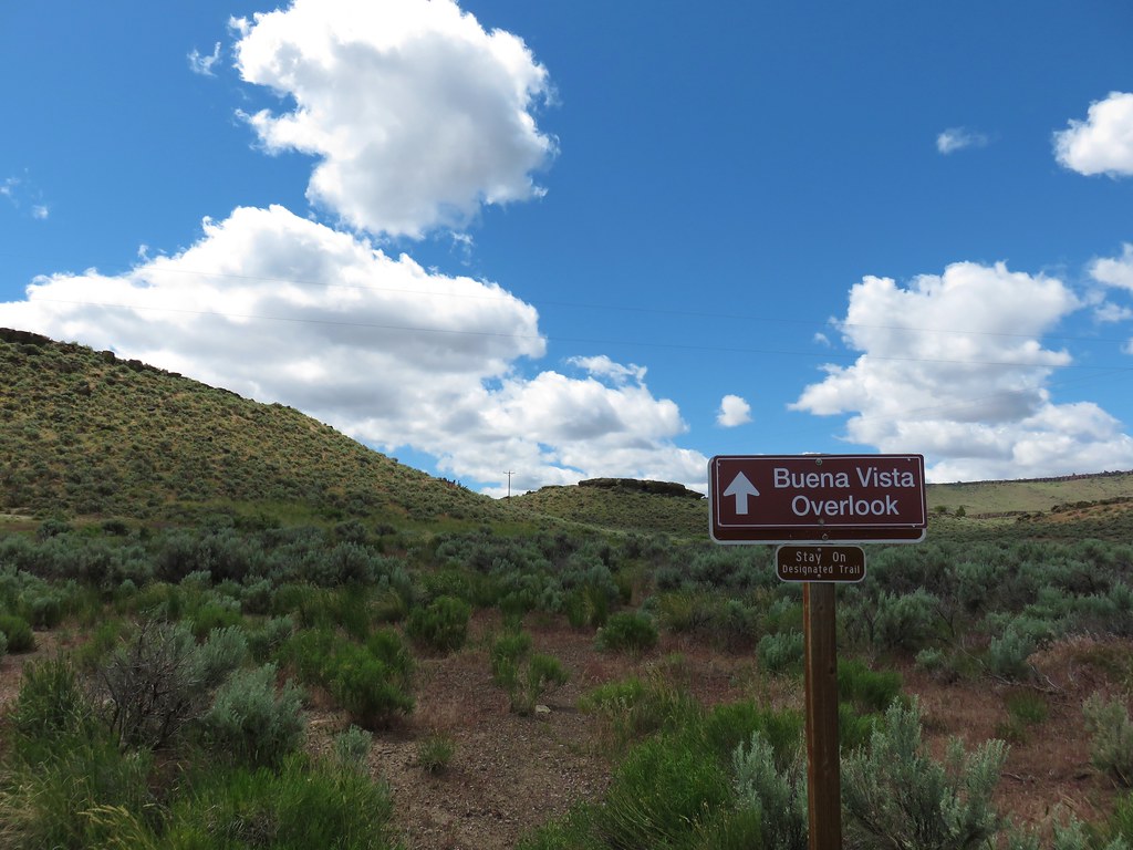
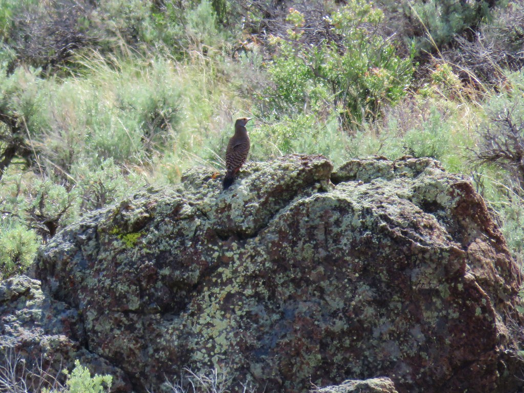
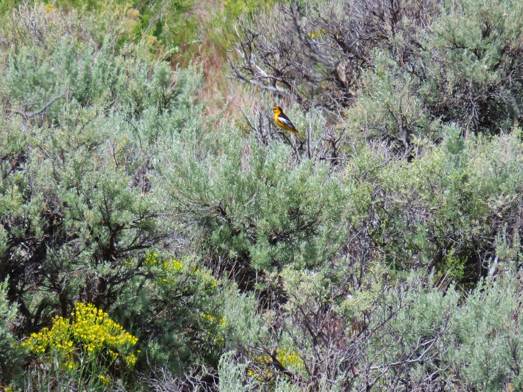
We chose this option and headed uphill through the sagebrush where we spotted a northern flicker and a bullock’s oriole.
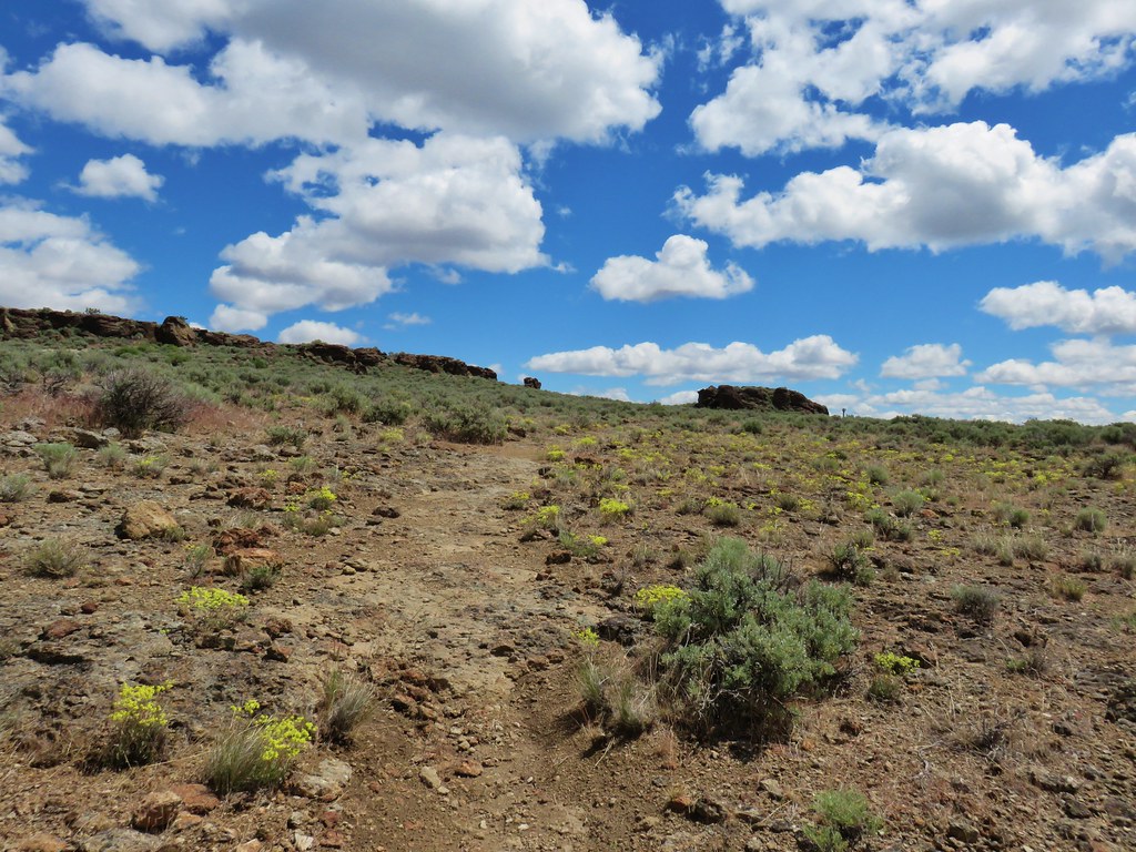
From the parking area on top we followed a gravel path to the overlook.
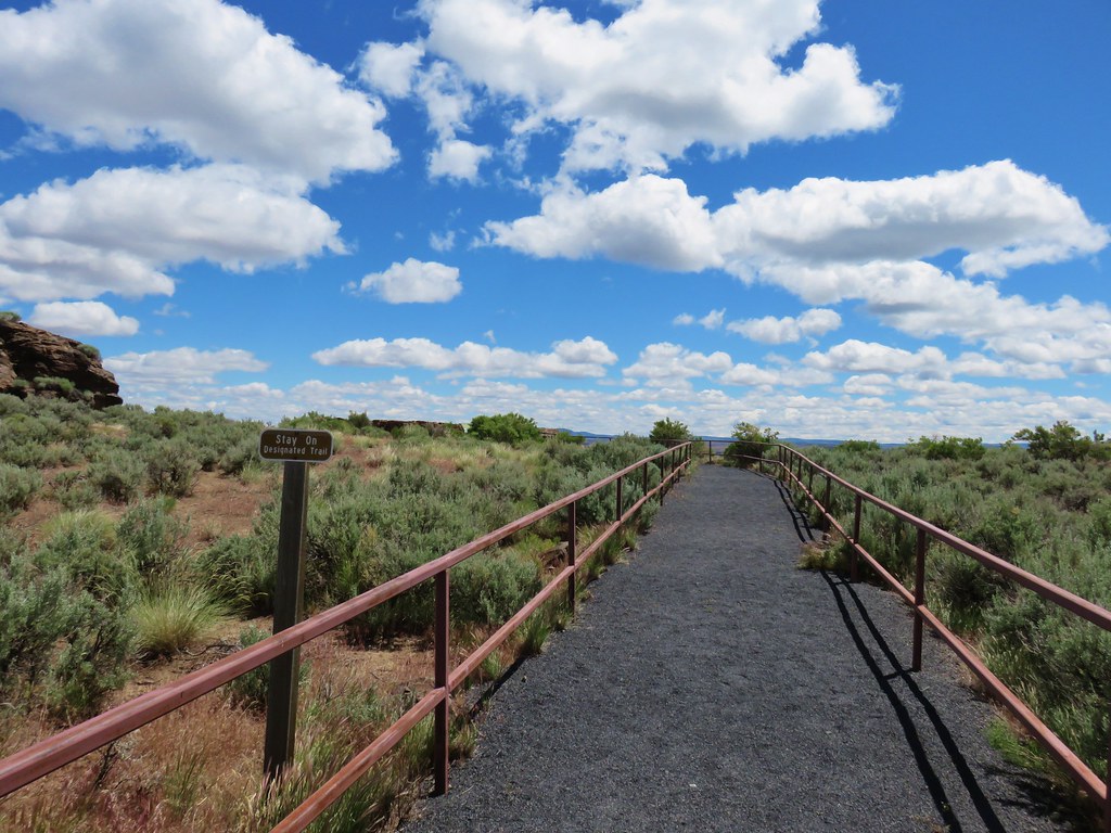
We had forgotten to bring our binoculars up with us so we had to settle for listening to the birds below in the ponds.

Once again Steens Mountain was visible on the horizon.

We hiked down the road to make a 1.1 mile loop out of the hike and then left the auto tour which would have had us back track to where we turned off and continue south to Frenchglen. Instead we drove west to Highway 205 and turned left for 1.9 miles to Diamond Lane. Here we turned left crossing the auto tour route at stop 10 (Diamond Lane) and continued east for a total of 10 miles to a sign for the Diamond Craters Auto Tour Stops 5-11.
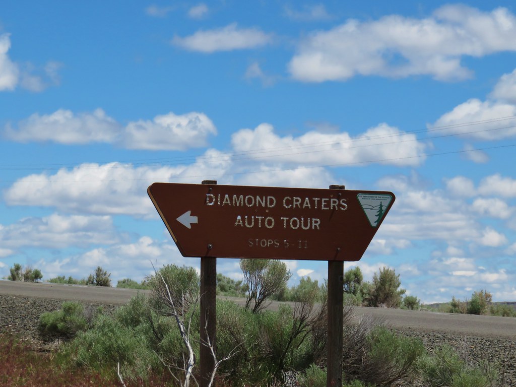
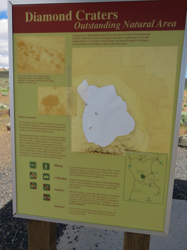
Prior to speaking with the volunteer at the refuge we had not planned on stopping here and had little information other than the small brochure she’d given us. We parked at a signboard where the one map had been vandalized.
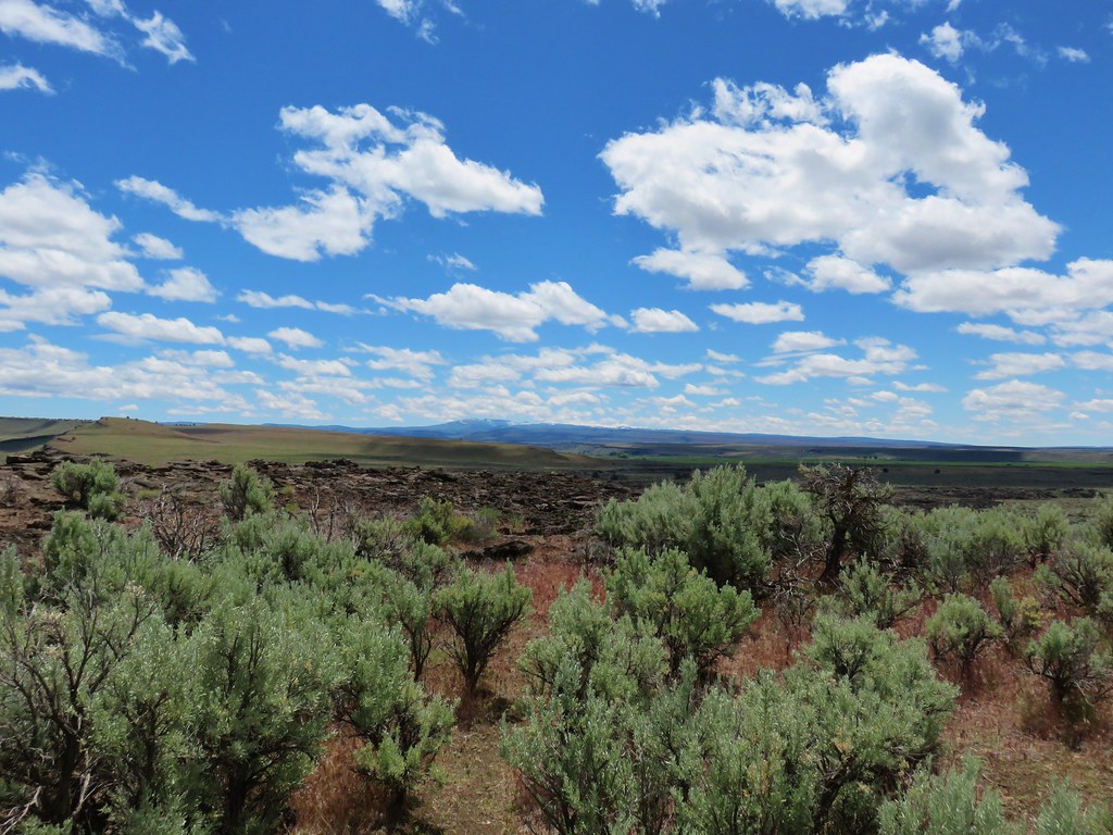
We decided to give hiking a try and followed a path toward Crater 5 aka Big Bomb Crater.
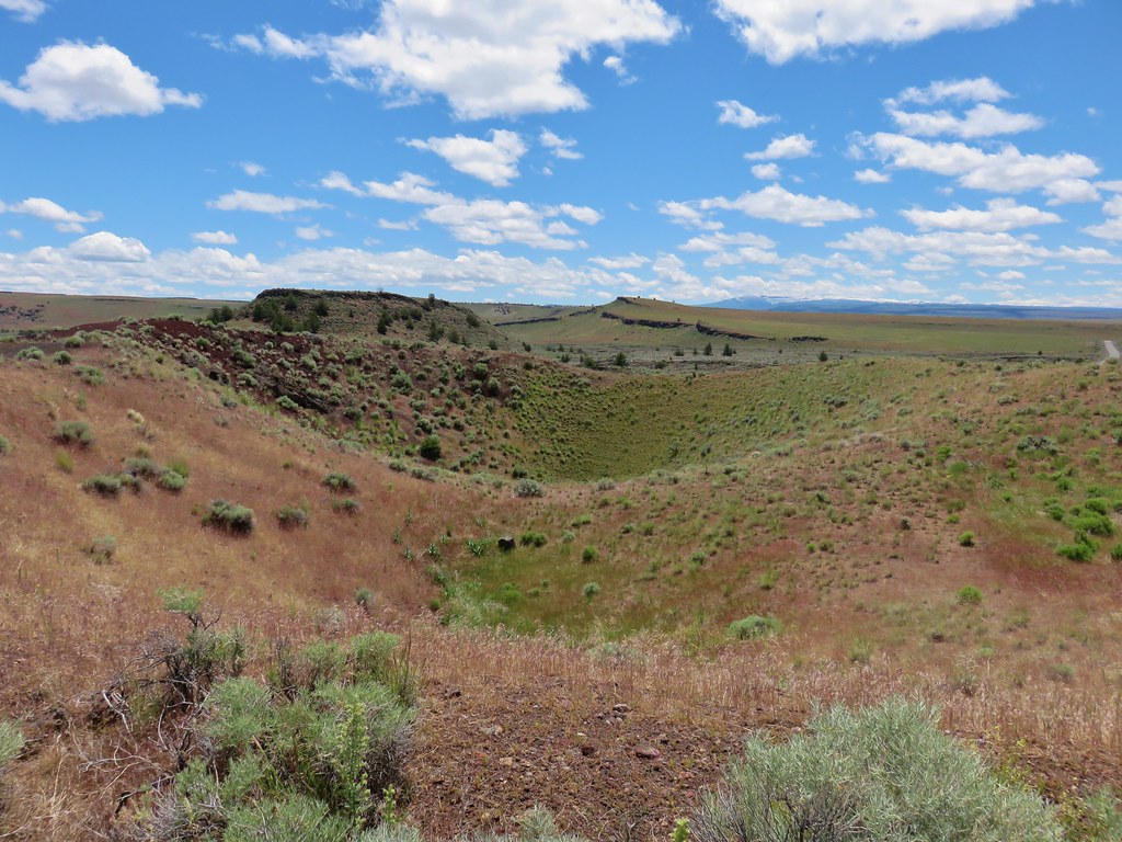
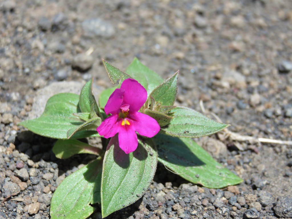
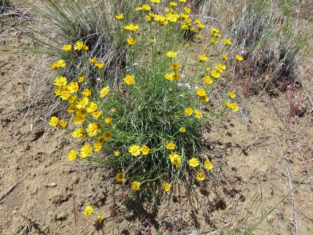
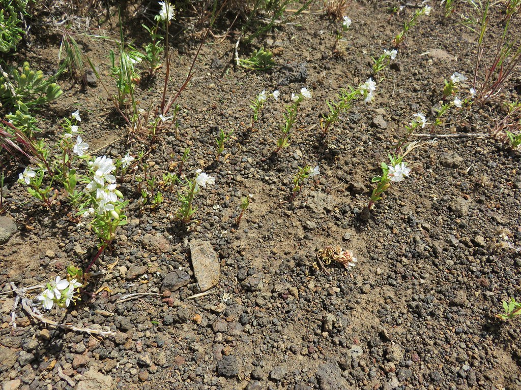
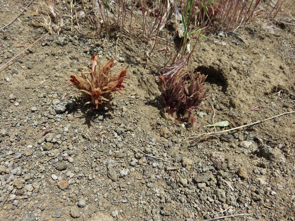
The trail petered out near the bowl so we backtracked to where we’d parked and decided to hike up the road a bit to the next crater which was ahead on our right. We passed a few small desert flowers along the way before reaching a view of the crater known as the Keyhole Explosion Crater.
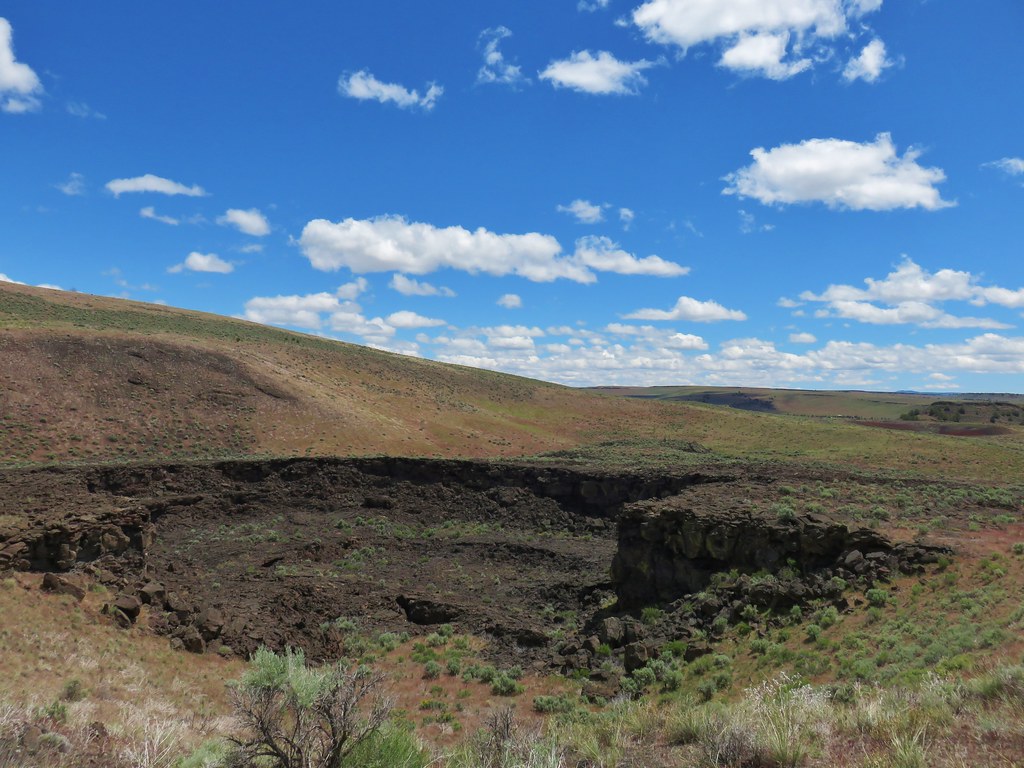
The road had split before we had arrived at this crater and ahead it continued to climb uphill.

Not knowing what lay ahead we opted to avoid the climb in the heat of the day and headed back to the split where we took the left hand fork to another crater, the Lava Point Crater.
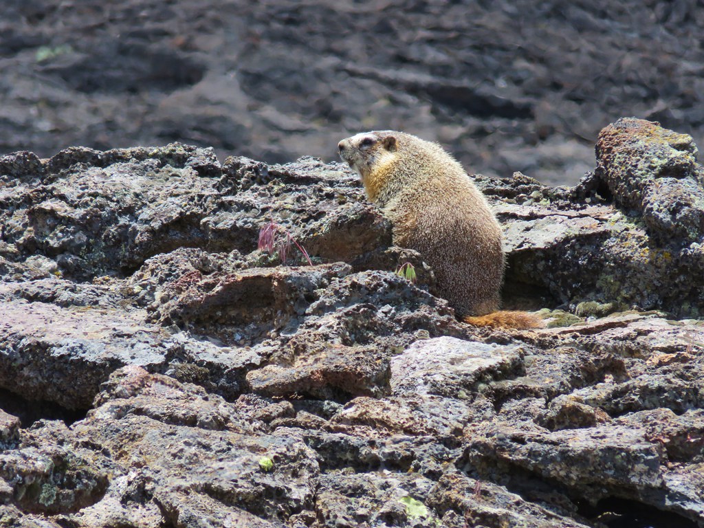
A marmot was admiring this crater when we arrived.
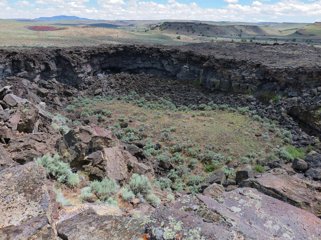
We ended our hike here and returned to our car. A short 1.7 mile jaunt had given us a sample of what the Diamond Craters Outstanding Natural Area had to offer. We hope to go back some day with better information and visit more of the area.
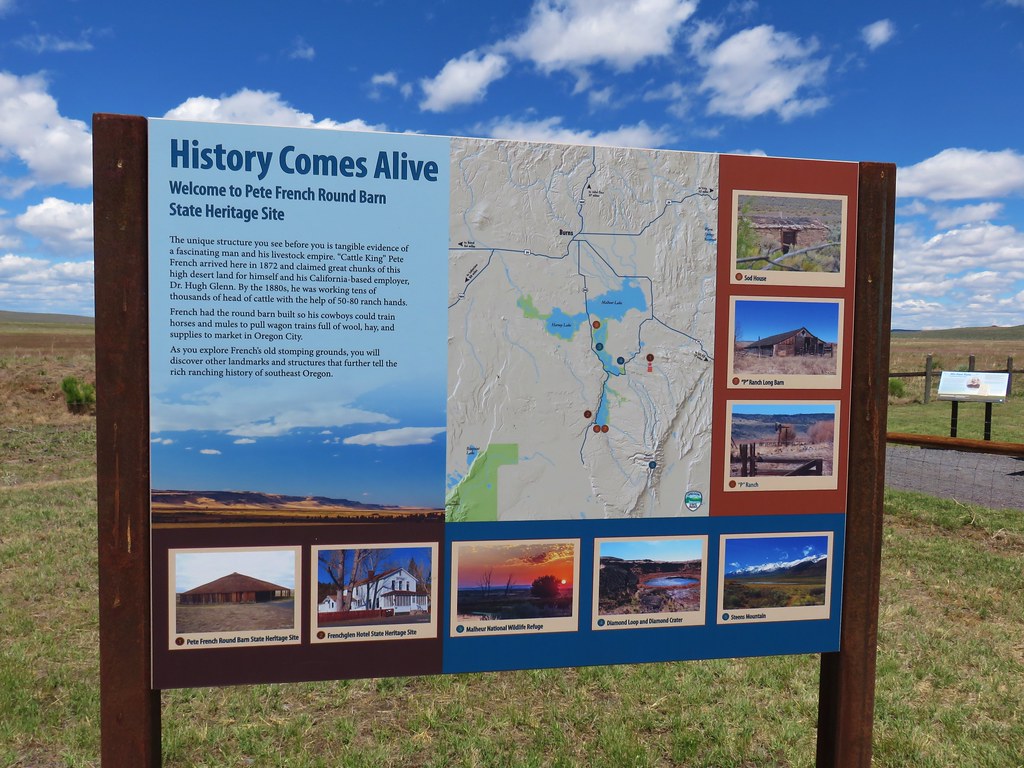
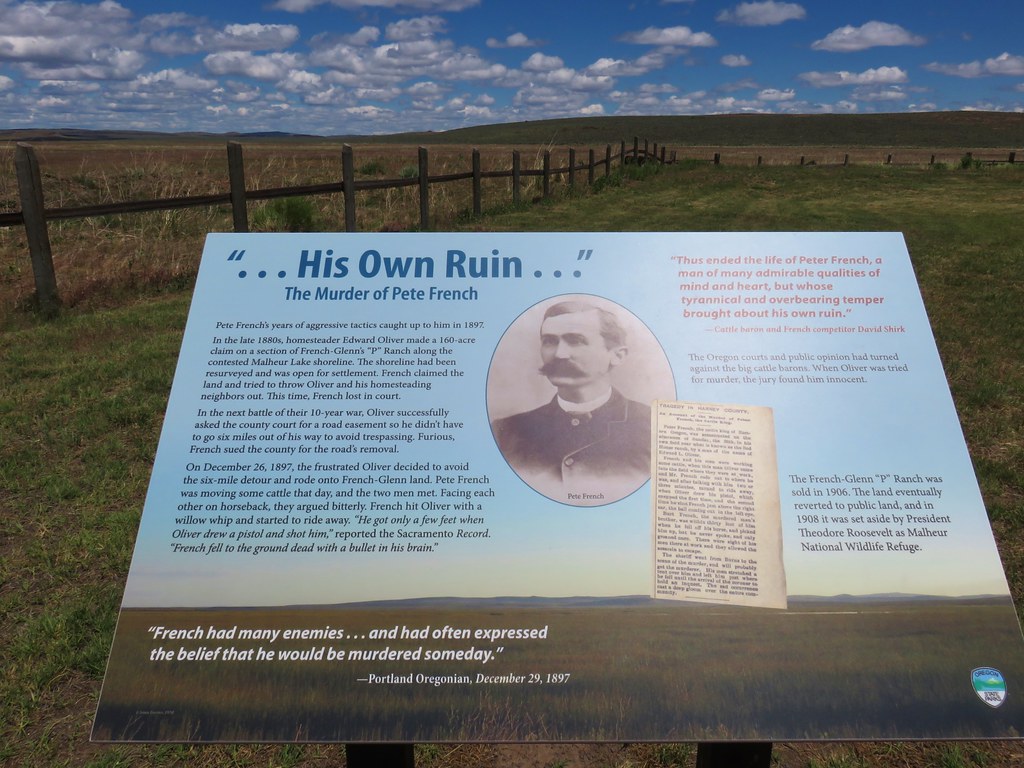
After leaving the area we continued NE on what had started as Diamond Lane then become Lava Beds Road and was now Diamond Craters Road. Just over six and a half miles from where we’d parked we turned right at a sign for the Peter French Round Barn State Heritage Area.
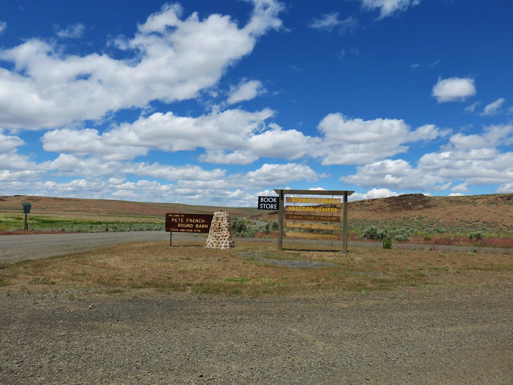
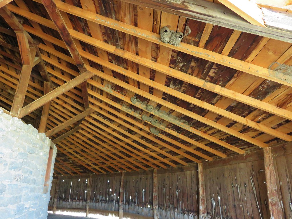
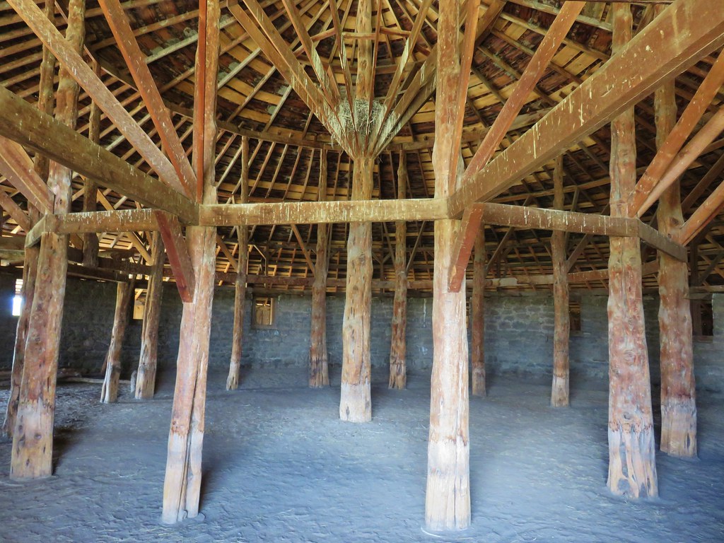
We skipped the visitors center here and headed straight for the round barn.
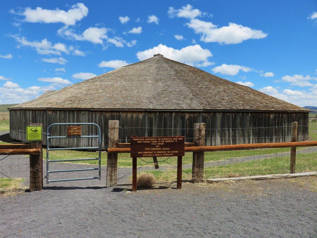
Information signs told the story of this unique structure and of Peter French who had amassed quite an empire before being shot.
While there are no trails at this park we did walk around and through the barn.

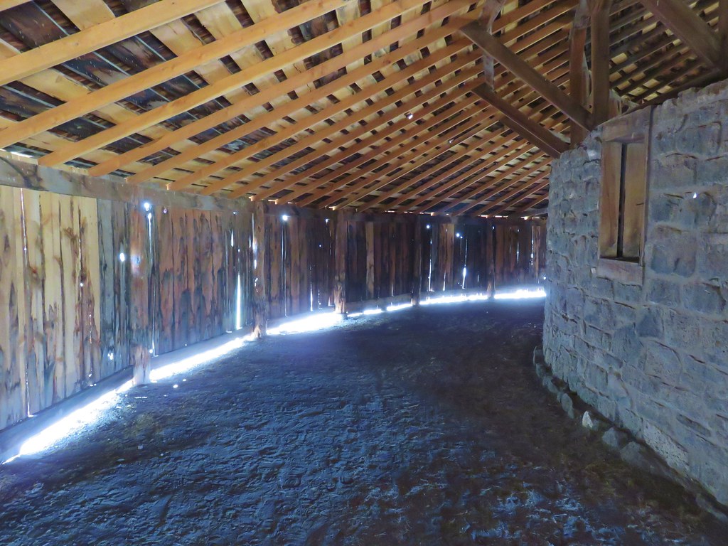
It was another interesting and worthwhile stop. From the Round Barn we continued on to Highway 78 where we turned right following it to Highway 95 where we turned left toward Jordan Valley. As we got closer to Jordan Valley we began to talk ourselves into possibly staying in Marsing, ID instead thinking that it was a larger city and might have amenities that we wouldn’t have in Jordan Valley such as cell coverage. By the time we passed the loan motel in Jordan Valley we had pretty much made up our minds to continue on to Marsing thinking that it was only 20 miles to the north. That was a miscalculation as it was actually close to 50 miles further and when we did finally get cell reception we found that there were no real options in Marsing for places to stay. We had to continue on for another 15 miles to Caldwell, ID where we wound up staying in a hotel just off I84 which we had been on the day before when we’d driven from Salem to the Deschutes Recreation Area.
It had turned into a long day of driving with three short hikes and a couple of stops mixed in. We decided to stay in Caldwell for two nights and then go back to our original plan of staying in Jordan Valley. Things were really shaping up for this to be one adventurous vacation. Happy Trails!
Flickr: SE Oregon Road Trip Day 2

7 replies on “Malheur Wildlife Refuge, Diamond Craters, and the Peter French Round Barn – SE Oregon Vacation Day 2”
Nice photo of the marmot. 🙂 We remember seeing those plump squirrels at the refuge HQ – doesn’t look like they ever miss a meal!
nice post. I’m glad you are featuring these parts or Oregon, forgotten Oregon. There is so much more to our state than people realize.
There really is and we see so few people comparably outside of the well known areas/trails.
Nice photos! We live in Southern Oregon near I-5 and are planning a trip to SE Oregon later this summer. Your trip notes and photos are helpful — thank you!
Good to hear that you found the reports useful. I’m sure you’ll have a great time.
[…] blackbirds, a bird we’d only seen one other time at the Malheur National Wildlife Refuge (post). Pigeon […]
[…] Malheur National Wildlife Refuge Headquarters. This was the one place we had previously visited (post) but we hadn’t driven the entire auto tour route that time and there were some other trails […]