For our second day at Olympic National Park we originally had planned a long hike on the Sol Duc River, but we both had people recommend visiting Lake Crescent we decided to shorten our hike to Sol Duc Falls and then do a few trails in the Lake Crescent Area.
We began by driving to the Sol Duc Trailhead which was nearly deserted at 6am on a Tuesday morning.

 Map of the area trails at the trailhead.
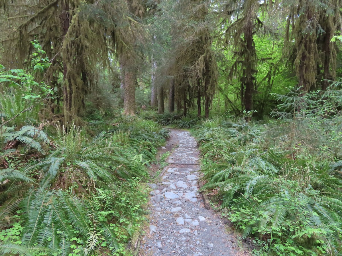
We set off down a set of stairs on the trail.
 Anyone know why the spelling on the sign is different?
 Violets

 Bridge over an unnamed creek.
 Trillium
 Coltsfoot
 Fairy bells
Near the three quarters of a mile mark we came to the Sol Duc Shelter.


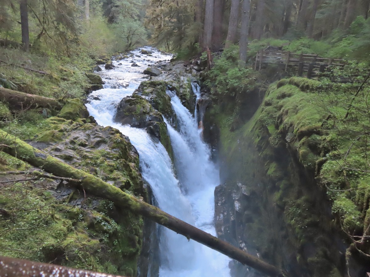
Just beyond the shelter was a footbridge over the Sol Duc River at Sol Duc Falls.

 Depending on the volume of water there are up to four channels which was the situation on this day.

 Heather on the bridge above the falls.
We spent some time admiring the falls then headed back passing a handful of hikers on their way in. Our hike here was just under two miles with approximately 200′ of elevation gain.

From the Sol Duc Trailhead it was a little over half an hour to another waterfall trailhead, Marymere Falls.

It was still just a quarter to eight when we parked here so this lot was fairly empty as well. We set off on the well signed trail past the Storm King Rangers Station.


 Storm King Ranger Station
The trail passed under Highway 101 and was relatively level to its crossing of Barns Creek.
 Forget-me-nots (non-native) along the trail.
 Lake Crescent


 Storm King Trail to the left.
 Marymere Falls Trail junction with the Barnes Creek Trail.
 Footbridge over Barnes Creek.
 Barnes Creek
 Trillium
 Footbridge over Falls Creek almost immediately after crossing Barnes Creek.
 Falls Creek
On the far side of Falls Creek a loop began and the trail started to climb to a viewpoint of Marymere Falls.
 Start of the clockwise loop.


 Marymere Falls
 The trail climbing up from the first viewpoint.
 Marymere Falls from the second viewpoint.
 Final viewpoint before the loop curved away from the falls and descended back to its start.
We completed the loop and headed back to the car.
 The footbridges over the two creeks.
 Unnamed fall on Falls Creek from the footbridge.
This hike also came in just under two miles, but with 500′ of elevation gain.
From the Marymere Falls Trailhead we drove east on Highway 101 toward Port Angeles to the end of Lake Crescent then turned left onto East Beach Road for three miles and left again on Boundary Creek Road to its end at the trailhead.
 It was now almost 9am so there were a few cars parked here already.
This paved trail follows a former railroad along Lake Crescent.

Our plan was to hike to the second of two tunnels and visit the Devil’s Punchbowl along the way. After a short initial climb the trail descended to the old railroad and leveled out as it followed the lakeshore.

 Various poems were located along the first mile of the trail.
 This trail is open to a variety of users.
 Haiku
Haiku


 A second haiku.
 Common whipplea
 Starflower
 Valerian
A dirt trail signed for the Devil’s Punchbowl split off to the left at the first tunnel.

 Clear water in Lake Crescent.

 Paintbrush
 Something in the pea family.
 Nearing Devil’s Punchbowl.
 Devil’s Punchbowl
 There was a fair amount of poison oak along the trail to Devil’s Punchbowl.

 Madrones
 Honeysuckle
 Common cryptantha
 Rejoining the railroad trail on the far side of the tunnel.

 Butterfly
 Another type of trail user.
 View west.
 View east.
 Big deervetch
 Fairy slippers
 Chipmunk
 Woodpecker
 Lake Crescent Lodge on the far side of the lake.
 Squirrel
 Wallflower
 The second tunnel.
 Thimbleberry
 White crowned sparrow
 Going through the tunnel.
 I went a little further around this bend while Heather took a seat on a log after exiting the tunnel.
 Paintbrush
 View across the lake toward the Barnes Creek Valley.
 I believe the snowiest peak is Lizard Head Peak.
 Saxifrage
 Chickweed
After a short break we headed back.
 Swallow
 Oregon sunshine
 Lupine
 Stonecrop
 Variable-leaf collomia

On the way back we opted to hike through the first tunnel instead of the trail by Devil’s Punchbowl.

 This was a longer tunnel and had little light near the middle.
 Descending to the trailhead.
This wound up being a 6.2-mile hike with about 250′ of total elevation gain.

It was still before Noon so we decided to check out the area around Lake Crescent Lodge, which was close to the Marymere Falls Trailhead, so we drove back to where we’d turned off HWY 101 for that hike and followed pointers for Bovee’s Meadow Day Use Area.

We spent some time at one of the two picnic tables near the lake shore before attempting to follow a trail east to the lodge.
 The lake from the picnic table.
 Common loon
 These mallards came flying in then waddled up to see if they could scrounge something from us, but we explained that we do not feed the wildlife (LNT principle six). They seemed to understand and promptly flew off.
 Stellar’s jay
 Trying to find the route to the lodge.
 Mushroom
A maze of user trails crisscrossed through the trees and there were some student groups working on projects which we were attempting not to disrupt. We wound up at Barnes Creek but with no way to cross.
 The lodge is just on the other side.
After looking a little more for a path that would lead to a bridge without going through the students we gave up and returned to our car and drove across Barnes Creek. We wound up parking at the Moments in Time Trailhead and hiking that two thirds of a mile interpretive loop before walking over to the Lake Crescent Lodge.


 Interpretive signs explaining the creation of Lake Crescent by glaciers.
 This trail had good signage unlike the area near Bovee’s Meadow.


 Chair near the lodge.
 Lake Crescent Lodge.
We poked around in the lodge and picked up a shot glass which is our go to souvenir for our trips. With the half mile of wandering near Bovee’s Meadow and a little over a mile between the Moments in Time Trail and walking to the lodge our day totaled 11.6-miles over the five stops.

Our hikes at Lake Crescent.
This was a fun day with a nice variety of scenery and trail types. While I’m sure a longer hike along the Sol Duc River would have been beautiful, we were glad we chose to check out the Lake Crescent area instead. We drove back to our cabin outside of Forks and cleaned up then went into town for dinner at Blakelees Bar & Grill which we both enjoyed. Our next two days would be a change of pace as we would be headed for the coast. Happy Trails!
Flickr: Sol Duc Falls and the Lake Crescent Area

 This trail is part of the Pacific Northwest Trail as were the beach hikes we did the previous two days.
 Damaged footbridge over Morganroth Creek at the 0.2-mile mark.
 The Wetland Loop Trail split off just beyond Morganroth Creek. I stayed right and planned on returning via the loop.
 This was a muddy trail which isn’t surprising for an area that receives 120″ of rain (3 meters) on average annually.
 Youth-on-Age
 Approaching the Bogachiel River.
 Bogachiel River
 The other end of the Wetland Loop was approximately a half mile from the Olympic National Park boundary.
 Kahkwa Creek. The log down in the distance was crossable but I opted to ford the creek on my first pass.
 Ford at Kahkwa Creek.
 Signs at the park boundary. The trail name changes here to the Bogachiel River Trail.
 Wilderness permits for back country camping. At this point I was not only in the park but also the Daniel J. Evans Wilderness.

 The dry creek where I turned around.
 The log crossing over Kahkwa Creek.
 The Wetland Loop Trail junction was near the Kahkwa Creek crossing.
 The Wetland Loop began along Kahkwa Creek.

 Skunk cabbage
 The Wetland Loop traversed up and down along a hillside above some wetlands.
 Scouler’s corydalis
 Wetlands below the loop trail.
 Completing the loop.
 Fairy lanterns


 James and Little James Islands
 The beach was mostly small pebbles to start. Our steps often sunk more than expecting requiring more effort than we’d have guessed. We spent quite a bit of time trying to find the most solid ground.
 Our footsteps on the beach.
 Stump in the sand.
 Ellen Creek. The creek flowed under the beach and emerged shortly before the ocean.
 Seagull
 Bald eagle


 Looking back through the arch.


 This racoon was searching the tide pools for breakfast.
 Looking back toward Hole-in-the-Wall.

 Many of the dark spots on these rocks are the small crabs.
 Does anyone know what this is?

 Oyster catcher
 Cormorants
 Cape Johnson in the distance.
 Paintbrush
 Unnamed creek not quite making it to the ocean above ground.
 Cape Johnson

 I turned around at the slide ahead.
 Hermit crab shells
 A good example of the challenging terrain.
 Seagull, oyster catchers, and a cormorant.
 Paintbrush on the cliffs above the beach.
 Hole-in-the-Wall and James Island back in view.
 Not a great picture due to the extreme zoom and low lighting. After looking closer at this photo I began thinking it was just a rock in the surf. Then I looked at the next photo and what would be the foot and the head were in different positions.
 Possible sea otter.
 The area around Hole-in-the-Wall was a lot busier on the way back.
 Driftwood on the beach.
 Heather spotted this little starfish while exploring the tide pools near the arch.
 Heather also spotted this which we believe is a velella velella.
 Starfish and anemones
 Bald eagels
 On the jetty looking at James Island.
 La Push across the river.
 Sea lion in the river.
 Heading back to the trailhead along the jetty.
 The jetty is actually part of the Quileute Indian Reservation.


 Hall of Mosses pointer.
 Spring fed Taft Creek.
 Start of the one-way loop.
 Interpretive sign along the loop.
 Looking up from the interpretive sign.
 Maple Grove
 Nursery log

 Fallen sign for the Spruce Nature Trail.

 This was another interpretive loop.
 Hoh River from the trail.
 This huge root ball was hosting its own mini forest.
 Taft Creek
 The trail extends all the way up to Glacier Meadows below Mt. Olympus.
 Violet
 Fungi
Fungi
 Another type of violet.
 Hoh River
 Bunchberry and strawberry bramble
 Slug
Slug Trillium
 Squirrel
 One of the “ups”.
 Star flower
 Hoh River
 Mineral Creek
 Scouler’s corydalis along Mineral Creek.
 Mineral Creek Falls
 Unnamed creek a short distance beyond Mineral Creek.
 Waterfall on the unnamed creek.
 Sign for the spur trail to Mount Tom Creek Camp.
 Wren
Wren
 Vanilla leaf
 Water droplet on a vanilla leaf.
 More violets
 Salmonberry along the trail.
 Big leaf maple canopy.
 There were a few obstacles such as this closer to 5 Mile Island.
 Cougar Creek crossing.
 Marker at the spur trail for 5 Mile Island Camp.
 Hoh River at 5 Mile Island Camp.
 View upriver from the same spot.
 Privy at 5 Mile Island Camp.
 Crow
Crow Cat Peak, Mount Carrie, and Ruth Peak partly under clouds.
 Cat Peak
 We saw a lot of robins, on this hike and the over the next four days.
 Slug
Slug
 Candy flower
 Almost back to the trailhead.
