Day two of our Memorial Day Weekend trip to NE Oregon was set to be our first visit to the Hells Canyon Wilderness. Our planned hike was a loop described by Sullivan as “rugged” starting from the Freezeout Trailhead and utilizing the Saddle Creek, Summit Ridge, and Freezeout Trails.
According to the weather forecast, day two was also the most likely to provide precipitation with a 90% chance of showers as the day wore on. It had rained a bit overnight at Wallowa Lake so we were pleasantly surprised to have a nice view of the mountains as we drove into Joseph that morning.
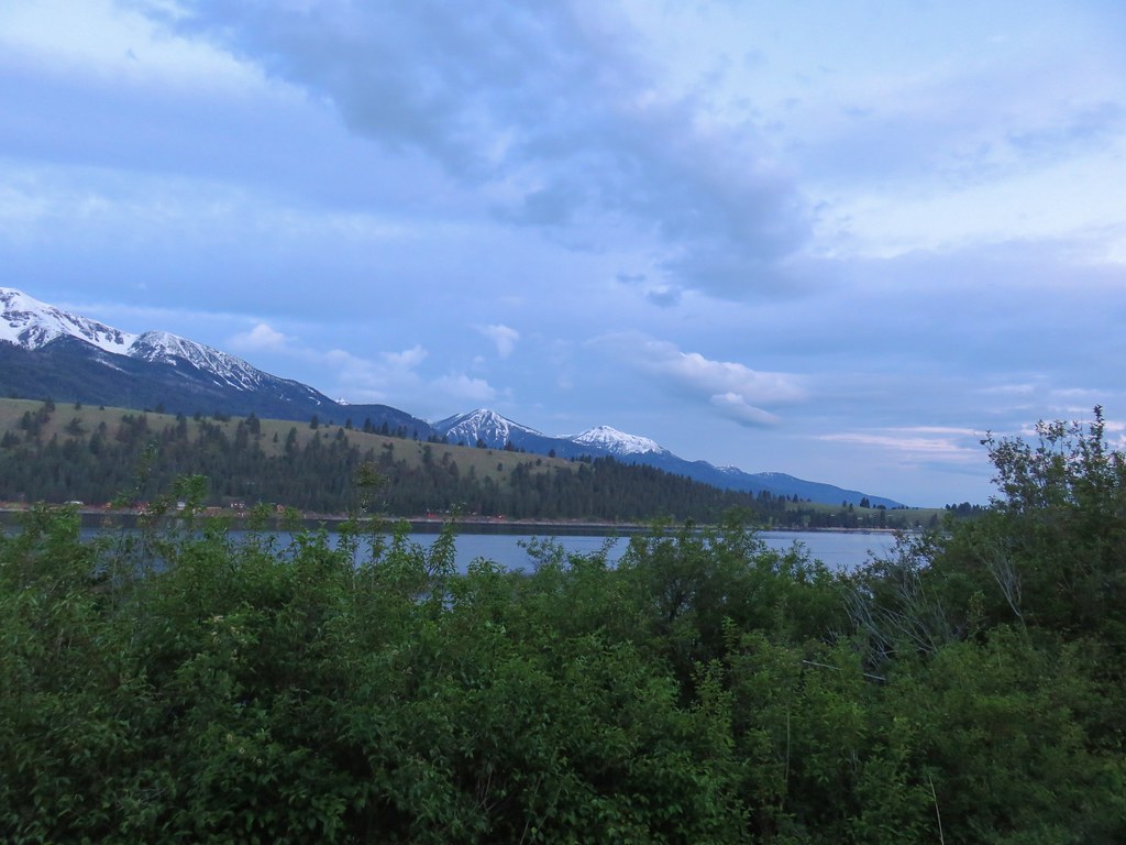


From Joseph we drove to Imnaha where we turned right onto the mostly gravel Upper Imnaha Road for 12.3 miles. Just before a bridge we veered left from the wide gravel road onto a much narrower, steep, more dirt than gravel road for 2.7 miles to the large trailhead.
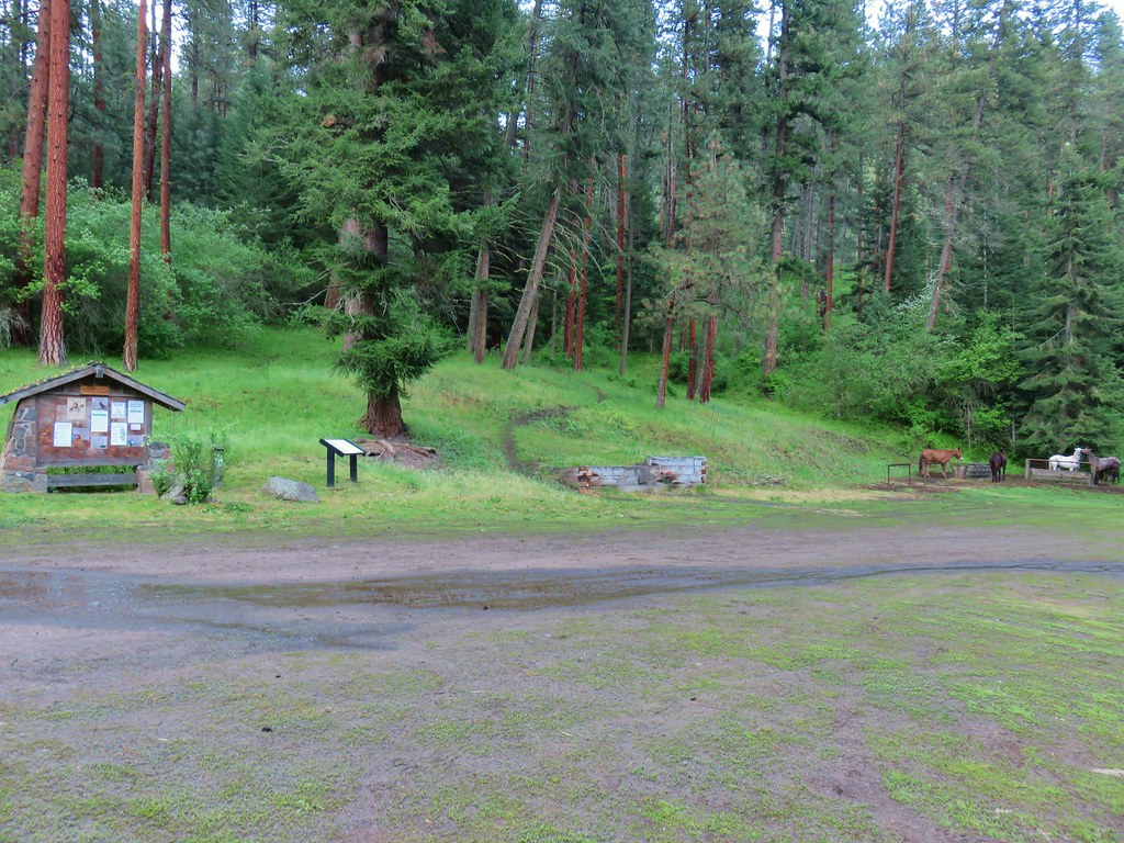
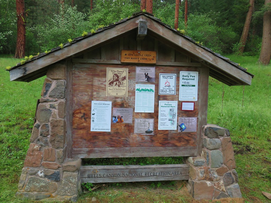
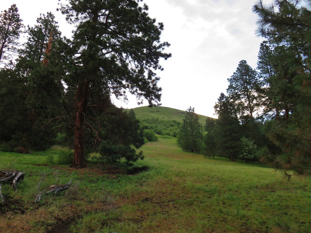
Two trails leave from this trailhead, the Saddle Creek and Freezeout. We took the Saddle Creek Trail on the left side of the informational signboard.

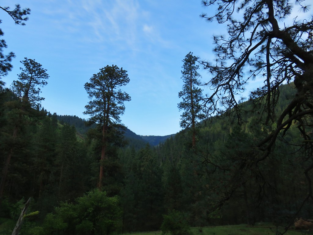
There was a decent amount of blue sky behind us to the east as we began to climb up the trail.
Ahead of us the Sun was still rising in the east where a few lighter clouds filled the sky.

We also noticed a few cows on the hillside ahead of us.
 (The black dot in the center of the hill is one such cow.)
We were busy looking for flowers and ignoring the cattle.
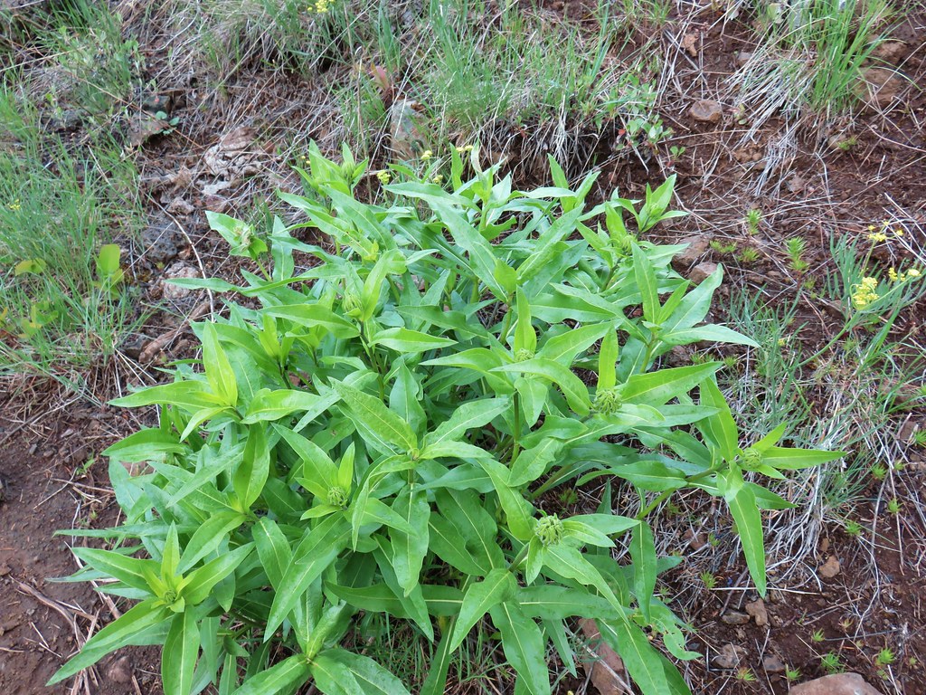
 Western stoneseed
 Prairie stars
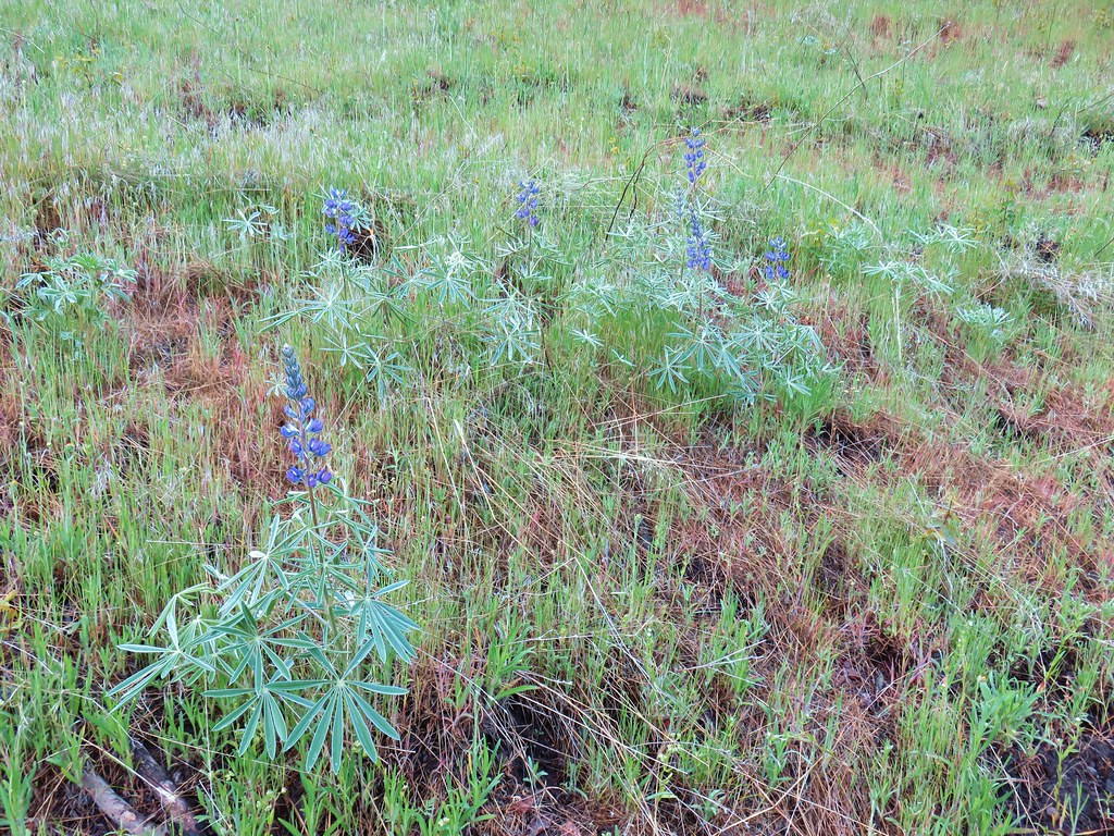 Lupine
We couldn’t ignore them for long though as we soon rounded a bend to find several of them in the trail. They began to head up the trail so we followed having played this game before (post). More cows began to hurry down the hillside and cross the trail and then we noticed the bull. He didn’t look overly please with us but he managed to get the rest of the herd off the trail and uphill a bit. We passed on by and then promptly heard several of the cows coming up quickly behind us. I knew this game too from my time moving irrigation pipes in Central Oregon as a teenager. I turned and they stopped then we repeated (like the school yard game “red light, green light”). Knowing this could go on for awhile when we got into a brushy section of trail we sped up and left them behind.

 Heather emerging from the brushy section.
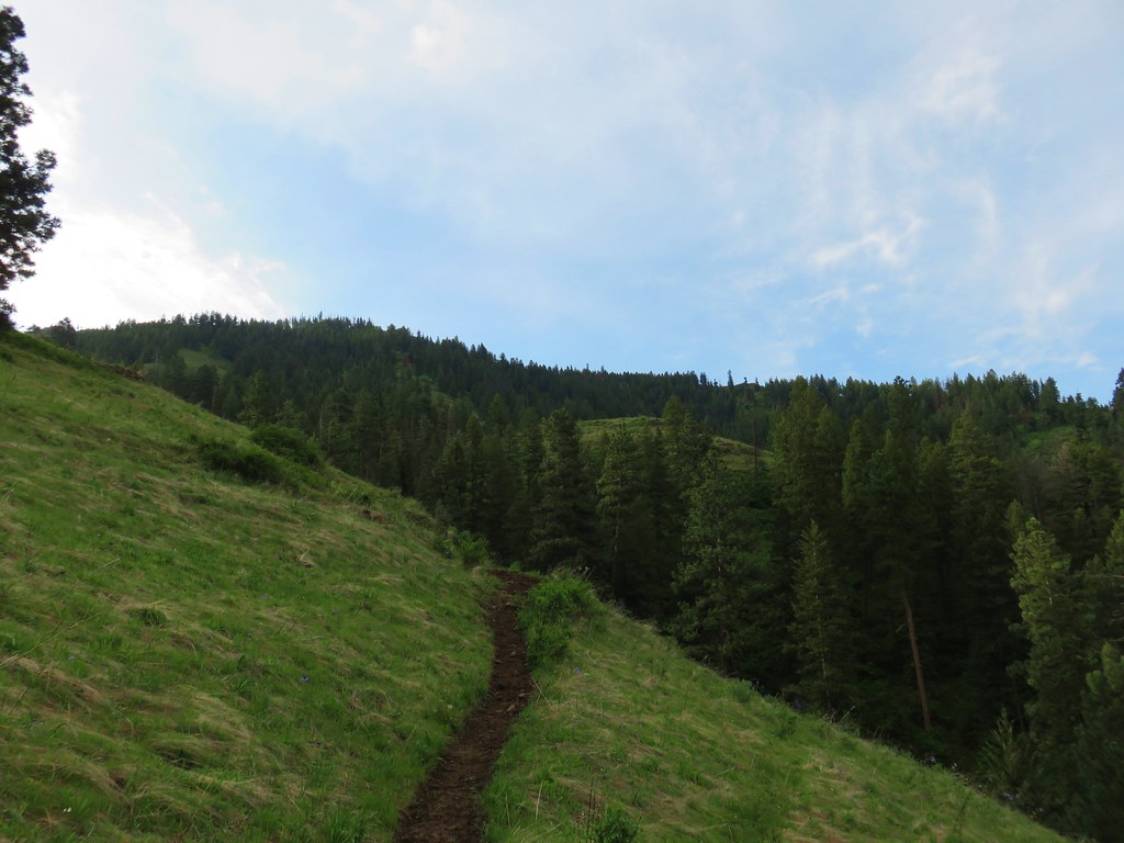
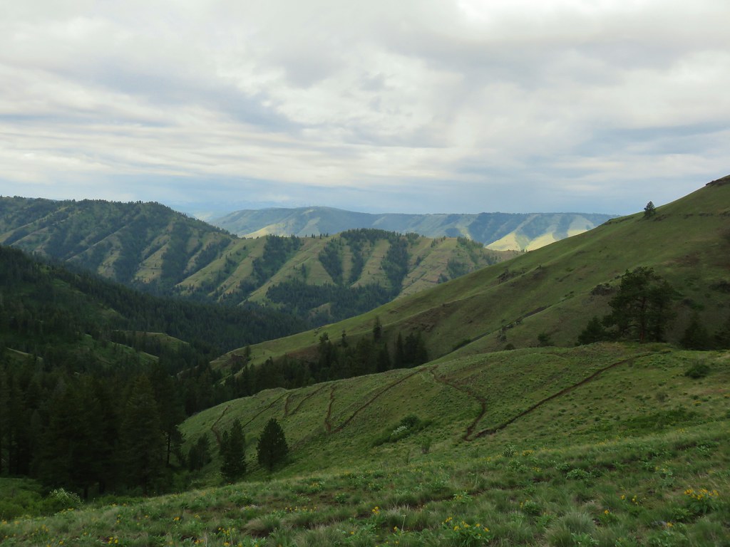
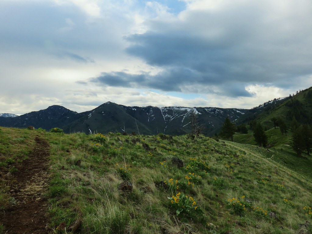
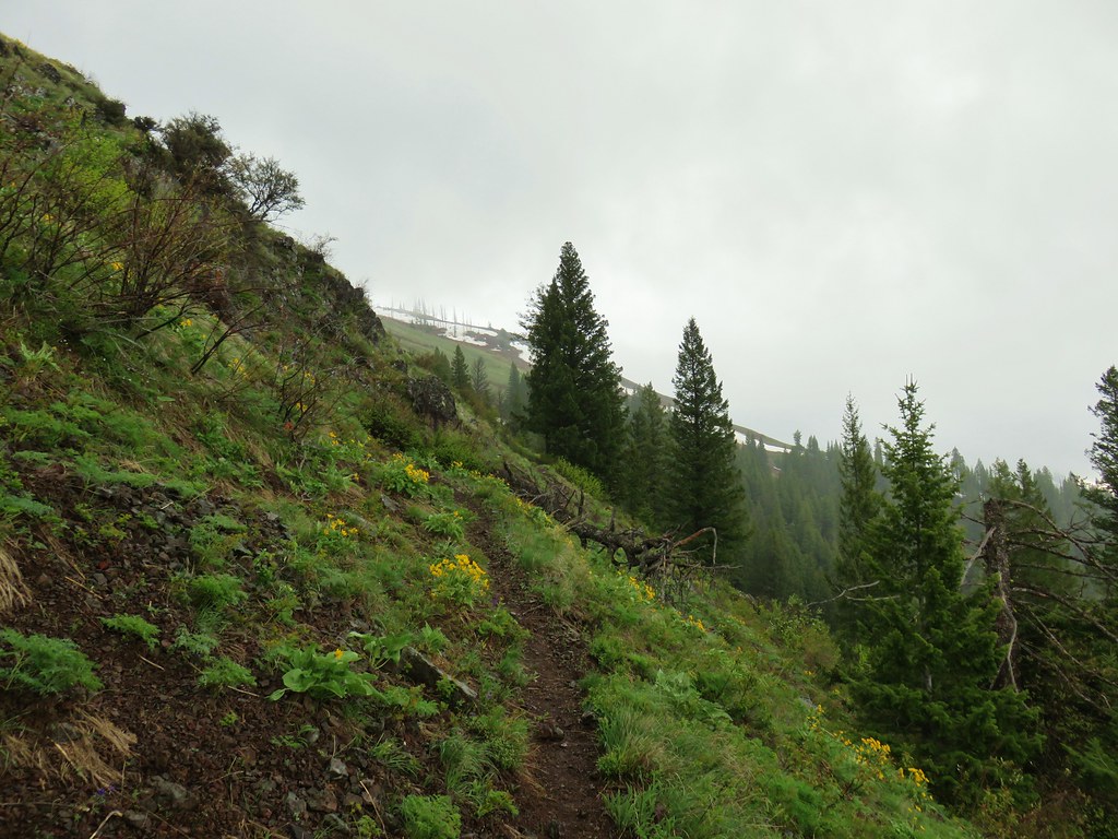
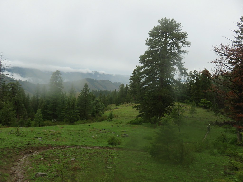
We could relax and start enjoying the hike again. The trail climbed up through open grass hillsides with occasional stands of trees. Views abounded.


About a half mile from the trailhead the Saddle Creek Trail made a wide arc into the tress to Saddle Creek.

The trail crossed the creek only to recross it moments later.


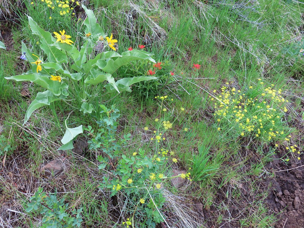
The forest hosted a few different flowers than the grassy hillsides.


The trail climbed away from the creek and began a series of switchbacks leading back to the open hillsides.


As we gained elevation the number of blooming flowers increased.
 Blue Dicks
 Balsamroot
 Balsamroot, paintbrush and biscuitroot
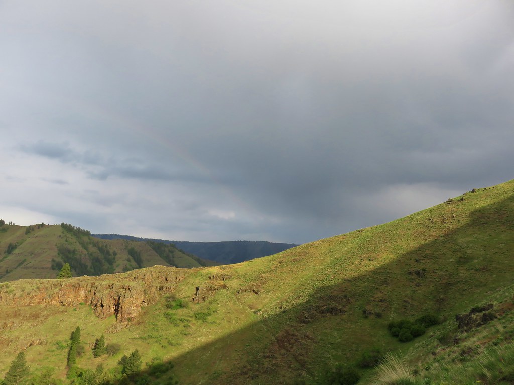
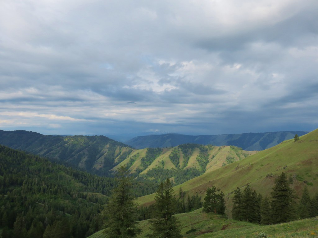
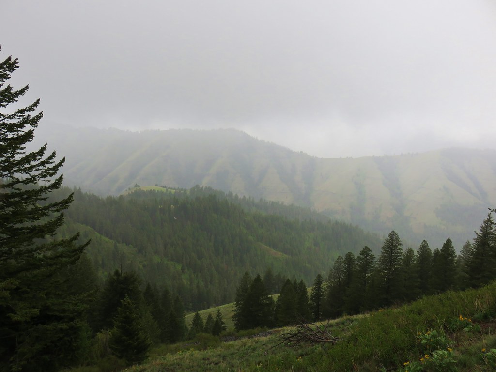
The views also got better as we climbed but we also began to notice showers passing by. A bonus result of the showers was a faint rainbow that framed the snowy Wallowa Mountains to the west for a time.


The Saddle Creek Trail kept climbing, sometimes via switchback and others up and around ridges.


There was a good number of flowers in bloom with quite a few more to come.
 Larkspur and monkeyflower
 Paintbrush
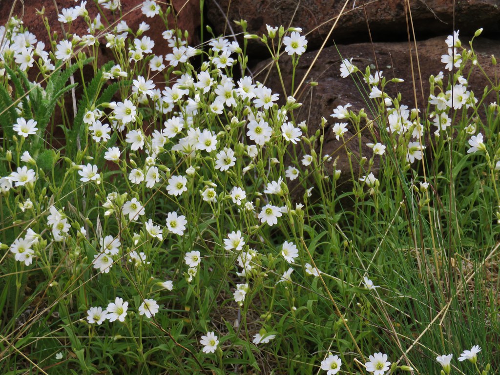 Chickweed
 Possibly going to be a penstemon
 Unkown
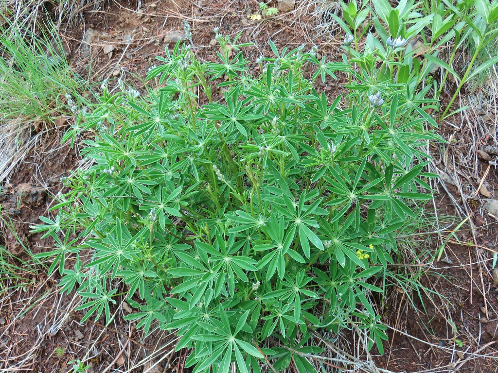 Lupine
We finally arrived at Freezeout Saddle after gaining over 1900′ in what our GPS claims was 3 miles.
A trail signpost marked the junction with the Summit Ridge Trail.

Despite the showers nearby we had a pretty good 360 degree view.
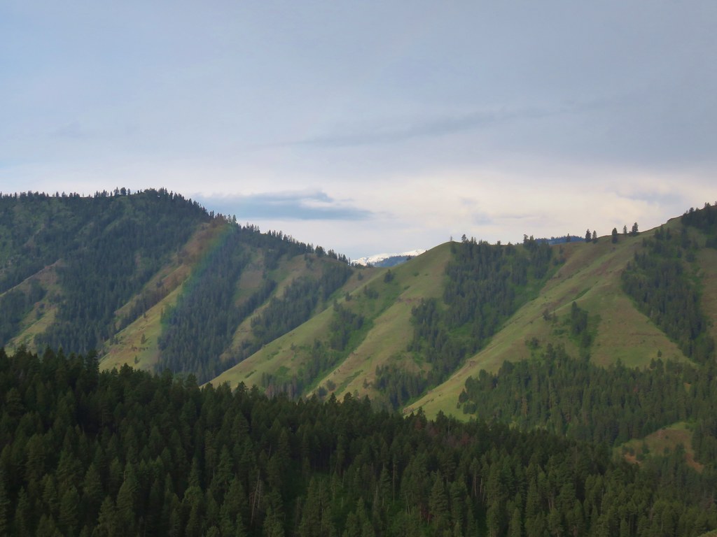
 West to the quickly vanishing Wallowa Mountains.
 North
North
 South
South
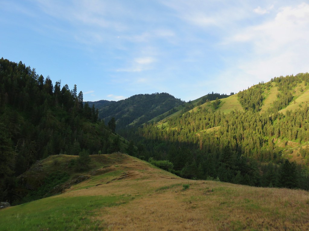
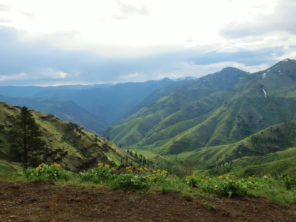
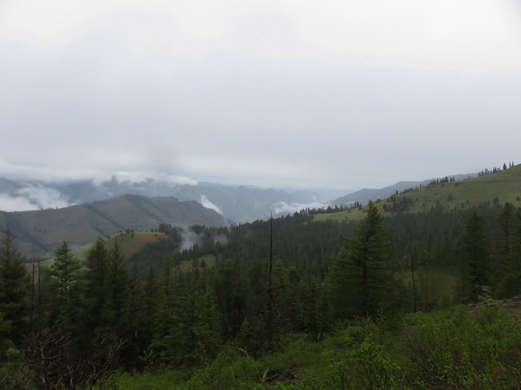
 East into Hells Canyon
We rested briefly at the saddle admiring the view.
After the break we headed south on the Summit Ridge Trail passing more views into Hells Canyon and some different wildflowers.
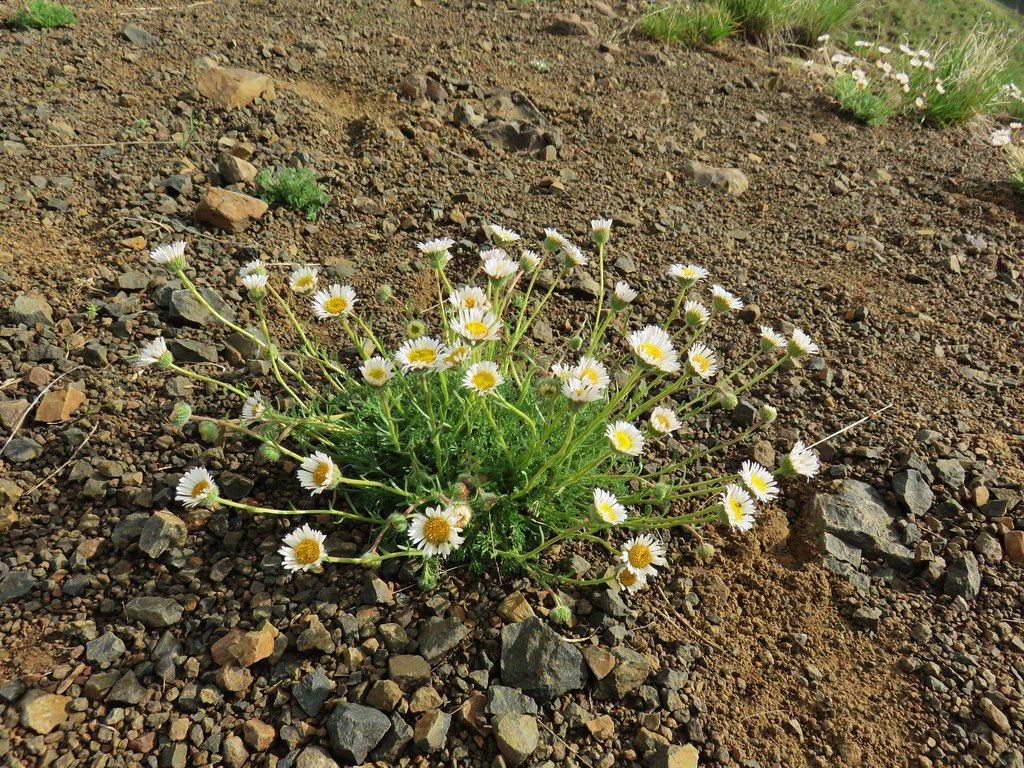 Cutleaf daisy
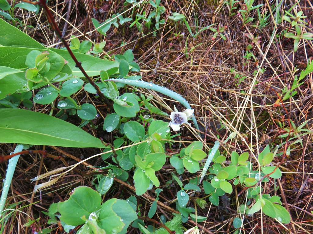
 A little white alpine pennycress
 Largehead clover


The view toward the Wallows had taken a hit though as some dark clouds and rain showers now lay between us and them.

We began to run into quite a few yellow glacier lilies when we reentered the trees as we traversed around the west side of a rise along the ridge.


There were also a few kittentails present.

We ran into our first non-bovine obstacle in the form of a downed tree in this section.

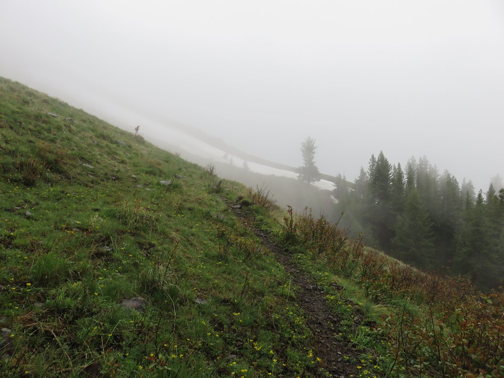
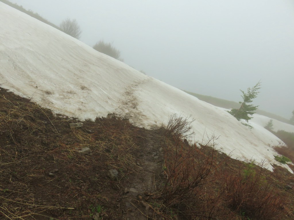
Oh if that had been the only other obstacle. As we came around the hillside and spotted a snowfield in the distance.
The rain “showers” had made their way over to us and at an elevation of approximately 6200′ we were partly in the clouds.
We hoped it would pass quickly and stuck to looking for more flowers which we found in a clump of hairy clematis.

We arrived at the snow field and sized it up. There was a clear track crossing from the side we were on.
We had brought our microspikes for just such an occasion but the snow looked narrow and the footprints were well established from what we could see so we eschewed the spikes and started across. Big mistake as the footprints had smoothed over on the far side of the snow (which was icy and even slicker than usual with the rain falling). I managed to heal kick some footholds and get off the snow without too much trouble but Heather had gone higher thinking it would be easier to get off by going up. Luckily she was able to kick in a little bit of footing and jam her poles into the snow to help keep her from sliding down the hill. I was able to the get a hold of her pack and we got her off the snow as well. Lesson learned, we carry the microspikes for a reason, use them!
A bit shaken we continued on stopping to admire a yellowbell.

The rain was not letting up so we’d thrown on our rain jackets which we had put off putting on thinking that we were liable to get wetter from sweat while we climbed than wearing them in the rain. The trail had leveled off along the ridge now and we began encountering more patches of snow.


Just under three miles from Freezeout Saddle we arrived at another signed junction.
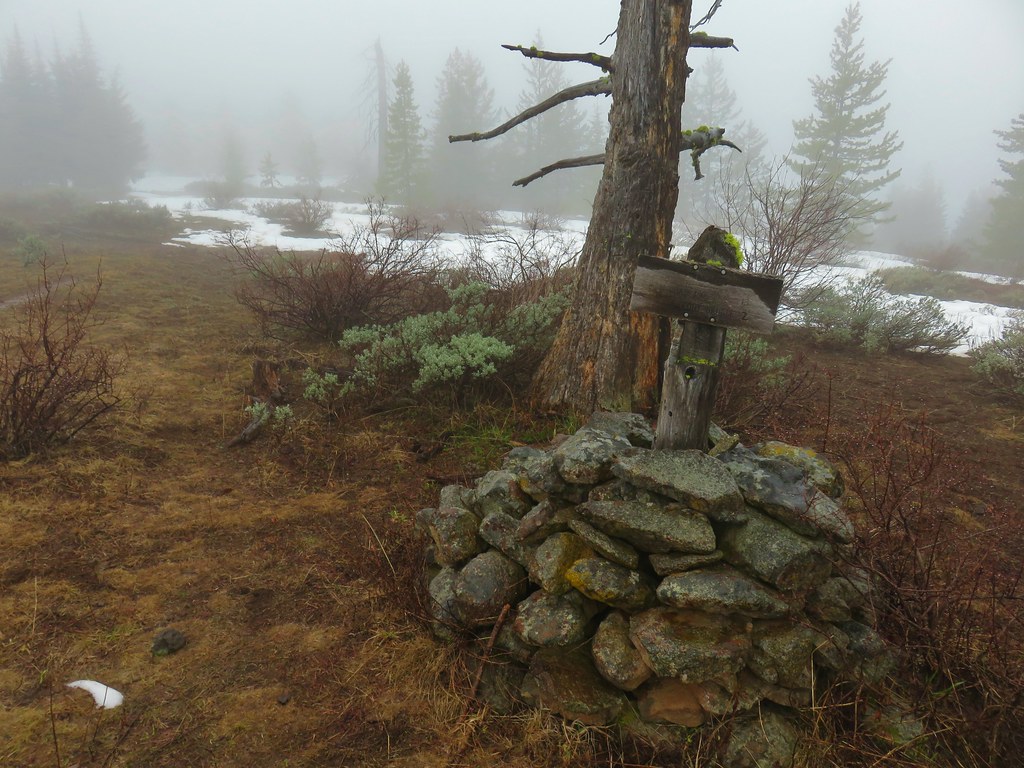
In our guidebook Sullivan has you go straight at this junction showing the fork to the right petering out after a short distance. The Forest Service map which is also on the GPS unit shows the right hand trail (Marks Cabin Trail) going all the way over to the Freezeout Trail. We initially headed straight but the footprints that we had been following through the snow patches disappeared and so had the trail. After about 450 feet we decided to go back to the junction and try the other way which would be shorter and we hoped less snowy. Incidentally the 450 foot excursion from the junction officially took us into the Hells Canyon Wilderness so we at least were able to mark off another wilderness area as visited.
Marks Cabin Trail was no easier to follow as it was faint even when there was no snow.

We used the maps to stay close to where the trail was supposed to be having to correct course a number of times due losing sight of it under the snow only to find it again by spotting cut logs or a bit of tread.

After crossing over a barbed wire fence we spotted a cairn in the grass but there was no sign of a trail anywhere near it.

More map work led us to what at least looked like a trail.

By now the rain shower had not only not passed over but it was now a snow shower. At some point we wound up a 100 feet or so above the trail and had to climb over a number of logs to get down to it.

Luckily we managed to get back to it near the junction with the Freezeout Trail which was marked by a small piece of white flagging (not shown as my hands were too cold to unclip the camera from my waist) 1.5 miles (they route we took) from the junction. Heather kept asking where the cabin was which I thought was a strange obsession to see some private cabin while all I wanted to do was get down below the snow. A couple days later she pointed out that we might have been able to warm up at the cabin (if it had been open or if someone from one of the vehicles at the trailhead had been using it) or use it to orient ourselves and make sure we were on the right trail.
We headed down the Freezeout Trail which quickly became faint in the grass.
The good news was it reappeared and the rain/snow was finally starting to let up.

The bad news was that after passing over a ridge the trail headed into a gully that was holding quite a bit of snow among trees and other vegetation (again not pictured due to cold hands and a bit of frustration). The trail is described as an old cattleman’s trail in the guidebook and that description fit in the steep gully. We knew the trail crossed the gully but we couldn’t see where and we didn’t want to try and cross any of the steep snow even with our spikes so we picked our way through the best looking gap in the snow patches and found what turned out to be the trail somehow.
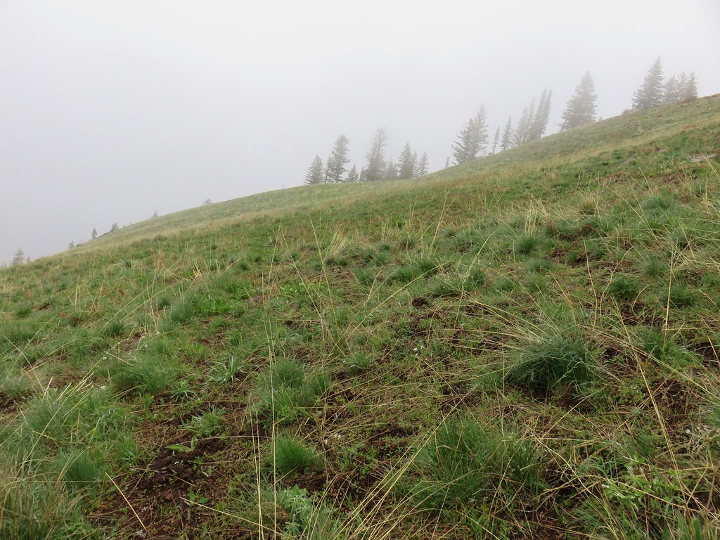
We were now done with the snow for the day and soon we were back traversing an open hillside with views albeit more limited than those from the morning.
(The rest of the photos were a fight with moisture and numb fingers so please excuse the numerous water spots. 🙂 )
Despite being cold and soaked we were still looking for flowers.
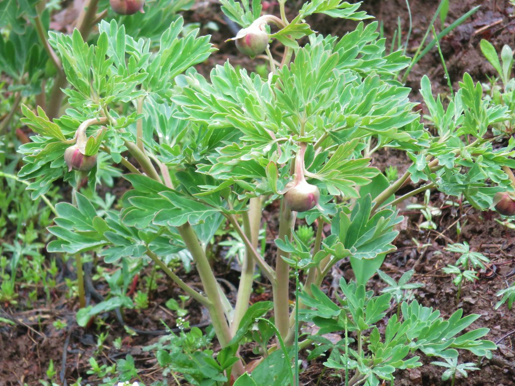 Brown’s peony getting ready to bloom.
 Mariposa lily starting to open.
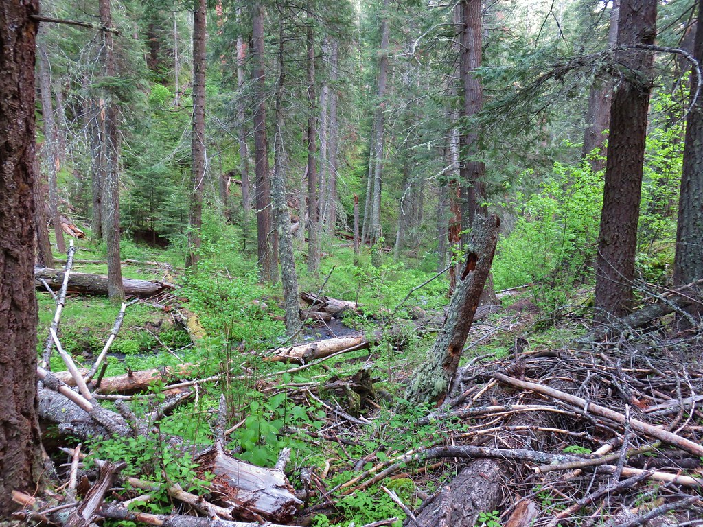
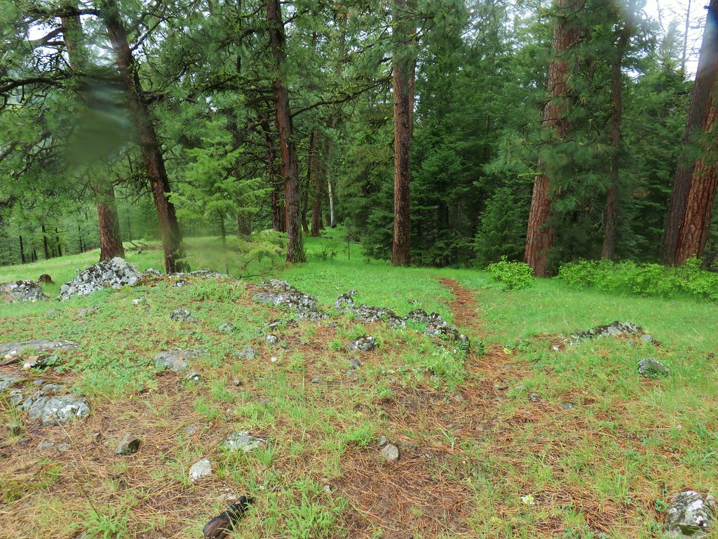
This portion of trail alternated between grassy open areas and ponderosa pine forest.
After the first mile from where we’d turned onto it, the Freezeout Trail steepened a lot as it headed downhill fast to an unsinged junction with the Long Ridge Trail.

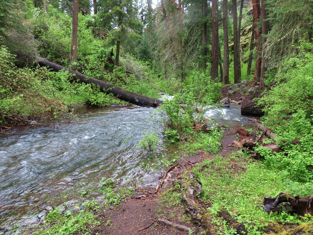
Shortly beyond the junction we crossed a scenic unnamed creek that refused to sign a waiver forcing me to blur out its identity.


The trail leveled out somewhat beyond the creek and at another opening we were able to look back up towards the ridge where we’d come from.

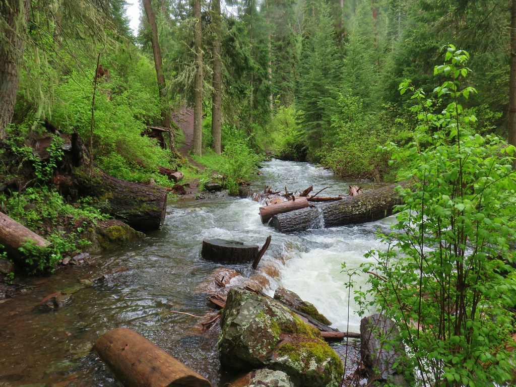
We were now traversing a hillside above Freezeout Creek and gradually making our way down to it through the forest.

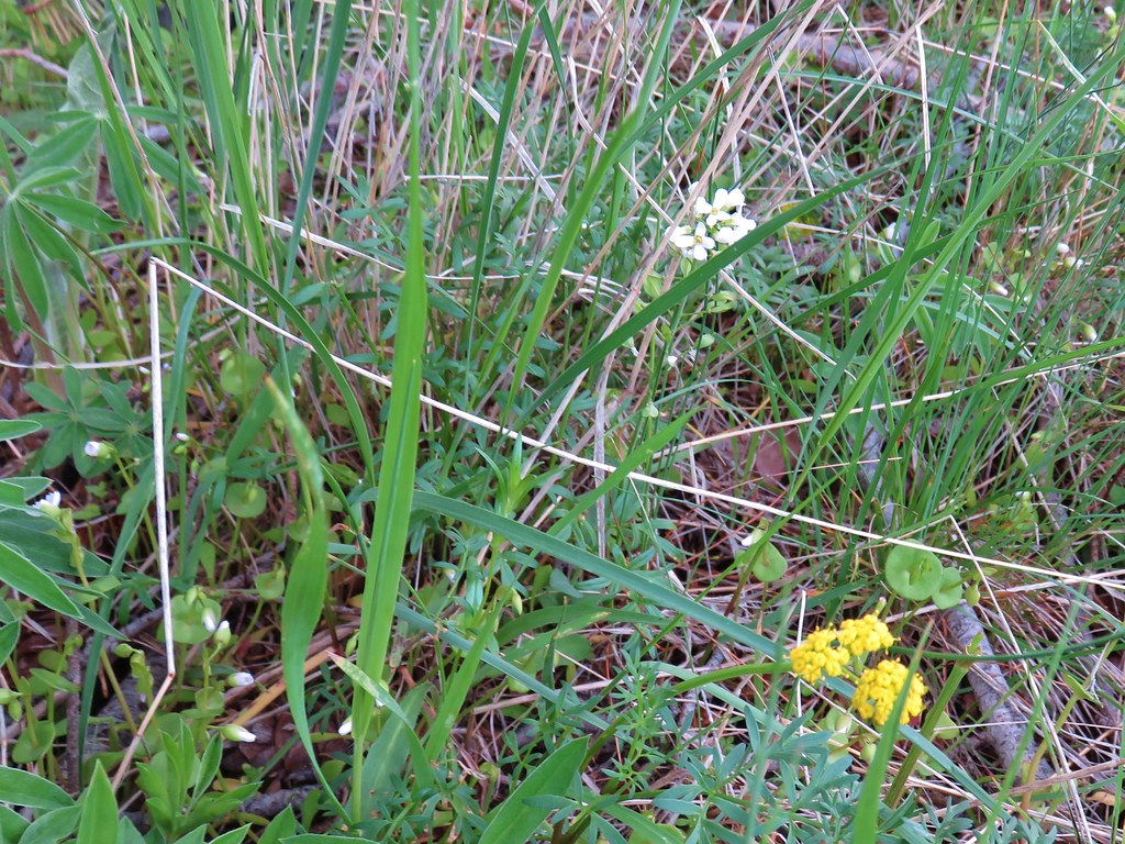
Along this strecht we spotted this cute little flower.
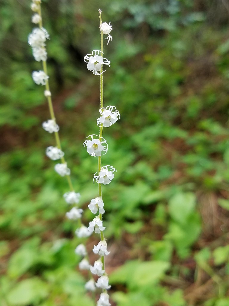
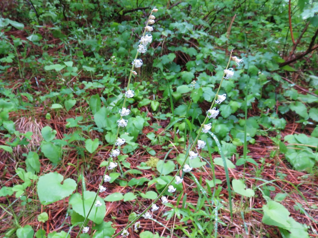 Small flower miterwort
As we neared Freezeout Creek we passed a junction for the Morgan Ridge Trail.

Our final obstacle of the day was navigating around Freezout Creek which has claimed a chunck of the trail as its own. A scramble path led up and around a tree which was lucky because the water actually looked quite deep where the trail had been.
From there it was just over a quarter mile back to the trailhead where we were more than happy to put on some dry clothes and warm up. The GPS tallied a 13 mile hike and it felt every bit of one with approximately 3700′ of elevation gain. The climb up really wasn’t all that bad but we were feeling the steep decent in our knees.
The day had one more bit of adventure in store for us as we headed down the narrow road from the trailhead. A pair of trucks, one with a horse trailer, were heading up and where we met the road was too narrow to pass. Heather had to back up a good distance until we found a spot where they could pass.
After the trucks went by we were able to get back to Joseph with the only other excitement being a pair of turkeys along the road.


In Joseph we stopped at the R & R Drive In for some comfort food which really hit the spot. Happy Trails!
Flickr: Freezeout Saddle
