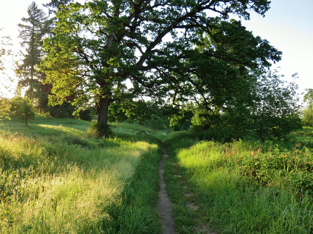
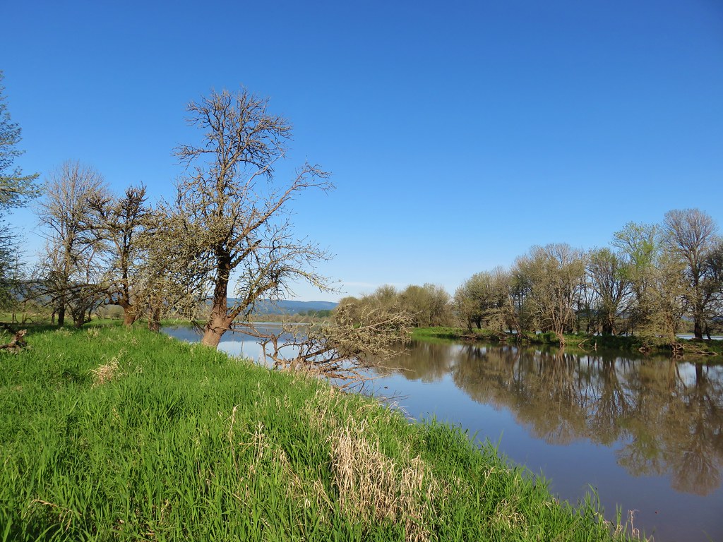
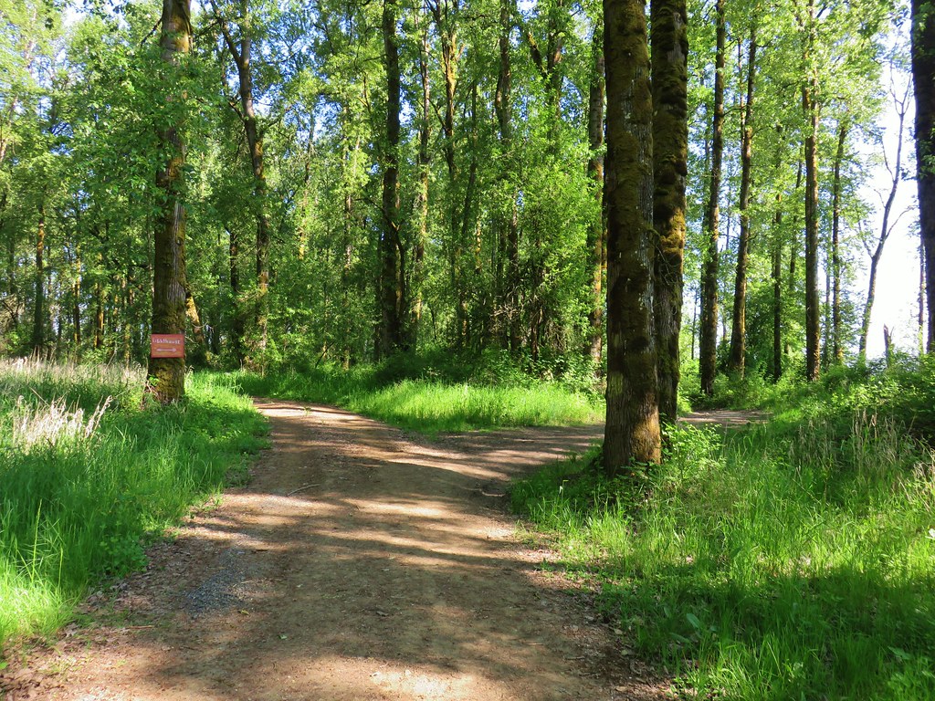
Our latest outing was a three stop trip to Sauvie Island in the Columbia River. After purchasing our $10/day parking permit online from the Oregon Department of Fish and Wildlife we headed for our fist stop at the Wapato State Greenway.

Here a short loop trail passes around Virginia Lake and along the Multnomah Channel.
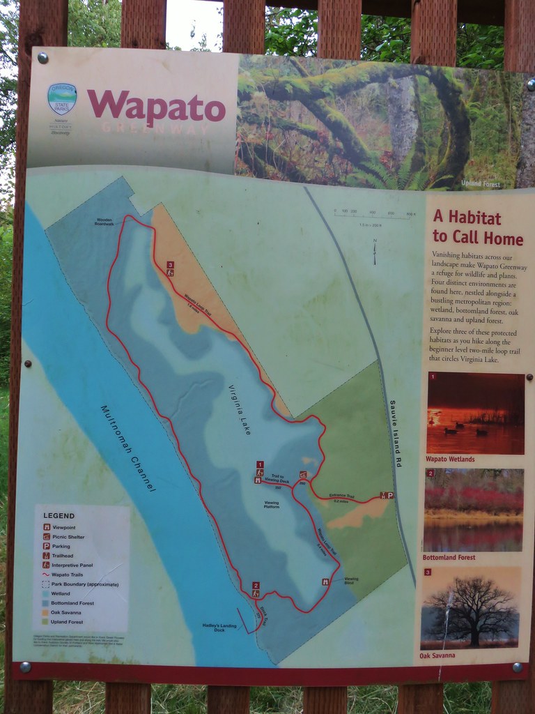
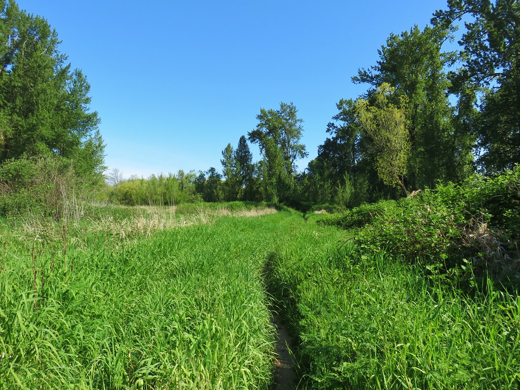
We set off on the entrance trail which quickly split (not shown on the map). We veered left on a mowed path through some grass.

Our plan had been to visit the viewing platform first thing but this left fork was not the true entrance trail and we wound up joining the loop trail a tenth of a mile south of the side trail to the platform.

We turned left onto the loop trail deciding to visit the platform near the end of our hike instead.
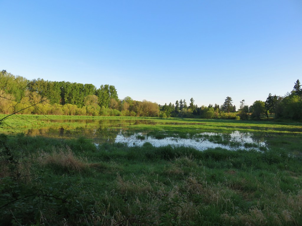
We passed a view of Virginia Lake and arrived at a viewing blind after a tenth of a mile.

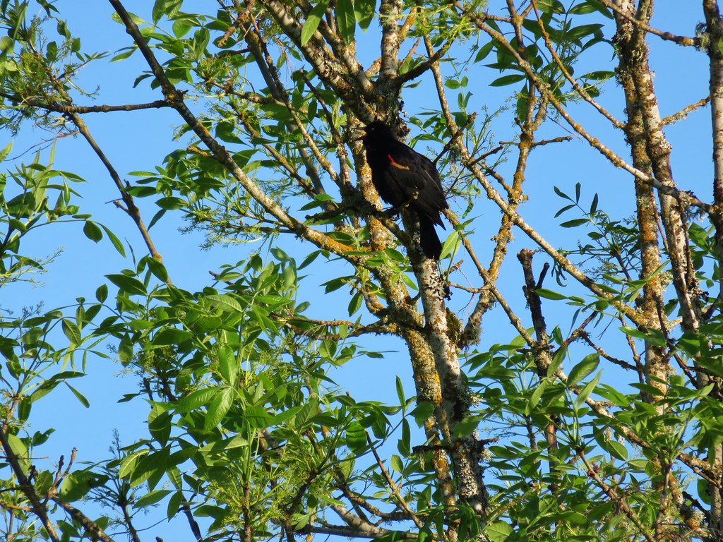
Other than the occasional red-winged blackbird sighting we didn’t see anything from the blind on this morning. We continued on the loop ignoring a spur trail to Hadley’s Landing Dock just before arriving at the Multnomah Channel.

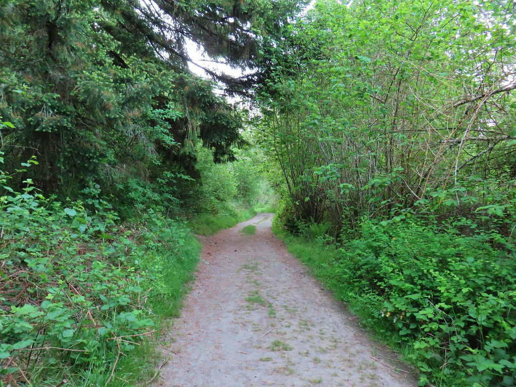
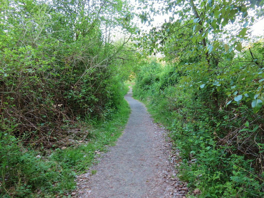
The trail passed through woods with occasional openings to grassy meadows. There were a few woodland flowers here and there but the most interesting thing was the wildlife. We saw a lot of birds and couple of shy rabbits. Most of the birds were busy foraging in the bushes or flitting from tree to tree so we didn’t have a lot of luck with pictures. We did appreciate the many songs they were singing as they made their morning rounds.


 Black-headed grosbeak
We also spotted what we at first identified as a pair of deer under a large oak.

As we watched them disappear into the brush we kept noticing more deer and ended up counting five of them.
After passing the picnic shelter we turned right down the side trial to the viewing platfrom.


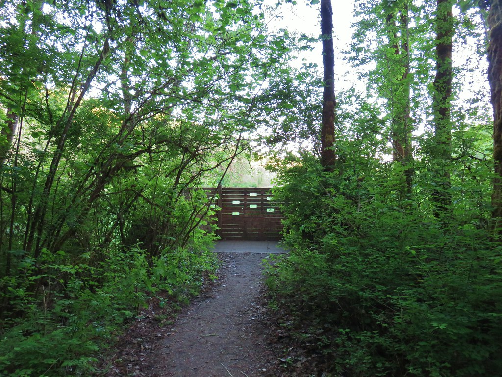
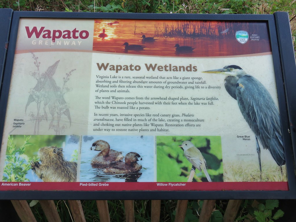
We had more luck with the wildlife from this viewpoint spotting a couple of different types of ducks, a great blue heron, and a pied-billed grebes.
 Mallards with a great blue heron in the distance.
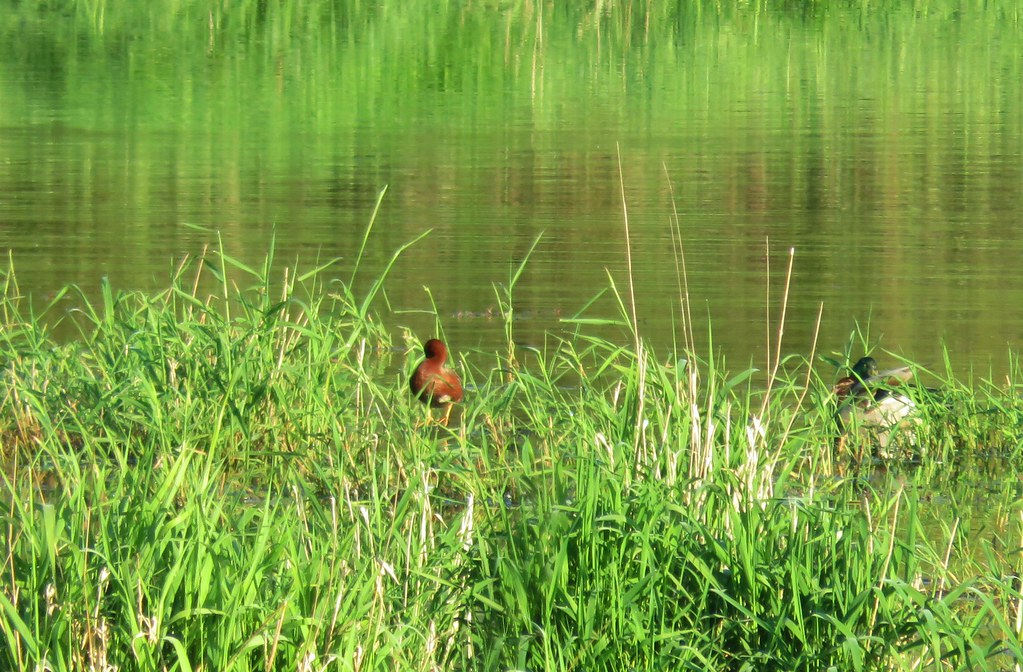 Cinnamon teal and a mallard
 Pied-billed grebe
We had never heard of a pied-billed grebe and were wondering what it was. Then we took the time to read the interpretive sign at the platform.
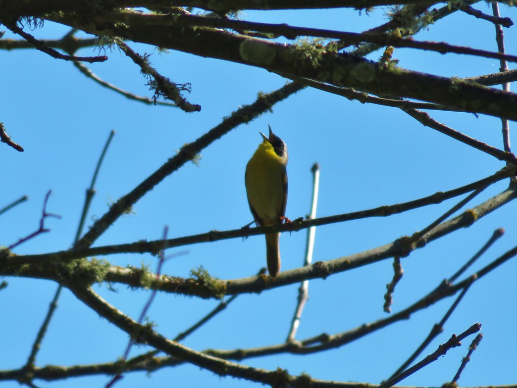
After leaving the platform we headed back to the car. Along the way we spotted another new bird to us. A Black-throated Gray Warbler. She was hopping around on the trail gathering something for a nest it appeared so the photos are a bit blurry.


Our second stop was at Oak Island,technically a peninsula. It is part of the Sauvie Island Wildlife Area and only open to hikers from April 16 through the end of September.
From the parking area a mowed path leads past a large signboard for .3 miles to the start of a loop.


The rabbits were a little less shy here.

We had a few cattle cross our path prior to reaching the start of the loop as well.

We actually missed the start of the loop which was marked by a post with a hiker symbol on it.

We stayed straight on the obvious track past this sign as the path leading right was so faint we hadn’t noticed it. Continuing in this clockwise direction the trail leads through open grass with Steelman Lake to the west.

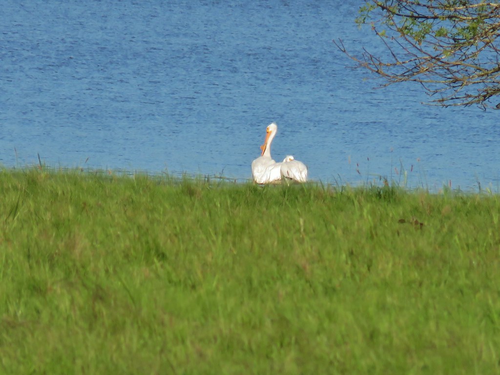
A number of great blue herons could be seen flying over the water and along the lakes shore we spotted a pair of white pelicans and a family of Canada geese.

The distinctive call of red-winged blackbirds was prevalent.
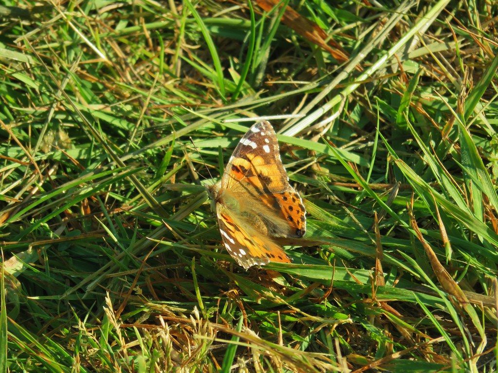
After passing through a gate the grass grew taller and the trail began to turn away from Steelman Lake. Here there were many butterflies and a few blooming camas.
 Looking back at the gate.


Just before turning south near Sturgeon Lake a .1 mile spur path to the left led to the narrows, a narrow channel connecting Steelman and Sturgeon Lakes.
 Looking toward Steelman Lake from the Narrows.
 The Narrows. Another lake, Mud Lake, is on the other side of the trees.
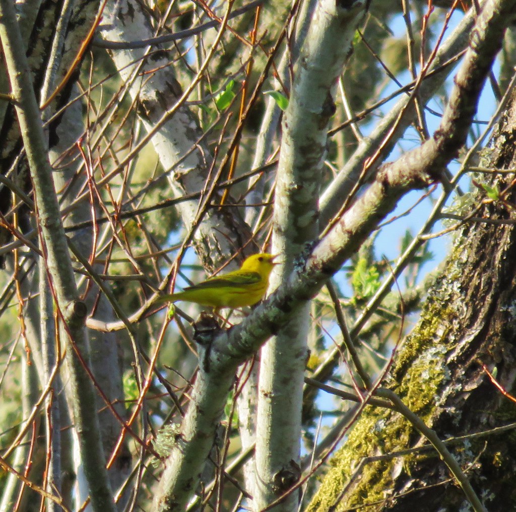
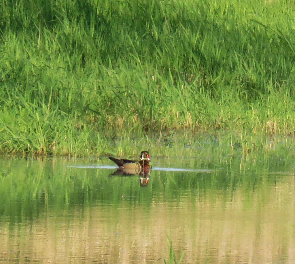
As we were returning to the loop we spotted a pretty yellow warbler and a wood duck.
Shortly after rejoining the loop Heather spotted a path down to a small beach along Sturgeon Lake where both Mt. St. Helens and Mt. Adams were visible but due to the lighting very hard to make out.
 Mt. Adams (it is really there)
 Mt. St. Helens
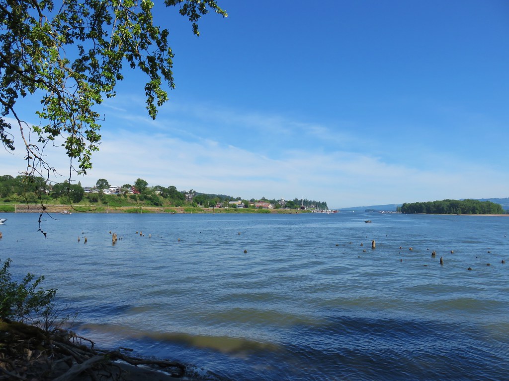
We had been similarly unsuccessful at getting a picture of Mt. Hood earlier from the Narrows. We finished up the loop and returned to our car ready to head to our final stop at the Warrior Point Trailhead. A coyote raced across the road near the parking are for the clothing optional Collin’s Beach. We’re not sure what it had been up to but it looked like it thought it was being chased. We had some fun imagining it had tried to run off with someones clothes.
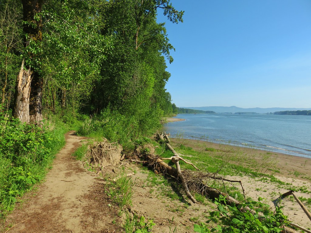
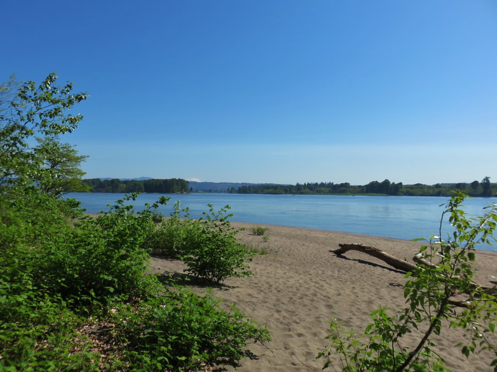
After that excitement we parked at the trailhead and before setting off walked down the the sandy beach along the Columbia River.


As we began hiking a bald eagle flew overhead.

The trail had occasional views of the River as well as Mt. St. Helens which was now a little easier to make out.

 Mt. St. Helens and an Osprey nest.
Our visit to the Island had already been on of the most diverse for birds and the Warrior Rock Lighthouse Trail just added to this. After the bald eagle and osprey we spotted a pair of American goldfinches.
 Female
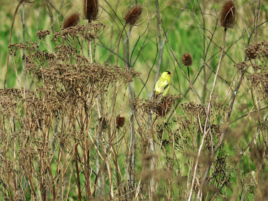 Male
Male
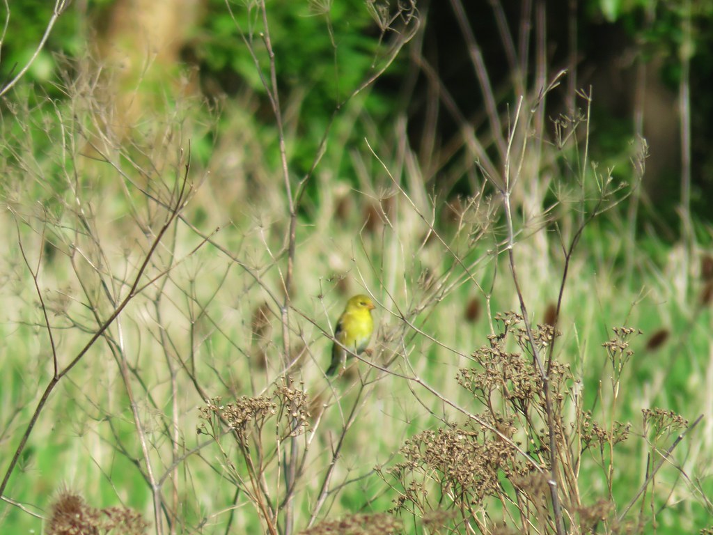
These were followed by a Bullock’s Oriole and a yellow throated warbler.

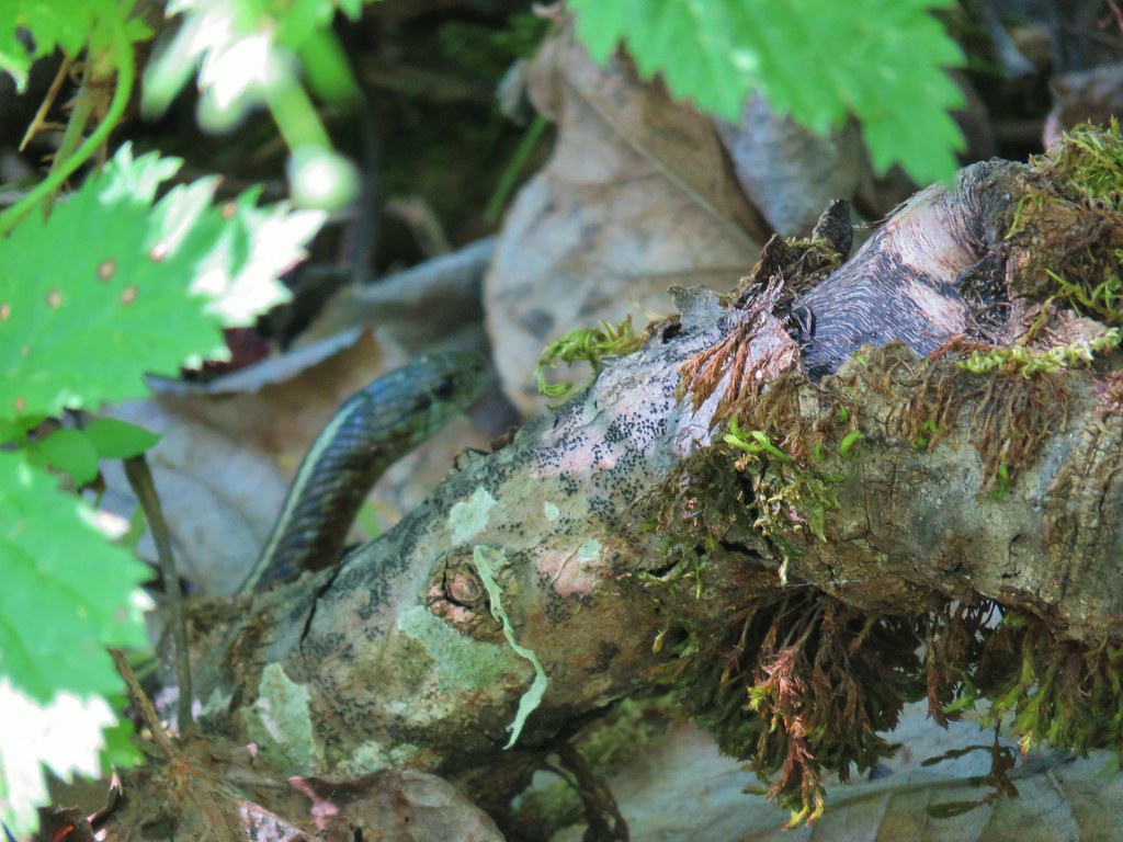
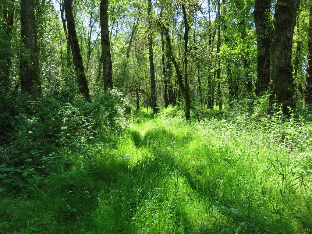
The trail itself varied as it spent some time in the woods, some along the river, and other passing through tall grass.
Considering the combination of grass, nearby water, and warm sunshine it seemed like the perfect conditions for snakes but we only spotted one.

After three miles we arrived at a sandy beach near the Warrior Rock Lighthouse
 Mt. St. Helens again.
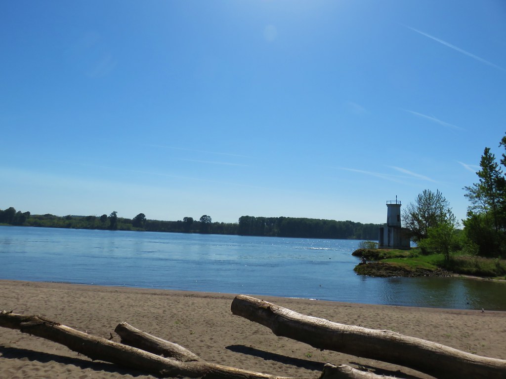
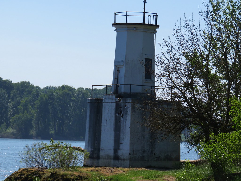
After a short rest on the beach we continued north on the sand to an old concrete gun mount.

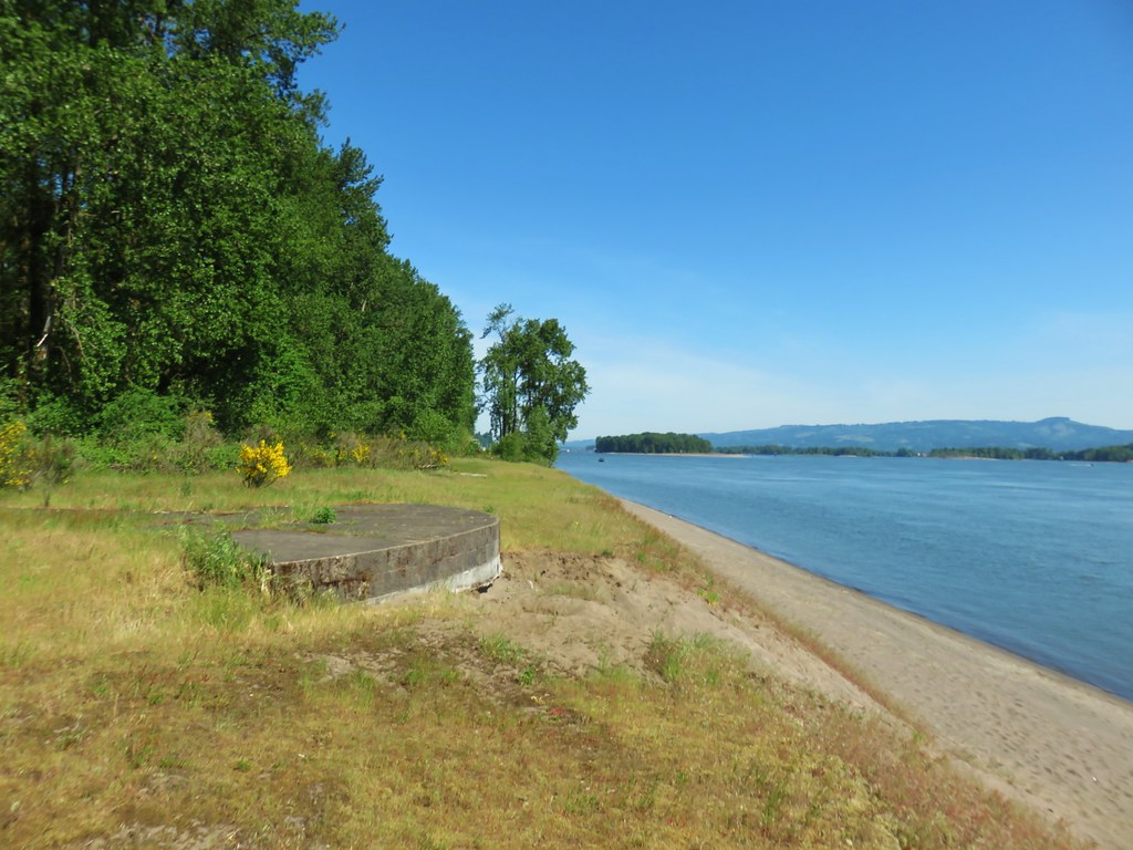
This is where things got a little interesting. Our guidebook said to turn inland here on a small access road to a T-shaped junction. The map accompanying the description on Oregonhikers.org appeared to show the track continuing north from this point along the river. We couldn’t see any sign of the small access road so we continued north along the beach until it was no longer possible. We faced the choice of backtracking or following a faint path inland to try and connect to an old road bed that would take us to Warrior Point. We headed inland.

There was a faint path, we’re guessing it was more of a game trail than anything but it wouldn’t have been too hard to follow except for all the blackberry bushes. We managed to push through what turned out to only be a tenth of a mile to arrive at the grassy road bed.
A brief detour right led us to a viewpoint at Warrior Point of the town of St. Helens.
 1905 Columbia County Courthouse
We followed the old road bed back from Warrior Point for a half mile where it met the Warrior Point Trail near the beach at the lighthouse.

We had only seen a handful of other hikers all day but on the way back to the car (it was only now a little after 11am) we passed a number of people heading toward the lighthouse. We were once again thankful to have gotten an early start.
Our distances for the day were 2.6 miles at Wapato Greenway, 3.3 miles at Oak Island, and 7.3 miles at Warrior Point for a total of 13.2. It had been a great day for wildlife and another enjoyable set of hikes in the Portland area. Happy Trails!
Flickr: Sauvie Island Hikes


 Lupine along the trail.

 Interpretive sign along the trail.
 Second from the left is Dug Peak, the pointy peak is Sawtooth Peak, and the round peak to the right is Hurricane Point.
 The trail descended from the hill and leveled out along some trees.
 Yellow warbler
 Brown-headed cowbirds


 Hounds tongue
 Death camas
 Oregon sunshine
 Bench with a view of Point Joseph behind.
 Sunflowers yet to bloom.
 Fiddleneck
 Descending to the highway.

 Old Chief Joseph’s gravesite. His original grave near Wallowa, OR had been looted twice before he was moved here in 1926.
 Wallowa Lake beyond the gravesite of Martha and Frank David McCully.
 A sightseeing robin.
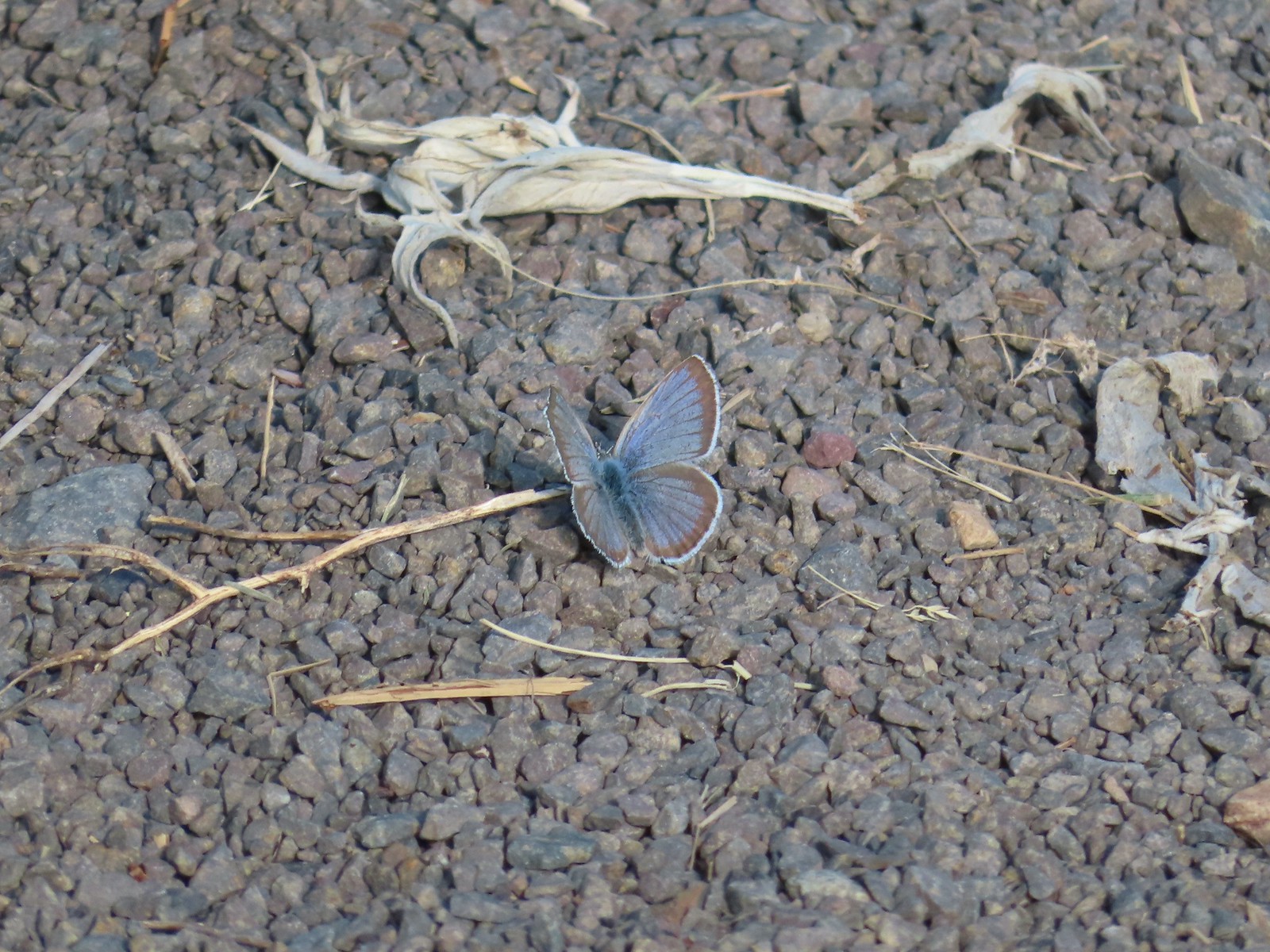 Butterfly on the trail.
 Western stoneseed

 Farmer’s Ditch
 View from the South Main Street Entrance.
 Passing back by Knight’s Pond.
 Some uplift action on the clouds from the trailhead.