An extra long weekend brought us to Central Oregon for a pair of Labor Day weekend hikes. We had planned the coup de gras of our hiking season for September 1st when we were set to climb the South Sister, but first we decided to take a “warm up” hike on the 31st on our way to Bend, OR. We chose Tam McArthur Rim which is located about 16 miles south of Sisters, OR at Three Creek Lake. The trail offered an up close look at Broken Top and a view of the Three Sisters to help us get excited for the next days climb. We also had the option of making this a short hike of just 5 miles by turning around at the rim viewpoint, but of course we opted to lengthen the trip. 🙂
The trail offered views from the beginning with Tam McArthur Rim and the North & Middle Sister looming over Three Creek Lake.

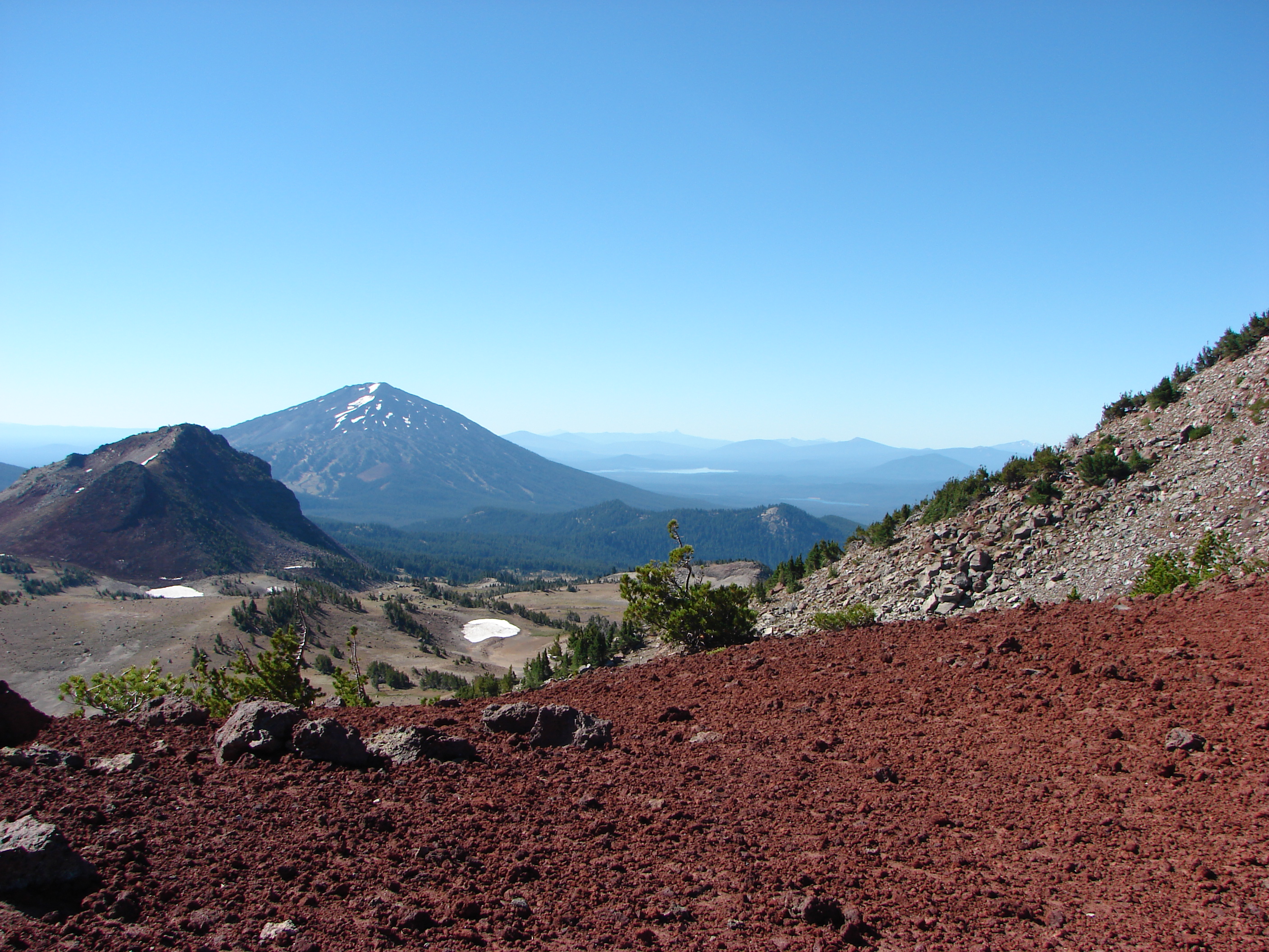
The trail climbed for the first 3/4 of a mile up a ridge to the rim’s plateau. Along the way views opened up across the lake to the north revealing several Cascade peaks. When we reached the plateau the mountains were temporarily lost as we traveled south across a semi-barren landscape. After a half mile the trail bent right and began gradually climbing along the sloped plateau. Mountains once again were visible, this time to the south. Mt. Bachelor rose above the plateau with Tumalo Mountain to it’s left.

As we gained elevation along the plateau the tops of Broken Top and the South Sister began to peek over the rims edge. The plateau itself was an interesting mix of rocks and sand dotted with clumps of trees. The plants were limited to those capable of surviving windy conditions on little water. Just prior to the final climb to the viewpoint the trail approached the cliff edge where we got our first good look at Little Three Creeks Lake.

Upon reaching the viewpoint we found that it was a nice wide area with a 360 degree view. At an elevation of 7730′ it was high enough to see a good distance. It was a wonderful spot to take a break and have a bite to eat and would have been an acceptable place to declare victory and turn around. While we sat at the viewpoint we were joined by a Red Crossbill who apparently thought it was a good place for a break as well. Although the view here was good enough to call it a day the trail continued on so we would too.

Continuing on from the viewpoint the trail stayed fairly level as it followed the edge of the rim toward Broken Top. The open landscape of the plateau meant constant views with Mt. Bachelor to the south, a string of Cascade peaks to the NW and Central Oregon to the east. Between the trail and Central Oregon the plateau was dotted with patches of snow that were still melting feeding silver creeks that flowed down toward the Deschutes River far below. The most prominent of these was the North Fork of Tumalo Creek.

The trail skirted around one of these snow fields and climbed a cinder slope where we could see the final mile of our path before us.
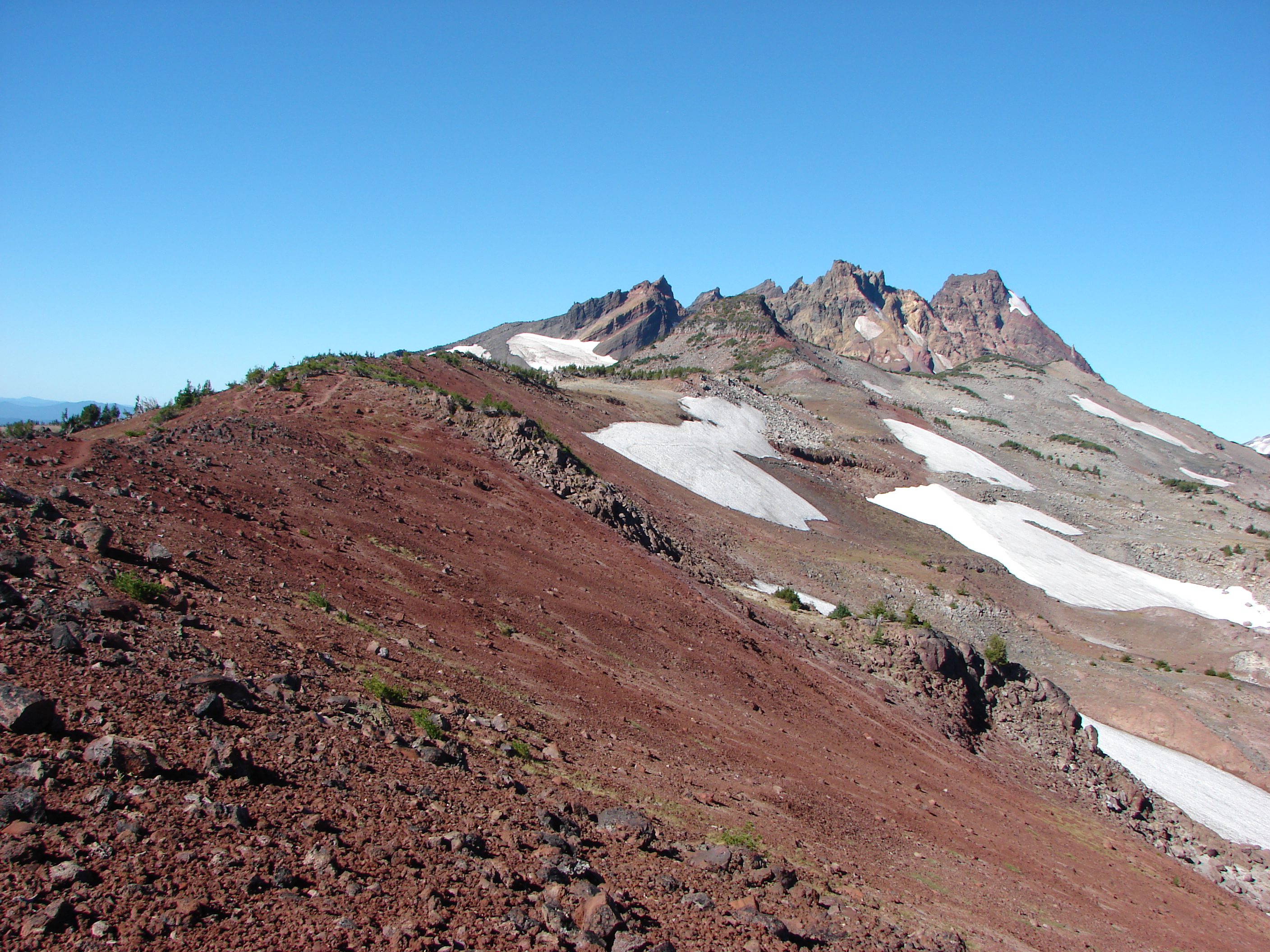
The final mile climbed a cinder ridge to the base of Broken Hand. From this ridge the views became even grander. To the south beyond Mt. Bachelor was Diamond Peak, Mt. Thielsen and eventually Mt. Scott which resides on the rim of Crater Lake.
To the north we could see all the way to Mt. Adams in Washington although haze made it difficult to see it well.

We ate lunch at the base of Broken Hand admiring the colors and shapes of the volcanic rocks of Broken Top and the Three Sisters. We spotted a fellow hiker sitting on the rim of the moraine containing Broken Top Lake, a destination we hope to see next year.

We spent quite awhile surveying the landscape around us, and I was especially intrigued by what appeared to be a good sized waterfall to the SE of the Middle Sister. It may have been along the outlet creek of one of the Chambers Lakes (possibly Camp Lake).

We also tried to spot climbers on top of the South Sister since we planned on being up there the next day but couldn’t make anyone out.
On our way back we began running into more hikers and other wildlife too. A silent group of ravens glided by apparently searching for something along the plateau.

We also spotted an impressive spider which had bright red legs and was just a bit larger than a quarter.

This was a great way to start a weekend of hiking and really got us excited about our hike up the South Sister. Happy Trails.
Facebook photos: https://www.facebook.com/deryl.yunck/media_set?set=a.10202026938382203.1073741853.1448521051&type=3
Flickr: http://www.flickr.com/photos/9319235@N02/sets/72157635322678462/

9 replies on “Tam McArthur Rim”
[…] this trail we could see part of snowy Tam McArthur Rim where the headwaters of Tumalo Creek […]
[…] McArthur Rim (post) and Broken […]
[…] this day they were mostly shrouded in clouds although we could see fresh snow on Tam McArthur Rim (post) and on the lowest portion of the South and North Sisters. Tam McArthur Rim is left center with […]
[…] McArthur Rim (post) and Broken […]
[…] Three Sisters on the right and Broken Top with Tam McArthur Rim (post) to the […]
[…] McArthur Rim (post), Broken Top with Green Ridge (post) and Black Butte (post) in front, and parts of the Three […]
[…] Hand along Tam McArthur Rim (post) on the left with the tip of Broken Top above the hill on the […]
[…] better look at Tam McArthur Rim (post) and Broken Top behind Mt. […]
[…] McArthur Rim (post), Broken Top, Mt. Bachelor (post) and the Three […]