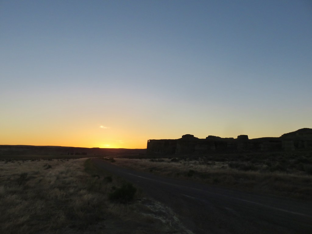
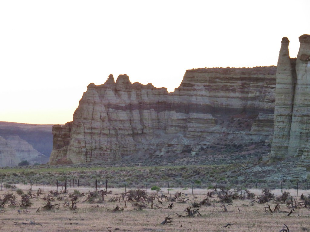
On day 5 we said goodbye to Jordan Valley and headed west on Highway 95 to Rome where we made a brief detour to visit the Pillars of Rome. The sun was still rising when we arrived so our lighting wasn’t great for photos but the interesting rock formation here were a taste of what we’d be seeing later during our hike at Chalk Basin.
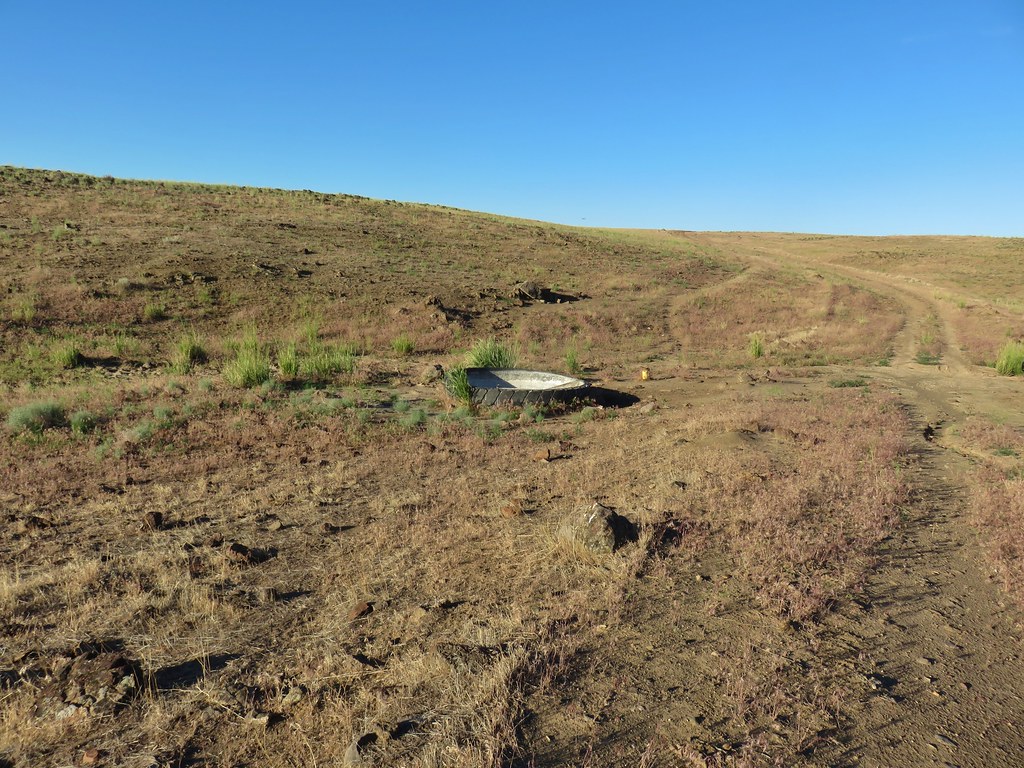
After visiting the pillars we returned to the highway and followed our guidebooks directions to Chalk Basin. The description of the drive calls for a high clearance vehicle and I would add you need all wheel drive at a minimum. The final 16.6 miles of the drive were by far the worst we’ve driven. A theme was developing on this trip and we once again parked before the recommended starting point. This time we parked .9 miles from where the guidebook suggested at an old tire that had been converted to a water trough.
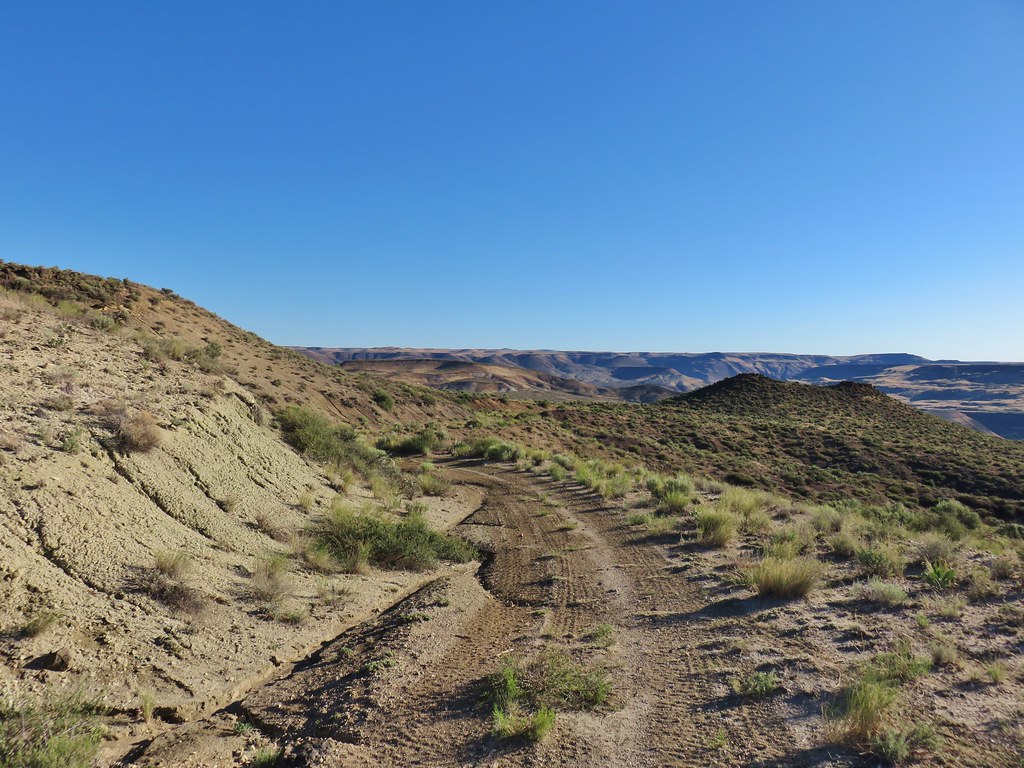
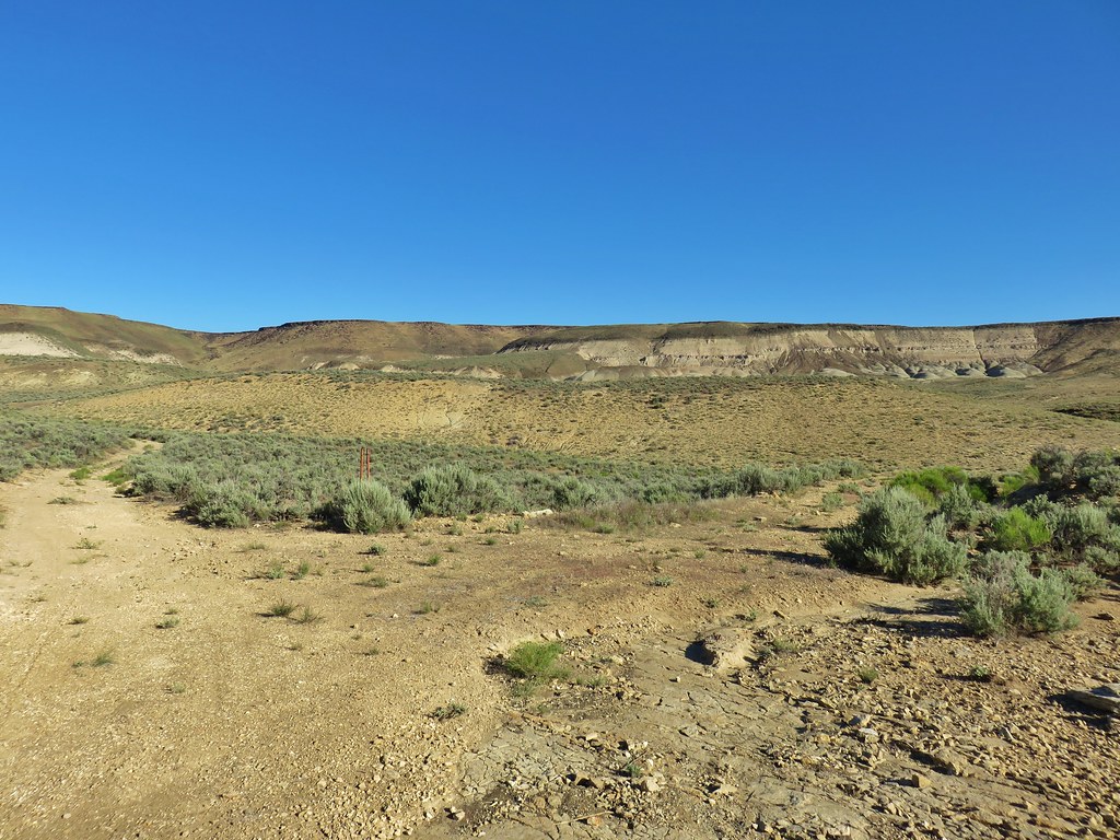
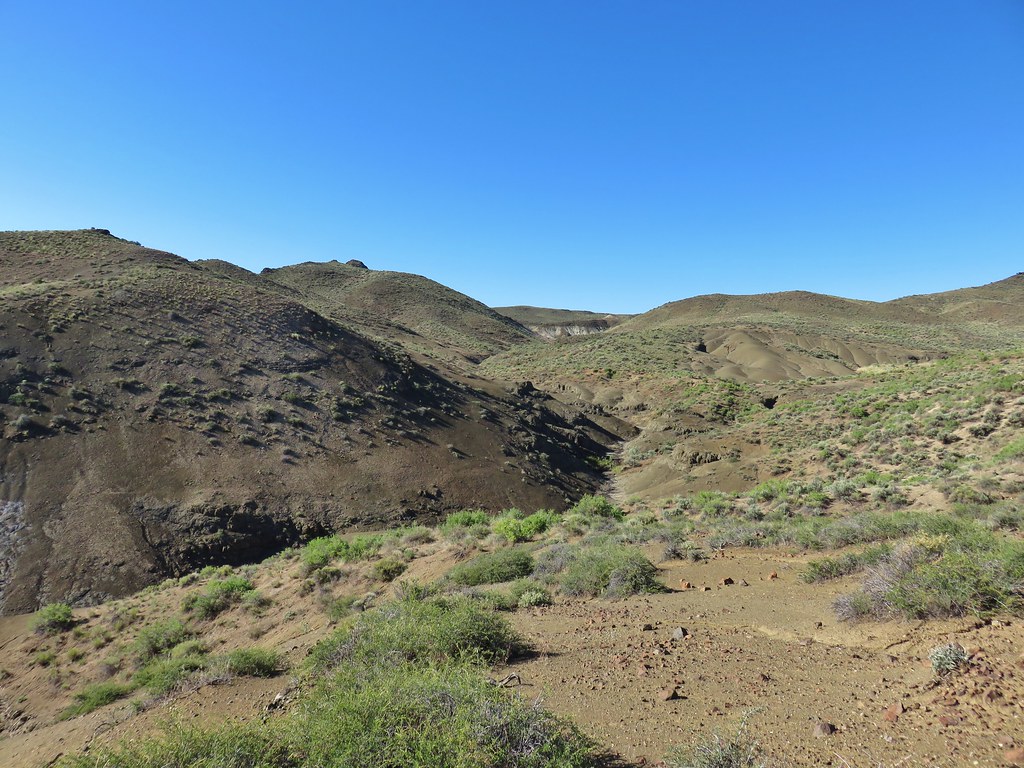
There are no trails at Chalk Basin but after walking the .9 miles we turned right at an x junction onto an even worse old roadbed and headed down into Chalk Basin.
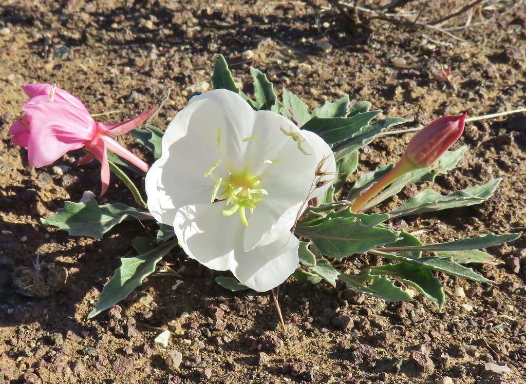
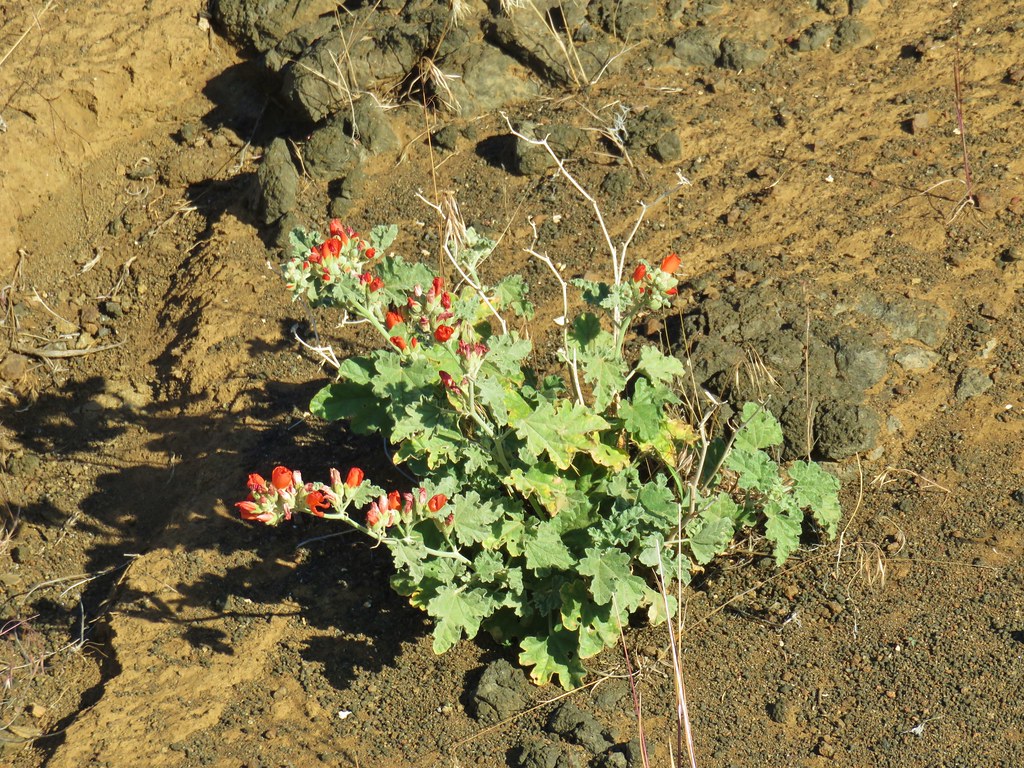
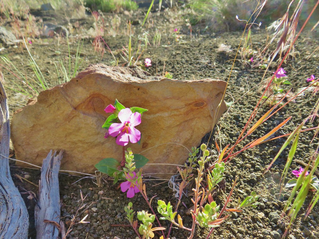
There were some tire tracks present, I can only assume they were from OHVs, as we followed the road for 1.2 miles to a fork. Along the way we passed some tufted evening primroses and an orange globe mallow.
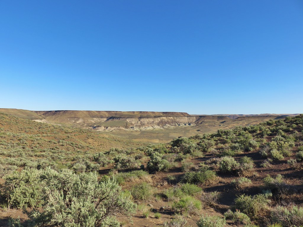
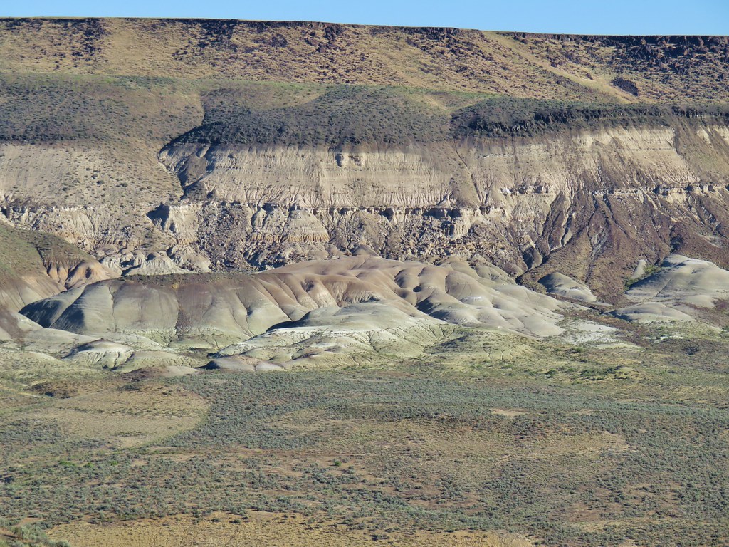
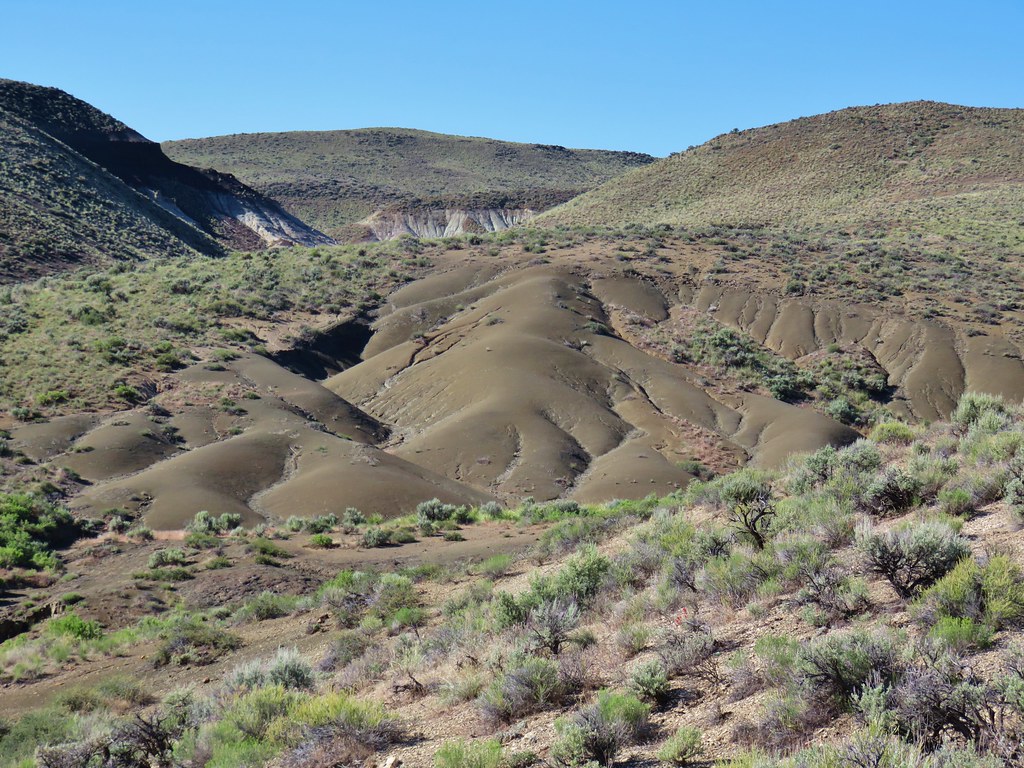
Across the basin we had a view of some mini painted hills.
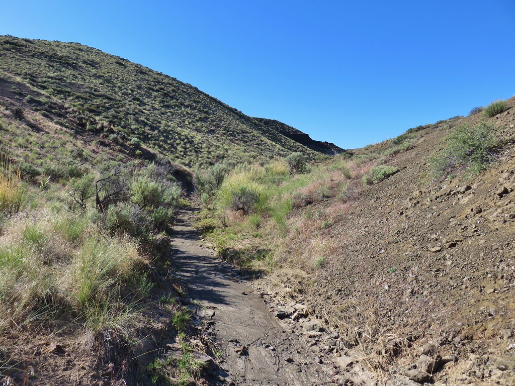
We veered right at the fork and in a tenth of a mile came to a crossing of a dry wash.
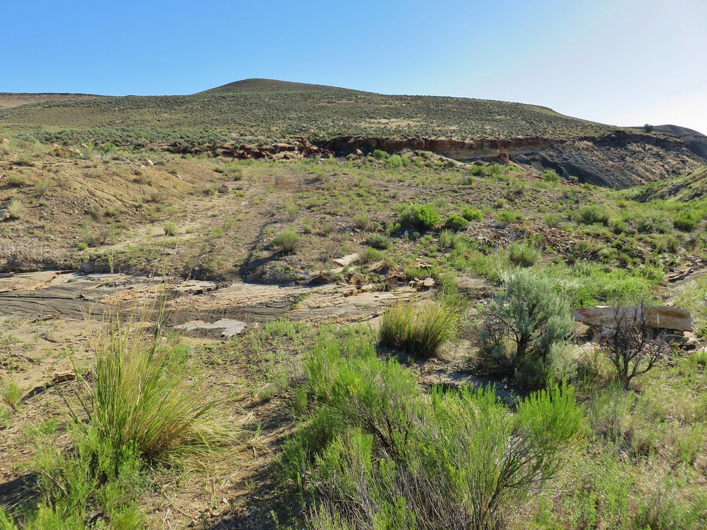
We turned right here and headed down the wash.
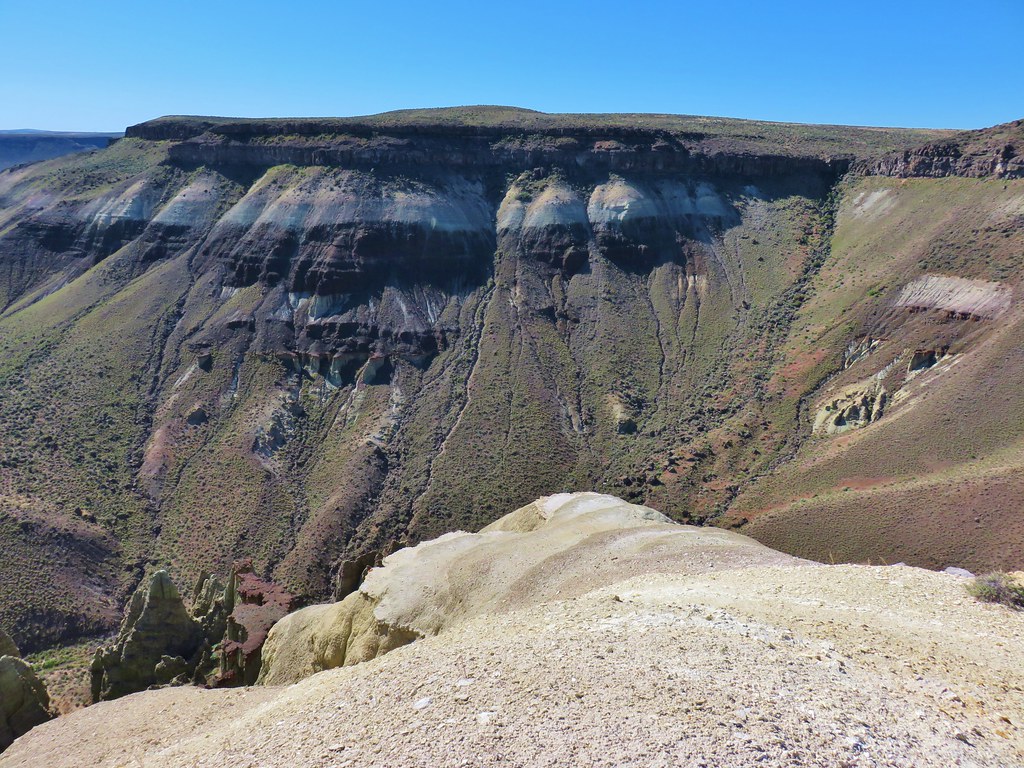
We followed this wash for .7 miles to a drop off at a dry waterfall. It was an interesting hike through the wash which it turned out was not entirely dry.
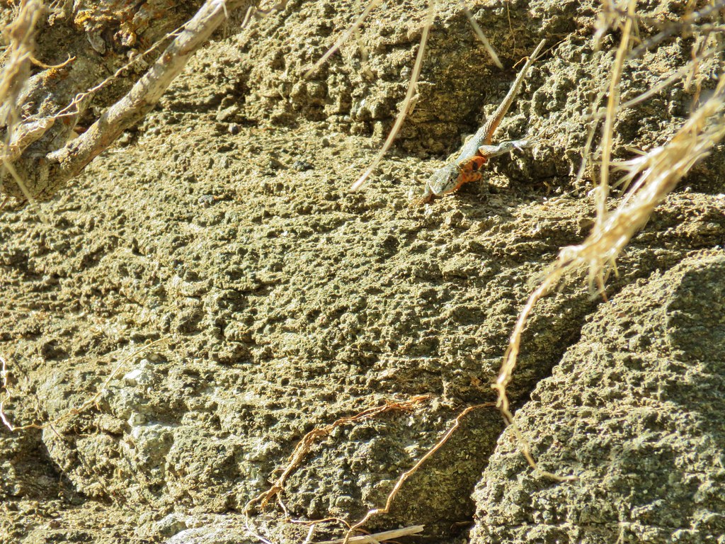 Side blotched lizard
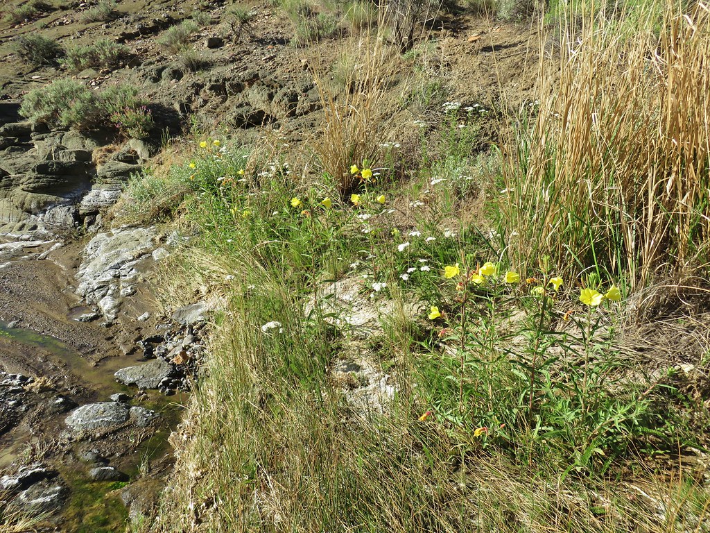 Wildflowers in the wash
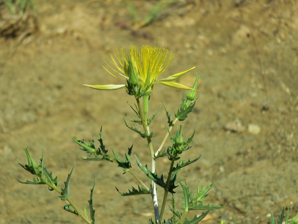 Smooth stemmed blazing star
 Monkeyflower
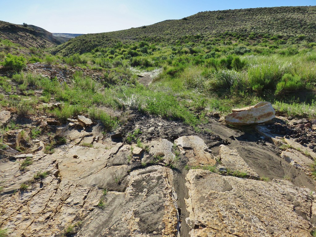
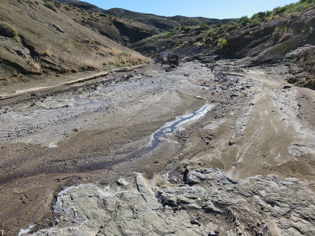 End of the water in the wash
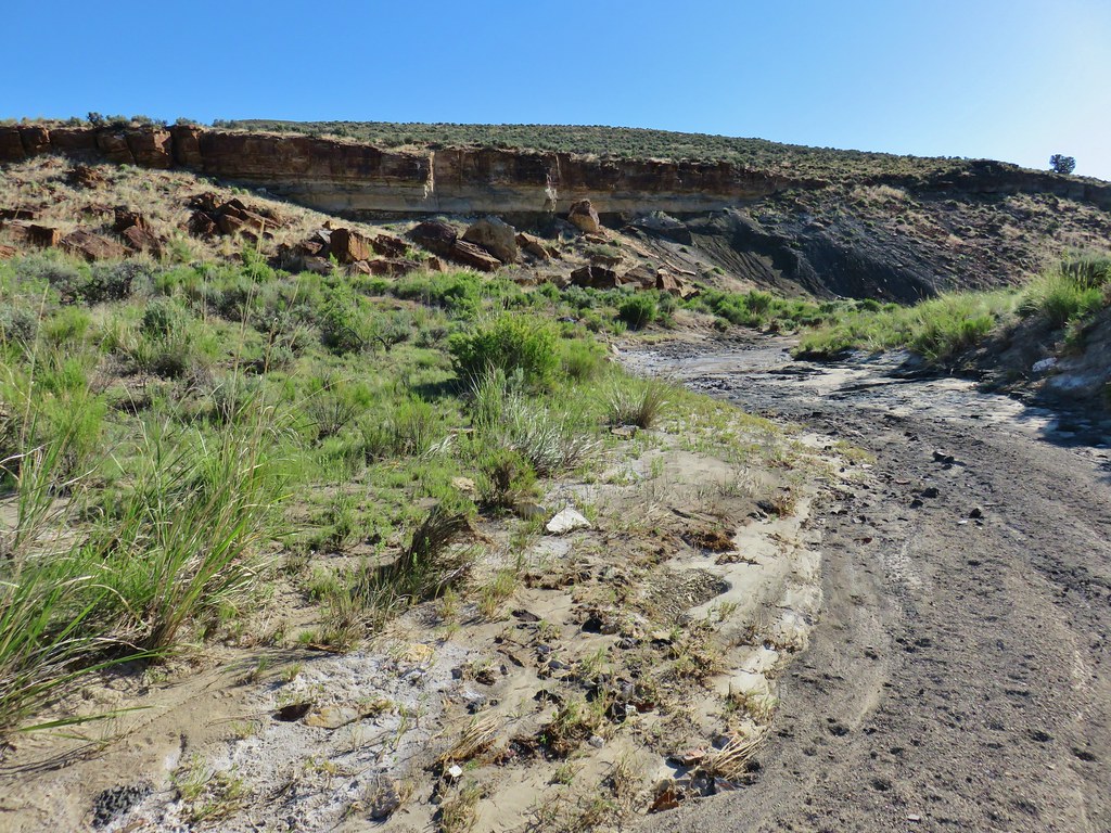
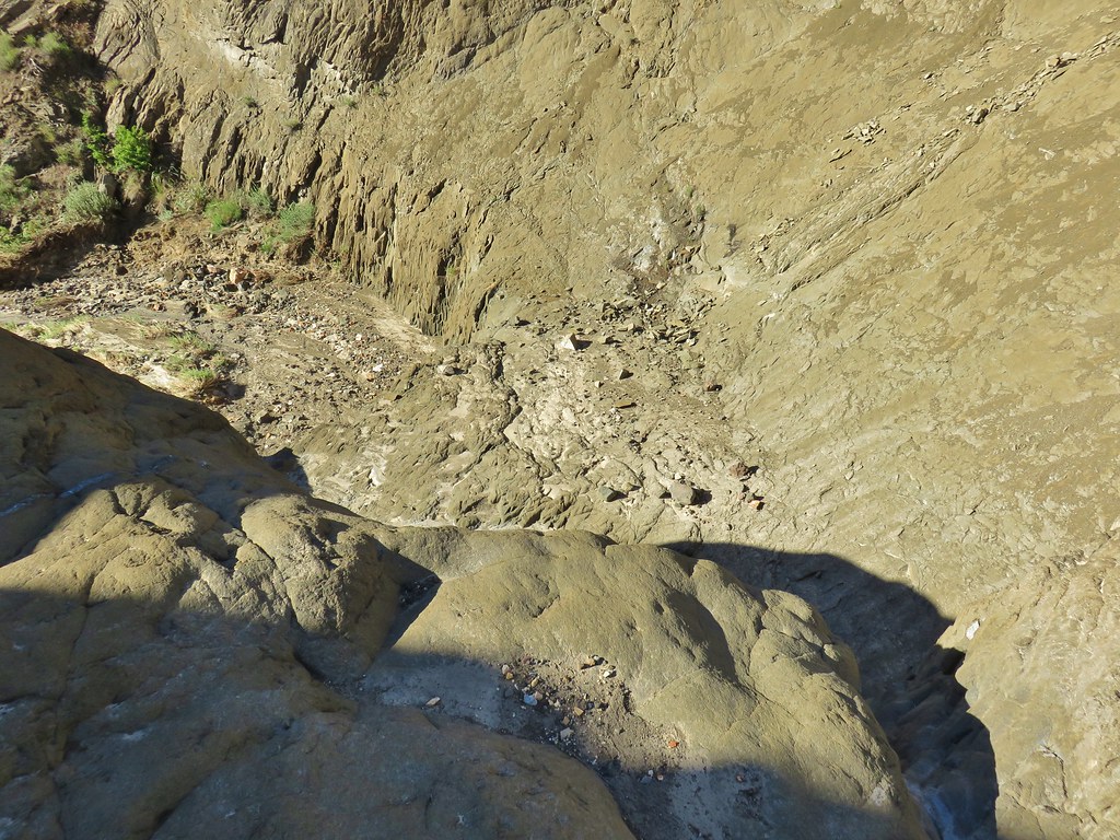 Above the dry waterfall
Following our guidebook we backtracked 100 feet and climbed out of the wash up the gentlest slope to the south.
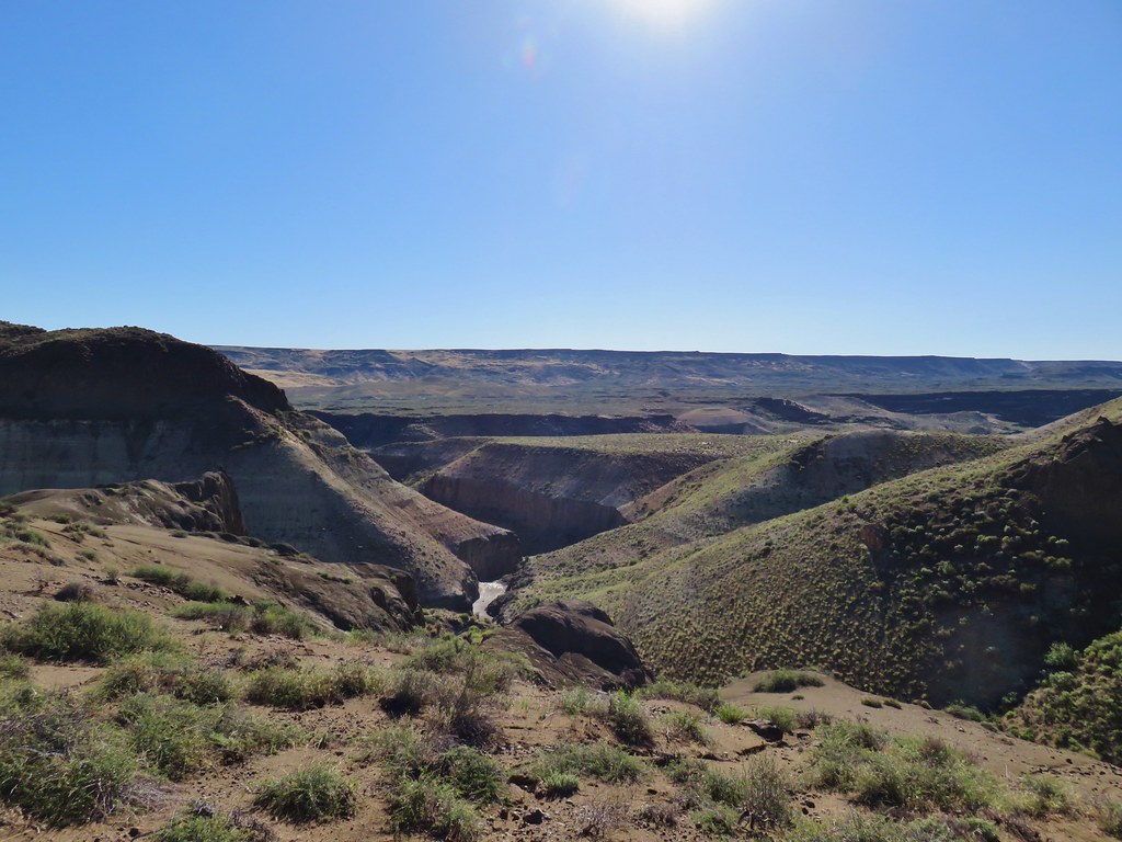
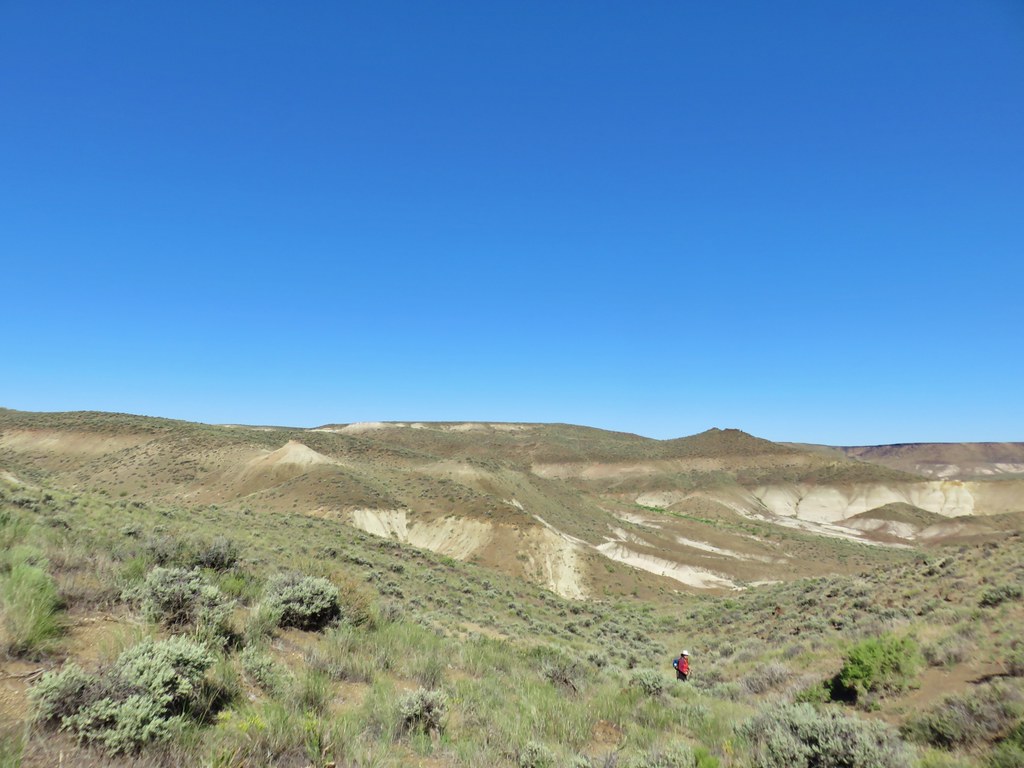
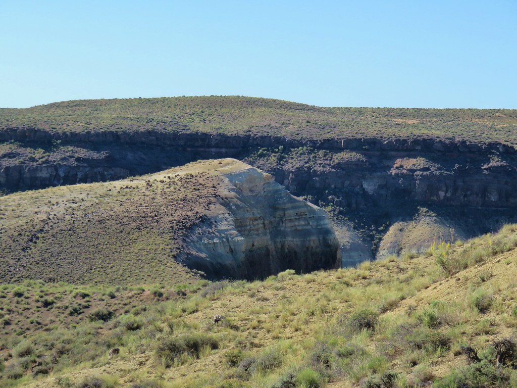
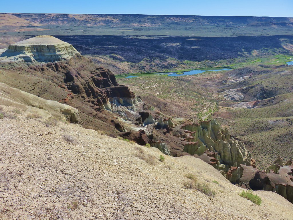
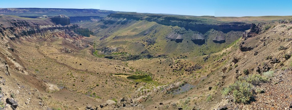
When we crested the hill we could see the canyon we had been in winding its way toward the Owyhee River Canyon.
We continued south heading for another large dry wash, this one running north/south.
We headed for that wash passing a group of smooth, rounded protrusions.
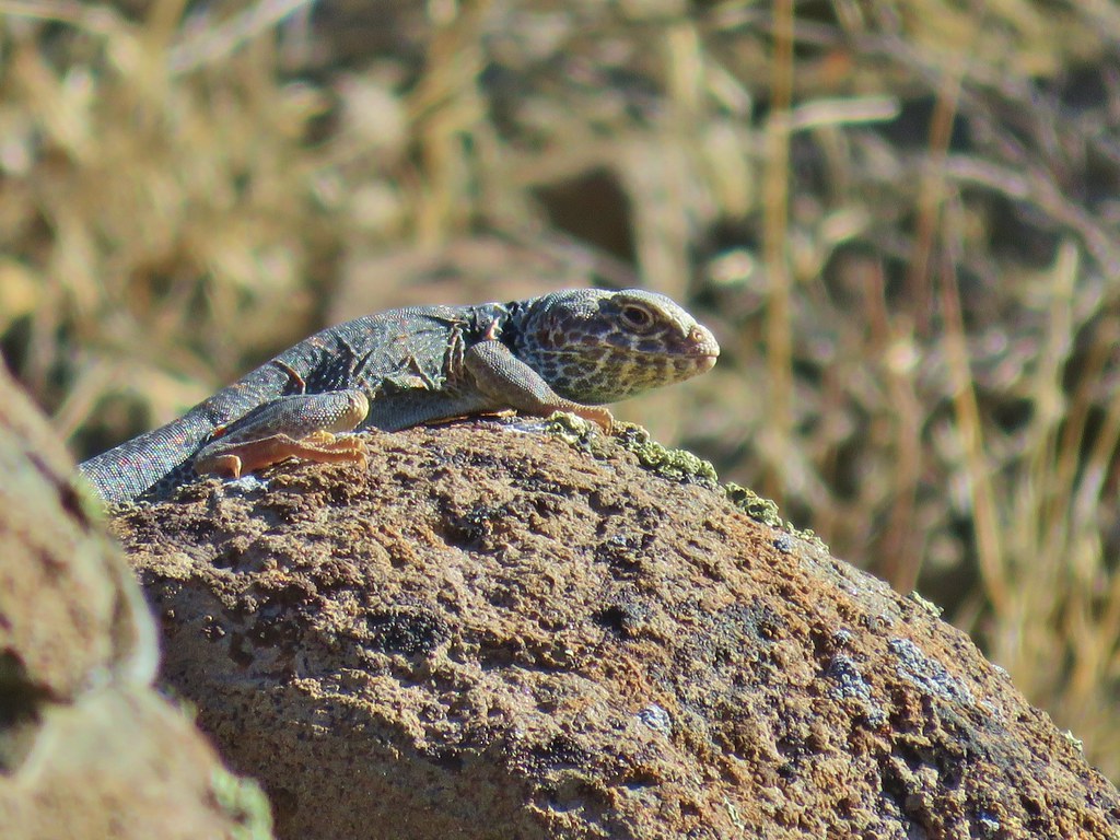
As we were dropping into this wash the one and only snake we would see on our whole trip passed between us heading uphill. It was a decently sized garter snake, not one of the areas many rattlesnakes. Heather never even saw it and it disappeared into the sagebrush. Soon after a small side blotched lizard raced into a different bush, then a much larger lizard raced out of that same area and up onto some rocks.
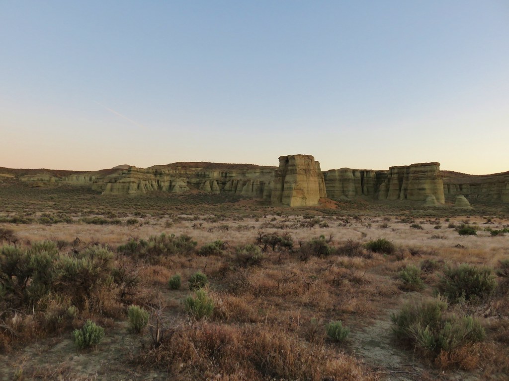
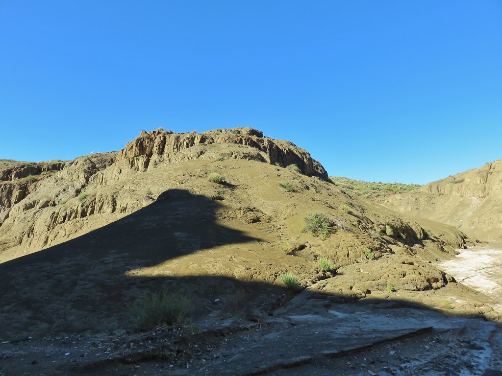
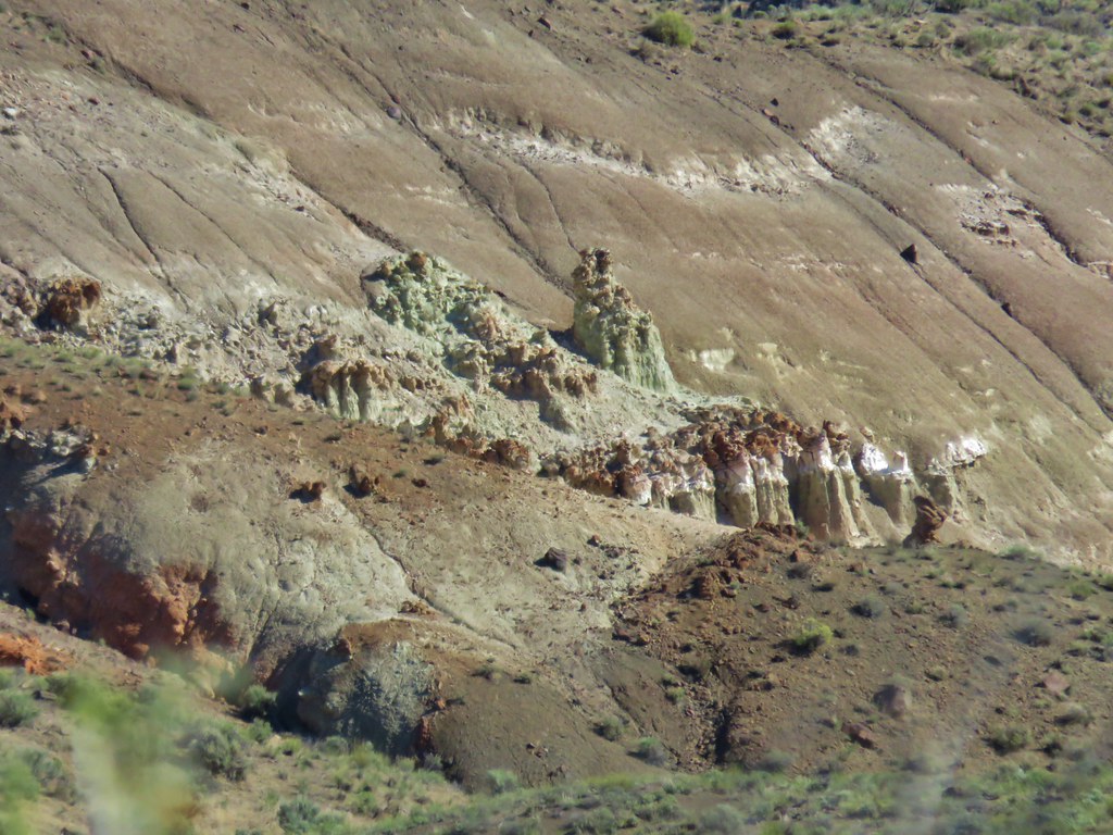
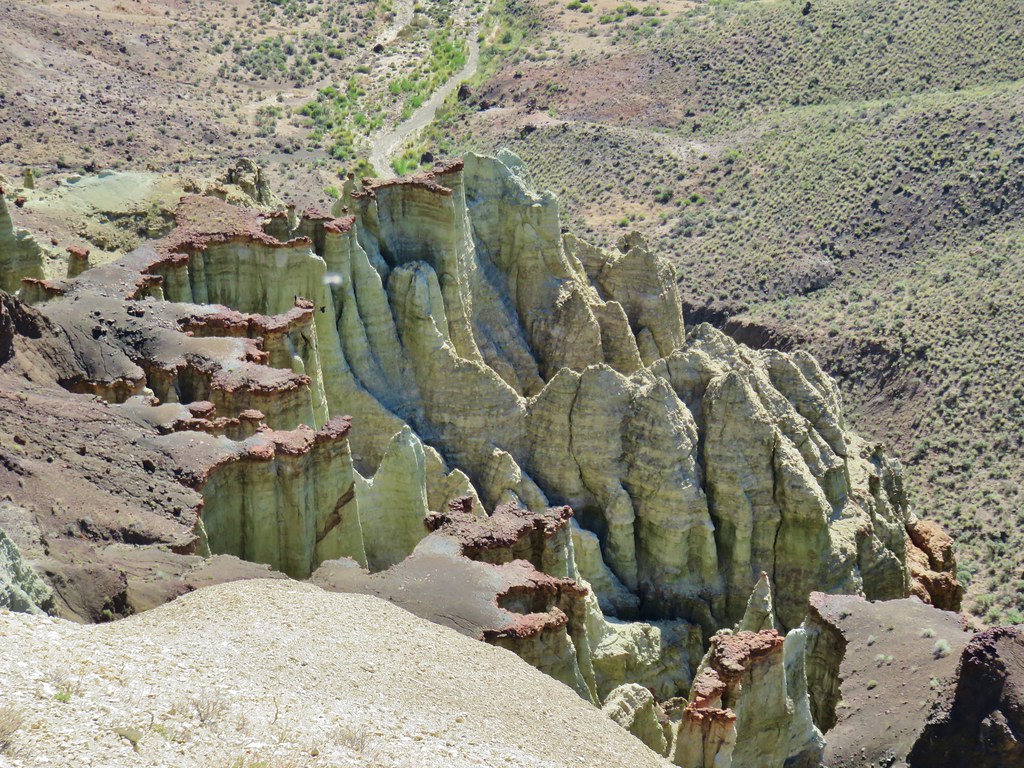
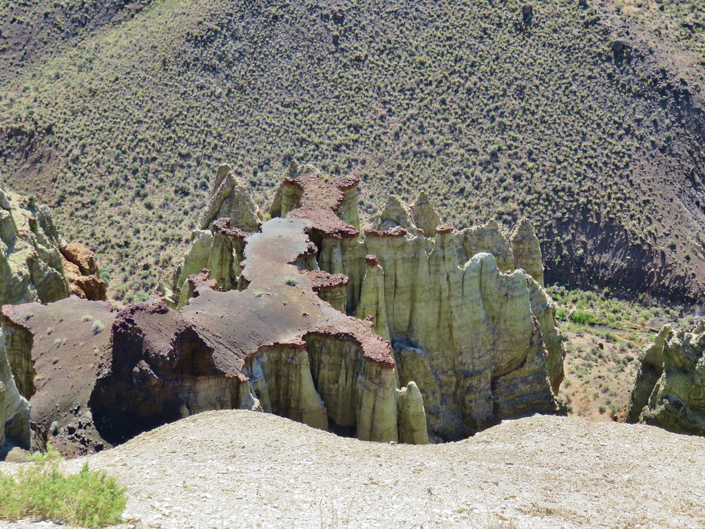
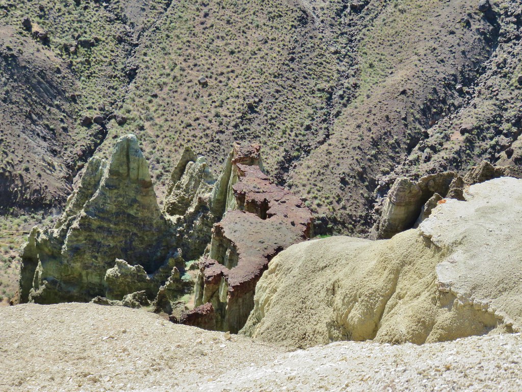
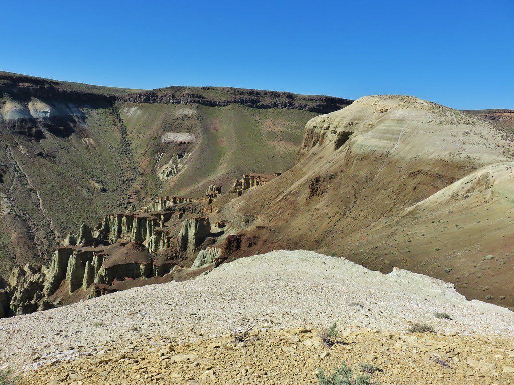
We were supposed to follow this wash for another .7 miles, staying left at forks, to the head of the wash. We passed some interesting rock formations along the way but somewhere along the line we took one left fork too many.
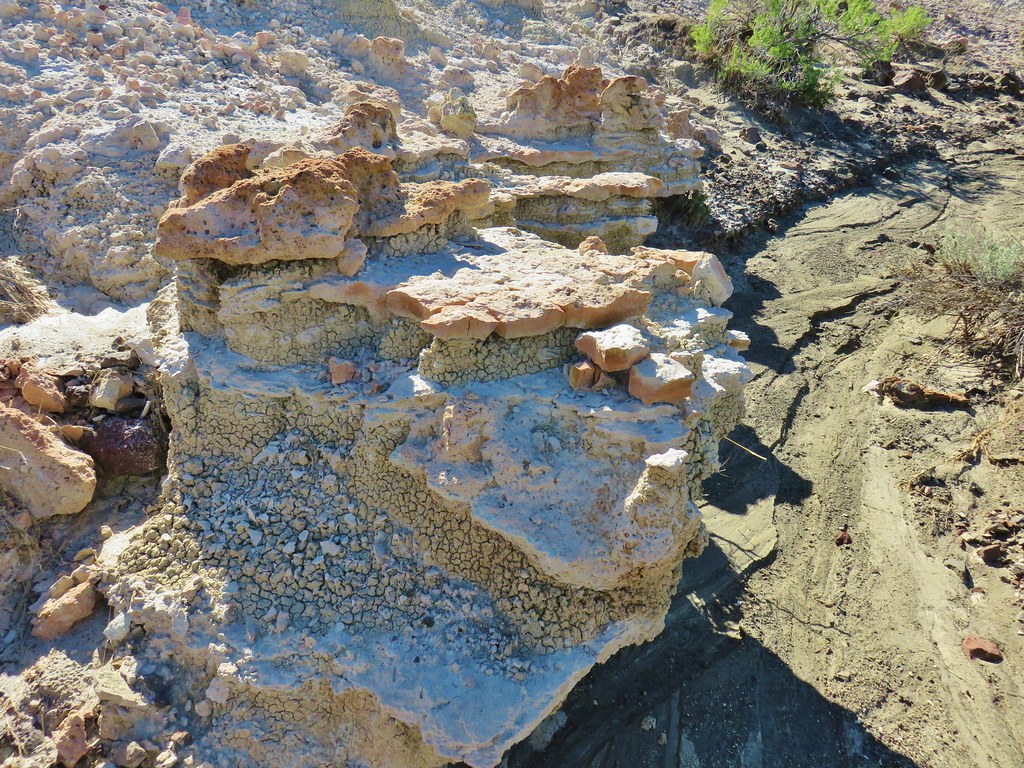

We didn’t realize it at first as we had been trying to only take the most obvious left hand forks. When we reached the end of the wash we headed cross country toward the lowest point we could see which happened to be a little to the south of a large rock fin.
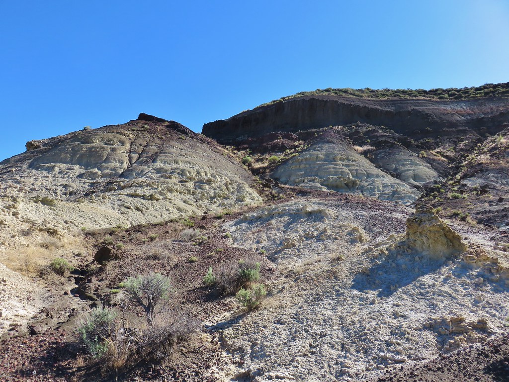
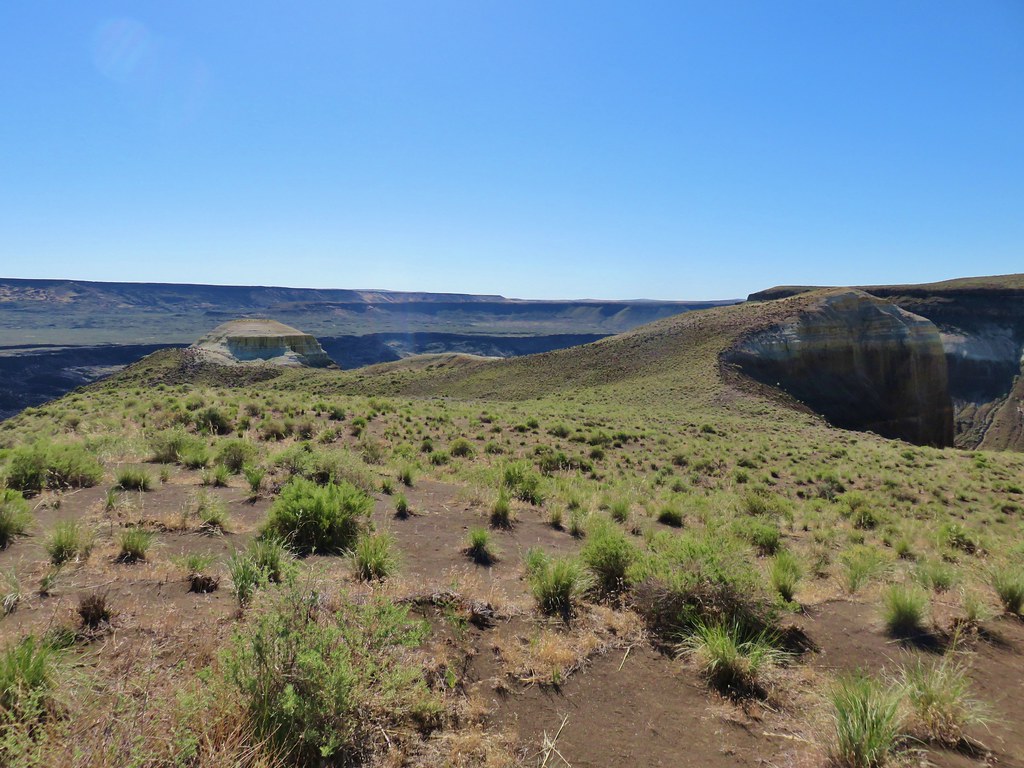
If we had been in the correct spot we would have crested a ridge at the edge of a rim just to the NE of a feature known as the Yellow Knoll. Instead when we reached the top of the ridge the Yellow Knoll was still quite a ways to the south.
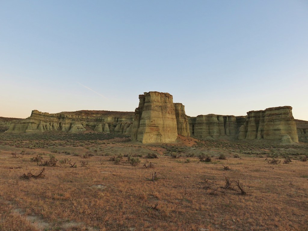
 Yellow Knoll with the Yellow Dome to its left.
 Yellow Knoll
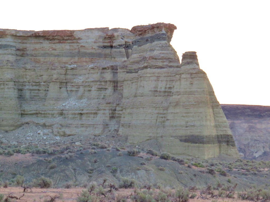
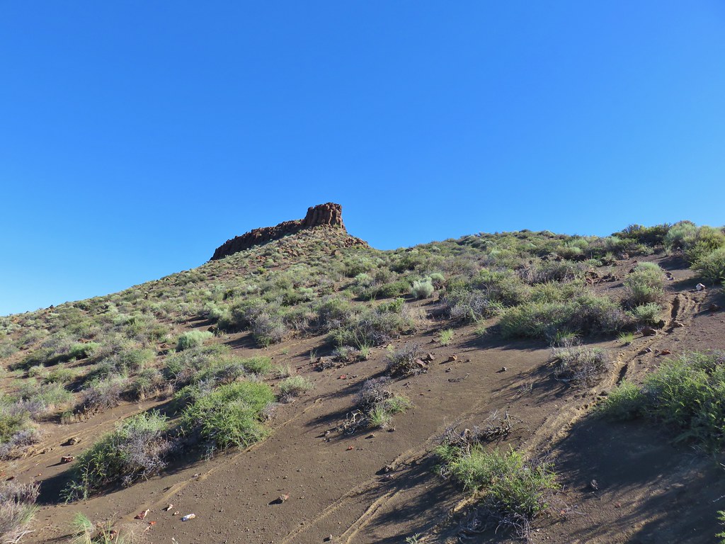
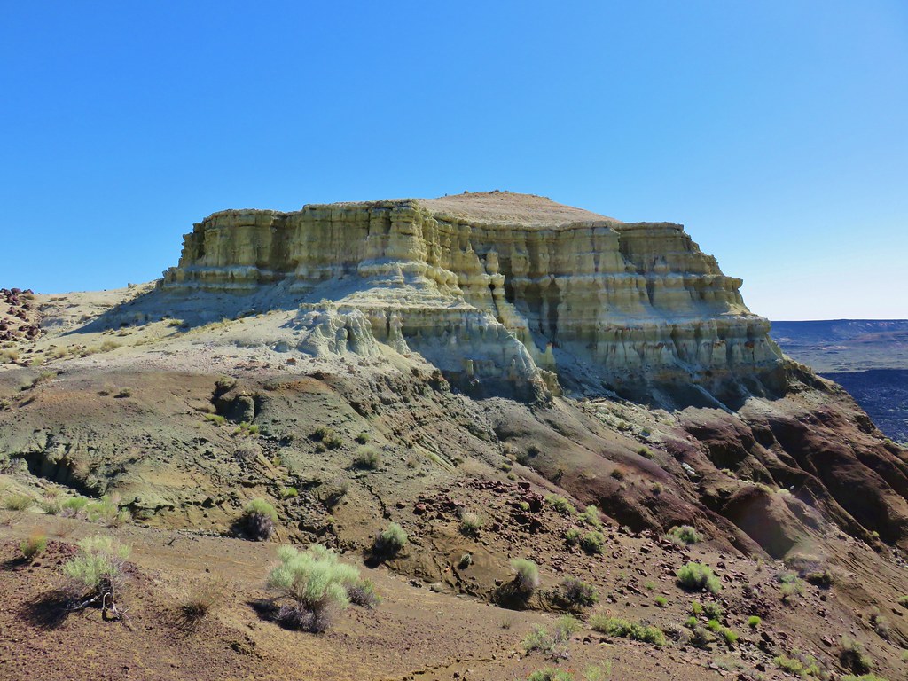
 Yellow Dome
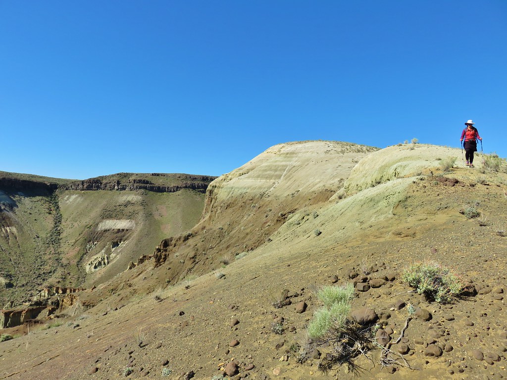
We followed the ridge up and down a little under half a mile to the Yellow Knoll. The views form the ridge were great as we made our way over.

We eventually made it over to the Yellow Knoll and hiked to a viewpoint atop it.
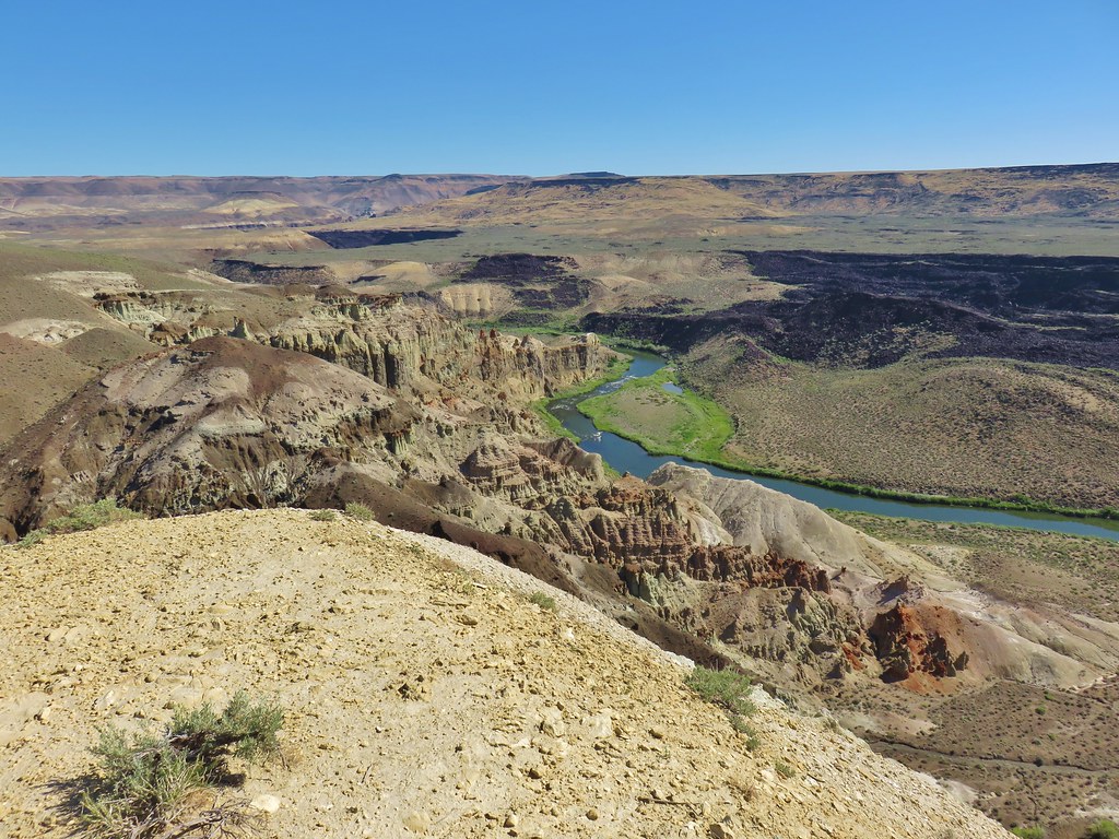
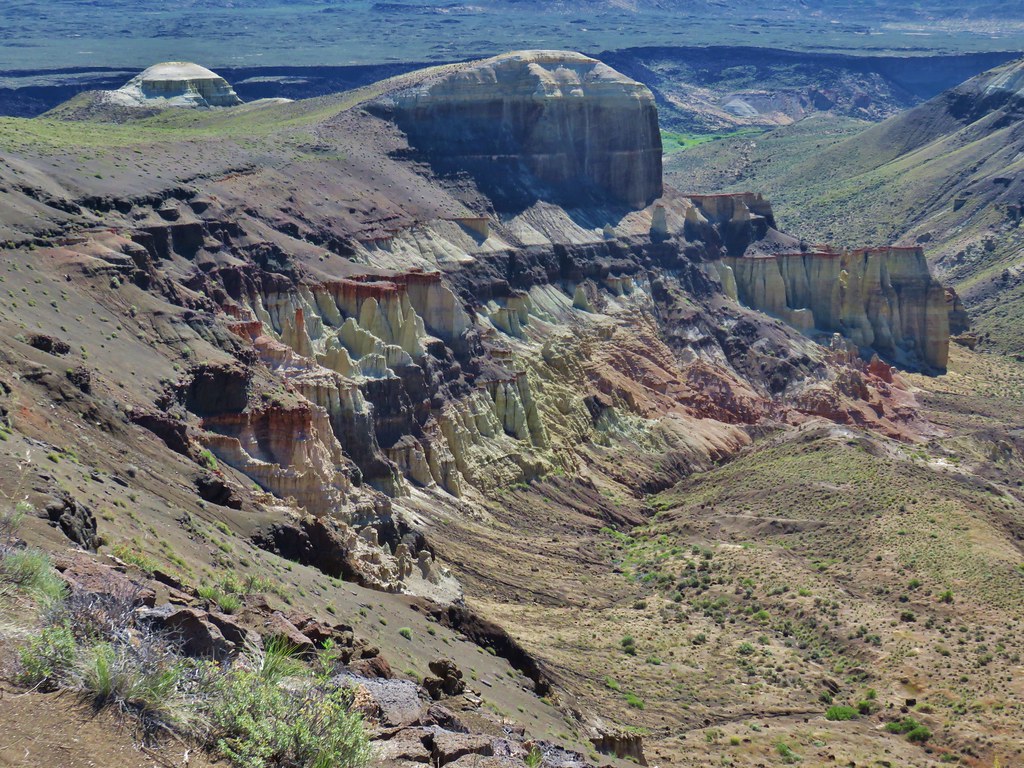
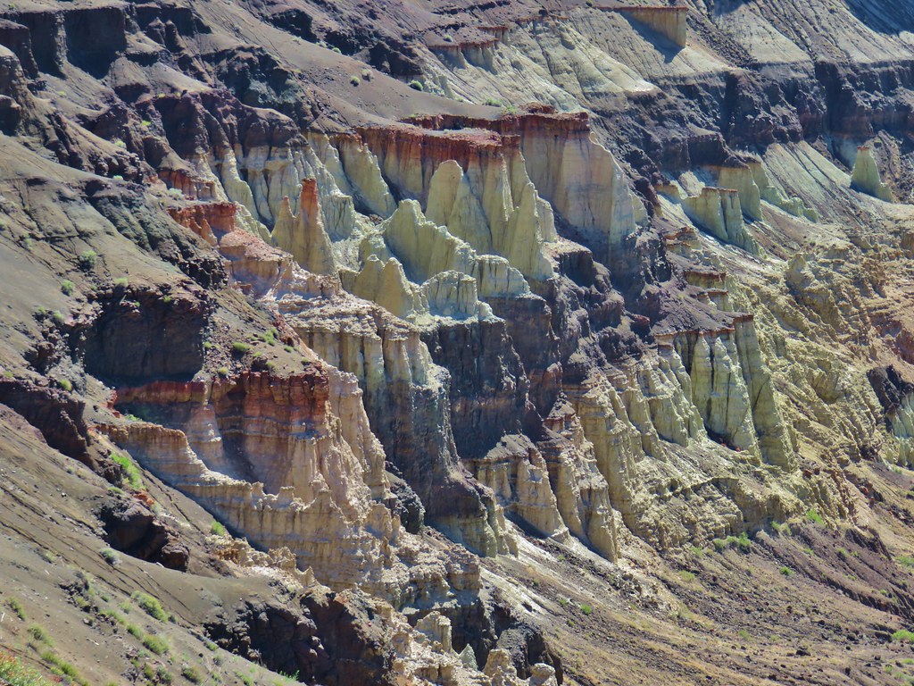
After checking out the view from Yellow Knoll we headed for Yellow Dome and climbed to its top.
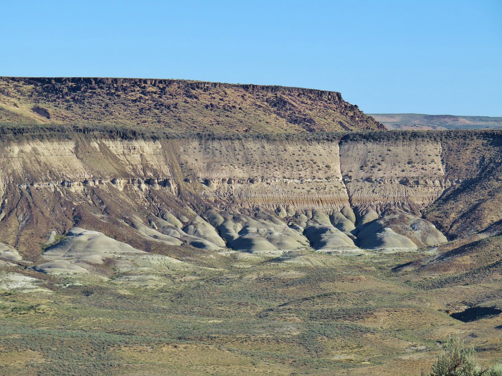
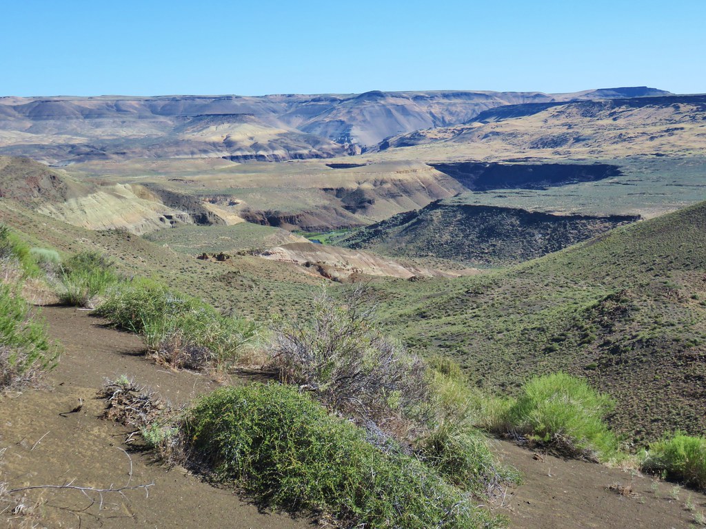
The view from Yellow Dome was even more impressive as the Owyhee River flowed past rows of chalk pillars.

After admiring that view we headed back past Yellow Knoll and followed the canyon rim for half a mile before striking off cross country following a dry stream bed in a westerly direction.
This dry stream ran past the water trough that we’d parked at so all we had to do was keep that on our left and it would lead us back to our waiting car.

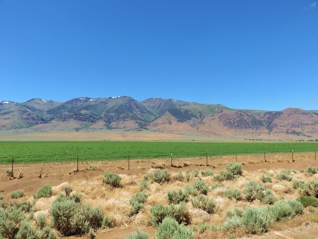
Dry stream bed (indentation) on the left with Steens Mountain in the distance.
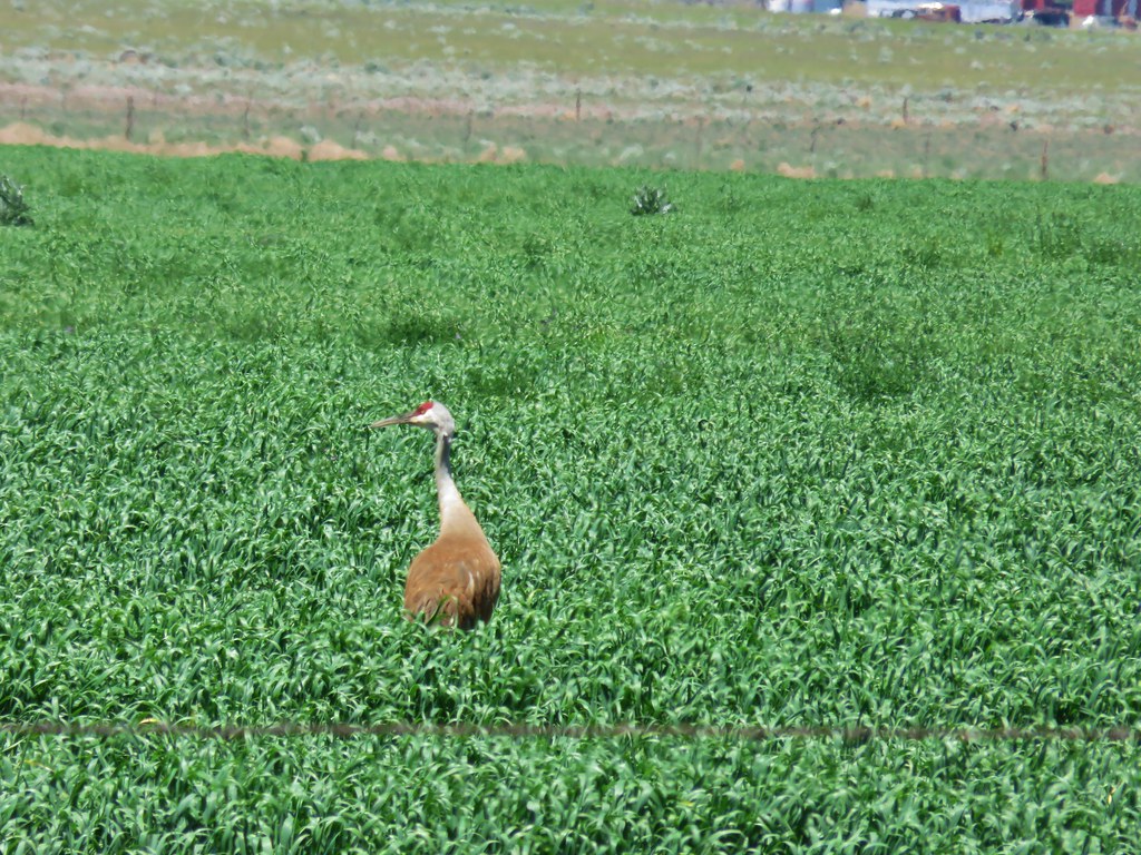
Following the stream bed worked perfectly and we were soon back on the horrible road after a spectacular 6.9 mile hike at Chalk Basin. After surviving the road we took Highway 78 north to East Steens Road where we turned left toward Fields. The road is paved for the first 10.9 then turns to gravel for the next 42.3 miles before turning pack to pavement. The views of Steens Mountain and the Alvord Desert along this drive were amazing and we did stop once when we spotted a pair of sandhill cranes in a field.

When we arrived at Fields Station we checked on the availability of a room. Fortunately there was one available for the night so we checked in. The room was actually a large front room with a bed, table, chairs, refrigerator/freezer and a coffee maker, a bathroom, and another bedroom in the back. After getting settled we went over to the store/cafe and ordered bacon cheeseburgers and a couple of their famous milkshakes before the cafe closed at 4pm. I had a 3C – Coffee, Chocolate, and Caramel and Heather had a combination of Raspberry and Chocolate. They lived up to the hype. We had a full day of hiking ahead of us before we started our journey home so we turned in early (a little extra early now that we were back on Pacific Standard Time instead of Mountain Time). Happy Trails!
Flickr: Pillars of Rome and Chalk Basin

4 replies on “Pillars of Rome and Chalk Basin – SE Oregon Vacation Day 5”
These are such great trip reports. That Yellow Knoll place is fascinating, like something out of a Dr. Suess book.
It really was an interesting area, if we’d have been willing to put in a little extra effort it would have been possible to hike down that dry creek bed and view the knoll and dome from below but it looked like a long hike back up from there in the heat.
[…] 100 separate “hikes” varying in length from a quarter mile at the Pillars of Rome (post) to 20.3 miles in the Waldo Lake Wilderness […]
[…] #99 Chalk Basin – Hiked 6/13/2018 […]