Categories
Coastal Range Hiking Oregon Trip report

Mary’s Peak, Beazell Memorial Forest & Ft. Hoskins County Park

Every once in a while it can be fun to change things up a bit. For our latest day of hiking we did just that. Instead of one longer hike we decided to knock a few shorter hikes off our to-do list. We had a graduation open-house that we wanted to stop in at that afternoon in Dallas, OR so we headed down to the central coast range for a trail triple header.

We started at Mary’s Peak, the highest peak in the Oregon coast range. We had visited the peak in 2009 when we were just starting to get into hiking. That day we had taken a 2.5 mile route from Conner’s Camp to the 4097′ summit. It was the most challenging hike we’d done up to that point and we felt every bit of the 1530′ climb. Our plan was to redo that hike (at least on the way up) to see how we would fare now that we’ve been hiking for several years.

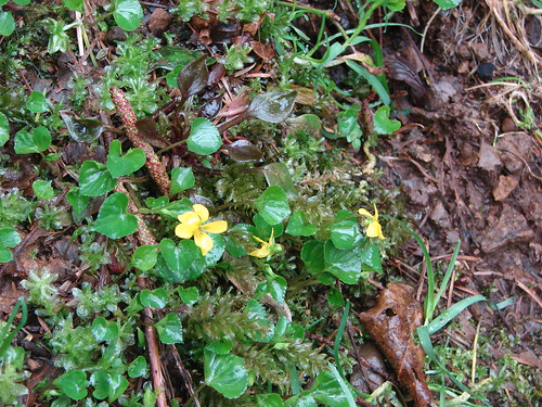
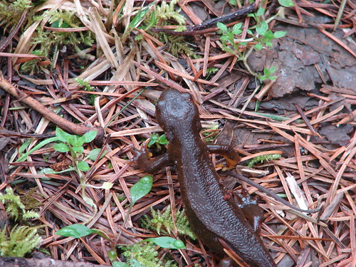
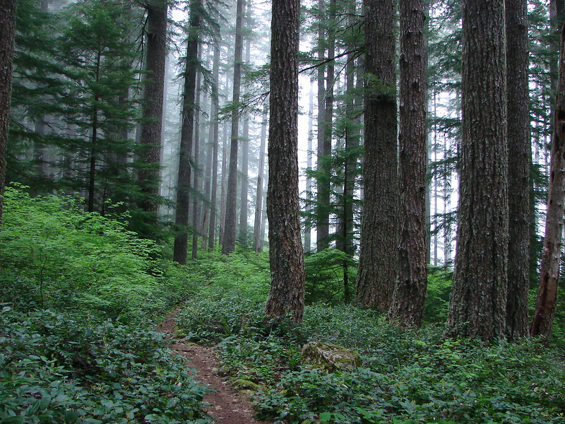
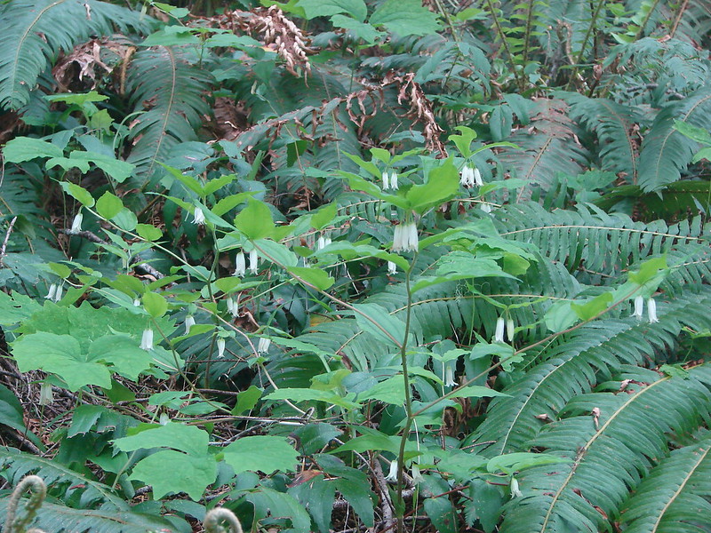
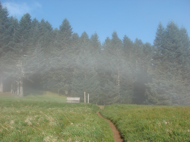
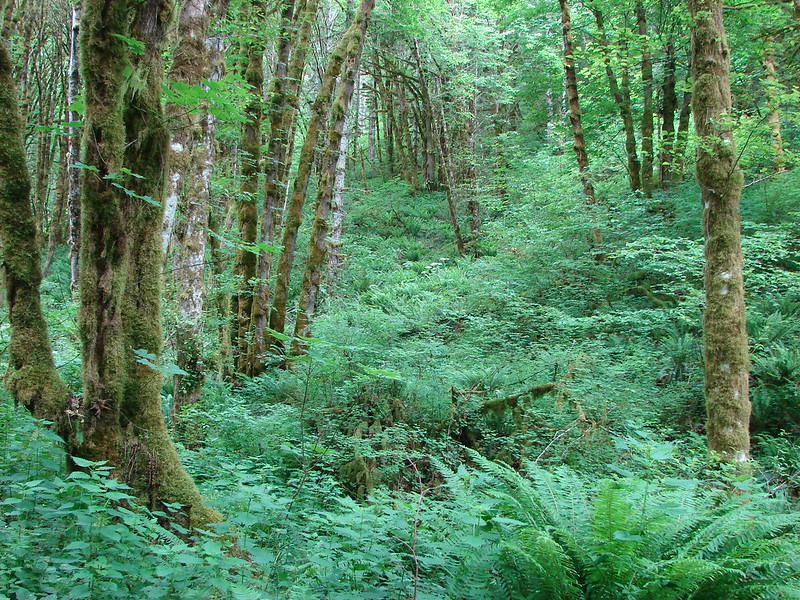
There are several ways to get to the summit varying in length from just over a mile to almost 11 miles round trip. The East Ridge trail would be our route up from Conner’s Camp. The trail sets off from the parking area in a forest of old-growth Douglas Fir which tower overhead. The forest is very open despite the giant trees due to the lack of lower branches which allows for an abundance of green undergrowth. Vine maple, salal, fern, and many other plants contribute to a lush green understory. Low clouds were hanging in the tree tops while many white woodland flowers dotted the forest floor.

DSC06454
DSC06465

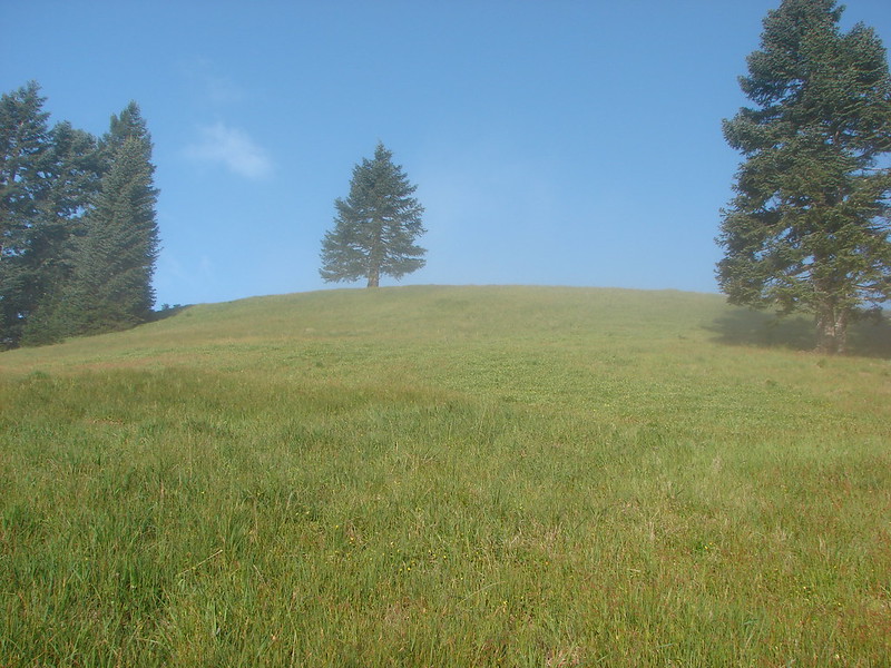
The trail climbs steadily for 1.1 miles to a junction where the East Ridge Tie trail continues on to the North ridge trail making a loop possible. We would be retuning from that direction but in order to recreate our 2009 climb we turned left to continue up the East Ridge trail. The trail steepens after the junction and it was this section that seemed to go on forever the first time we hiked it. It proved to be a stiff climb but we quickly reached a second junction, this time with the North Ridge trail. Forking to the left we continued up a short distance to the lower meadow and blue(ish) skies. 🙂

DSC06487

The trail wraps around a hillside through the meadow, which was yet to really start blooming, before reaching a gravel service road in a saddle. The clouds were lapping up over the hillside from the north creating what can only be described as a “fog rainbow”.

DSC06504

DSC06505

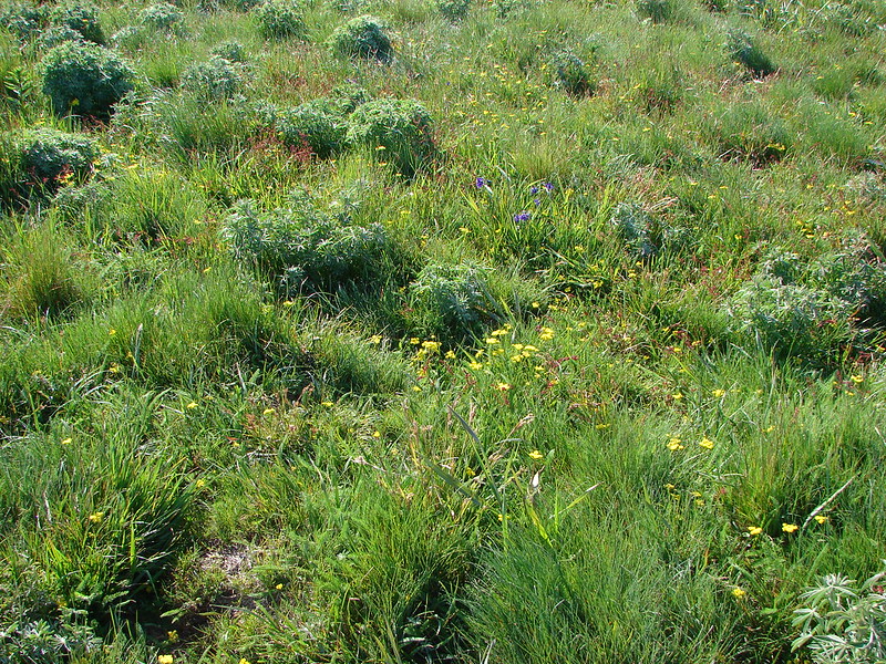
The gravel road winds up to the summit around the south side of Mary’s Peak, but a more direct (and steeper) trail leads up to the upper meadow from the far side of the road. Since that was the way we had gone before we crossed the road and headed up again (and again wondered why). When we emerged from the narrow swath of trees that divides the two meadows we found that the upper meadow was also yet to bloom. Clumps of lupine had yet to even begin to bud and only a few scattered flowers dotted the slope.

DSC06517

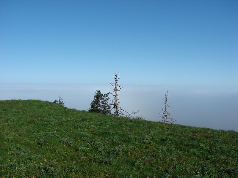
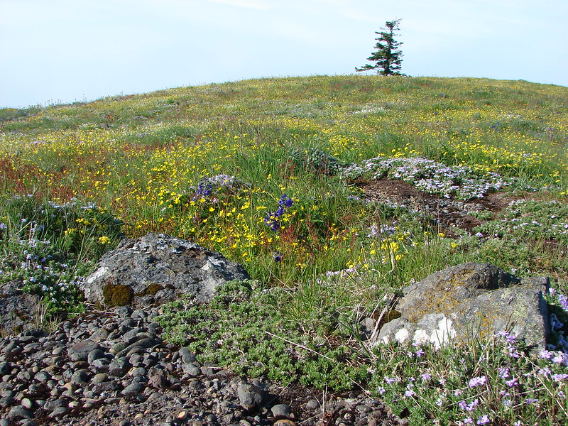
The sky was blue though and we had the peak to ourselves so we climbed through the meadow to a picnic table at the summit. We were above the clouds but it appeared that Mary’s Peak was the only peak which had managed to rise above them. Even the 10,000′ Cascade peaks to the east were hidden. To the west the Pacific Ocean blended in so well with the layer of clouds and blue sky that it was difficult to make out where one ended an another began.

The view west:
DSC06518

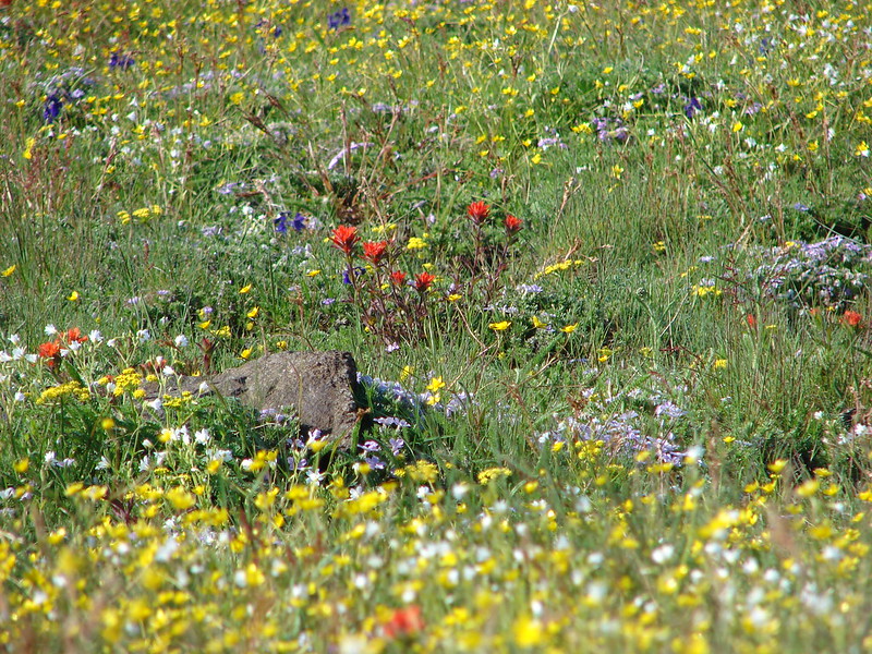
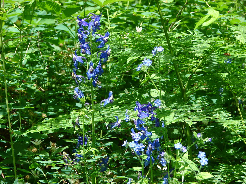
After setting our stuff down at the table we began exploring the summit. To the west where the road came up from below we began to find flowers. Purple larkspur and yellow biscuit root covered the ground.
DSC06524

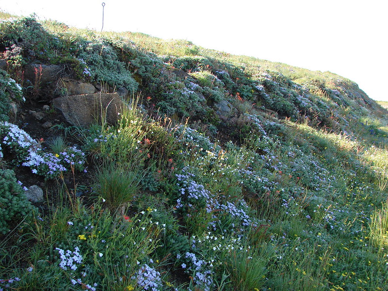
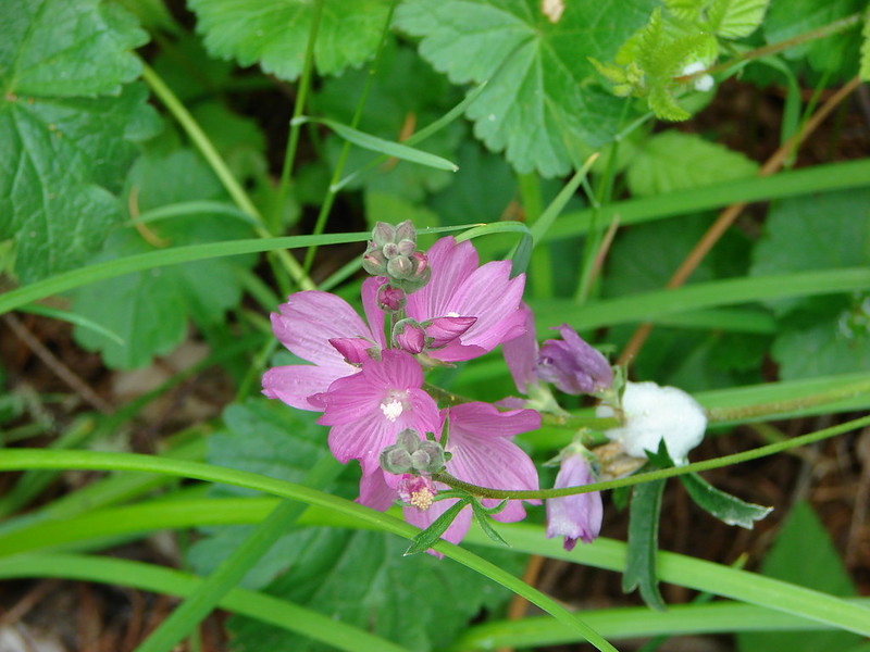
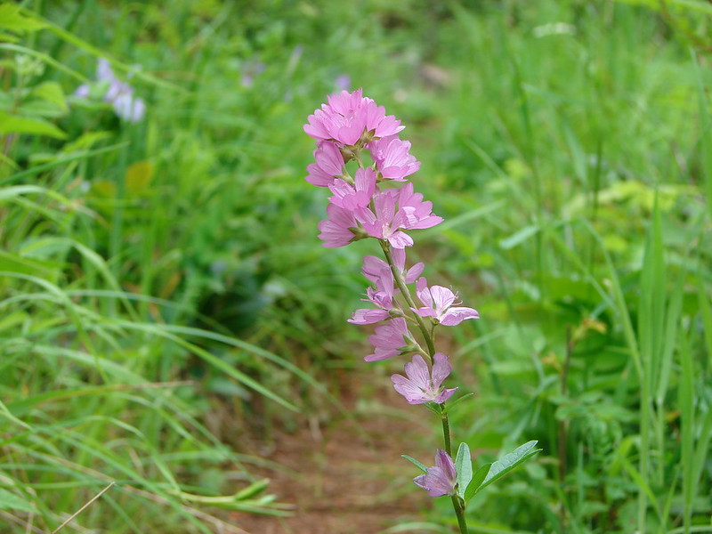
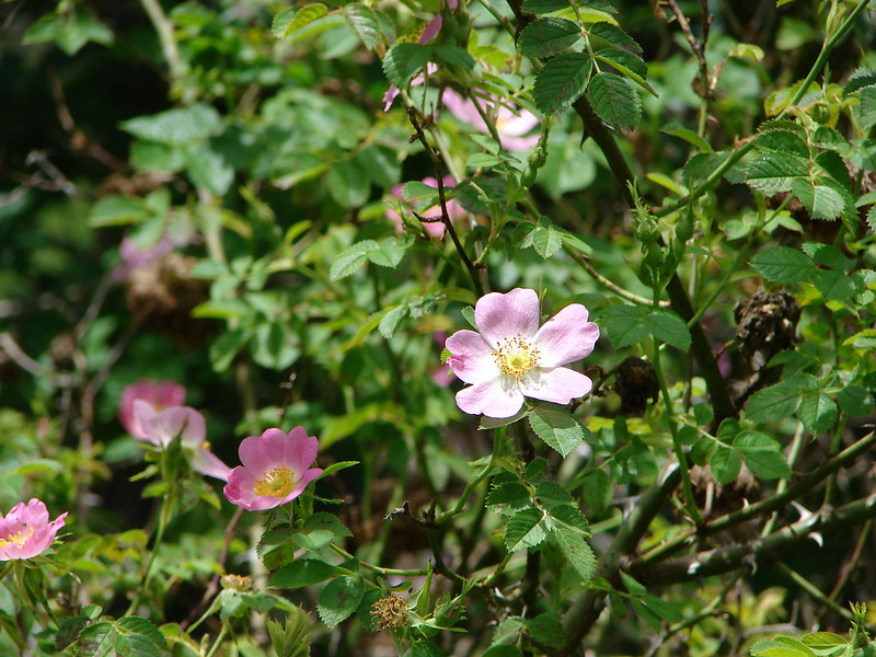
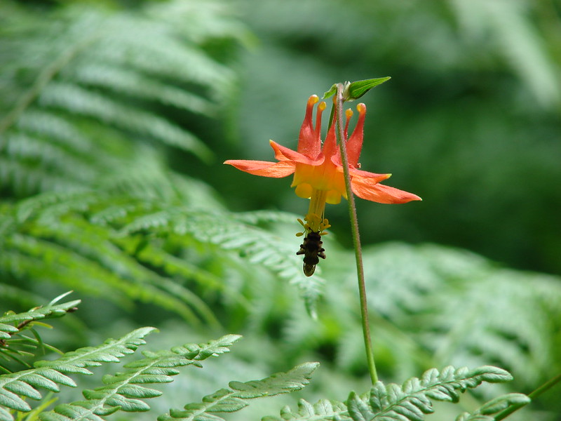
We started to head down the road following the flowers and as we rounded a bend we were greeted with a color explosion. We’d found the flowers. They were all on the south side of the peak. Phlox, larkspur, paint, and various yellow wildflowers covered the slopes on this side.
DSC06532
DSC06549
DSC06553
DSC06557

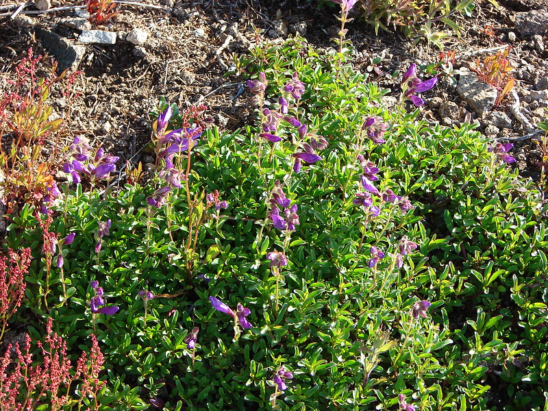
After taking a few pictures (okay lots) we went back to the table to gather our packs and headed back down the road. As we made our way down we found some blooming lupine and penstemon as well.
DSC06577
DSC06578

To get back to the car we took the 1 mile section of the North Ridge trail from the upper junction to the East Ridge Tie trail and turned right on it for 1.2 miles back to the first junction and finally back to Conner’s Camp.

From there we drove back to U.S. Highway 20 and headed west to the Kings Valley Highway Junction. Turning right we continued 4.8 miles on Highway 223 to the Beazell Memorial Forest. The forest consists of 586 acres gifted to Benton County by the former owner, Fred Beazell, as a memorial to his late wife Dolores. Our plan here was to hike a 3.2 mile loop using the South Ridge trail.

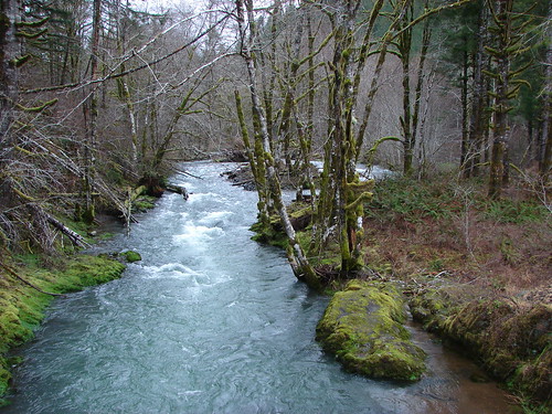
The trail begins at a footbridge behind a restored barn which was being readied for a wedding reception on this day. After crossing Plunkett Creek on the bridge the trail joins an old road for half a mile. The forest is dense and scenic in a narrow valley. At the .5 mile mark the trail splits off to the right and recrosses the creek twice before rejoining the road at a junction in another half a mile.

DSC06697
DSC06716

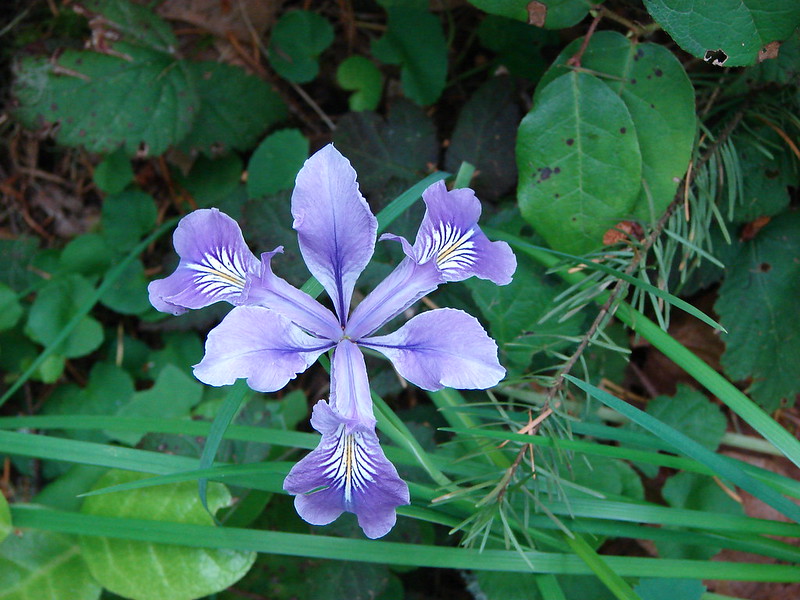
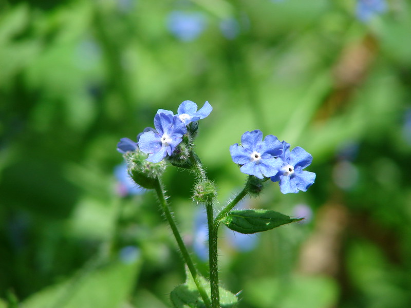
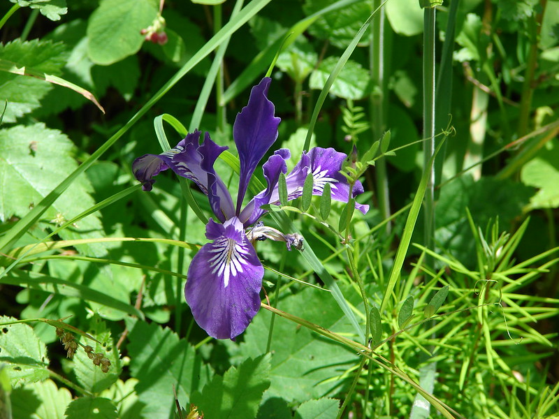
Here the South Ridge trail leads to the right up the side of the valley. A sign was posted warning of a logging operation and trail closure from October 2013 through April 2014. Being that it was June we continued on. The trial switchbacked up 350′ through increasingly open forest with wild iris and some flowers we had not seen before.
DSC06735
DSC06760
DSC06771

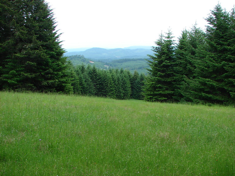
At the top of the hill a short spur trail leads to a small meadow with a nice view across the valley.
DSC06792

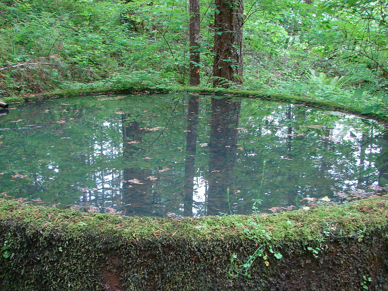
After leaving the meadow the trail drops down over the west side of the hill where signs of the logging operations could be seen. After joining a logging road for a bit the trail again split off to the right, passing an old cistern before returning us to the barn and our car.
DSC06808

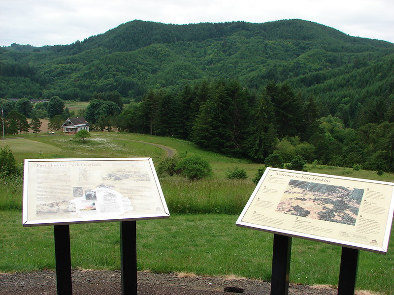
We had one more hike planned for the day so we hopped back into the car and continued another mile and a half north on Hwy 223 to Hoskins Rd. Following signs to the left for Fort Hoskins County Park we drove another 1.8 miles to the park entrance on the right. The park is at the site of an 1856 outpost.
DSC06815

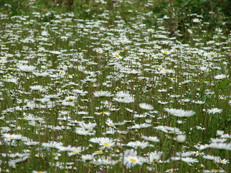
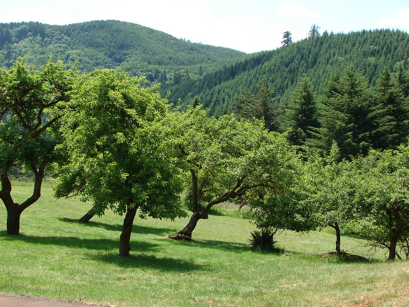
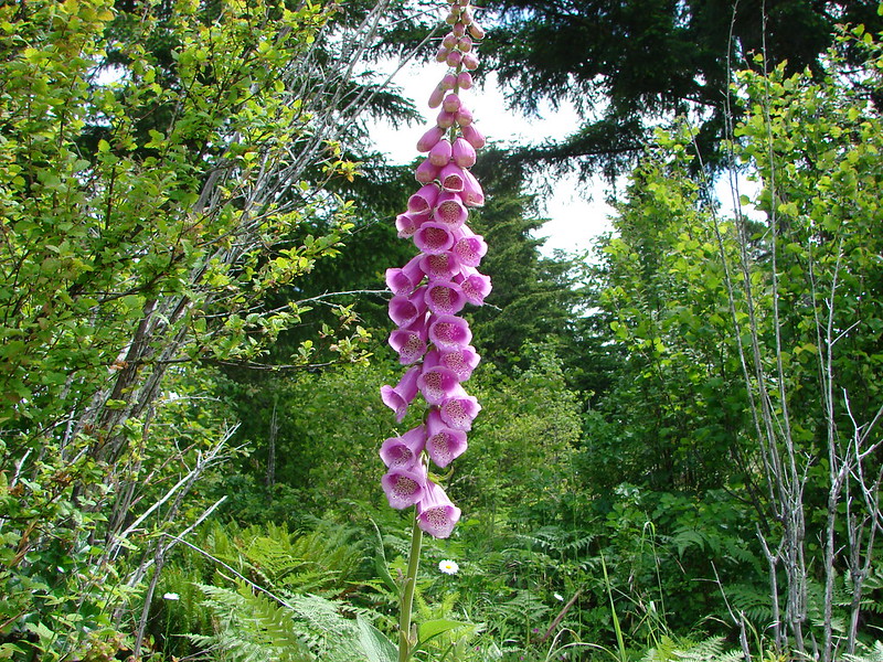
We started our hike here by taking the half mile interpretive loop past the old fort site and historic buildings. This path looped around a lovely meadow where daisies and foxglove bloomed and a few apple trees remained from an old orchard.
DSC06842
DSC06858
DSC06932

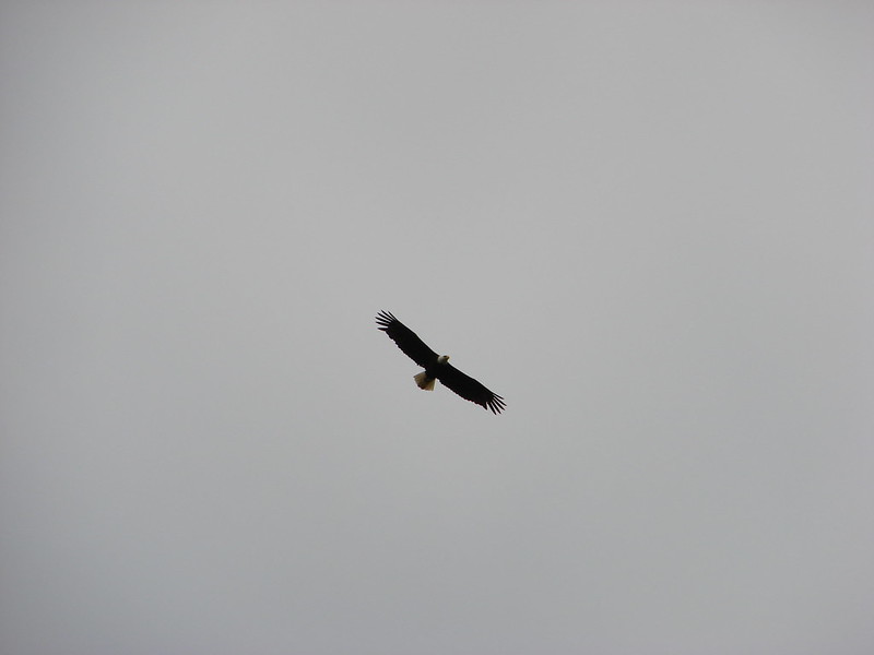
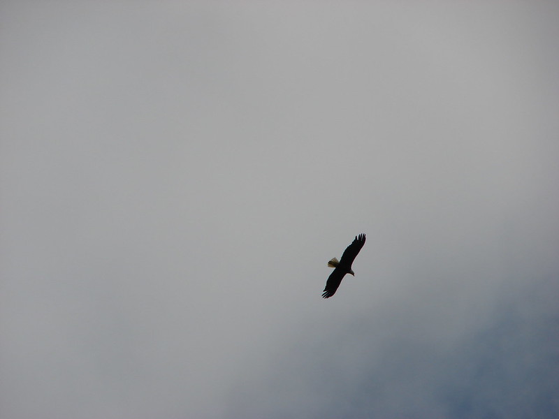
While we were inspecting the Commander’s House a Bald Eagle flew past and began circling overhead.
DSC06841
DSC06849
DSC06856

The path then passed the foundation of the Hoskins School before climbing back to the parking area where a longer loop began on the far side of the road.
DSC06867

The longer 1.3 mile loop climbed over 300′ through a hillside meadow filled with wildflowers.
DSC06874
DSC06876
DSC06879
DSC06893
DSC06910DSC06920
DSC06926
DSC06930

The day turned out better than I had expected. We managed to get 12.3 miles of hiking in while visiting some interesting places and still made it to the graduation party on time. Happy Trails!

flickr photos: https://www.flickr.com/photos/9319235@N02/sets/72157644555553479/
facebook: Mary’s Peak https://www.facebook.com/deryl.yunck/media_set?set=a.10204131646278585.1073741879.1448521051&type=1
Beazell Memorial Forest https://www.facebook.com/media/set/?set=a.10204132717145356.1073741880.1448521051&type=3
Ft. Hoskins County Park https://www.facebook.com/media/set/?set=a.10204132785187057.1073741881.1448521051&type=3

Categories
Coastal Range Hiking Oregon Trip report

Wilson River

So far so good. We managed to get a hike in each month leading up to the marathon in April. Our recent visit to the Wilson River in the Tillamook State Forest was our final hike until after we’ve raced and recovered. We picked this hike because it provided a fairly level 8 miles which seemed like a reasonable outing at this point in our training. We chose Saturday morning for the trip based on a forecast showing no rain until that afternoon versus rain all day on Sunday. Yep, I fell for it again. The drunk monkeys that come up with the weather forecast weren’t even close as the 0% chance of precipitation was more like 95% as it rained or drizzled on us almost the whole time. Fortunately it didn’t rain hard since we hadn’t put our rain gear back into our packs.

The Wilson River trail extends over 26 miles, but for this trip we planned to hike out and back along a 4 mile section from the Jones Creek Day Use area to Bridge Creek Falls. It was great to get back on the trail and especially nice to see some signs of Spring. We set off from the parking area following the river west toward the Tillamook Forestry Center. Since the center opens at 10am the gate on the suspension bridge was still closed so we passed by and headed toward Wilson Falls after taking a quick peak back at Kings Mountain. Heather and I had done a loop hike in 2010 up neighboring Elk Mountain and down Kings Mountain. It remains to this day one of the toughest hikes we’ve tackled.

Kings Mountain
Kings Mt. from the Wilson River Trail

The forest was beginning to transition from Winter to Spring as buds were showing or already opening on many plants and several varieties of early flowers were blooming trailside.

Snow Queen
Snow Queen
Trillium
Trillium
Wood Violets
Violets
Slender Toothwort
Slender Toothwort

The river was running quickly due to heavy recent rain which had also swelled the creeks and runoff streams feeding into the river. Even if it hadn’t been raining there was no way our feet were going to stay dry. 🙂

Wilson River
Wilson River
Cedar Creek
Cedar Creek
Runoff flowing over the trail
Wilson River Trail
Trail crossing below Wilson Falls

We had two waterfalls to visit on this portion of the trail. The first was Wilson Falls which lay hidden right beside the trail until we were almost directly below it.

Nearing Wilson Falls
Wilson River Trail
Wilson Falls
Wilson Falls

The second falls was also our turnaround point. We had to leave the river and cross Highway 6 to find the short trail to Bridge Creek Falls. An impressive fall in a narrow canyon.

Sign for Bridge Creek Falls along Hwy 6
Bridge Creek Falls
Bridge Creek Falls
Bridge Creek Falls
Trying to give an idea of the size of the falls.
Bridge Creek Falls

We hadn’t had any company on the trail and had only seen a handful of fishermen on the way to Bridge Creek Falls, but things got more crowded on the trail on the return trip.
Slow traffic

Slug
Another slowpoke
Rough skinned newt
This one moved to the side to let us pass
Rough Skinned Newt
Finally we came to a standstill
Newt

We didn’t wind up going into the Forestry Center. The rain had picked up and we were wet and muddy when we arrived back so we decided to pass on this trip. We did cross the suspension bridge in an attempt to return to the car from the opposite side of the river but washouts had closed that portion so we backtracked across the bridge and returned the way we had come that morning. The hike worked out just the way we’d hoped. Good scenery, no crowds, and not too taxing physically. Truly a hike that says “Happy Trails”.

Flickr album: http://www.flickr.com/photos/9319235@N02/sets/72157642067822544/
Facebook album: https://www.facebook.com/media/set/?set=a.10203510030938590.1073741869.1448521051&type=1

Categories
Coastal Range Hiking Oregon Trip report

Saddle Mountain

I am not sure we had completely dried out after our Hamilton Mountain hike (I know ours shoes hadn’t) but we were back in the “saddle” yesterday for another hike. Saddle Mountain state park was our destination, located in the NW corner of Oregon just 20 miles from the coastal city of Seaside. Saddle Mountain is known for it’s wildflowers and rare plants as well as being the highest point in northwest Oregon.

Once again we were we greeted at the trail head by a layer of low clouds which made for a damp morning. The good news was that there was no wind or rain this time. The trail started out amid salmon and thimble berry bushes in a forest of alders. The trail climbs 1603 feet in just 2.5 miles so the forest and plants changed often. A quick .2 climb to the Humbug Mountain viewpoint provided a view up toward Saddle Mountain’s cloud covered summit.
024

We returned to the summit trail and headed up through the fog passing multiple meadows full of wildflowers and lush forests. Much like our previous hike, visibility was limited to a couple hundred feet due to the low clouds but the variety of plants and flowers we were encountering kept us entertained. The trail itself was fairly steep and much of it consisted of wire enclosed rocks which looked like it could be slick but we didn’t have any real problems. Several picnic tables were placed along the trail at switchbacks which allowed for breaks from the climb if needed.

As we approached the summit we noticed some very slight breaks in the clouds which gave us hope. We decided to have some lunch and spend some time at the summit hoping that some views would open up. The clouds were actually moving from east to west toward the Ocean which we could now occasionally see through the clouds. We spent over an hour watching the clouds pass by us as better and better views opened up on all sides. Many swallows zoomed about as we waited and a Junco and a crow also stopped by to check us out. As the view opened up to the west was the Pacific, north the city of Astoria, OR and the Columbia River flowing into the Ocean
317
and to the south the coastal mountains. The only disappointment was that on a clear day the Cascade mountains from Mt. Rainier to Mt. Jefferson would have been visible to the East.

We headed back down now able to see the forest below. The wildflowers became even prettier as the increased light made their colors more intense. We took the side trail to the Humbug Mountain viewpoint again to get the cloudless view of Saddle Mountain before returning to the car.
462

If you are a wildflower or plant enthusiast this is a great hike, especially from May-July when the flowers are on display. If you can find a clear day (which isn’t easy near the Oregon Coast) the view is a great bonus. Next up is Mount June and yet another attempt at a view of the Cascades. Until then-Happy Trails.

For more info on Saddle Mountain visit: http://www.oregonstateparks.org/index.cfm?do=parkPage.dsp_parkPage&parkId=140
Photo albums-fb: https://www.facebook.com/media/set/?set=a.10201276380778732.1073741834.1448521051&type=1
flickr: http://www.flickr.com/photos/9319235@N02/sets/72157633845363594/