Over the last few months, a couple of people including a coworker and my cousin and Uncle mentioned a hiking option just west of Dallas, OR around Ellendale Creek. It wasn’t something that had ever hit my radar, but they all live in the Monmouth/Dallas area and suggested it might be something we’d like to check out. Since I’m always looking for new options I looked into it and found the Ellendale Creek Loop entry in AllTrails which is listed as a 4.9-mile loop gaining 987′. Full disclosure, I have a tolerate/dislike relationship with AllTrails. For me there are two things it can be useful for – locating hikes like this one and getting trail conditions. The latter use depends on how frequently a trail is used since seldom hiked trails result in seldom updated conditions. Even when a hike has frequent recent updates the information needs to be taken with a grain of salt due to people’s different interpretations of what things like “steep”, “muddy”, “buggy” etc. What I dislike about it is the lack of detailed descriptions of the route(s) and that even though community submitted hikes are vetted before being added they sometimes don’t make any sense why the route was chosen. (See our Emigrant Springs State Heritage Area post.) But I digress so back to this hike.
The brief AllTrails description mentioned an extensive network of singletrack in the area thar eventually led to the Siuslaw National Forest. With that tidbit of information I turned to CalTopo to get a better look at the roads and trails in the area with their Public Lands layer enabled. That revealed that the loop described by AllTrails spent most of the 4.9-miles on private timber land, but a section along the top of the loop passed through a Bureau of Land Management (BLM) parcel. That parcel shared a border with one of four Siuslaw National Forest parcels, each of which shared a corner with one of the other FS parcels. The map showed a number of roads and trails throughout the parcels allowing for a longer hike than the 4.9-mile loop. I came up with a general plan to leave the loop in the BLM parcel and explore into the Siuslaw National Forest before returning and finishing the loop. With no information on trail conditions and not knowing if any of the roads/trails that crossed into private lands would be marked private or signed no trespassing it made sense to leave my options open. The one thing I had been warned of on both AllTrails and the limited information I could find in the online mountain biking community was that none of the trails were signed.
I parked along the south shoulder of Reuben Boise Rd near a gated road.

I was the second car here. There was room for quite a few more along the shoulder.

I spotted this trail just behind where I’d parked but I didn’t take it because I wanted to make sure I’d read the information at the gate.
With the loop being primarily on private lands it was important to make sure it was open, didn’t require a permit, and to be aware of the landowner’s rules/regulations.


After reading up on the rules I headed down the gated gravel road which crossed an unnamed creek after 0.2-miles.


The loop was shown as beginning on the far side of the creek and I wound up missing it. It was a good example of one of my frustrations with AllTrails. I was planning on hiking the loop counterclockwise and should have turned right on a trail almost immediately after passing the creek.

The correct trail in the afternoon on my way back.
Had the hike description mentioned taking a right on a singletrack after crossing the creek I’d have been fine, but it simply said the “outer loop crosses Ellendale Creek and passes through dense forest”. Had I had cell service I would have likely been okay as I would have been able to view my location on the AllTrails map, but I didn’t have service so I checked the maps on my GPS and that I’d downloaded from CalTopo. The GPS didn’t show anything to my right and none of the maps (including the AllTrails base layer) showed a trail heading off to the right. What the maps did show was a road splitting and then a second split off of the lefthand fork. Looking ahead I could see the road splitting so I continued forward and took the right hand fork.

About 100 yards up this road I realized something was off. I was headed south instead of NW. I stopped and looked at the maps again but saw the same three roads and I know I hadn’t passed a road on my right. I happened to be standing near another trail veering off to the right and I could see on the CalTopo map a couple of trails located between the “road” I was supposed to be on and the road which I had determined I was actually on.

I decided to take this trail hoping I might find a way over to the right road, but it didn’t exactly do what CalTopo showed it doing. It dumped me back out on the road I’d been on after 0.2-miles in the forest.

I confirmed on the maps that the road I was on would eventually connect me up to the route of the loop and simply stuck to this road as it climbed steadily.


The road heading down to the left wasn’t shown on any maps which is something to be aware of anywhere recent logging has occurred.

Mt. Jefferson in the distance from the road.

Mt. Jefferson

I passed the first of just four people I’d see on the trails all day along this stretch.
The next moment of confusion came when the roadbed curved left with what appeared to be singletrack continuing straight.

Once again the maps all showed a road going straight and a “trail” veering left. Regardless of which was the road or the trail it was clear from the maps that going straight would lead me directly to the AllTrails loop. Just to be sure I checked to see if I had cell service which I now did so I pulled up AllTrails and confirmed all my suspicions. This was the first time I’d ever used my phone to actively track my location since I always have the Garmin on me. If this were something I was to do regularly I would use Gaia GPS and not AllTrails, but for today it was helpful. I headed straight on the singletrack which turned out to be a much older roadbed.

This quickly brought me to a “T” junction with the “road” that the loop followed where I turned left.


This was obviously a road too at one point, but not anytime recently.

Had I veered left instead of staying straight I would have eventually come up here from the left.

The map showed this as a 4-way road junction where the loop route turned left which is what I did.
I was now on BLM land and headed toward a crossing of Ellendale Creek.

Queen Anne’s Lace (non-native)

Salal blossom beginning to form.

As I neared Ellendale Creek two deer dashed across the road and up the forested hillside.

I took a picture but between the forest and the distance I didn’t get the deer. Shortly after resuming the hike a third deer came up from the creek and ran across the road, again before I could get a photo.

The third deer is somewhere up on that hillside.

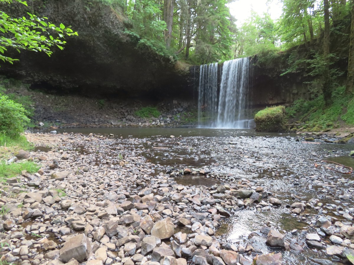
Ellendale Creek
A tenth of a mile beyond the creek I came to a road junction where trails also headed up and downhill. Here the route of the loop was along the road to the left, but this was where I had planned to leave the loop and head into the National Forest. I stayed straight ignoring a second road on the left and began climbing.


Shortly after I started the climb I spotted a mountain biker and their pup heading in the same direction. They were taking a break and as I neared I thought for a moment I heard my name but then decided they were probably just calling to their dog. Then I heard my name again and thought that Deryl was an odd name for a dog. Another Deryl later and I realized that it was our friend Yolanda and she was trying to get my attention. She was able to provide me with some information about some of the trails in the area as we continued uphill to Rob Mill Road (Road 1924).

Robb Mill Road at the junction.
Most of the mountain bike websites mentioned starting from Robb Mill Road which is what she’d done. They were heading left on the road back toward the gate at its end and my plans had me going right so after a little more information we said goodbye and went our separate ways. I followed the fairly level gravel round along the hillside above Ellendale Creek watching for the “White Gate” on a spur road that would be on my right.


Yolanda had told me to keep an eye out for a trail veering off to the left shortly beyond the White Gate. This spur trail would lead to split where the Tree Fort and Tree House trails (shown on the CalTopo & AllTrails maps) both head south back to Robb Mill Road. Before reaching that split this spur also connected to what was shown as a road labeled Muddy Puddles on the maps right at the National Forest border. My plan was to follow Muddy Puddles west to a crossing of Canyon Creek then continue on and hook back up with Robb Mill Road.

The spur trail.


Muddy Puddles on the right. Again, this was shown as a road on the maps.
I was now in the Siuslaw National Forest and the trail was a little rough but passable with signs of occasional trail maintenance.


I’m not sure who has been out working on these trails, but they’d done some recent work.


This was the biggest tree that I saw over any trail during my hike.


The trail got pretty faint as it neared Canyon Creek. Shortly before reaching the creek I noticed an even fainter trail veering off to the right that the map showed connecting up to Robb Mill Road.

There are two trails in the above photo, the one to the right heads to Robb Mill Road.
I passed some flagging on my left that was a little earlier than where the map showed the trail crossing Canyon Creek so I ignored it and continued on reaching the creek a short distance later.


Remains of a little footbridge on Cayon Creek.
Based on the map the trail bent around after crossing the creek and climbed a little over 100′ to Robb Mill Road. I nearly lost the tread completely on the far side of the creek and used my phone to stick to the track. The tread became clearer near what I determined to be the current creek crossing which the orange flagging I’d passed had been for.


The new route of the trail across Canyon Creek.


Robb Mill Road.
This had become a choose your own adventure hike at this point so I paused on the road to plot the next leg of my hike. Turning left on the road would simply head me back toward where I’d left the road near the White Gate and a right would lead me out of the National Forest for a bit before reentering another parcel further south. My other option was to cross the road sticking to singletrack and climbing to a ridge on what the maps show as the Burma Trail. If I chose the right combination of trails and roads I would eventually connect back up with Robb Mill Road near the southern end of that second National Forest parcel. That was the plan I settled on and across the Robb Mill Road I went.
Burma gained over 500′ from Robb Mill Road over the next 1.25-miles.


The trail leveled out a bit a couple of times along a ridge before dipping down twice to saddles.

About a half mile from the road the trail made a “corner crossing” between the two Forest Service Parcels.

Forest Service boundary sign.

Nearing the high point of the trail which also ran along the border of a clear cut.
The trail began descending from its high point and I came to a fork. It didn’t matter which way I went as the two forks rejoined in a tenth of a mile according to the maps so I forked right.


The forks rejoining.
My biggest mistake of the day came shortly after the forks rejoined. I’d noticed that I would be coming to another fork and the lefthand fork led to Robb Mill Road while the right looped around to the west to join Burma Road.

Despite the left fork being the used trail my ability to tell my left from my right malfunctioned and I forked right. I quickly found myself struggling through a mess of downed trees.

At the second pile of blowdown I did a map check and realized what I’d done. Fortunately I had only gone a tenth of a mile down this trail, but unfortunately I had to go back through the blowdown.


At least it was a little clearer after I’d removed a few limbs during my first pass.
I turned onto the correct fork and followed it somewhat steeply downhill a third of a mile to Robb Mill Road.


Unnamed creek crossing just before reaching the road.

Robb Mill Road through the trees.
Since I hadn’t had an exact route planned I had set a three-hour turnaround time which was 10:45am. It was 10:35am when I arrived at Robb Mill Road which was close to my turnaround time and the road provided an opportunity to make a loop back without having to climb back up to the high point. That was assuming none of the private land was off-limits, which they were not on this day. I turned left on the road and followed it back 2.1-miles to where the Burma Trail had crossed it.


Markes at the boundary of the National Forest.

There were a couple of logging roads that weren’t shown on any maps, so I used my phone quite a bit to make sure I was still on Robb Mill Road.

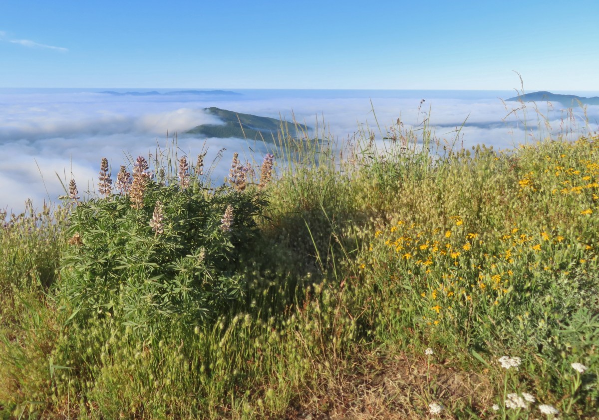
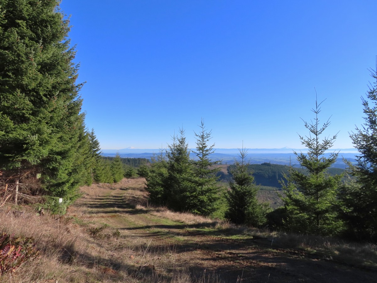
Views opened up as the road passed through previously logged areas.

Madrone

Mt. Hood straight ahead with Mt. Jefferson visible in the gap on the right. In addition to Hood and Jefferson Three Fingered Jack and the Three Sisters were also visible.

Mt. Hood

Back in the Siuslaw National Forest.

Arriving at the Burma Trail junction.
In hindsight I should have stayed straight on the road and followed it all the way back, but instead I dropped down on the trail and descended to Canyon Creek.

If I hadn’t come up here earlier I don’t know that I would have seen the path down.
I didn’t want to follow the exact same route back so after crossing Canyon Creek I took the faint trail I’d passed on my way up and followed it 0.2-miles to Robb Mill Road.


I turned right onto the road and followed it 1.4-miles to where I’d left the road in the morning.


Gate at the national forest boundary.

I turned onto the spur trail again but forked left at the Muddy Puddles junction then forked right at the next “Y” onto the Tree Fort Trail.

Left is Tree House and right is Tree Fort.
This was a totally unnecessary detour simply to check out some additional trails. I followed Tree Fort for 0.7-miles then made a hard left at a three-way junction onto Tree House.


Mary’s Peak (post) in the distance.

A little patch of snow on Mary’s Peak.

After 0.4-miles I arrived at the above three-way junction. Tree Fort followed an old logging road headed left while singletrack continued downhill to, you guessed it, Robb Mill Road.


Orange peel fungus.

Junction with Tree House (on the left).
I followed Tree House for half a mile to yet another three-way junction.


Had I taken Tree House instead of Tree Fort I would have arrived here in just a tenth of a mile instead of 1.1-miles. I turned right then forked left when this trail split and in two tenths of a mile found myself at Robb Mill Road near where I had said goodbye to Yolanda earlier.


I stayed left but either path would have dropped me down to Robb Mill Road.

Instead of following the road down I crossed over and picked up the continuation of the trail.

In another third of a mile I was back on the AllTrails Ellendale Creek Loop.

I was kind of tired of road walking so when I saw that there was trail parallel to the road that the loop followed, I decided to try it.

This turned out to be a mistake as the trail dropped steeply into then out of a depression. It was so steep and slick that I had to slide down.

I climbed up the far side which was slightly less steep then bushwacked 100′ over to the road.


I followed the road downhill 2.3-miles to complete the loop.

Road 1906 was the number.

More views of the Cascade Mountains.

The Three Sisters

Mt. Jefferson beyond the Willamette Valley.


Ellendale Creek

Arriving back at the road junction where I started my loop.
There were quite a few cars at the trailhead when I got back at 1:20pm. Despite the number of cars, I only saw four people on the trails. My convoluted route came to 15.1-miles with approximately 1800′ of cumulative elevation gain.

Blue represent the area covered by AllTrails with the orange being my addition.
Here is the track on the CalTopo map showing the National Forest (green) and BLM (orange).

This is truly a choose your own adventure area and offers a lot of options as long as access is allowed. Watch for active logging operations and seasonal fire closures, but otherwise this was a great place to get some trail miles in less than 30-minutes from Salem. Happy Trails!
Flickr: Ellendale Creek


 The trail on the east (right) end.
 The trail on the west (left) end and the restrooms.


 The pullout only has room for two cars, a third might be able to squeeze in but it would be tight. DO NOT drive past the gate if it happens to be open as motor vehicle use by the public is not allowed beyond the gate.


 A section of intact forest.


 False lily-of-the-valley


 Chipmunk


 Salmonberry


 Another junco


 Mt. Rainier


 Dandelion (non-native) in the penstemon. There were surprisingly few non-native wildflowers which was nice.

 Looking back after having made it onto the ridge. The loop route is the road seen on the right cutting along the hillside, not the roadbed straight ahead going up the knoll.


 Lomatium


 There were a couple of downed trees and at least one spot where part of the tread had given way on the hillside. A bigger issue was the broken glass and other garbage left by mouth breathers that was littered about.
 It was just over a third of a mile to the falls.
 Beaver Creek below the falls.
 Trail snail
 Fringecup
 Starflower


 Fairy lanterns
 Scouler’s corydalis
 Bleeding heart
 False lily of the valley
 Highway 30 crossing.
 Sign along the section of trail between the highway and the fish hatchery.
 Trail pointer on the shelter at the fish hatchery.
 Youth-on-age
 Numbering on a tree for the interpretive trails.

 Bigfoot off the Gnat Creek Trail.
 Trillium
 Huckleberry blossoms and a downed tree along the Gnat Creek Trail.
 Scouler’s corydalis along the trail.
 The start of the short loop.
 One of two benches along the loop.
 Gnat Creek from the bench.
 The backside of the loop was a little overgrown.
 Star-flowered Solomonseal
 We mostly stayed right at junctions to keep along the creek.

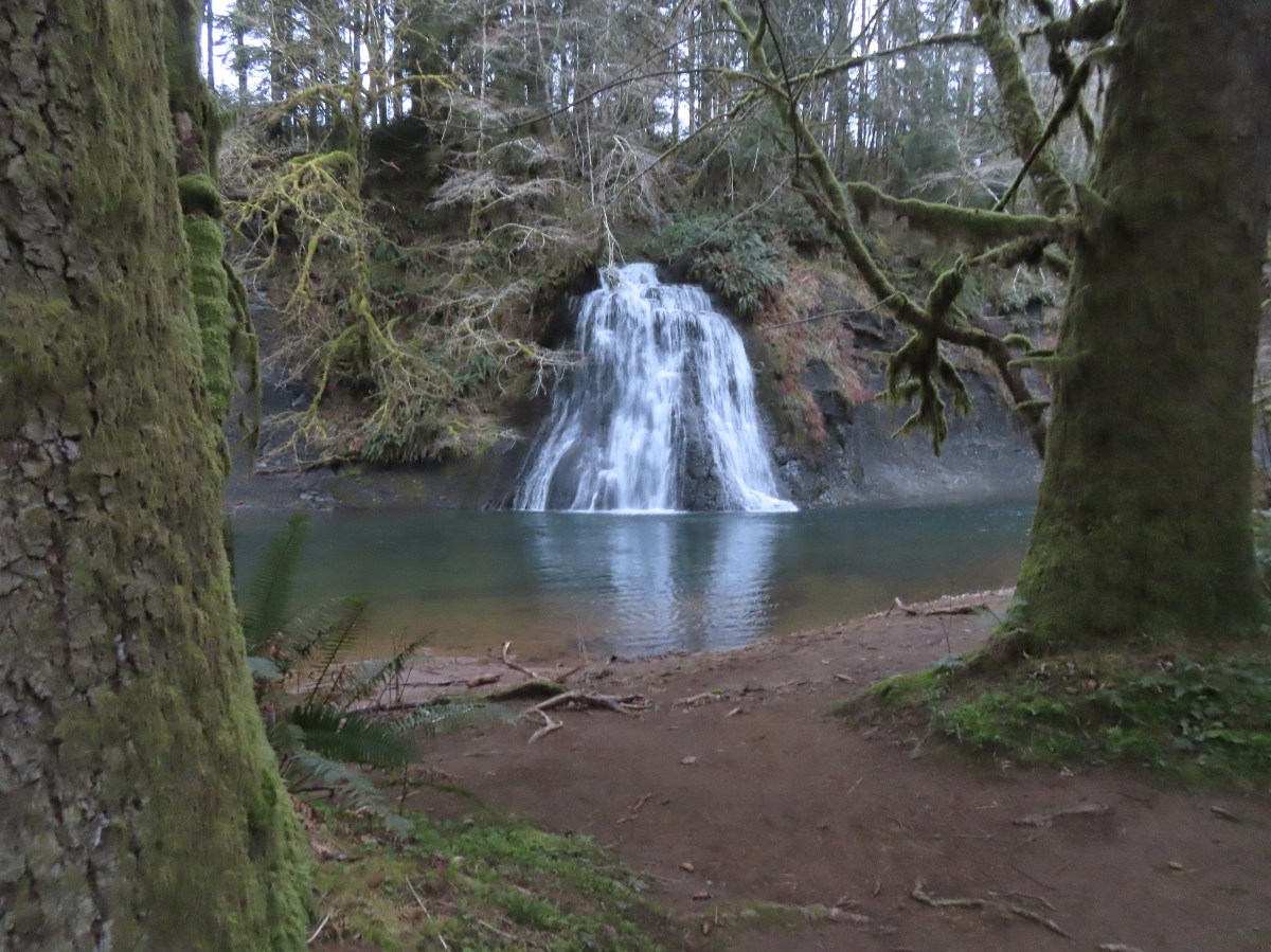
 Barrier Falls

 Unnamed waterfall near the hatchery trailhead.


 Mill Creek from the bridge.
 Stellar’s jay
 Chipmunk
 Loon Lake
 The lake was formed by a landslide. The boulders in the Mill Creek picture above were part of that landslide.
 Trillium
 This was our first hike in the Elliott State Forest and possibly only hike given the forest webpage states under “There are no established trails, restrooms, or trash receptacles.”
 Fairy lanterns
 Given that the unnamed stream that feeds the waterfall appears to start just a bit further uphill I suspect it doesn’t often have much of a flow, but it was a decent waterfall in a lovely setting.
 A very short path led down to the waterfall.
 Camp Creek Falls. The rock here is sandstone which creates the 31′ stairstep cascade.
 Snail
Snail Before reaching Highway 38 I had to pull over to get a couple of photos of an elk herd.


 Camas
Camas Not sure why this was lying on the side of the trail away from the trailhead, but it provides information on the seasonal allowed usage of the units.
 Geese
Geese
 Roses
Roses Channel along the dikes.


 Rough-skinned newt
 Slug
Slug Snail
Snail Made it out.


 Bench along Coyote Creek

 I should have gone this direction. The presence of the bench should have tipped me off.
 Overgrown but in the right spot.
 The orange section is where I turned right instead of left as I should have. I estimate that going the correct way would have added approximately 0.75-miles. I don’t know what type of condition the other section of trail through the woods is in.

 Road to Fisher Butte,
 Camas
Camas Bird viewing platfrom.
 Red-winged blackbird
 Bullfrog. They were everywhere and continuously startled us when they would make a loud “alarm” sound before jumping into the water.
 We turned left at the platform onto this dike.
 Sparrow
 Blue-winged teals. This was the first time seeing this species during Wildlife Week. We had seen a couple of these ducks back in 2021 at Cold Springs National Wildlife Refuge in Eastern Oregon (
 Another big field of camas.
 Fisher Butte at the end of another dike.
 Geese in formation.
 Checkerbloom
 Blue sky, a far cry from the low clouds and showers we’d driven through in the Eugene area earlier in the morning.
 Geese and cinnamon teals.
 I needed a more powerful camera to make out the various ducks and other birds we were seeing in the distance.
 There were a number of great blue herons hunting in the wetlands.
 Another viewing platfrom.
 Looking toward the Royal Avenue Unit.
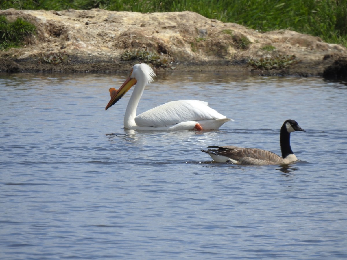
 Pelicans. Another species that I hadn’t seen at any other wildlife area this week.
 Purple martin
 One of at least a half dozen American bitterns that we saw in flight. We were unable to spot any before or after they were in flight.
 Swallows in flight
 There was a lot happening in this part of the unit.
 White pelicans and a mute swan (non-native)
 Geese
Geese Another first this week – greater white fronted geese. It’s a blurry photo but it was the best I could do given their distance.
 Goose passing the swan.
 Same goose passing a pelican.
 Northern shoveler
 Hawk
Hawk Another large group of various ducks and other birds.
 Bald eagles
 Two types of camas
 Heading back to the trailhead along the side of Fisher Butte.
 Flax
Flax The final stretch of Wildlife Week.
 \
\


 Moss carpet
 The first of several road and/or OHV trail crossings.
 Skunk cabbage
 Coming to an OHV trail crossing.
 Violet
 Another OHV crossing.
 Trillium
 Mushrooms
 Approximately 1.4-miles along the Wilson River Wagon Road the trail followed Saddle Mountain Road for 150 yards before resuming on the far side.
 The trail resuming on the left off Saddle Mountain Road.
 Deyoe Creek


 The Wilson River Wagon Road Trail arriving at University Falls Road across from the University Falls Trailhead.
 University Falls Trailhead.

 There was a clearcut on the right-hand side of the trail.
 The Gravelle Brothers Trail joined from the right after 0.2-miles. This is the trail we’d used to reach the falls in 2015.
 Salmonberry blossoms

 Trillium near the falls.
 Heading down the road from the trailhead.
 Coltsfoot


 Wood sorrel
 University Falls Road below to the right.
 This appeared to be a new section of trail replacing the old alignment on the north side of the road.
 The closed section of the trail that remains on the north side of the road.
 The closed section of trail coming up on the right with the continuation of the trail ahead on the left.
 The other end of the closed section.
 This section was open so I waved Heather on and we headed down through the clearcut to the horse camp.
 A lot more hikes may look like this if the current administration gets its way.
 The horse camp in the trees.


 Footbridge over Deyoe Creek.
 Rough skinned newt.
 In true Oregon fashion the weather was a mix of sprinkles and blue skies.
 Violet enjoying some sunlight.
 This stump looked suspiciously like Davey Jones from the Pirates of the Carribean movies to us.
 Huckleberries
 Devil’s Fork


 1930 Caterpillar Model 30
 Bridge over Cedar Creek.
 Cedar Creek
 North Scappoose Creek
 Sun hitting the top a hill in the distance.
 There was a lot of
  Forest along the trail.
 One of several interpretive signboards along this segment.
 While the Sun was out the trail remained mostly shaded and therefore cold. We both would have benefited from some slightly warmer layers.
 Hair ice
 More hair ice
 Another interpretive sign ahead.
 MP 13
MP 13 The Nehalem Divide TH on the left and the Crown Z Trail continuing on the right.
 I believe that is Silver Star Mountain (

 North Scappoose Creek winding past a private home.
 The Ruley Trailhead ahead.

 From the saddle South Triangulation Point, the highpoint of the loop, is to the right.
 Bleeding heart
 Fairy lanterns
 Solomonseal
 Inside-out flower
 Paintbrush
 Lupine
 Starflower
 Salmonberry
 Cardwell’s penstemon
 Beargrass
 Wallflower
 Little-leaf montia
 Fringecup
 Salal
Salal Rosy bird’s-foot trefoil
 Band-tailed pigeons
 Looking back at the saddle before heading into the trees.
 Vetch
Vetch Leaving the clearcut.
 Rock cliffs marking the location of Kilchis Falls.
 Located on a tributary of the North Fork Kilchis River the falls reportedly seldom have much flow, but there was enough water today to make for a pretty sight.
 The small pool below the falls.
 Avens
Avens Spider hiding on a columbine.
 Scouler’s corydalis
 Youth-on-age
 Valerian

 Hedgenettle
 Waterfall on an unnamed creek. It was quite a way back in thick vegetation.
 The above waterfall sans zoom.
 Buttercup
 Fick Creek joining the river.
 Potholes on the North Fork Kilchis River.
 Triangulation Creek flowing into the river.


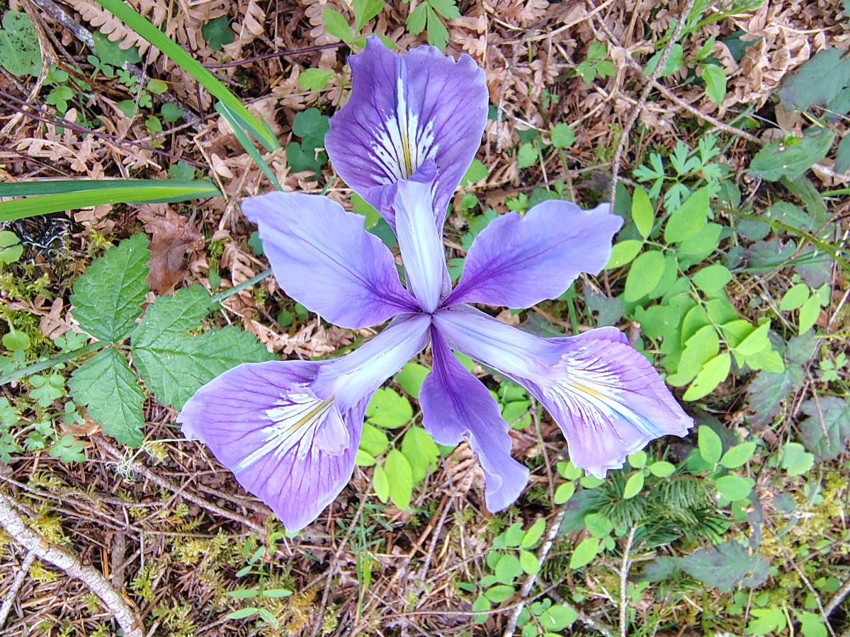
 Snail shadow on a iris.
 Middle Road coming downhill on the right. This is the

 A very blurry picture of a doe that was way down the hillside in the forest.
 Large rock and log in the middle of Middle Road.
 Monkeyflower surrounded by candyflower
 Paintbrush on some cliffs above Middle Road.
 Thistle
 The road at the 1.3-mile mark along Middle Road.
 The saddle at the 1.6-mile mark.
 Memorial at the saddle.
 Middle Road continuing on from the saddle.
 Beargrass
 The road on the left at the 2.1-mile mark.
 Iris
Iris Stream flowing down the road.
 Coming up to the 4-way junction.
 Middle Road from the 4-way junction.
 The two lefthand forks at the 4-way junction.
 FB3
FB3


 Monkeyflower
 Beargrass, paintbrush and penstemon
 More flowers on a rocky outcrop along FB3.
 A bunch of monkeyflowers.
 Springs along the road.
 Snake cooling off in the mud.
 The snake didn’t budge as we passed around it.
 This fork is approximately 4.2 miles from the Middle Road Trailhead.
 Snake number two on the day.
 This one didn’t budge either.
 Switchback below the saddle.
 Approaching the saddle.
 Gated road up Triangulation Point.
 South Triangulation Point
 Serviceberry, paintbrush, yarrow, and iris.
 Paintbrush and Cardwell’s penstemon
 Iris
Iris Broadleaf arnica, paintbrush and penstemon
 Columbine among others.
 Broadleaf arnica
 Final pitch to the summit.
 We could see our car parked at the saddle below Cedar Butte from South Triangulation Point.
 Motorcycle track heading down from the summit with Triangulation Point on the other side of the saddle.
 Looking to the NW you can see out to the Pacific Ocean. The line of peaks furtherst back staring from left to right consists of Neahkahnie Mountain (
 Closer look at Surgarloaf Mountain and Kidder Butte.
 Wildflowers on South Triangulation Point.

 Another nice clump of wild iris.
 Lupine
 Flowers lining the road.
 More motorcycles at the 5-way junction.

 Variable-leaf collomia
 The road briefly followed a narrow ridge.
 Anemones
 Moth
Moth
 Heather spotted this little one. Not sure if it’s a vole, pocket gopher, or something else.
 Silverleaf phacelia and chickweed
 A lomatium

 Larkspur and monkeyflower
 This pink larkspur really stood out on the cliffs.
 Littleleaf miner’s-lettuce
 Several types of yellow wildflowers.
 Still dropping a little after the cliffs.
 Bleeding heart and candyflower
 Climbing the road at the edge of the clearcut.
 The saddle where our car was parked across the clearcut.
 South Triangulation Point from Cedar Butte Road.
 South Triangulation Point
 Looking down the North Fork Kilchis River valley from the saddle.
 The trail information lists the hike as “difficult” due to the amount of elevation gained over just three quarters of a mile to the summit.
 The start of the Cedar Butte Trail.
 Star-flowered false solomonseal
 Black-headed grosbeak
 False lily of the valley
 The trail was in good shape with just one small tree down over it.
 Blue-eyed Mary
 Small saddle below the summit.
 Beargrass
 Phlox
Phlox Final pitch to the summit.
 Wild onion
 Benches at the former lookout site.
 View from the summit.
 Wildflowers at the summit.
 Kings Mountain is the high point to the right along the ridge.
 Fairy bells and vanilla leaf
 Almost back
