Categories
Hiking Northern Coast Oregon Oregon Coast Trip report

Tillamook Head

We recently wrapped up our 2013 hikes. We started on the Oregon Coast at Cape Perpetua in February and ended 140 miles to the north at Tillamook Head. Undaunted by some recent snow and cold weather (lows in the teens) we were determined to complete our final scheduled hike. The forecast for Seaside was for clear skies and a balmy 36 degrees and highway 26 over the coast looked passable so we bundled up and set off. We were looking forward to the possibility of seeing some snow at the coast since it is a rarity here in Oregon.

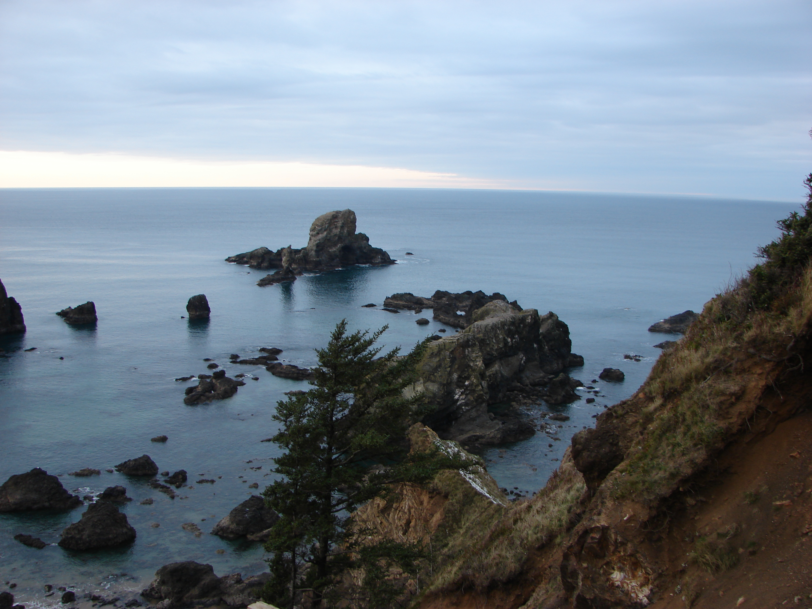
We chose to begin our hike at Ecola State Park on the Cannon Beach side of Tillamook Head. This meant paying a $5 fee to park which we could have avoided by parking at the Seaside end, but better views and a less steep start to the hike were worth the expense. We were the lone car in the large picnic parking area at 8am and had the views all to ourselves.

View south from the Ecola Picnic Area

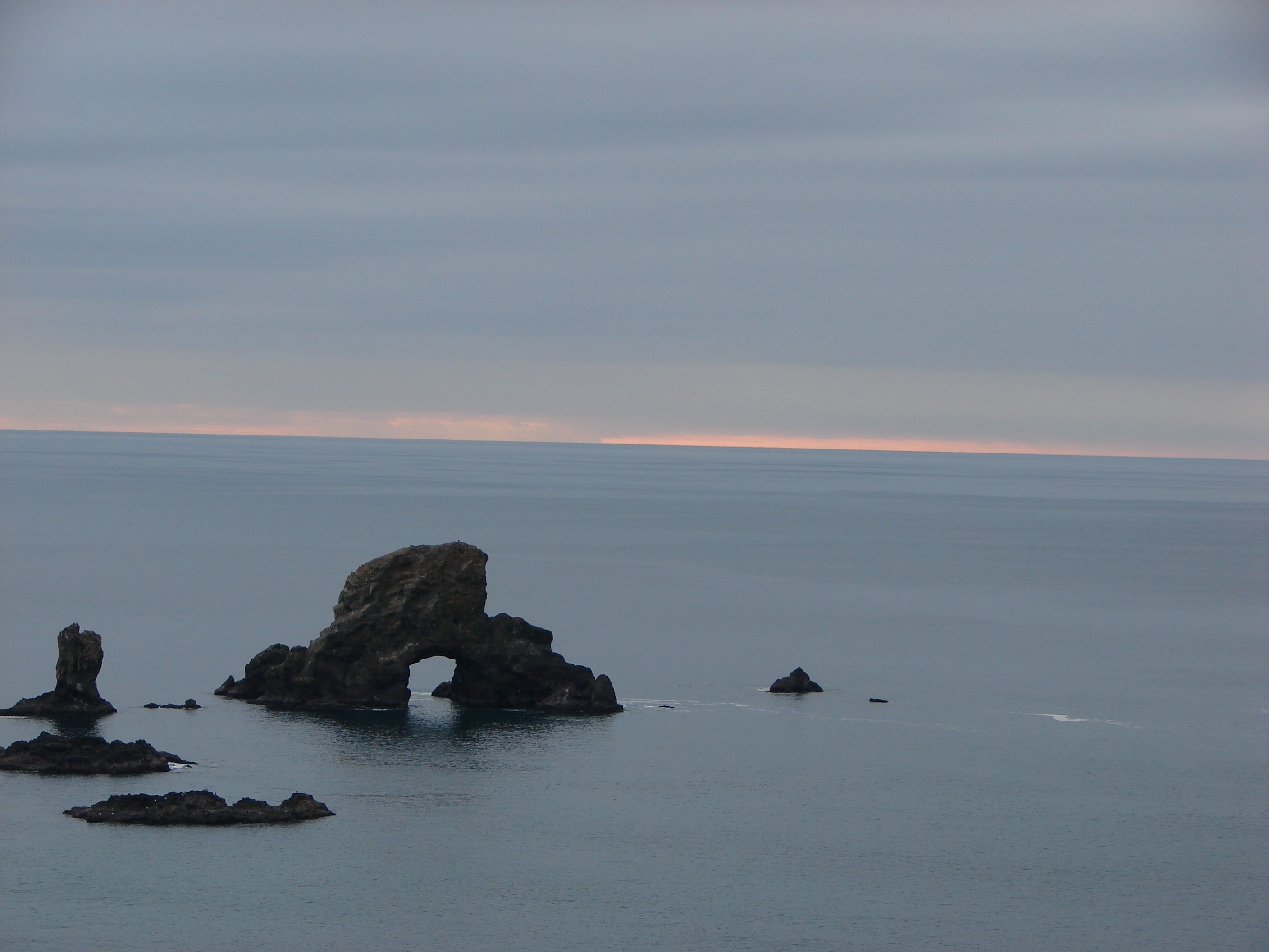
From the picnic area we headed north toward Indian Beach stopping occasionally to take in the views of Sea Lion Rock and the old lighthouse on Tillamook Rock.

Sea Lion Rock
Sea Lion Rock
Tillamook Rock
Tillamook Rock

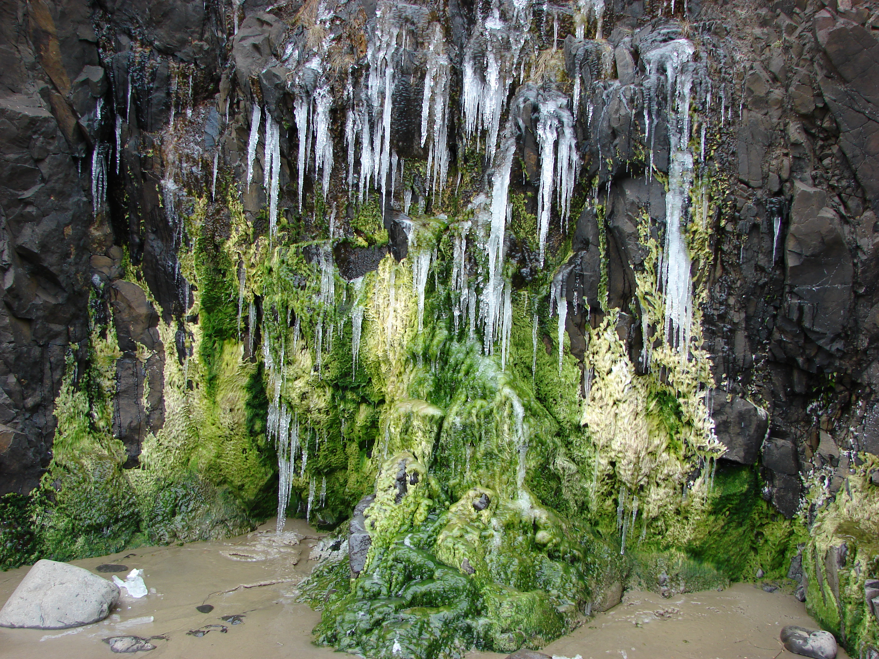
When we arrived at Indian Beach we found some very interesting ice formation in addition to the superb views.
044

053

066

068

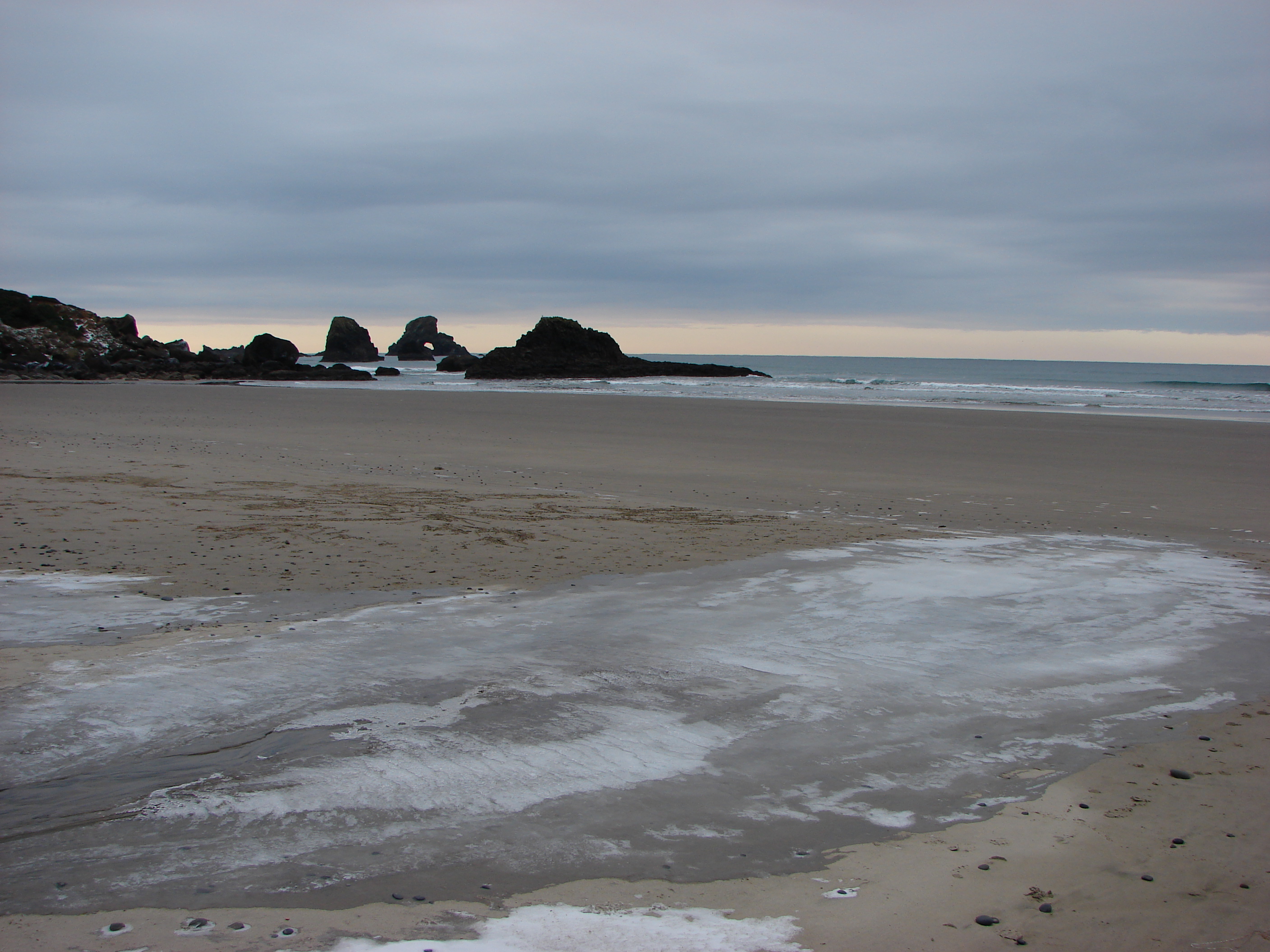
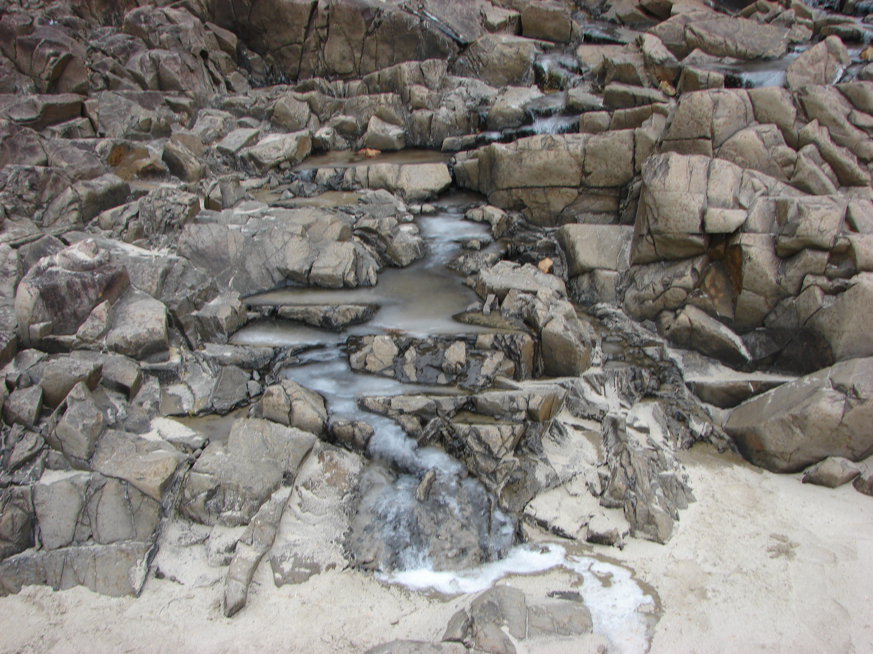
In addition to the ice there were a couple of small tide pools to check out.
082

From Indian Beach we continued north taking the Clatsop Loop Trail, part of which William Clark traveled in 1806 with a party in search of a stranded whale. The forest here is still home to some of the same Sitka Spruce trees that he and his group passed by which was a neat thing to think about. The loop trail turns back at Hikers Camp where you can visit the nearby remains of a WWII radar installation.

Hikers Camp
Hikers Camp
WWII radar installation

We kept heading north from Hikers Camp heading toward the summit of Tillamook Head, a whopping 1130′ above sea level :). We passed over the summit and went just a bit further until the trail began to really descend toward Seaside. We decided we didn’t want to have to climb all the way back up so we called it good and head back to Hikers Camp to complete the loop trail. It had started to snow, more like small white pellets, and the clear skies promised by the weather.com had never materialized. We passed more ocean views and various types of vegetation as we headed back to Indian Beach.

114

135

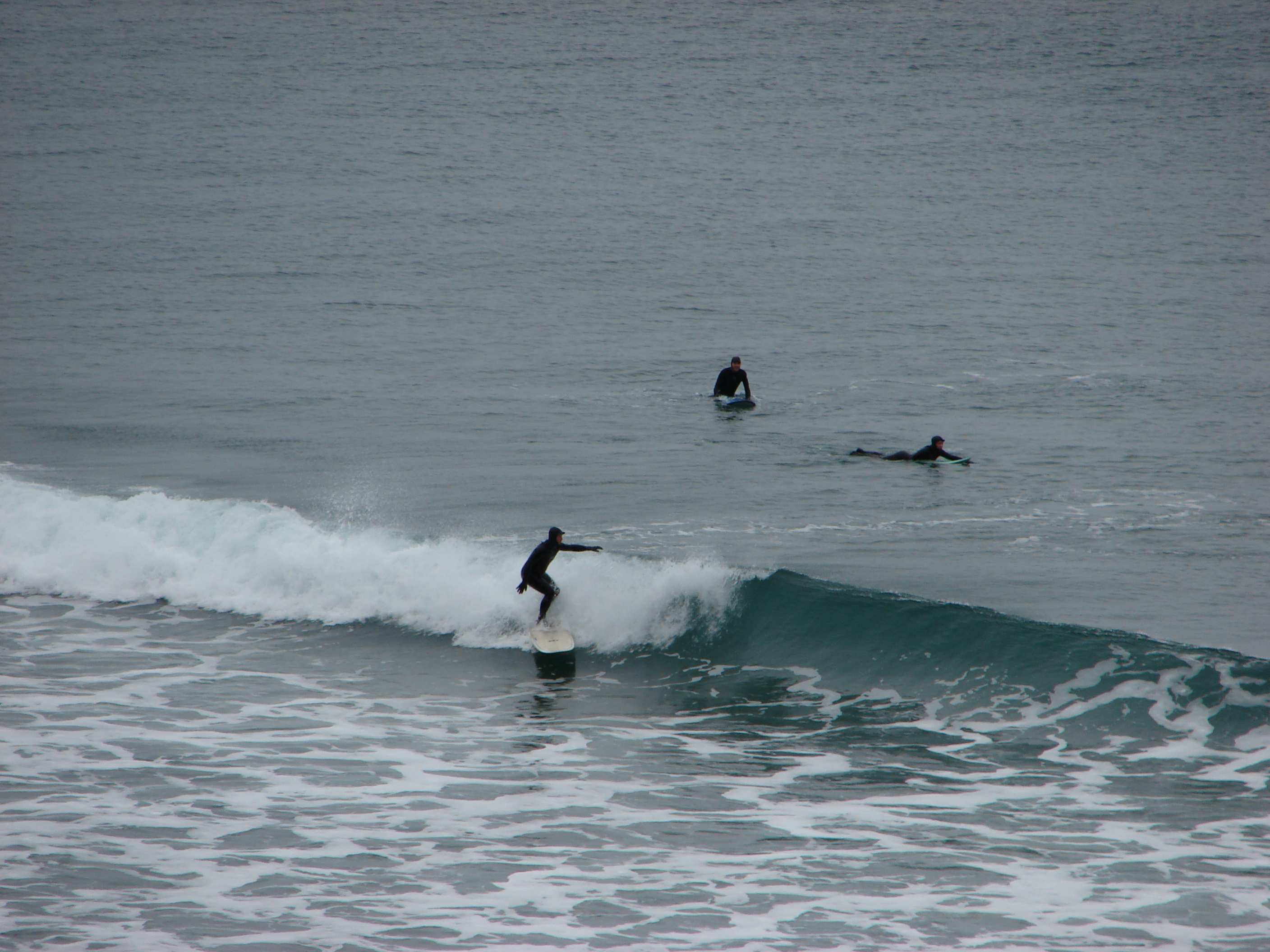
We had only seen one other group of people so far and that was a family that came down to Indian Beach briefly when we were there, but upon arriving back at the beach we discovered it had been populated by some brave surfers.

142

149

It wasn’t until we had left Indian Beach and were almost back to the picnic area though before we ran into any traffic on the trail.
171

She was moving too fast for the camera but it was fun to watch her come up the hillside and then dash off into the forest.

The number of cars in the parking lot had swollen to three (including ours) when we got back to the picnic area at about 3pm. Despite the completely incorrect weather forecast it had been a great hike and a perfect way to end for 2013. Happy Trails!

173

Photos on facebook: https://www.facebook.com/deryl.yunck/media_set?set=a.10202865376982644.1073741866.1448521051&type=3
Flickr: http://www.flickr.com/photos/9319235@N02/sets/72157638495394186/

Categories
Coastal Range Hiking Oregon Trip report

Saddle Mountain

I am not sure we had completely dried out after our Hamilton Mountain hike (I know ours shoes hadn’t) but we were back in the “saddle” yesterday for another hike. Saddle Mountain state park was our destination, located in the NW corner of Oregon just 20 miles from the coastal city of Seaside. Saddle Mountain is known for it’s wildflowers and rare plants as well as being the highest point in northwest Oregon.

Once again we were we greeted at the trail head by a layer of low clouds which made for a damp morning. The good news was that there was no wind or rain this time. The trail started out amid salmon and thimble berry bushes in a forest of alders. The trail climbs 1603 feet in just 2.5 miles so the forest and plants changed often. A quick .2 climb to the Humbug Mountain viewpoint provided a view up toward Saddle Mountain’s cloud covered summit.
024

We returned to the summit trail and headed up through the fog passing multiple meadows full of wildflowers and lush forests. Much like our previous hike, visibility was limited to a couple hundred feet due to the low clouds but the variety of plants and flowers we were encountering kept us entertained. The trail itself was fairly steep and much of it consisted of wire enclosed rocks which looked like it could be slick but we didn’t have any real problems. Several picnic tables were placed along the trail at switchbacks which allowed for breaks from the climb if needed.

As we approached the summit we noticed some very slight breaks in the clouds which gave us hope. We decided to have some lunch and spend some time at the summit hoping that some views would open up. The clouds were actually moving from east to west toward the Ocean which we could now occasionally see through the clouds. We spent over an hour watching the clouds pass by us as better and better views opened up on all sides. Many swallows zoomed about as we waited and a Junco and a crow also stopped by to check us out. As the view opened up to the west was the Pacific, north the city of Astoria, OR and the Columbia River flowing into the Ocean
317
and to the south the coastal mountains. The only disappointment was that on a clear day the Cascade mountains from Mt. Rainier to Mt. Jefferson would have been visible to the East.

We headed back down now able to see the forest below. The wildflowers became even prettier as the increased light made their colors more intense. We took the side trail to the Humbug Mountain viewpoint again to get the cloudless view of Saddle Mountain before returning to the car.
462

If you are a wildflower or plant enthusiast this is a great hike, especially from May-July when the flowers are on display. If you can find a clear day (which isn’t easy near the Oregon Coast) the view is a great bonus. Next up is Mount June and yet another attempt at a view of the Cascades. Until then-Happy Trails.

For more info on Saddle Mountain visit: http://www.oregonstateparks.org/index.cfm?do=parkPage.dsp_parkPage&parkId=140
Photo albums-fb: https://www.facebook.com/media/set/?set=a.10201276380778732.1073741834.1448521051&type=1
flickr: http://www.flickr.com/photos/9319235@N02/sets/72157633845363594/