For the third time during the week the forecast for a planned hike in the Cascades showed clear skies when I went to bed but then it showed areas of patchy smoke when I rechecked in the morning. The first two times I pivoted to a hike on the Oregon Coast but on Thursday I decided to risk the “areas of smoke” before 11am forecast for Salt Creek Falls and Vivian Lake. The smokey conditions are the result of numerous lightning caused wildfires. Over 2000 strikes were recorded in Oregon on 7/15/26 and another reported 8357 ground strikes occurred on 7/22/26. The staggering number of strikes combined with extremely dry conditions led to some large fast-growing fires in Central and Eastern, Oregon. At least two of my high school classmates have had to evacuate due to the Akawa Butte Fire north of Sisters.
The area around the Diamond Peak Area had thus far avoided any large fires and the handful of small starts had all been quickly contained which is why I had looked at revisiting our 2013 hike from Salt Creek Falls to Vivian Lake (post). I arrived at the Salt Creek Falls Day Use Area just before 6am and was happy to find that there was no smell of smoke in the air.

I started by heading for Salt Creek Falls where there is ongoing construction at the main overlook. (A sign noted that the area is closed when construction is happening and other access routes need to be used, but there was no construction happening yet today.)


Beyond the construction there is a viewpoint of the falls and the start of the Salt Creek Falls Trail.


While we’d been to this waterfall twice before we had never gone down the trail.
The trail descends steeply losing approximately 200′ of elevation to a railed viewpoint of the 286′ waterfall.


Salt Creek Falls is an impressive waterfall, and the basalt cliffs add to the visual appeal.

I trudged back up from the lower viewpoint and followed the paved path along the cliff to the top of the falls.


From the top of the falls I stayed right at junctions and crossed Salt Creek on a footbridge where a sign announced the Diamond Creek Falls Trail.


Salt Creek
On the far side of Salt Creek, and after crossing another small footbridge, the trail split.

The split is the start of the Diamond Creek Falls Loop.
The trail to the right provides the shortest distance to Diamond Creek Falls and also offers access to Too Much Bear Lake so that is the direction I headed.


Warning sign at the start of the loop.
After a brief climb I came to the first cliff edge viewpoint.

I then detoured down a use trail to visit Too Much Bear Lake.

The first use trail didn’t provide much a view of the lake.

One of two great blue herons that I did see from the first use trail.

Back up on the trail along the basalt cliffs.
I detoured again down to Too Much Bear Lake on a better use trail that did bring me to the edge of the lake.


After my second foray down to the lake, I continued on the loop.

There were several short spurs that led to viewpoints on the right.


This spur led to an obstructed view of Lower Diamond Creek Falls, which according to the NW Waterfall Survey, has a height of 180′ over 4 drops.

Lower Diamond Creek Falls from the viewpoint.

Zoomed in on the waterfall.
Continuing on the loop the trail passes near the top of Lower Diamond Creek Falls.


The trail continues a gradual climb to a junction 1.3-miles from the start of the loop. The trail to the right is signed “Lower Diamond Creek Falls” however this is an error, and the spur trail actually descends to Diamond Creek Falls.


I turned down the spur trail and descended to a footbridge over Diamond Creek.


Musk monkeyflower

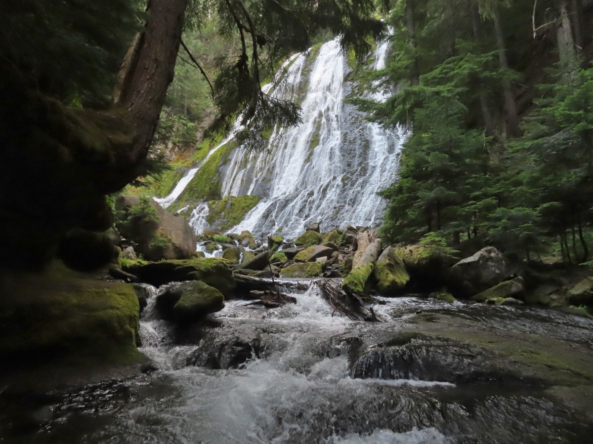
Shortly after crossing the bridge the trail brings you to 134′ Diamond Creek Falls, in my opinion one of Oregon’s prettiest.

The setting adds to the beauty.

In 2013 we had visited on July 4th and were hounded by mosquitos, but today the waterfall was mosquito free, so I was able to enjoy the waterfall and explore as I liked.


Yellow willowherb

I’m assuming this is an arnica of somesort.

After spending some time at the waterfall I returned back up to the loop and continued on to an overlook of the waterfall.


Sickletop lousewort near the overlook.
Just beyond the overlook the trail split again at an unsigned junction. The loop continued to the left while the Vivian Lake Trail headed uphill to the right.

I headed right and began the 2.2-mile climb to Vivian Lake. For the first 0.3-miles the trail crossed some swales, Diamond Creek using a road bridge, and climbed to a railroad crossing.


Prince’s pine

Bugbane

>
Columbine

Approaching the road.


Fireweed

Diamond Creek

The trail continuing on the other side of the bridge.

Gnome plant was prevalent in the forest.

More swales

The railroad tracks.

No trains today but the tracks are in use.
On the far side of the tracks there are two trails, an obvious old roadbed and a narrower trail to the roadbeds right. They will both get you to the same place, but the narrower trail is the official Vivian Lake Trail (it’s also shorter) and the one I took.


A quarter mile beyond the railroad tracks the trail comes to a wilderness registration box at the edge of the Diamond Peak Wilderness.

While I was filling out the self-issued permit I felt a bite near my right elbow and looked down to see three mosquitos there. There was another on my left arm and none of them had reservations so I dispatched of them and quickly continued on. After 75 yards I realized I no longer had hiking poles so I had to turn around and go back to the kiosk to retrieve them. After gathering my poles I again headed toward Vivian Lake.


Twinflower

Lupine

Sugar sticks


Mushrooms

Hedgenettle

One-sided wintergreen
The trail climbed steeply at times passing a very obscured view of Middle Fall Creek Falls.


You can hear the waterfall much better than you can see it.

There is a much better view of Fall Creek Falls 1.3-miles from the Diamond Creek Falls Loop.

Spur to the viewpoint above Fall Creek Falls.

Fall Creek Falls
Beyond Fall Creek Falls the trail leveled a bit as it traveled above Fall Creek before steepening again prior to reaching a signed junction near Vivian Lake.


Rosy spirea


Clasping arnica


Approaching the signed junction. The trail to the right leads to the lake while the Vivian Lake Trail continues to the left to Notch Lake and eventually the Vivian Lake Trailhead (post).
I followed the trail to Vivian Lake and made my way to some campsites where I took a break on the lakeshore.

There were a few mosquitos in this area, but they were absent from the lakeshore.


Frog in the grass.


My break spot.

My only company at the lake were a few ducks who kept their distance.

Aside from an occasional faint smell of smoke and some haze depending on the direction I was looking the fires weren’t an issue.
Just as I was about to leave the clouds began to break up and I decided to make my way around the lake a bit to try and get a view of the top of Mt. Yoran.


Mt. Yoran
After getting my view of Mt. Yoran I made my way back to the Vivian Lake Trail, stopping often to admire the scene at the lake.


Once I was back to the Vivian Lake Trail I headed downhill toward the Diamond Creek Falls Loop.

On my way down I spotted something coming up the trail below me.

It wasn’t another hiker, but rather a young buck who stopped and stared at me through the trees.

We stared at one another for a while then I told him I was heading that way. Proving deer are smarter than cows he turned around and took a couple of steps down the trail, then left the trail and bounded away from me uphill through the brush. Cows would have taken a few steps down the trail, stopped, looked back at me and then taken a few more steps down the trail. This would have repeated for a half mile or more and resulted in the trail being carpet bombed with cow pies, but I digress.
Back to the hike when I finally reached the Diamond Creek Falls Loop I turned right and completed the loop.


False hellebore

Snacks included blueberries, huckleberries, and a ripe salmonberry.

The Diamond Creek Falls Loop.

Rhododendron lined the trail. The loop is a great hike for rhododendron earlier in the year but that is also typically mosquito time.

Mount David Douglas from the trail.

The trail crossed two roadbeds.


Completing the loop.
I recrossed Salt Creek then turned right looping around the picnic area to return to the trailhead parking lot next to a Diamond Creek Falls Trail sign.


I somehow managed to turn my GPS off after marking the trailhead and didn’t catch it until I was at Too Much Bear Lake so I had to fill in the first part of the track manually. Based on the additional information I did get, this hike was between 9.5 and 10 miles with 1900′ of elevation gain.

Even though it was a Thursday I was surprised that I only passed one other person on the trails, and that was shortly before I completed the Diamond Creek Falls Loop. There were a few cars at the trailhead and people headed to Salt Creek Falls but I’d had the trails almost entirely to myself. Happy Trails!
Flickr: Salt Creek Falls to Vivian Lake


