A combination of wildfire smoke, hot temperatures, and possible thunderstorms convinced us to abandon our plans to backpack over the weekend. To make matters worse thunderstorms late in the week had started at least 50 new fires across several forests. We are now at the point of the year when we just want it to start raining, and if it keeps raining that’d be fine (preferably without any flooding).
Looking at the various forecasts the only decent option for us appeared to be the central coast so I looked through our future plans for something that fit the bill. I landed on a multi-stop day which included, as originally planned, five stops for short hikes surrounding Tillamook. We wound up skipping the final planned stop at Oceanside Beach after seeing how packed the beach was and finding that there was absolutely nowhere left to park in the area.
We began our morning at Fort Yamhill State Heritage Area.

A short loop passes through the site of the fort which operated between 1856-1866. The interpretive signs along the way provide insight into the lives of that time and provide a stark reminder of how poorly the Native American population was treated.
 Most of the buildings are gone but this relocated Officers Quarters is being restored.

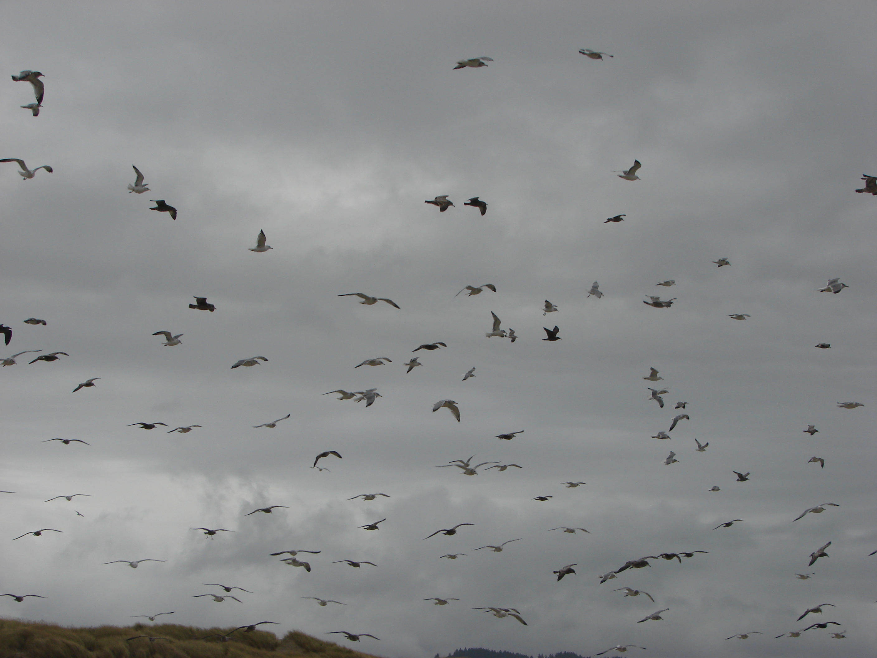
 It was hard to tell at times if it was cloudy or smokey which would be a theme for most of the day.
 Flagpole behind an interpretive sign.
 Most of the trail is ADA accessible but not the entire loop.
 The forest was quite a contrast from the open hillside.
The loop was just a little over half a mile. The numerous interpretive signs to read made it an interesting and informative first hike.
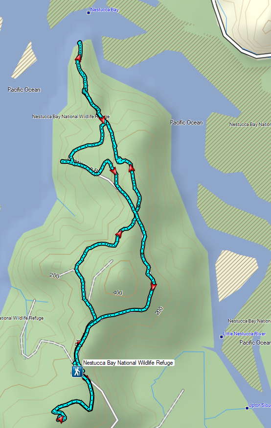
From the heritage area we made our way to the Nestucca Bay National Wildlife Refuge.
We followed signs for the trailhead and parked in a good sized, and empty, gravel lot.

Two trails begin at the lot, the Pacific View Trail and the Two Rivers Nature Trail. We opted to start with the nature trail which started by following a gravel roadbed for a quarter mile to a trail sign.


 Lots of fading flowers: yarrow, goldenrod and aster mostly.
 Some of the caterpillar tents on the hillside.

We decided to follow the trail down to the viewpoint at the end of the peninsula and then take the road back up to the trailhead so at the sign we turned left onto what began as another old roadbed but quickly turned to a dirt track.


 The nature trail crossed the service road after half a mile.
 The continuation of the nature trail on the right.

 We were pleasantly surprised at how forested this entire trail was.
 There were lots of frogs hopping off the trail. Can you see this one?
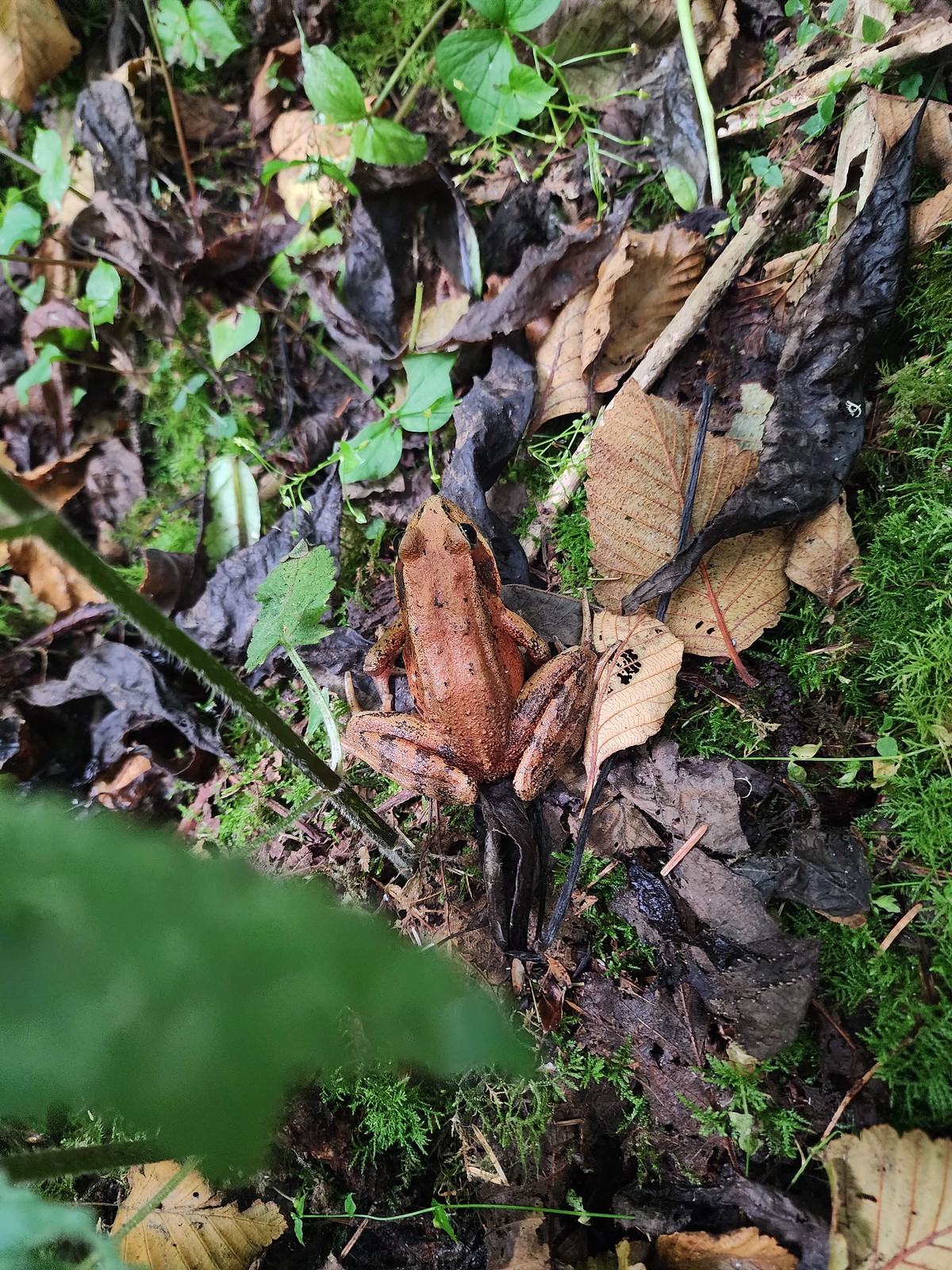 Norther red-legged frog?
 A little less than half a mile after crossing the road we passed a junction with a trail leading to the picnic area. We would visit the picnic area on our way back and pick up the service road there.
The trail passed a small viewpoint looking across Nestucca Bay before ending at a bench at a railed viewpoint overlooking the confluence of the Nestucca and Little Nestucca Rivers.


 The Little Nestucca is to the right with the Nestucca River straight ahead.
 Cormorants
After enjoying the view we headed back uphill to the junction where we turned right and made our way to the picnic area.


 We disturbed a doe near the picnic area.
 The doe leaving the picnic area.
 A path here leads down to the bay to provide fishing access (we didn’t follow it).
From the picnic area we followed the roadbed a mile back to the trailhead.

 Ground squirrel
 Thistle
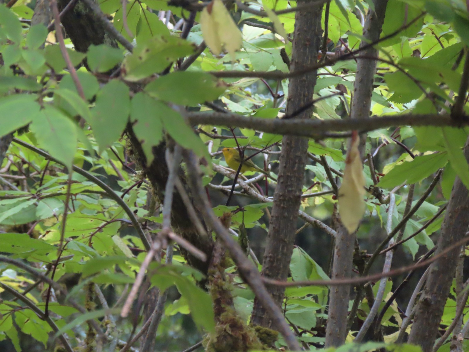 Wilson’s warbler
 The overlook on the far hillside.
 The trailhead from the service road.
Once we’d returned to the trailhead we walked to the opposite end and picked up the Pacific View Trail near the outhouse.

A paved path led uphill through the meadow to the wooden overlook.

 Haystack Rock and Cape Kiwanda (post) from the trail.
 Haystack Rock
 Pearly everlasting, spirea, and aster.
 View from the overlook.
 Bench at the overlook.
 Little Nestucca River from the overlook.
 White-crowned sparrow
 Ladybug
This was an enjoyable stop and left us wanting to return in the future to hopefully have a clearer view and see the refuge at different times of the year. With both trails this stop came in at 3.5 miles and approximately 350′ of elevation gain.
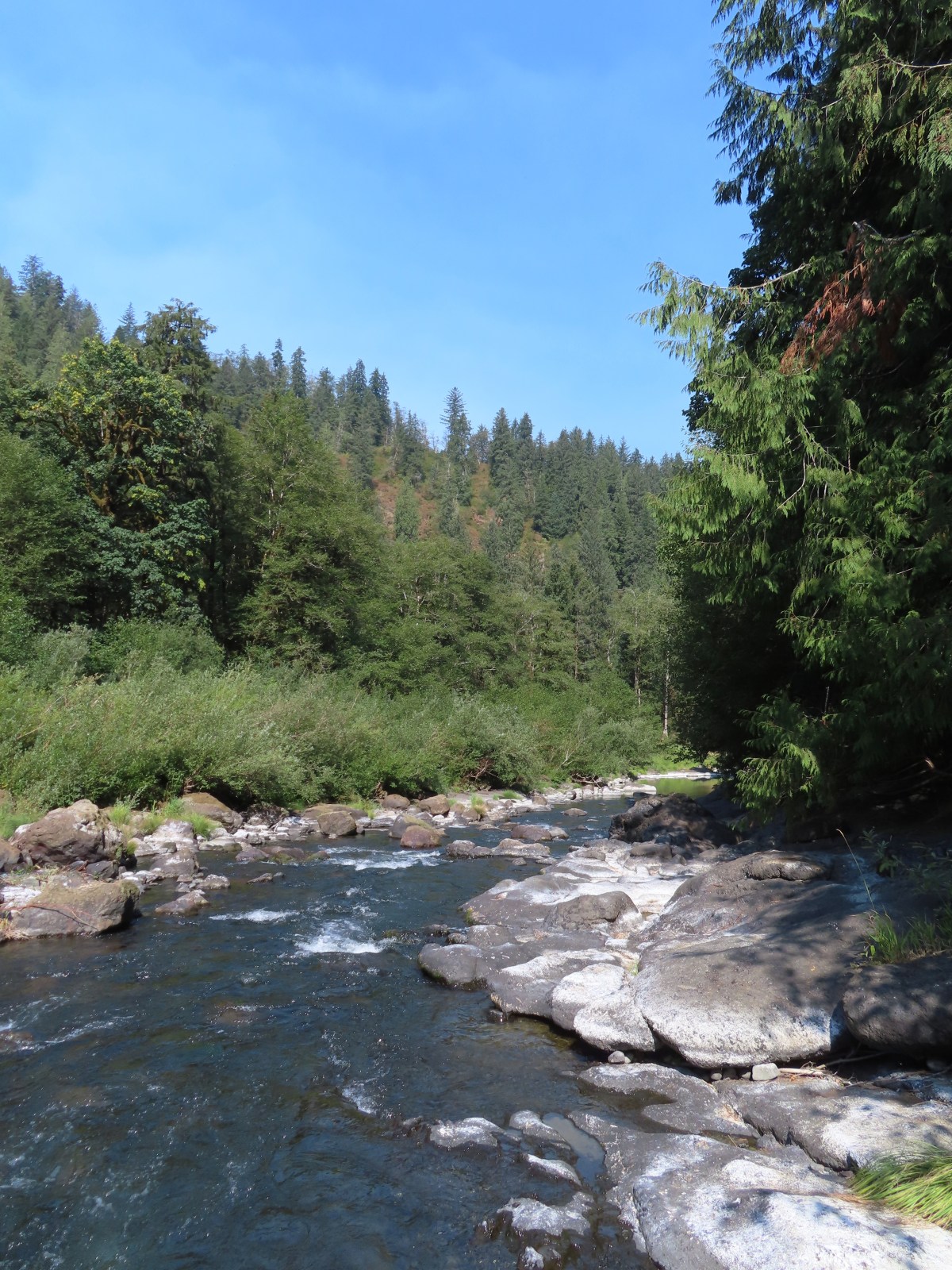
From the refuge we headed north on Highway 101 toward Tillamook but turned just before crossing the Trask River and making our way to the Peninsula Park Trailhead.

Part of the Tillamook State Forest the Peninsula Day Use Area offers a nearly 1-mile loop with views of the Trask River and picnic tables at the far end of the peninsula.

 Trask River from the trailhead.
 Garter snake near the trailhead.
It’s recommended to hike the loop counter-clockwise but we failed to pay attention to that hint and after staying right at the first trail pointer we forked left when the trail split again after 500′.
 We followed the pointer here and went right.
 Here we again followed the pointer and went left. We failed to notice the pointer on the lower sign not facing us. It was also hard to tell if the rocks were actually part of a trail or just a scramble route. Turns out they are “stone steps”.
Having gone left we quickly passed a short spur down to the riverbank.

 The inland clouds were breaking up giving us some nice blue sky.
 Ouzel
Ouzel

After exploring the riverbank we returned to the trail and continued on the loop.

 Big tree along the trail.
 Arriving at the picnic area.
The picnic area provides access to a small sandy beach at the Trask River Bend.


After a short break at the bend we started back. From the picnic area the trail climbed up the ridge, steeply at times following it to the high point then down to fork where we’d forked left.
 The trail to the left.

 Huge nursery log.
 It’s hard to see here but this section was very steep.
 Steps along the ridge.
 The stone steps looked more like steps from this direction.
 Arriving back at the trailhead.
Given the steepness of the trail along the ridge we could see why going counterclockwise would have been preferable, but it was a nice hike nonetheless.
Up to this point the only other people we had seen was another couple that arrived at Fort Yamhill as we were getting back into our car. That was about to change with our fourth stop of the day at the Rockaway Cedar Preserve.
The trailhead is located along Highway 101 north of Tillamook.


We wound up parking on the shoulder of the highway a short distance from the full trailhead (along with many other vehicles). We walked back along the shoulder to the trailhead and set off on the raised boardwalk.

 Skunk cabbage
 Bindweed
 While there were quite a few people visiting the preserve there were still moments when we had the boardwalk to ourselves.


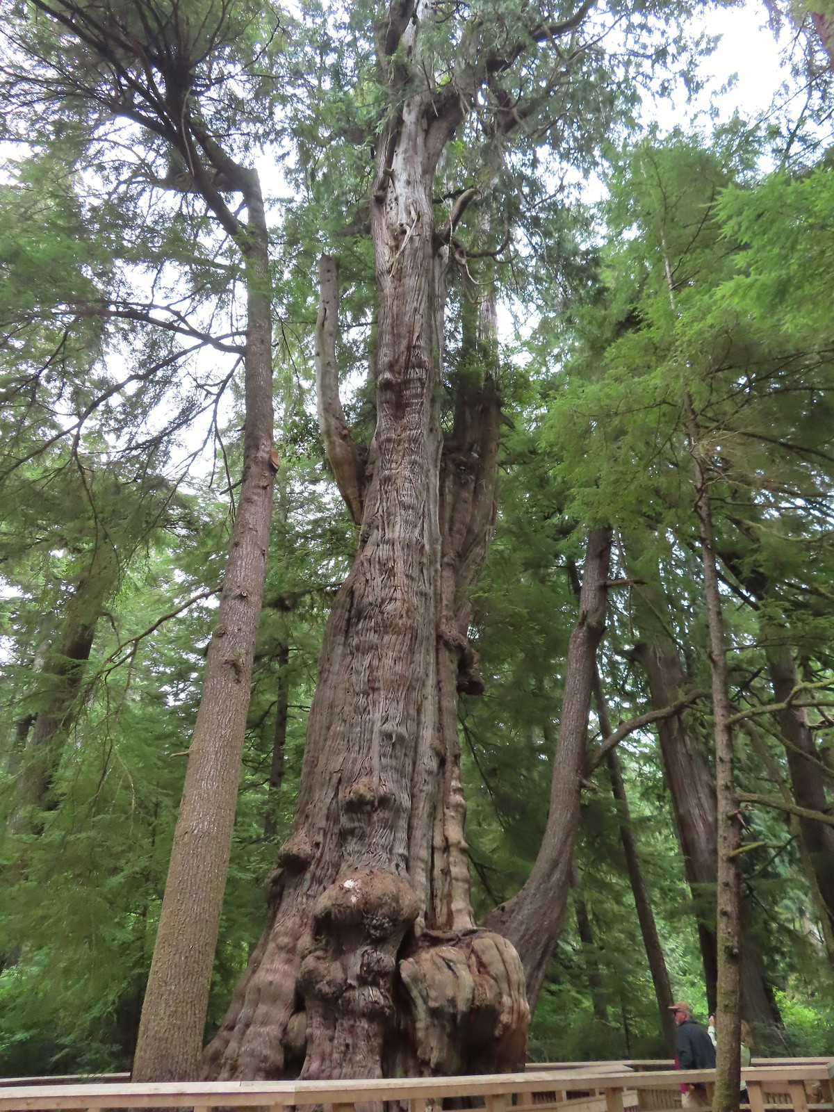
The half mile boardwalk ends at a 154′ tall western red cedar whose trunk has a circumference of 50′.


 Tree root along the cedar from another tree that is growing from it.

 Another big cedar, but not anywhere near as big as the other.
After admiring the huge tree we returned the way we’d come taking a short detour to the “viewing platform”.

 We passed a “hiker trail” pointer which is a reportedly rough, muddy track that links up to the boardwalk near the big cedar. We had seen the other end near the smaller big cedar but there was a “trail closed” sign at that end so we hadn’t even considered taking it.
 Interpretive sign at the viewing platform. There were some benches here which were mostly occupied and not much of a view.
 Salal
Salal
We returned to the trailhead and drove back south to Oceanside where we had planned for a final short hike, but as I mentioned earlier the Oceanside Beach State Wayside parking lot was full with multiple cars circling for spots and the road into and through Oceanside was also lined with cars. That was enough to convince us that our day was over. We will try Oceanside again during a less busy time of the year and likely as our first hike of the morning.
This was a shorter day with the four hikes totaling 6.8-miles with 700′ of total elevation gain. It had been a fun day with a very diverse set of hikes, all of which we would revisit.
 The trailhead locations around Tillamook.
We still have a few trips planned this year to complete featured hikes (post) so we are hoping for some rain over the next couple of months to help control the fires and knock down the smoke. In the meantime we will have to adjust to conditions as we go. Happy Trails!
Flickr: Ft. Yamhill, Nestucca WLR, Trask River Bend, and Rockaway Cedar