Categories
Hiking Northern Coast Oregon Oregon Coast Trip report

Cannon Beach

For our second day while staying in Gearhart we picked Cannon Beach as our hike. Located just 10 miles south of Gearhart on the other side of Tillamook Head we planned on starting at the city information center on 2nd St. and hiking south along the beach to a waterfall at Hug Point. The round trip would be just under 10.5 miles and allow us to be back to our hotel before the Seahawks played their first regular season game. (We might have been better off hiking based on the way their offense wound up playing.)

The clouds from the previous day were still breaking up as we left our room creating a nice sunrise over Saddle Mountain.

IMG_8216

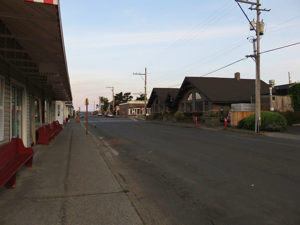
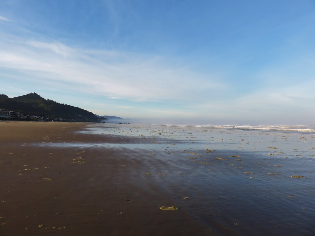
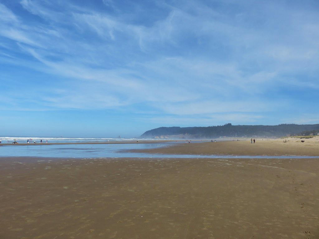
We drove south on Highway 101 to Cannon Beach, parked, and walked three blocks to the beach.

IMG_8218

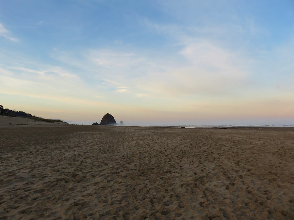
The morning coastal fog was rolling in somewhat obscuring the view of Tillamook Head to the north.

IMG_8225

IMG_8226

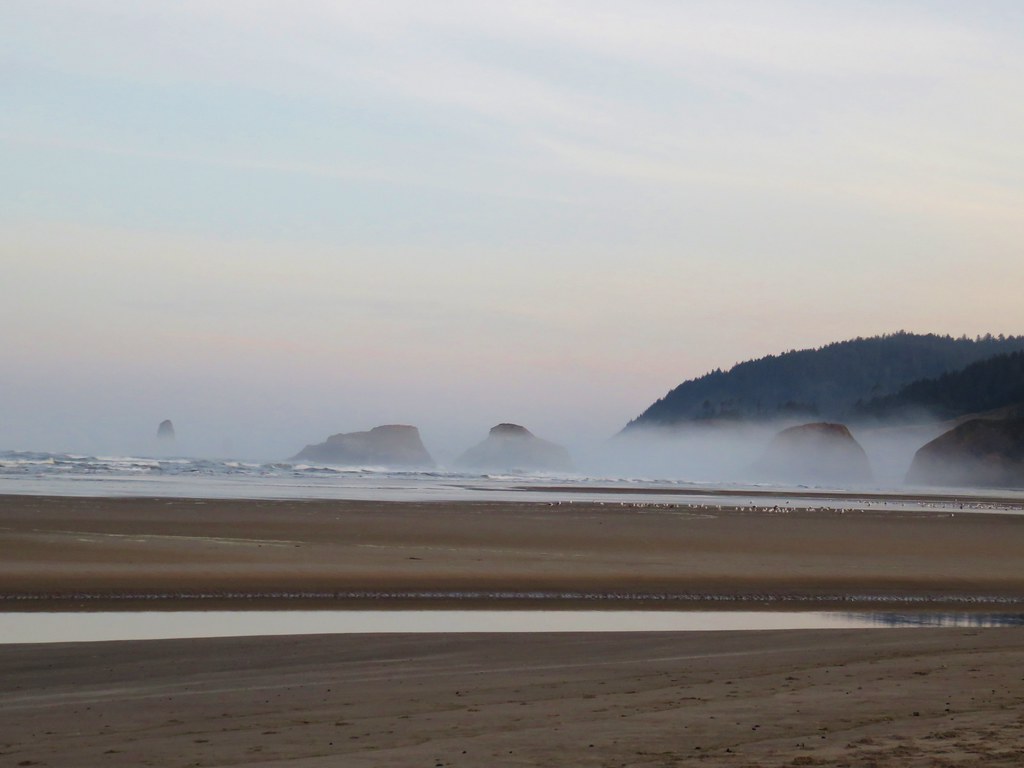
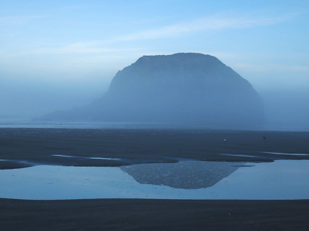
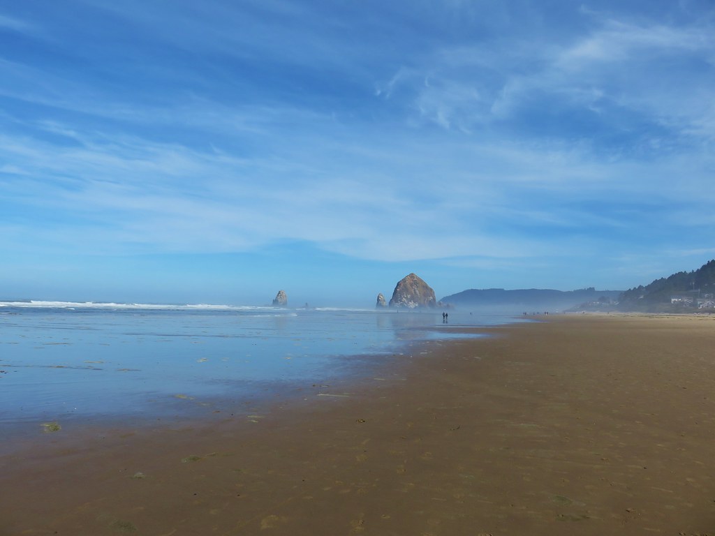
To the south Haystack Rock fared a little better although some of the smaller rocks around it were in the fog.

IMG_8222

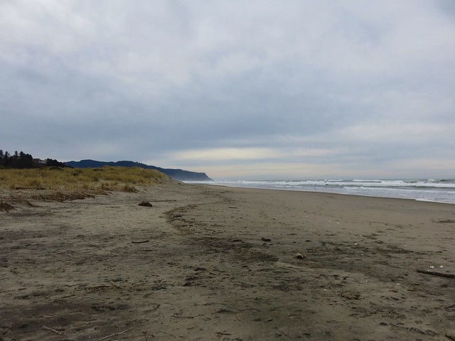
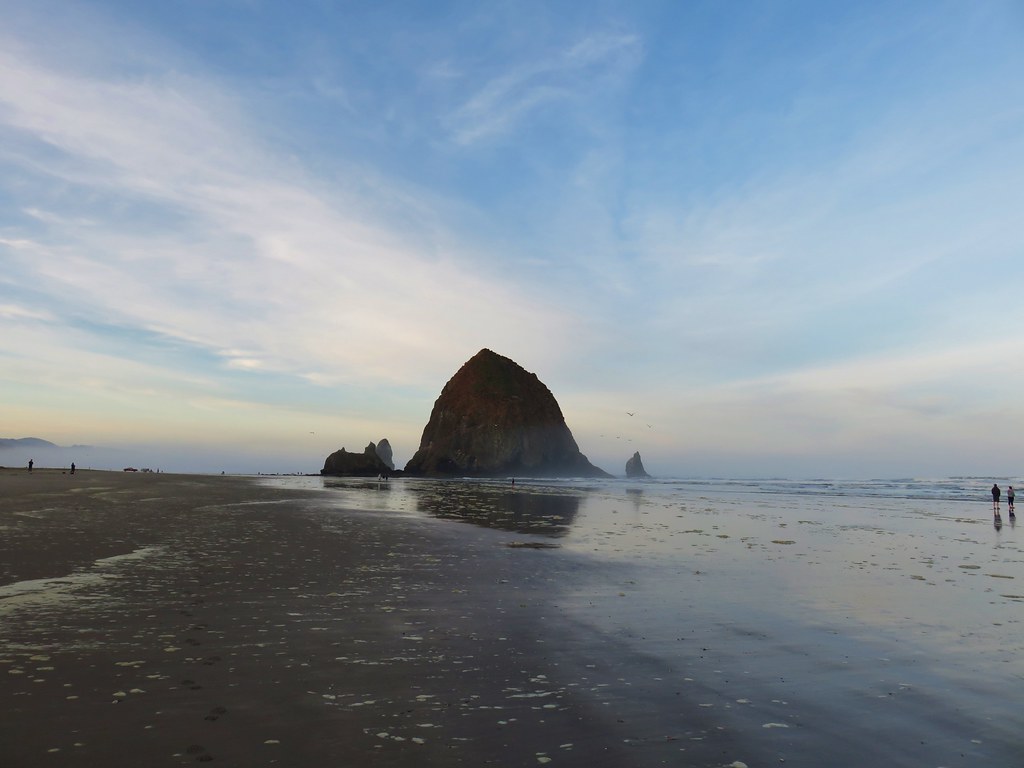
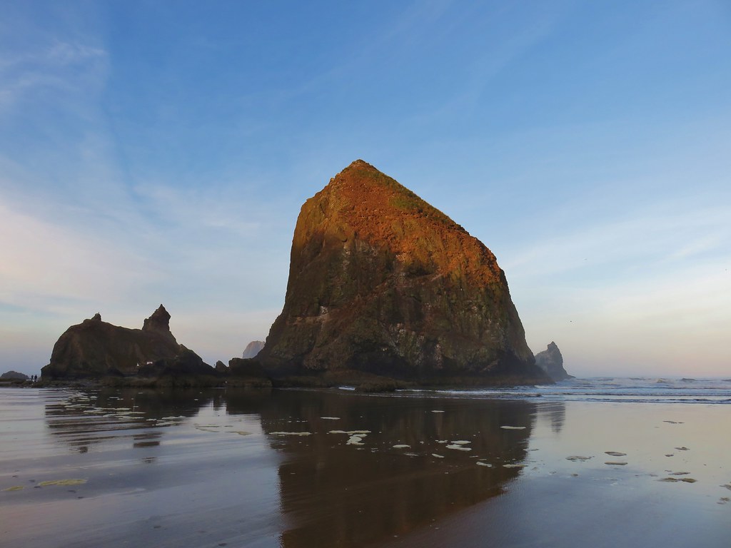
We turned south on the beach heading for Haystack Rock which was about a mile away. The rock began catching some early morning sunlight as we passed.

IMG_8228

IMG_8233

IMG_8239

IMG_8247

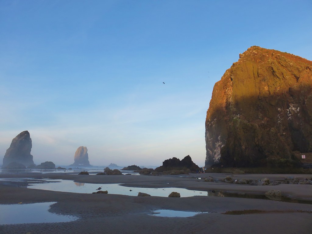
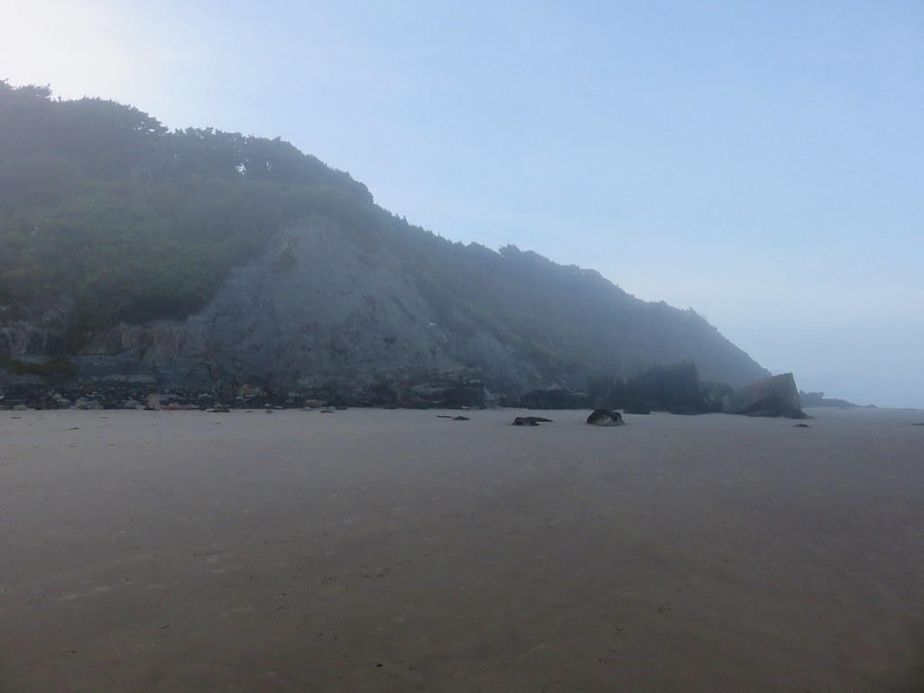
We continued on passing the Tolovana Beach Wayside on the way to Silver Point two miles beyond Haystack Rock.

IMG_8262

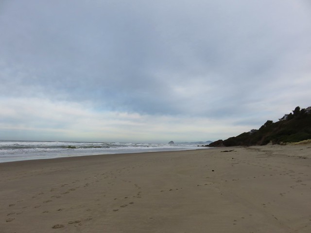
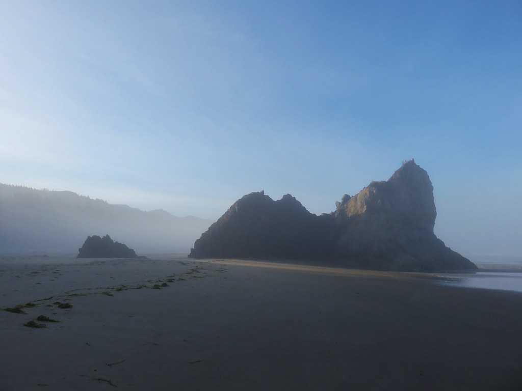
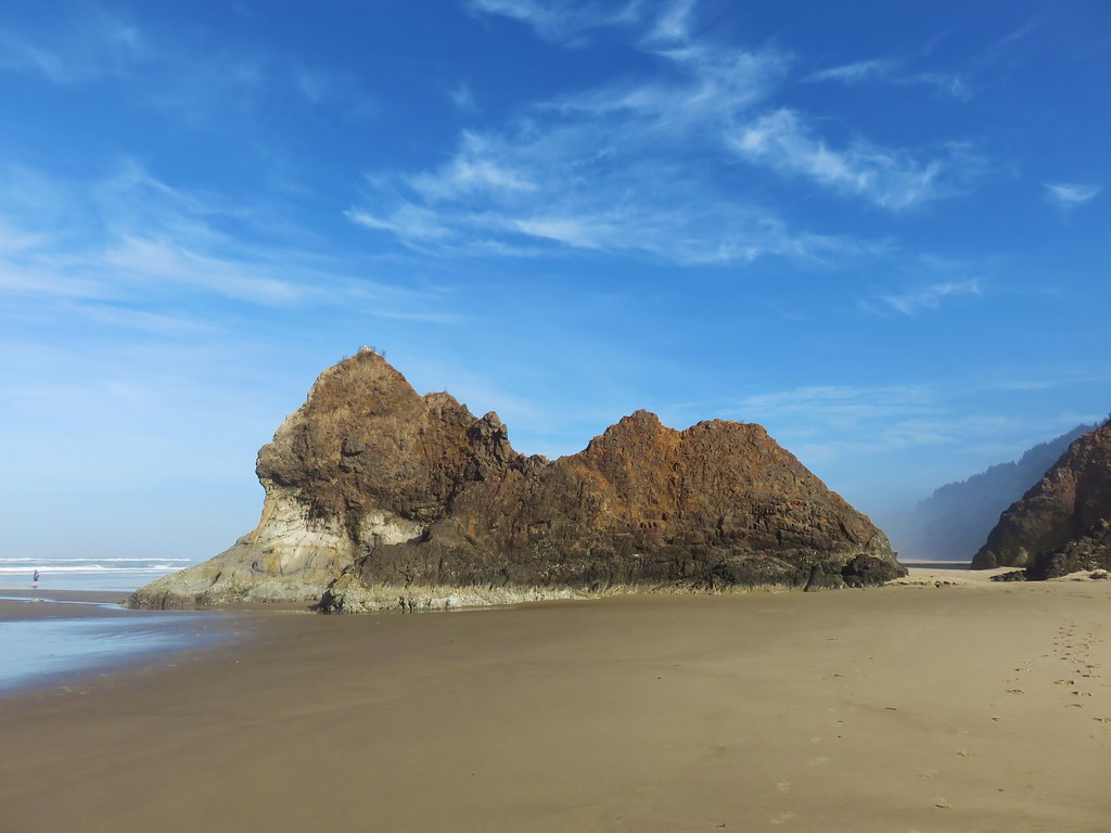
It was fairly foggy at Silver Point where we found several large rocks just offshore, including the aptly named Jockey Cap.

IMG_8272

IMG_8274

IMG_8282Jockey Cap

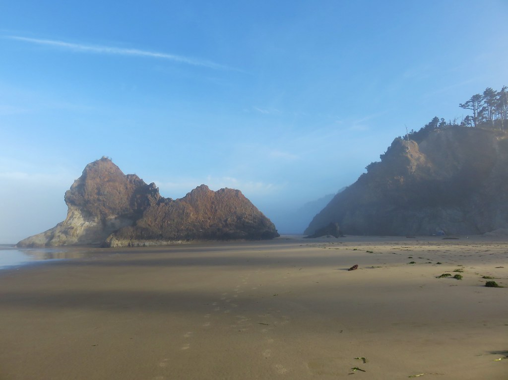
A little over a half mile after passing Silver Point we arrived at Humbug Point where we passed another well named rock, Lion Rock.

IMG_8286

IMG_8289

IMG_8296

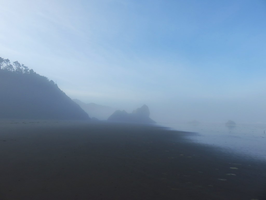
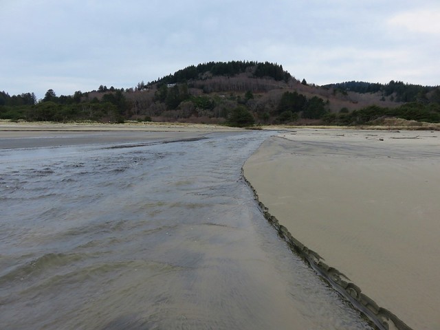
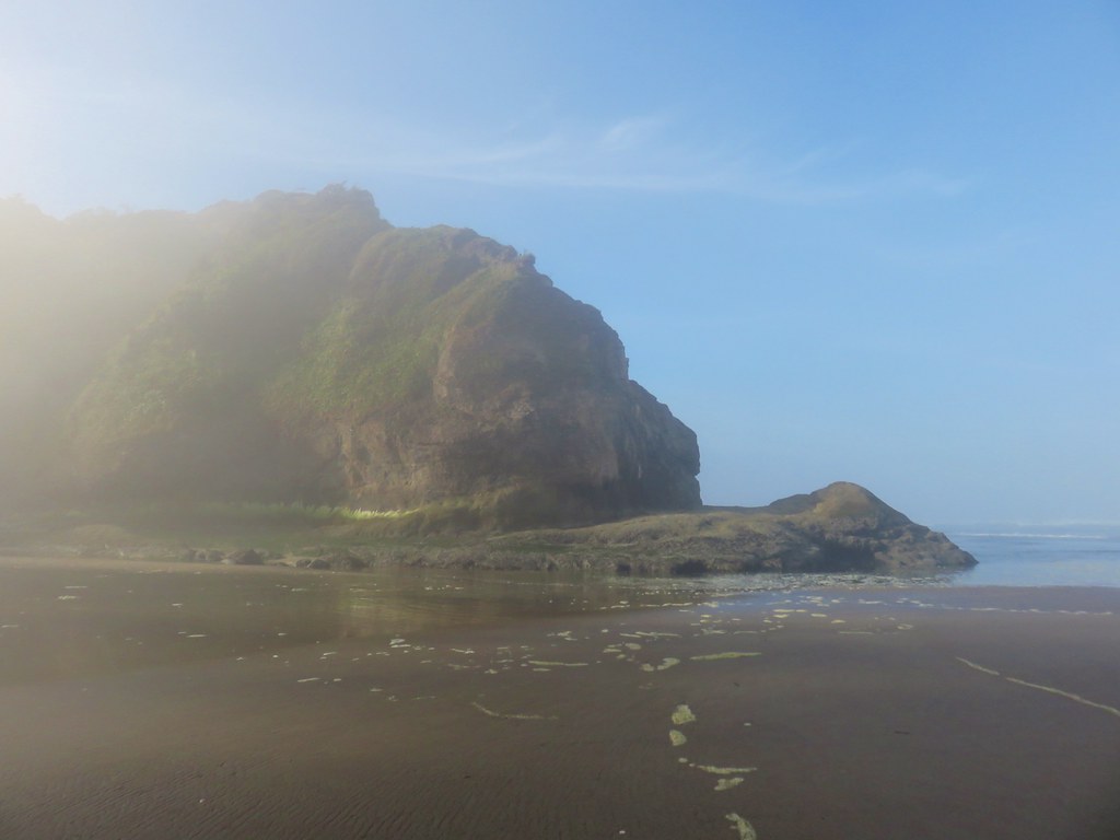
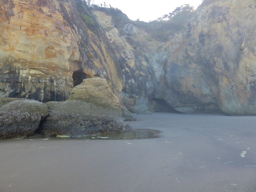
It was another mile to Hug Point which was also dealing with the morning fog.

IMG_8299

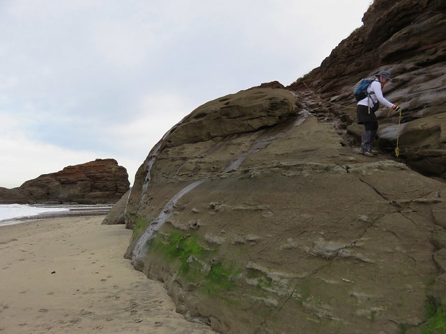
Hug Point was part of a wagon route where settlers had to wait for low tide to be able to pass by. A roadbed was blasted in the headland around 1920 which was still obvious as we approached.

IMG_8300

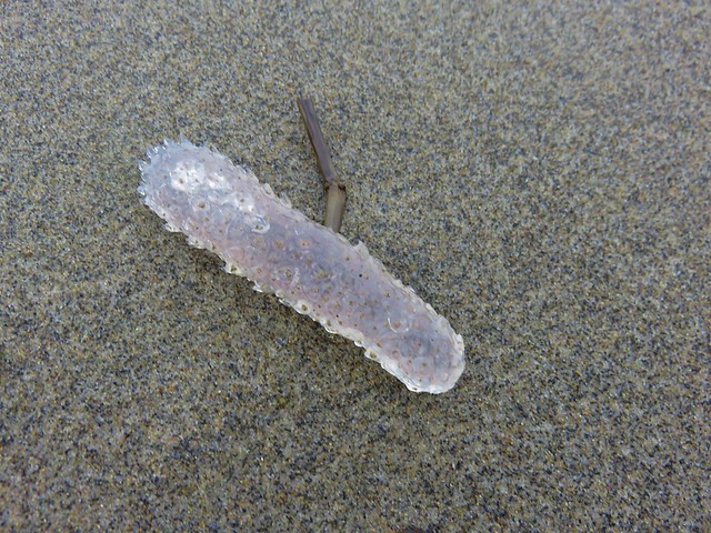
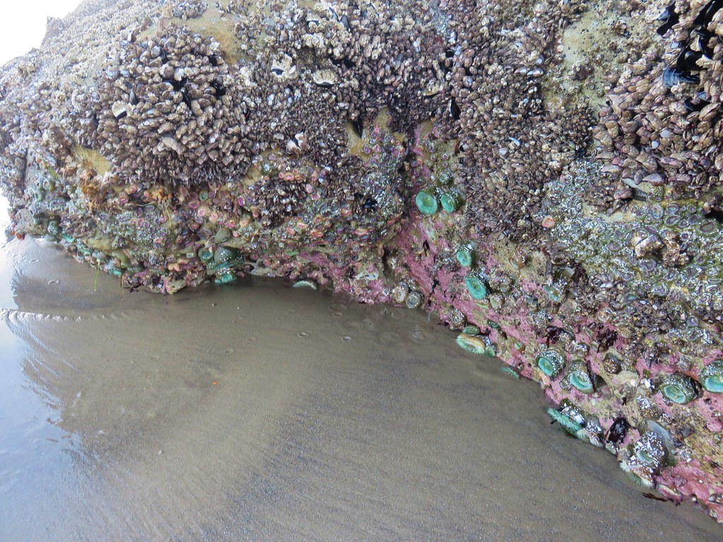
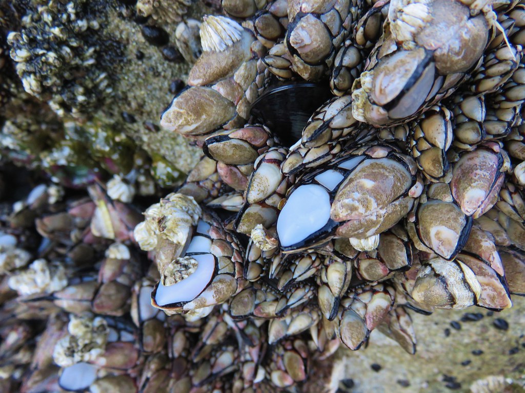
The other reason we had chosen this hike for the day is that low tide was around 9:20am which we figured was a little later than when we would be arriving. It was a little after 8:30 when we did reach the point and we could have easily stayed dry by crossing over on the roadbed but when we approached it we noticed a lot of marine life on the rocks.

IMG_8301

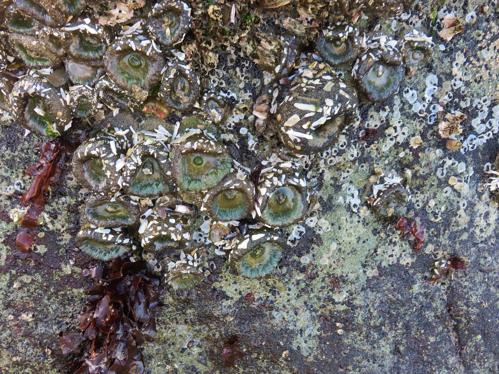
Instead of trying to avoid them we decided to take off our shoes and socks and wade around Hug Point. The water was about calf deep at its deepest so getting through was easy enough. One the other side we found more anemones and other marine creatures clinging to the rocks.

IMG_8304

IMG_8305

IMG_8308

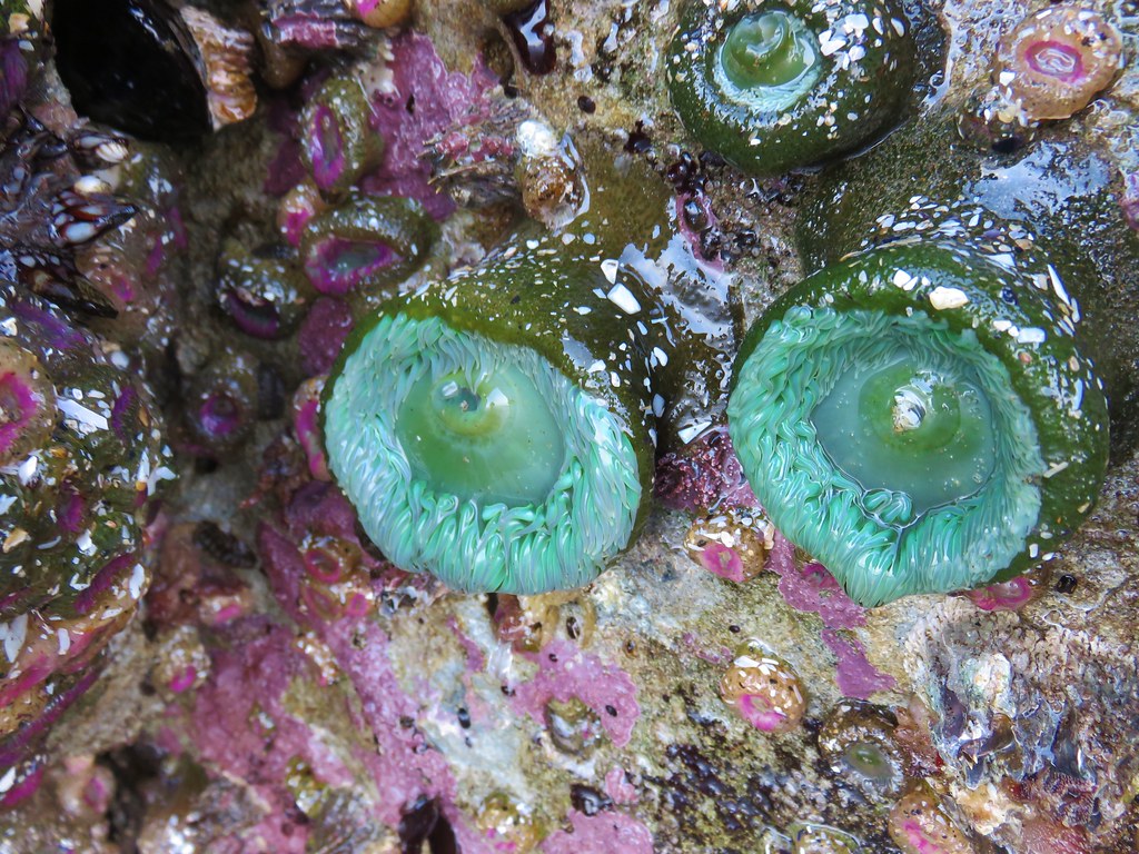
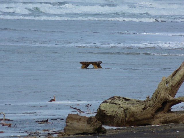
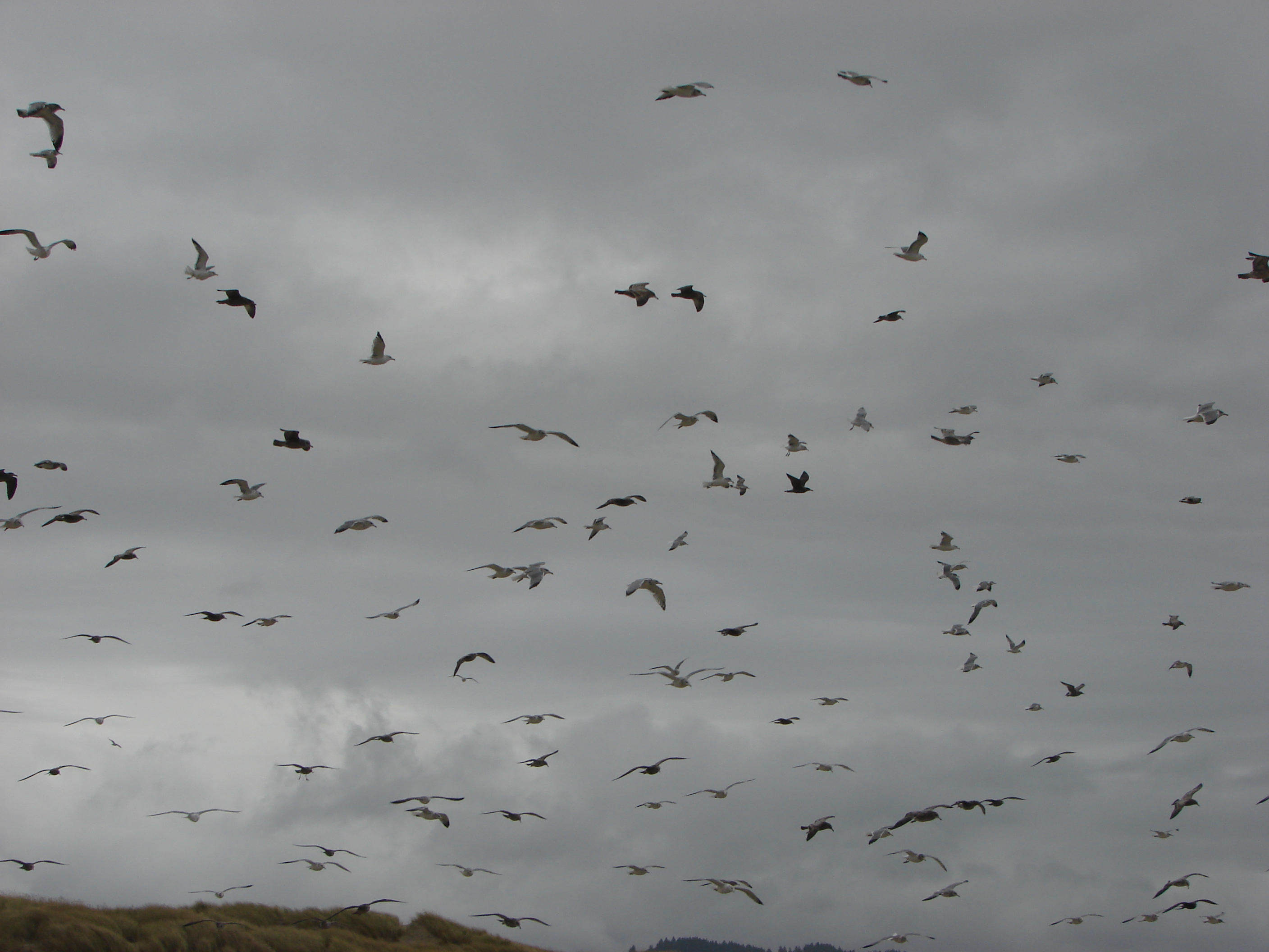
Seagulls seemed to be treating it as a buffet.

IMG_8310

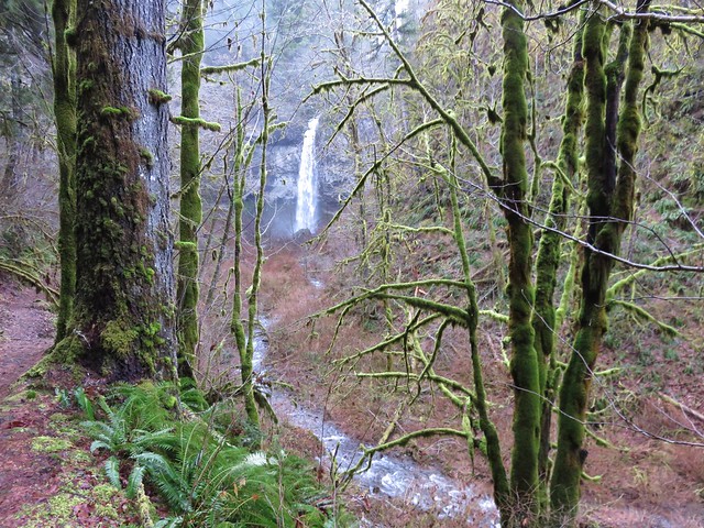
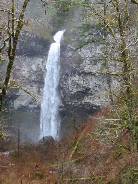
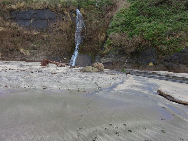
After passing a small cove we spotted the small waterfall on Fall Creek. It wasn’t exactly the best time of year to be visiting the falls but the water was still flowing.

IMG_8311

IMG_8315

IMG_8320

IMG_8322

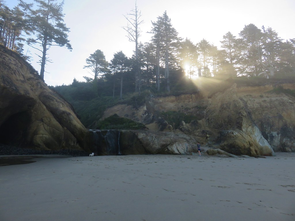
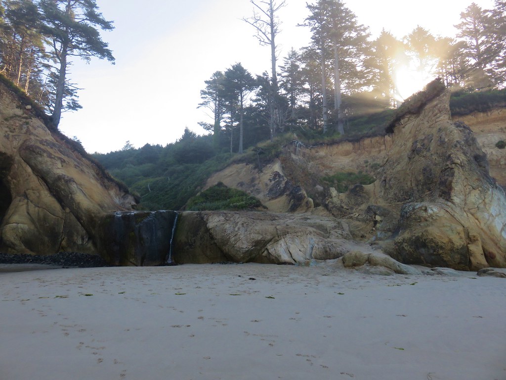
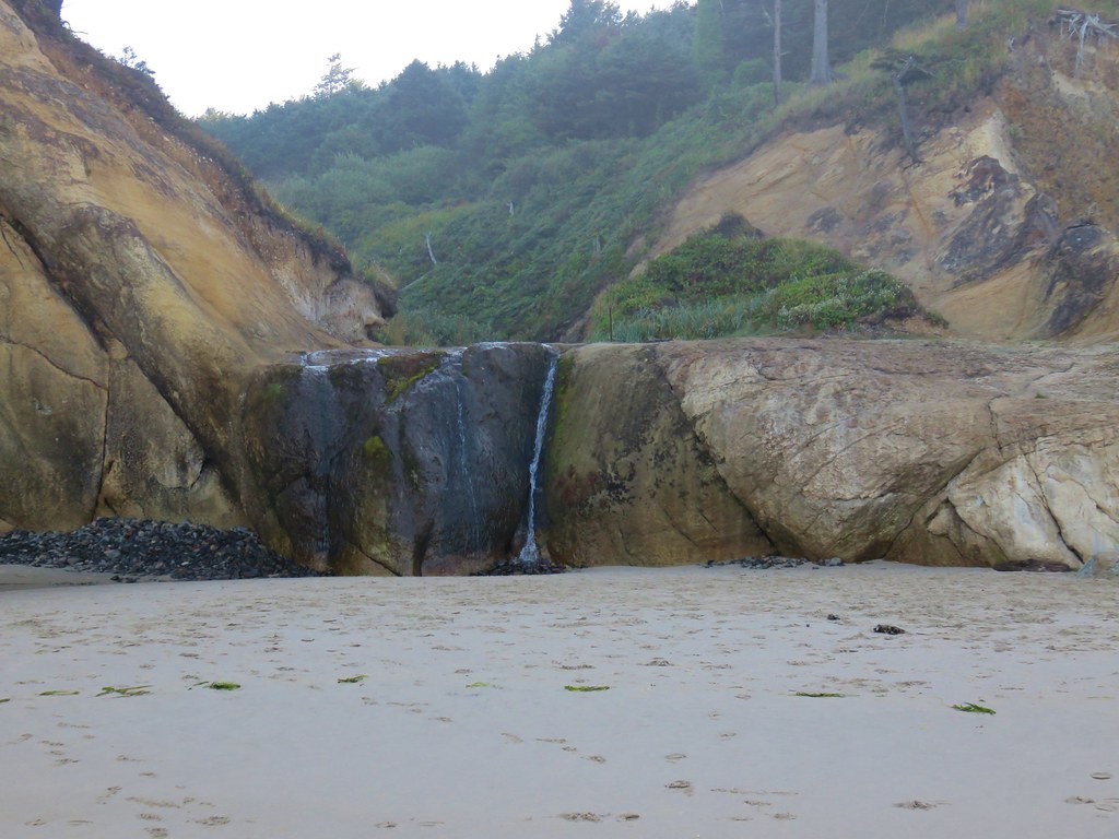
The falls can be accessed from the Hug Point Wayside which avoids the need to navigate around Hug Point. We’ll likely stop there some other time when the flow over the falls is greater.

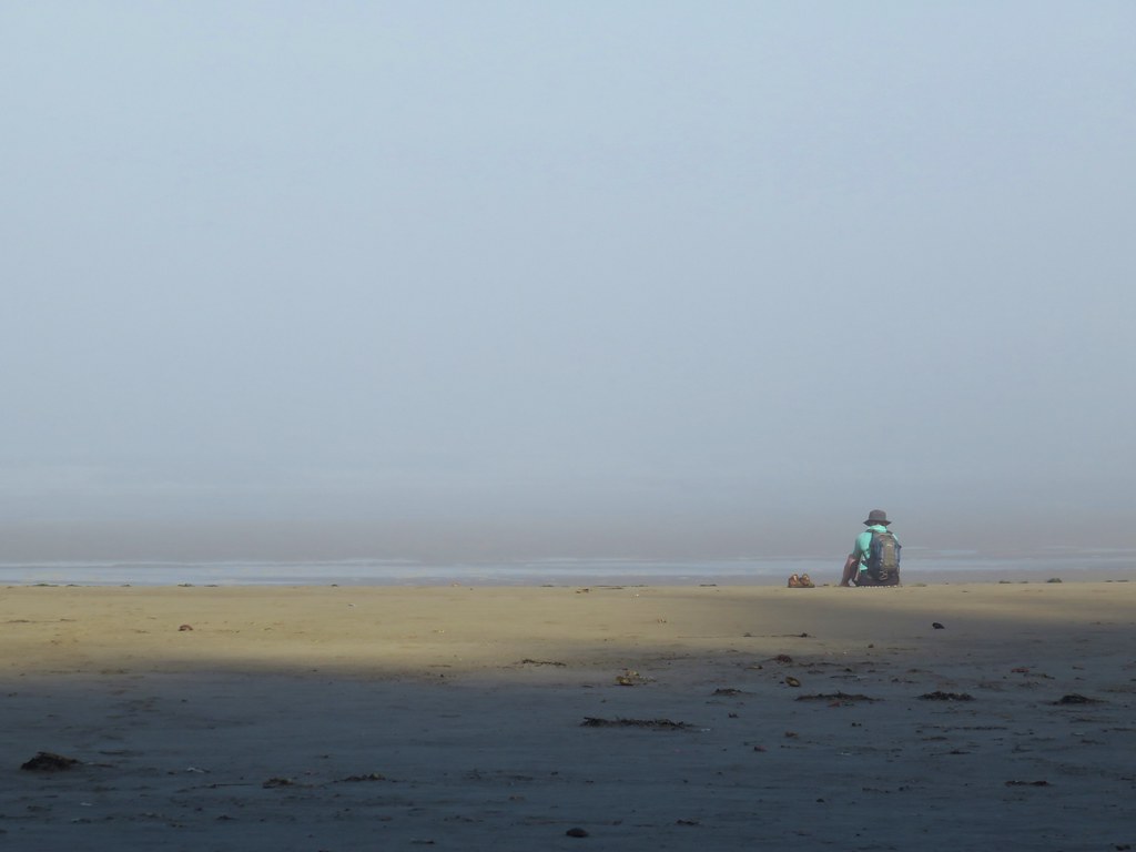
We turned around here and headed back. After another wade around Hug Point we pulled out our Therm-A-Rest Z Seats and took a seat while our feet dried.

IMG_8342

The clouds continued to break up as the morning progressed.

IMG_8345

IMG_8356

IMG_8359

IMG_8362

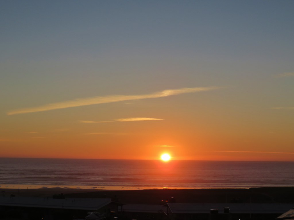
We finished our 10.4 mile hike just before 11am and headed back to the hotel for a relaxing afternoon of football. By the time the sun was setting most of the clouds had disappeared teasing a little more blue sky for our Monday Hikes.

IMG_8365

Happy Trails!

Flickr: Cannon Beach

Categories
Central Coast Coastal Range Hiking Oregon Oregon Coast Trip report

Niagara Falls and Neskowin

We took advantage of a favorable forecast and headed out for our February hike to visit a pair of coastal waterfalls and then the beach near Neskowin.  We’ve had a lot of snow and rain this winter making it a good time to catch the waterfalls assuming you can reach them.  The storms have left their mark on some of the trails and roads so we weren’t sure what to expect as we prepared to head out, but a quick check of the Forest Service website listed the Niagara Falls Trailhead as open so we were optimistic.

The Niagara Falls Trailhead is located east of Mt. Hebo in the Siuslaw National Forest. There was good signage along the route which took us  5 miles east of Blaine, OR on Upper Nestucca Road (Forest  Road 85) where we turned right onto Niagara Road (Forest Road 8533). A small herd of elk were grazing in the field at this turn.
IMG_8536

IMG_8538

We followed this gravel road for 4.3 miles. The road was in pretty good shape and had obviously been cleared recently. At the 4.3 mile mark we forked right following signs for the trail for another .7 miles to the trailhead.
IMG_8543

The mile long Niagara Falls Trail led downhill through a fern filled forest crossing a small creek three times on footbridges.
IMG_8545

IMG_8551

This small creek was flowing well enough to create its own decent, albeit hard to see little fall.
IMG_8553

As the trail leveled out along Pheasant Creek the first fall to come into view was Niagara Falls.
IMG_8556

IMG_8563

As the trail neared Niagara Falls an opening to the left revealed Pheasant Falls.
IMG_8576

A footbridge below Pheasant Falls brought us to a picnic table at the end of the Niagara Falls Trail.
IMG_8579

IMG_8582

IMG_8590

We returned the way we’d come. The 2 mile hike had been a nice warm up and now we were headed back to Highway 101 and then south to Neskowin.

We stared our second hike of the day at the Winema Road Beach Access which is located near the Wi-Ne-Ma Christian Camp. The beach access can be reached by driving .6 miles on Winema Road which is 4 miles north of Neskowin along Highway 101.
IMG_8604

From the beach the view south extended to Cascade Head and to the north to Cape Lookout beyond Haystack Rock.
IMG_8614

IMG_8615

Our timing wasn’t great as it was a little before 10am when we started and high tide would be just after 12:30 so it was already coming in. This meant we would not be getting to a couple of places that would have been accessible at lower tide. We headed north first for .4 miles to some rocks jutting out onto the beach. Along the way we passed a small waterfall that we had not been expecting.
IMG_8618

IMG_8619

At low tide it is possible to continue .6 miles to the mouth of the Nestucca River across from Bob Straub State Park but the waves were already reaching the rocks and we knew if we continued we’d be stuck until the tide went back out so after playing around on the rocks for a minute we turned around and headed south.
IMG_8621

We hadn’t gone too far to the south when we reached the outlet creek of Daley Lake which wasn’t mentioned in our guidebook. The only way across was to ford the creek, but luckily it was only ankle deep and not too cold.
IMG_8627

On the other side of creek was a picnic table that seemed really out of place. Heather noted that it appeared to be close enough that the ocean would reach it, although it wasn’t very close at that time. The rest of the sights were pretty typical of a beach walk. Driftwood, rocks, pieces of shells, seaweed, boats, sea birds, and lots of washed up garbage.
IMG_8628

IMG_8633

IMG_8624

There was something we couldn’t recall seeing before though. Large numbers of pickle shaped jelly fish looking things of various sizes.
IMG_8622

A little under 2.5 miles from the Winema Beach Access the beach became impassable due to the tide reaching the rock wall protecting the houses at Neskowin. Luckily the Mt. Angel St. access was located at the north end of the rock wall so we left the beach and walked inland to Breakers Blvd.
IMG_8634

We turned right on the paved street and walked for .7 miles to Carlton Ave. where we turned left toward the Proposal Rock Inn which was on the far side of Neskowin Creek. At the creek we turned right and followed it to Proposal Rock.
IMG_8638

IMG_8639

Our guidebook indicated it was possible to continue another .6 miles south to Cascade Head but the creek was far too swollen for us to ford it. Likewise we were unable to reach Proposal Rock due to it’s being surrounded by water.
IMG_8644

With the tide in we couldn’t walk back along the beach from there so we took the paved streets of Neskowin once again back to the Mt. Angle St. access. We then hiked back along the beach where we discovered that Heather had been right about the ocean reaching that odd picnic table.
IMG_8653

IMG_8654

IMG_8651

You just never know what you’re going to see along the Oregon Coast. Happy Trails!

Flickr: Niagara Falls & Neskowin

Categories
Central Coast Hiking Oregon Oregon Coast Trip report

Pacific City

It had been several months since we’d taken a hike along the Oregon Coast so for a change of pace we headed to Pacific City to check out Cape Kiwanda and Bob Straub State Park. We parked at the lot for Cape Kiwanda near the Dory Boat Launch and started our hike by heading over to the cape. Haystack Rock rose from the ocean just beyond the cape while seagulls patrolled the beach.
012

After a little exploration on Cape Kiwanda we retraced our steps and headed out to the tide pools next to the cape. The tide was out far enough to reveal several starfish and anemones.
038
We then headed south along the beach toward the Nestucca Spit and Bob Straub State Park. Vehicles are allowed on certain parts of this beach but only a couple came down and none stayed long. Several flocks of seagulls were gathered along the beach as well as a handful of other ocean birds.

Seagulls on the beach

Sandpipers
Sandpipers
Pelicans
Pelicans

When we reached the end of the spit we turned along Nestucca Bay to make a loop around the spit through Bob Straub State Park. More birds awaited us in the bay including some ducks and a heron.

Heron
Heron

Ducks
Ducks

We also saw many clam shells and a couple of nearly complete crabs. We enjoyed watching the seagulls pick up the clams, fly them into the air, and then drop them.

Seagull with a clam
Seagull with a clam

Clam shell
Clam shell
Crab
Crab

We originally missed the trail that would take us from the bay shore across the spit to a forested trail network. When we reached an impassable estuary we turned around and located the correct path. We found a surprisingly dense and scenic forest waiting for us in the middle of the spit. Moss covered the ground and many trees while bright colored mushrooms dotted the green carpet. A few flowers remained in bloom even as many of the leaves showed their fall colors.
168

169

178

There was a confusion of trails in the forest and absolutely no signs indicating where any of them went or which was the correct one to reach the park. We eventually found ourselves in a meadow along the Nestucca River. The trail we were on went down to a nice little beach along the river where it promptly ended. We turned back around and took a different path only to wind up arriving at the same meadow from a different direction. At that point we had already been on a couple of overgrown paths and I was getting a little irritated at the lack of signs. It was time for drastic measures so we turned to the gps and struck off on a faint game trail in the direction of the park. This worked out fairly well as we wound up popping out of a thicket of scotch broom on an old road less than 50 yards from the parks entrance road.

Scotch Broom where we emerged onto the old road

We walked to the parks parking lot and then followed a short trail back to the beach and headed back toward Cape Kiwanda. One the way back we encountered the largest flock of seagulls we’d seen all day. They took to the air as we passed by making for a scene straight out of the movie The Birds. As I was busy taking pictures I realized I was a sitting duck and should probably move before I was hit by a seagull bomb.
214

224
Despite the constant presence of gray clouds we had only had a couple of short bouts of rain until now. We escaped the seagulls only to be met with a sudden uptick in wind followed by a heavy sideways blowing rain. The rain let up just before we reached the Dory Boat Launch and our car where we dried off a bit and then walked across the parking lot to the Pelican Pub & Brewery for some lunch. http://www.yourlittlebeachtown.com/pelican
The food was great and the view out to Cape Kiwanda and Haystack Rock made for a perfect end to an interesting beach hike.
Happy Trails.

Facebook photos: https://www.facebook.com/deryl.yunck/media_set?set=a.10202353684630655.1073741860.1448521051&type=3
Flickr: http://www.flickr.com/photos/9319235@N02/sets/72157636339936434/