After a false start we closed out our 2019 hiking season with a bang on a 16.7 mile jaunt to three peaks near Wahtum Lake. We set off on Saturday morning for this hike but only made it 16 miles from our house where we wound up stuck on Interstate 5 for more than three hours due to an unfortunate accident that resulted in a fatality. By the time we were able to proceed it was too late for our liking so we took a mulligan and tried again the next morning.
Our next attempt went better and we arrived at the trailhead at the Wahtum Lake Campground just before dawn. A loan car was parked at the trailhead with just a bit of fresh snow on it from the night before. (We would find out later that he had spent the night at Mud Lake.)

After some deliberation regarding our planned route we settled on the following. We would hike down to the lake then go southbound on the Pacific Crest Trail to the Indian Mountain Trial and take it up to the summit of Indian Mountain. Then we would return to Wahtum Lake on the PCT and follow the Chindrie Cutoff Trail around the southern end of the lake and climb up to the PCT near the Chindrie Mountain Trail (This part of the plan wound up being changed but more on that later) and hike up to that summit as well. After tagging Chindrie the plan was to return to the PCT and go southbound once again to the Herman Creek Trail following it to the unofficial trail to the summit of Tomlike Mountain. Finally after returning to the Herman Creek Trail from Tomlike Mountain we would backtrack a few hundred feet to the Anthill Trail which would lead us back to the Wahtum Lake Campground.
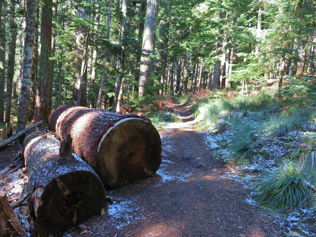
From the campground we took the Wahtum Express Trail down a series of slick looking steps entering the Mark O. Hatfield Wilderness along the way.


After dropping a little over 200′ in .2 miles we arrived at the PCT as it curved around Wahtum Lake.

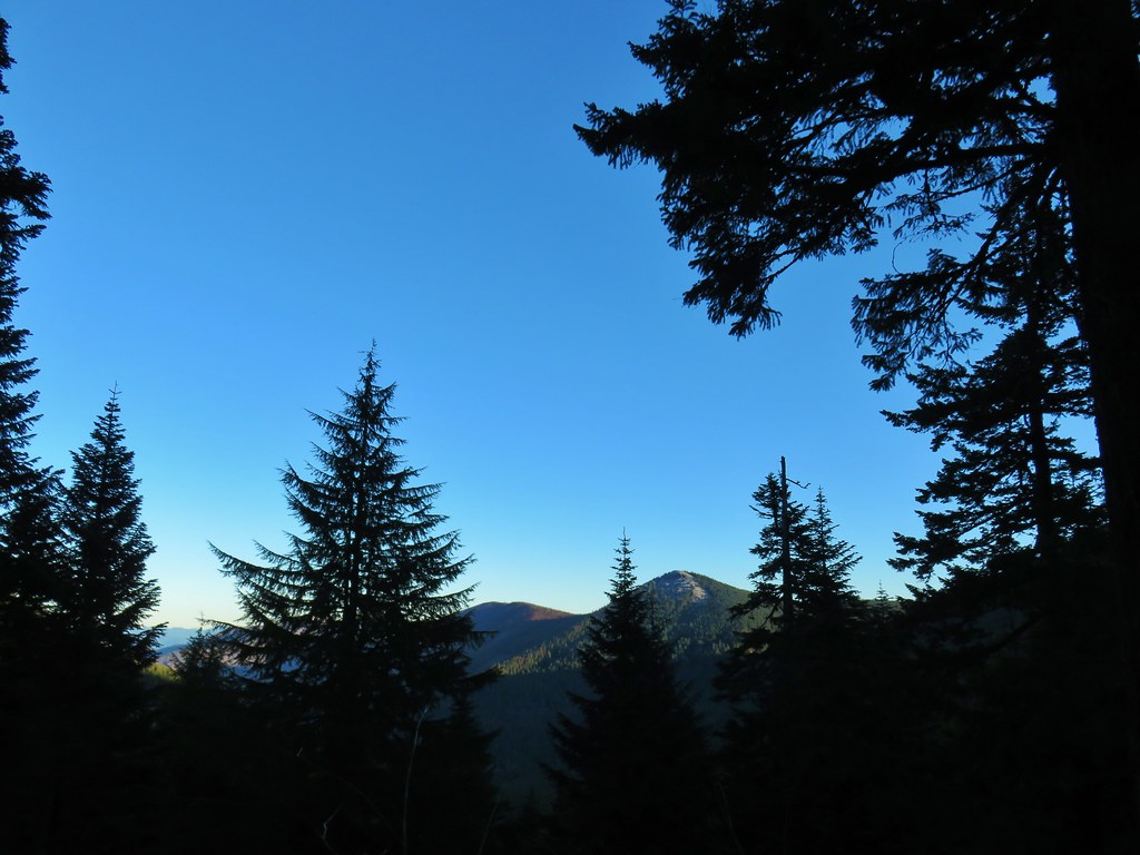
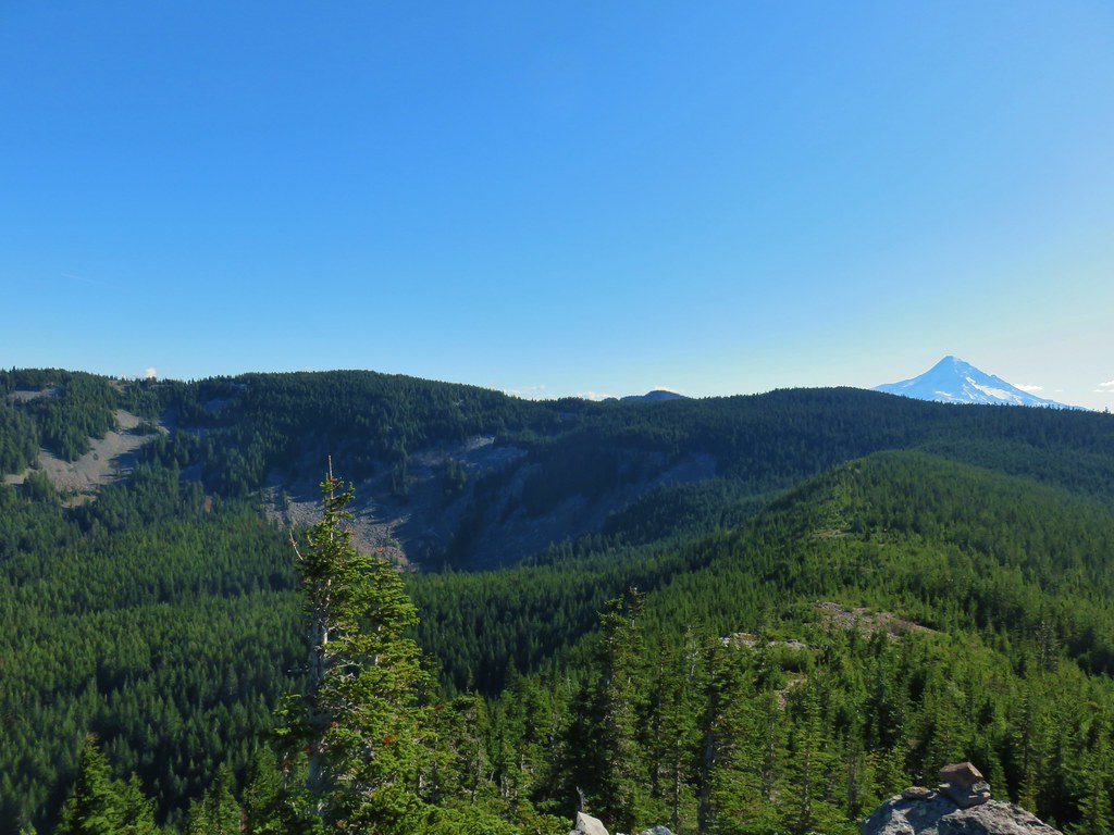
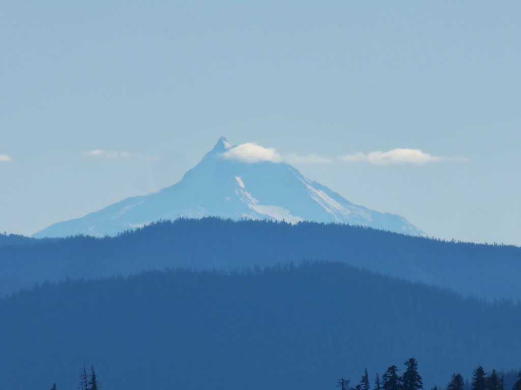
Before turning left (south) on the PCT we went down to the lake shore. It was a little under 30 degrees and a crisp breeze was making it feel even colder so we didn’t linger but between a small island and a section of snow flocked trees to the north it was a nice scene. Chindrie Mountain was visible across the lake to the SW.

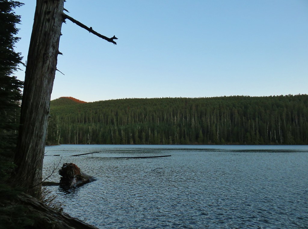 Chindrie Mountain from across Wahtum Lake.
We set off on the PCT passing a couple of additional nice views of the lake before arriving at a trail junction at the lakes southern end.


At the junction we noticed a closure sign for the Eagle Creek Fire closure area over the signs for our planned route to Chindrie Mountain.
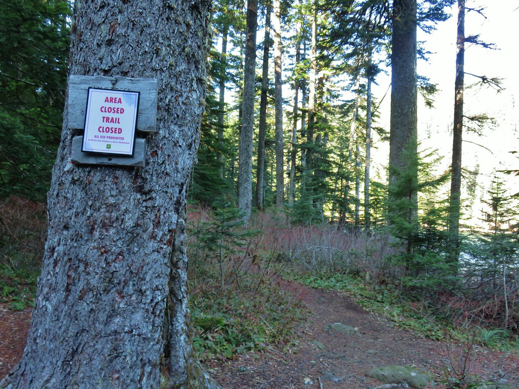
I admittedly hadn’t checked the Forest Service closure map in a while but it had been my understanding that the Eagle Creek Trail was closed at the junction with the Chindrie Cutoff Trail but I had expected this trail to be open. Being uncertain we altered our plans and decided to follow the PCT all the way around the northern end of Wahtum Lake on our way between Indian and Chindrie Mountains. According the mileage shown on our map that would and approximately three quarters of a mile to our day. Further research would confirm that it was indeed only the Eagle Creek Trail that was closed which was just over a tenth of a mile further along the Chindrie Cutoff Trail (it would have been nice if the sign had been clear about that).
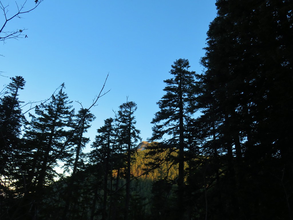
We continued south on the PCT gradually gaining over 400′ as we contoured along the side of Waucoma Ridge before arriving at the old Indian Springs Campground a little under 3 miles later. Along this stretch we had some additional views of Chindrie Mountain as well as Tanner Butte and Washington’s Table Mountain (post).
 Chindrie Mountain
 Tanner Butte
 Table Mountain

 Chindrie Mountain again.
We also got our first look at Indian Mountain and Mt. Hood .6 miles from Indian Springs after leaving the wilderness and popping out of the forest alongside Forest Road 660.
 Indian Mountain
 Mt. Hood
The presence of ice formations and a bit of snow here and there made the scenery even better.


 Crossing FR 660 near Indian Springs
 Trail sign at the junction with the currently closed Indian Springs Trail.
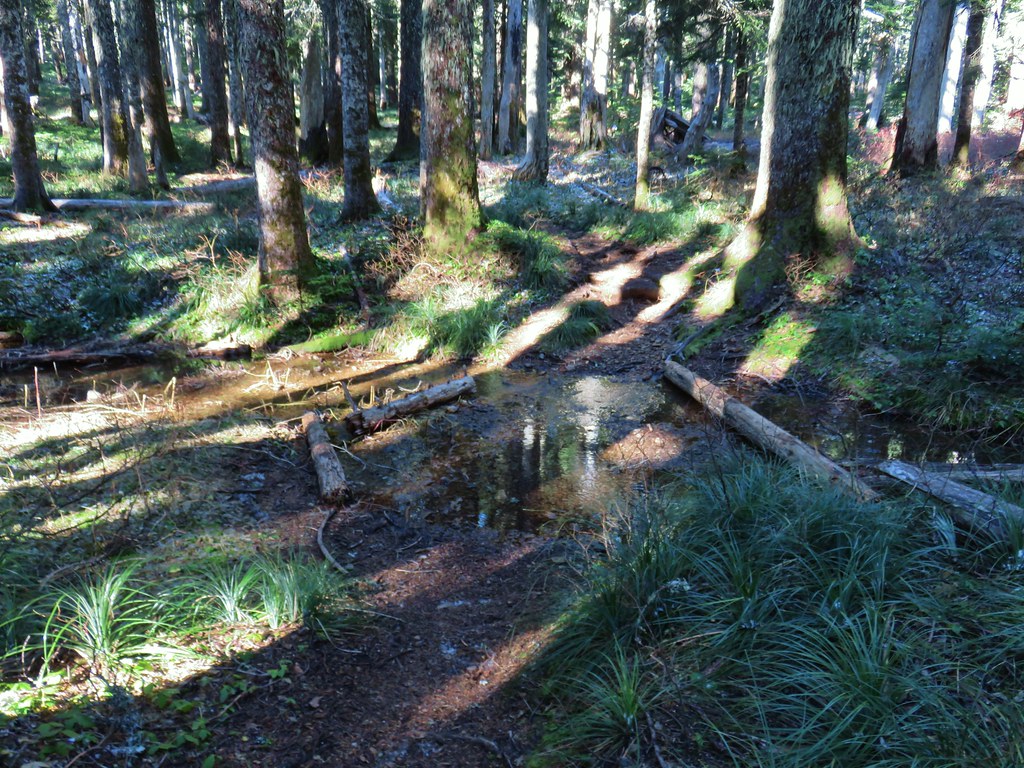
We continued south on the PCT for another third of a mile crossing a small stream before climbing up and around a treeless ridge where a frigid wind was steadily blowing.


The view from the ridge was spectacular. To the north the snow covered peaks in Washington were visible beyond Chindrie Mountain and to the south was our goal, the 4892′ Indian Mountain.


As the PCT rounded the ridge we came to the junction with the Indian Mountain Trail.


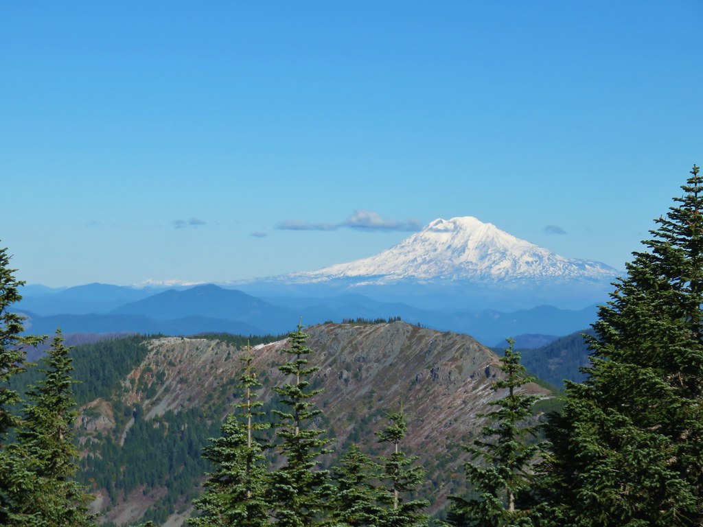
The wind was pushing us around a bit as we turned up the Indian Mountain Trail. As this trail climbed the open ridge the views just got better eventually leading to a decent view of Goat Rocks (post) between Mt. Adams and Mt. Rainier.

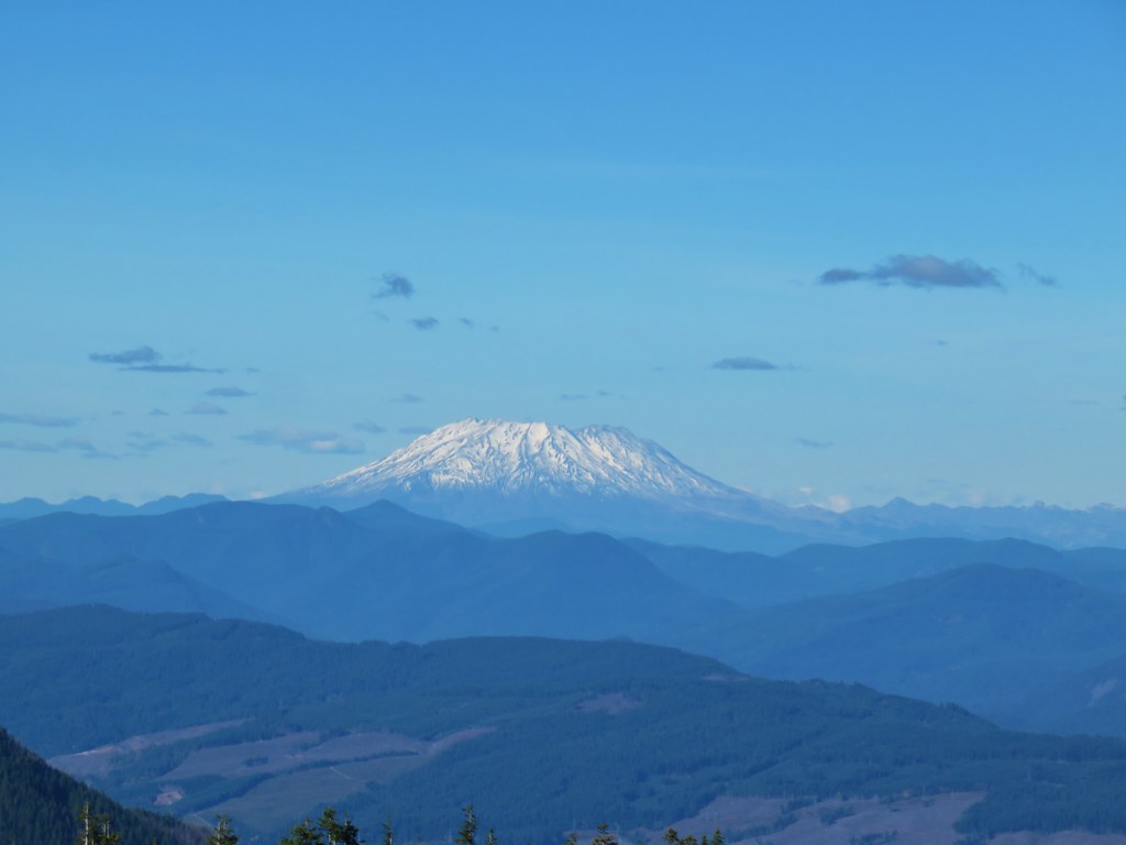
 Table Mountain and Greenleaf Peak with Mt. St. Helens in the background.
 Mt. St. Helens
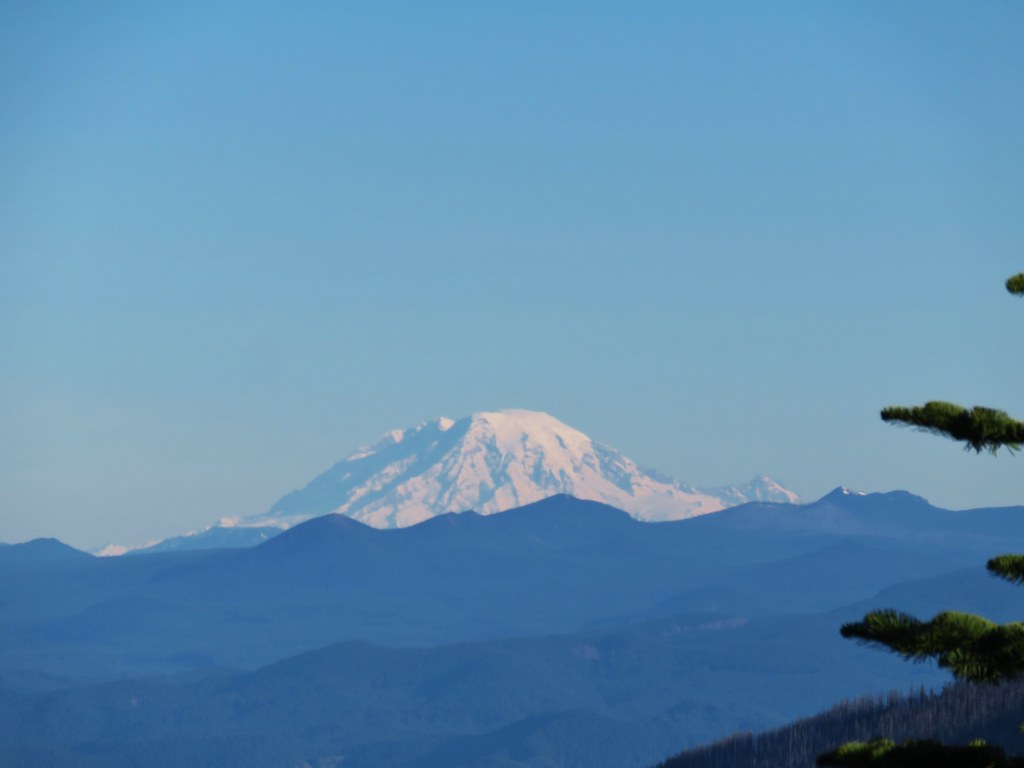 Mt. Rainier
 Goat Rocks
 Mt. Adams and Chindrie Mountain
The trail finally went back into the trees which gave us some relief from the biting wind.


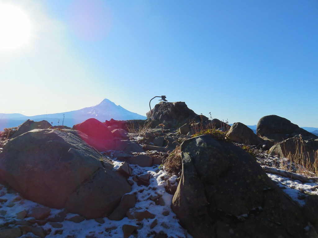
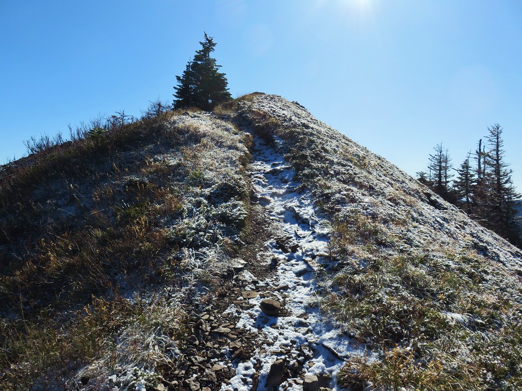
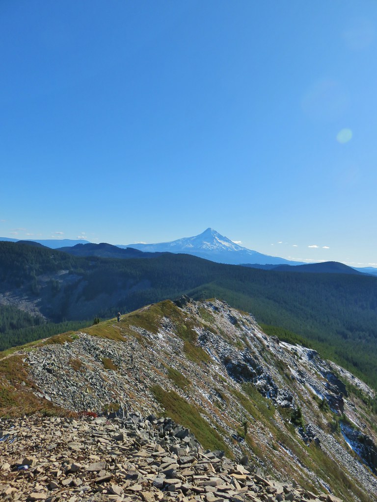
After passing remains of the former lookout (and bathroom) the trail climbed to the rocky summit a mile from the PCT.


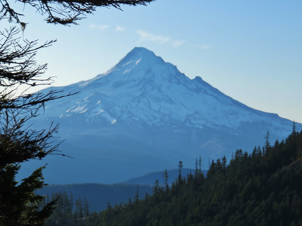
Given the time of day and year the Sun wasn’t in the greatest spot for pictures but the view of Mt. Hood was great and there was also a decent view further south to Mt. Jefferson.
 Mt. Hood and Mt. Jefferson
 Mt. Jefferson
 Mt. Hood from the former lookout site.
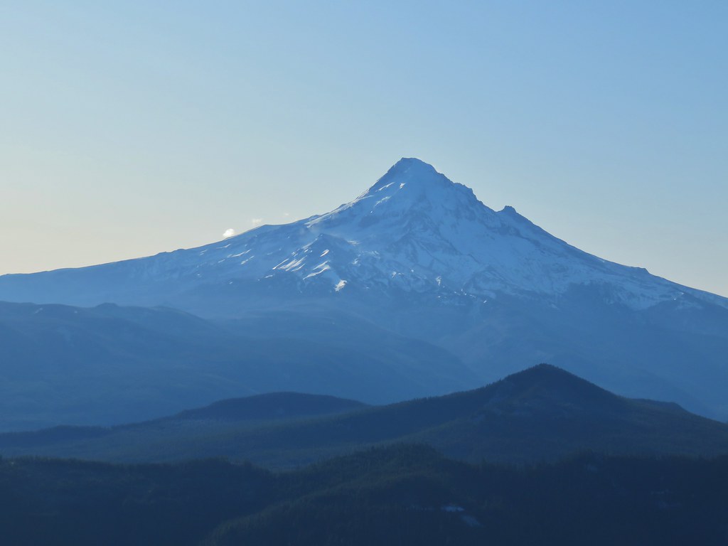 Mt. Hood with Lost Lake Butte (post) in front.
The snow and cold weather added some nice touches to the scenery here as well.
 Snow on the north side, green on the south.
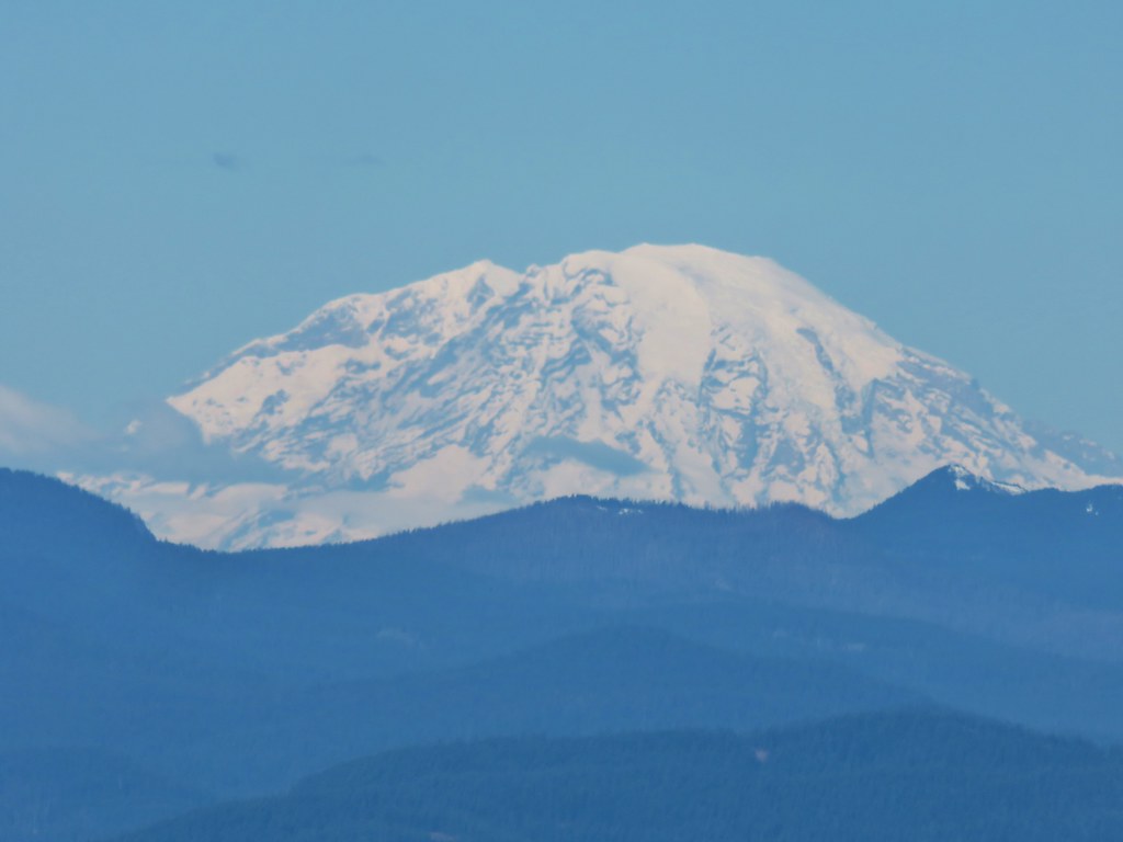
 Mt. St. Helens with some snow on the trees in the foreground.
 Crystals on a bush.
We headed back the way we’d come and arrived back at the junction with the Chindrie Cutoff Trail where we paused to see if we could find any indication that that trail was indeed open. With no confirmation in sight we erred on the side of caution and stuck to the PCT which began a gradual climb up and away from the lake beyond the Wahtum Express Trail.


We gained another 400 plus feet over the next 1.6 miles before arriving at a junction with the Herman Creek Trail.
 Stream crossing
 Herman Creek Trail junction.
We stuck to the PCT and promptly passed the junction with the Chindrie Cutoff Trail. At this end there was no closure sign signifying that we could indeed have taken the trail up from Wahtum Lake savings us about .7 miles (but at a “steeper” price).

Another 100 yards on the PCT brought us to a fork where the Chindrie Mountain Trail headed uphill to the right.


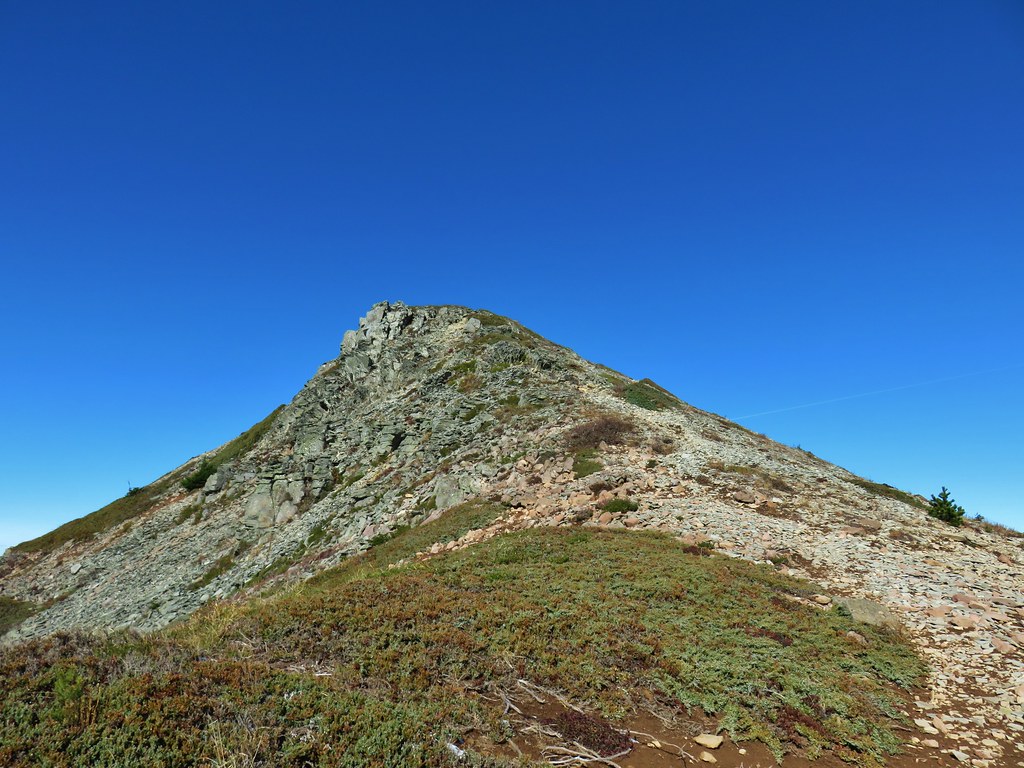
This .4 mile trail was the steepest we were on during the hike as it gained approximately 400′ on the way to the rocky viewpoint atop the mountain.
 Looking at the summit from the trail.
 Mt. Hood
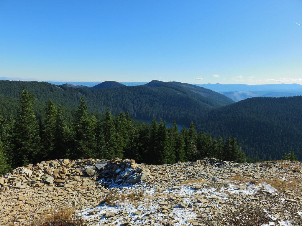
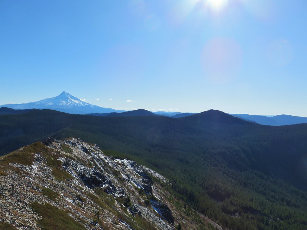
The 360 degree view included Wahtum Lake to the east below.

The view south included Mt. Hood and Indian Mountain (and some Sun glare).

Tanner Butte rose above the fire scarred Eagle Creek Valley to the west.

The best view, given the position of the Sun, was to the north where the Washington Cascades lined the horizon.

There was also a good view of the rock spine of Tomlike Mountain in front of Mt. Adams.
From the angle it looked like a pretty gradual ascent. It was a little breezy at the summit so we didn’t linger long because the wind was making it cold. We returned to the PCT and then to the Herman Creek Trail junction where we set off on that trail.

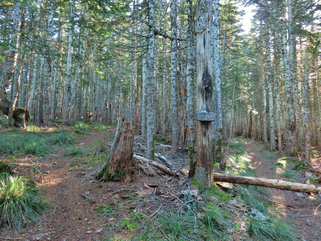
We had been on the lower end of the Herman Creek Trail before (post) but not this end. Here the trail climbed gradually through an open forest with with lots of beargrass.

After a quarter mile we passed the Rainy/Wahtum Trail.

 Lots of beargrass clumps.
About a mile from the PCT we passed another junction, this time with the Anthill Trail which we would be taking back to Wahtum Lake later.
Just under a tenth of a mile later the Herman Creek Trail made a hairpin turn before beginning a steep descent to Mud Lake. Here the unofficial trail to Tomlike Mountain headed out along the ridge to the left. A yellow “temporary” Forest Service sign at the junction identified only the Herman Creek Trail.
 Trail to Tomlike on the left.
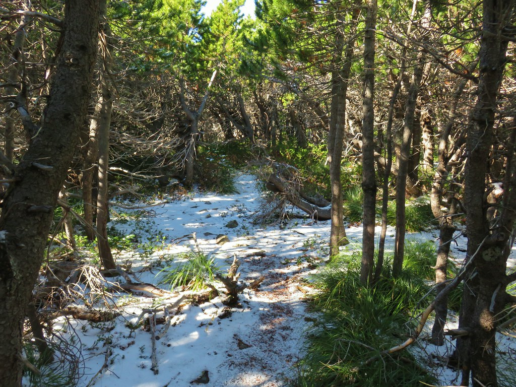
The trail began in the trees before skirting some cliffs above Mud Lake.

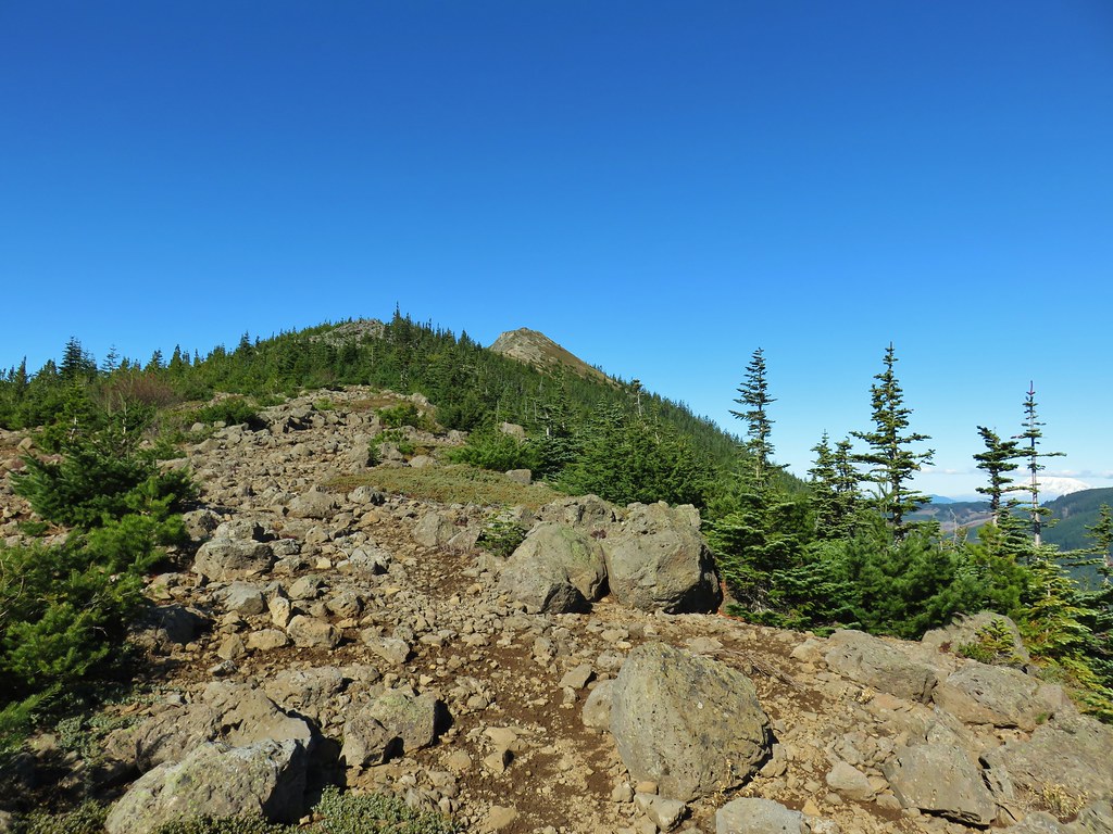
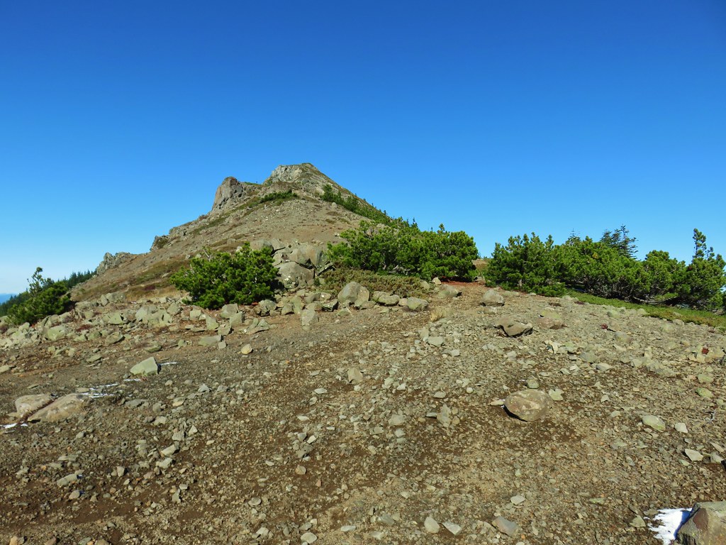
The trees began to give way allowing for a view ahead to Tomlike Mountain which from this angle looked like it might be a bit steeper of a climb than it had from Chindrie.

The other thing we noticed was that it looked further than the mile that the map showed between the summit and Herman Creek Trail. Sometimes it seems like it’s better not to be able to see your goal.

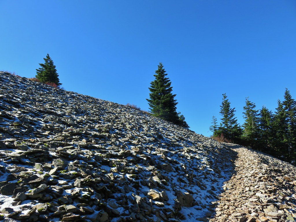
Much of the path was faint with occasional cairns or flagging marking the way. The rocky terrain was somewhat challenging given that we had, by this point, covered over 12 miles already.
 There’s at least one cairn here.
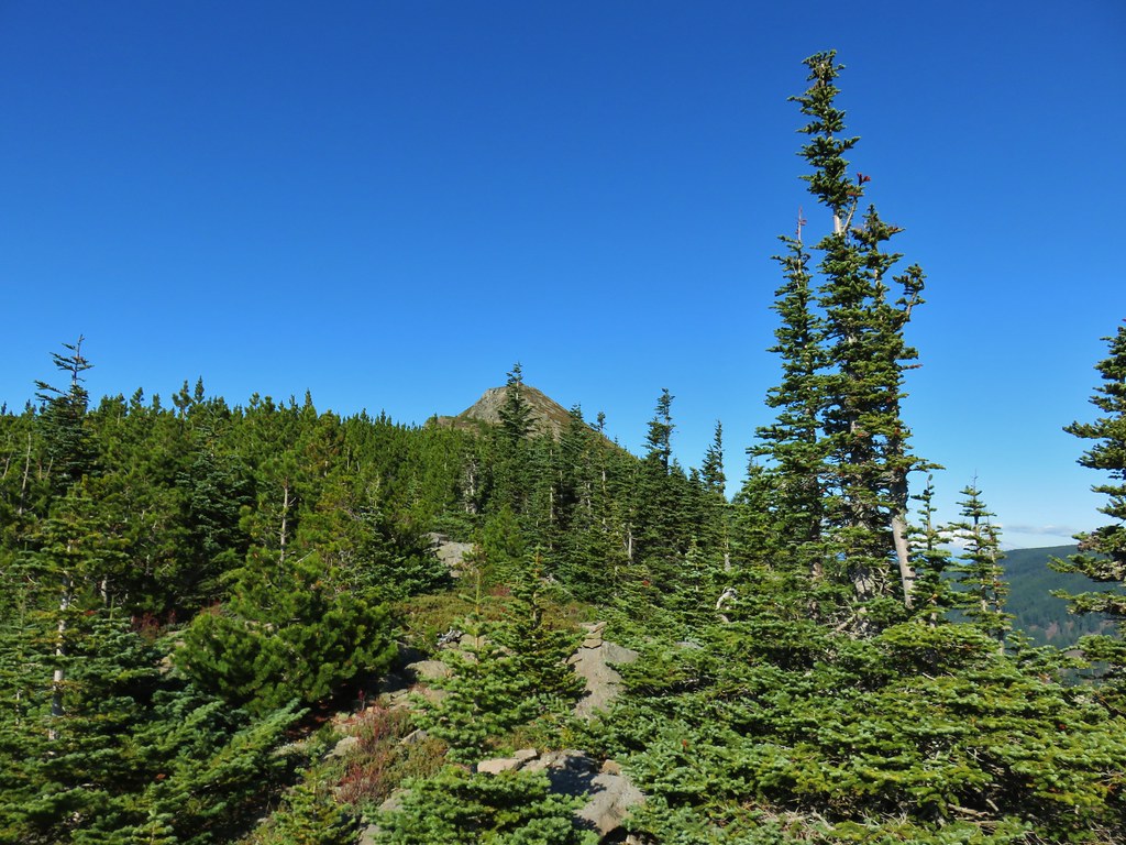
The higher we climbed along the ridge the more of Mt. Hood that was visible behind us.

After climbing up a pile of larger rocks the trail entered a patch of small trees which we found to be a fun little section.

The trail emerged from the little trees for the final time as it climbed to the rocky summit.
 Mt. Adams to the right.
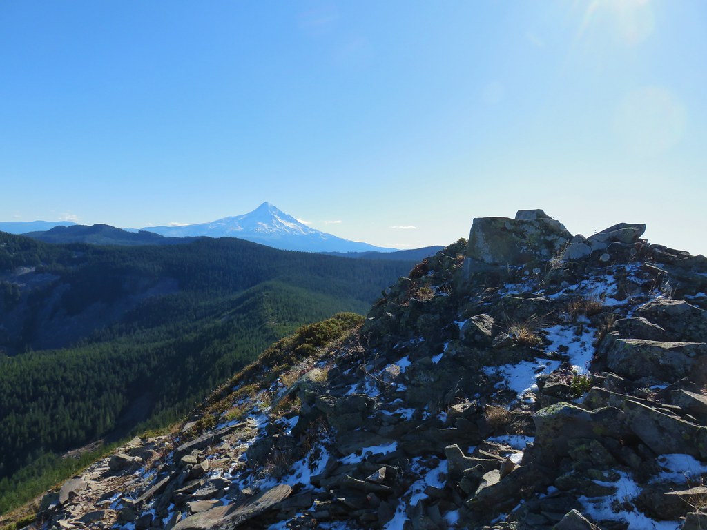
 Mt. Hood with Indian Mountain rising up behind Chindrie Mountain to the right.
 Heather crossing the ridge below the summit.
The trail continued for a bit beyond the summit although it didn’t provide any real different views.


 Mt. St. Helens, Mt. Rainier, Goat Rocks and Mt. Adams from left to right.
 Mt. St. Helens
 Mt. Rainier
 Goat Rocks
 Mt. Adams
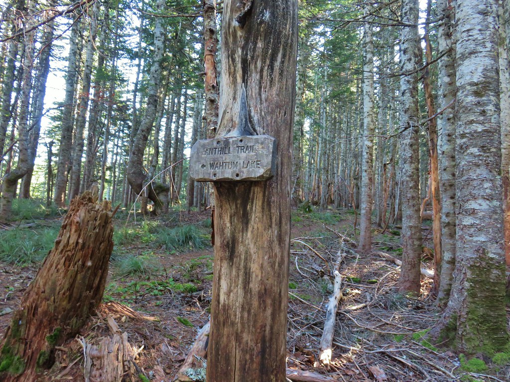
We left Tomlike Mountain and returned to to the Herman Creek Trail and then walked back to the Anthill Trial junction and turned up that trail for a final 1.9 miles back to Wahtum Lake.
 Anthill Trail on the left.
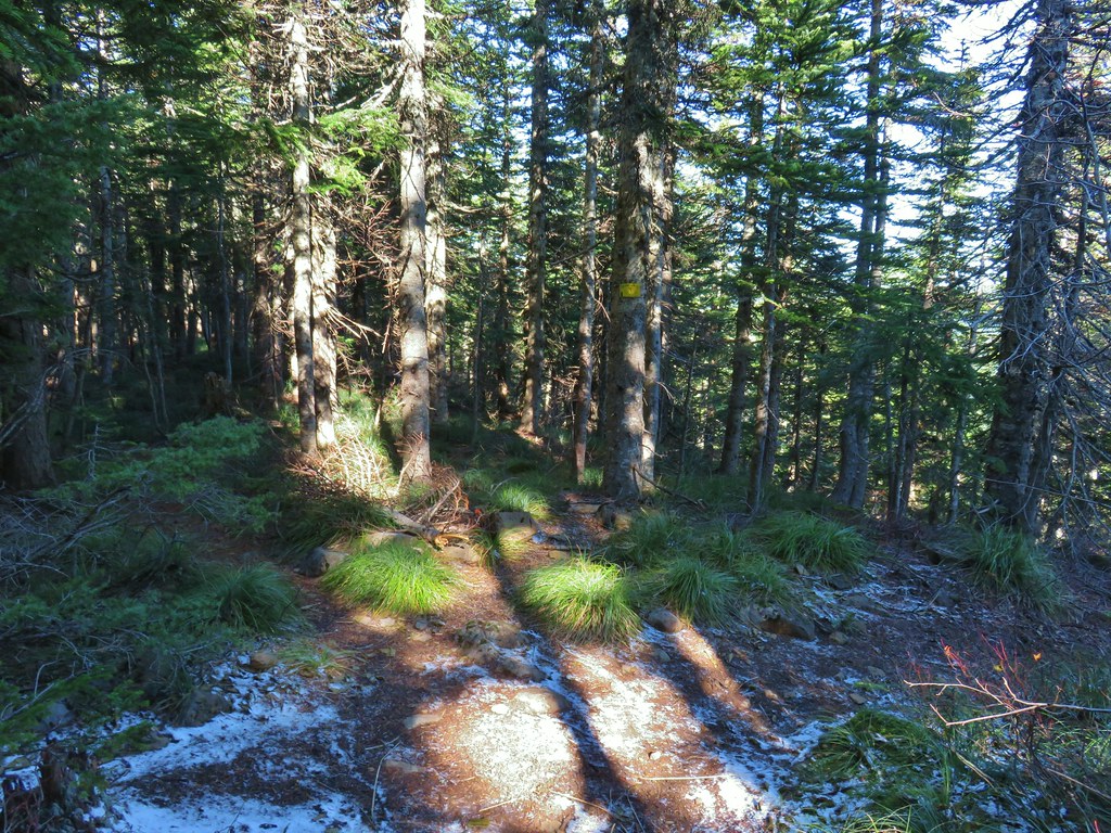
The Anthill Trail climbed for a half a mile to an old road bed which ran between Wahtum and Rainy Lakes.
We crossed the road and continued to climb gradually to a saddle where we crosed over a ridge and began a descent which included views of Mt. Hood, Mt. Jefferson and Wahtum Lake.


 Mt. Jefferson
 Wahtum Lake and Chindrie Mountain
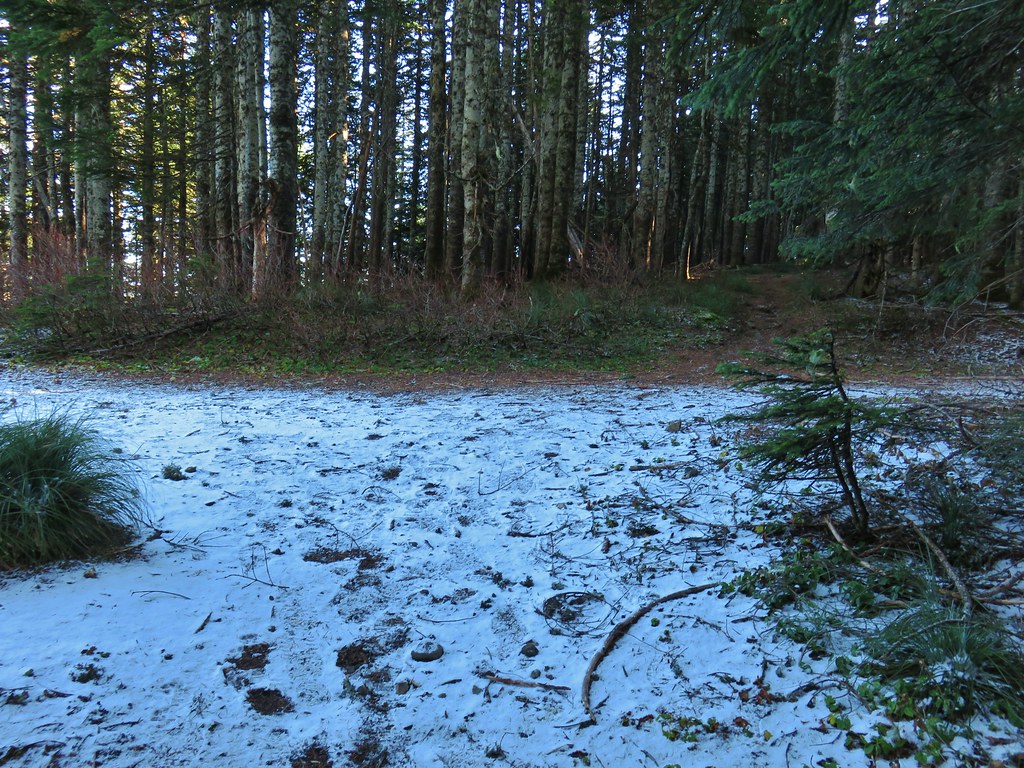
The descent was gradual until the final quarter mile or so where it steepend before arriving at the campground.


It was a great way to end our hiking season with a little snow on the ground and a lot of blue sky above. The persistent wind was a little chilly, but we had dressed appropriately so it wasn’t too much of an issue (my fingers weren’t pleased about having to come out so often for pictures). We plan on getting out a couple more times this year but it’s time to back off a bit and relish in the memories of some great hikes this past year. Happy Trails!
Flickr: Wahtum Lake with Indian, Chindrie, and Tomlike Mountains

5 replies on “Wahtum Lake with Indian, Chindrie, and Tomlike Mountains – 10/27/2019”
That’s a great hike. I love that area.
Nice trip. You really stretched the hiking season with this one. I expect you’ll be on snowshoes next time.
[…] Indian Mountain (post) […]
[…] #51 Wahtum Lake – Hiked 10/26/2019 […]
[…] Starting at the green up to the left is Augspurger Mountain (post) and Dog Mountain (post) on the Washington side of the Columbia River Gorge. Mt. Defiance (post) is the high point on the Oregon side with Mt. Hood to the right. The three lower peaks to the right of Mt. Hood are Tomlike, Chinidere, and Indian Mountain (post). […]