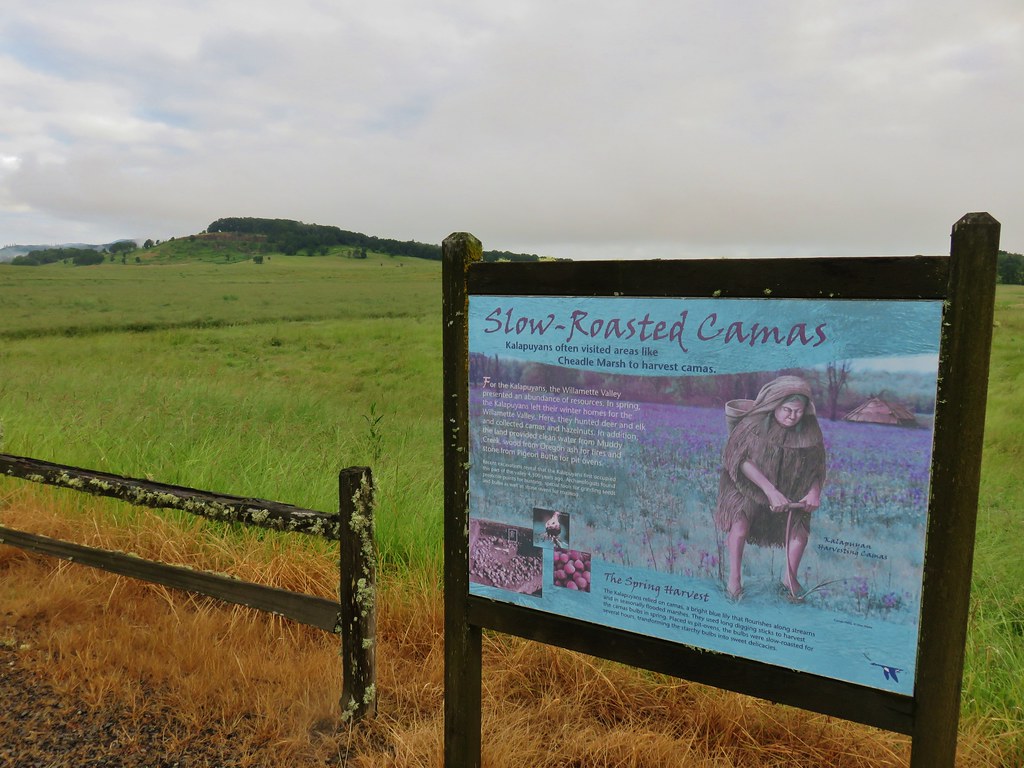
A cloudy weekend forecast had us looking for a hike that was not only open with the ability to properly social distance, and was also not view dependent. This led us to revisit the William L. Finley National Wildlife Refuge which is open except for the main entrance road, Finley Refuge Rd; was closed to vehicles. We had hiked some of the trails at the refuge in October 2017 (post), but left others unexplored. For this hike we planned to start at the Cheadle Marsh Trailhead located .9 miles along Bruce Road and hike up Pigeon Butte and then continue on a loop that had yet to be determined. We had a few possible options and were playing it by ear based on the weather and how we were feeling as we were still recovering from our first backpacking trip of the year the over Memorial Day weekend.
We had downloaded copies of the refuge map which we learned pretty quickly didn’t show everything present at the refuge. The map showed two parking areas prior to the Cheadle Marsh Trailhead so after passing two parking areas we pulled into the third small gravel lot.

If I had been paying more attention I would have realized that this couldn’t be the right trailhead based on a marsh being on our right instead of Muddy Creek and there not being a view of Pigeon Butte from here. Maybe it was because I was distracted by a heron that flew by right as I was getting out the car which disturbed an egret on the opposite side of the road. I grabbed the camera and was trying to get to a spot where I could see the egret or where the heron might have landed. I couldn’t make anything out through the reeds in that direction but then I looked at the marsh on the side of the road we had parked on and there was another blue heron just about right in front of me.
There was also a rough-skinned newt on the bridge and a duck leading her ducklings away through the marsh.


It also may have had something to do with it having been just before 6 am when we’d arrived but in the excitement of seeing all the wildlife my critical thinking had no chance and we set off on the grassy path which was not leading by Cheadle Marsh but rather McFadden’s Marsh.

We hiked through the wet grass for .6 miles before starting to think we might be on the wrong path. It was here that we crossed a drainage ditch coming from Muddy Creek and feeding into the marsh. That prompted a look at the GPS which seemed to indicate that we were in the wrong spot, but I didn’t believe it at first because we’d parked at the third parking area and the map showed that Cheadle Marsh was the third.
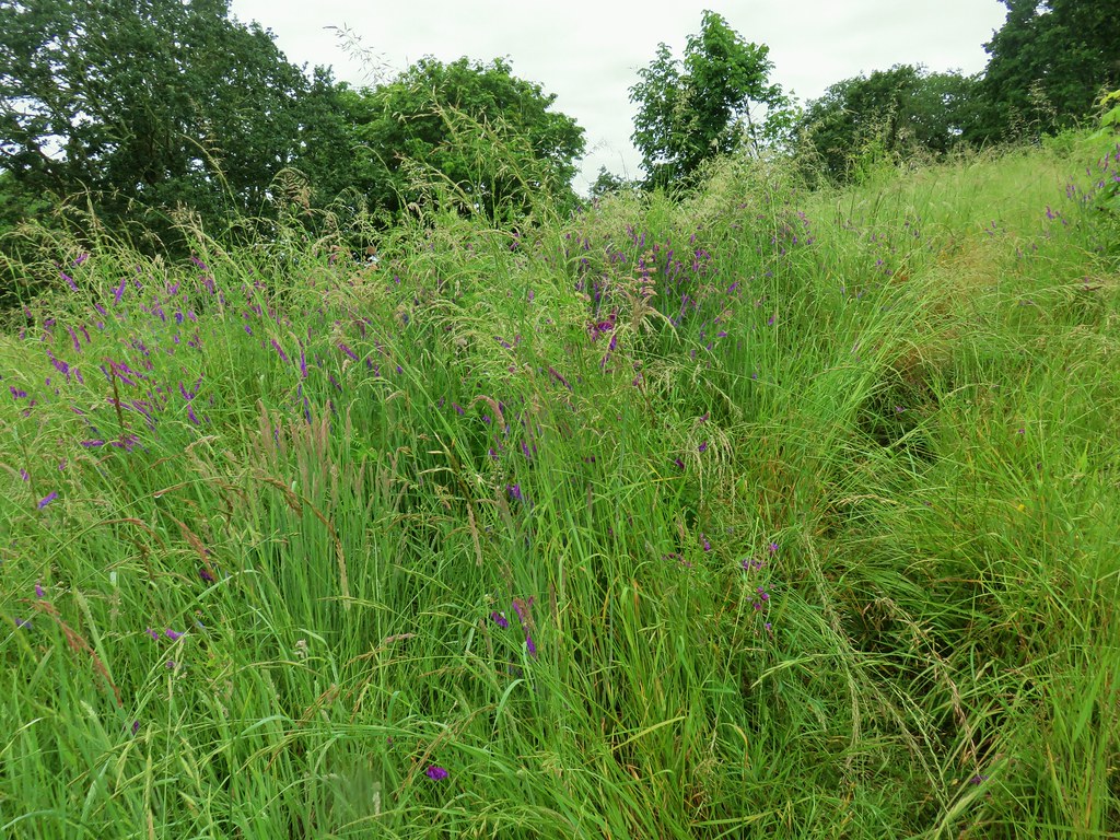
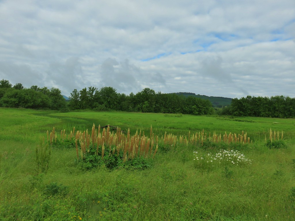
 Lupine along McFadden’s Marsh
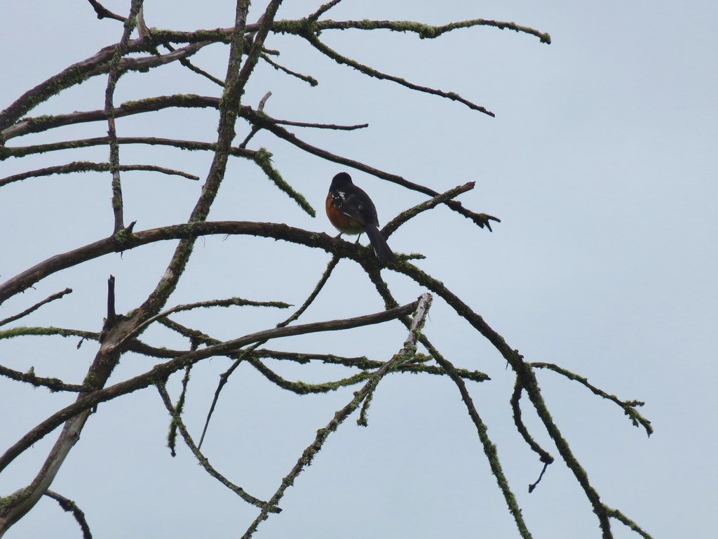
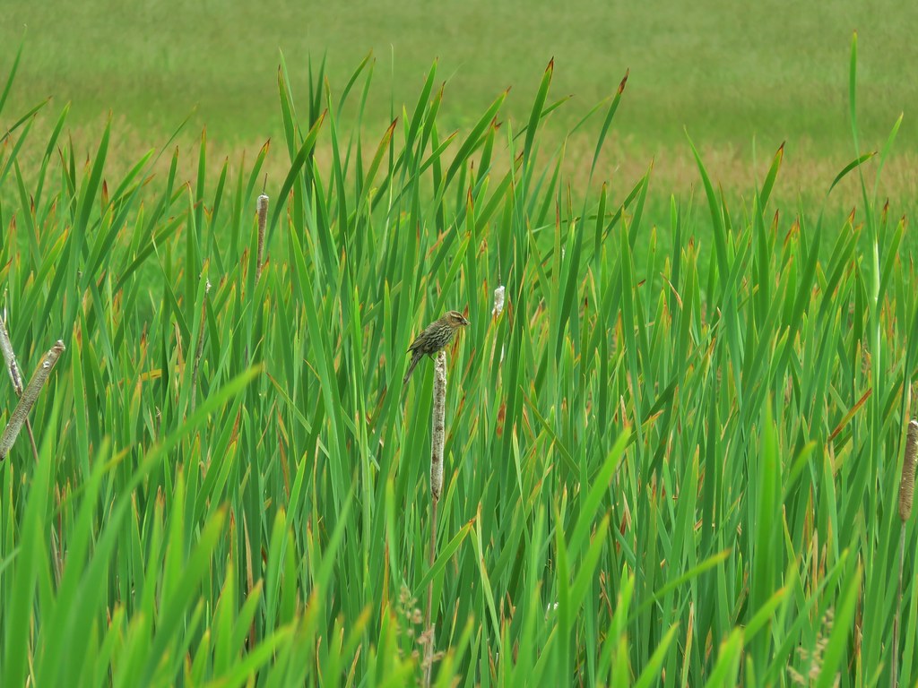
 Small bird in the grass.
 I am almost never sure on yellow flowers like these which one it actually is.
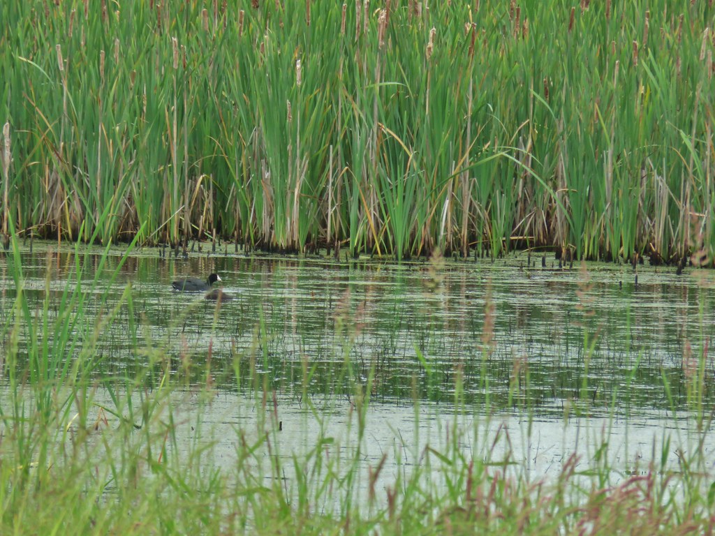
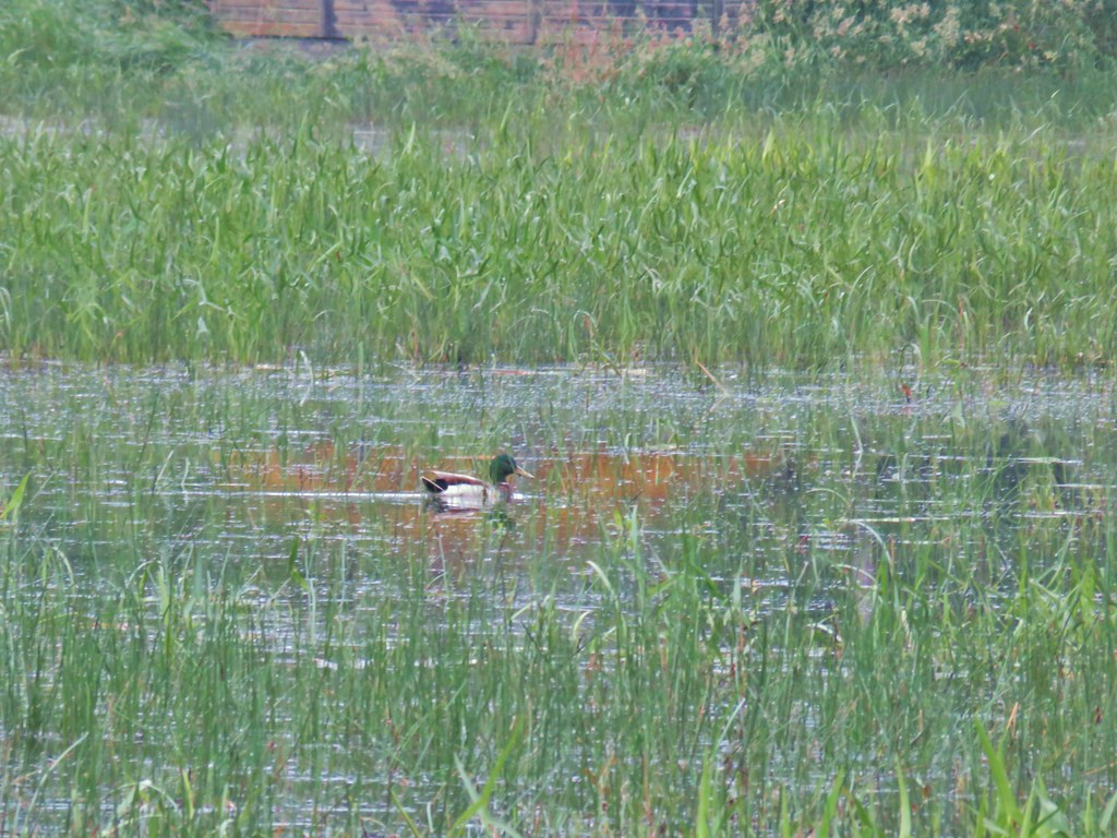 Mallard at McFadden’s Marsh.
 Ditch draining into the marsh.
 Wood duck and duckling speeding away down the ditch.
 Watch your step in the grass!
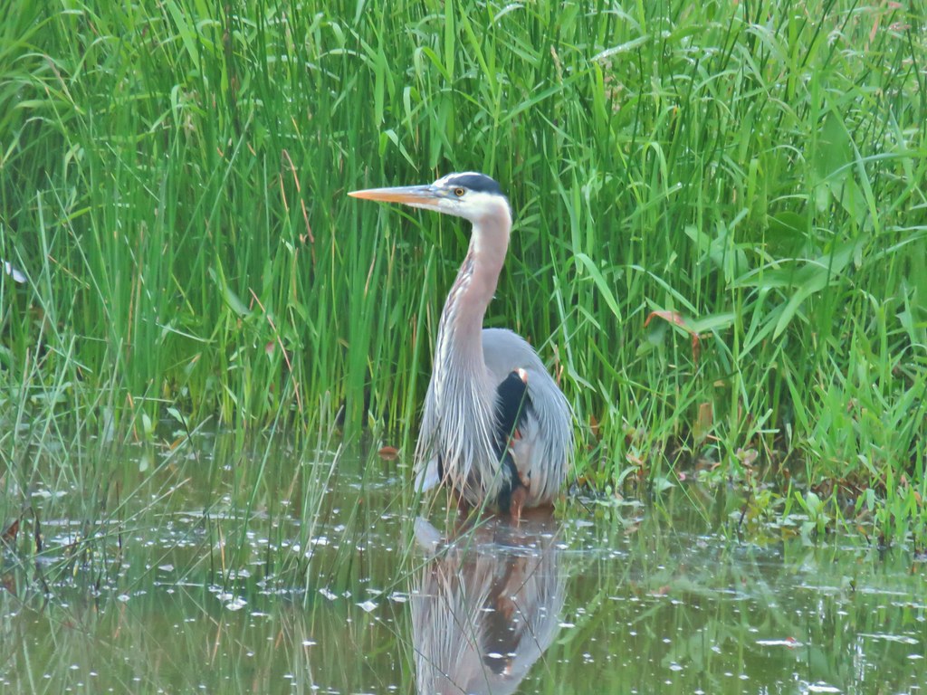
 Another heron standing in the marsh.
We went another quarter mile before I was able to convince myself that we were indeed on the wrong path and that I shouldn’t have trusted the map. It’s a love hate relationship with maps. You should always have at least one map of the area with you but they aren’t always accurate so sometimes you have to use other available information to get the full picture. We walked back to the parking area and decided to just leave our car there and walk up Bruce Rd. to the correct trailhead which was a little less than a quarter mile away.
 Walking over Muddy Creek on Bruce Road.
 A pair of California quail and a rabbit on Bruce Road near the Cheadle Marsh Trailhead.
Now that we were at the correct trailhead we did indeed have a view of Pigeon Butte.
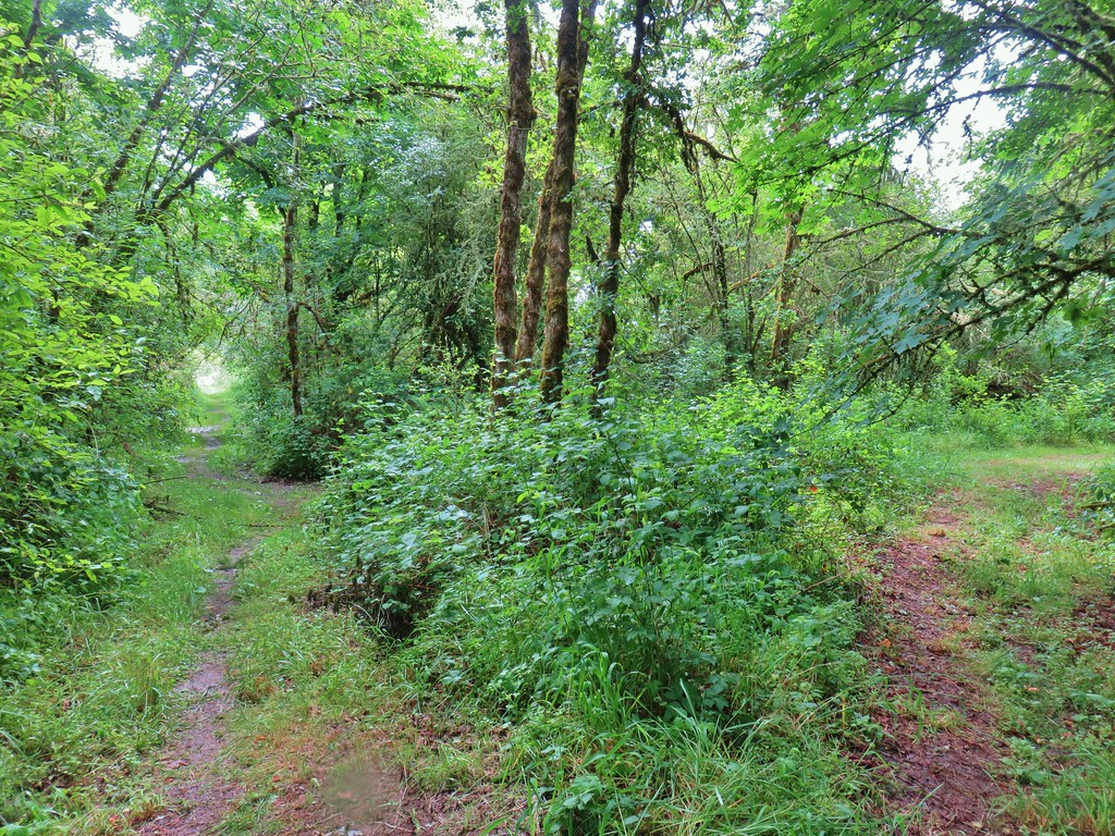
We passed a gate and followed another grassy track between Cheadle Marsh on the left and the hidden (thick vegetation) Muddy Creek on the right.


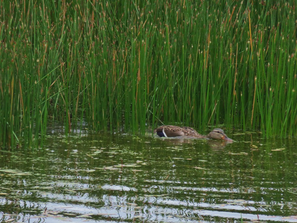
There wasn’t as much activity at the smaller Cheadle Marsh but there was a lone duck paddling about in an apparent effort to unveil breakfast.
There were also numerous smaller birds which was a theme throughout the whole visit. Most were so busy flying from tree to tree or reed to reed that only quick glimpses could be had while hiking, but we could see that settling down in one spot to bird watch would likely be productive.
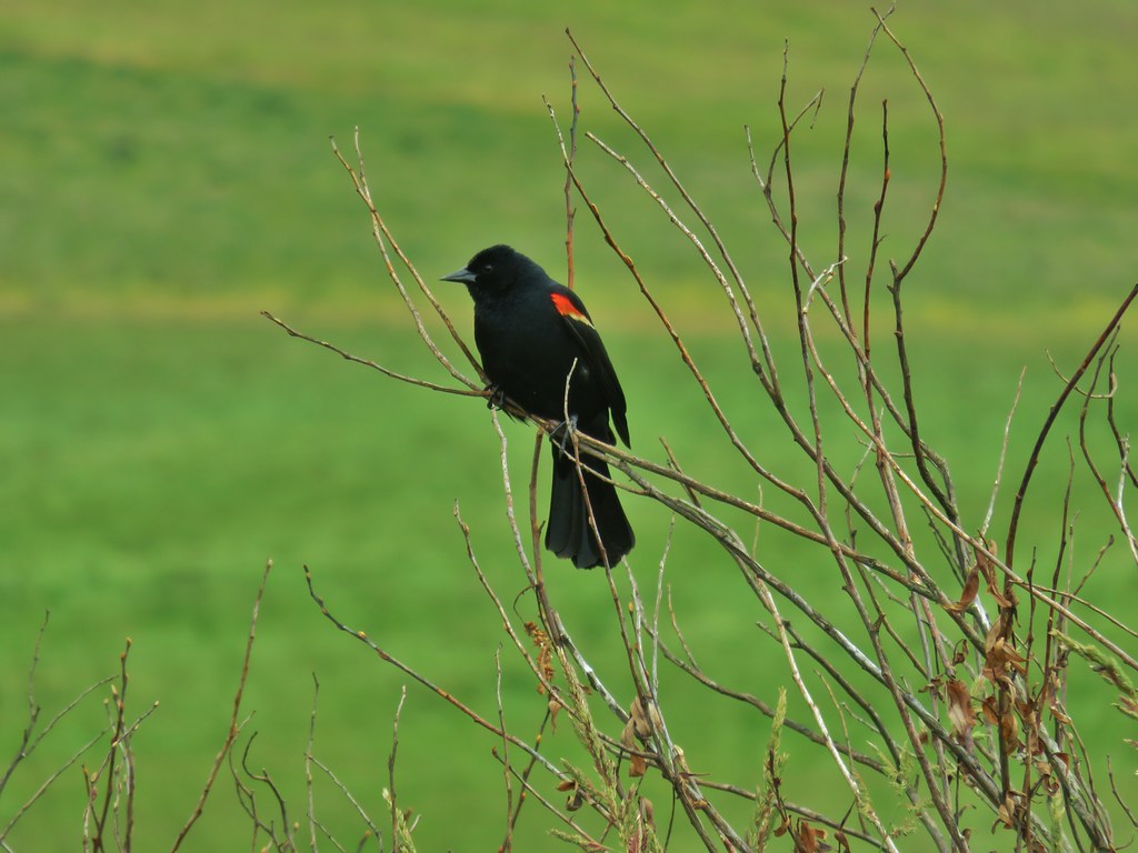
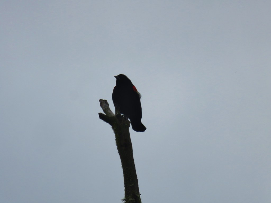 Red-winged blackbird that did pose for a moment.
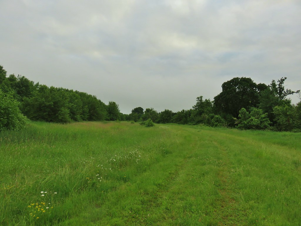
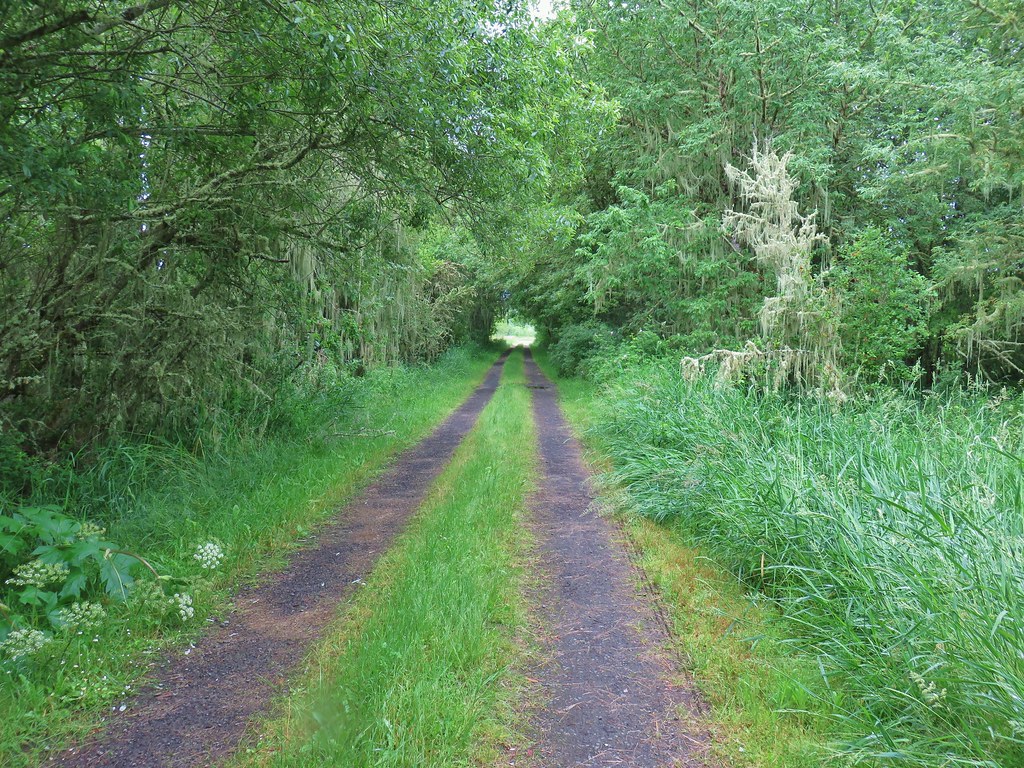
We followed this grassy path for almost a mile as it headed north past the marsh then turned west toward Pigeon Butte.

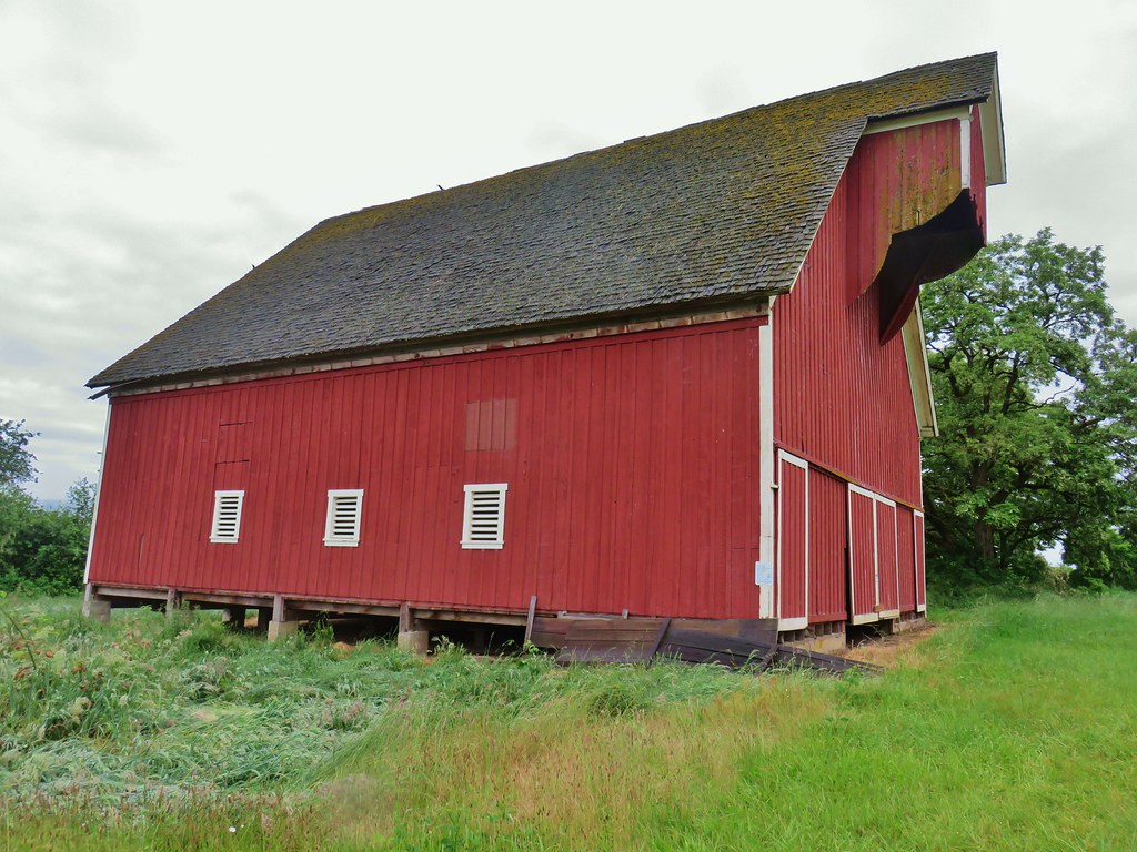
Just before the mile mark we came to a junction where a short grassy track headed uphill to the right just over 100 yards to the historic Cheadle Barn. Originally constructed in 1900 the barn is now on the Benton County Reister of Historic Places and the National Register of Historic Places.
 Note the rabbit in the foreground, this was a theme on the day.
After visiting the barn we returned to the junction and continued what was now south on the grassy track for another 110 yards to another junction near a pond. Continuing south would lead us back to Bruce Road not far from the Cheadle Marsh Trailhead allowing for a short (around 2 mile) loop. We turned right passing by the pond on what was now a gravel track.
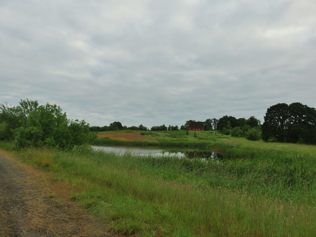 The pond and Cheadle Barn.
 Pied-billed grebe family at the pond.
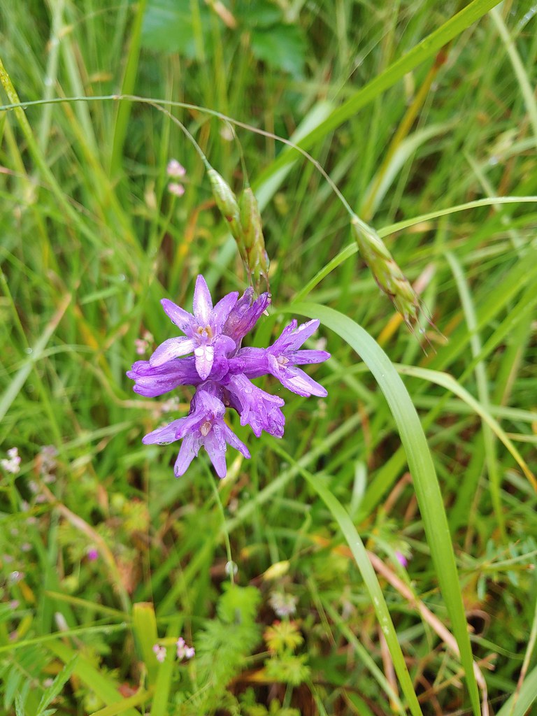 Ookow
Ookow
 Heading toward Pigeon Butte.
We followed this path to the edge of Pigeon Butte where it turned north again and climbed a bit along the butte’s shoulder.
We turned left on another grassy track at the edge of the tree line and headed up the 543′ butte. The road was fairly busy but not with other hikers.
 Snail on a stick.
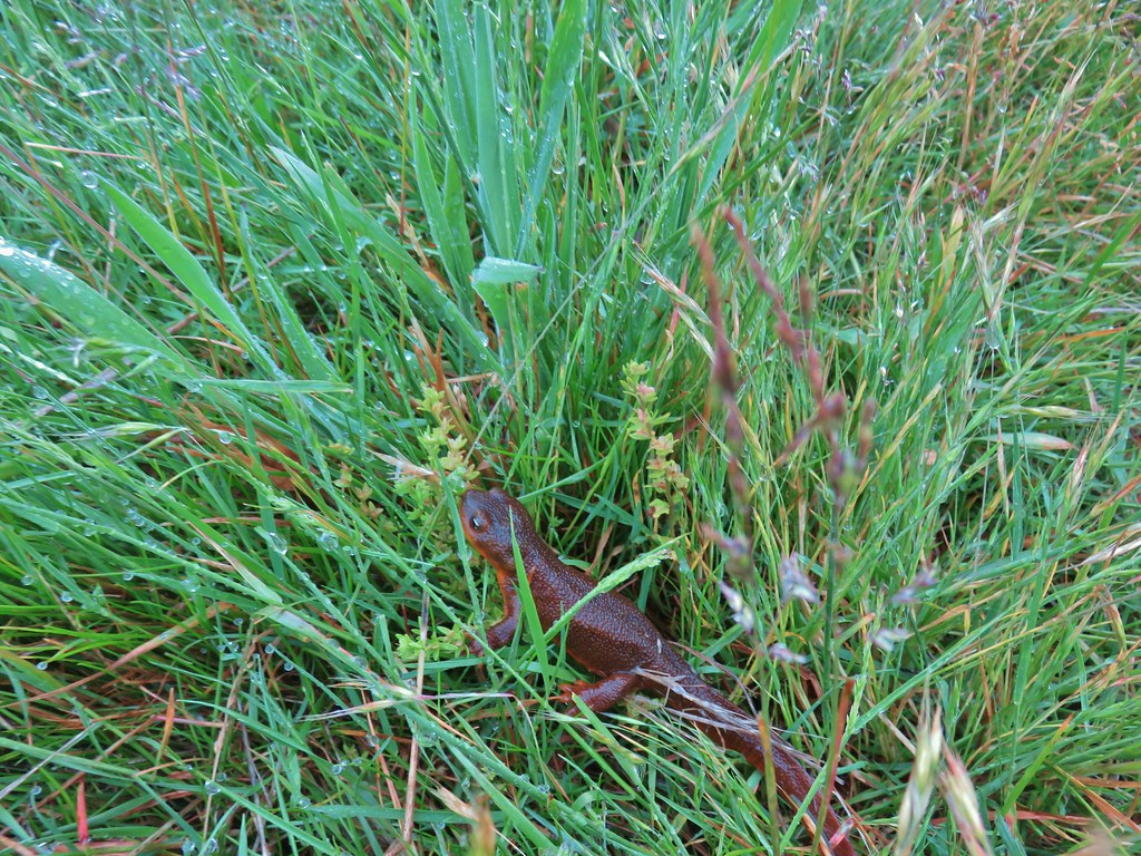
 Rough-skinned newt
 Spotted towhee that wouldn’t look at us.
 Quail on the road near the quarry.
This old road bed led past a quarry to a viewpoint on the SW side of the butte.

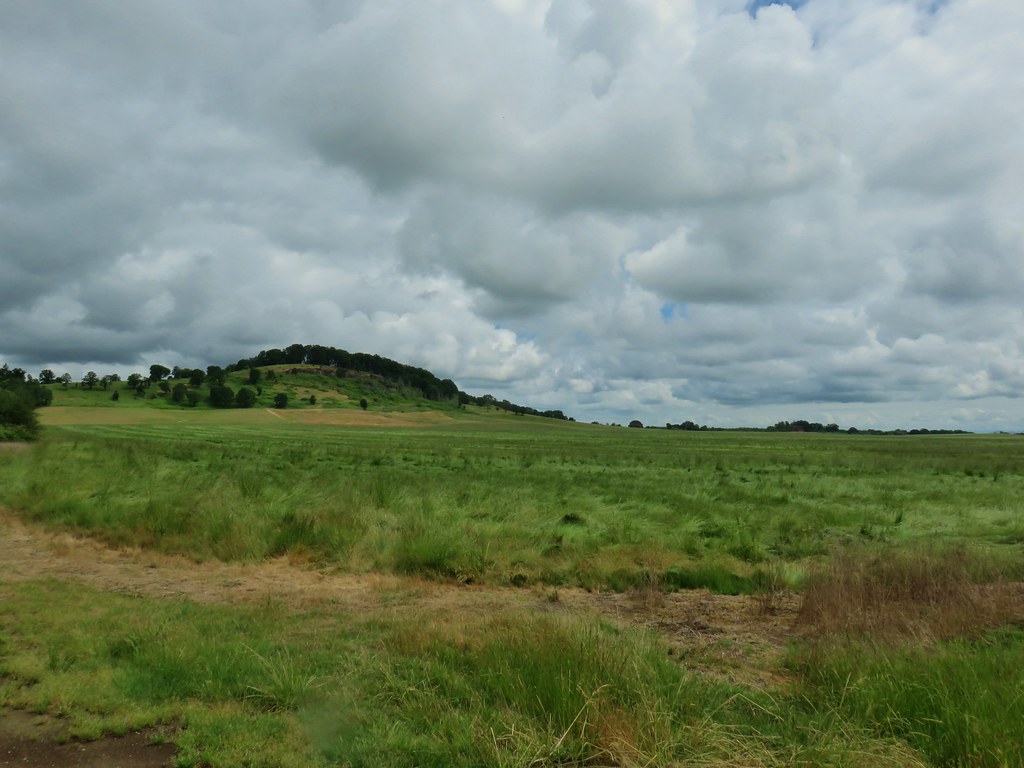
With all the clouds it wasn’t the greatest view and Mary’s Peak (post), the highest point in the Coast Range, was completely hidden by those clouds.

There was a very overgrown trail leading up toward the summit from the viewpoint.
 The trail is on the right of the mass of vetch blooming.
 Checkermallow
After checking for any hidden poison oak, the trail was deemed clear and we climbed to the wooded summit.
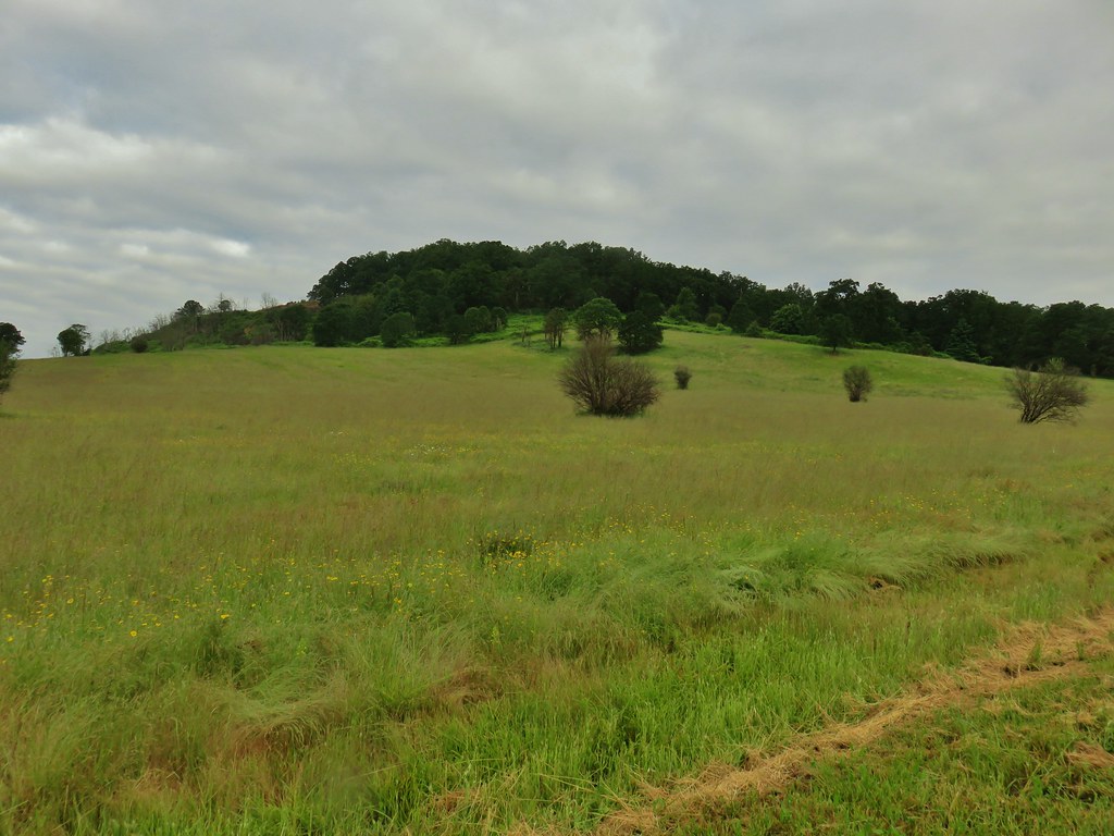
The trees obscured any view and thoughts of looping back down along the summit ridge were abandoned when we noticed the increasing presence of poison oak so after tagging the summit we returned to the viewpoint and headed back down the way we’d come. The side trip up Pigeon Butte was just a mile round trip with 180′ of elevation gain. When we arrived back at the junction on the buttes shoulder we turned left and continued north descending past some fields .
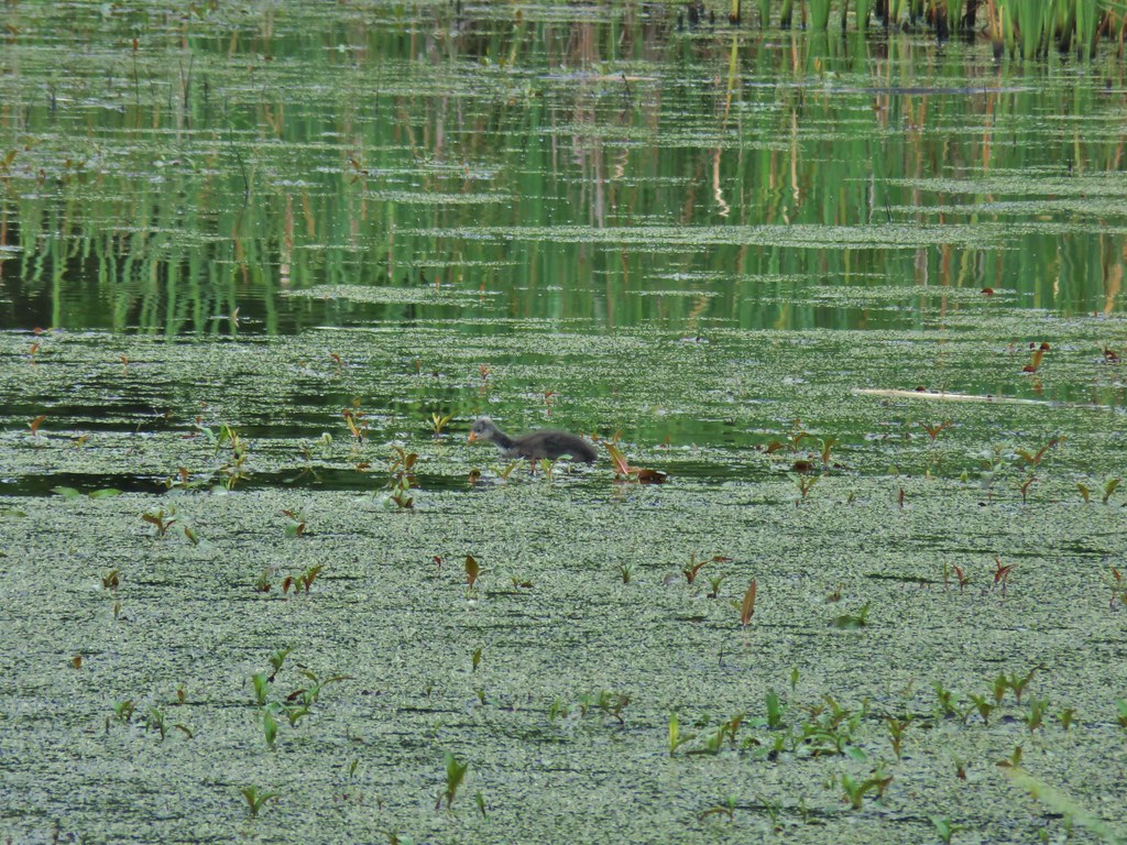
Amid the fields to the left we passed a shallow pond where we spotted an American Coot and her young.

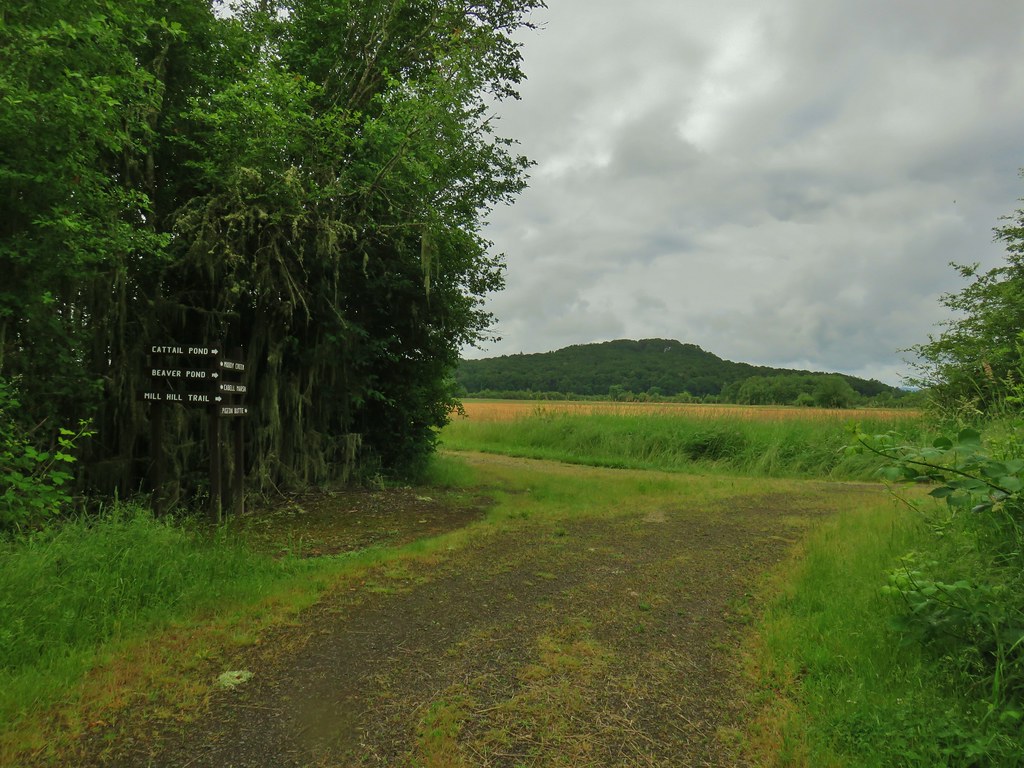
Just under a mile from the path up Pigeon Butte we came to another intersection. This one had a big sign with pointers for various refuge features.

From here the loop hike described in the Oregonhikers Field Guide would have us turn left (west) toward the Cattail and Beaver Ponds. We wanted to revisit Cabell Marsh and the Homer Campbell Boardwalk though so we continued north passing some big lupine plants.


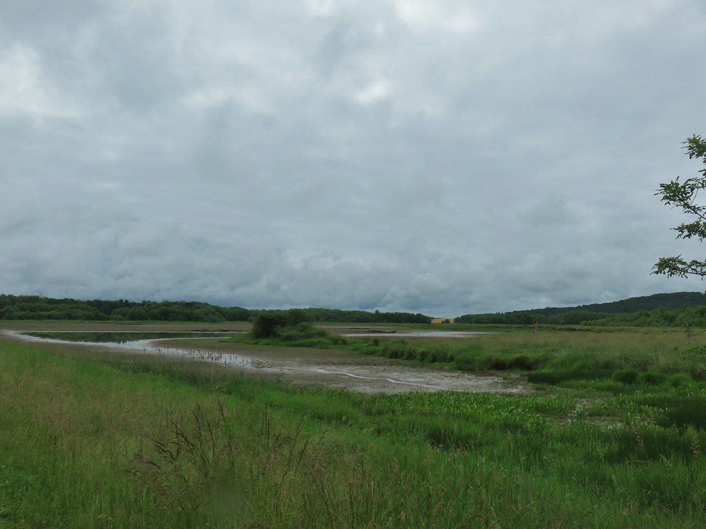
When we reached Cabell Marsh a half mile from the sign we were surprised by the lack of water.

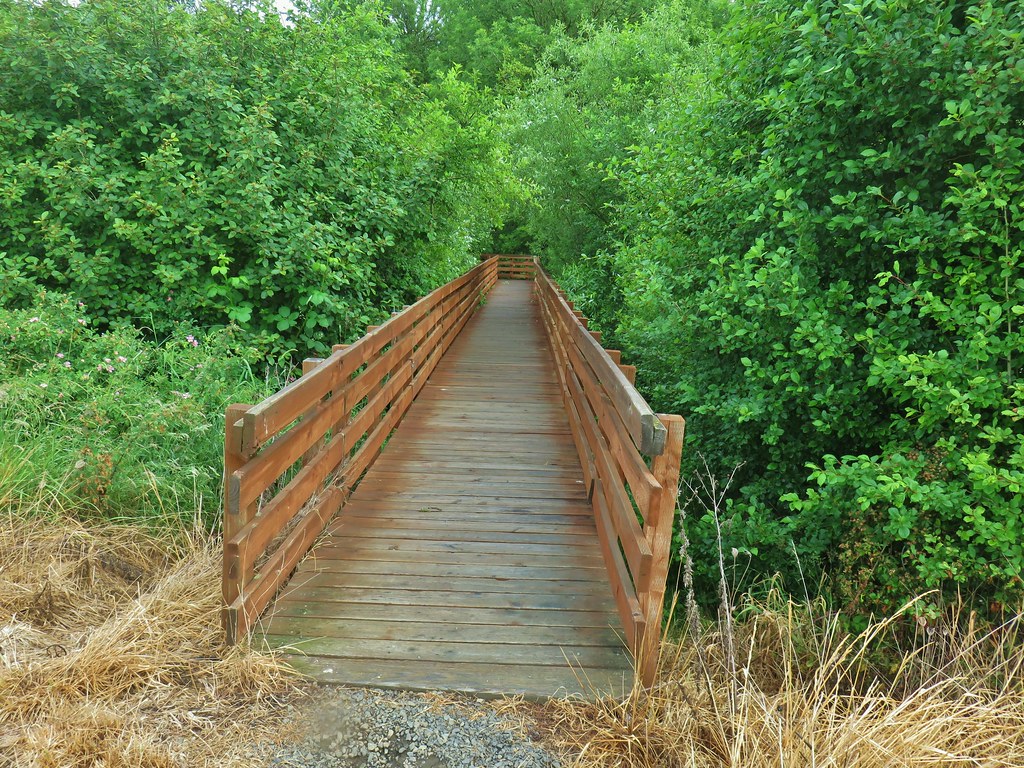
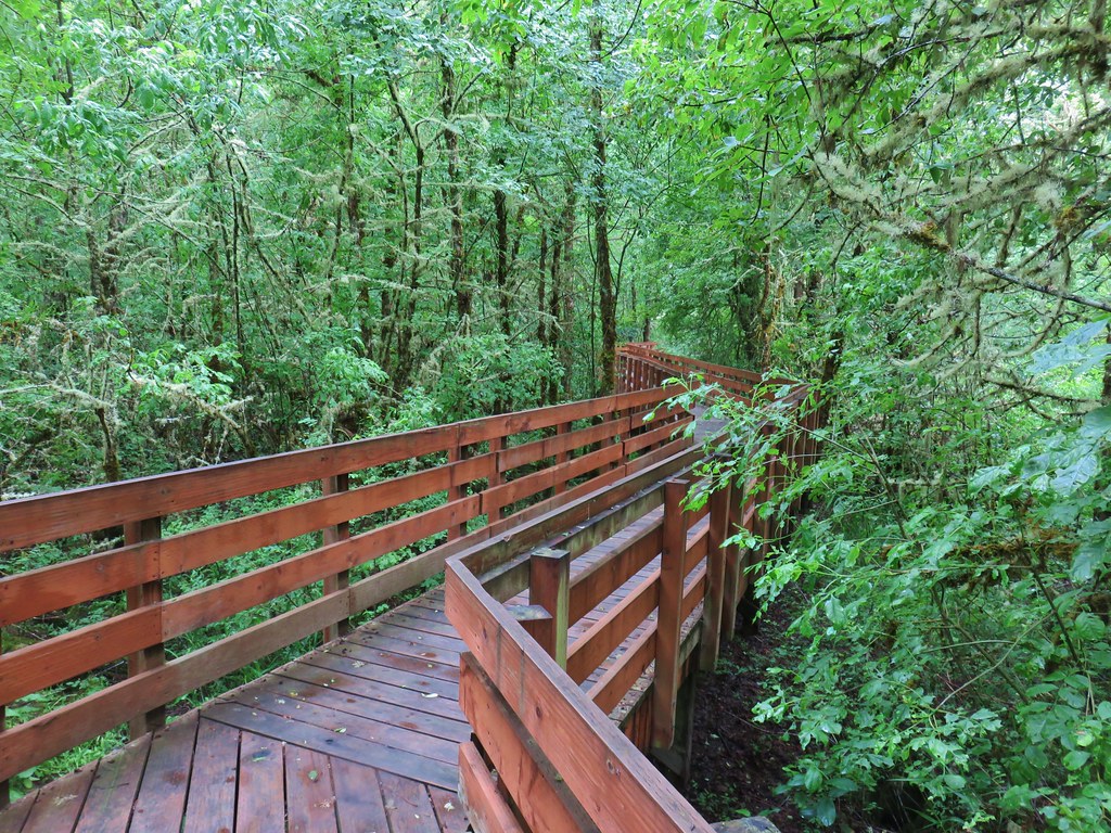
Later after returning home a little research revealed that the marsh had been drained to try and deal with some invasive species. We turned right at the Homer Campbell Boardwalk which was still as impressive as it had been on our first visit.
 With so little water there wasn’t really a reason to visit the blind.

We arrived at the parking lot on the far end of the .4 mile boardwalk to find that despite no vehicles being allowed to the trailhead it was still busy.
 Three rabbits at the parking area.
 Rabbit #1
 Rabbit #2
 Rabbit #3
 Finley Refuge Rd from the parking area (the dark spot in the mowed grass along the far side of the road was another rabbit).
We had left open the possibility of doing a long loop by following this road left to the Woodpecker Loop and retracing much of our 2017 hike but better judgement (and tired feet) prevailed so we returned to Cabell Marsh via a gated grassy roadbed located at the SW corner of the parking area.
While the lack of water had an impact on the number of birds at the marsh we did manage to spot a few (and a muddy rough-skinned newt).
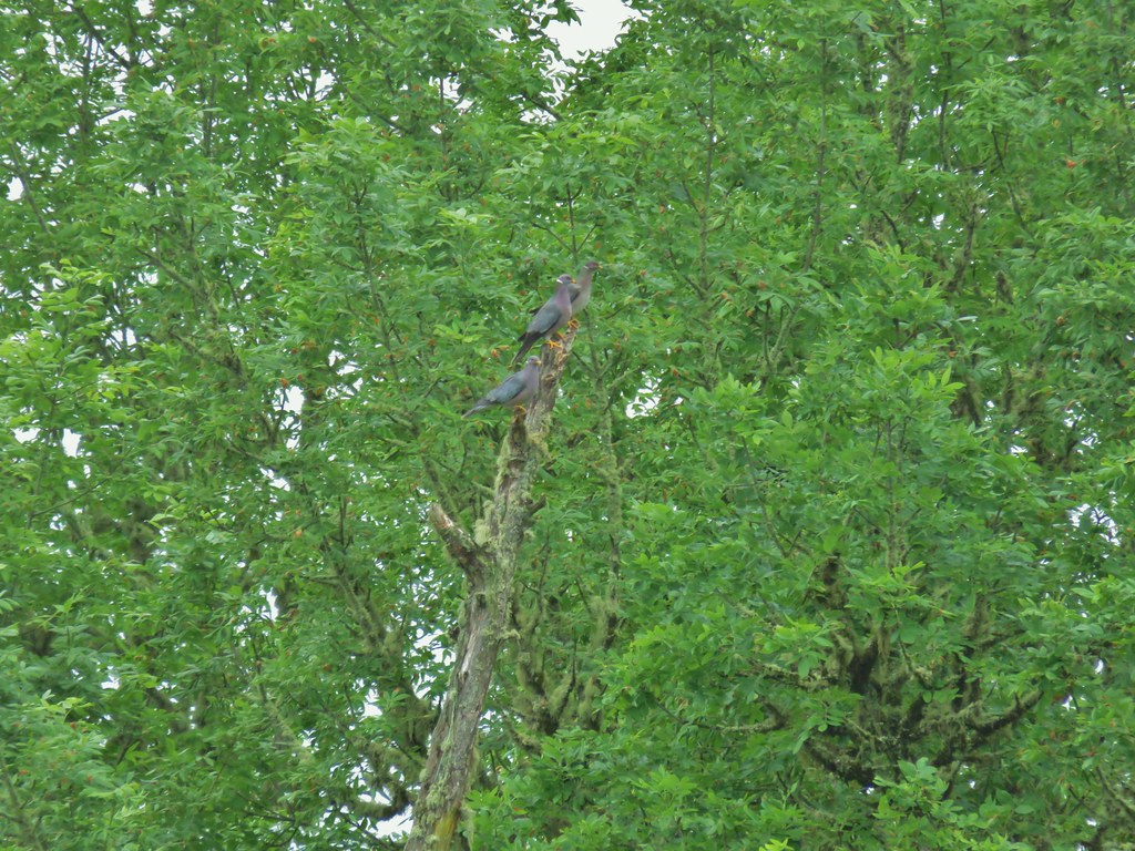 Band-tailed pigeons
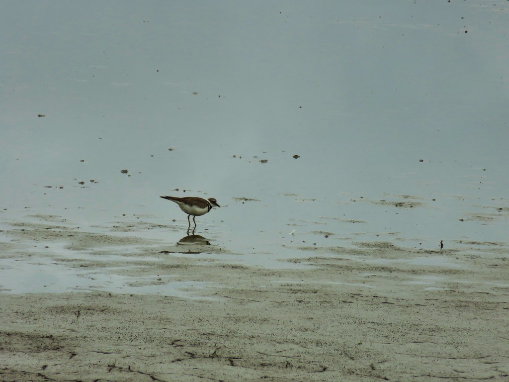 Killdeer

When we arrived back at the signed juction we turned right (west) and headed for the ponds.
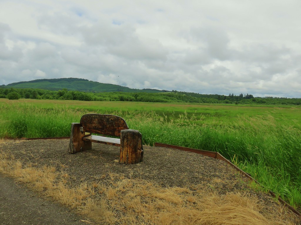
The roadbed headed west for a little over half a mile, passing a nice wooden bench with a view back to Cabell Marsh, before turning south for just under a half mile to a sign for the Cattail Pond.
 One of several male American goldfinches we spotted along this stretch.
 Vegetation along Gray Creek.
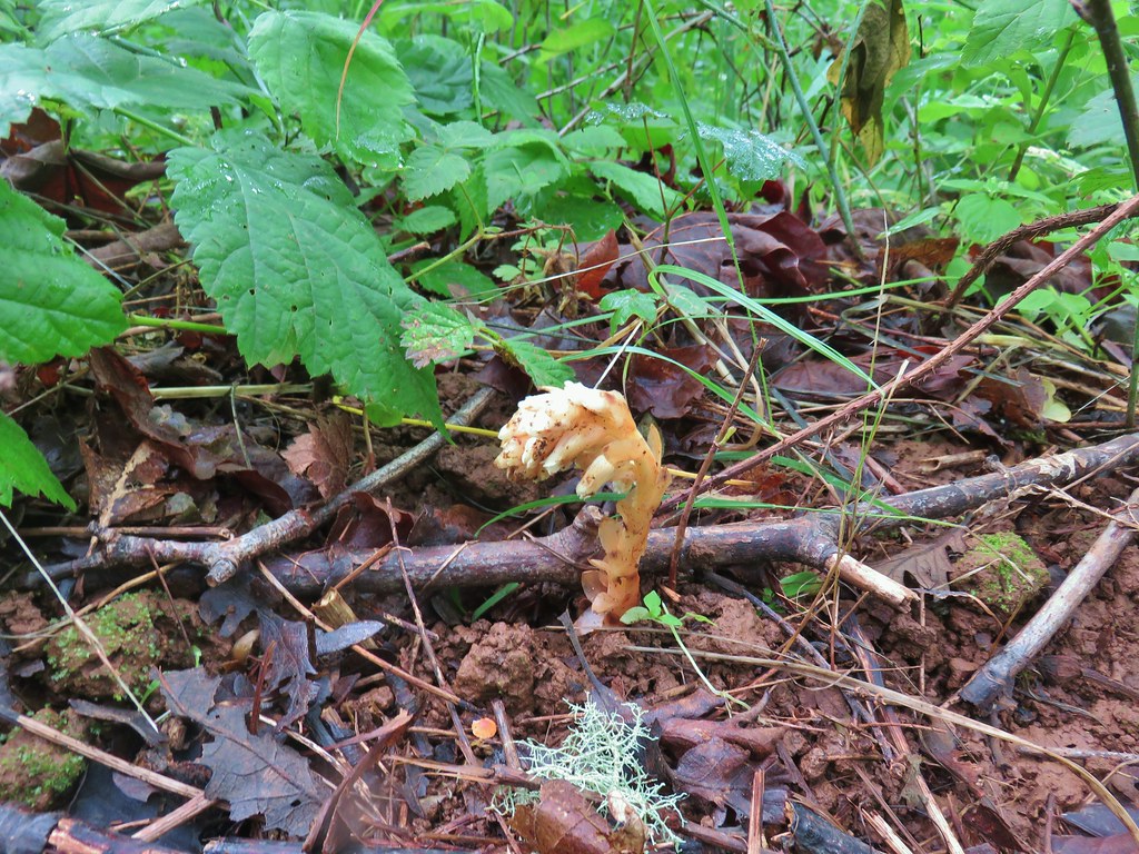
 Mushrooms
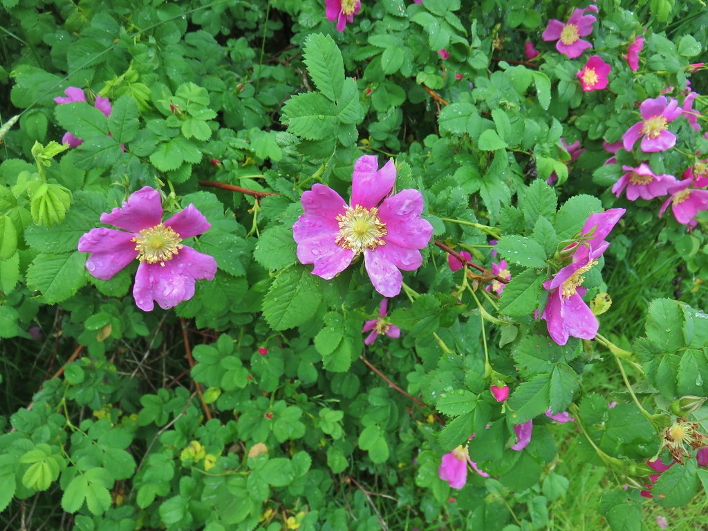
 Roses along the roadbed.
 Slug
Slug
 Yep, another rabbit.
 We started to think this rabbit wasn’t going to hop into the brush like all the others had.
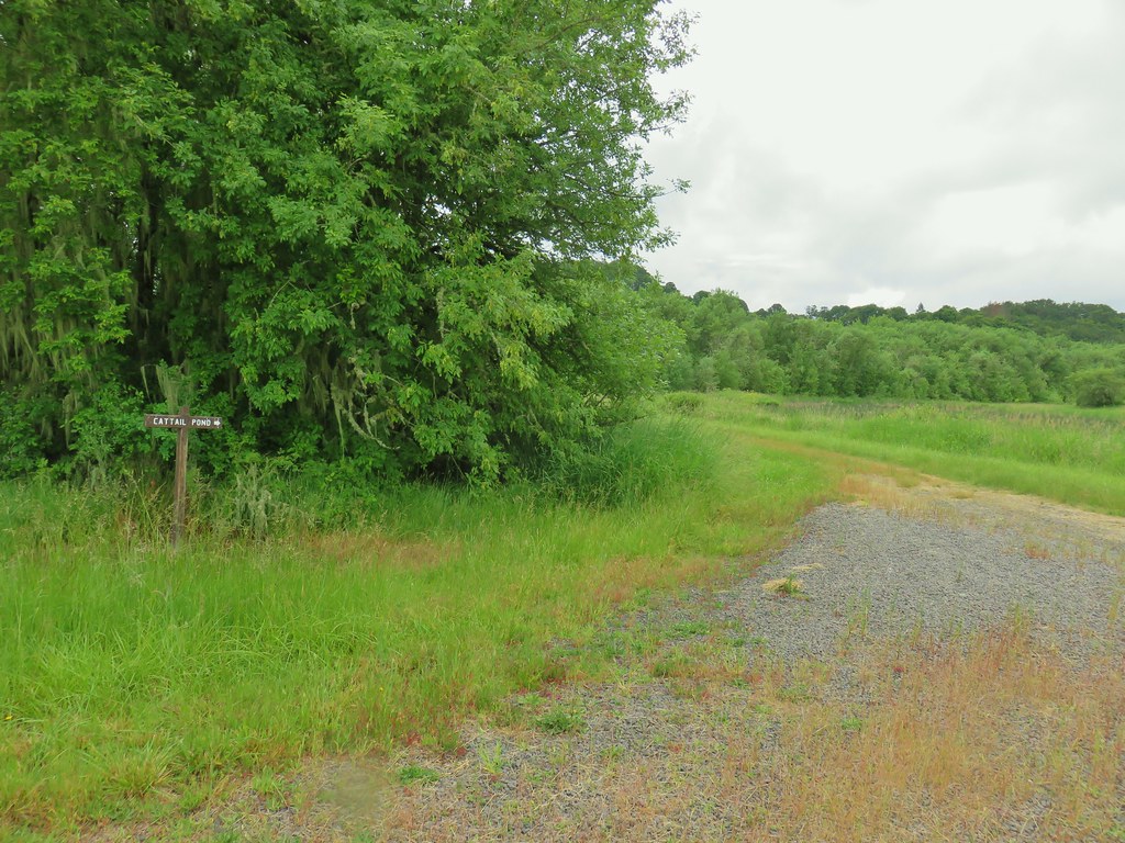 Sign for the Cattail Pond.
A left turn here was one option for the loop but we wanted to see the Beaver Pond so we stayed on the roadbed for just a little longer to a sign for the Beaver Pond.
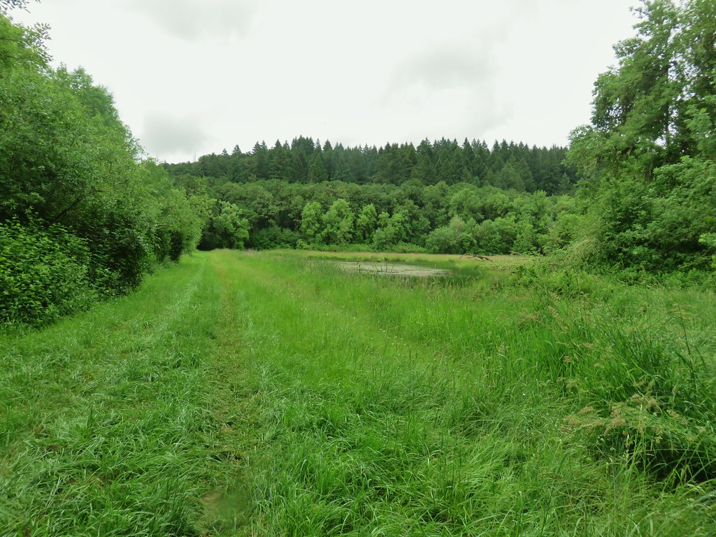
 Cattail Pond from the roadbed.
 Common yellowthroat

We turned left onto a grassy track at the Beaver Pond sign and were soon passing by the pond.

At the far end of the pond we found ourselves on an actual trail.

The trail led us around the forested base of Maple Knoll a quarter of a mile to an unsigned junction.
 The junction.
Here the maps failed us for a second time. We had expected to come to a junction with the path that had passed by the Cattail Pond at which point we would turn right and head back out to Bruce Road. The maps we had showed no other junctions so we turned right at this junction and followed it along the base of Maple Knoll.
 Forest on Maple Knoll’s hillside.
 Pinesap
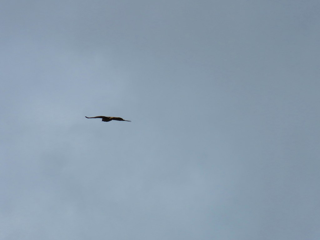
The track we were on was sticking to Maple Knoll though and as it wrapped around the base we were quickly heading west again instead of due south to Bruce Road. After .4 miles we decided we had been fooled again and turned around. The detour hadn’t been a total waste as we got to see a hawk fly over and a group of ground squirrels plotting something nefarious from a stump.


 It’s the one peaking out from behind the stump that had us the most concerned.
When we got back to the unsigned junction we turned right and in 175′ came to a second unsigned junction. We turned right (south) here and this time it was nearly a straight shot along a roadbed for a half mile to Bruce Road and the Beaver and Cattail Ponds Trailhead.

 Northern flicker
 Sparrow
It was a mile road walk back to the Cheadle Marsh Trailhead (one and a quarter back to where we had parked). After the 4 mile paved road walk the weekend before (post) this one gravel wasn’t too bad. There were nice views of Pigeon Butte and quite a few flowers and birds to look at. We were especially excited to see a couple of yellow headed blackbirds, a bird we’d only seen one other time at the Malheur National Wildlife Refuge (post).
 Pigeon Butte
 Red-winged blackbird


 Pollinators in a poppy.
 Turkey vulture
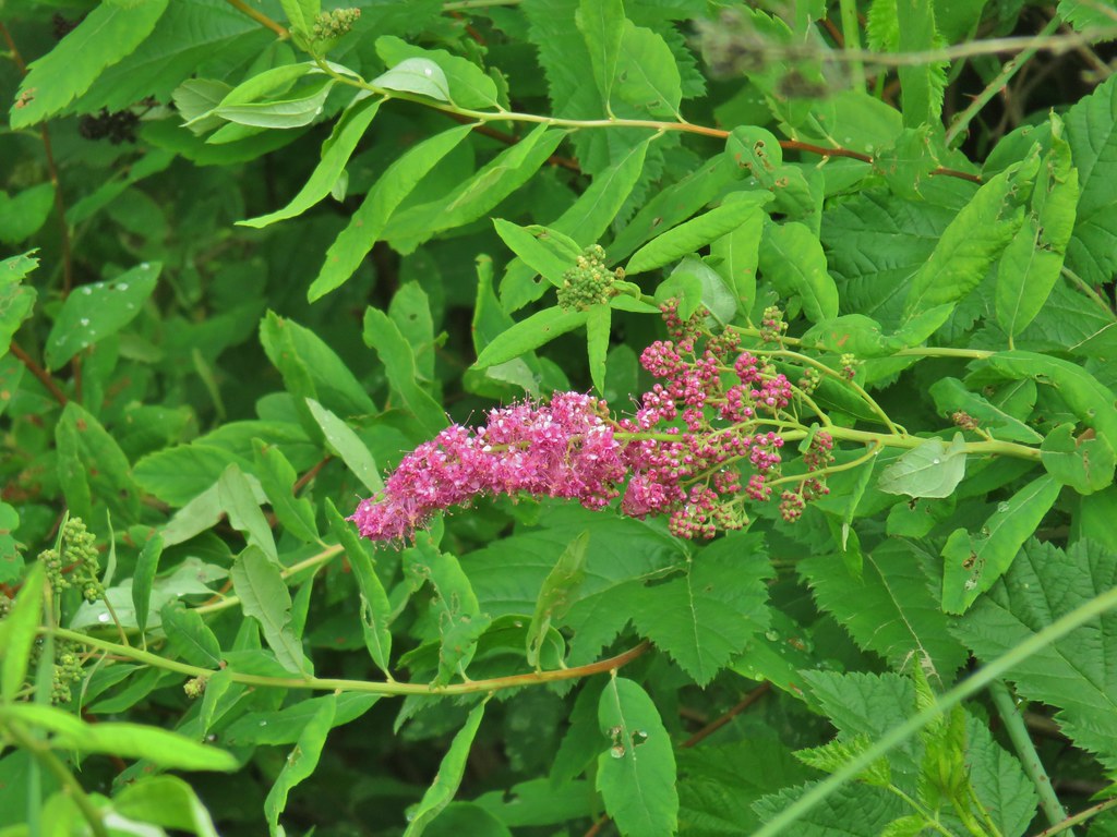 Douglas spirea
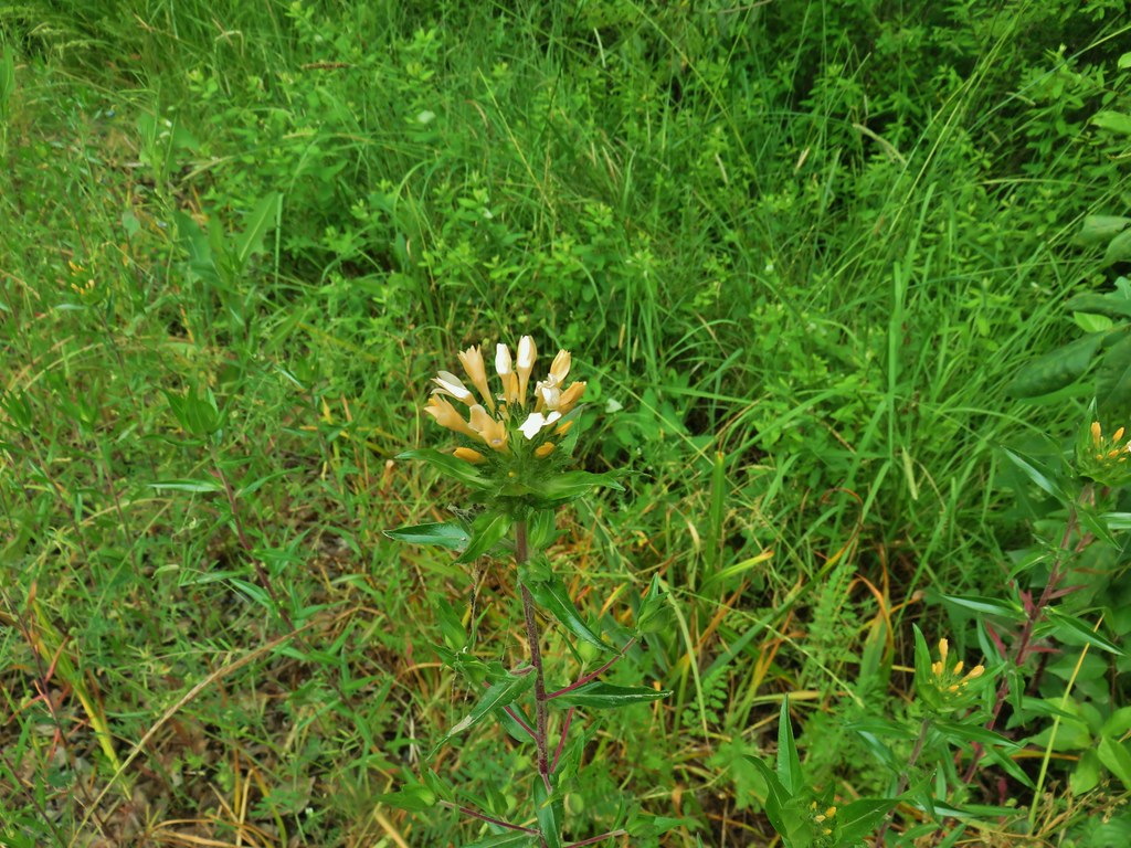 Grand collomia
Our excursion (with the two accidental out and backs came in at 11.8 miles so we were more than happy that we hadn’t tried to do the longer loop along Finley Refuge Rd. For a cloudy day this was a great hike with a lot of wildlife sightings and a few flowers. The paths were wide enough that the poison oak was rarely an issue (there was a lot of it starting on the path along the base of Maple Knoll that we had mistakenly taken). The wide paths also would have been useful for social distancing, but we only passed one other hiker all day even though there were a lot of cars parked and driving along Bruce Road.
As we were preparing to leave I mentioned that the only bummer was having not gotten a good look at the egret that morning. When we started to drive across the marsh on Bruce Road I looked over to see if there might be an egret there now and sure enough there was.

We are looking forward to some of the higher country opening up and melting out so that we can take some poison oak free hikes. Happy Trails!
Flickr: Pigeon Butte

4 replies on “Pigeon Butte – 05/31/2020”
[…] in 2017 visiting the Cabell Marsh and hiking the Woodpecker and Mill Hill Loops and the other in 2020 starting near Pigeon Butte. My plan was to combine most of those two hikes and add a few new short […]
[…] Finley Wildlife Refuge – Hiked 10/21/2017, 5/31/20, & […]
[…] We hiked the Homer Campbell Boardwalk, Woodpecker Loop, and Mill Hill Loop that day. We returned in 2020 to check out the SE corner of the refuge including Pigeon Butte. I returned in 2021 during a solo […]
[…] was my fifth visit to this refuge (2017, 2020, 2021, 2024) and my plan was to repeat my October 2024 route and add the 1.8-mile Mill Hill Loop. […]