After three straight overnight trips it was time for a day hike. Our destination was the Eight Lakes Basin in the Mt. Jefferson Wilderness. The two most common routes to the area are from either the Duffy Lake Trailhead to the SW or the Marion Lake Trailhead to the north. The basin is a little closer to the Marion Lake Trailhead so this was where we decided to begin our hike.

We were surprised at the number of cars already parked at the trailhead when we arrived at 6:15am. Later we realized much of it was due to it being the opening weekend of hunting season. We had visited Marion Lake once before in October of 2014 on our way home from Central Oregon, but this time we would be continuing past the lake 4 miles to reach the Eight Lakes Basin and returning on a wide loop.
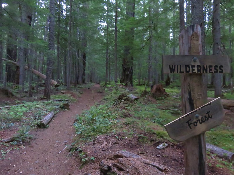
The first 1.8 miles of trail was familiar but some things had changed since our previous visit including the condition of the wilderness sign.
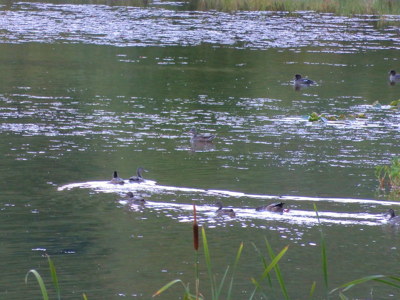
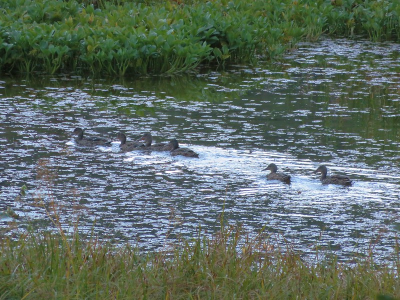
About a half mile prior to reaching Marion Lake the trail passes smaller Lake Ann.

On the far side of a lake a Great Blue Heron landed on a log along with some ducks while numerous other ducks could be seen on the water.

Shortly after Lake Ann we came to a split in the trail where the Marion Lake Trail headed left and the Marion Outlet Trail went right. Both trails lead to Marion Lake but the the Outlet Trail is .5 miles longer. They also lead to different portions of the lake, the Marion Lake Trail arrives at the northern end of the lake while the Marion Outlet Trail meets the Blue Lake Trail at the lake’s northwestern tip.
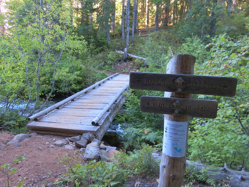
The main reason to take the Marion Outlet Trail though is to take a short unsigned side trail and visit Marion and Gatch Falls.
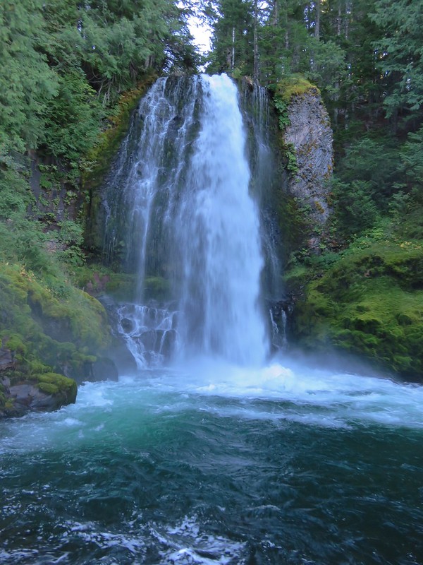
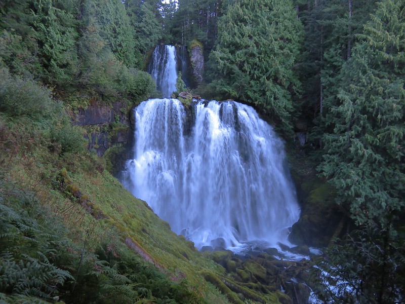
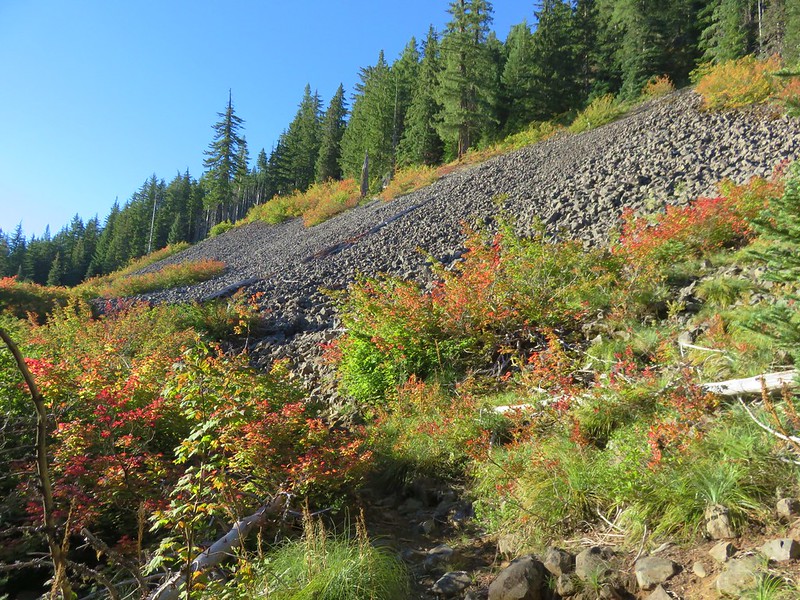
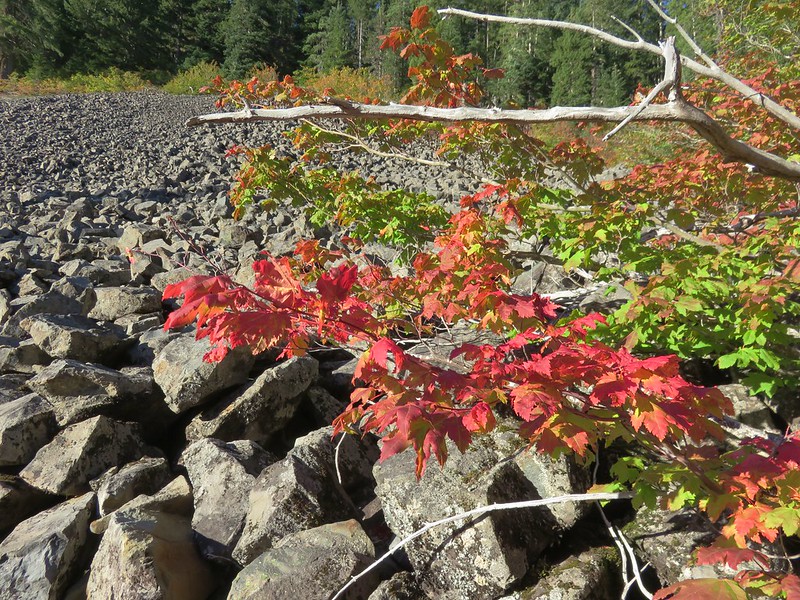
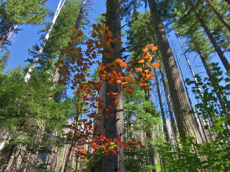
The trail down to the falls is somewhat steep in places but the views are wonderful. After visiting the falls we hiked to the Blue Lake Trail junction and crossed Marion Creek on the footbridge. Just beyond the footbridge the trail crosses a rock slide where the vine maple was starting to show its Fall colors.
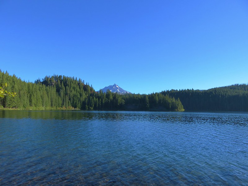
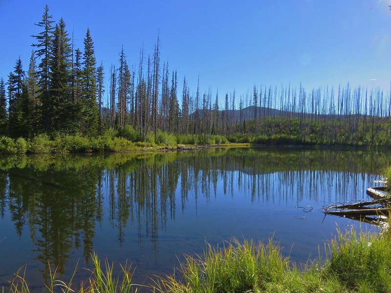
After entering the trees again we took a trail down to the lake to get a view of Mt. Jefferson across the water.
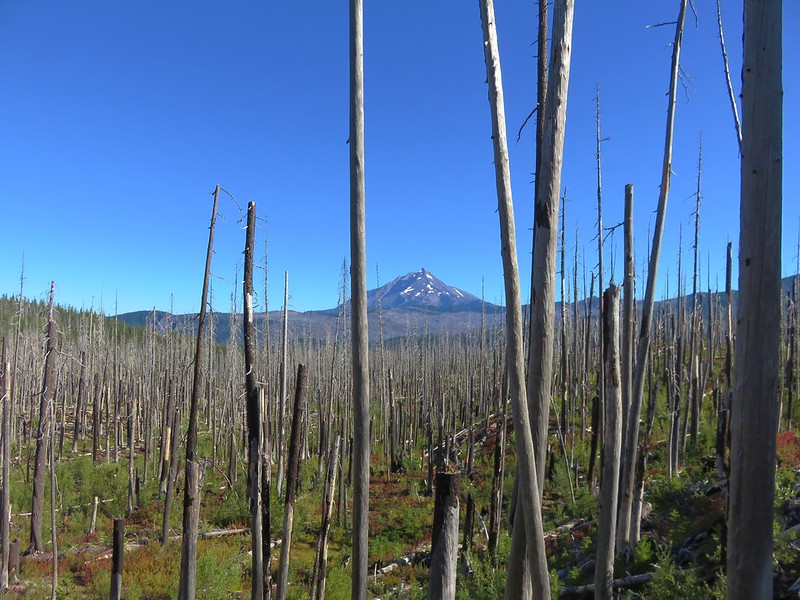
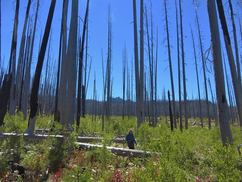
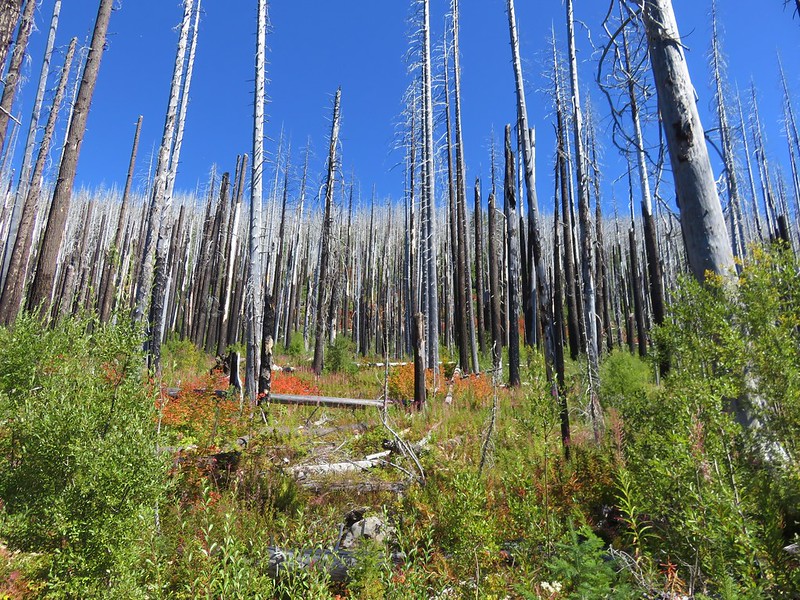
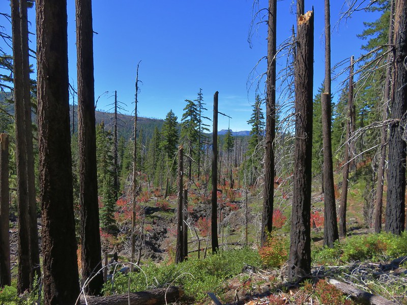
We continued on the Blue Lake Trail which soon entered the forest burned by the 2003 B & B Fire.
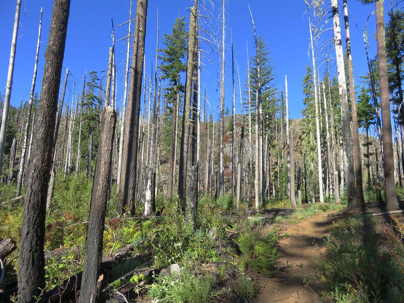
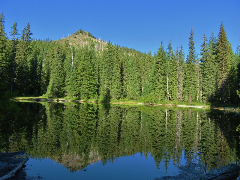
The B & B Fire burned over 90,000 acres of forest and we would be spending a large portion of the day hiking through the burn. Some areas though were spared and one of those areas was a mile up the Blue Lake Trail at a junction with the Pine Ridge Trail.
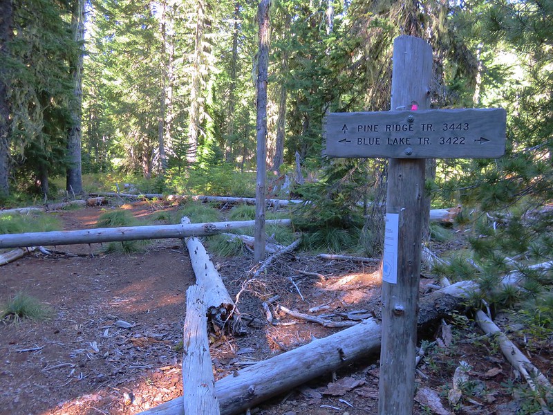
By taking the Pine Ridge Trail we could have climbed up Marion Mountain, but we were leaving that for another time. Just beyond the junction a small pond reflected the rocky summit of that peak.
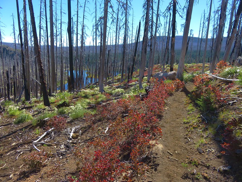
It was three miles from the Pine Ridge Trail junction to the next trail junction at Jorn Lake in the Eight Lakes Basin. A little over a mile from the pond was Jenny Lake.
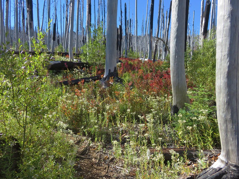
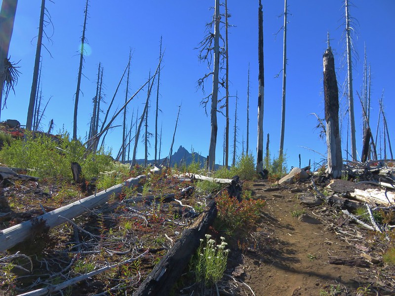
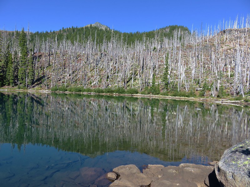
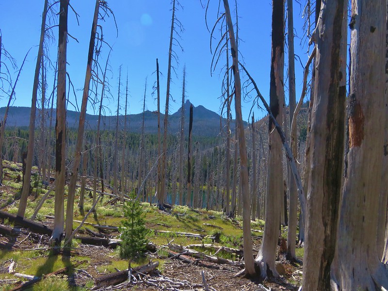
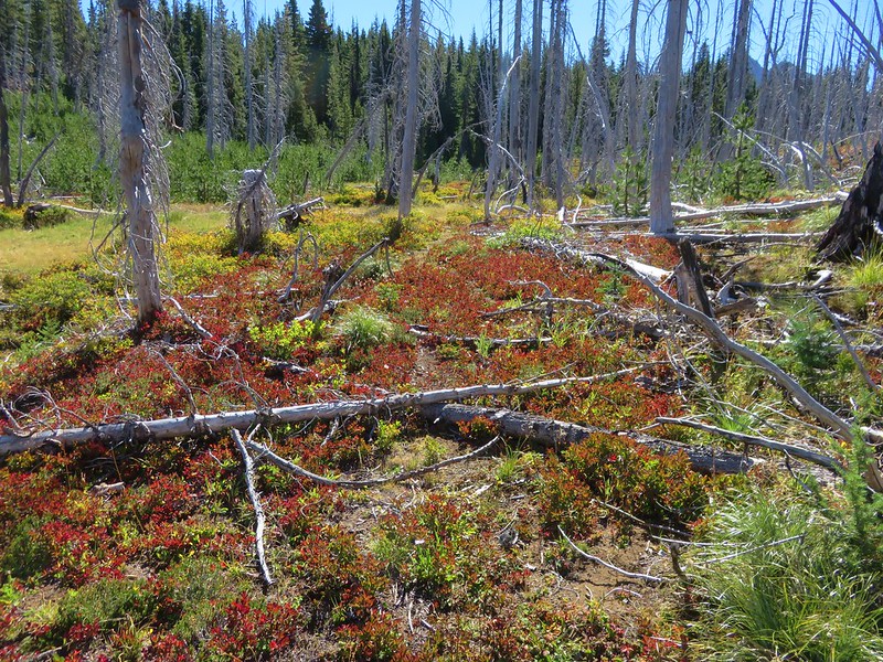
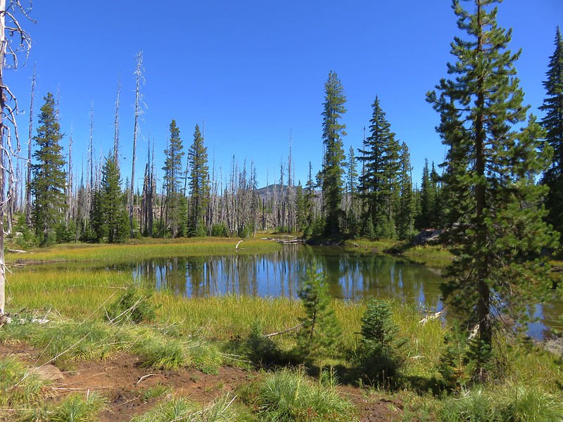
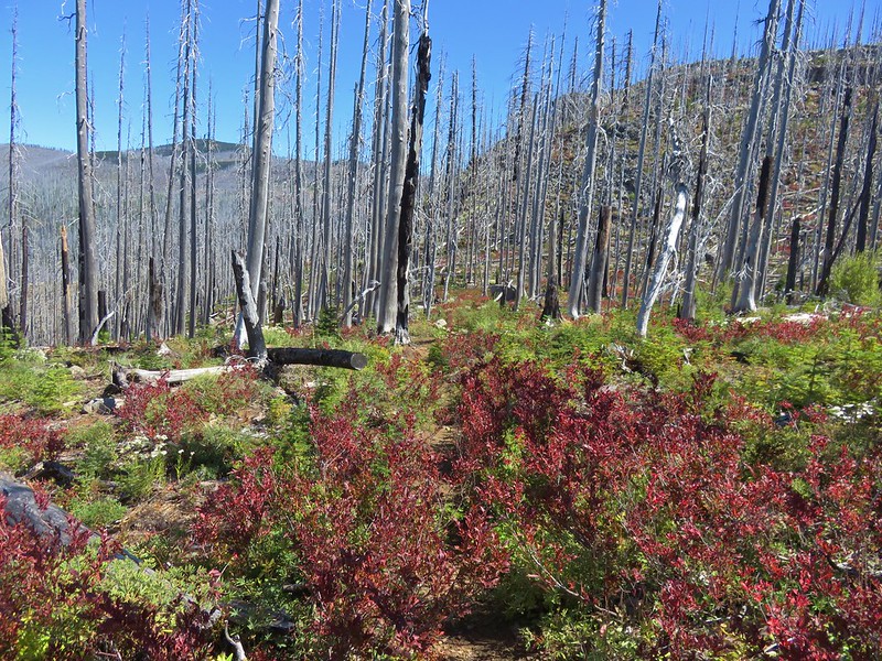
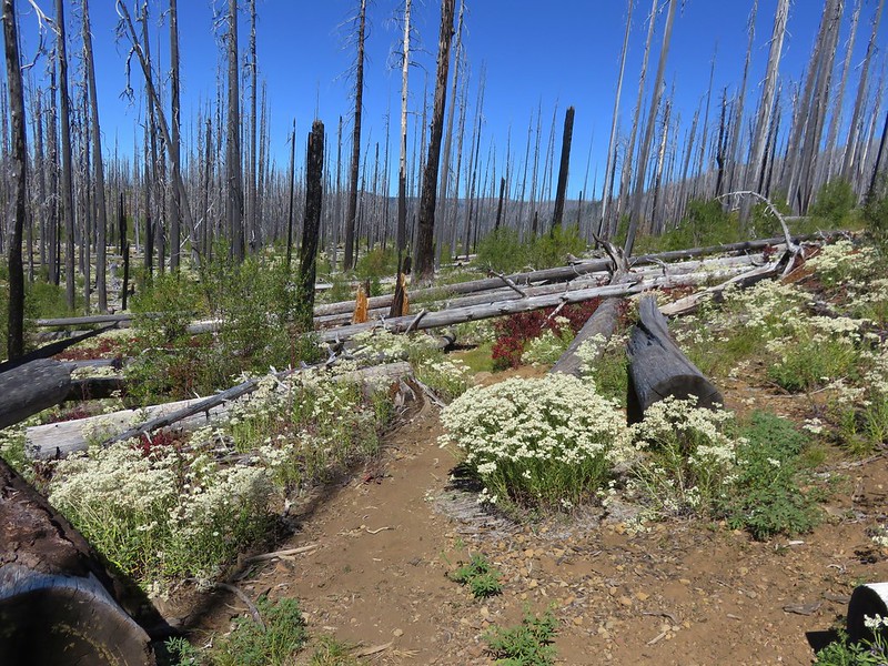
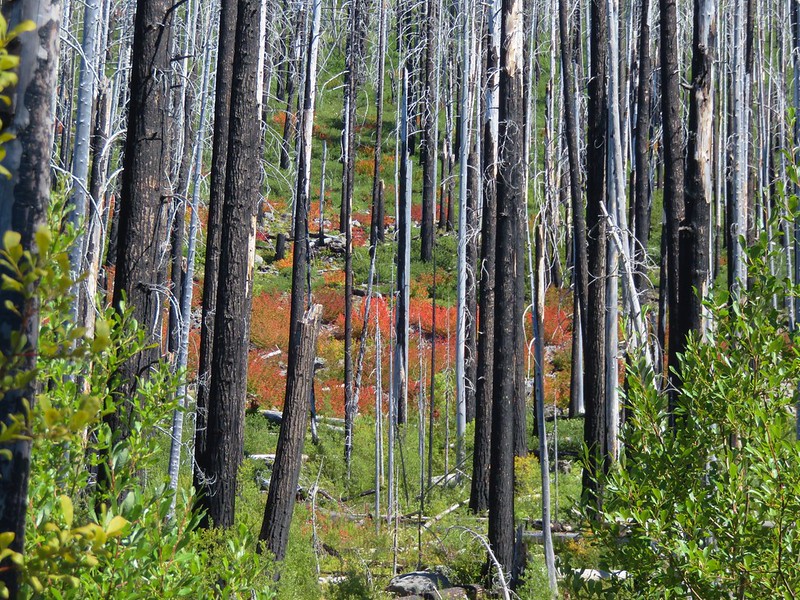
Beyond Jenny Lake the forest around the Blue Lake Trail had all been burnt by the 2003 fire. The lack of live trees allowed for some big views through the silver snags and it was interesting to see how the forest was at work recovering. Small trees were working on replacing those lost and white pearly everlasting flowers made a nice contrast to the red huckleberry leaves dotting the ground.
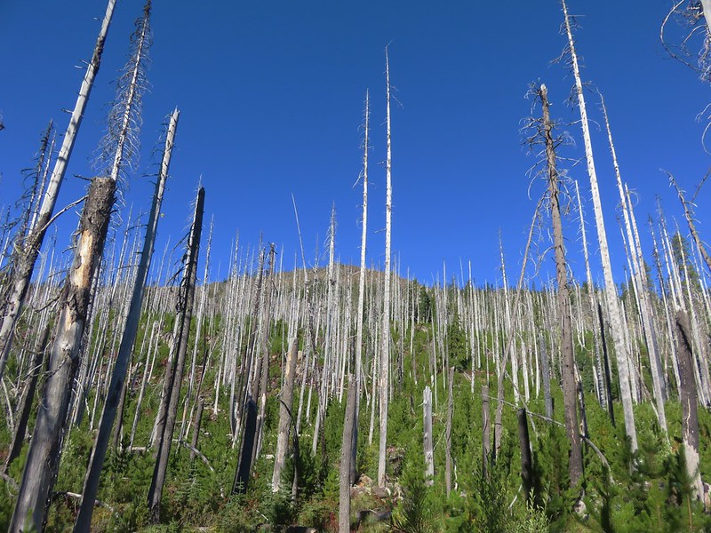

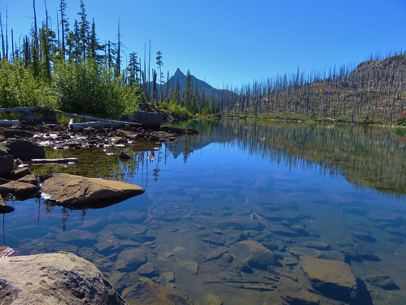
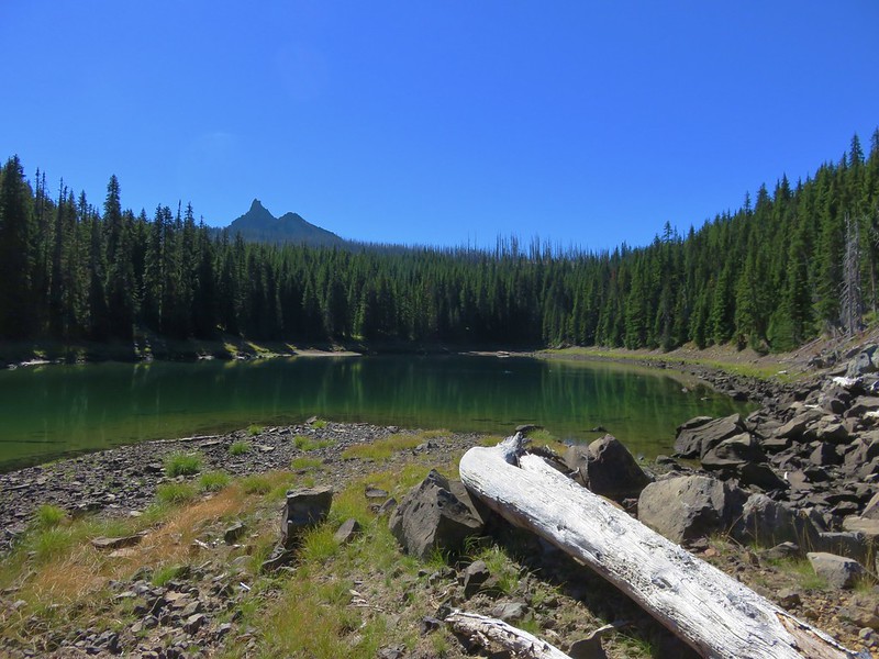
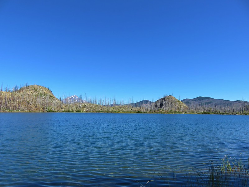
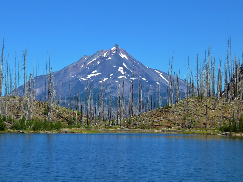
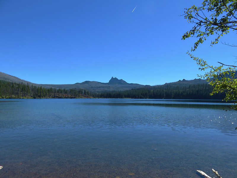
The lack of trees also caused the trail to be exposed to the Sun which had come back with a vengeance after the previous weekends cooler temperatures. A short way from Jenny Lake the trail began a series of switchbacks as it climbed up and over a ridge before dropping down into the Eight Lakes Basin. The full exposure made this a really warm climb, but when we reached a saddle on the ridge the view of Three Fingered Jack with the basin below was worth it.

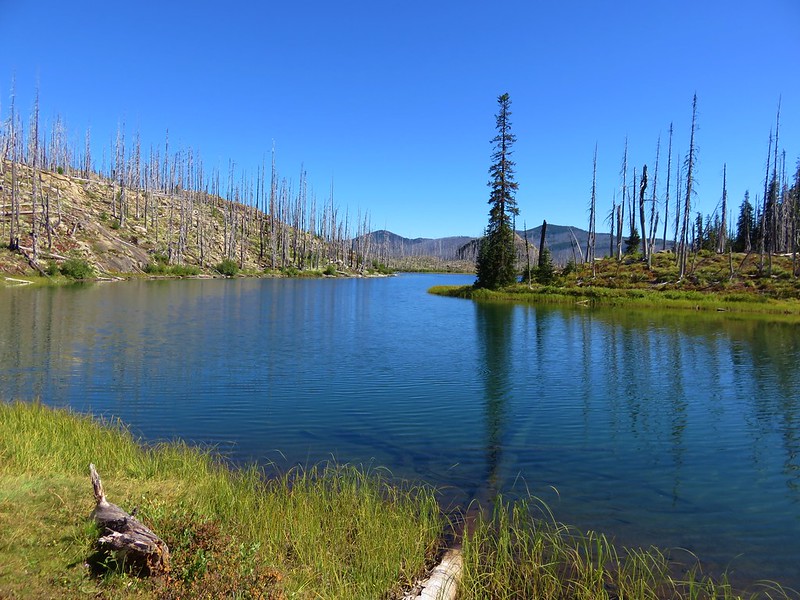
From this direction the first lake in the basin that we reached was Blue Lake.

We headed down to the lake where we were able to find a little shade on a rock along the shore.
After having a snack and cooling down we continued on following the Blue Lake Trail further downhill toward Jorn Lake.
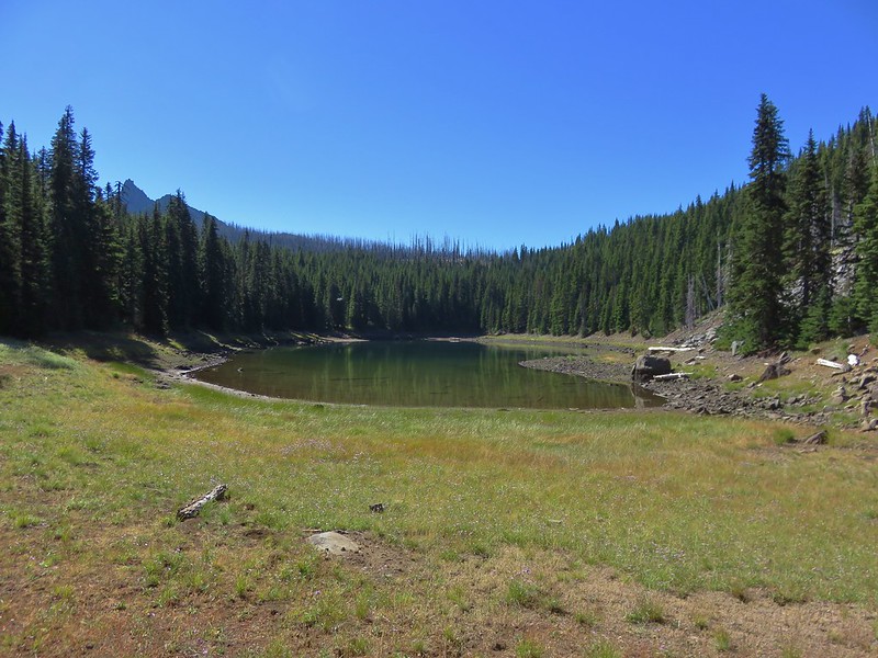
Before checking out Jorn Lake more closely we wanted to continue past our planned loop a short distance to visit Red Butte Lake. We had scrambled up Red Butte in 2010 when we had taken a hike from the Duffy Lake Trailhead. We had turned around after climbing up the butte and not made it as far as Red Butte Lake so we figured this time we’d check it out. We wound up following a series of unofficial trails between Jorn and Red Butte Lakes which passed several nice looking campsites before finally bringing us to the shallow little lake.
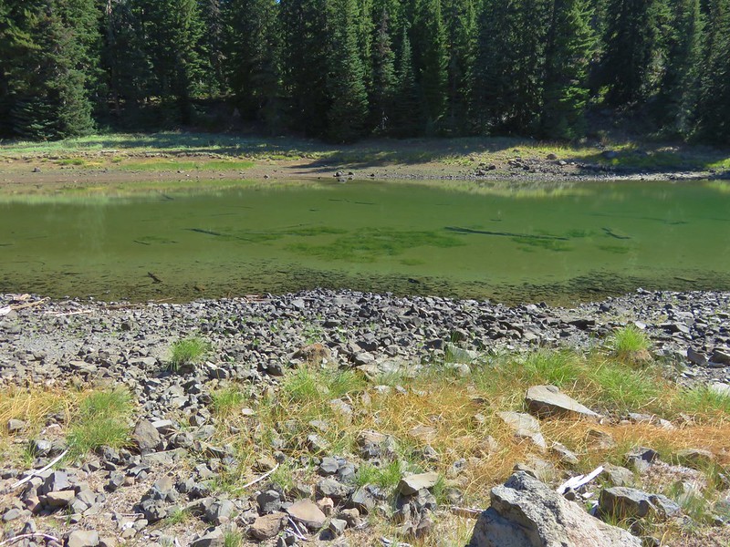
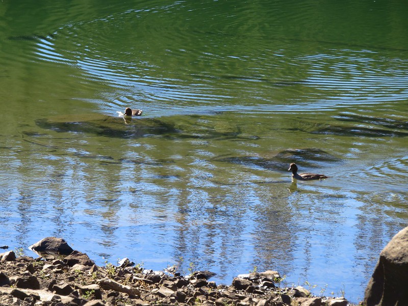
We found a log to sit on and tried to watch some ducks enjoying the lake but it was just too hot to sit out in the sunlight so we decided to head back to Jorn Lake where some of the trees had been spared from the fire.
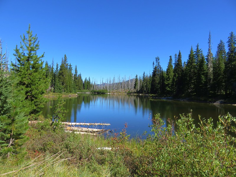
We took the official Blue Lake Trail back down to a junction with the Bowerman Lake Trail near Jorn Lake.
Before we turned onto the Bowerman Lake Trail we went down to Jorn Lakes shore.
While we were sitting by the lake a doe came down to the eastern end of the lake.
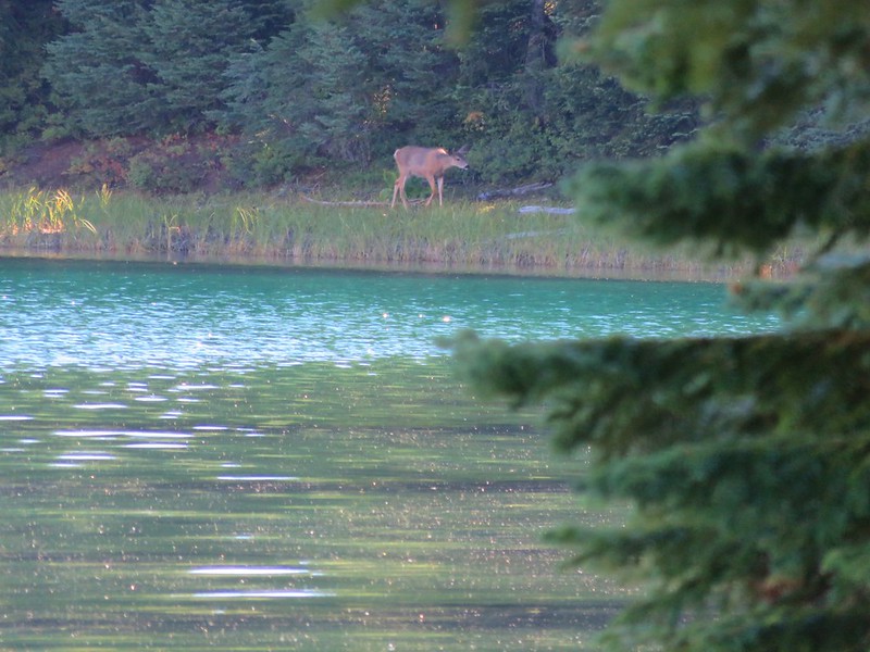
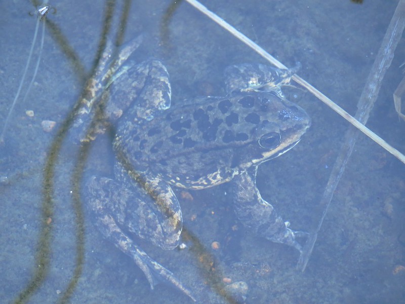
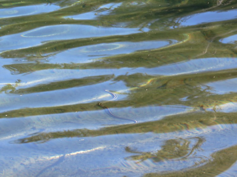
After she disappeared behind some trees we began to walk along the shore toward where she was since that was the direction we would be heading on the Bowerman Lake Trail. On the way a frog and a garter snake went from the shore into the water.
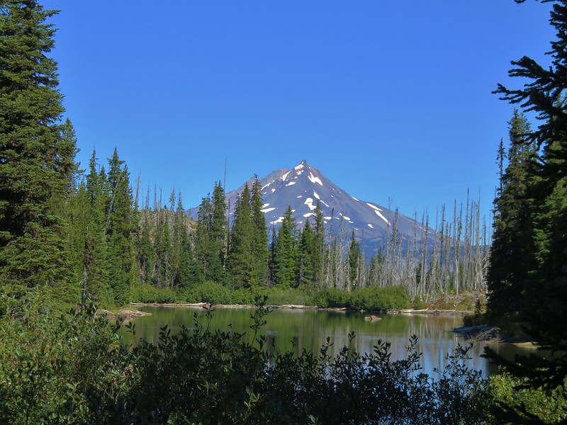
The best view of Mt. Jefferson came at the SE end of the lake.
We left the lake and briefly returned to the Bowerman Lake Trail but then quickly left it to check out a series of ponds between Jorn Lake and Bowerman Lake.

It was at Bowerman Lake that we realized it was opening weekend of hunting season when we ran into a gentleman who was resting by the lake.
Bowerman Lake was the last lake in the Basin that the trail passed and we were soon back into the snags.
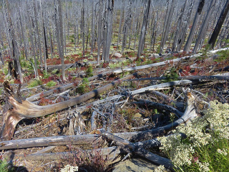
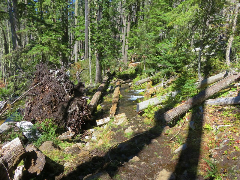
The trails up until this point had been well maintained but the next 2+ miles on the Bowerman Lake Trail became increasingly difficult as numerous snags covered the path.
We spent quite a bit of time going over, under, around logs. Often times it was just easier to walk on top of them. Conditions improved after we reached the Minto Pass Trail where someone else had apparently encountered the obstacles over the Bowerman Lake Trail.
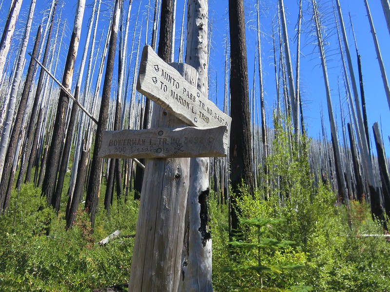
We were now following the Minto Pass Trail two miles to Marion Lake. Many of the vine maples along this trail were in full Autumn mode.
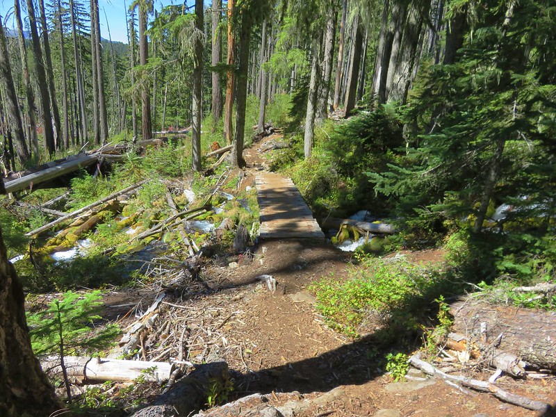
The trail crossed several springs and creeks as it neared the lake including the very pretty Mist Creek.

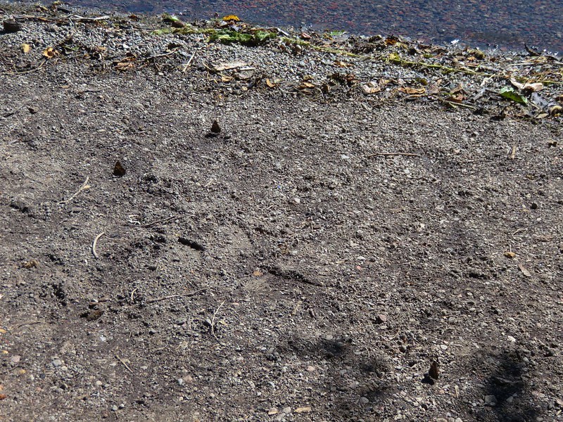
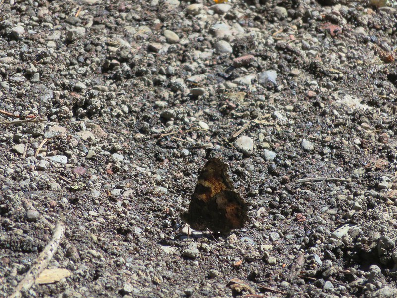
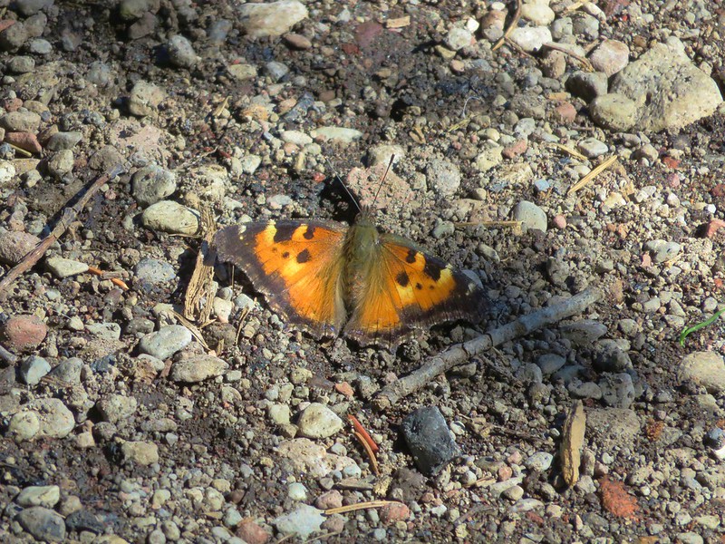
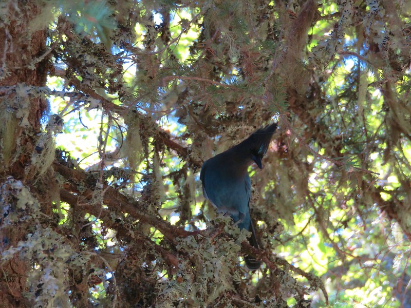
When the trail approached Marion Lake we walked down to the lake shore for one final rest stop. Three Fingered Jack rose above the lake on the horizon and we were joined by a number of tortoiseshell butterflies and a friendly Stellar’s blue jay.
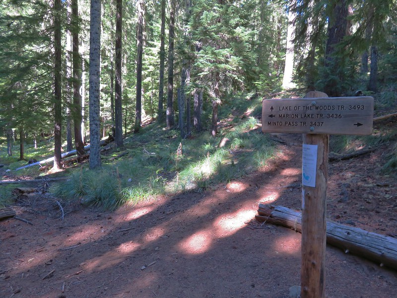
The Minto Pass Trail had been recently rerouted, adding a couple of switchbacks, just before arriving at a three-way junction with the Lake of the Woods and Marion Lake Trails.
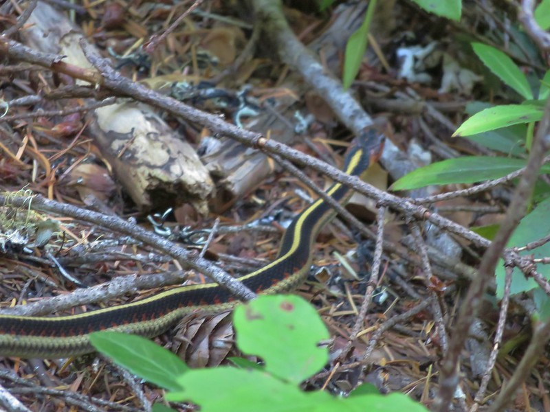
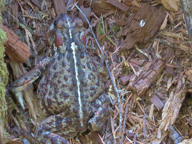
Back on the Marion Lake Trail we followed it for a half mile passing a trail to the lake’s day use area and continuing another .3 miles to the Marion Outlet Trail junction where we had begun our loop. We retraced our path from the morning spotting a garter snake and a large western toad along the way.
Unfortunately not all of the wildlife encounters were so nice. Between spotting the snake and the toad we had paused at Lake Ann for a moment and Heather was almost immediately stung by a yellow jacket. Several more were buzzing around and we ran to the end of the lake to avoid any additional stings.
What was supposed to be a sort of “easier” hike than what we’d been doing lately turned out to be a little more taxing than planned. Between the warm temperatures and exposure in the burn area and the stretch of trail covered in downed snags we were feeling pretty tired by the time we made it back to the trailhead. We had also managed to turn the 15.2 miles we had planned on into 17.9 miles by visiting the falls, Red Butte Lake, and doing some other off-trail exploring. It had been worth it though. The colors were amazing, we’d seen a lot of wildlife, and despite the full parking lot hadn’t seen very many other people along the way. Happy Trails!
Flickr: https://www.flickr.com/photos/9319235@N02/albums/72157673717910585
