On our previous outing at the end of March I was testing my left leg (post) after some tightness in that knee. While that hike went relatively well and my left knee/leg came out of it feeling no worse for the wear my back tightened up followed by pain in my right hip. I went in for a physical therapy appointment in mid-April and was given some stretching and strengthening exercises to help me get back on track. The working theory is that I strained something, probably when my left leg hyperextended slightly on a step on my Deschutes River Hike in January (post) which caused me to change my gait enough to put extra strain the muscles in that leg which have always been extremely tight. As the physical therapist put it those tight muscles were then fighting over the knee and the knee was losing. The right hip issue was likely a result of another change to my gait to compensate for the left leg. He surmised that at this point my whole pelvic area was off kilter, so we are working on correcting that. The good news was he didn’t put any limits on activities (within reason).
After a week of doing my exercises, I was ready to give another hike a try. To be honest I wanted to get a hike in before April was over because I hadn’t gone a full calendar month without taking at least one hike since January 2013. It also did seem like the physical therapy was helping and I wanted to see how my body reacted to a short outing.
I wanted to keep my day to no more than three miles and decided on a potential two stop day beginning at Ritner Creek Park. The small county park is located near the unincorporated community of Pedee in Polk County. Heather did not join me opting for a longer hike at Ellendale Creek which I’d visited without her this past January (post).
Things got off to a rocky start before I’d even arrived at my first stop when I stopped to try and take a picture of a turkey crossing gravel Gage Rd. When I tried to turn my camera on nothing happened. I had just recharged the battery the night before and had not brought any of my extras because the day was going to be so short. I tried removing and reinserting the battery to no avail. Given I had just recharged the battery I feared the camera may have taken its last picture, but it turned out to be the battery and not the camera. Without my camera I was relegated to using my cell phone for pictures.
I parked at the small parking area along Gage Road just before 6:30am and was surprised to find two other vehicles. Trails led off in both directions from the ends of the parking area.

 The trail on the east (right) end.
 The trail on the west (left) end and the restrooms.
I headed east first. The trail on this side only extended about 150 yards before ending at Ritner Creek.

There were snails littered along the trail and few wildflowers along the sides.


Fringecup

Candyflower

Strawberry

Ritner Creek at the end of the trail. Another trail is visible on the far side.
I returned to the parking area and headed west next. The trail on this side of the park arrived a footbridge after approximately 100 yards.


The trail turned east on the far side of the creek and continued another 0.2-miles ending across from the end of the trail on the other side.


Bleeding heart

Western meadowrue


Elderberry

Salmonberry

Violet

One of several picnic tables along the trail on this side of the creek. There were fire pits and garbage cans as well.

Star-flowered Solomon’s seal

Fairy lanterns


End of the trail.
I discovered that the two vehicles belonged to turkey hunters who were not thrilled when I let them know I’d seen one crossing the road on my way to the park. My hike here was just a little over half a mile. While there isn’t a lot of hiking to do here the picnic tables, creek and restrooms would make it a good place for kiddos or for a nice lunch spot.
The short hike along the creek hadn’t caused any issues with my back, hips. or legs so I headed for my second stop which was Fort Hoskins Historic Park which was just 9.3 miles from Ritner Creek Park in neighboring Benton County.
We’d visited Fort Hoskins way back at the beginning of June 2014 (post). The park offers two hiking loops from the trailhead. The lower half mile interpretive loop visits the former fort site with a spur leading to the 1869 Frantz-Dunn House while the 1.3-mile upper loop passes through a restored oak savanna on the side of Dunn Ridge.

With the two loops heading off in different directions from the trailhead I could bail after the first loop if I was starting to have any issues. I decided to tackle the upper loop first hoping to see some wildflowers on the hillside. The upper loop also offered the most climbing gaining over 300′ on its way up the ridge. The upper loop starts at a small post across the entrance road from the restrooms.


Rose checkermallow
After a tenth of a mile the trail splits with the right-hand fork heading out into a meadow and the left staying in the trees. I stayed left and continued climbing through the forest.

The right-hand fork heading into the meadow.


Evergreen bugloss

Fairy slipper

Poison oak. The trails were clear but there was a fair amount just off trail in places.

Vetch

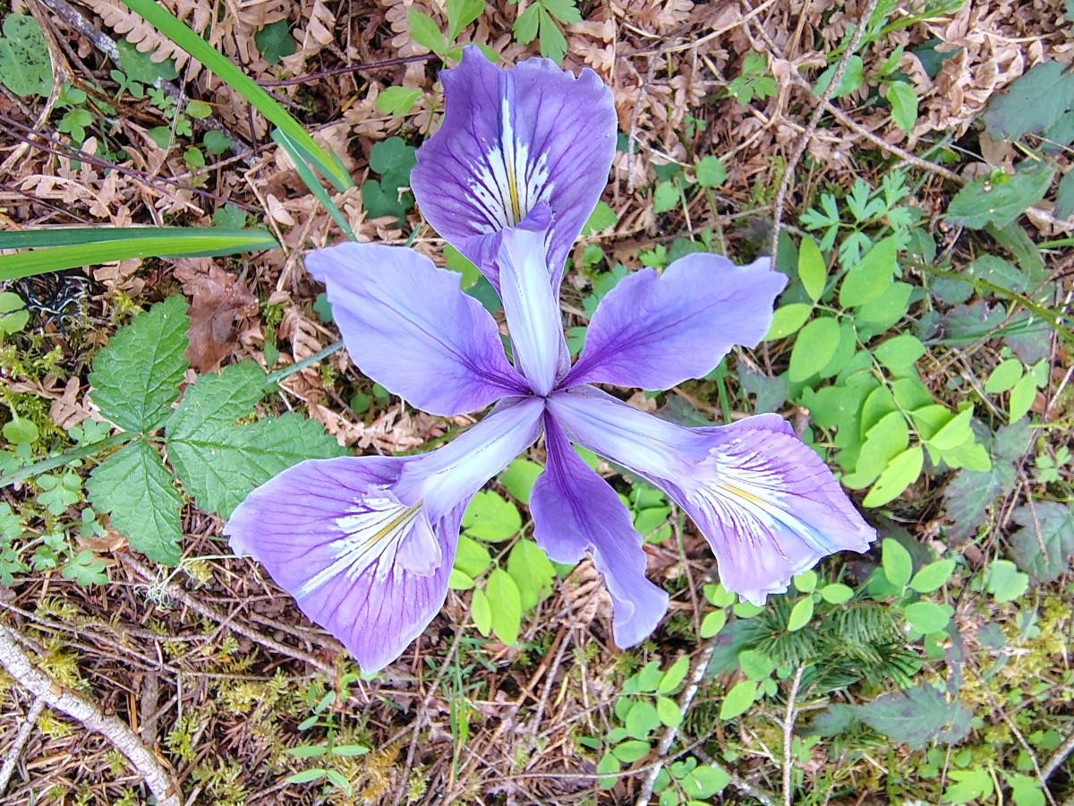
Iris

Fairy lanters

Violet

Snow queen


Checker lily

The trail leveled out near the top of the ridge and headed into the restored oak savannah.


There were a lot of iris blooms in the meadow.

Looking west into Kings Valley from Dunn Ridge.

The trail starting to head down through the meadow.

Serviceberry


Buttercup

Purple dead-nettle

The Commanders House below at the old fort site.

The split for the upper loop.

It looks like someone took a piece of pie.
When I got back to the trailhead I decided to give the lower loop a go. I followed a paved path to the picnic shelter then down the gated road to the former fort site.

The picnic shelter


The picnic shelter from the parade grounds.
We had not visited the Frantz-Dunn House in 2014 so this time I turned down a roadbed before the Commanders House and checked it out.


Apple blossoms
After visiting the house I headed back up to the Commanders House and completed the interpretive loop.


Foundation of Hoskins School.

Final paved stretch before reaching the trailhead.
The two loops and detour down to the Frantz-Dunn House came to 2.3-miles and 450′ of elevation gain.

I ended the day with just under 3-miles which was a few tenths of a mile more than my back would have liked. My lower back had started to tighten up on the lower loop and is still a little tight as I am writing this the next morning. On the bright side the left leg and right hip do not appear to have suffered any setbacks. It appears that I’ll be sticking to shorter outings for a bit as I work my way back through PT. I will try and make the most of it and use the time to possibly check out some places like Ritner Creek that we would likely not visit under normal circumstances. Happy Trails!
Flicker: Ritner Creek & Fort Hoskins Parks
