Having canceled plans for trip to the North Cascades National Park due to my ongoing back/hip/leg issues Heather decided not to use up a week of vacation. That left me on my own as I continue to try and work back to a place where a week of fairly intense hiking is possible. My plan for the week off was to get out 5 times over the 10 days. Hike one was to Canyon Creek Meadows on Saturday when Heather was able to join (post).
Hike two was going to be Black Crater in the Three Sisters Wilderness which we had visited in 2016 on a cloudy day and gotten no view from the summit (post). Unfortunately, when I got up a 3:15am and double checked the forecast it had gone from sunny to areas of smoke due to wildfires. The forecast was similar to the north in the Mt. Hood area and to the south, around Diamond Peak, there was a chance of rain showers. I then checked the Oregon Coast which was free of precipitation and smoke. I decided to head to the Cape Perpetua Scenic Area and hike some of the trails in that area.
We’d visited the Cape Perpetua Scenic Area in 2010, 2013 and 2018. For this visit my plan was to hike a loop incorporating some of the trails that we hadn’t been on during any of the previous visits.
I began at the Cape Perpetua Visitor Center at 6am.

Not surprisingly I was the first car in the lot.
I made my way to the RV Parking area where the Cook’s Ridge Trail begins next to a signboard with a map.


My plan was to take the Cook’s Ridge Trail up to the Cummins Creek Trail and then follow that trail down to the Oregon Coast Trail and follow that trail back to the Visitor Center. I was also hoping to detour down into the Cummins Creek Wilderness to see Cummins Creek near the Cummins Creek Trailhead.
The Cook’s Ridge/Discovery Loop Trail climbed steadily up an old logging track for 0.4-miles to the start the 0.6-mile loop.


I stayed left at the junction and after another 0.3-mile climb passed the upper loop junction.


Ghost pipe (Monotropa uniflora L.) There was a lot of this plant along the trails during this hike.

View from the Discovery Loop.

Ghost pipe on both sides of the trail.

There was something fairly large rustling around in the brush, but I never saw anything.

Signs at the upper junction. I stayed left on the Cook’s Ridge Trail heading for the Cummins Creek Trail. It was 2.8 miles to that trail which consisted primarily of gradual climbing although there were a couple of downhills to drop into saddles.


None of the coastal huckleberries were ripe yet.

Starflower

Douglas squirrel

More ghost pipe.

Little prince’s pine
At the 2.4-mile mark I passed the junction with the Gwynn Creek Trail.

Up until now the hike had been entirely new to me. In February 2013 we had descended to this junction from the Cook’s Ridge/Cummins Creek Trail junction and taken the Gwynn Creek Trail back down to return to the Cummins Creek Trailhead. Incidentally that was the first hike we covered in this blog. I continued uphill another 1.1-miles to the Cummins Creek Trail junction.


Red elderberry

Fringecup

An aven and self-heal


Coastal brookfoam

Bleeding heart

Coming up on the Cummins Creek Trail junction.
I made a sharp right onto the Cummins Creek Trail and continued to climb briefly before the trail began a long gradual descent.


Yarrow

Elegant brodeia

Ocean spray


Snail
After a half mile on the Cummins Creek Trail I passed a 0.1-mile spur trail to a viewpoint.

We visited the viewpoint in 2013 and given how cloudy it was I decided to save those 0.2-miles for my detour to Cummins Creek. A tenth of a mile beyond the viewpoint spur I came to another junction.

To the left was the old Cummins Creek Trail and to the right the newer Cummins Creek Loop Trail (as shown on the trailhead map). In 2013 we’d come up the newer trail so today I turned left and headed down the older trail.


Thimbleberries, I did manage to find one ripe one and a few ripe red huckleberries.

The upper portion of the trail was a little overgrown, but it was clear of obstacles.

View out to the Pacific Ocean.

White triteleia


Crab spider on a daisy.


Tiger lily
After a steep half mile descent I arrived at an old roadbed with a trail sign.

I turned right and followed the old roadbed 1.4-miles to a junction with the Cummins Creek Loop Trail.


Creeping buttercup

Coastal manroot
The road sits on the edge of the Cummins Creek Wilderness.


Moth

The Cummins Creek Loop Trail joining from the ridge on the right.
Given how steep the descent was to the roadbed I was glad that we had not tried to take this trail up in 2013. From the junction I continued to follow the old roadbed for 1.2-miles where I turned left onto a clear but unsigned trail leading downhill into the Cummins Creek Wilderness.


This rabbit hopped out onto the trail and posed for a moment.

I was surprised to find some blooming fairy lanterns.

I turned down the trail which had decent tread to begin with.

After climbing over and through a couple of downed trees I arrived at a flat basin.

The trail got overgrown fairly quickly and I lost it in a swale of skunk cabbage, ferns and grass.

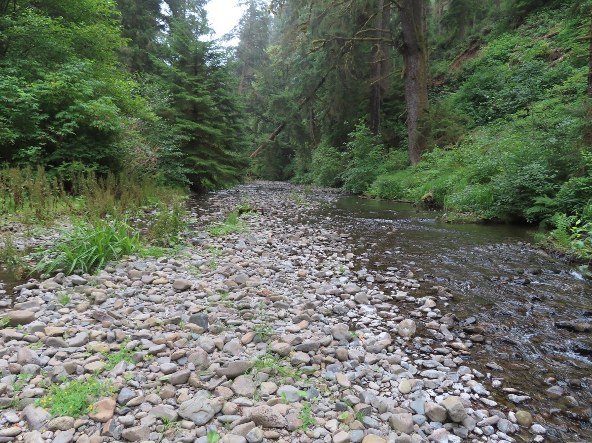
There were some faint, possibly game, trails heading toward the creek so I picked one and made my way toward the sound of water. I popped out of the brush next to a bunch of logs and a couple of small rock islands.

Mushrooms

Where I popped out of the brush.

I climbed over these logs to reach the rocks.

Cummins Creek

California figwort along Cummins Creek.
After a short break I recrossed the logs and found a little clearer game trail back to the main trail and returned up to the Cummins Creek Trail. I followed the Cummins Creek Trail 0.2 more miles to the Cummins Creek Trailhead then walked the road an additional 0.2-miles to a small pullout with a signboard marking the Oregon Coast Trail.


It was 1.3-miles back to the Visitor Center. This section provided several views of the Pacific.


I had one of these ripe salal berries and it was the best salal I think I’ve ever had. If you’re familiar with the berry you know that the skin can be a little thick and hairy, but they have a sweet flavor.


Gwynn Creek

I passed the junction with the Gwynn Creek Trail 0.3-miles from the road. Since we had come down the Gwynn Creek Trail in 2013 I was once again on a section of trail I hadn’t hiked before.


Cape Perpetua from the trail. You can barely make out the stone shelter atop the cape if you zoom in.


Highway 101


My loop came to 9.6-miles with approximately 1600′ of elevation gain.

Over half the loop was new-to-me trail. I passed a total of five people, three were between the Cummins Creek Loop/Cummins Creek Trail junction and where I detoured down to Cummins Creek, and the other two were on the paved trail up to the Visitor Center. While we don’t often hike on the coast in July since that is prime time for higher elevation hikes this proved to be a great alternative. Based on the forecast for the rest of the week I may be looking for another coastal hike or two. Happy Trails!
Flickr: Cook’s Ridge/Cummins Creek Loop

