My brother and his family came for a weeklong visit on the 4th of July from Missouri. When we first talked about the visit Jason mentioned they were hoping to join us on a hike so I’d asked what their ideal hike would entail. The answer was something in the Mt. Jefferson Wilderness, preferably involving a lake and a waterfall with a length of 5 to 6 miles. I immediately thought of Marion Lake, a hike that includes two lakes, a pair of waterfalls, and views of both Three Fingered Jack and Mt. Jefferson. As an extra bonus our son Dominique would also be joining us.
We had done this hike back in 2014 (post) and returned in 2016 for a much longer loop to the Eight Lakes Basin deeper in the Mt. Jefferson Wilderenss (post). Those visits were prior to the implementation of the Central Cascade Wilderness permit system. Permits are now required from June 15th to October 15th. Overnight permits are required to stay anywhere in the Mt. Jefferson. Three Sisters, and Mt. Washington Wilderness areas while day use permits are currently required at 19 of the 79 trailheads accessing these wilderness areas including the Marion Lake Trailhead. Day use permits are released in two rounds. About 40% of the day use permits for a specific date are released at 7am ten days before that day with the reminder made available two days before the date. I was ready at our computer at 7am on 6/26 and secured the six $1 permits we’d need for our families.
They were good sports and were willing to be on the road at 6am to allow us to be at the trailhead around 7:30am and take advantage of the cooler morning temperatures.


We followed the trail gradually uphill for approximately three quarters of mile to the boundary of the Mt. Jefferson Wilderness.


Prince’s pine

Twinflower


Most of the rhododendron were done blooming but a few blossoms remained.

Anemone

There were a few ripe huckleberries along this stretch.

Washington lily
Our sharp-eyed niece spotted this frog along the trail.


Wilderness sign near the boundary.

Sugar sticks, also spotted by Bekkah.
The trail continued its gradual climb which included a couple of switchbacks before arriving at Lake Ann near the 1.6-mile mark.


One of several small springs along the trail.


Wintergreen

Thimbleberry

The outlet of Lake Ann flows beneath the trail here through the porous lava.

The trail passing along Lake Ann.

Lake Ann
After a short break at Lake Ann where we spotted a common merganser on the water and debated whether or not the brown hump on the far side of the lake was a grazing deer or something else (it was something else) we continued on. Just two tenths of a mile later we arrived at a junction where the trail split.

The Marion Lake Trail went left while the Marion Lake Outlet Trail was to the right. We forked right onto the Outlet Trail and in another tenth of a mile came to the unsigned trail to Marion Falls on our right.

We turned right onto this rougher path which crossed over a small ridge then descended to the top of Marion Falls.

This trail had a number of downed trees that required stepping over.

Gnome-plant

Above Marion Falls.
While there was some blowdown over the trail to the top of the falls it isn’t a particularly difficult 0.2-miles. The trail steepens significantly however if you wish to reach the bottom of the waterfall.

The trail disappearing as it drops steeply down the hillside.


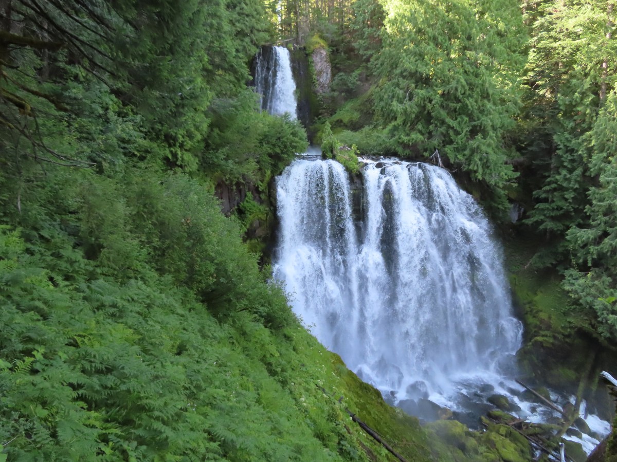
Marion Falls
At the bottom of Marion Falls you are also near the top of Gatch Falls. (Some say it is actually just the lower tier of Marion Falls.)

Bachelor Mountain (post) from the top of Gatch Falls.

Monkeyflower

Looking back up the trail from below.
To get a view of Gatch Falls requires an even rougher and steeper descent.


Marion Creek continues tumbling downhill to Gooch Falls (post) a little over two miles downstream.
After admiring the waterfalls, we climbed back up to the top of Marion Falls and took a well-earned snack break before returning to the Marion Lake Outlet Trail.


We followed the trail another half mile around rocky hillsides where my brother’s family spotted a pika as it darted over the rocks and paused briefly before disappearing.

There is plenty of pika habitat such as this in the area.
After the half mile we found ourselves at a junction with the Blue Lake Trail.

At the junction we faced a choice, in order to keep the hike at 6-miles we would have needed to turn left here and hike 0.7-miles along Marion Lake to the Marion Lake Trail and turn left again for 0.4-miles to the junction with the Marion Lake Outlet Trail near Lake Ann. If, however, we wanted to get a view of the wilderness’ namesake, Mt. Jefferson, a detour or two would be needed. By turning right on the Blue Lake Trail for a quarter mile across a talus slope, the top of Mt. Jefferson would be visible across the lake which is what we did.


Better views can be had by going a little further, but because trees line the trail beyond it requires descending steeply to the lake shore which was a little more effort than we had in us today.

After getting a look at Mt. Jefferson we recrossed Marion Creek and hiked along the forested lake shore to the next detour at the day use peninsula.


The only beargrass that had any blossoms left on it.

Three Fingered Jack

Marion Peak is the forested peak to the left and Marion Mountain (post) is the rounded hump just left of center.

We detoured out the peninsula and took a break on some bedrock smoothed by ice age glaciers with a view of the top of Mt. Jefferson.


I continued steeply down the end of the peninsula to get another view of Three Fingered Jack before joining the rest of the group on the rocks.


California tortoiseshell

Creamy stonecrop and beardtongue

Paintbrush
After a nice break we returned to the main trail and continued on to the junction with the Marion Lake Trail.


Vine maple and thimbleberry along the trail.

Signpost at the junction.
We turned left and started the 2.2-mile return to the trailhead.


Lake Ann in the afternoon.

Heading out of the wilderness.

Pearly everlasting at the trailhead.
My GPS registered 6.6-miles for this hike. Total elevation gain for the hike was approximately 975′. My trip to the end of the peninsula added a little over a tenth of a mile.

Everyone survived the hike and more importantly seemed to enjoy it. It was a lot of fun spending the day with family and enjoying God’s creation. Happy Trails!
Flickr: Marion Lake

