Categories
High Cascades Hiking Mt. Hood Area Oregon Trip report

Ramona Falls – 07/09/2026

It’s been a busy week here. Monday, we took my brother and his family on a hike to Marion Lake (post), Tuesday I drove our son home to Eugene where we stopped at Meadowlark Prairie for a short outing (post). Wednesday, I had a follow-up appointment with my doctor who referred me back to physical therapy, this time for my back, as well as massage therapy to hopefully address the remaining issues I’m having.

While my back and hips are still bothering me, I’m not under any activity restrictions so Thursday I headed back to the trails. My brother and his family had gone down to Northern California for a couple of days to see the redwoods and Heather had to work leaving me on my own. After considering a couple of options I landed on Ramona Falls which Heather had visited back on May 30th. I was also hoping to visit the remains of the Upper Sandy River Guard Station.

I got an extra early start to my day and arrived at the Ramona Falls Trailhead shortly before 6am.
IMG_7894

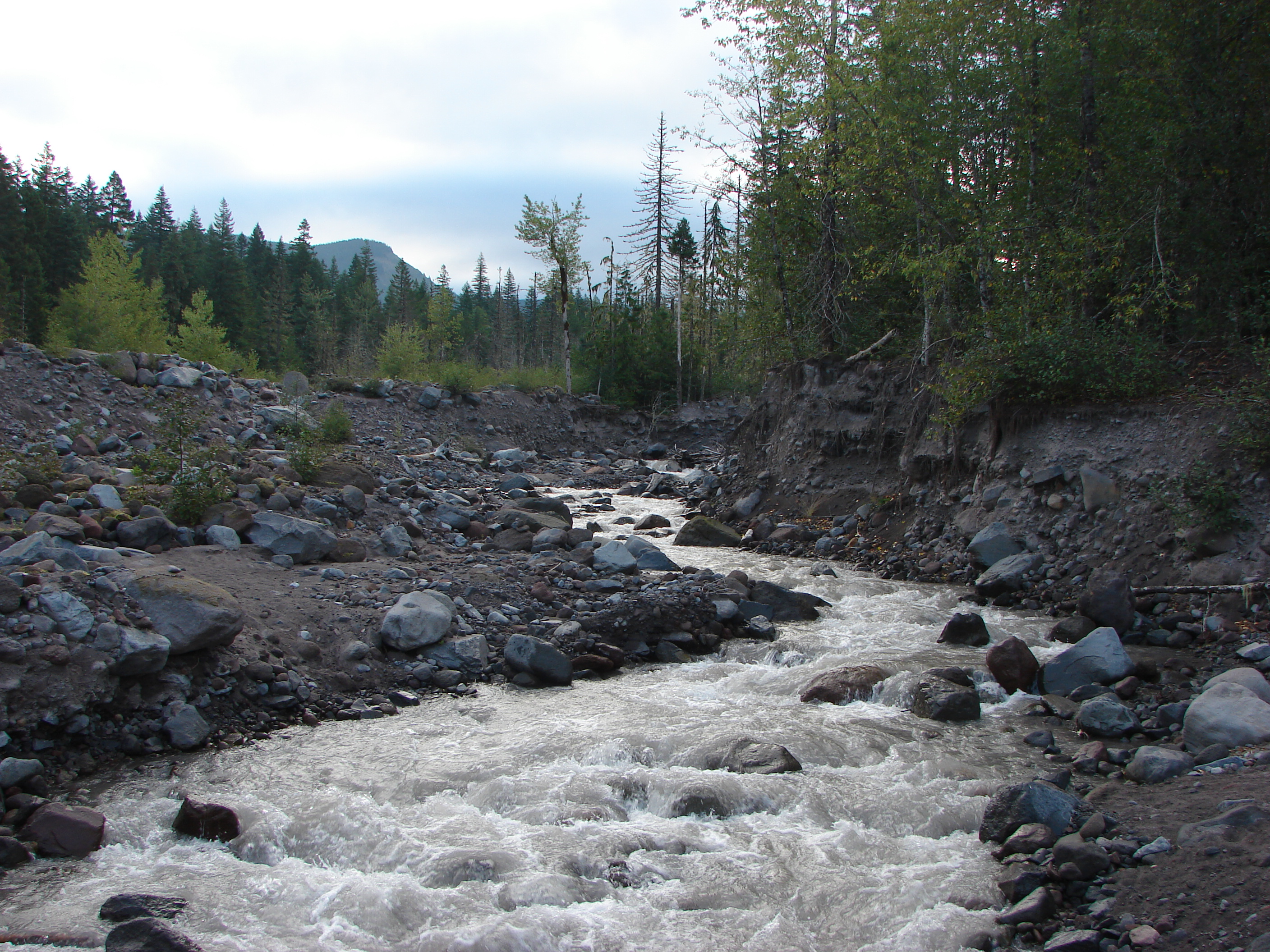
The trail almost immediately enters the Mt. Hood Wilderness making a very gradual climb along the Sandy River for 1.3-miles before dropping to a crossing of the river.
IMG_7897
The wilderness sign to the right behind the trail sign at the trailhead.

IMG_7899

IMG_7905
White spiraea

IMG_7906
A faded wilderness map stands near a junction where the Sandy River Trail joins from left.

IMG_7911

IMG_7918
Fireweed

IMG_7921
Beardtongue

IMG_7927
Pearly everlasting and penstemon

IMG_7935
Mt. Hood from the trail just before dropping down to the river for the crossing.

IMG_7939
Monkeyflower

It had been almost thirteen years since I’d been on this trail, having last visited when we hiked up Yocum Ridge (post). That was the year before a hiker was tragically swept away attempting to cross the seasonal bridge the Forest Service used to install for the Sandy River Crossing following a sudden storm. That was the last time a seasonal bridge would be installed. The crossing now changes from year to year depending on where the best option can be found. This year the crossing consisted of three logs, two small logs tied together and a larger log sitting around waist high to hold onto.
IMG_7940

IMG_7941
Easy peasy crossing this year.

IMG_7943
On the other side of the river I spotted a raspberry bush with a single ripe berry and more to come.

I continued another third of a mile to a junction with the Pacific Crest Trail.
IMG_7944
Last Chance Mountain

IMG_7946

IMG_7949

IMG_7950
The PCT to the left (northbound) and to the right (southbound). Ramona Falls can be reached in either direction on a loop, but I prefer clockwise so I stayed left.

After half a mile I left the PCT at another junction by turning right on the Ramona Falls Trail.
IMG_7953

IMG_7955

IMG_7956

IMG_7958

IMG_7959

Next was a 1.8-mile stretch on the Ramona Falls trail to a junction with the Timberline Trail near Ramona Falls.
IMG_7961

IMG_7964
Salal

IMG_7965

IMG_7969
Twinflower

IMG_7972

IMG_7981
Most of the rhododendron blossoms were done but there were a few remaining in the cool forest here.

IMG_7984

IMG_7987

IMG_7999
The Timberline Trail junction and the first glimpse of Ramona Falls.

I had passed a couple of tents a little before reaching the junction but I was the only one at the waterfall at 7:23am. I took a short break and had a snack before continuing on my hike.
IMG_8001

IMG_8003

IMG_8013

IMG_8015
The view from my break spot.

After my snack I continued on the Timberline Trail toward the PCT.
IMG_8021
Looking back at the falls.

IMG_8024
Squirrel

IMG_8026

I had dropped the location of the Upper Sandy Guard Station, which sits on a bench below the Timberline Trail and above the PCT, on my map. As I neared the pin I began looking for a faint trail to the left. My first attempt was too early and the short path led to a secluded camp site but my second attempt led me to a rough trail the led down to the crumbling guard station.
IMG_8029

IMG_8031

IMG_8032
The remains of the guard station.

IMG_8033
The Sandy River Canyon.

IMG_8035

IMG_8038
For the fascinating history of the station please read this post by WyEast Blog.

From the guard station I followed a steep path downhill past another pair of tents to the Pacific Crest Trail (also the Timberline Trail here). To get back to the trailhead I needed to turn right and head northbound however I was in an exploring mood and had not ever been to the Sandy River Crossing which was only 0.3-miles away, so I turned left.
IMG_8042

IMG_8045
Red elderberry

IMG_8047
Paintbrush

IMG_8051

IMG_8052
The Sandy River crossing. The river is pretty braided here and crossing wouldn’t have been too difficult, but it would have required fording at least one of the braids and I didn’t have my water shoes with me and didn’t want wet shoes so exploring further up the trail toward Paradise Park (post) was not an option.

Instead I decided to head upstream along the river and see what the area between Yocum Ridge and Slide Mountain was like.
IMG_8054

IMG_8056

IMG_8058
No official trails head up the canyon but there were some footprints and several camp sites closer to the crossing.

IMG_8059

This area was also popular with pikas. Several seemed to be having a conversation in “meeps” about my presence. It took a while but I finally spotted one of them.
IMG_8063

I rambled a little of half a mile beyond the crossing before deciding that I’d had enough scrambling over rocks and turned around.
IMG_8068

IMG_8070
Buckwheat

IMG_8074
The view from my turnaround spot. Not only was it rocky but it was getting increasingly brushy.

With no actual trails my route back was quite a bit different in spots, and I spotted some flowers I’d missed on my first pass.
IMG_8076
Starting back.

IMG_8078
Beardtongue

IMG_8080
Paintbrush

IMG_8081
Buckwheat patch.

IMG_8085

IMG_8086
Monkeyflower and algea

IMG_8089
Golden-mantled ground squirrel

As I neared the Timberline Trail/PCT crossing I spotted pink flagging on the far side that marked the continuation of the trail.
IMG_8091

IMG_8092

IMG_8093
California tortoiseshell

I found a spot where I could cross the first braided channel of the river but from the little island I was on I couldn’t see a way to cross the next one without getting wet.
IMG_8094

IMG_8097

I returned to the riverbank and picked up the trail then headed back.
IMG_8101

IMG_8105
Sugar sticks

The PCT/Timberline Trail climbed to a junction on a ridge where the Timberline Trail split off to the right toward Ramona Falls and the PCT went left. I went left and descended to the junction with the Ramona Falls Trail and then left the PCT to return to the trailhead.
IMG_8106

IMG_8111

IMG_8113

IMG_8117

IMG_8119
Woodpecker

IMG_8129

IMG_8139
Back at the crossing.

IMG_8141
Last look at Mt. Hood with the Sun kind of in the way.

IMG_8148
Back at the trailhead.

Ramona Falls was as beautiful as I’d remembered and getting to see the old guard station was neat. Doing the hike on a weekday morning provided a lot of solitude. I only passed 13 people on the trails and ten of those were from the crossing to the trailhead. I’d seen about the same number of people at the various camp sites that were occupied. The hike itself came to 9.5-miles with approximately 1400′ of elevation gain.
Screenshot 2026-07-09 124818

This was the longest hike I’d done since my January 31st 14.8-mile hike along the Lower Deschutes River (post). I’m a little tight/sore as I write this trip report, but the hike itself felt really good. Hopefully this next round of therapy will help get me the rest of the way back. Happy Trails!

Flickr: Ramona Falls
Categories
High Cascades Hiking Mt. Hood Area Oregon Trip report

Yocum Ridge

Yesterday we completed what turned out to be our longest hike to date – Yocum Ridge. According to our 100 hikes guidebook the distance of the trail is 8.7 miles one way to a viewpoint of Mt. Hood’s Sandy Galcier. With that in mind we were anticipating a total distance around 17.5 miles, but by the time we were done exploring Yocum Ridge our garmin showed a total distance of 19.7 miles. :O Our original plan was to meet my parents at the trail head and hike together to Ramona Falls, but they were unfortunately unable to make it so Heather and I were off on our own just before 7am.

It was a cloudy morning as we crossed the Sandy River and made our way along Ramona Creek toward the falls.

Crossing the Sandy River

Ramona Creek is one of the prettiest creeks we’ve hiked along, but the dense forest always seems too dark to get any pictures to really do it justice.

Ramona Creek
Ramona Creek

When we arrived at Ramona Falls it was just as impressive as we had remembered it from our first visit the previous July.

Ramona Falls
Ramona Falls

From Ramona Falls we took the Timberline Trail north for .7 miles to the Yocum Ridge trail and began our climb. We were presently surprised by the gentle grade of the trail which climbs nearly 3000′. The lower portion of the trail was heavily forested with lots of mushrooms and red huckleberries. We spotted one pika (and heard many more) and a small frog along the trail as well. The clouds were low and a light fog filled the trees making it impossible to tell if the trail offered any views. We passed a couple of small ponds and some meadows that had been home to flowers earlier in the year.
048

We were holding out hope that we would eventually climb above the clouds and into blue skies but we began to think that was just wishful thinking. We caught our break though as we approached the south side of the ridge near a rock field and wild flower meadow. When we came out of the trees in the meadow we were greeted by blue sky and sunlight. Looking up toward Mt. Hood the summit was visible above the tree tops.

Mt. Hood above the tree tops.

The clouds were still all around so we decided to double time it up the trail not knowing how long the views would last. We were slowed by the increasingly scenic wildflower meadows and views to the south across Paradise Park to the distant summit of Mt. Jefferson.

Paint & aster meadow


Paradise Park & Mt. Jefferson

As we hurried up the trail other flowers such as western pasque, bistort, fireweed, and groundsel showed up in the meadows. The trail then entered a series of spectacular meadows as it traversed around the ridge finally revealing a view of Mt. Hood.
110
Small clouds were passing in front of the mountain as we approached through the meadows. From this side of the ridge we had an up close view of Illumination Rock and the Reid Glacier.

Reid Glacier & Illumination Rock

The wildflower meadows were on all sides as the trail headed straight for the mountain.
129

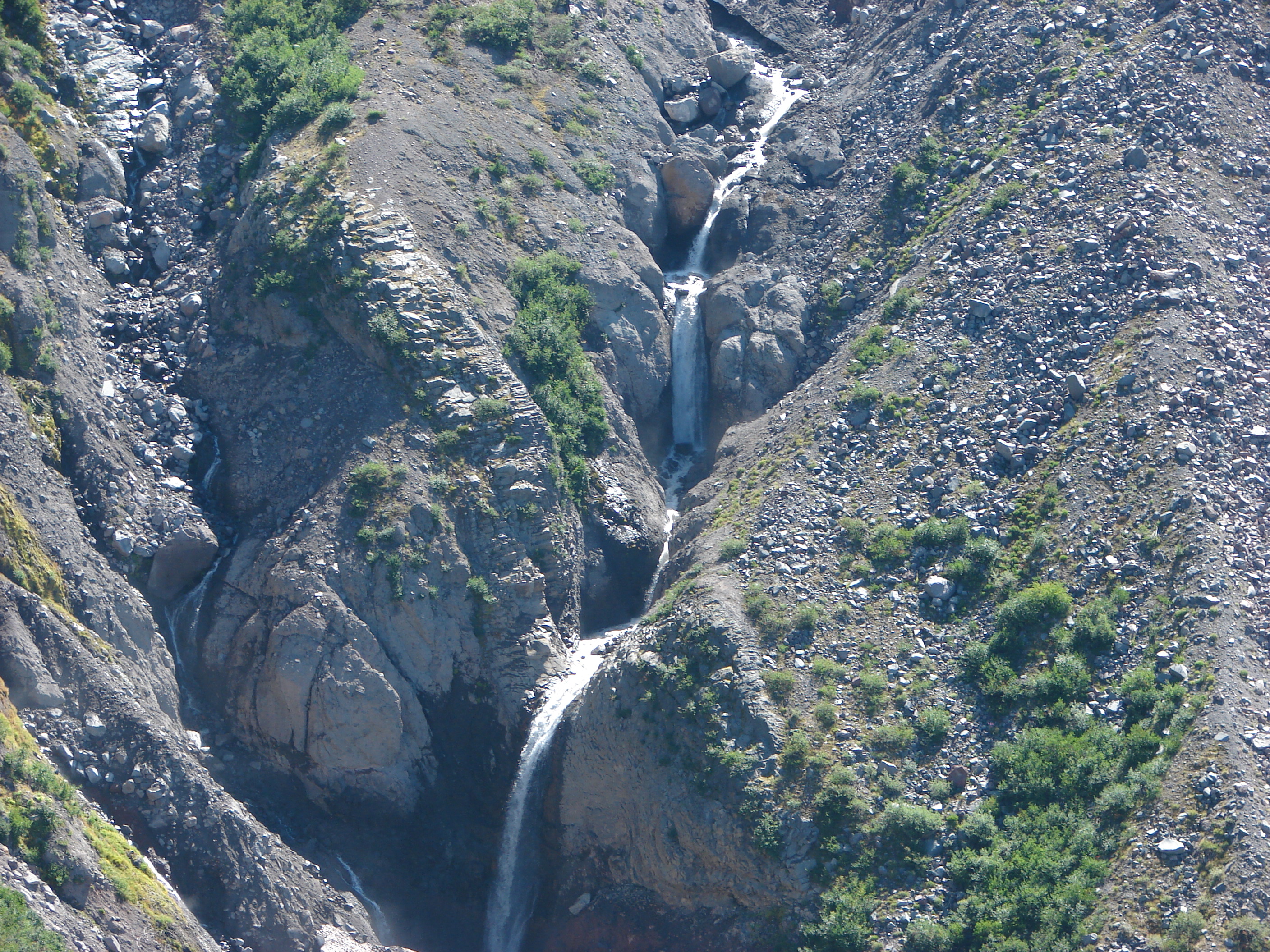
The trail eventually came to the edge of the Sandy River canyon where melt water from the Reid Glacier feeds the Sandy River. A series of waterfalls could be seen (and heard) below.
145
We explored the area and spotted another good sized water fall further down and across the canyon. This one was flowing from the Paradise Park area down into the Sandy River.

Waterfall along the Paradise Park branch of the Sandy River

We finally pulled ourselves away from the spectacular views and continued on the trail toward the north side of the ridge. The trail climbed as it crossed the ridge and passed through many more wildflower meadows. When we reached the north side of the ridge we found the clouds again. There was a bank of clouds settled over the valley between Yocum Ridge and McNeil Point. Here the trail turned up the ridge at it’s steepest grade. We reached a small saddle below the rocky cliffs that top the ridge where we found a couple of camp sites and lingering snow patches. To the right of the cliffs we could see blue sky, but on the left it was all clouds. We decided to continue on what appeared to be a faint path across loose rocks and sand to see if we could once again rise above the clouds. The “faint path” completely disappeared and visabillity was all but gone when we decided to turn around and go back. We looked at some trip reports later that showed we had been headed straight for the mountain with the Sandy Glacier to our left but we’d have never known it.

Heather returning on the “faint path”.

Back at the saddle the clouds began to rise keeping the mountain hidden but giving us a better look at the flowers surrounding this area. He we found lupine, cat’s ears, and even a few avalanche lilies. While exploring the tent sites we stumbled on a small group of scotch bluebells.

Avalanche lilies
Avalanche lilies
Cat's ear
Cat’s ear


Scotch bluebells
Scotch bluebells

When we started our return trip the clouds had risen from the valley floor giving us views below, but when we arrived at the Reid Glacier viewpoint Mt. Hood was hidden. We found a couple of fellow hikers here that we had met near Ramona Falls and asked if they had made it in time to see the mountain and they had not. We all stuck around waiting to see if we would catch another cloud break since there was still plenty of blue sky around. While we were waiting a Red Tailed hawk circled overhead checking us and the meadow out.

Red Tailed hawk
Red Tailed hawk

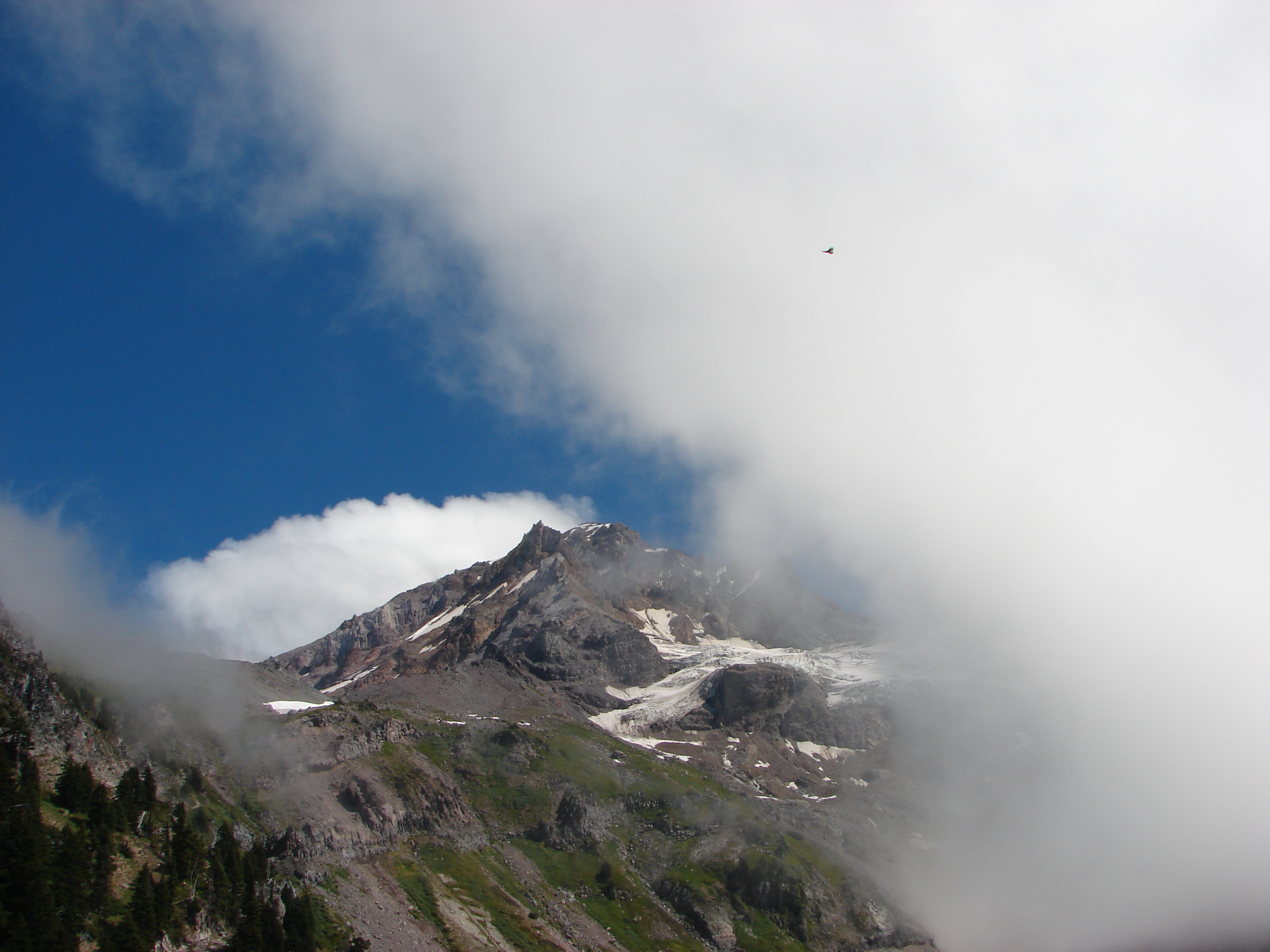
While I was attempting to catch the hawk in flight Mt. Hood decided to make an encore appearance.

Red Tailed hawk over Mt. Hood

The clouds continued to roll in allowing us brief glimpses of the mountain before we decided it was time to start our return trip.

On the way down we were provided some new views due to the rise in the cloud levels. We spotted the bottoms of Mt. Jefferson and Mt. Adams, Lost Lake, and the large waterfall coming from Paradise Park.
360
We stopped briefly at Ramona Falls where a large crowed now milled about and then continued on the final 3.4 mile leg along the Sandy River to our waiting car. It was a long hike and we only got to see half of the views, but in the end it didn’t matter. What we did see was amazing enough and now we have an excuse to return since we have unfinished business on the north side :). Happy Trails.

Facebook photos: https://www.facebook.com/media/set/?set=a.10201968046749949.1073741852.1448521051&type=1
Flickr: http://www.flickr.com/photos/9319235@N02/sets/72157635221888570/