For the final hike of our vacation we decided to say farewell to the mountains for the year. Black Butte provided us the opportunity to get one last good view of the Cascades and a nice bit of elevation gain to boot. We had been checking the weather forecast as often as possible to see if it would be worth the effort and when we went to bed the night before our hike the forecast was for clear sunny skies all day long. They were wrong. lol
My first inkling that something was amiss was when I was loading the car in the morning and there were no stars visible in the sky. As we began our drive to the trailhead occasional sprinkles of rain were falling, but we were committed now and figured that it was early and maybe the clear skies were just a little late.
We arrived at the lower Black Butte Trailhead under cloudy skies but at least there was no rain. The trail set off through pine trees and a carpet of orange ferns.

We caught several glimpses of Black Butte on the lower portion of the trail and at least it was cloud free (it had not been on the drive earlier).

The lower portion of the trail passed through a variety of forest types. The ever changing makeup of the trees and plants was very interesting.


There would have been some mountain views on a clearer day along this portion as well but on this day all we could make out was the snow line at the base of Mt. Washington and Three Fingered Jack. We were still hoping that the cloud cover would burn off by the time we reached the summit so we continued to climb to the upper trailhead.
From the upper trailhead we climbed out of the forest to the more exposed upper slopes of Black Butte. Here the view was virtually unobstructed by trees but the clouds were a different story. There was a thick layer of clouds above our heads but low enough to hide the taller Cascade Peaks. Below us were smaller patches of clouds passing by and sometimes over us.


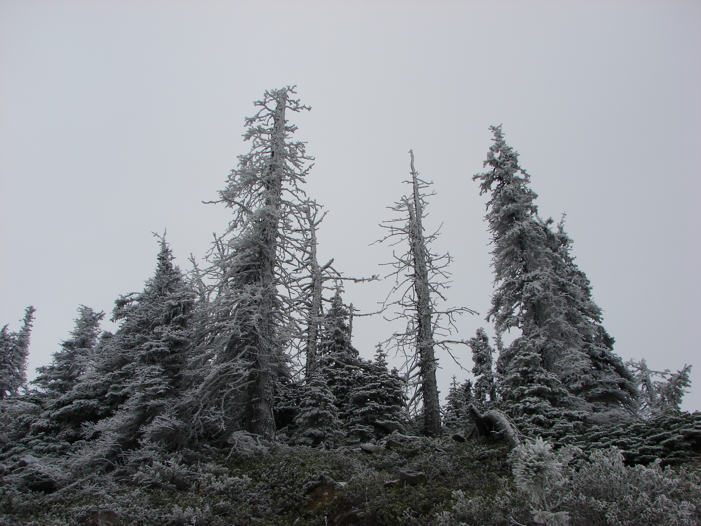
As the trail wound up and around the butte we got our first good look at the lookout tower. We also noticed that the summit appeared to be a bit snowy or at least frosty.

We had been overly warm as we climbed so far and had taken most of our layers off but as we entered the “white” zone we were met with much colder air. As we worked our way around the north side of the butte a slight breeze brought even colder air to us and kept this side of the butte wintry white.


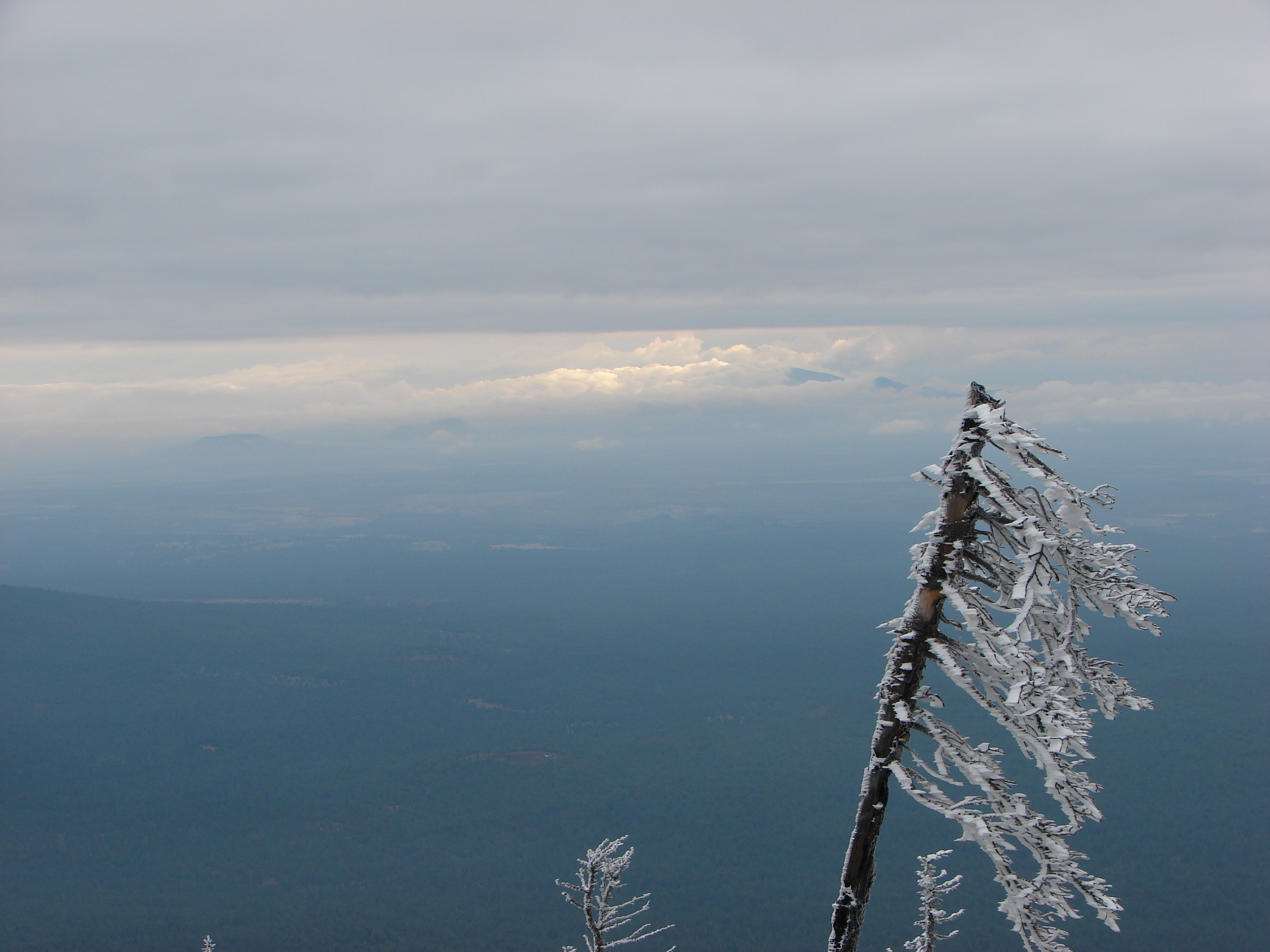
To the north we could see the edge of the upper cloud layer as sunlight reflected off the lower clouds.
To the NE we spotted the top of a snowy mountain against blue sky – Mt. Hood!

Further around we found ourselves staring at the base of Mt. Jefferson. The view was strangely reminiscent of the view we’d had on Double Peaks on the opposite side of the mountain just 3 days earlier with clouds covering the upper 2/3rds of the mountain and blue sky apparently above and behind the mountain.

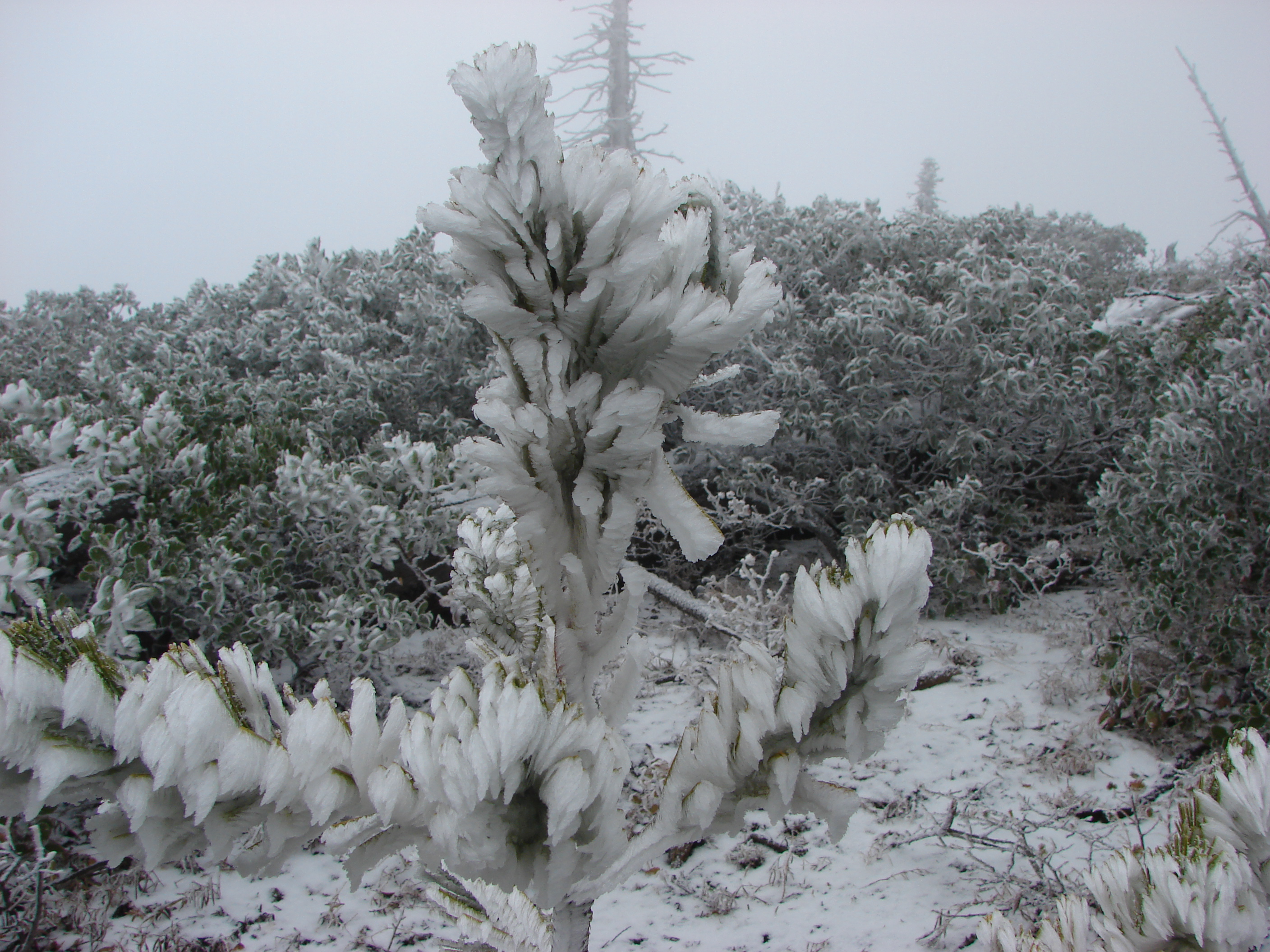
At the summit the snow/ice created some interesting scenes.

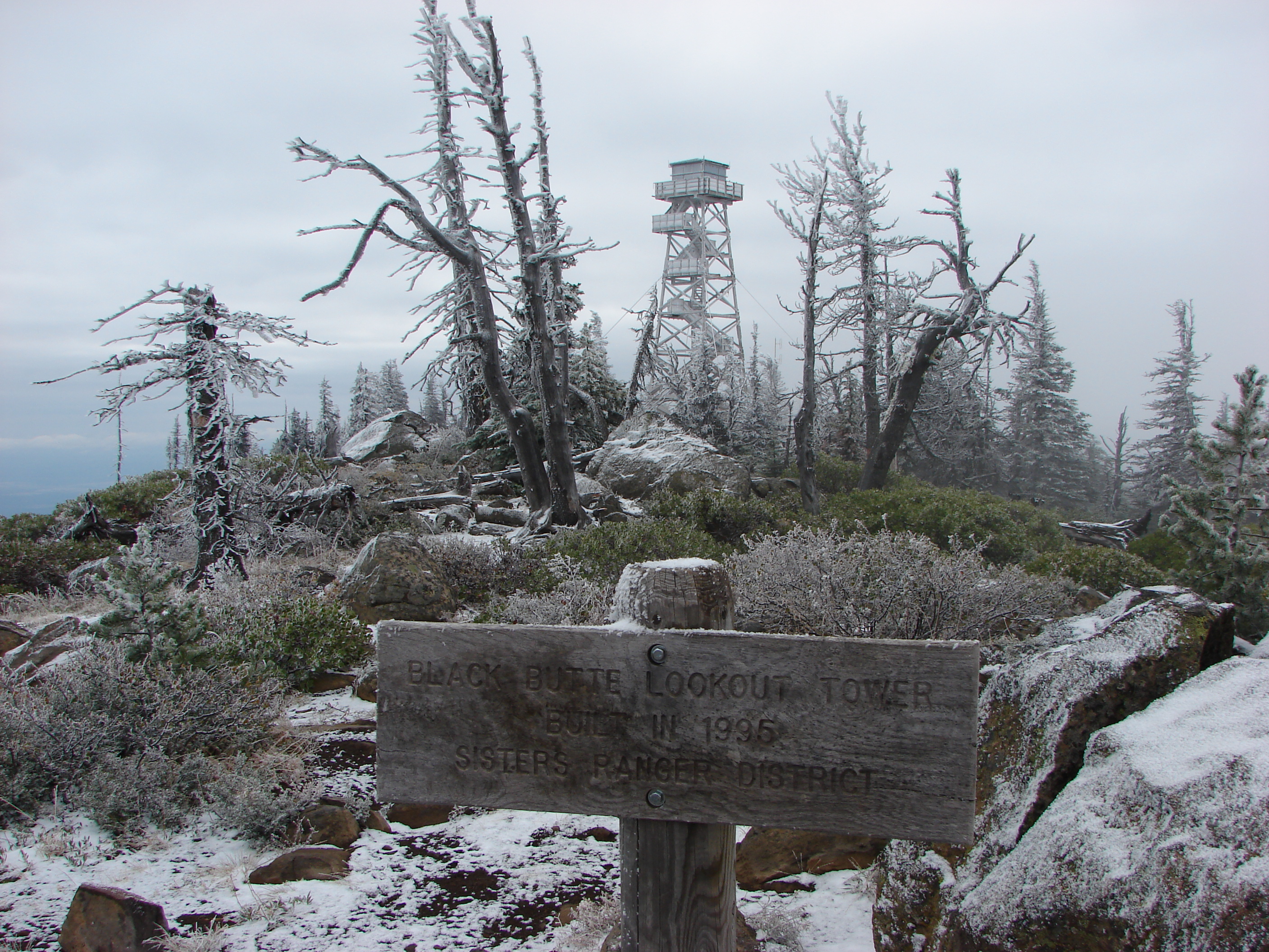
We explored the area on top of the butte where the lookout tower is not the only structure. A 1924 cupola that was the former lookout and a log cabin where the lookout staff lives were also present.


Signs on the summit listed the mountain peaks that would be visible on a clear day from Broken Top to the south to Mt. Adams to the north. We were mostly left with our imaginations. 🙂 Looking out over the log cabin we could see a good portion of Three Fingered Jack and some of Mt. Jefferson.

We hung around for a little over half an hour hoping that the clouds would break up but the lower clouds just kept coming up from behind us and the upper clouds didn’t seem to be budging. Just as we started to leave though we noticed the upper layer was breaking up to the north and there seemed to be some breaking up near Mt. Jefferson. We turned around and headed back toward the cabin but the low clouds were rising up just in front of us so we again headed back down. I kept looking back though hoping for something when we finally got a little break and the summit of Mt. Jefferson made an appearance over a ribbon of clouds.

As the upper clouds retreated south we suddenly had blue sky above us and the frosty coating quickly melted from the trees and plants.
As we came around to the south side of the butte Mt. Washington was a bit more visible.


Just as quickly as the blue sky had appeared one of the larger low clouds enveloped the side of Black Butte and we were once again without a view.
When we got down past the upper trailhead we finally got back out of the cloud and could once again see out to where the mountains would be. Even though the upper layer of clouds had mostly retreated the lower clouds were quickly replacing it and many of them clung to the taller peaks. We did manage to get a good view of several small peaks and buttes though.


We even got a brief glimpse of North Sisters summit.

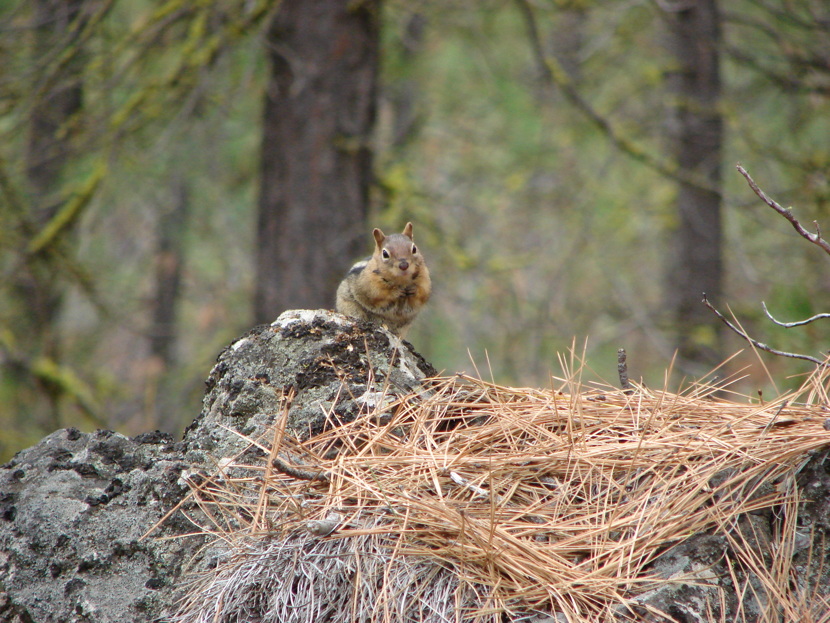
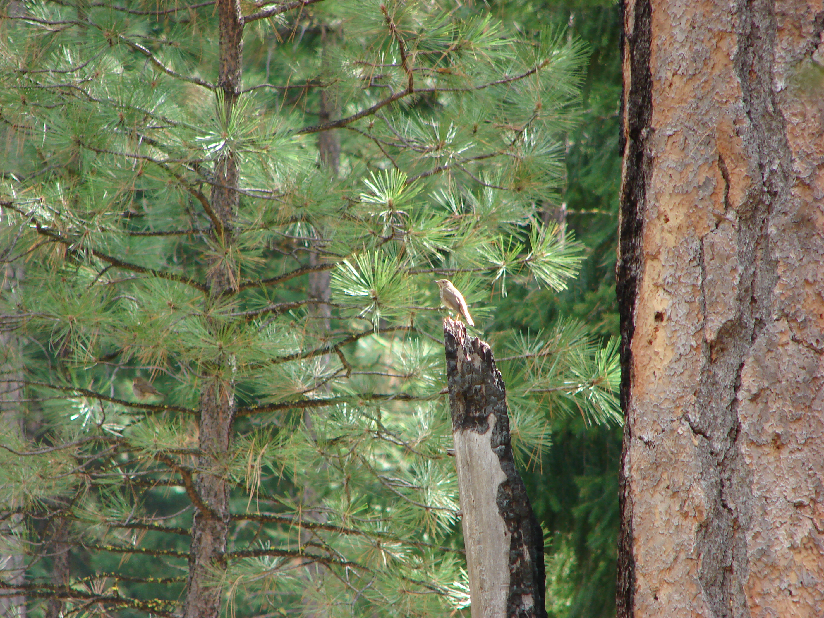
This time on the lower trail we spotted a decent amount of wildlife including chipmunks, douglas squirrels, golden-mantled squirrels, and various birds. Some were more willing to have their pictures taken than others.


We were supposed to meet my parents at the trailhead at 2:00 so they could drop off Dominique (who had chosen not to accompany us on the hike). A series of mishaps led to a bit of an adventure but while we were waiting a group of deer came by the parking area.

We eventually met up with my parents and reclaimed Nique and headed home. With that the bulk of our 2013 hikes were behind us. We’ll hopefully get out a couple more times this year, but our activities have now shifted to running for the next several months. It’s the beginning of our race season and we are all starting to train for a 15 mile trail run in a couple of months. Happy Trails.
Facebook photos:https://www.facebook.com/deryl.yunck/media_set?set=a.10202390873000341.1073741863.1448521051&type=1
Flickr: http://www.flickr.com/photos/9319235@N02/sets/72157636523907403/

4 replies on “Black Butte”
[…] Black Butte […]
[…] ridge passed above Booth and Martin Lakes which lay to the east. Black Butte (post) beyond Martin and Booth […]
[…] Day we headed home from Bend and stopped to revisit a hike that we first did on October 14, 2013 (post). We covered the trailhead and route in that trip report. This entry will focus on what we saw this […]
[…] – Black Butte 10/13/2013 & 5/28/2018 Burned 2009 Black Butte […]