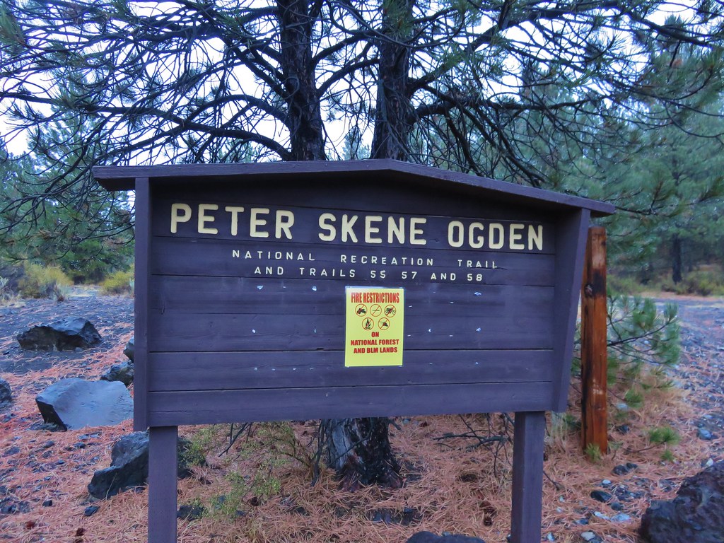
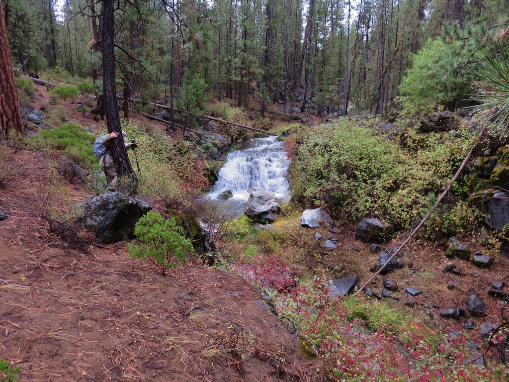
Sometimes it’s the hikes that we don’t expect a lot from that really surprise us. According to the forecast the Thursday of our vacation week was going to be the wettest day of the bunch. We chose Paulina Creek as our destination since mountain views were likely out of the question and rivers or creeks are good rainy day hikes. We began our hike at the Ogden Group Camp just 2.8 miles from Highway 97 on Road 21 to the Newberry Caldera.
 //embedr.flickr.com/assets/client-code.js
The Peter Skeen Ogden Trail covers over nine miles along Paulina Creek from the group camp to the Paulina Lake Lodge at Paulina Lake, the creeks source. Our plan was to hike approximately 6 miles up the trail to a waterfall near the Tenmile Sno-Park. According to the guide book we would see McKay falls near the 2.5 mile mark and the other fall near our turnaround spot. Other than that we didn’t have a lot of information on what to expect from this hike.
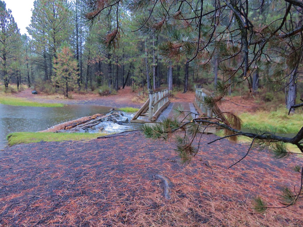
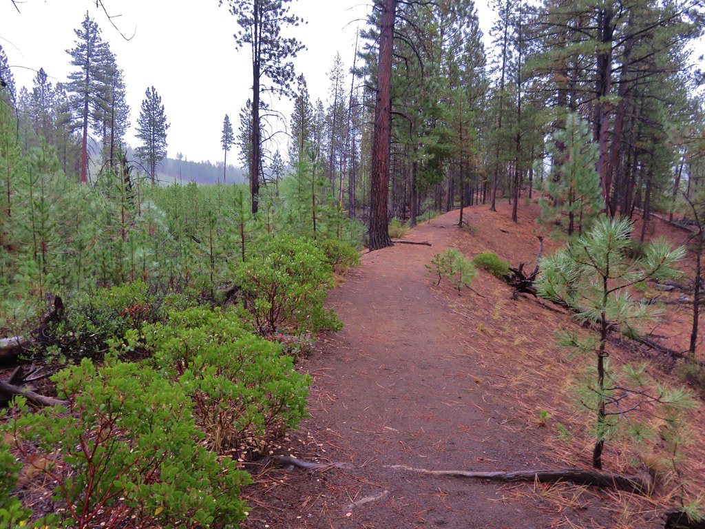
It was raining when we arrived at the trailhead so we threw on our rain gear before setting off across a footbridge over Paulina Creek.
 //embedr.flickr.com/assets/client-code.js
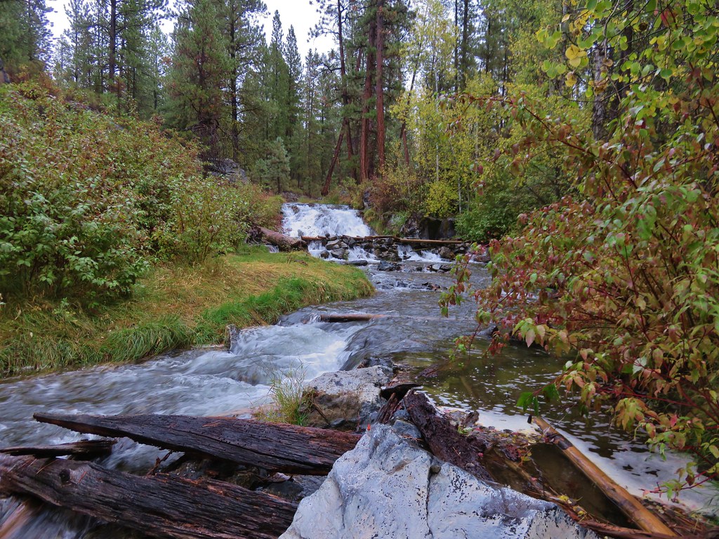
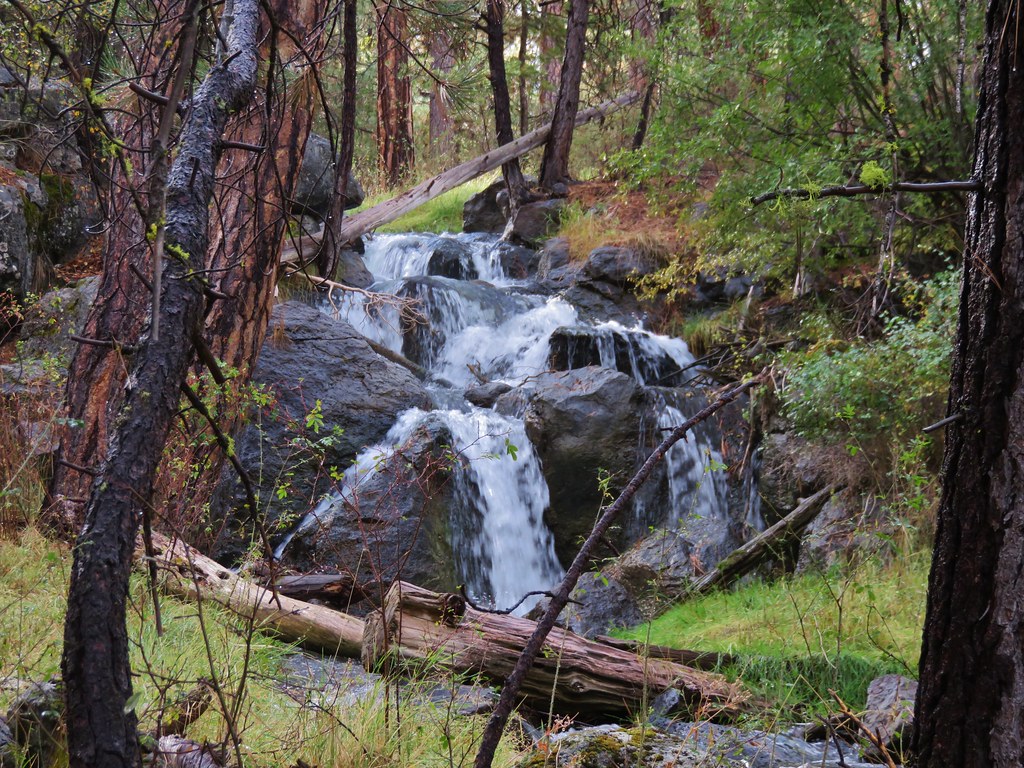
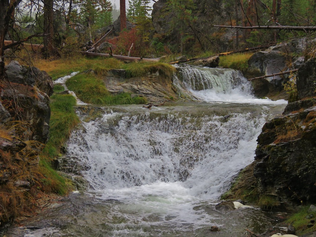
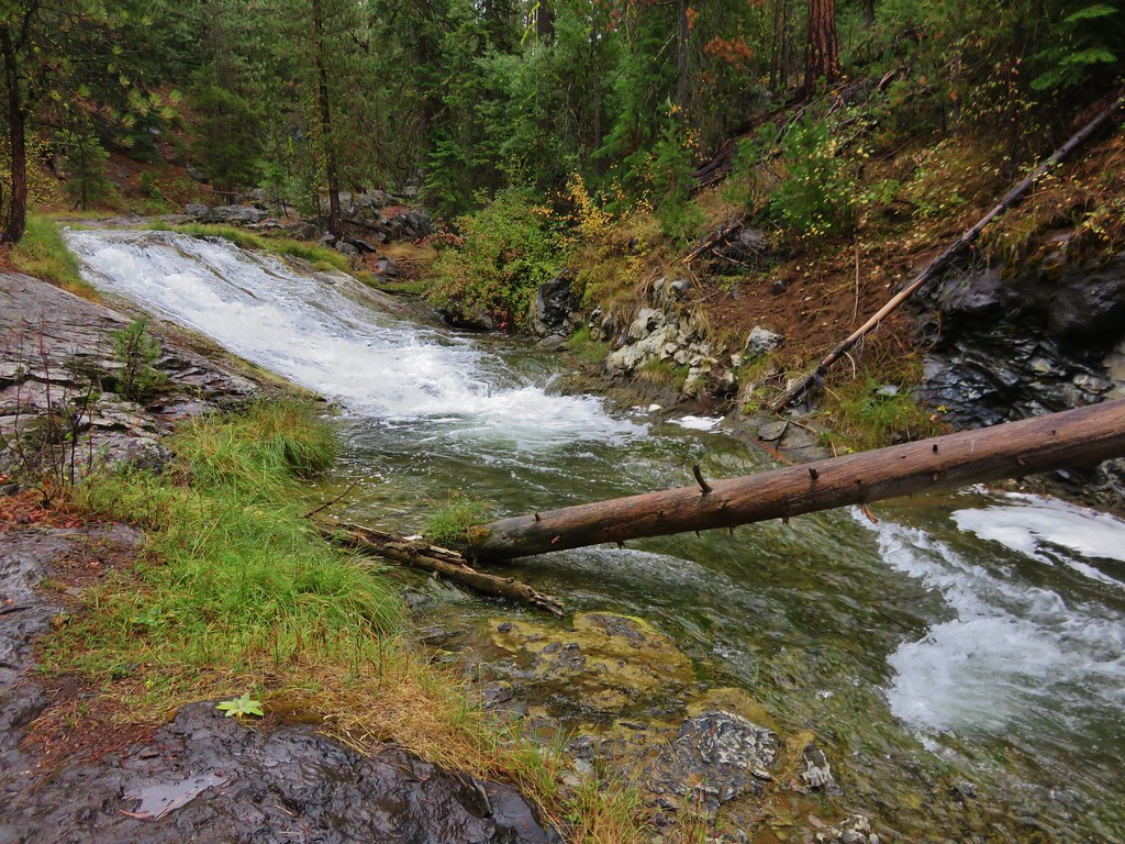
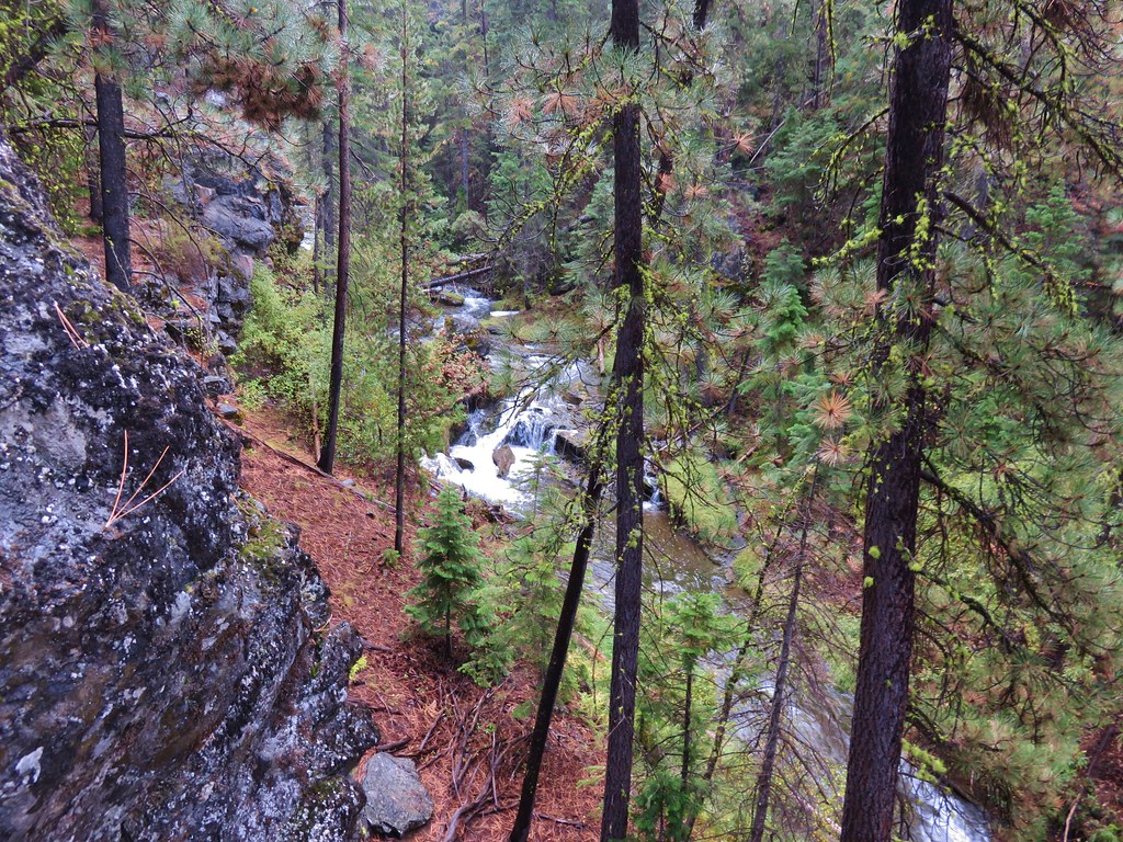
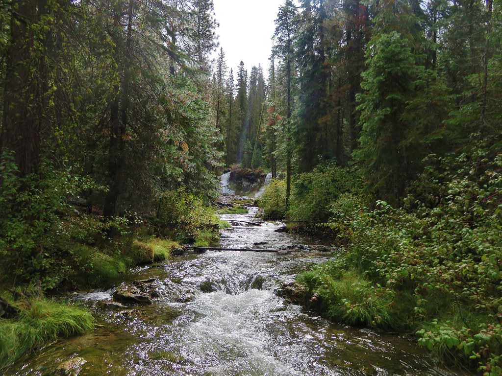
We spent much of the hike to McKay Falls off of the official trail as it often veered away from the creek. The creek put on a nice show along the way including several small waterfalls.
 //embedr.flickr.com/assets/client-code.js
 //embedr.flickr.com/assets/client-code.js
 //embedr.flickr.com/assets/client-code.js
 //embedr.flickr.com/assets/client-code.js
 //embedr.flickr.com/assets/client-code.js
 //embedr.flickr.com/assets/client-code.js
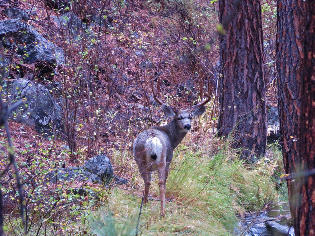
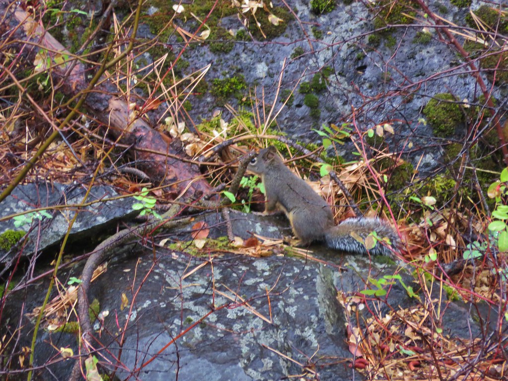
There was plenty of wildlife as we spotted several deer including a small buck that was lying dead near a second footbridge where the trail recrossed the creek. A little beyond the second bridge we spotted a good sized buck grazing by the creek.
 //embedr.flickr.com/assets/client-code.js
 //embedr.flickr.com/assets/client-code.js
 //embedr.flickr.com/assets/client-code.js
 //embedr.flickr.com/assets/client-code.js
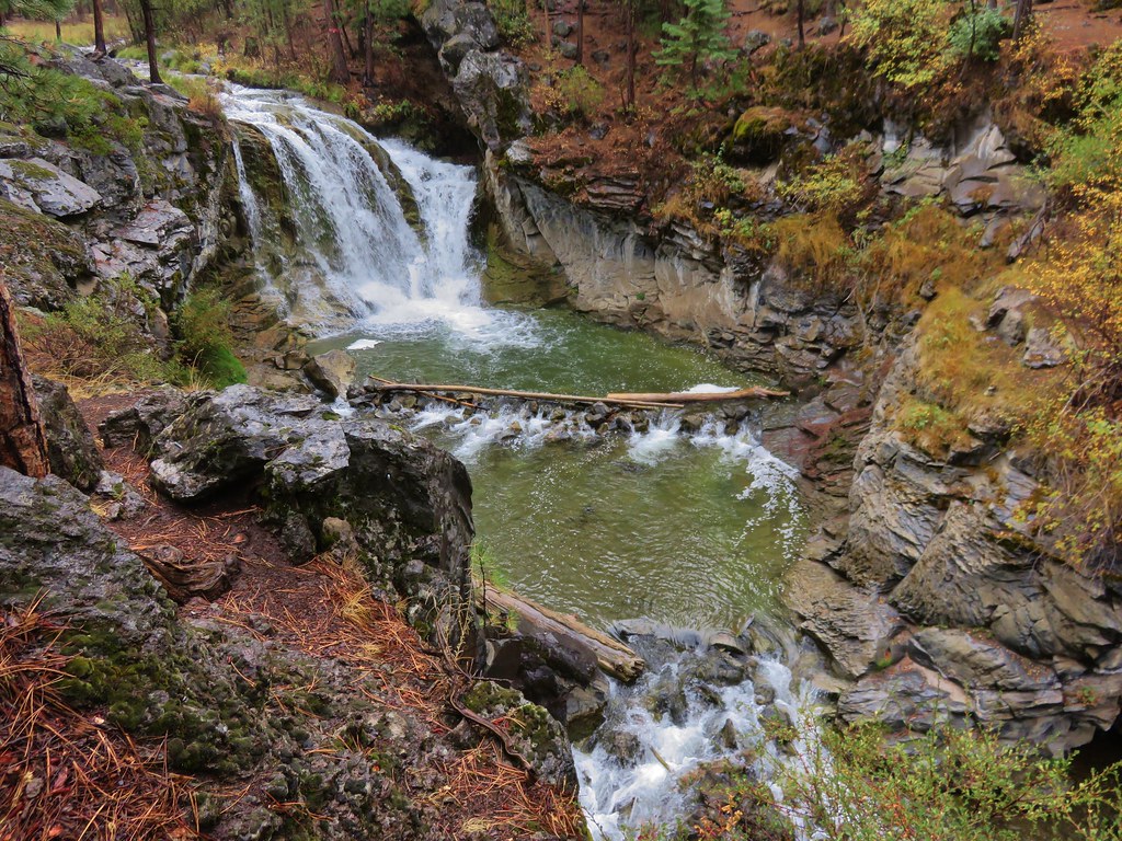
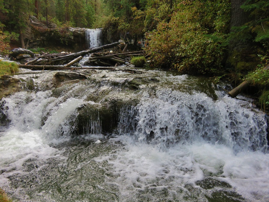
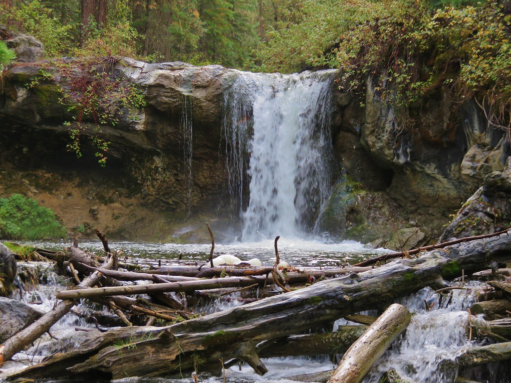
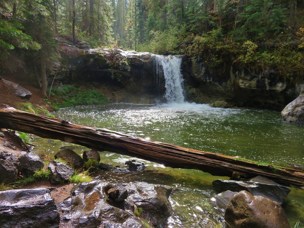
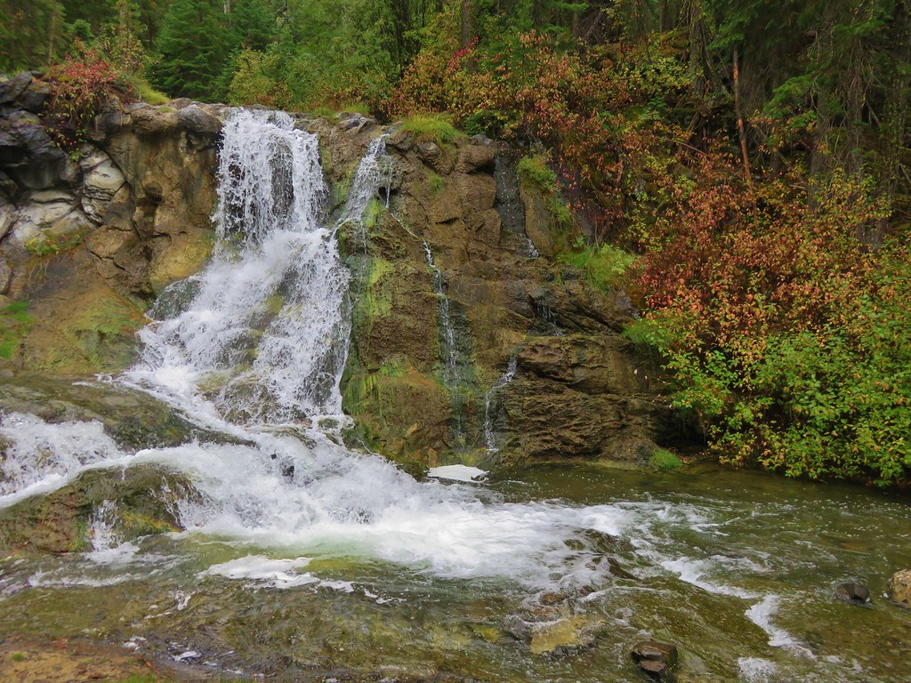
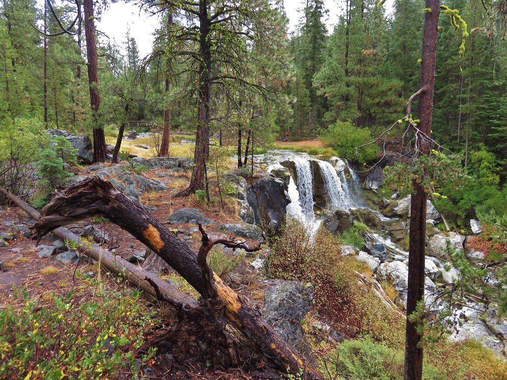
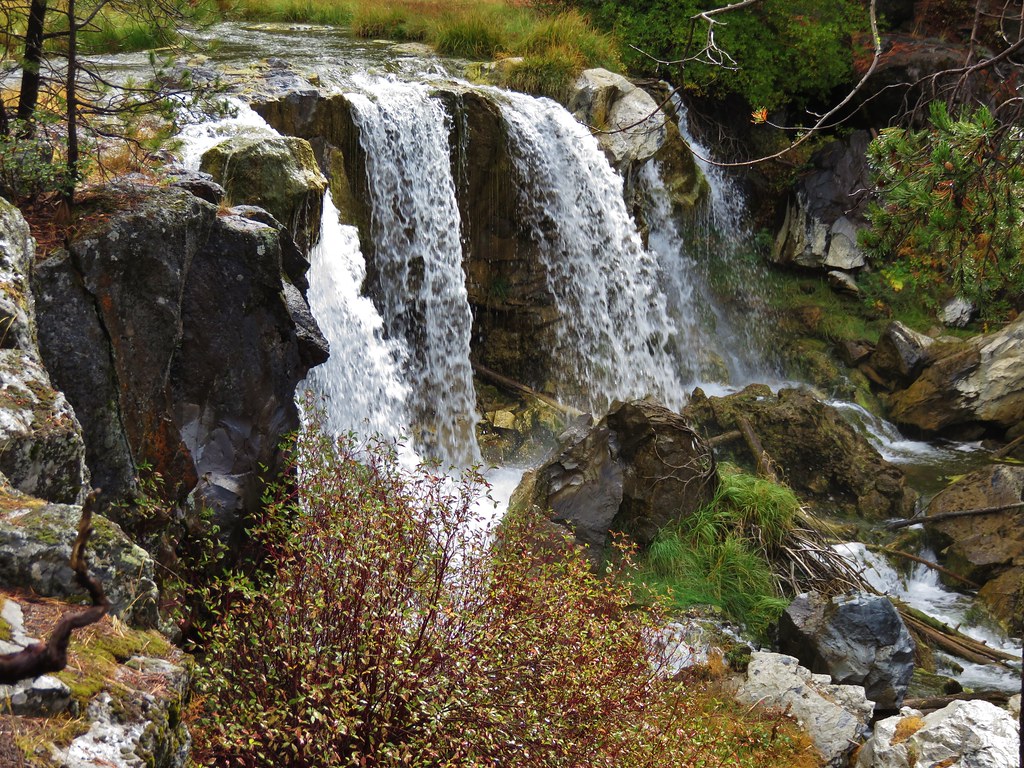
When we reached McKay Falls we were already impressed with the number of smaller waterfalls we’d seen along the way.
 //embedr.flickr.com/assets/client-code.js
 //embedr.flickr.com/assets/client-code.js
 //embedr.flickr.com/assets/client-code.js
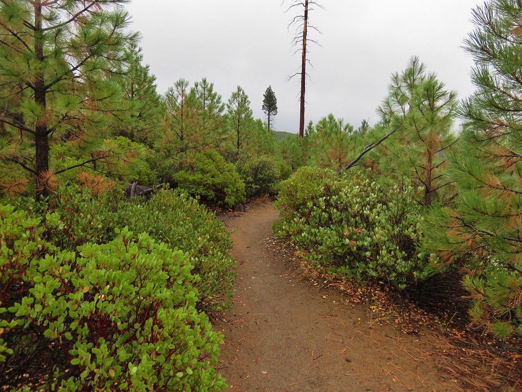
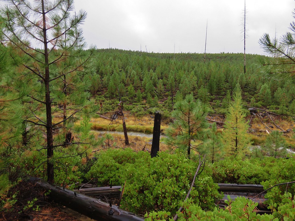
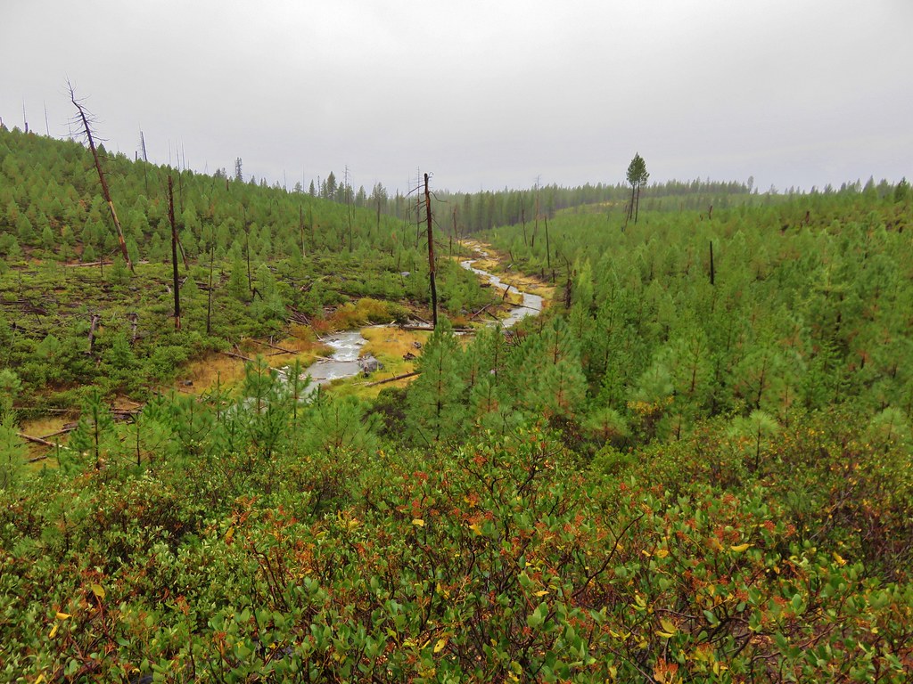
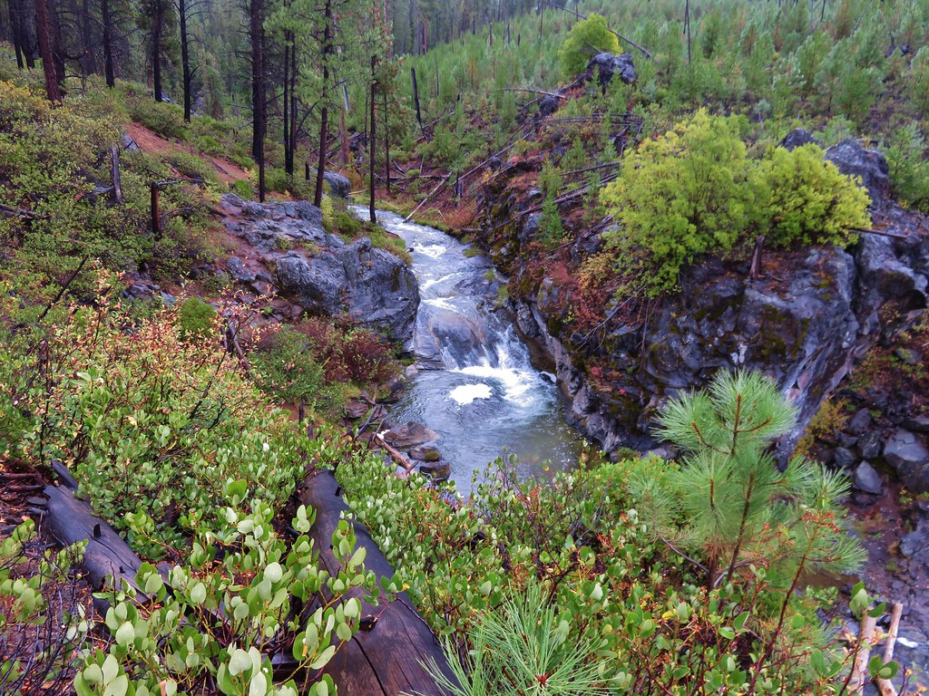
Beyond McKay Falls the trial entered an area that appeared to have been burnt by fire at some point leaving young trees and manzanita.
 //embedr.flickr.com/assets/client-code.js
 //embedr.flickr.com/assets/client-code.js
 //embedr.flickr.com/assets/client-code.js
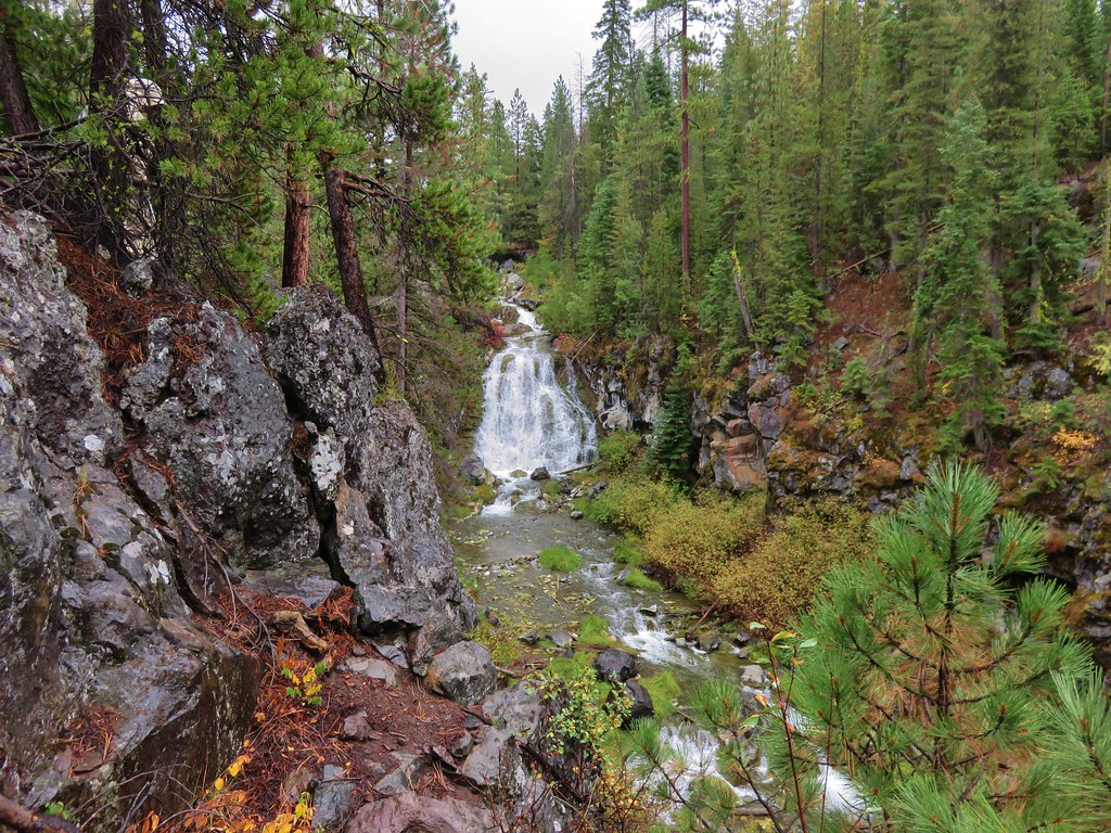
The trail was quite a way above the creek in this section but the lack of large trees made it easy to see.
 //embedr.flickr.com/assets/client-code.js
 //embedr.flickr.com/assets/client-code.js
 //embedr.flickr.com/assets/client-code.js
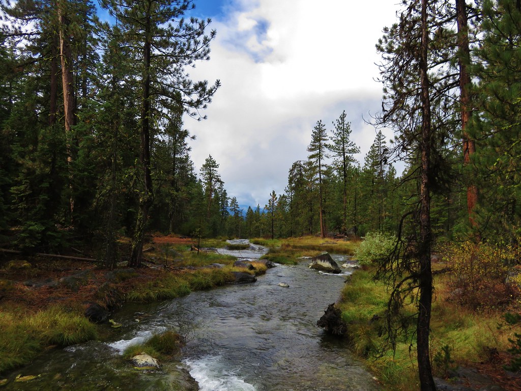
The trail then reentered forest that had not been affected and new trees were added to the mix including various firs. 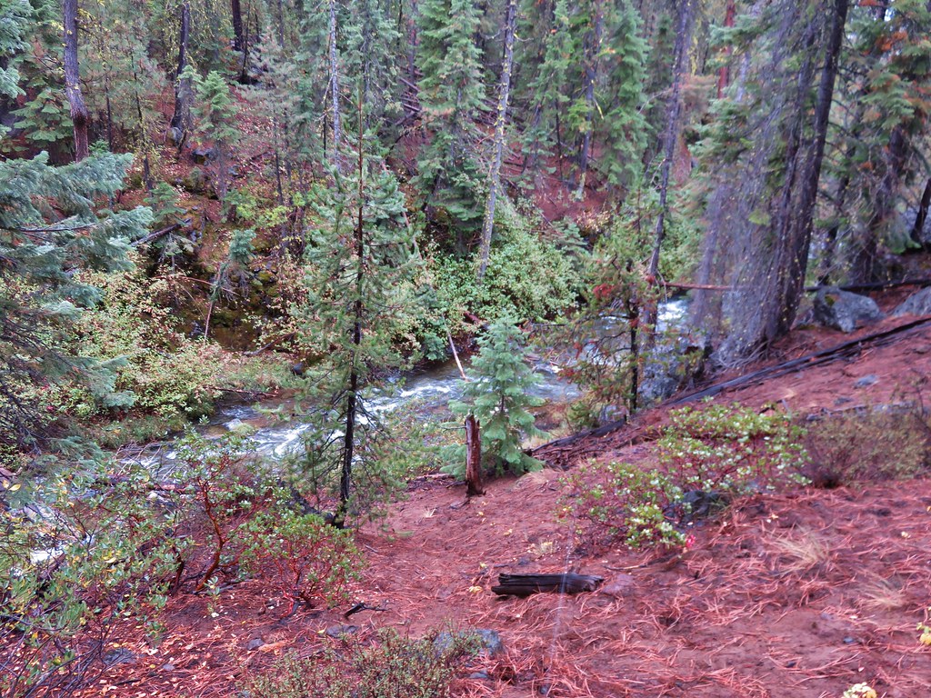 //embedr.flickr.com/assets/client-code.js
 //embedr.flickr.com/assets/client-code.js
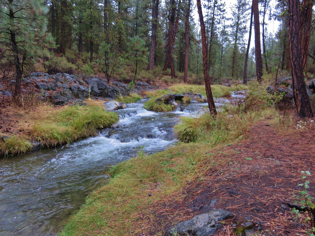
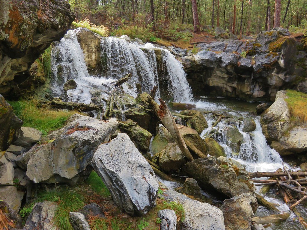
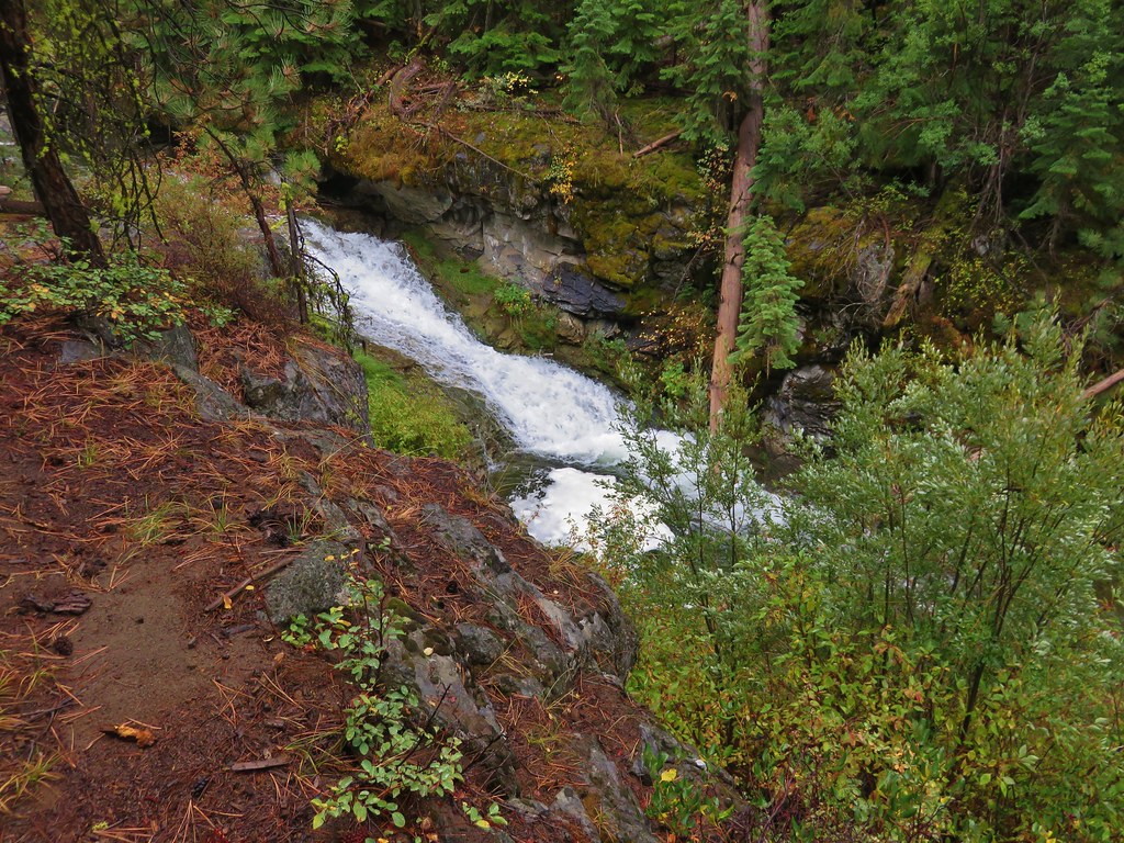
The waterfall action picked up again and we spent more time off-trail searching for views.
 //embedr.flickr.com/assets/client-code.js
 //embedr.flickr.com/assets/client-code.js
 //embedr.flickr.com/assets/client-code.js
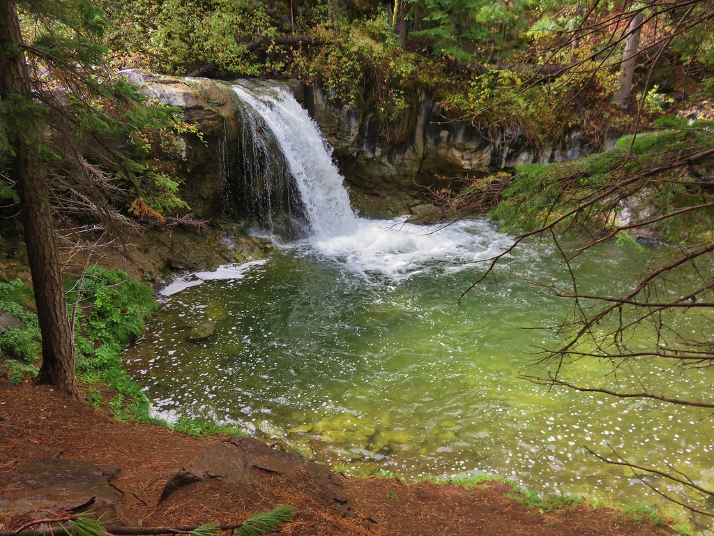
We began to wonder if we would know which fall was marked in our guidebook as our turnaround point. Our solution was to watch the elevation on our GPS unit since the book showed the waterfall at 5400′. This turned out to be a good plan because we came to a nice waterfall that would have been worthy of being marked in the book around the 5100′ elevation.
 //embedr.flickr.com/assets/client-code.js
 //embedr.flickr.com/assets/client-code.js
 //embedr.flickr.com/assets/client-code.js
 //embedr.flickr.com/assets/client-code.js
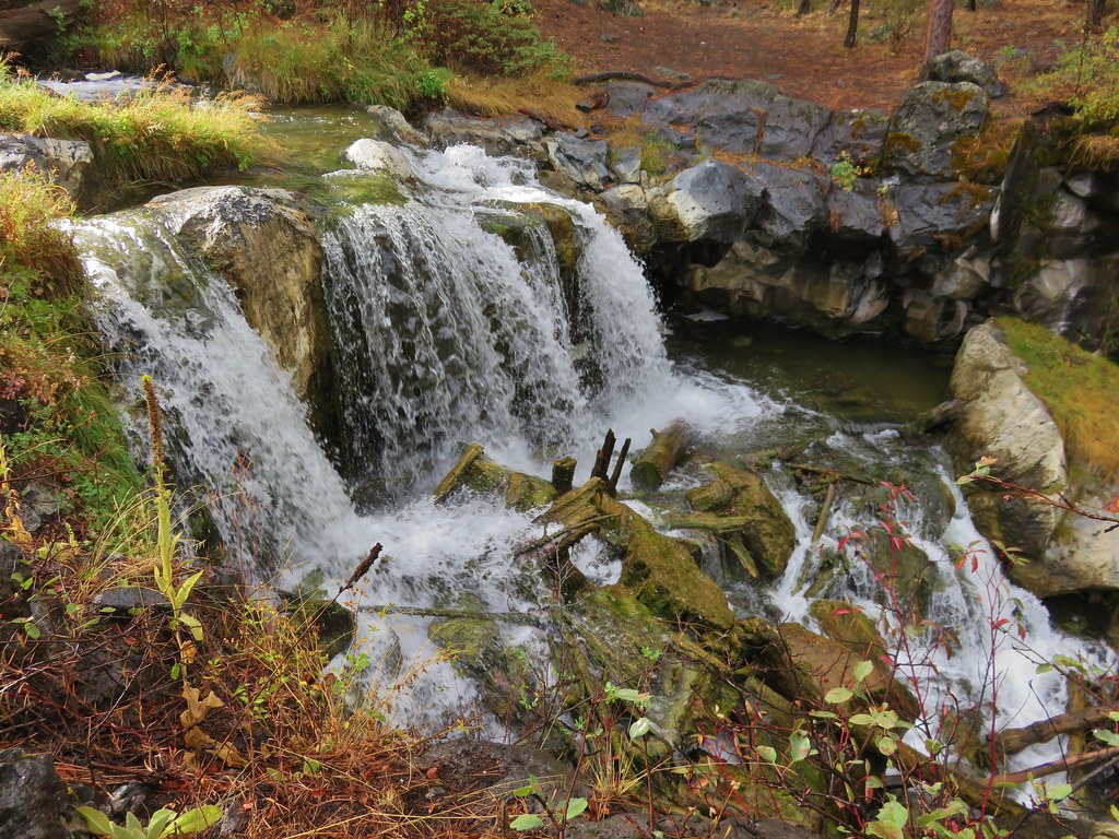
Just upstream from that fall was another nice pair of falls.
 //embedr.flickr.com/assets/client-code.js
 //embedr.flickr.com/assets/client-code.js
 //embedr.flickr.com/assets/client-code.js
 //embedr.flickr.com/assets/client-code.js
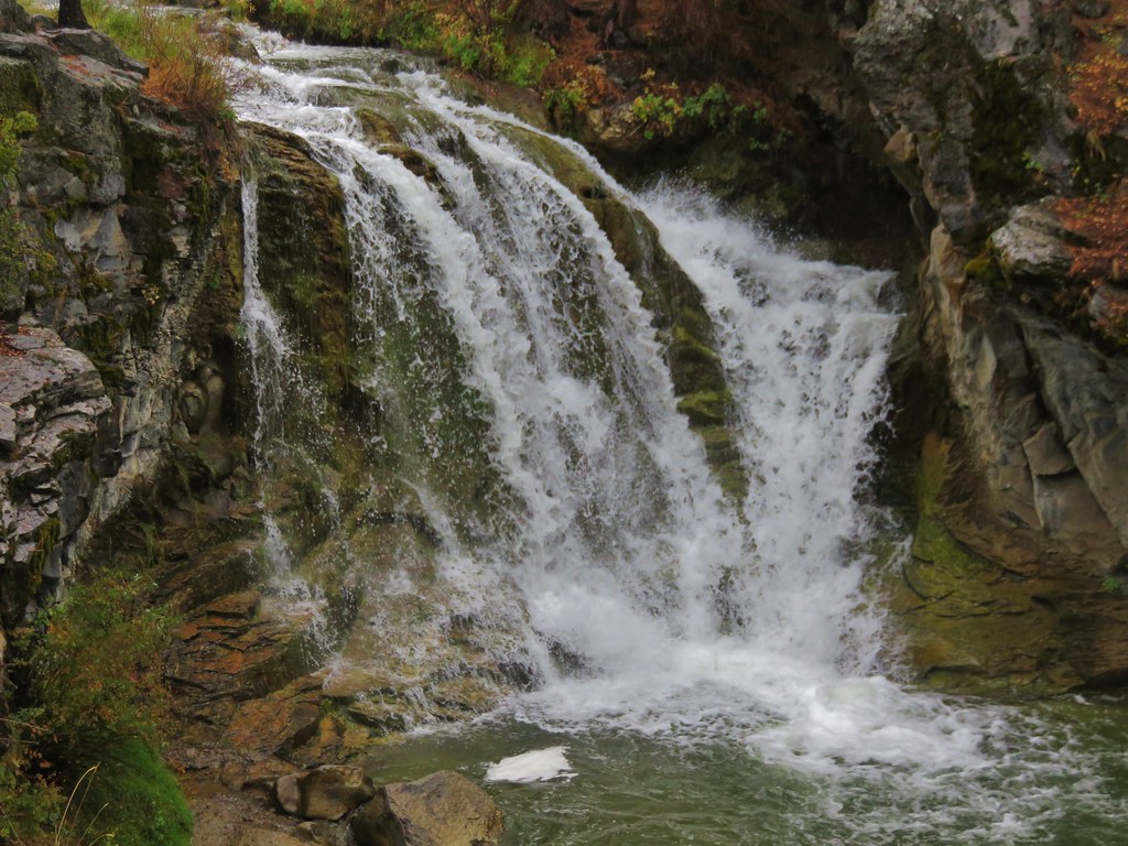
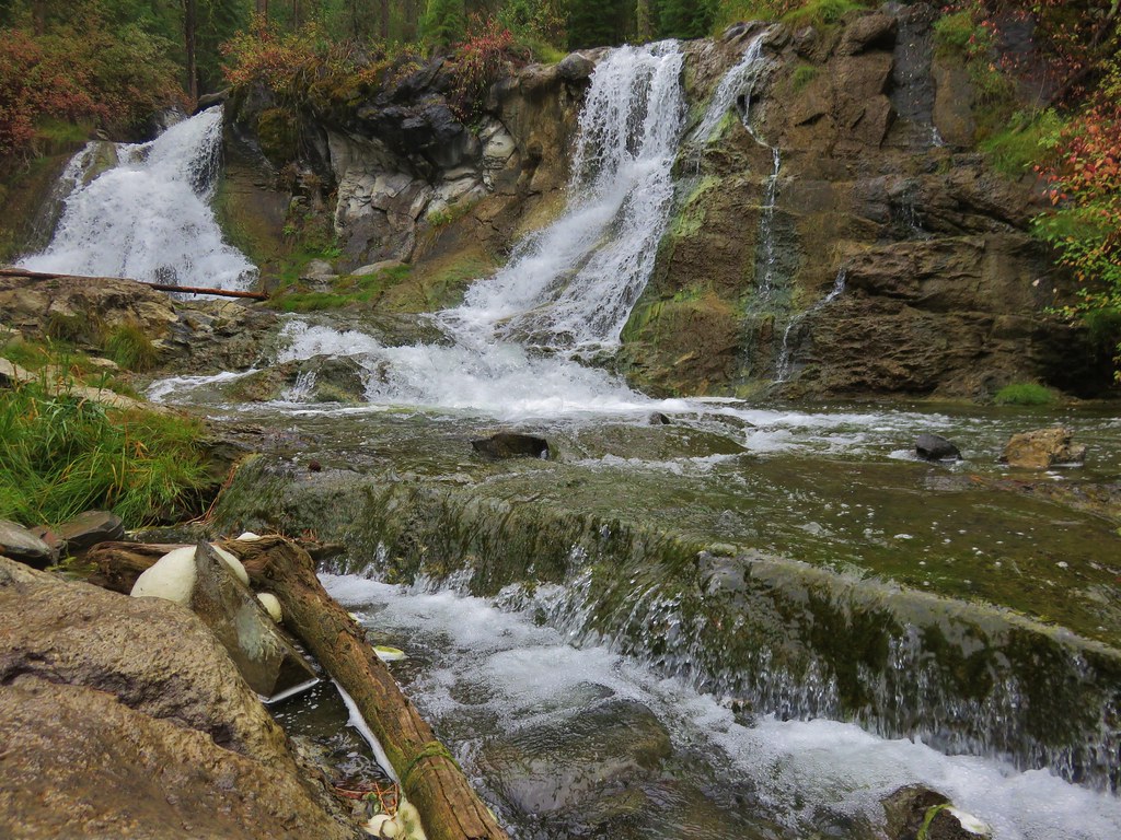
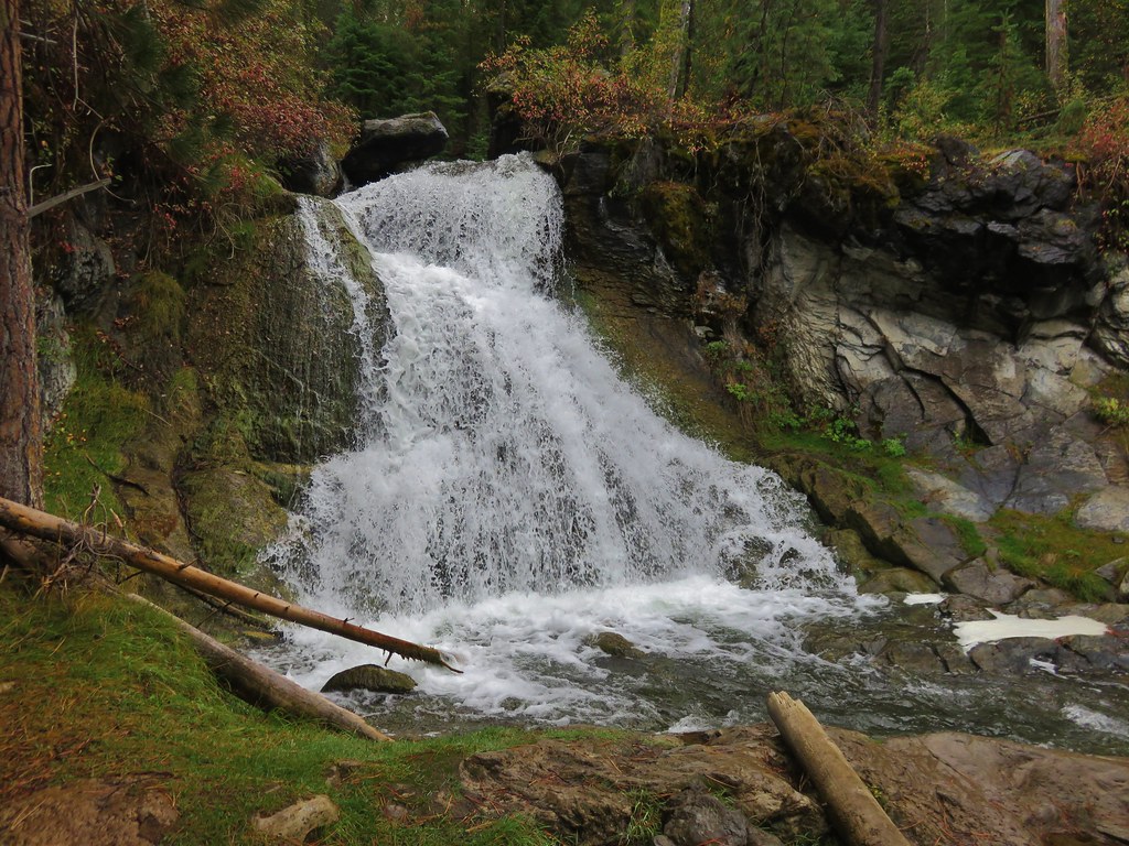
We still hadn’t reached the 5400′ elevation according to the GPS so we continued up the trail even further where we came to the largest fall of the day.
 //embedr.flickr.com/assets/client-code.js
 //embedr.flickr.com/assets/client-code.js
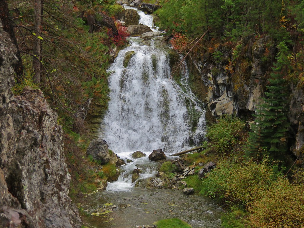
We could see an additional fall upstream through the trees and kept going. This one turned out to be Island Falls, the only other fall with an official name.
 //embedr.flickr.com/assets/client-code.js
 //embedr.flickr.com/assets/client-code.js
There was a footbridge just beyond Island Falls leading to Tenmile Sno-Park. We walked out onto the footbridge as our official turnaround point but couldn’t help wondering how many more falls lay between us and Paulina Creek Falls a little over 3 miles away.
 //embedr.flickr.com/assets/client-code.js
 //embedr.flickr.com/assets/client-code.js
On the return trip we stuck to the official trail until we reached the footbridge near the dead deer. Instead of crossing the creek we stayed on the north side following a clear path back to the group camp.
 //embedr.flickr.com/assets/client-code.js
 //embedr.flickr.com/assets/client-code.js
Despite being the wettest day of the week it had been the perfect day for hunting waterfalls along the creek. Happy Trails!
Flicker: https://www.flickr.com/photos/9319235@N02/albums/72157658448480299

2 replies on “Paulina Creek – Ogden Group Camp to Tenmile Sno-Park”
[…] loops around Paulina Lake and is on our schedule for this year along with the upper portion of the Peter Skene Ogden Trail. To complete our loop for this trip we would follow the lake shore for roughly 2.5 miles to the […]
[…] us to fill in some blanks along both Paulina Creek and Paulina Lake left from two previous hikes. (Paulina Creek and Paulina […]