Categories
Central Oregon Hiking Newberry Crater Oregon Trip report

Paulina Lake via Ten Mile Sno-Park

The year of rearranging continued to present challenges as we prepared for our final week of vacation. Originally planned for mid-August we had rescheduled a planned trip to Steens Mountain due to work considerations. An unusually cold and wet weather system due to arrive from the Gulf of Alaska the first Sunday night of our vacation derailed those plans. In fact it ended any thoughts of attempting to backpack as the entire week called for rain or snow showers, depending on elevation, everywhere we looked. At the last minute we decided to dial up a group of hikes in the southern Blue Mountains near Sumpter, OR.

The disappointment of having to change our plans once again this year was tempered by the prospect of the wet weather helping to put out the numerous wildfires burning in the Pacific Northwest.

We had planned to stay in Bend on our way to Steens Mountain and visit Heather’s parents and it made sense to do the same on the way to Sumpter so the only hike planned for the week to survive the rearranging was a visit to Paulina Lake in the Newberry National Volcanic Monument. This hike would allow us to fill in some blanks along both Paulina Creek and Paulina Lake left from two previous hikes. (Paulina Creek and Paulina Peak)

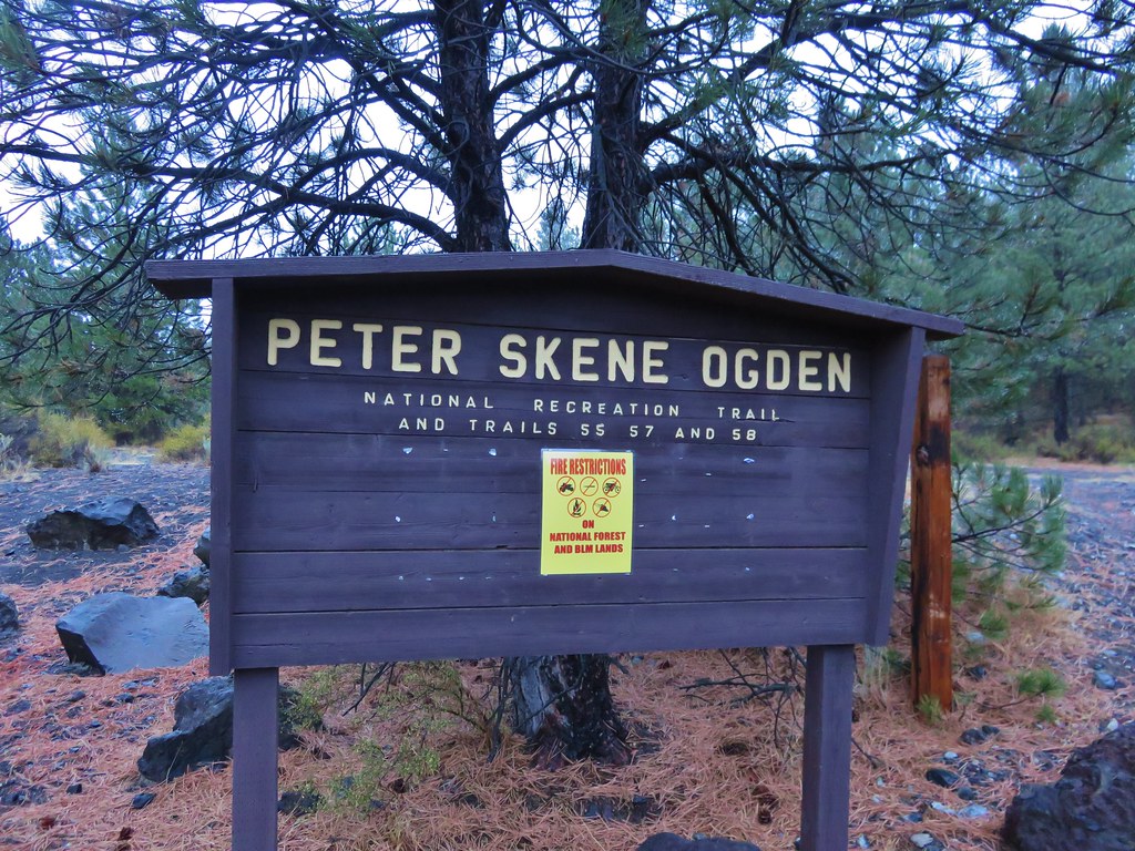
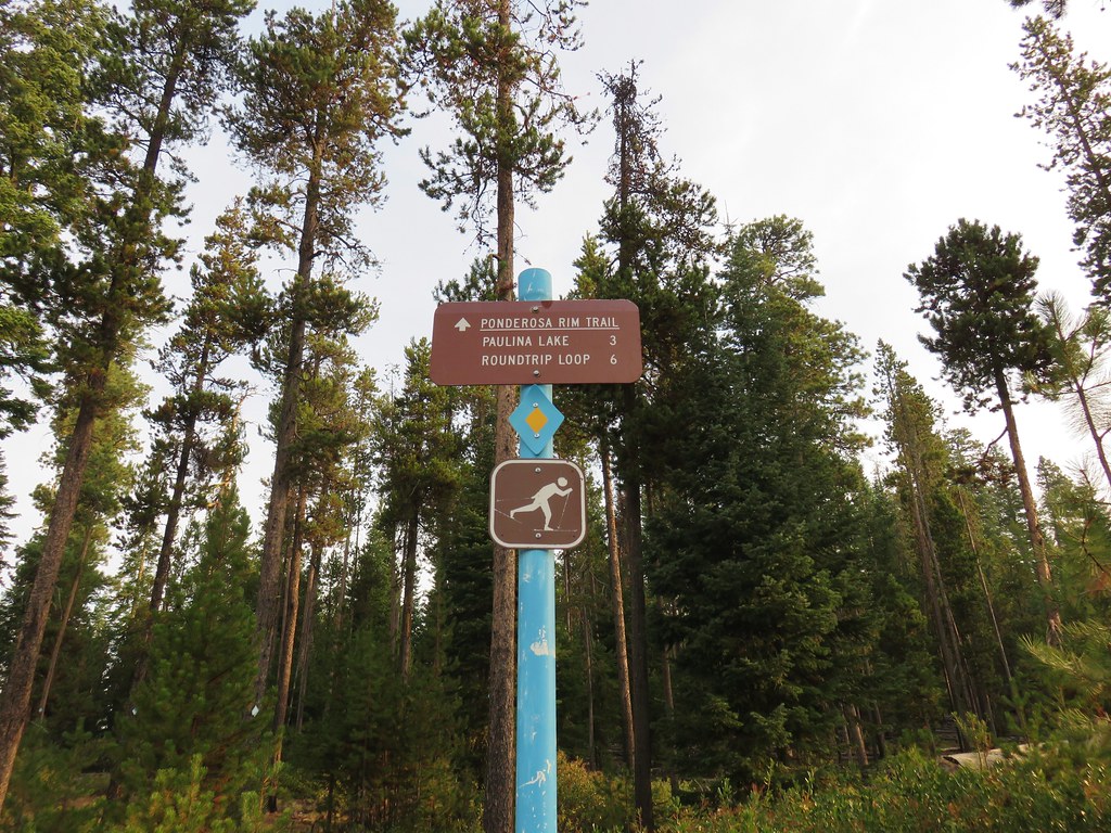
On our hike up Paulina Creek from the Peter Skene Ogden Trailhead we had turned around after approximately 5.5 miles at footbridge over Paulina Creek. After looking at some maps it appeared that this footbridge was near the Ten Mile Sno-Park. Our plan this time was to start at the sno-park and hike over to the bridge and take the Peter Skene Ogden Trail up past Paulina Falls to Paulina Lake, loop around the lake, then return down the creek for a total of about 14.5 miles.

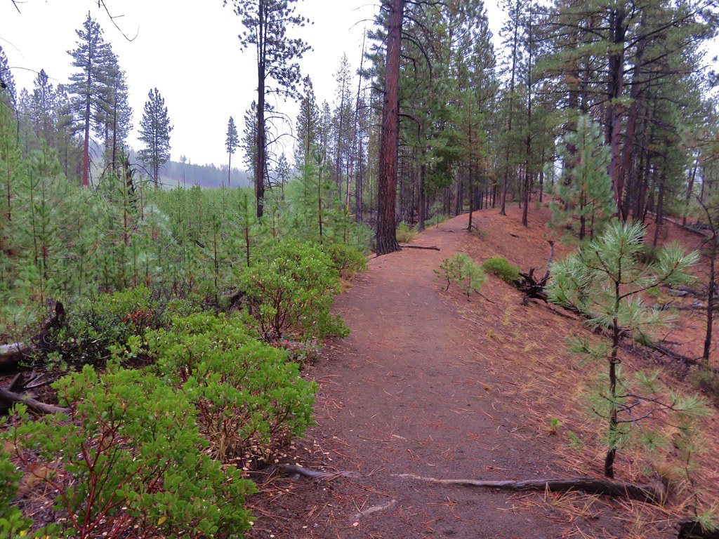
The drive from Salem to Bend was extremely smokey but fortunately for us the conditions inside the Newberry Caldera were much better, just a general haze instead of the heavy smoke we’d passed through. After parking at the sno-park we decided to follow the Ponderosa Trail hoping it would take us to the footbridge.
IMG_8849

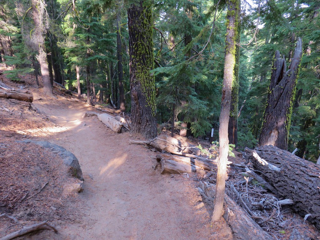
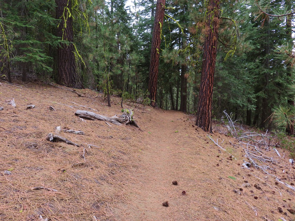
In hindsight we should have printed out a copy of a nordic trails map of the area especially given that they do not show up on the GPS map nor were they included in our guidebook’s map. The trail was easy enough to follow, there was a visible path as well as blue diamond markers on the trees to mark the way.
IMG_8852

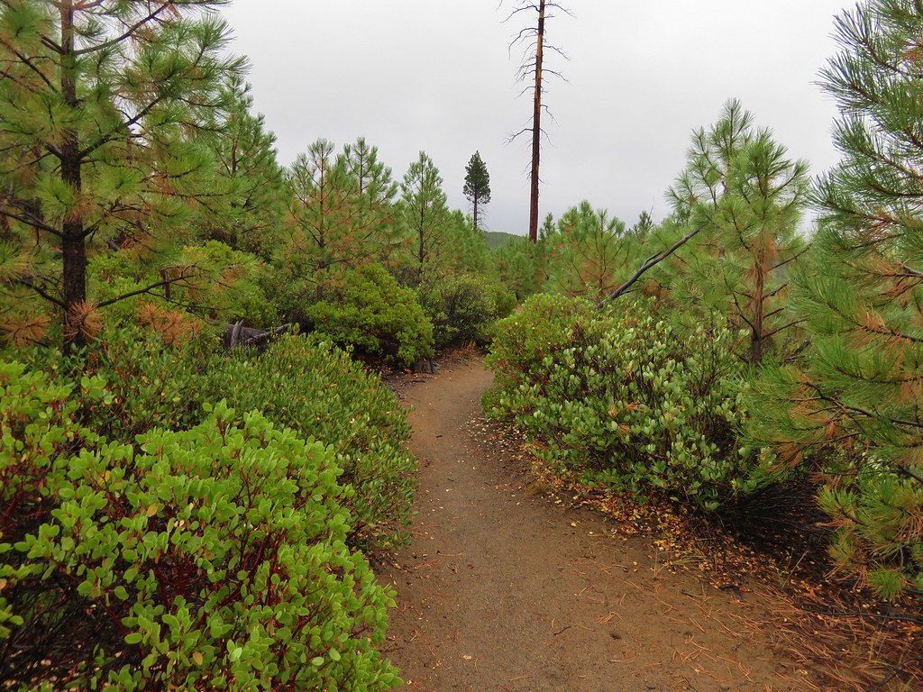
We quickly realized we were heading up the creek away from the footbridge but we decided to just keep going since we knew from the trail sign that the Ponderosa Trail went to Paulina Lake. We could take this up to the lake then come down on the trail we’d intended to come up on after finishing the lake loop.

When we came to a snowmobile track (Road 500) we followed it right for about four tenths of a mile before veering left back onto the nordic trail towards the sound of Paulina Creek.
IMG_8853

IMG_8854

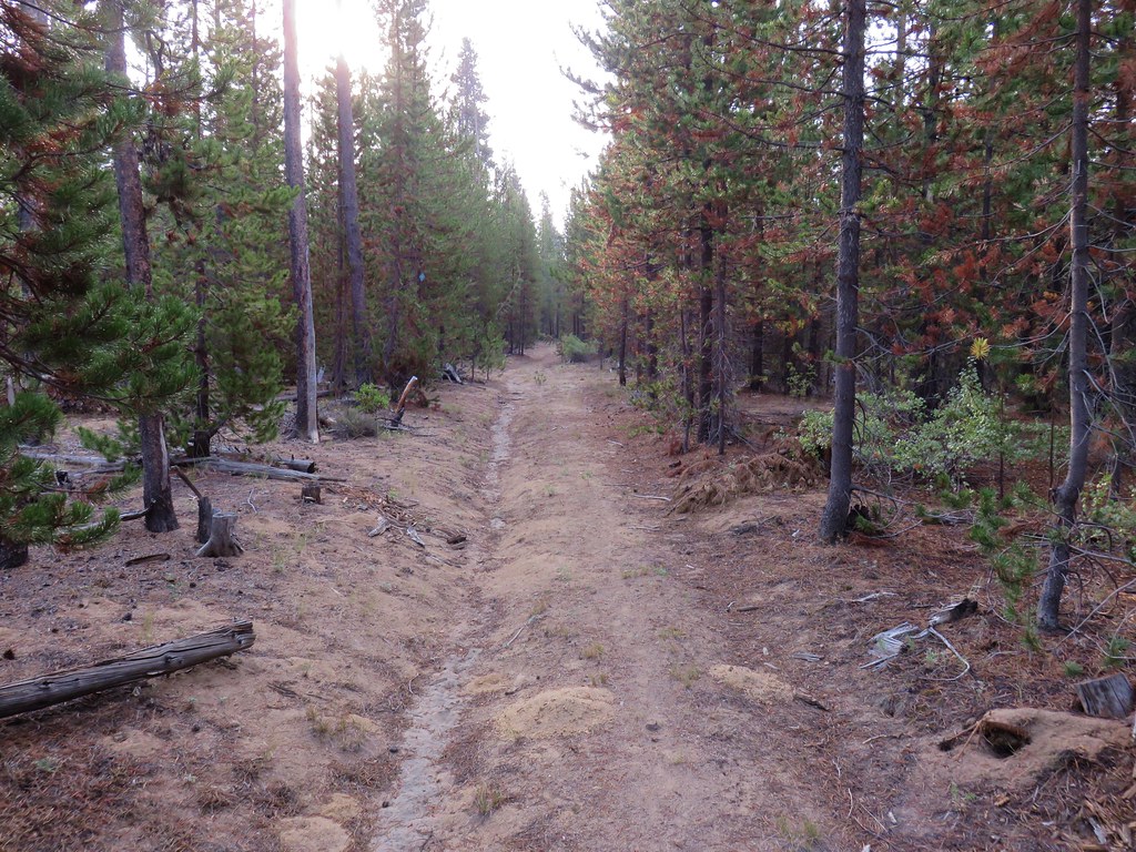
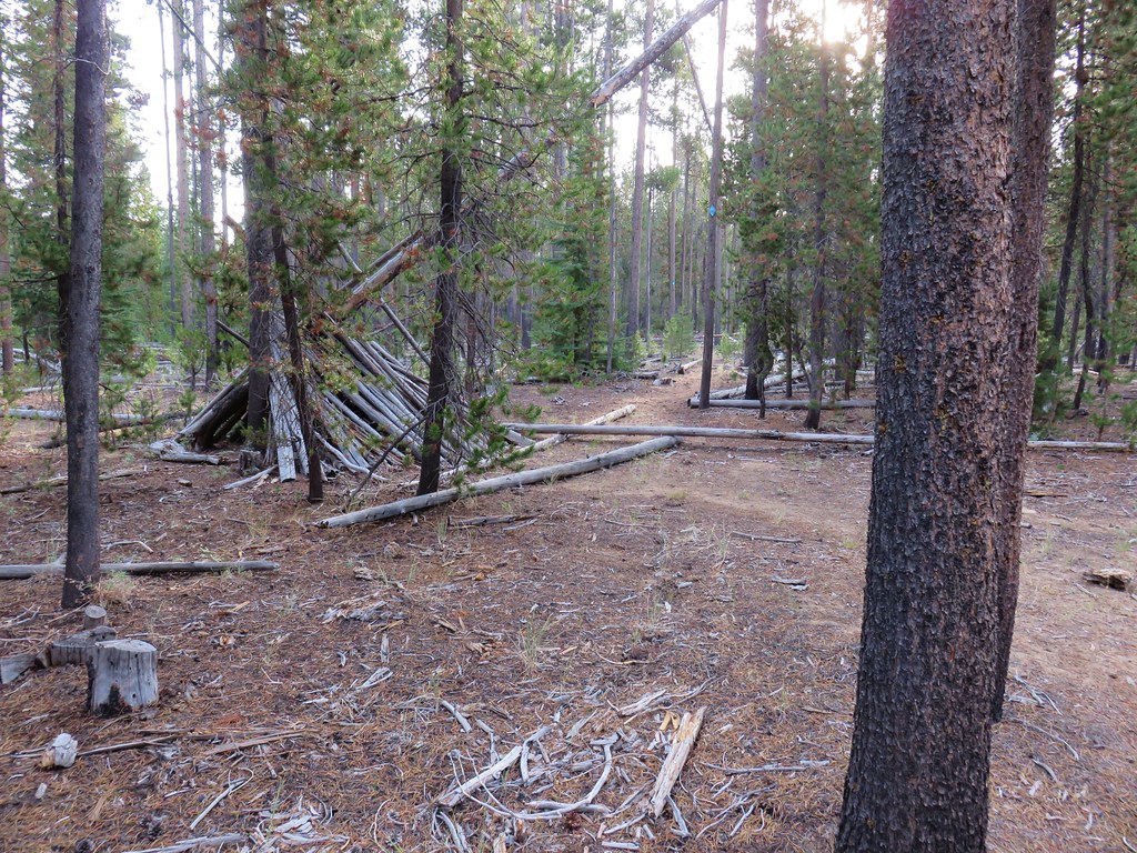
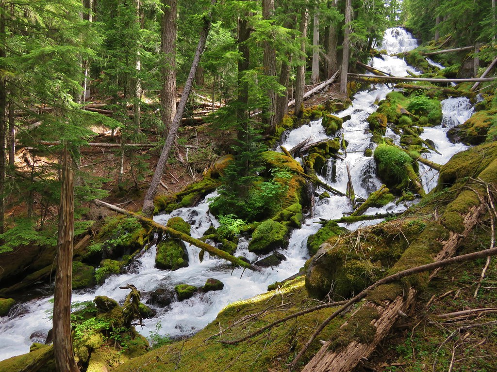
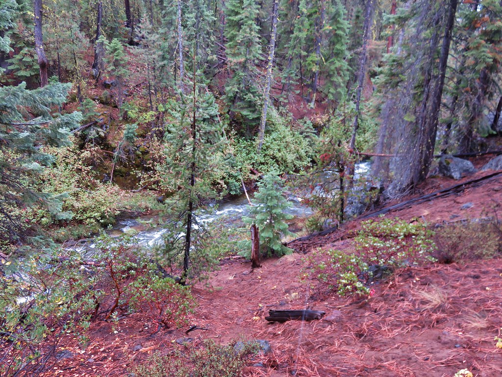
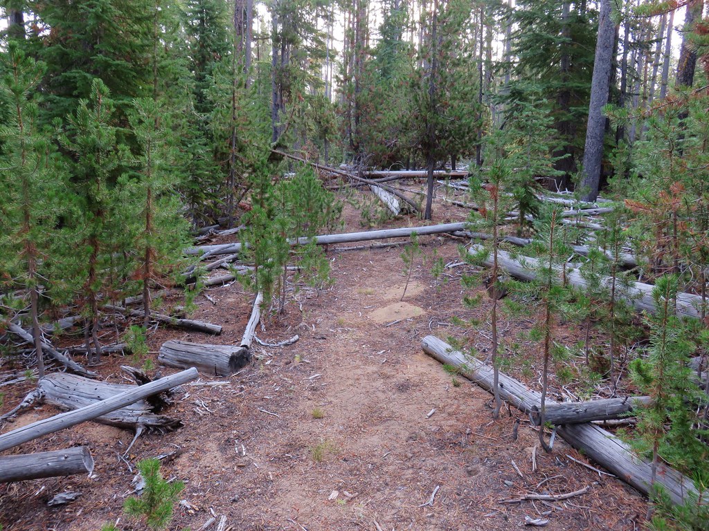
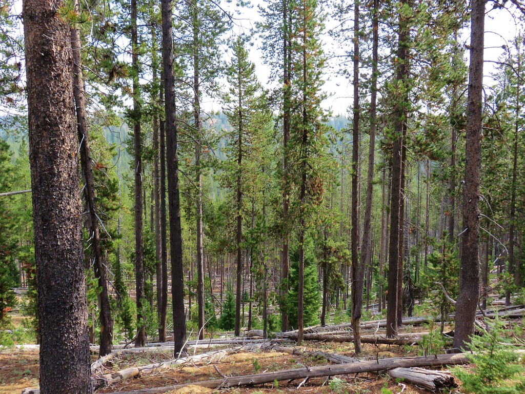
Being a nordic trail the Ponderosa Trail had a good deal of blowdown but it was mostly lodgepole pine trees which we easily stepped over.
IMG_8855

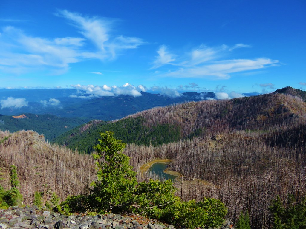
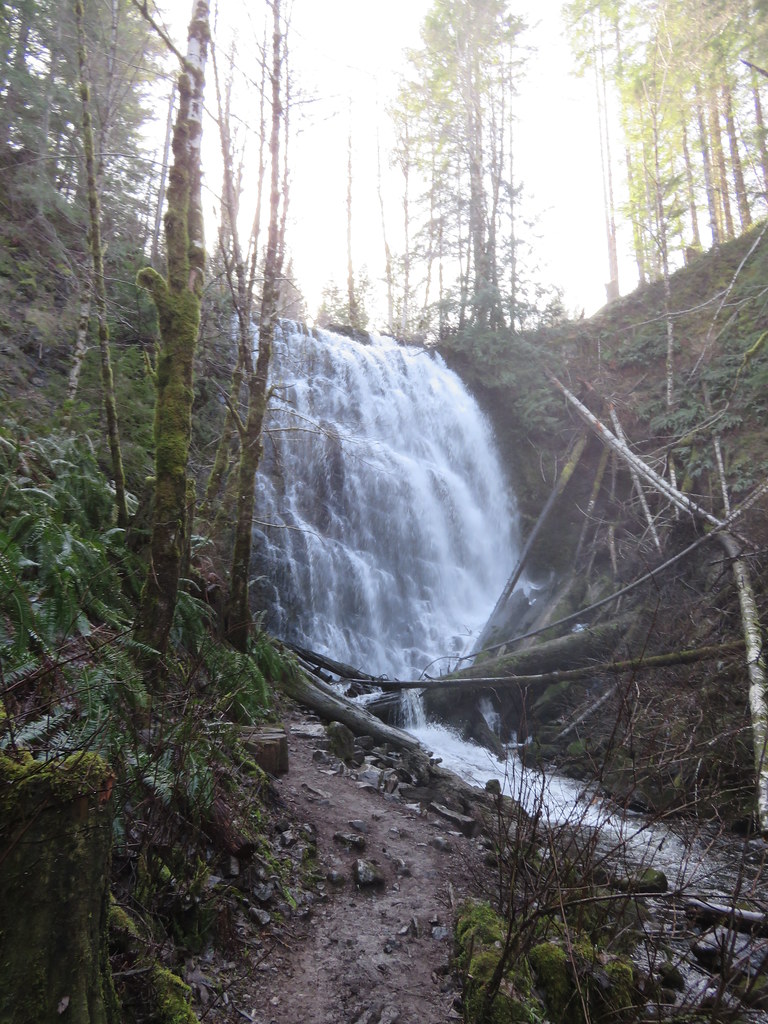
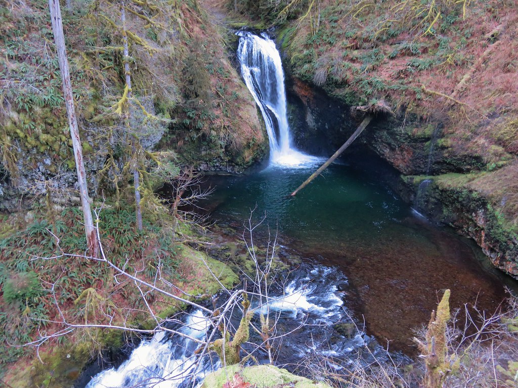
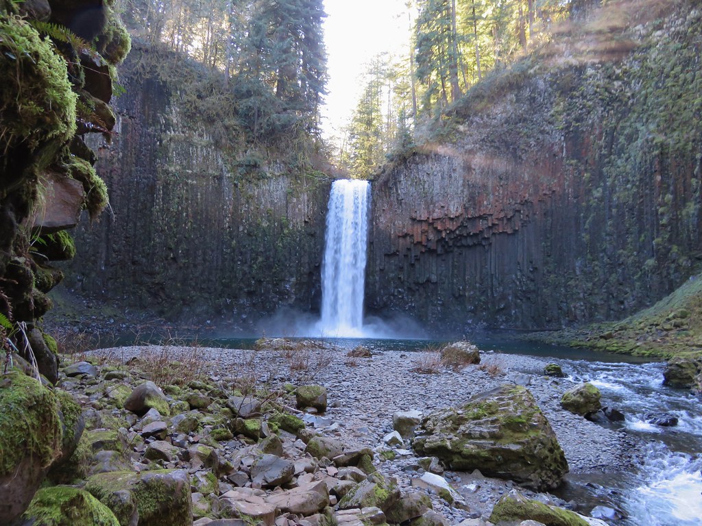
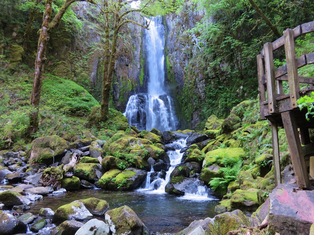
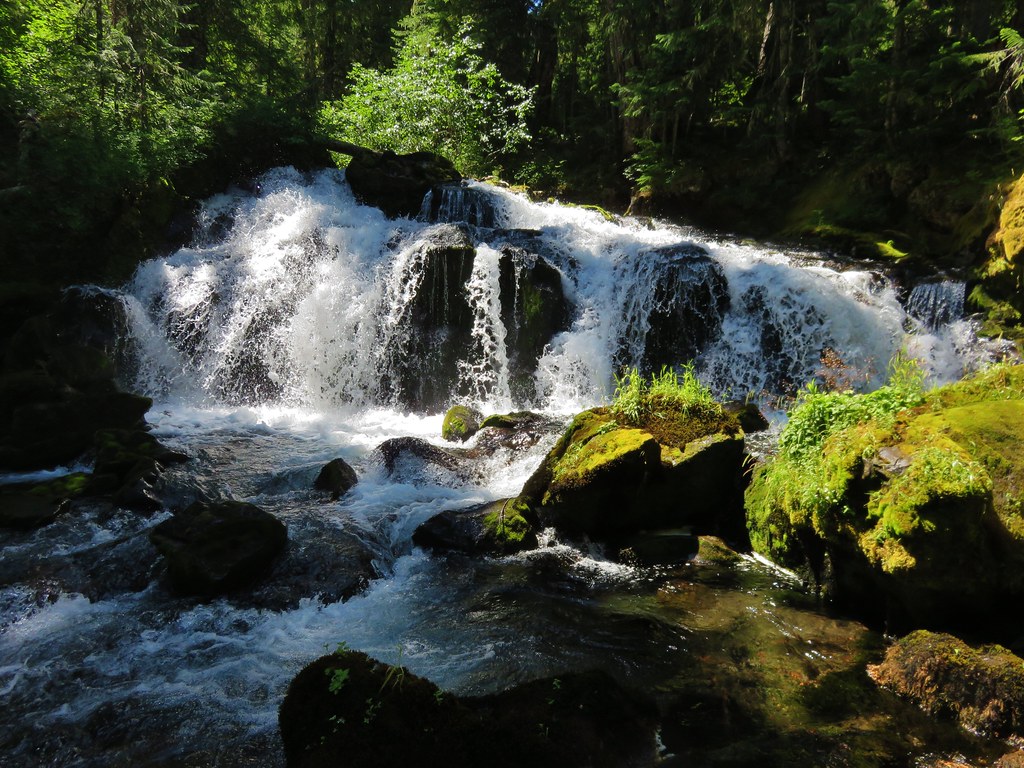
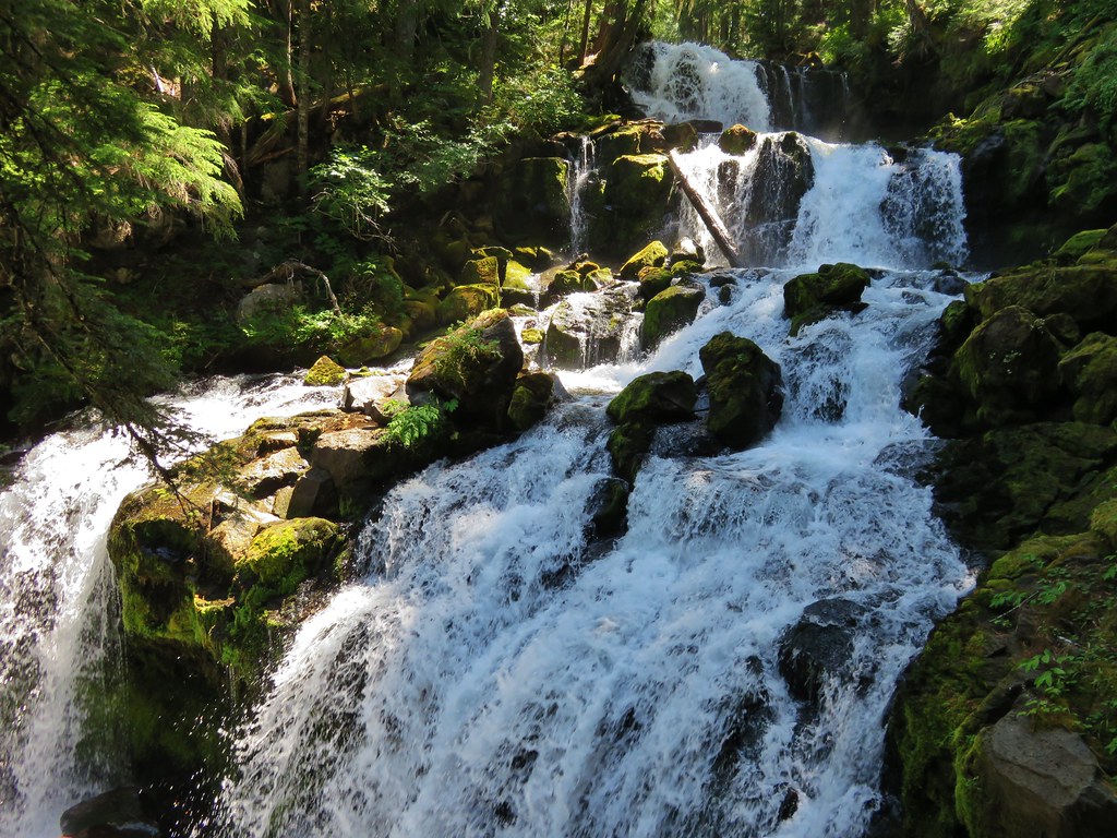
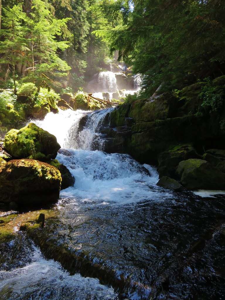
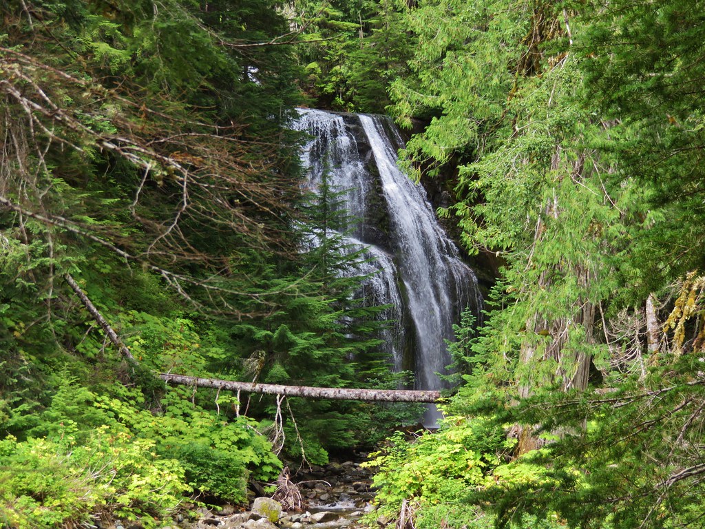
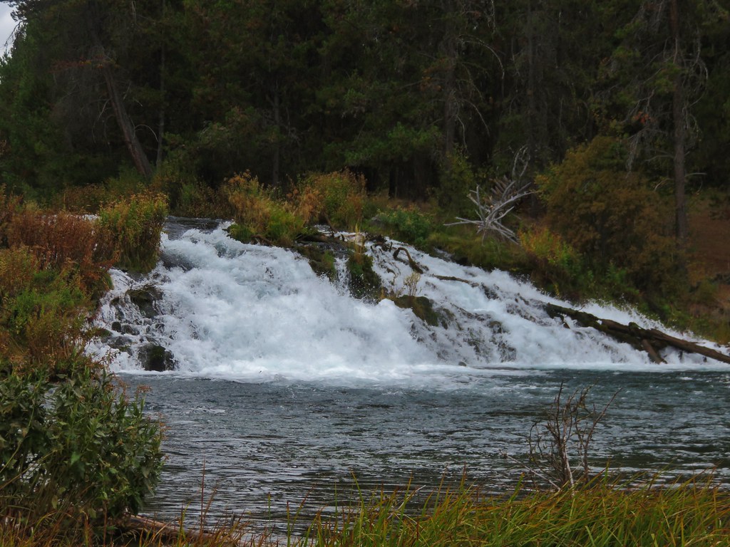
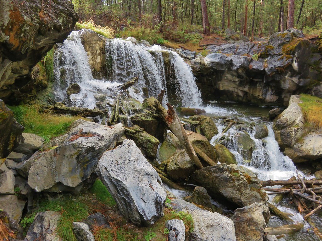
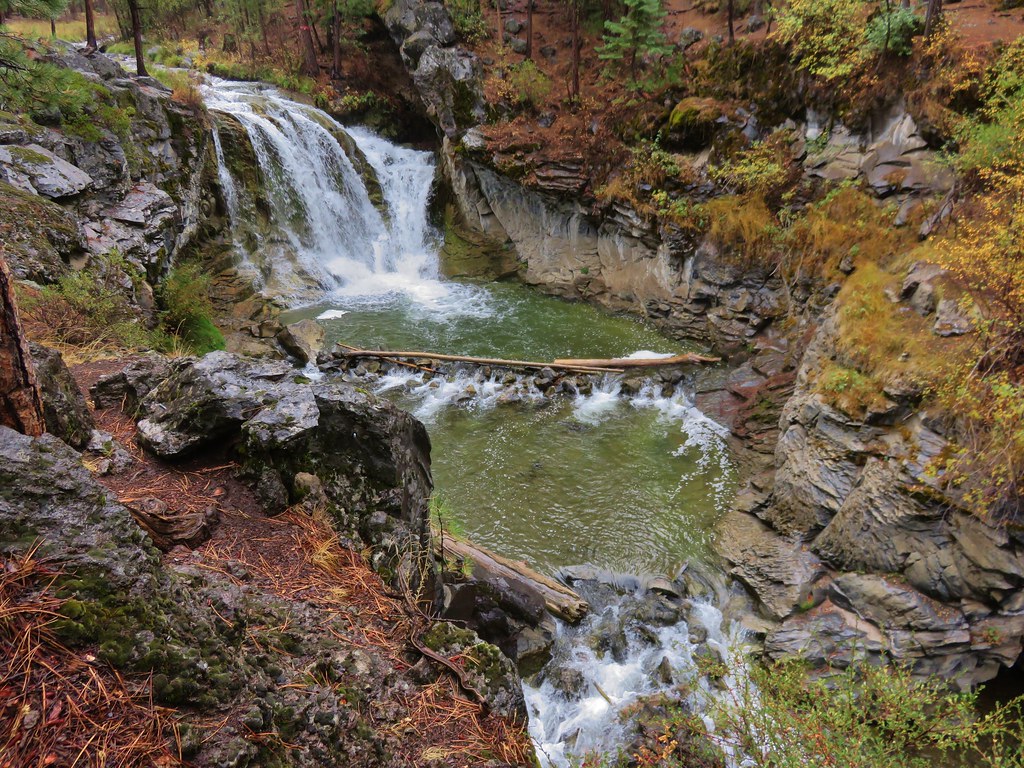
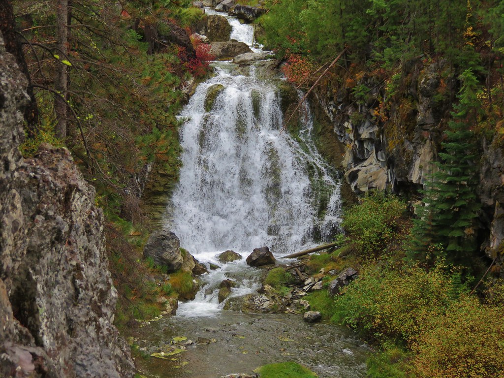
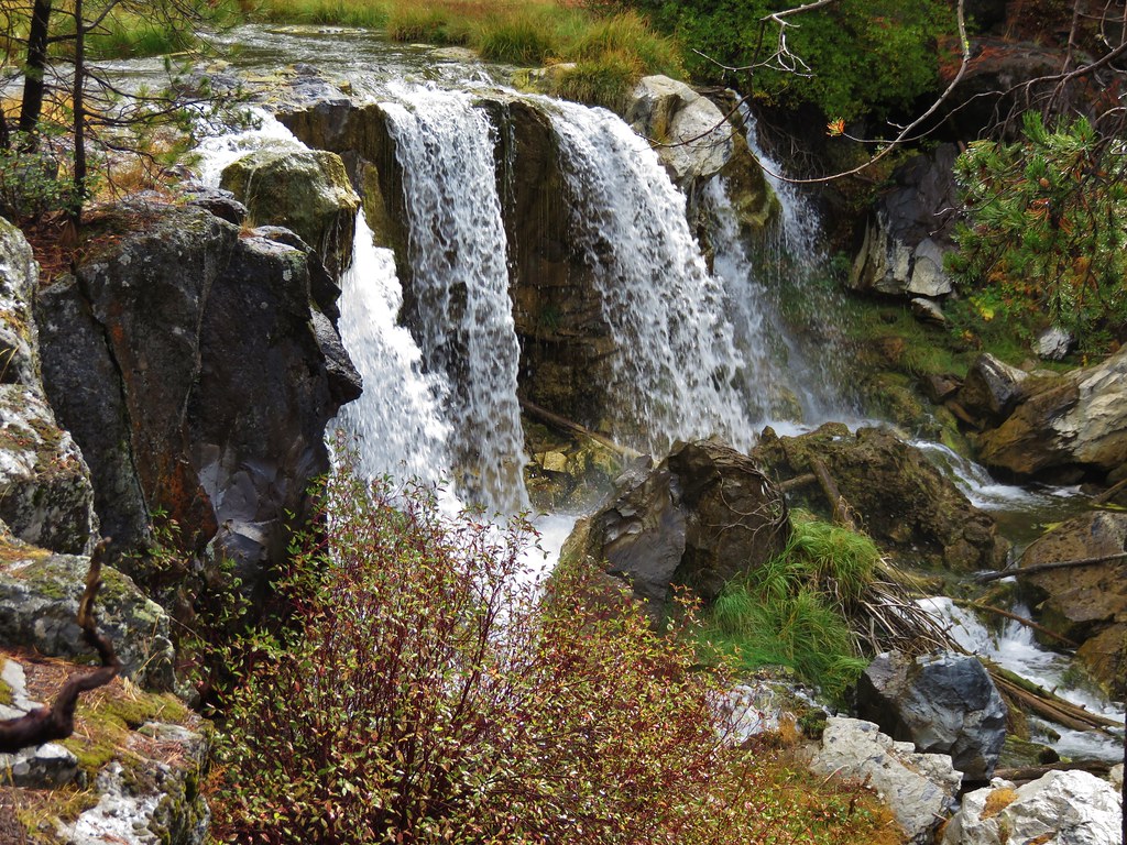
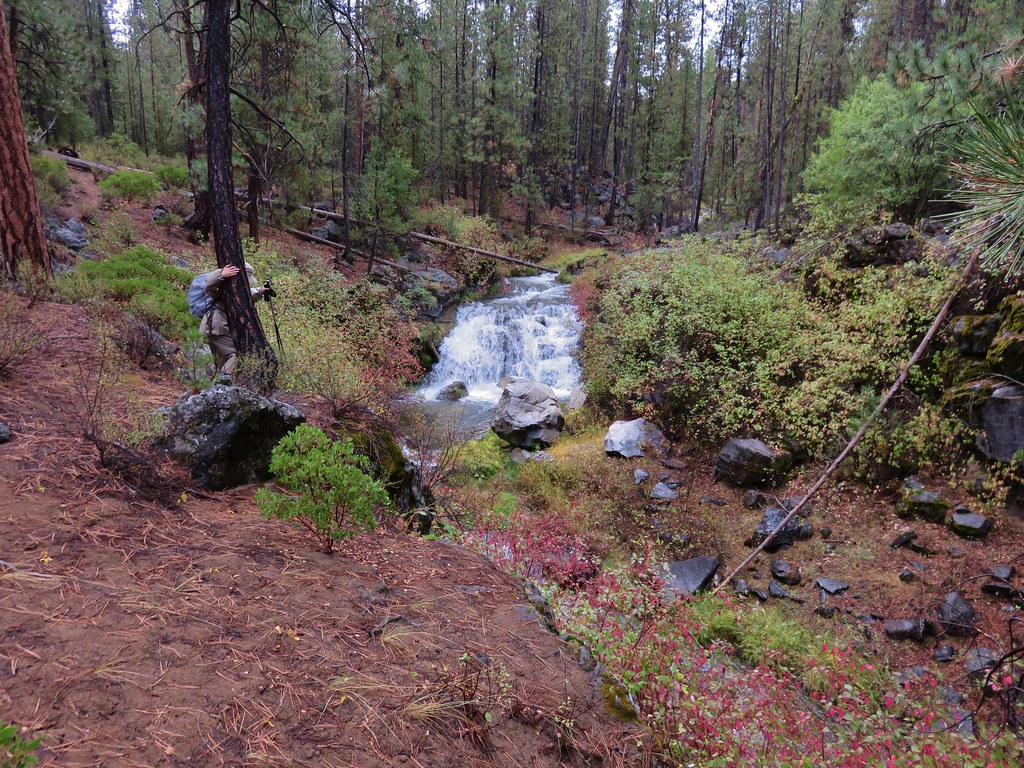
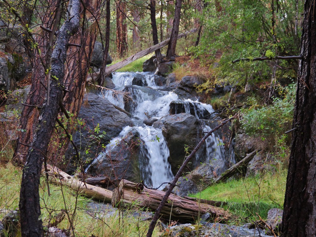
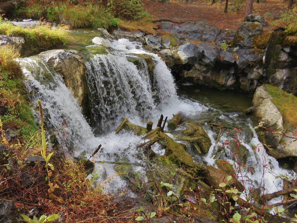
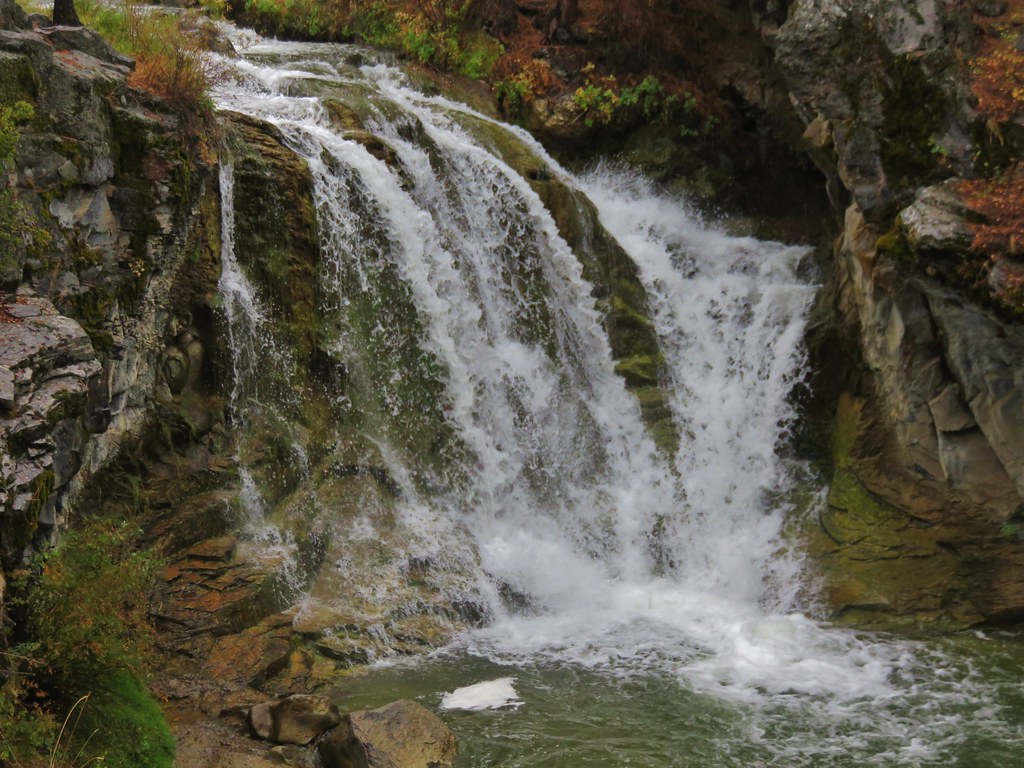
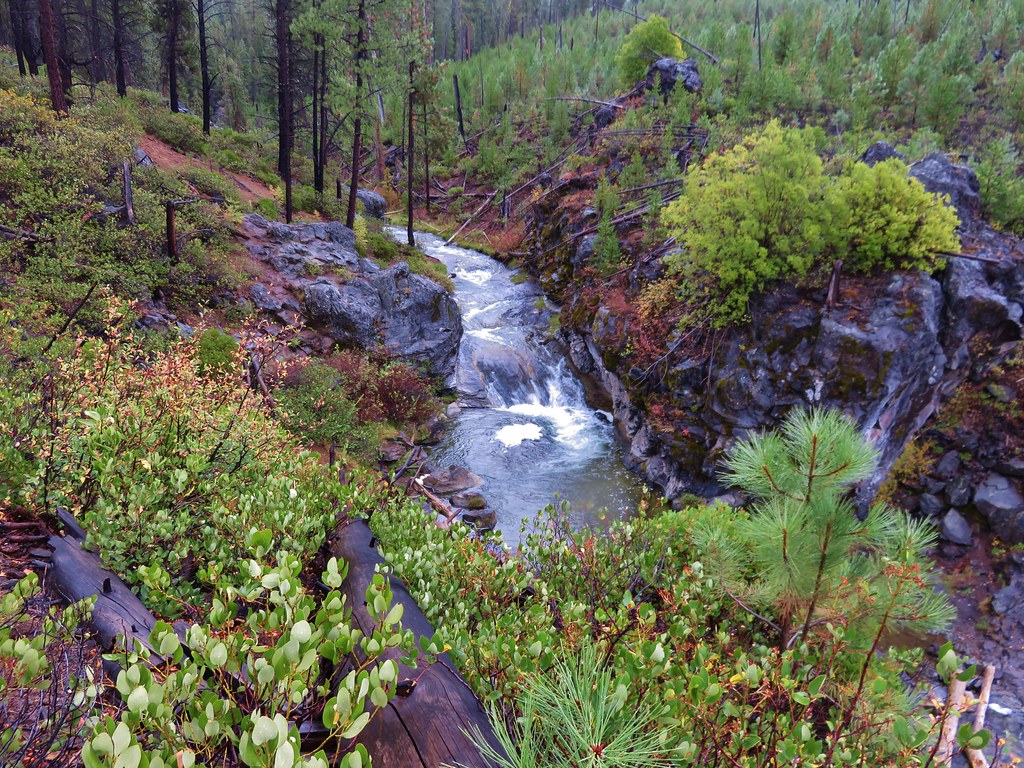
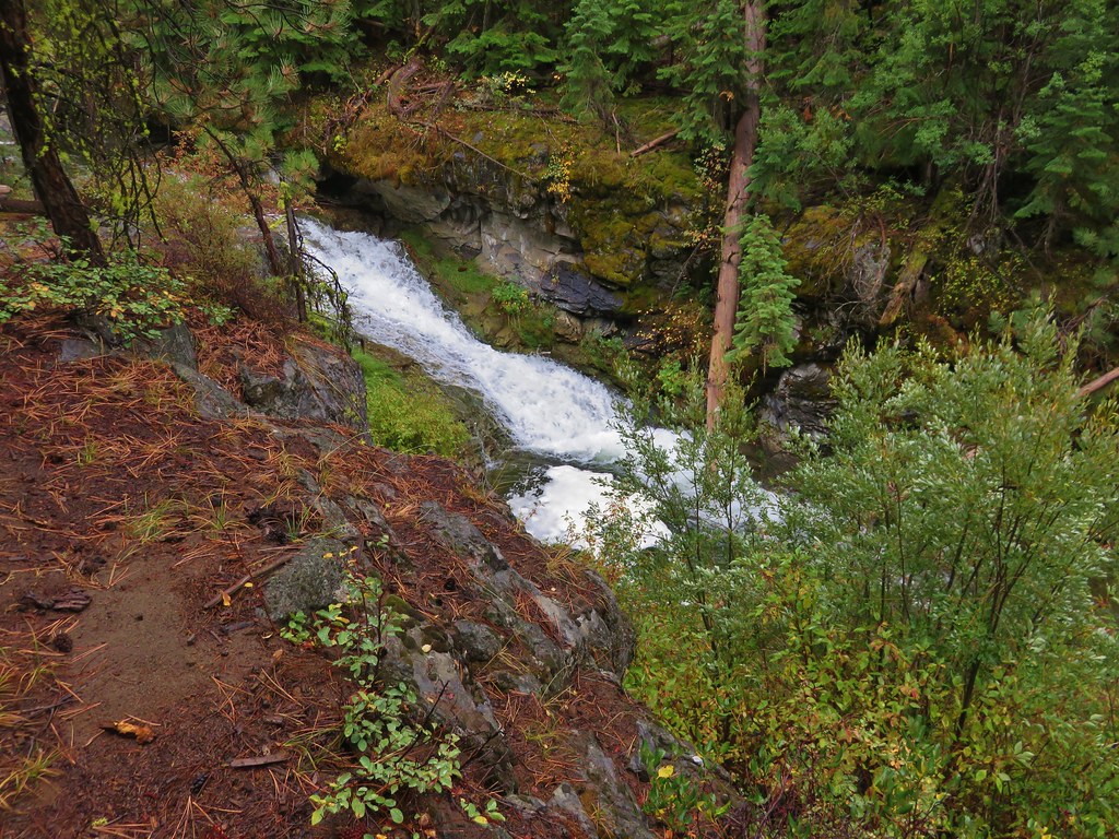
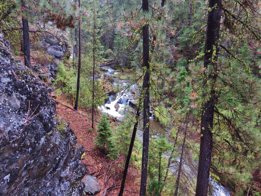
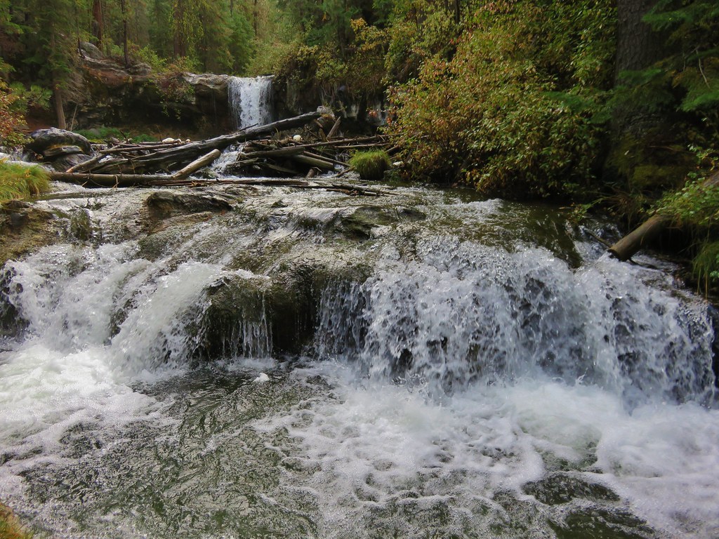
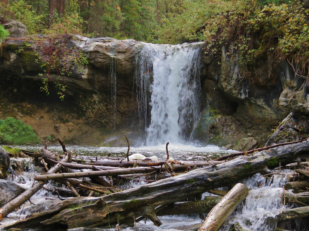
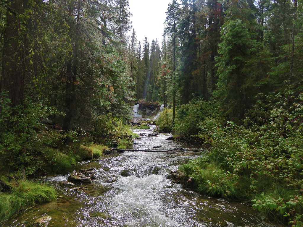
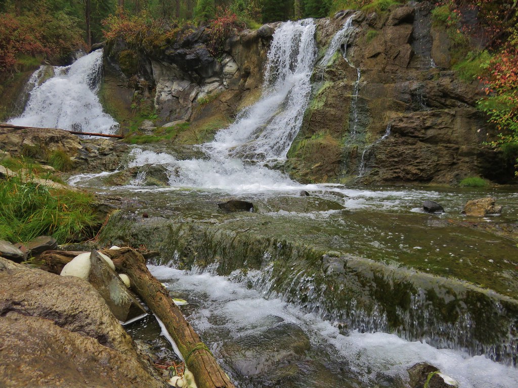
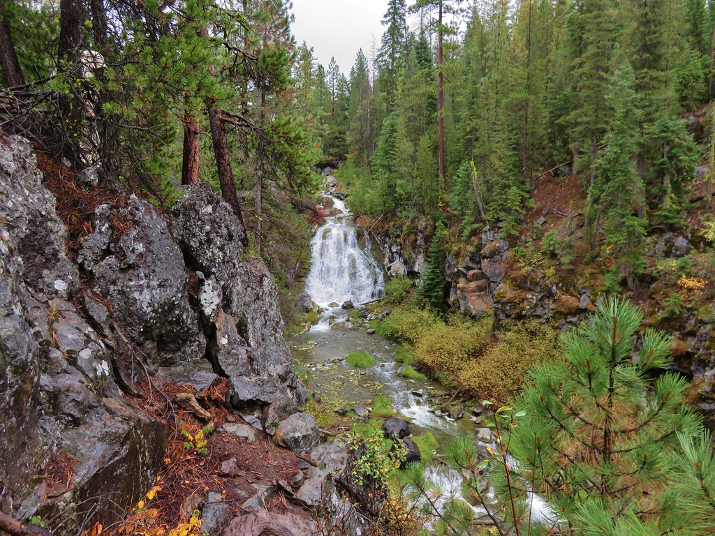
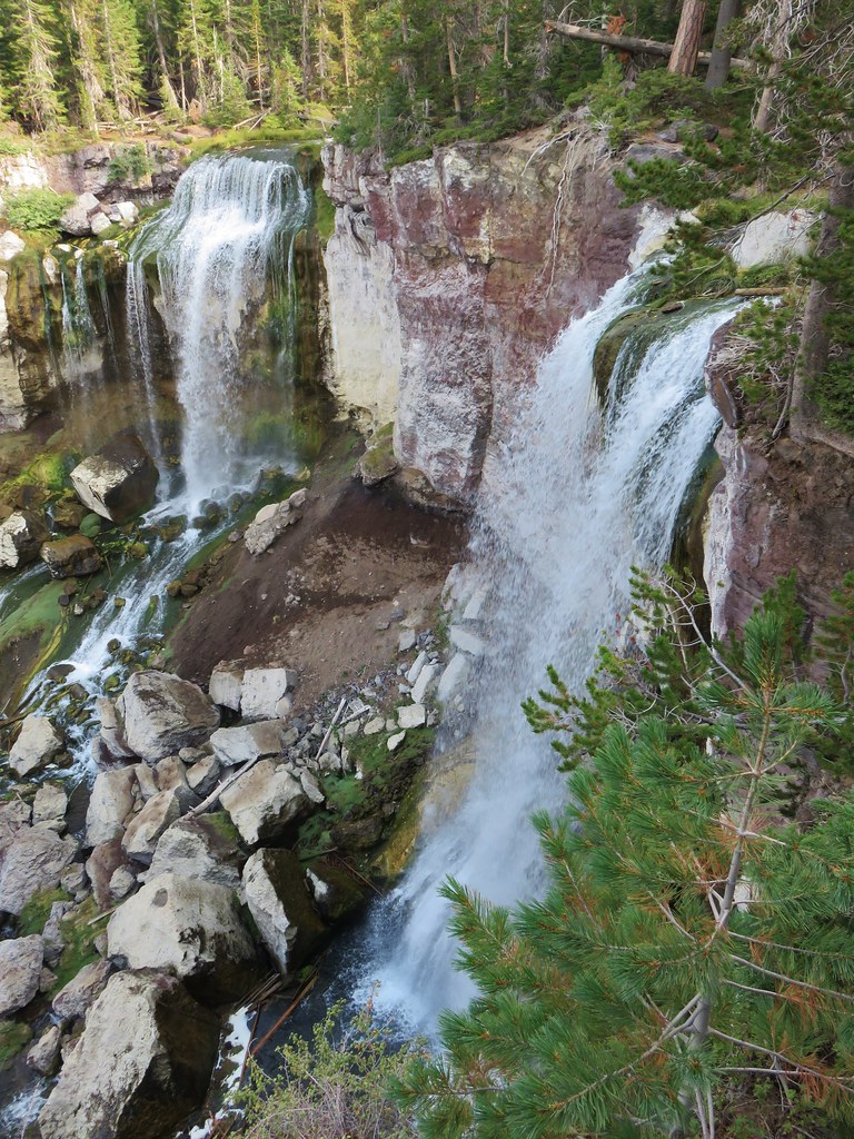
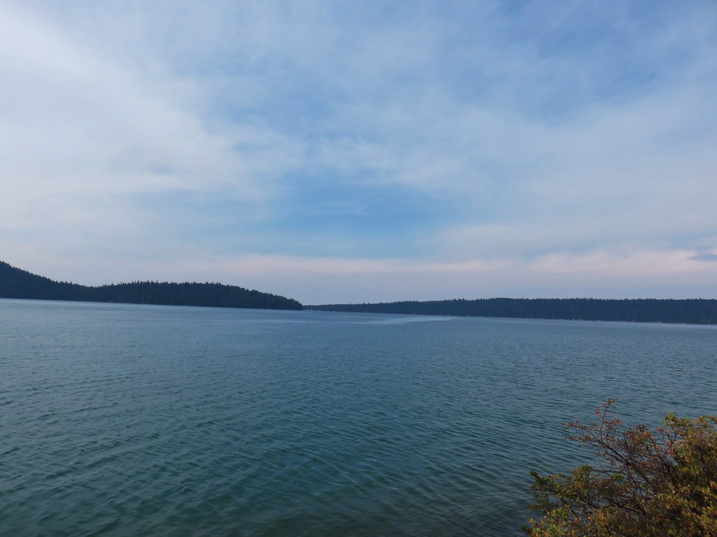
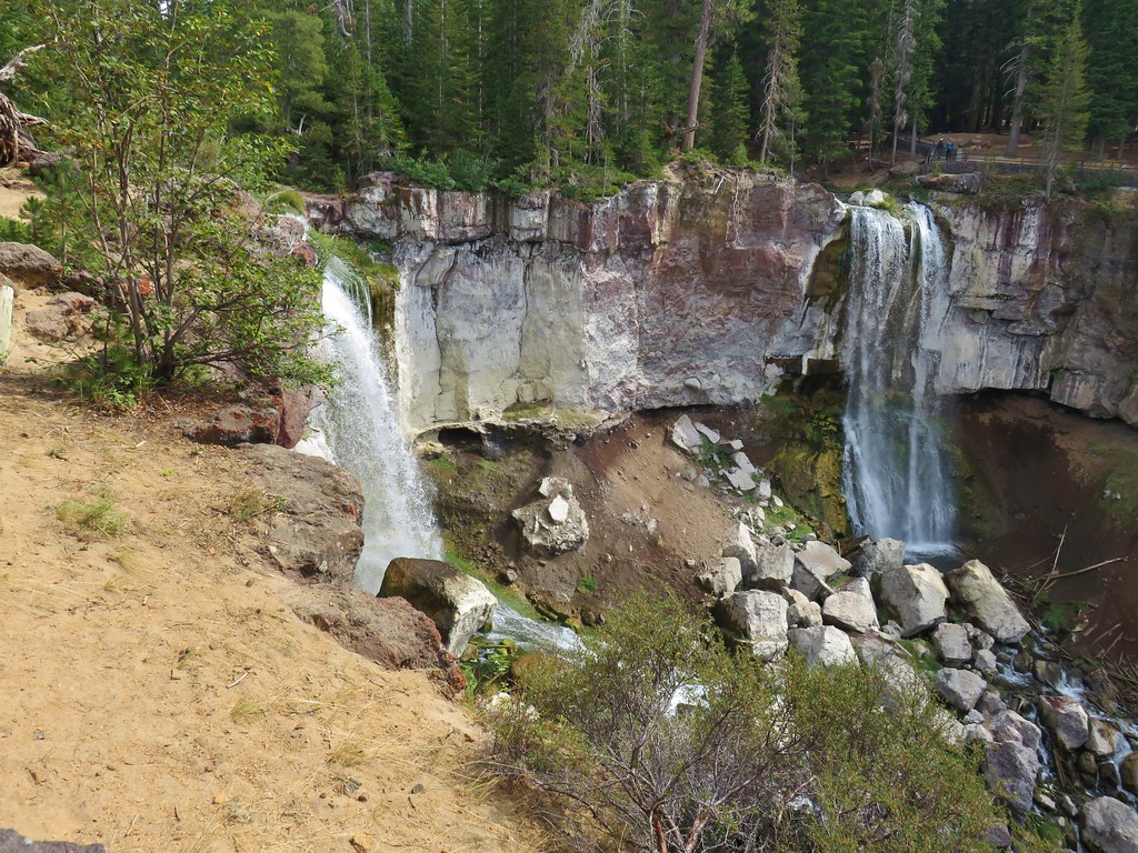
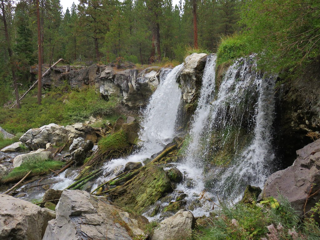
The trail never approached the creek and offered almost no views of the water. A little over 2.5 miles from the sno-park we arrived at a signed trail to a viewpoint below Paulina Creek Falls.
IMG_8874

IMG_8859

IMG_8864

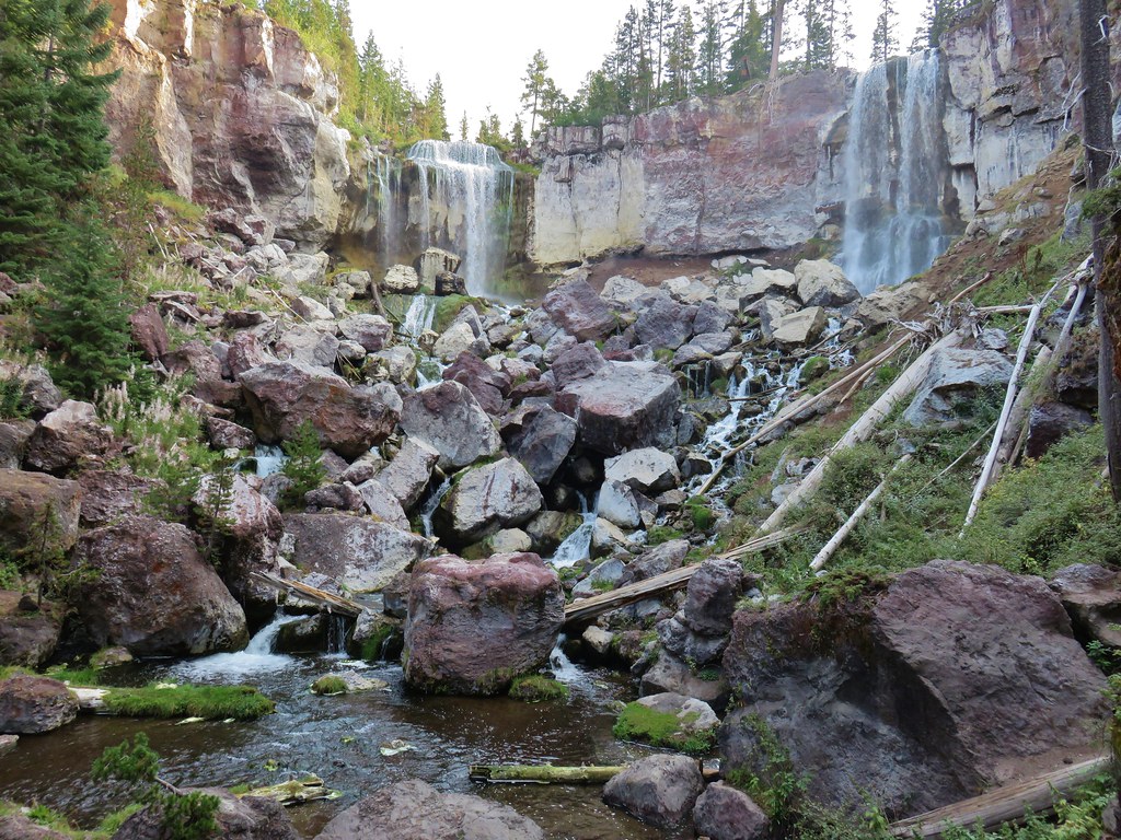
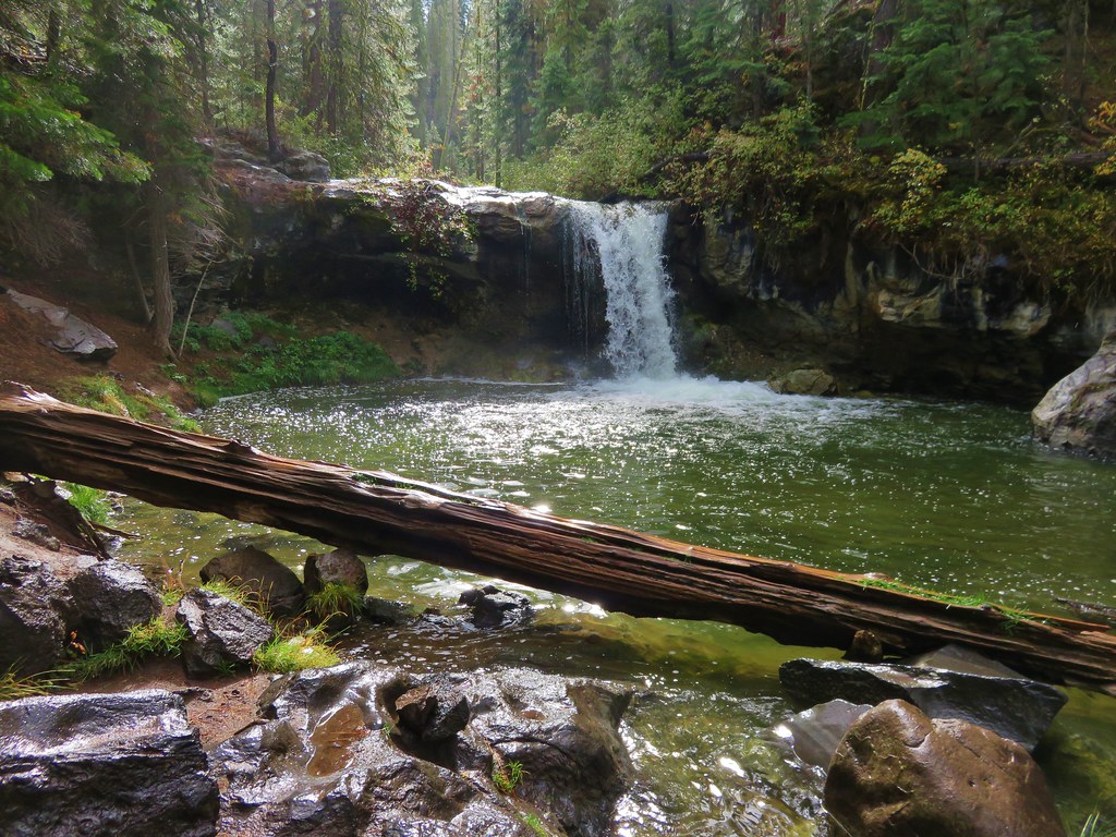
After visiting the lower viewpoint we continued on to the upper viewpoint which had been our turnaround point during our Paulina Peak hike.
IMG_8878

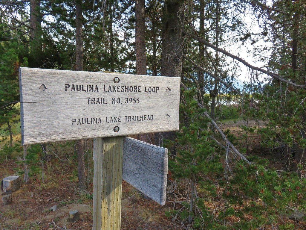
We headed upstream a little over a quarter mile to the start of the Paulina Lake Loop just after crossing the road to the Paulina Lake Lodge.
IMG_8887

IMG_8888

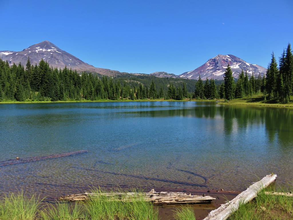
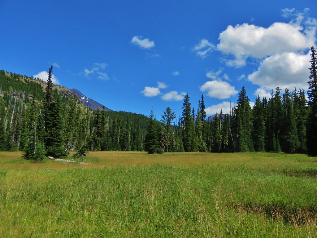
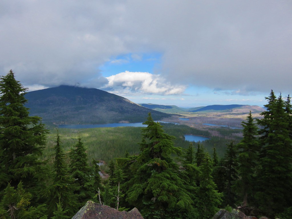
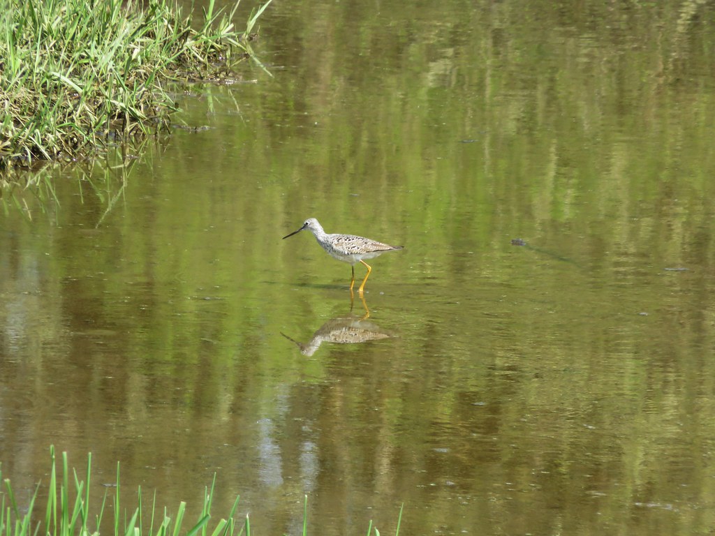
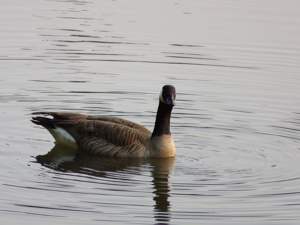
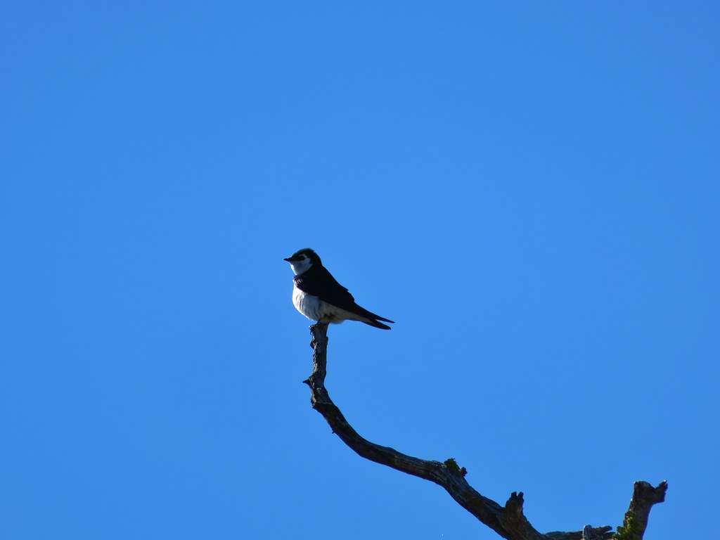
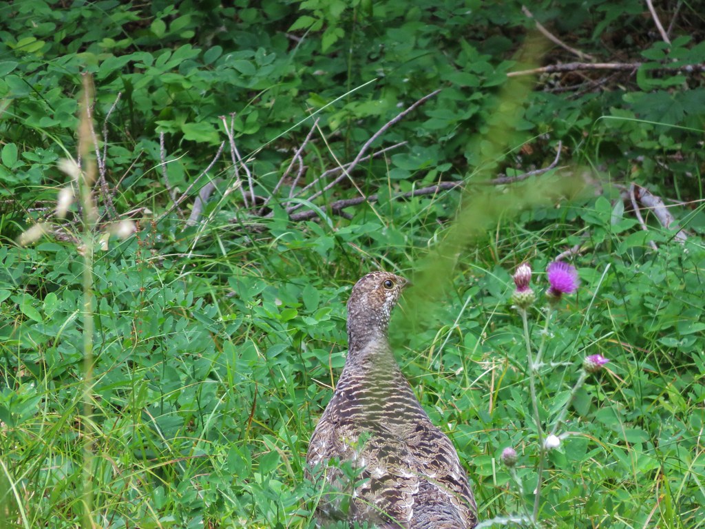
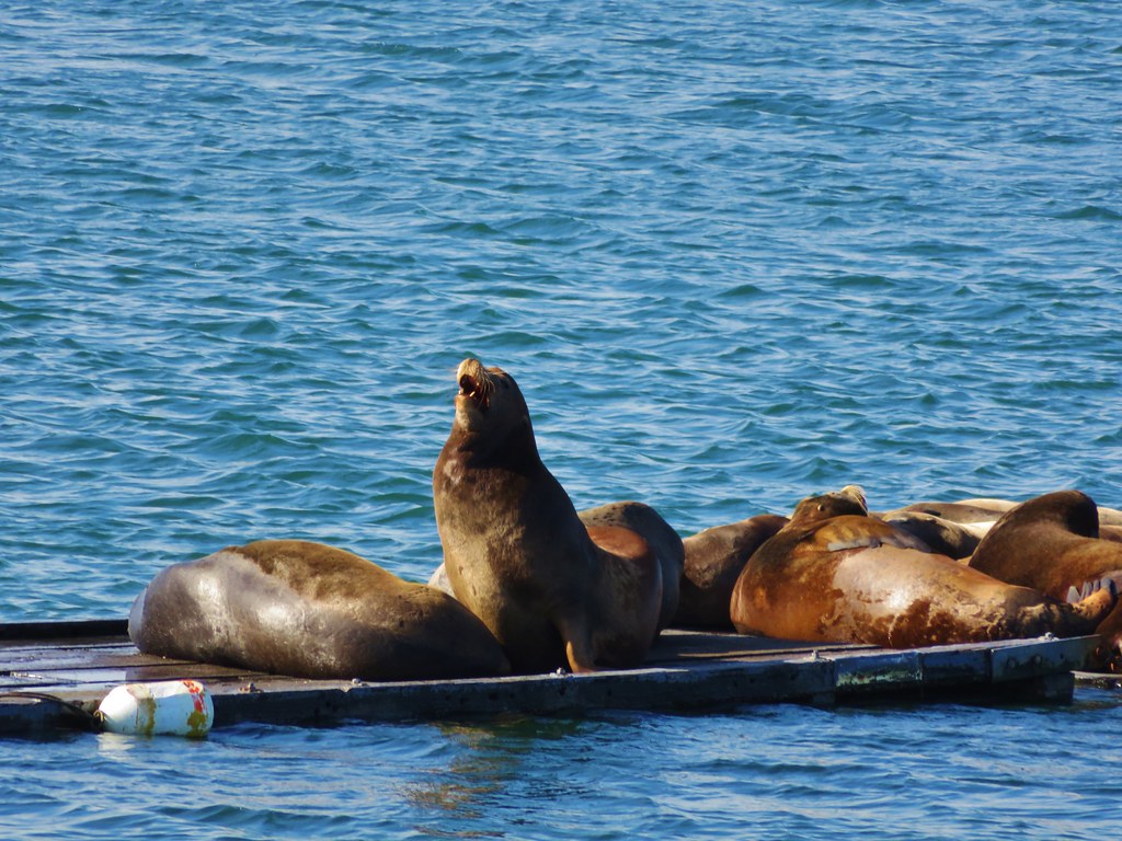
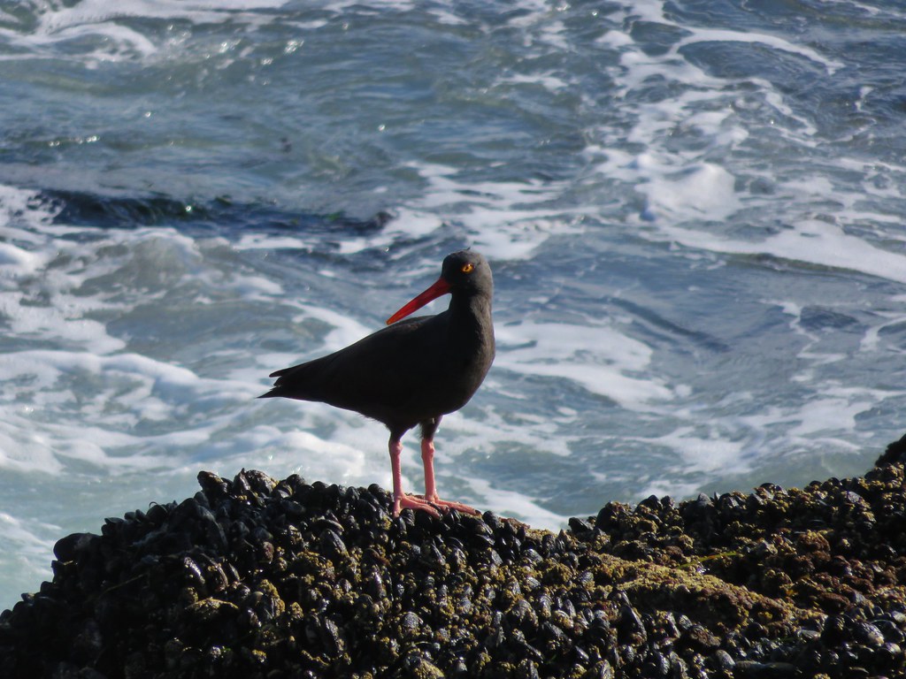
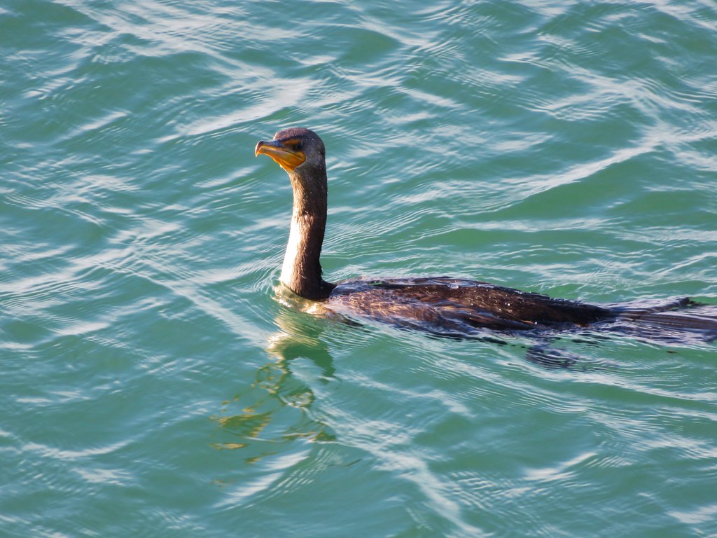
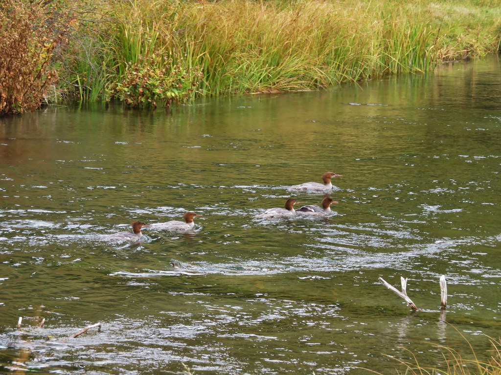
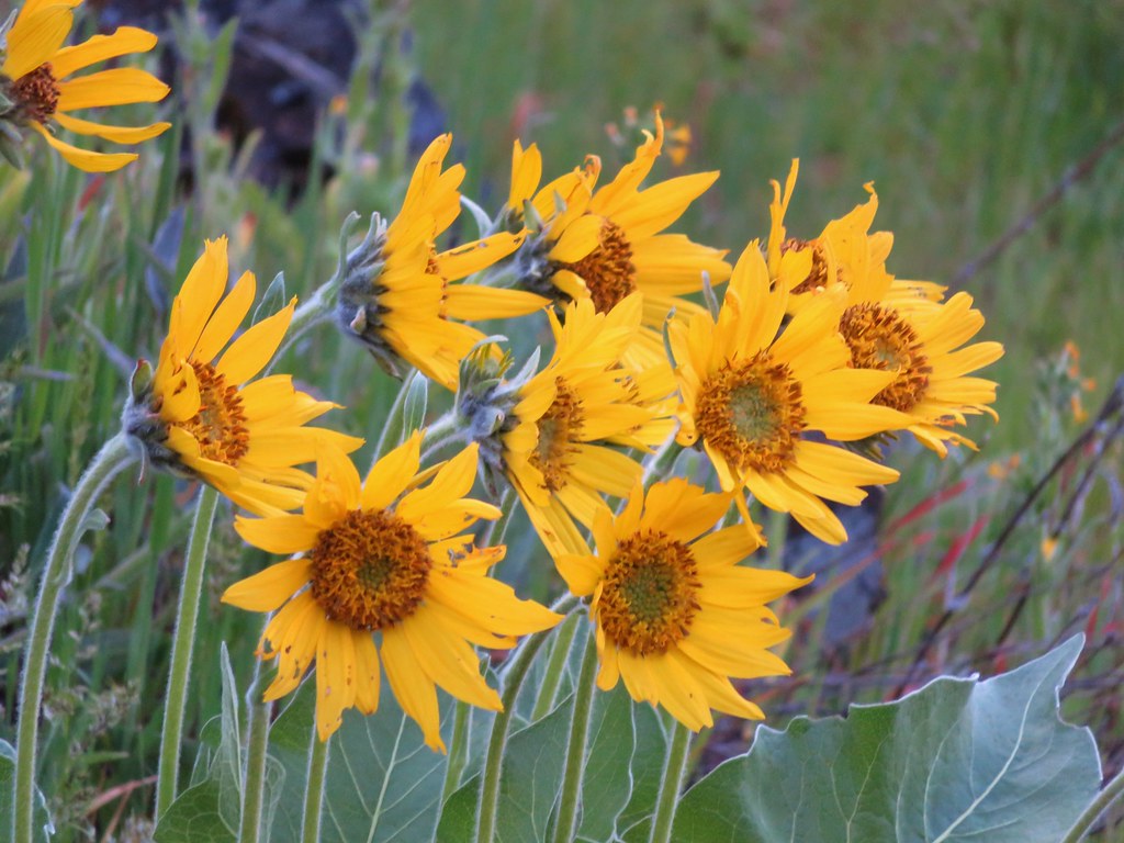
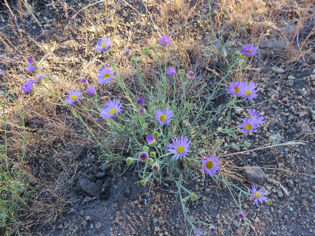
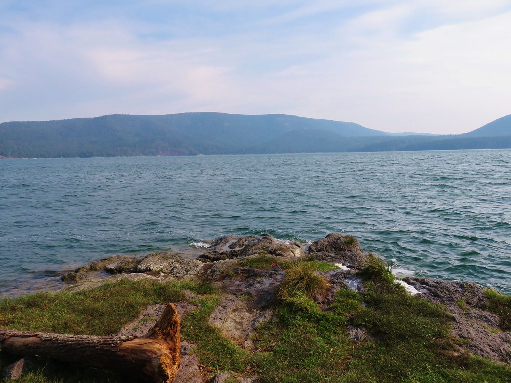
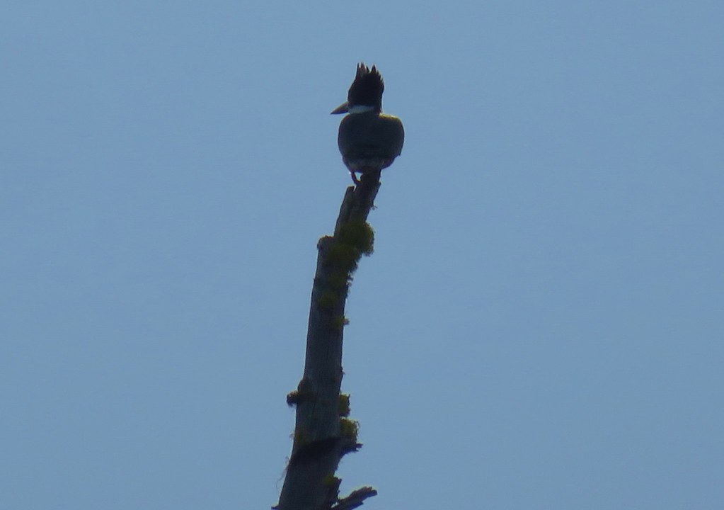
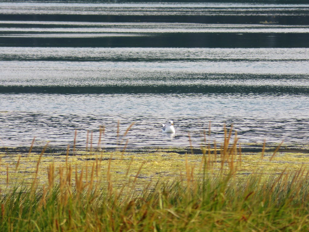
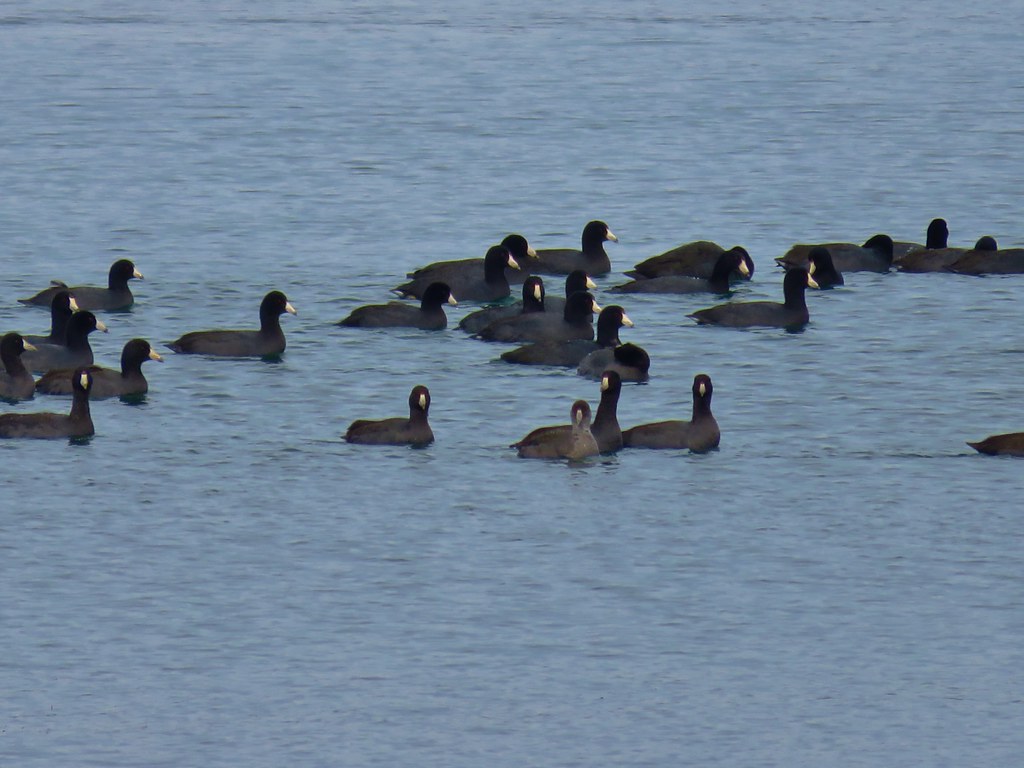
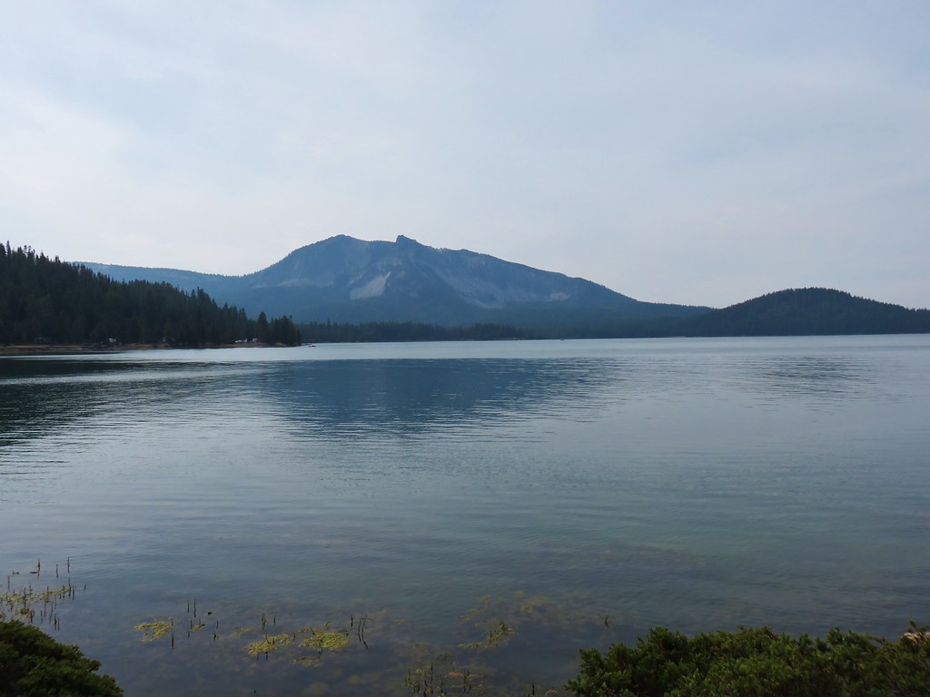
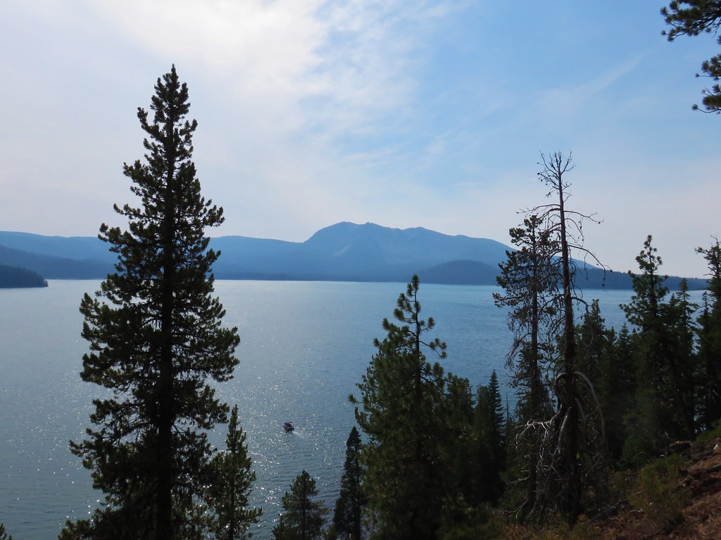
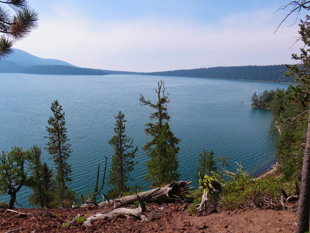
We started around the lake in a counter-clockwise direction which was the same direction we’d gone during our Paulina Peak hike. We passed some familiar scenery including a small rocky peninsula and a marshy area filled with birds and a view of Paulina Peak.
IMG_8900

IMG_8901

IMG_8901

IMG_8909

IMG_8915

IMG_8922

IMG_8932

IMG_8926

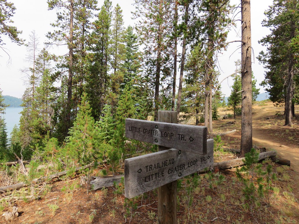
After 2.4 miles on the loop we arrived at the boat ramp near Little Crater Campground.
IMG_8936

IMG_8939

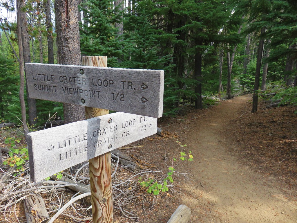
On our previous visit we had taken the Silica Trail from the parking area here. This time we could either follow the paved road to the campground on the loop trial or we could climb up and over Little Crater, a cinder cone. Even though I had planned on taking the Little Crater Trail my 14.5 mile estimate had not taken into consideration that this route would add a little over a mile to the hike.
IMG_8940

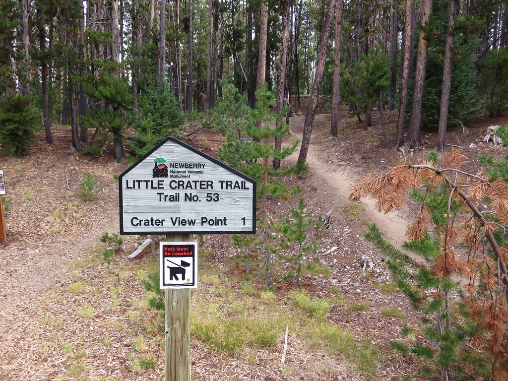
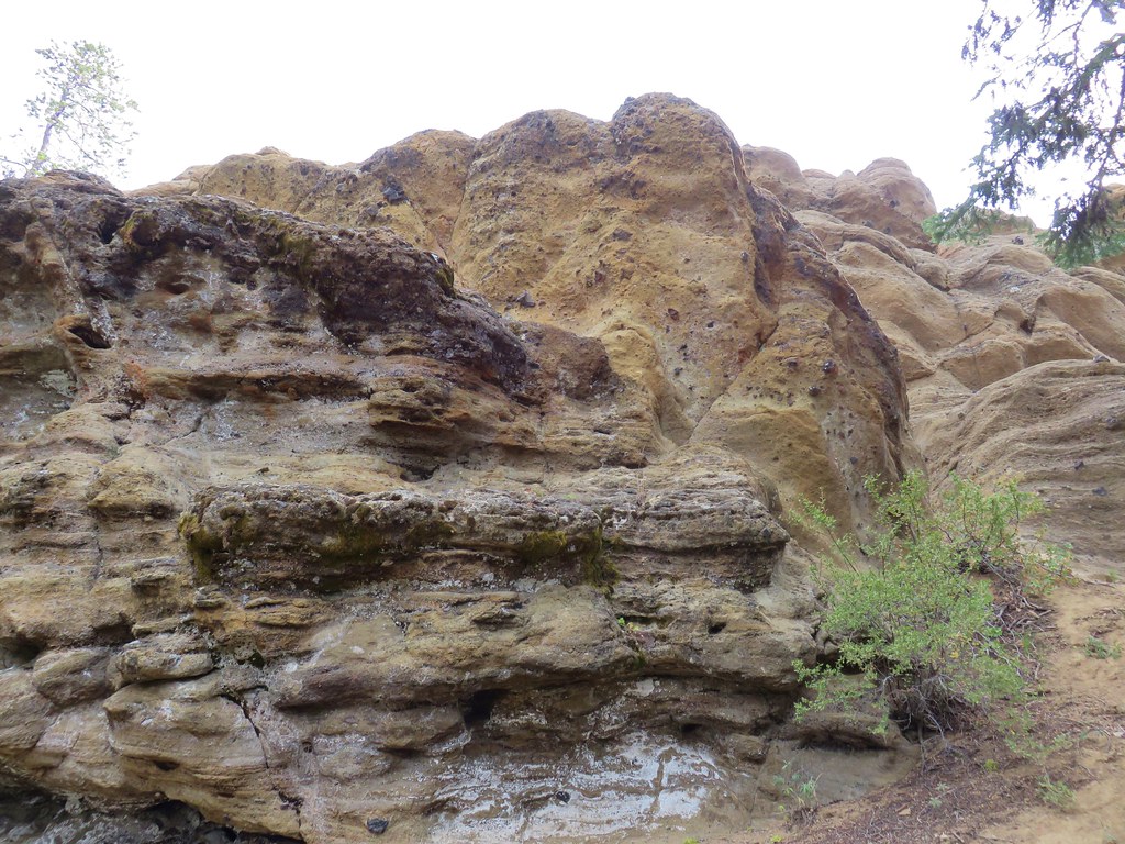
The Little Crater Trail climbed up past an interesting rock outcrop to a junction.
IMG_8941

IMG_8942

IMG_8946

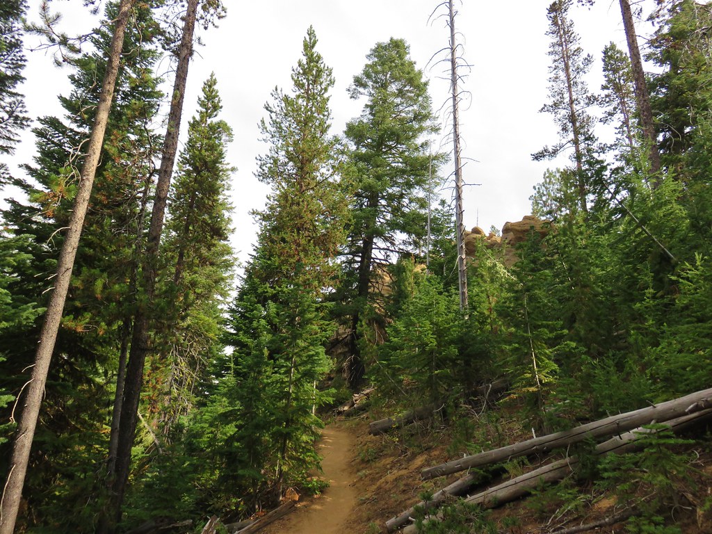
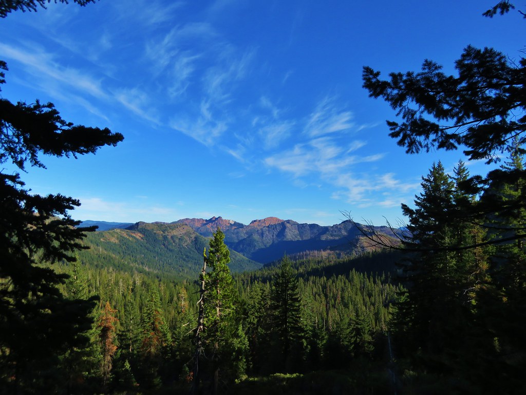
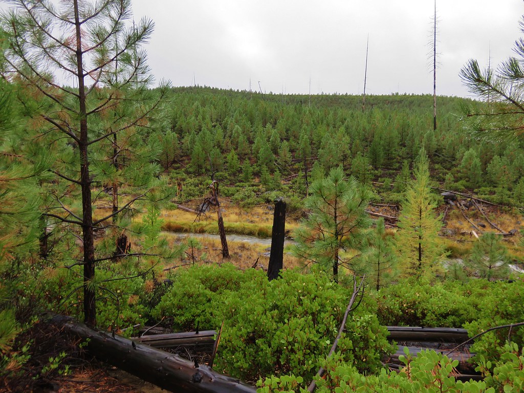
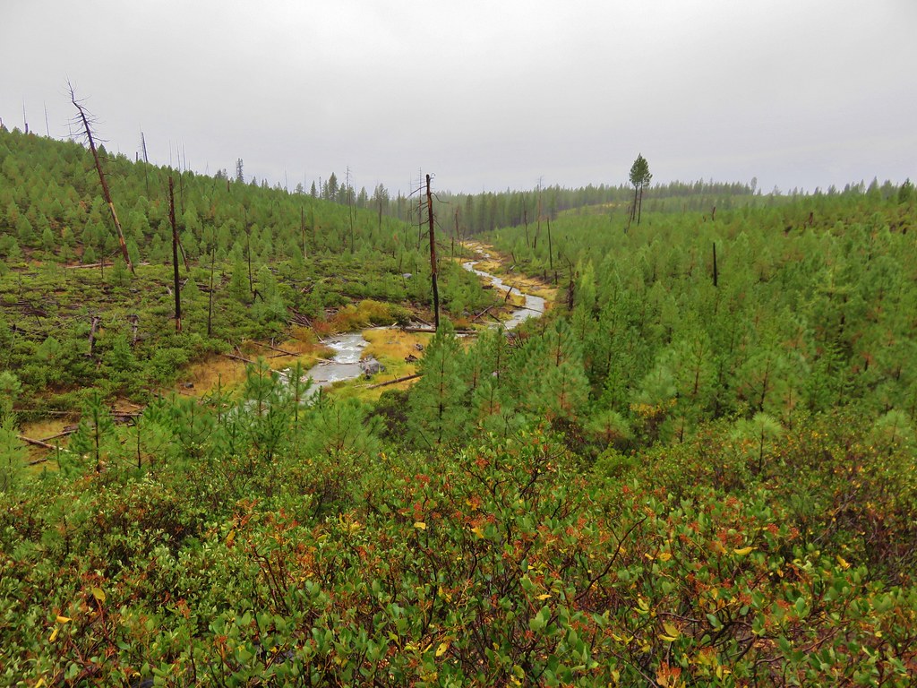
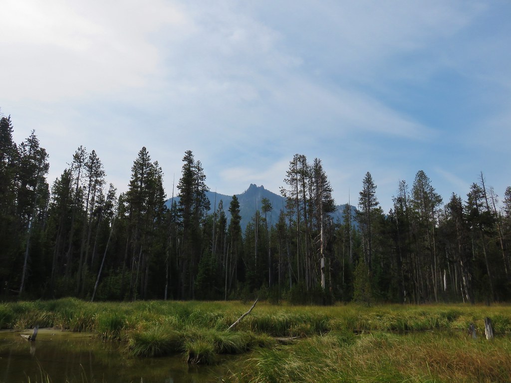
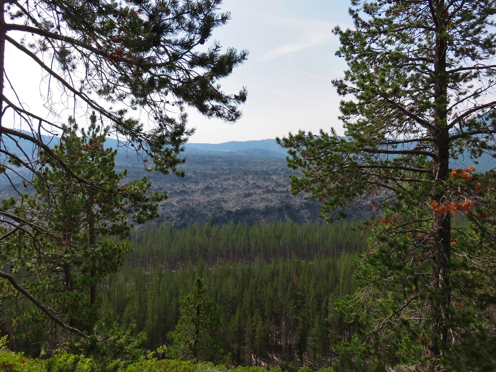
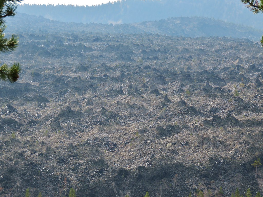
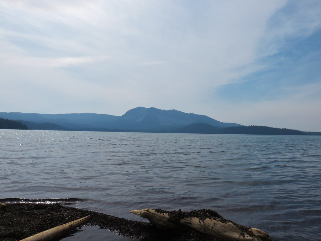
At the junction we went right passing around the crater and gaining increasingly impressive views of the Newberry Caldera.
IMG_8948

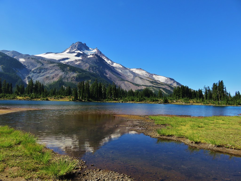
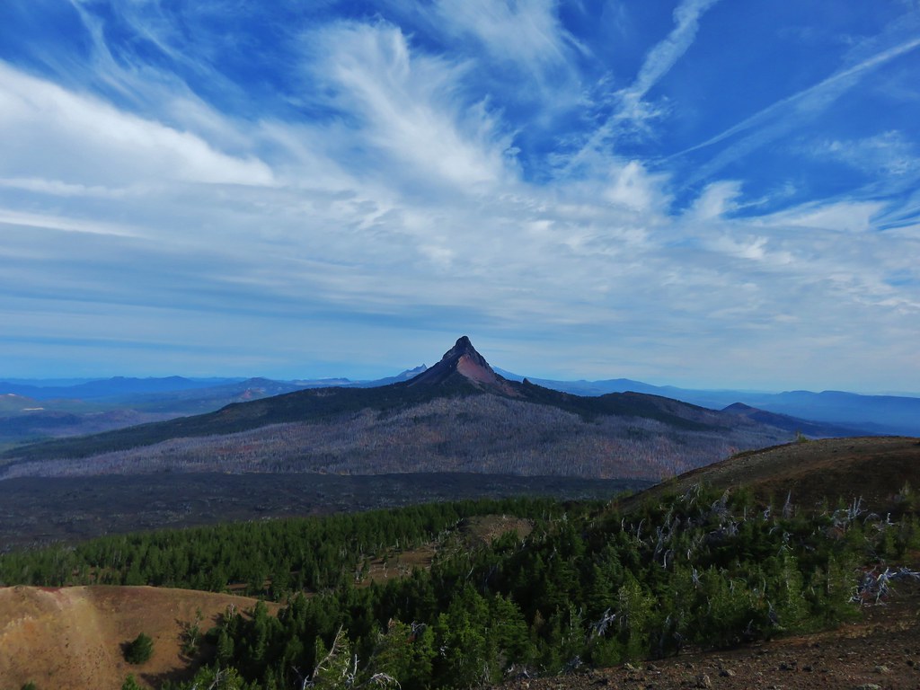
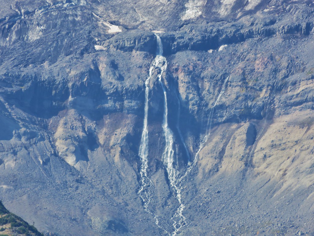
The first views were of the Big Obsidian Flow and Paulina Peak.
IMG_8951

IMG_8952

IMG_8953

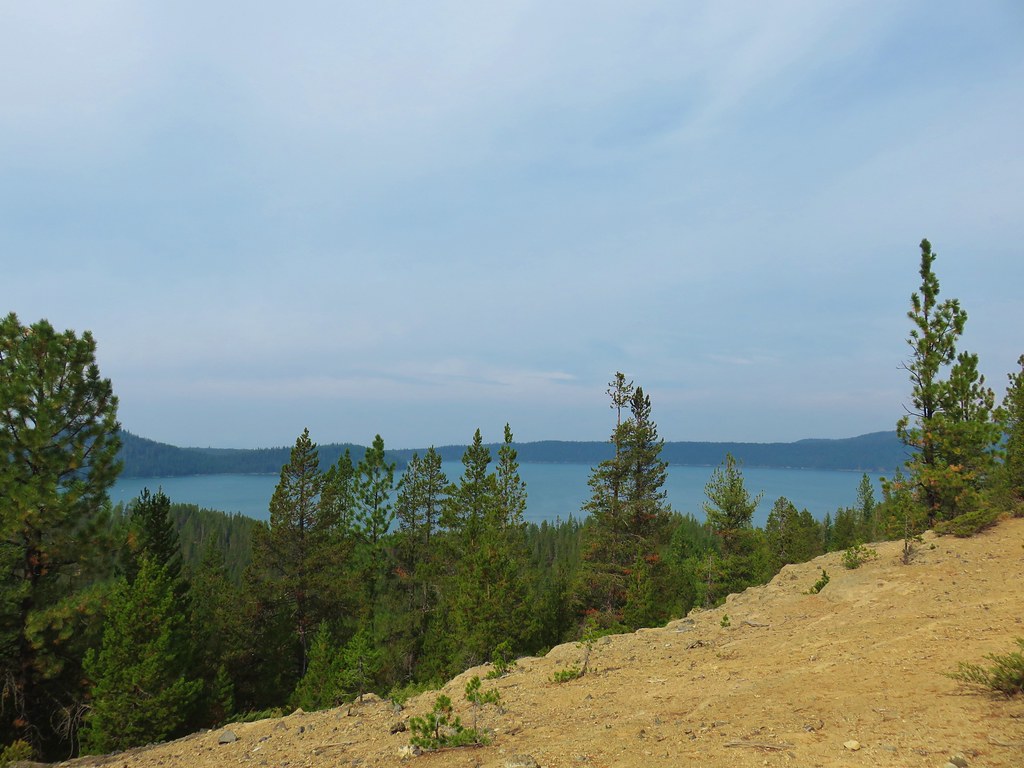
Paulina Lake was soon visible to the west and East Lake came partially into view to the east behind the Central Pumice Cone.
IMG_8970

IMG_8973

After passing over the summit the trail descended to another junction where we turned right following a pointer for Little Crater Campground.
IMG_8987

We picked up the loop trail just to the north of the campground.
IMG_8992

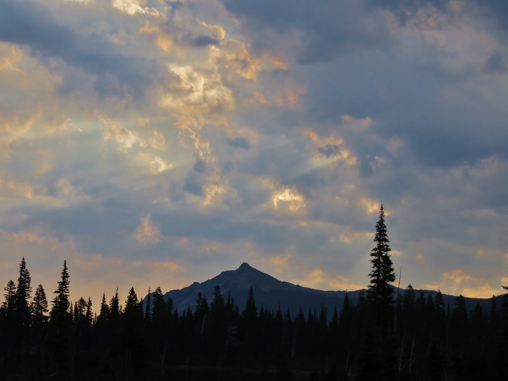
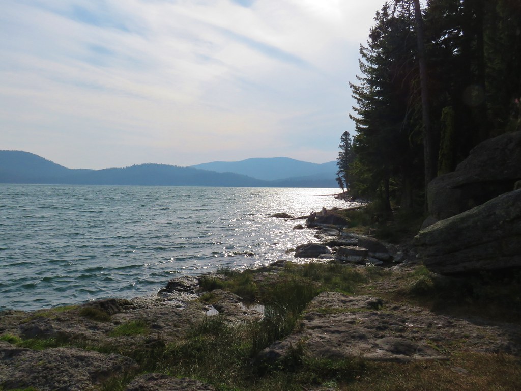
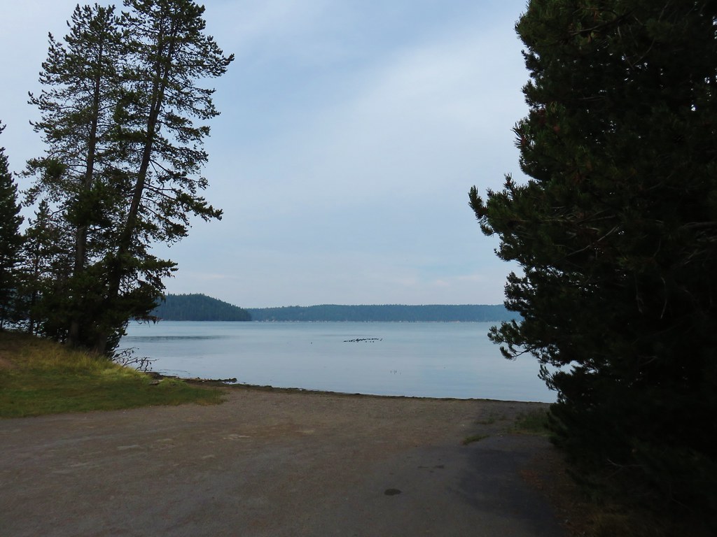
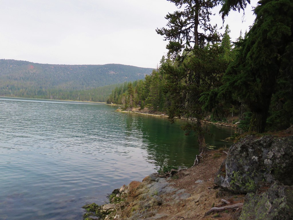
The next section of the loop trail had some nice, albeit hazy, views of Paulina Peak and the marina at the lodge way across the lake.
IMG_8993

IMG_9000

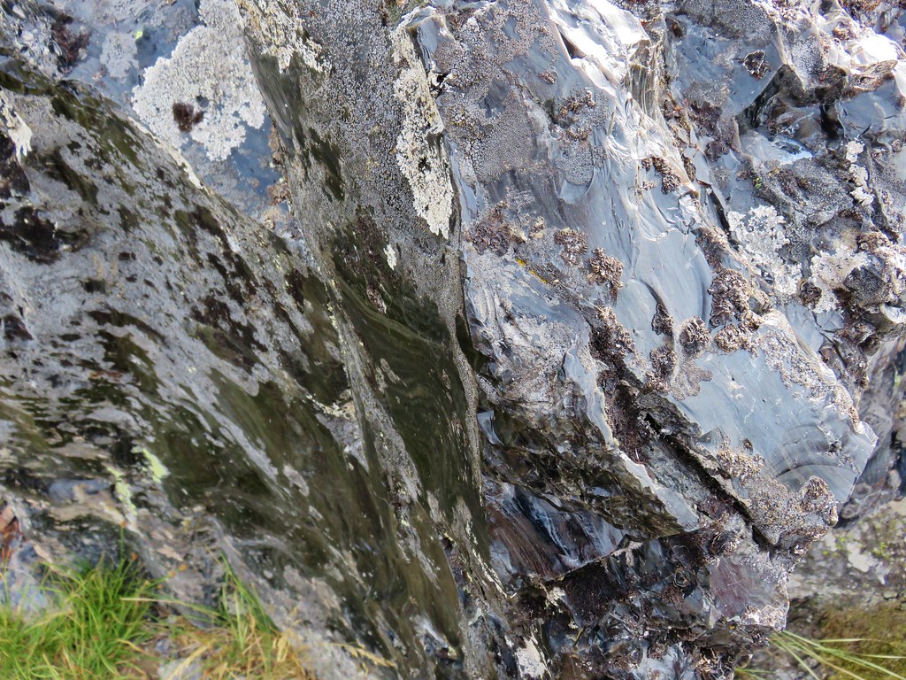
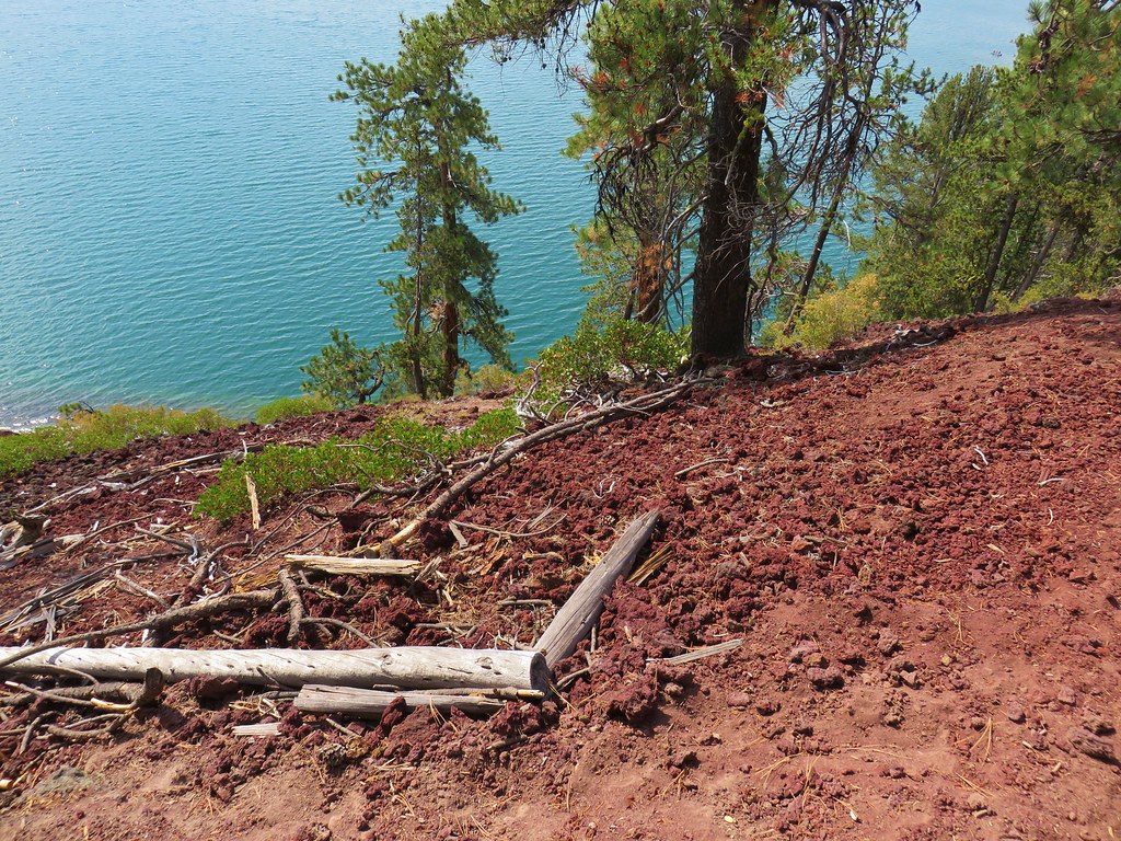
The trail hugged the lake shore as it passed by the inter lake obsidian flow.
IMG_9009

IMG_9010

IMG_9015

IMG_9014

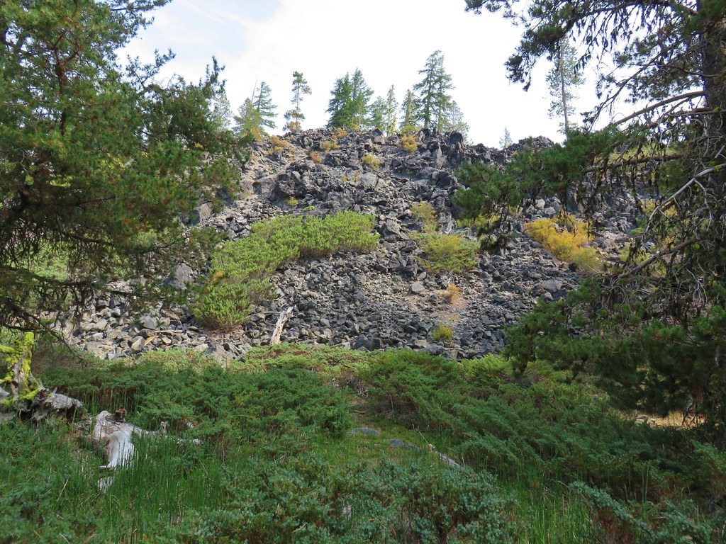
Beyond the lava flow, and 1.2 miles from Little Crater Campground, we came to a side trail down to some hot springs along the lake shore.
IMG_9016

IMG_9017

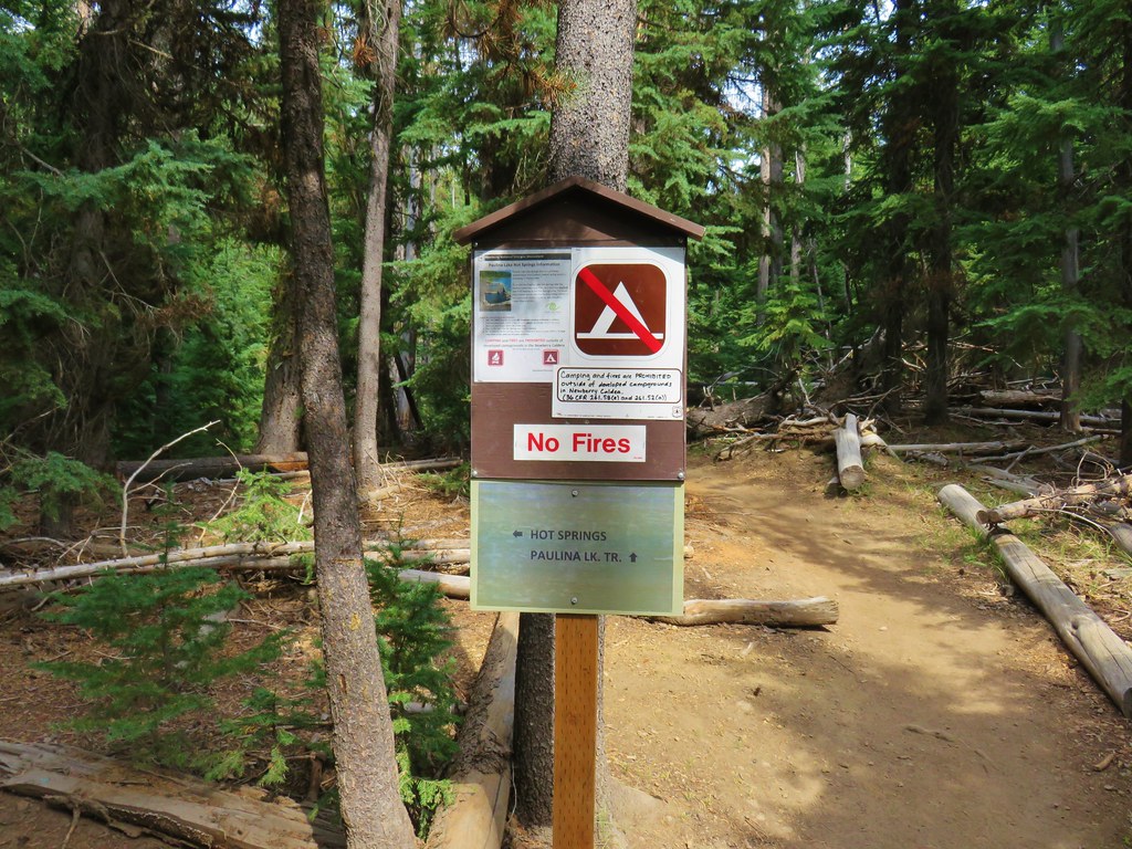
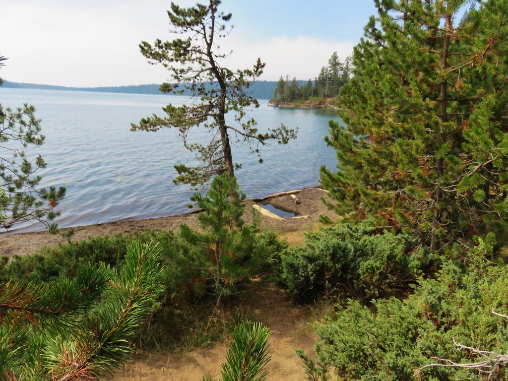
Our timing was good as two groups of hikers were just leaving as we arrived. We decided to take off our shoes and socks and soak our feet in one of the pools.
IMG_9018

IMG_9019

IMG_9021

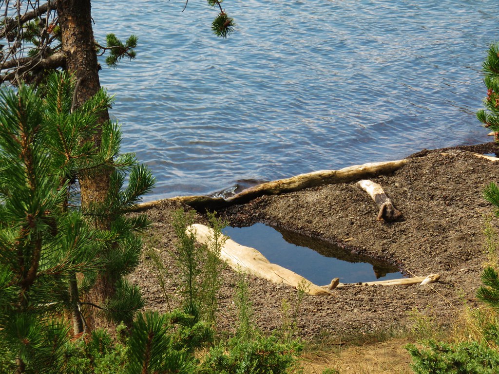
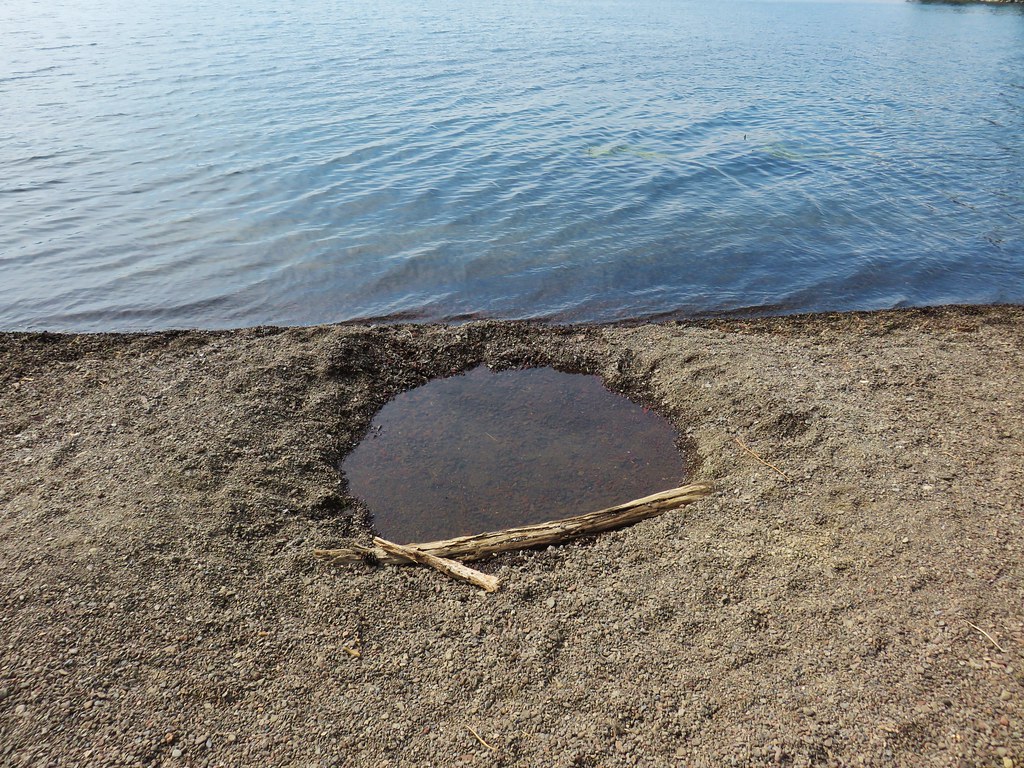
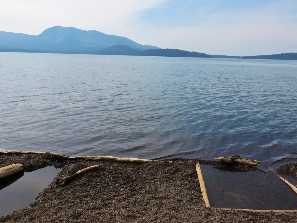
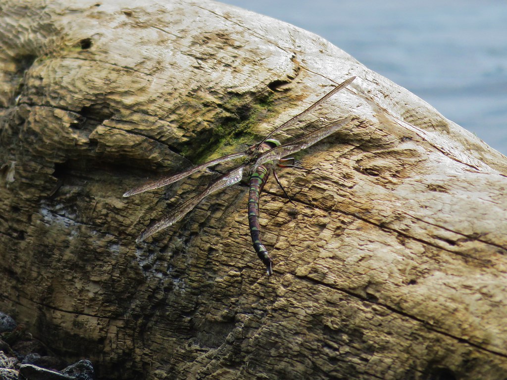
The water was amazing. It was almost exactly the temperature of a nice hot bath even with a little water from the lake lapping in. We sat for a while enjoying the view (and a large dragonfly) before continuing on.
IMG_9023

IMG_9026

We finally tore ourselves away from the hot springs and continued on. From the springs the trail climbed above the lake as it traversed a cinder hillside
IMG_9030

IMG_9034

IMG_9036

The trail then descended back near the lake shore to North Cove before entering a little thicker forest.
IMG_9044

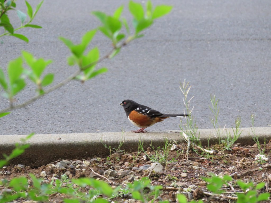
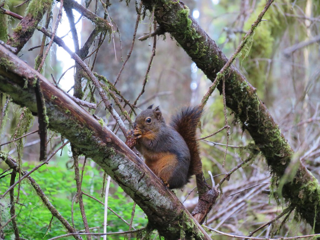
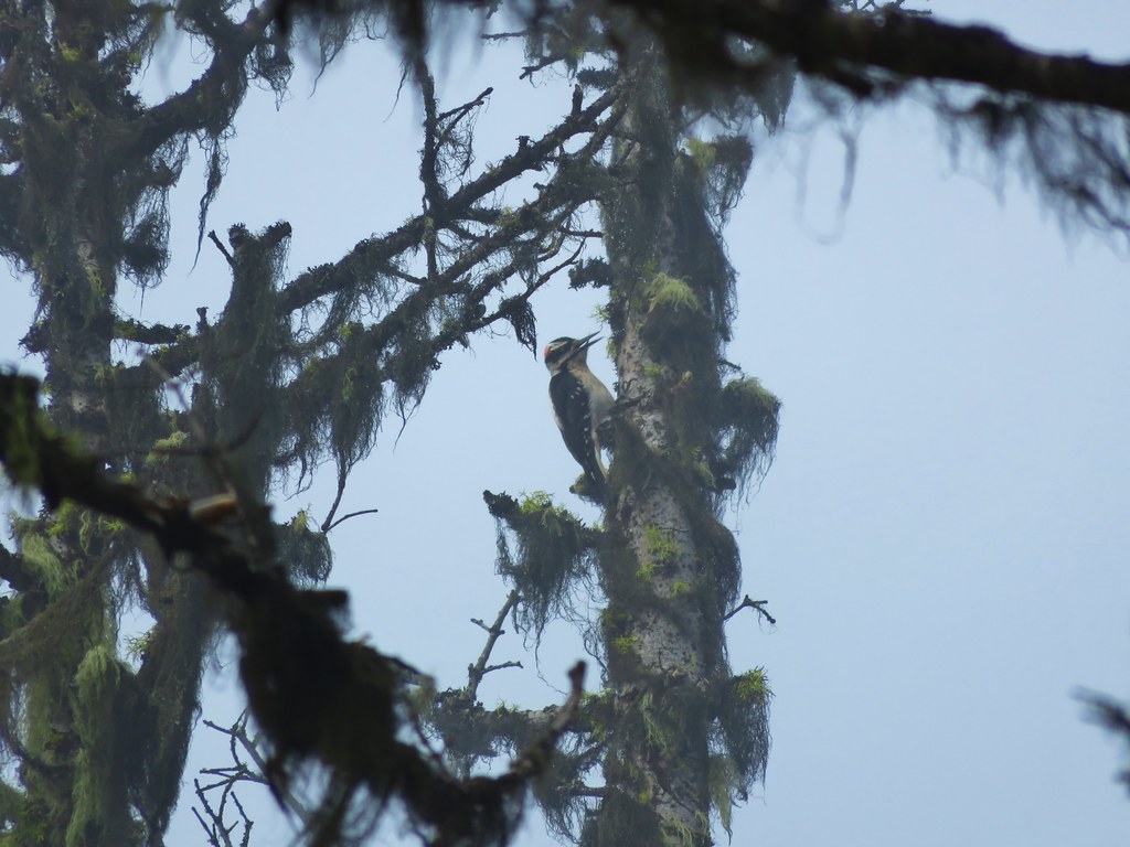
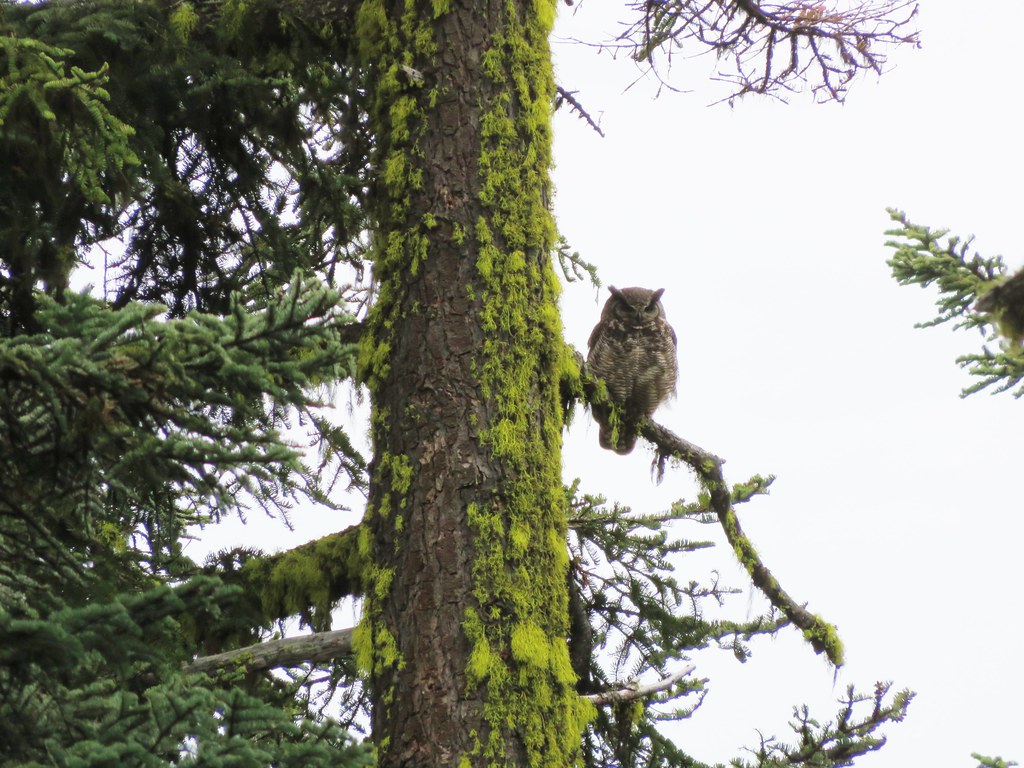
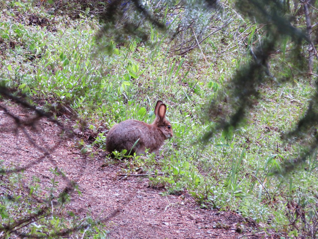
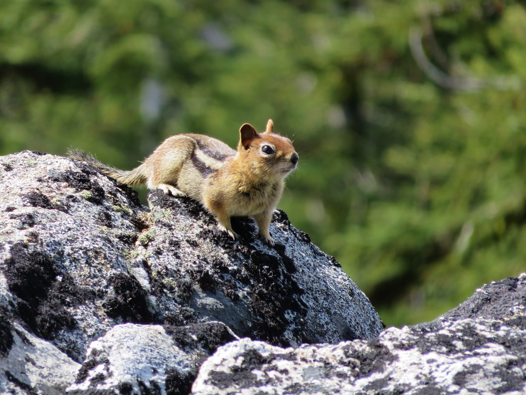
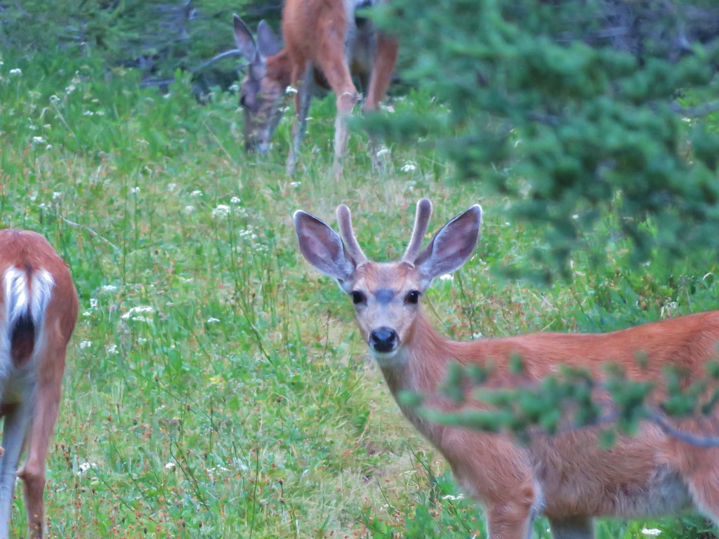
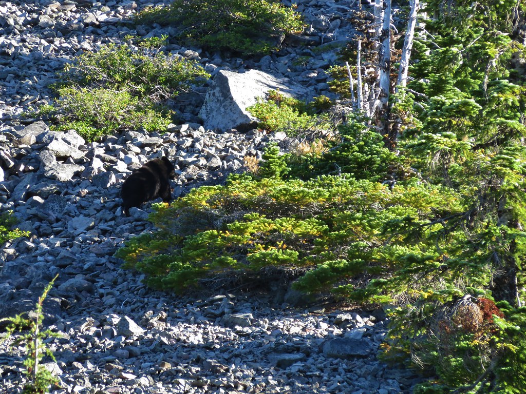
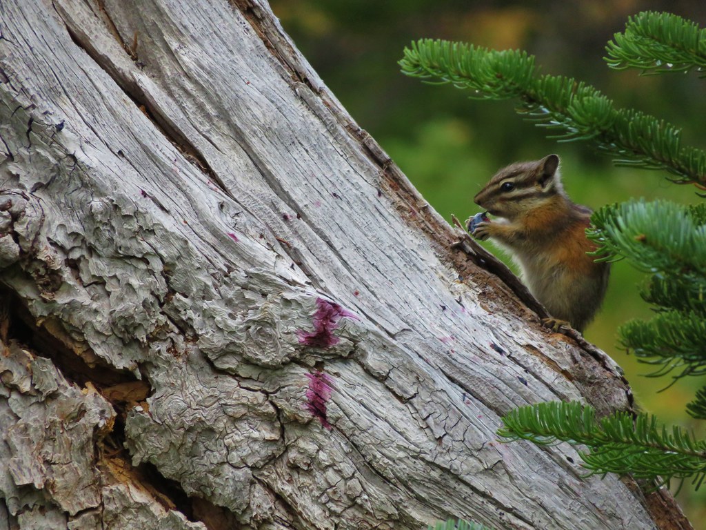
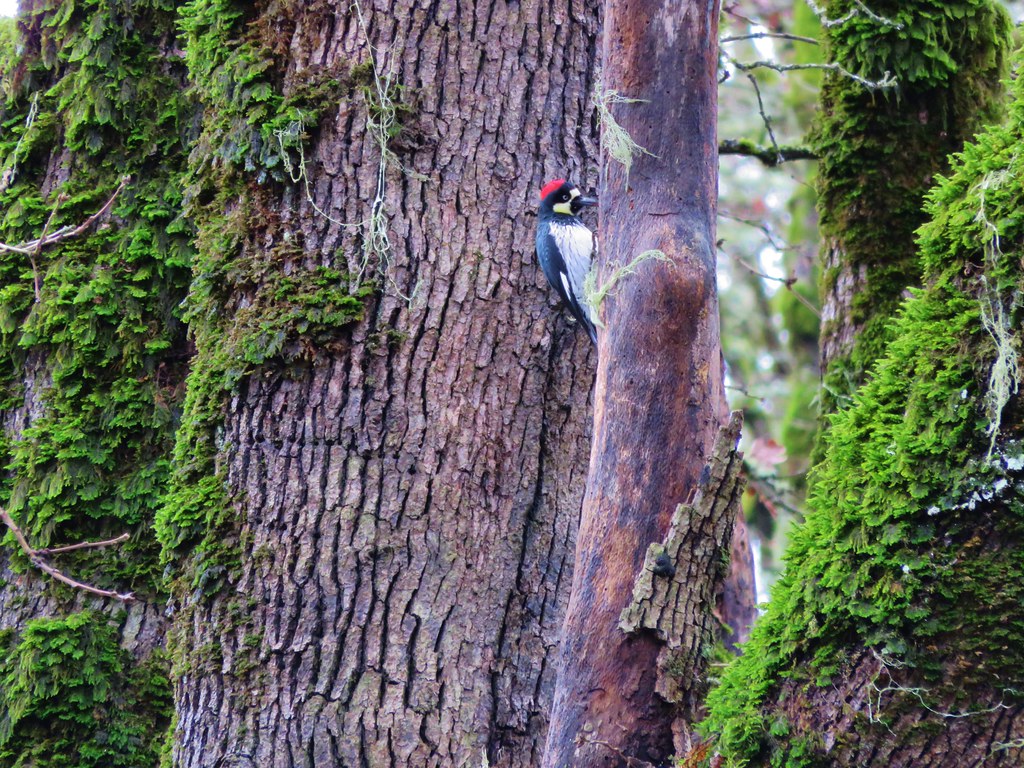
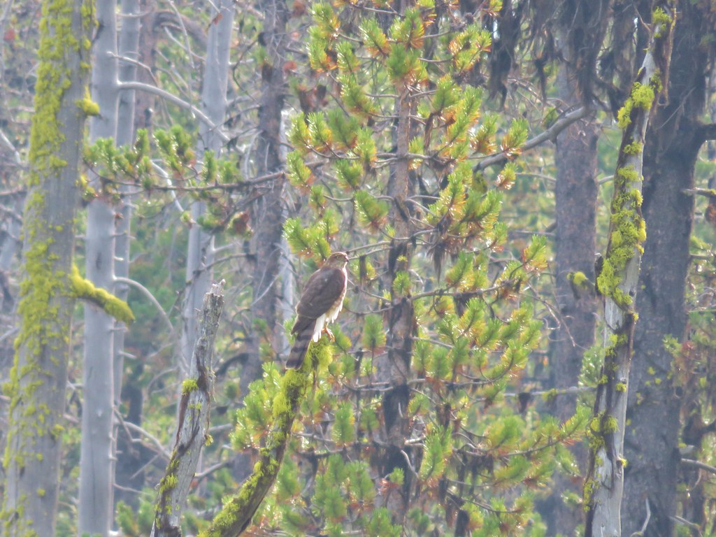
We had seen been seeing hikers off and on all day and as we passed through the trees along this stretch I thought I spotted a little black dog along the side of the trail. Then a second small black animal emerged from the brush on the other side of the trail and I realized they weren’t small dogs they were little bear cubs! Heather spotted the second cub as I was simultaneously announcing bear and trying to get the camera ready. I once again failed to get a photo though as we were too busy talking loudly and trying to locate mama bear. We never did spot her but she had to be close by given how small the cubs were. We paused long enough to give the bears plenty of time to leave the area before continuing.

Approximately 2.2 miles from the hot springs we turned uphill following a trail sign and passed above the Paulina Lake Lodge before descending after a quarter mile to a junction with the Peter Skene Ogden Trail.
IMG_9054

IMG_9055

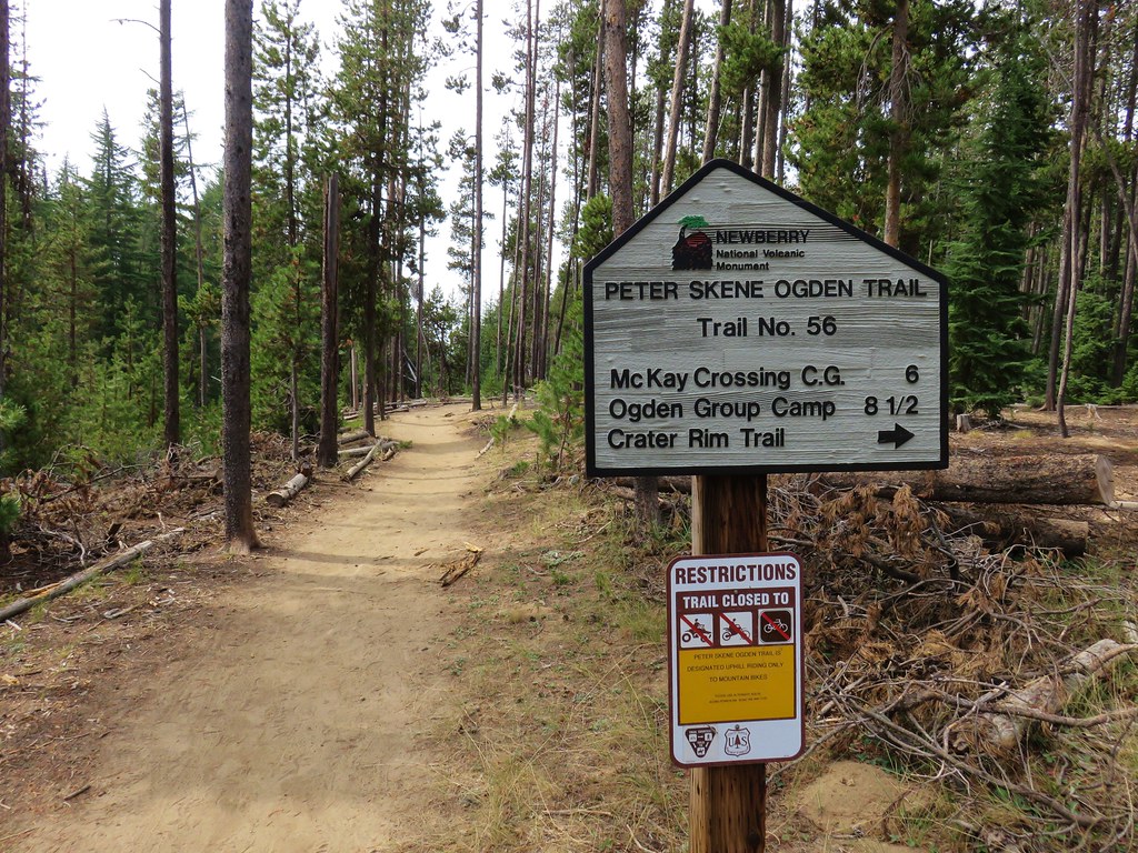
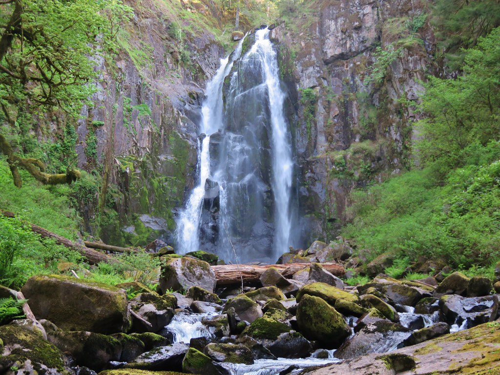
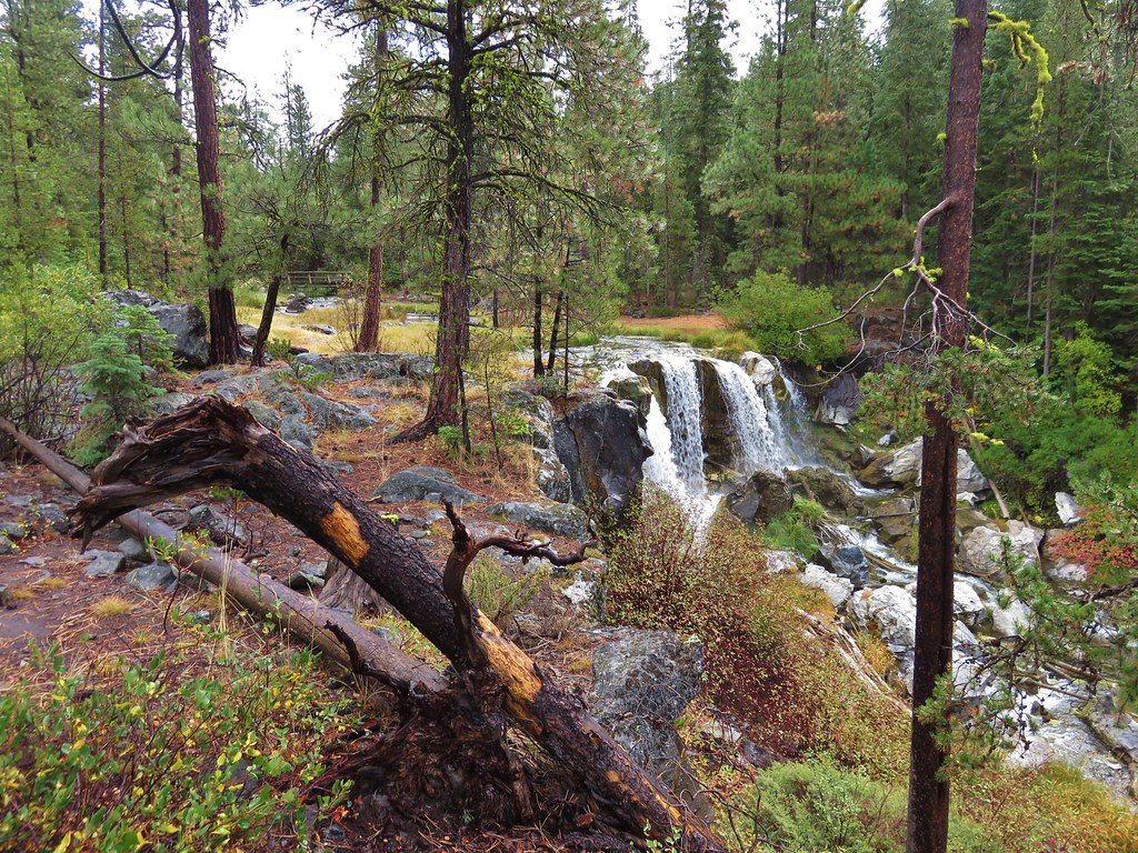
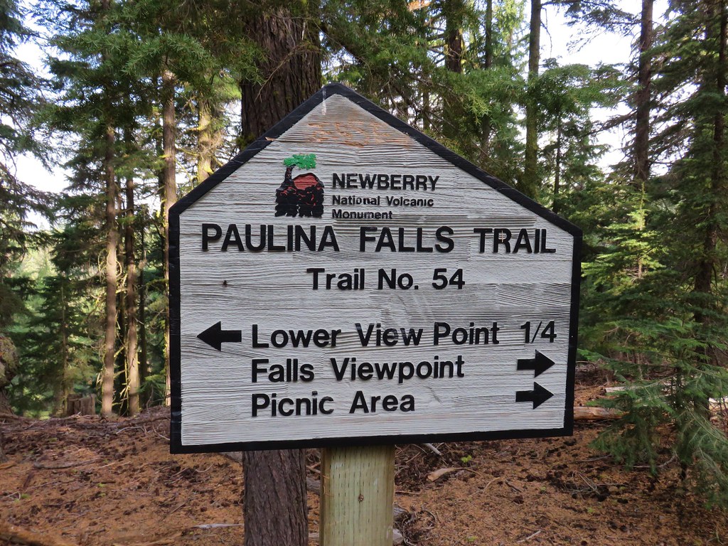
We turned down this trail which passed another viewpoint of Paulina Creek Falls after a quarter mile.
IMG_9059

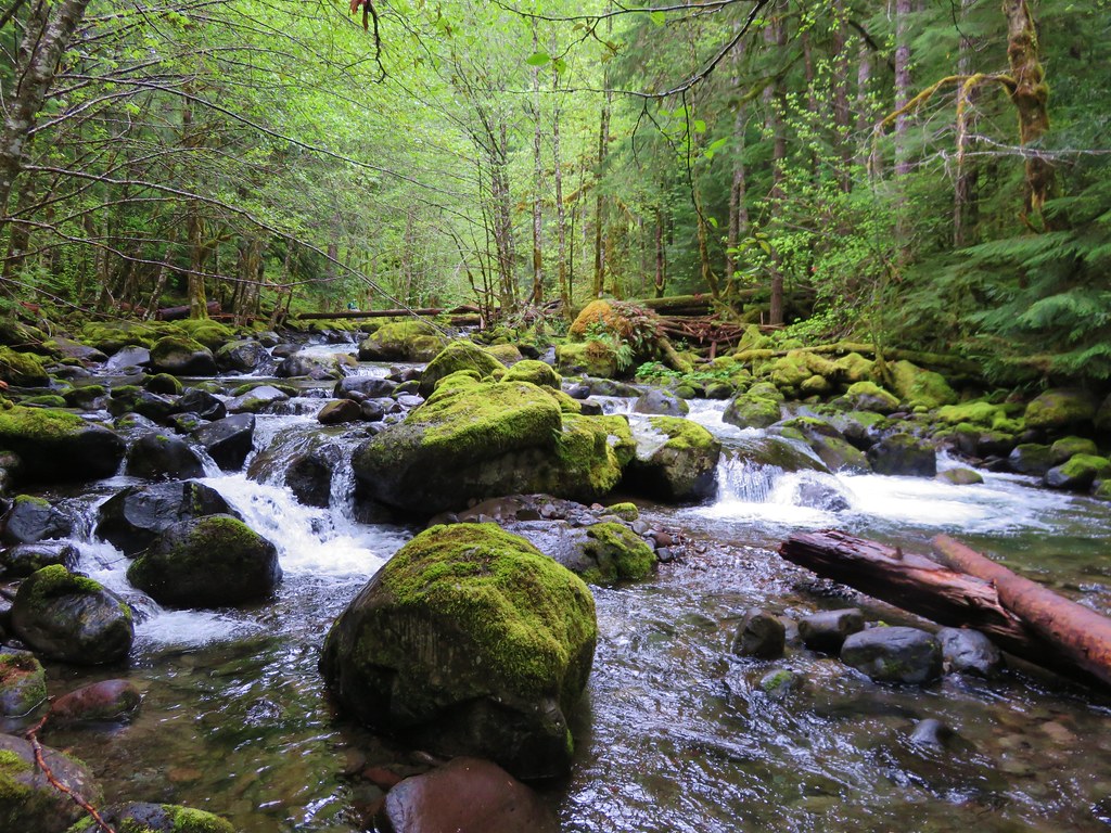
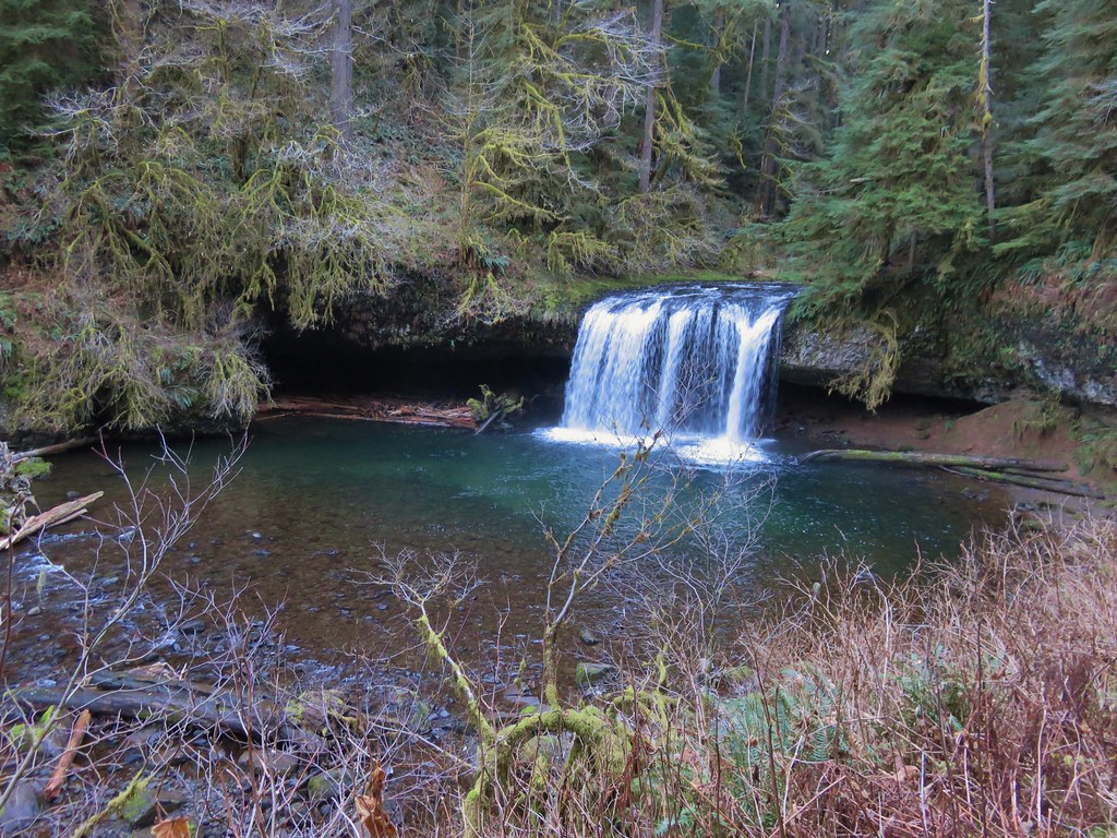
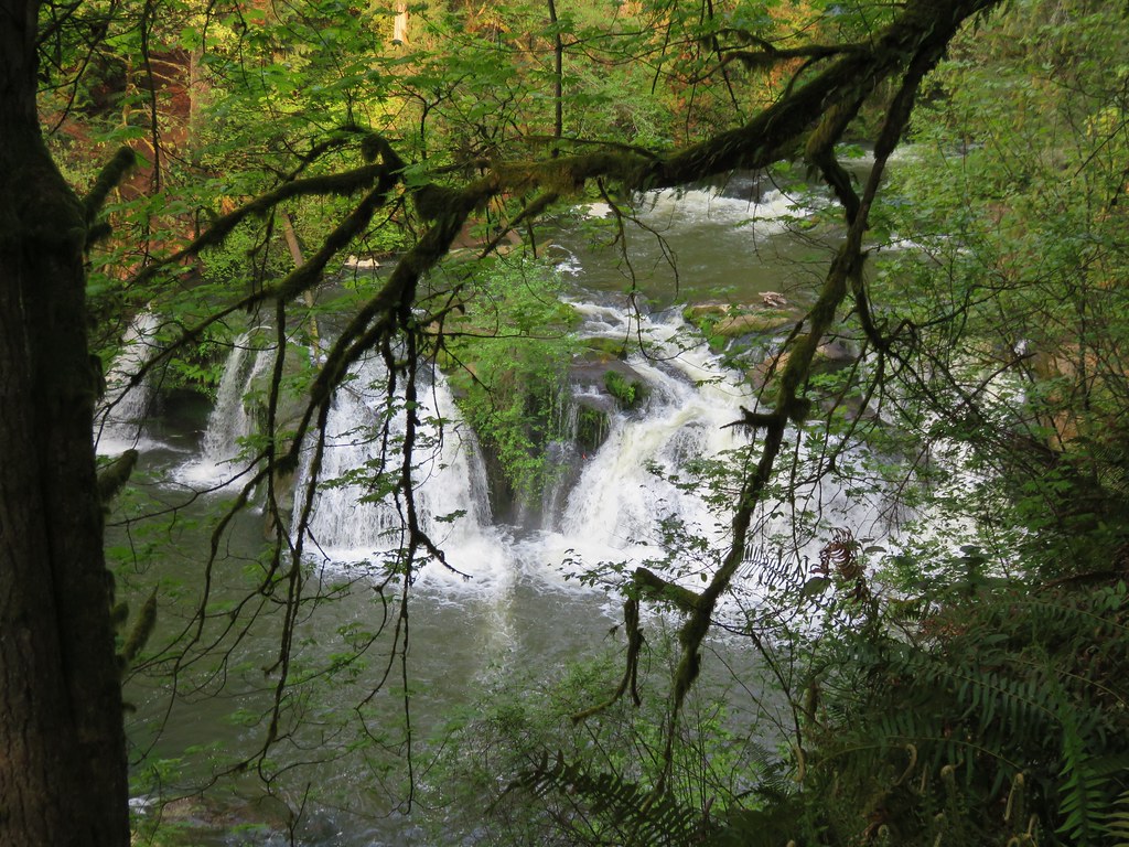
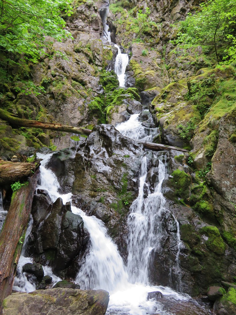
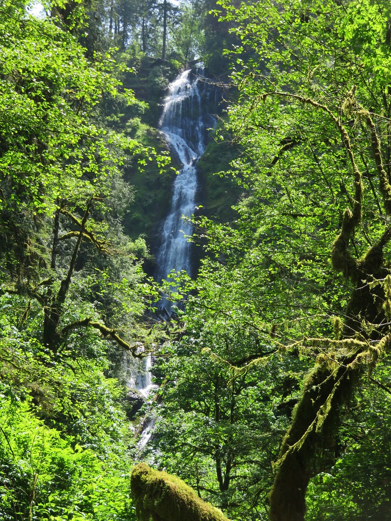
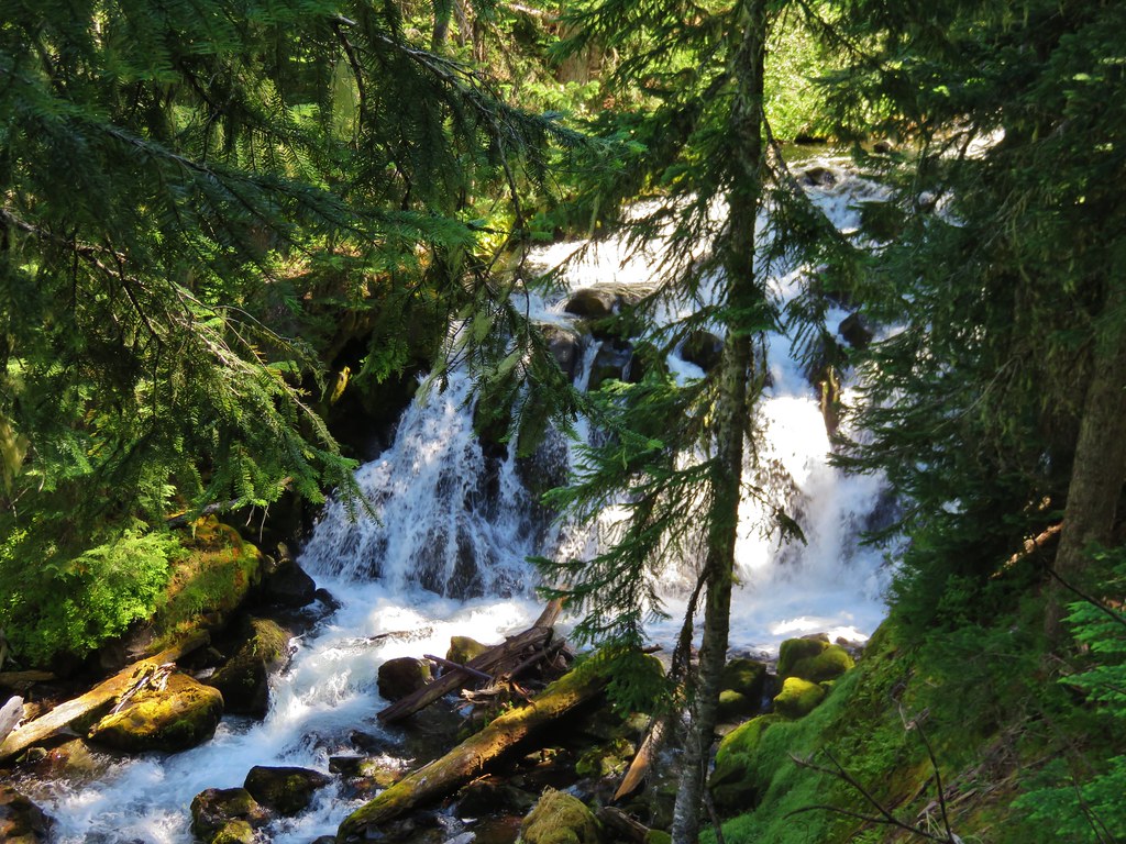
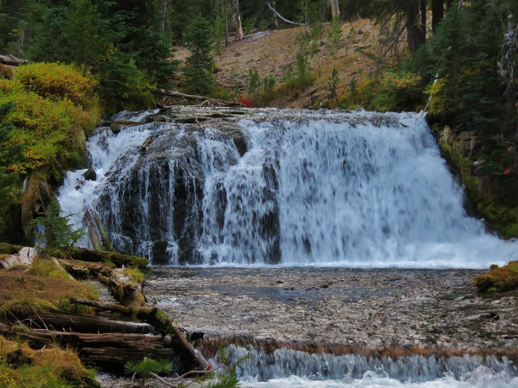
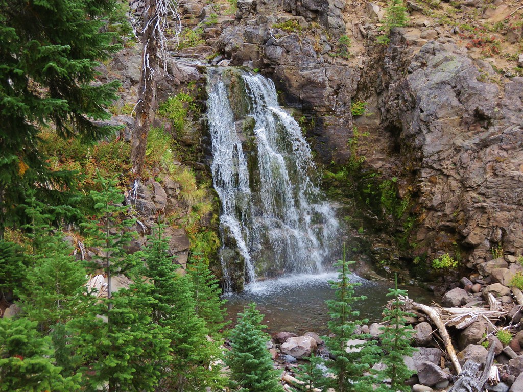
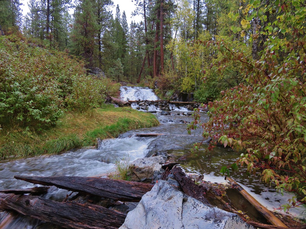
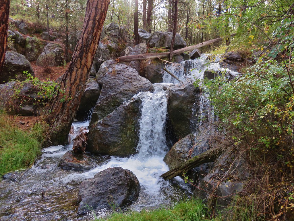
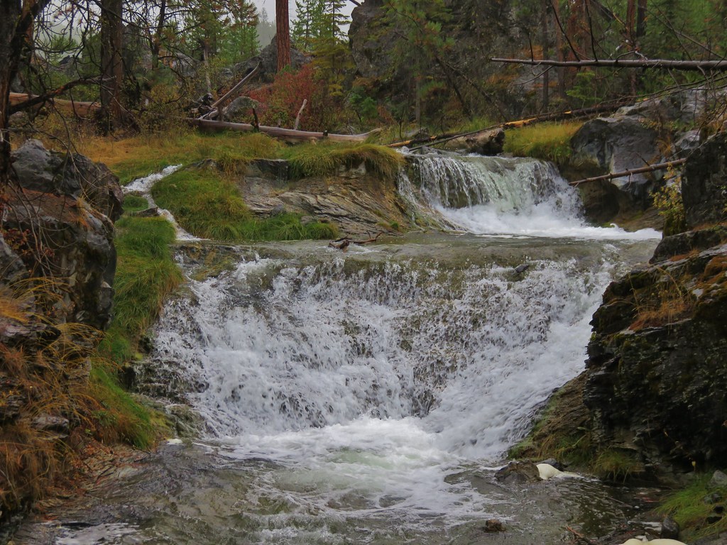
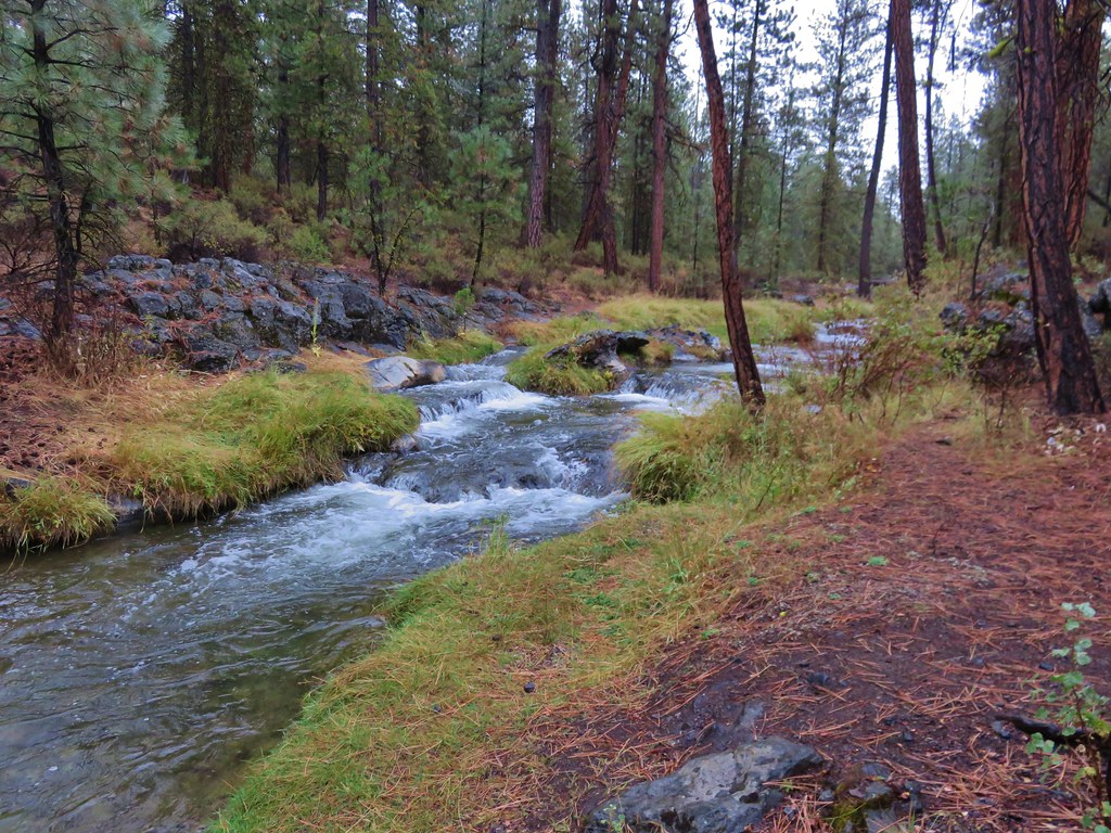
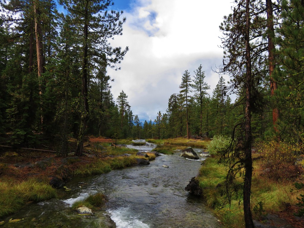
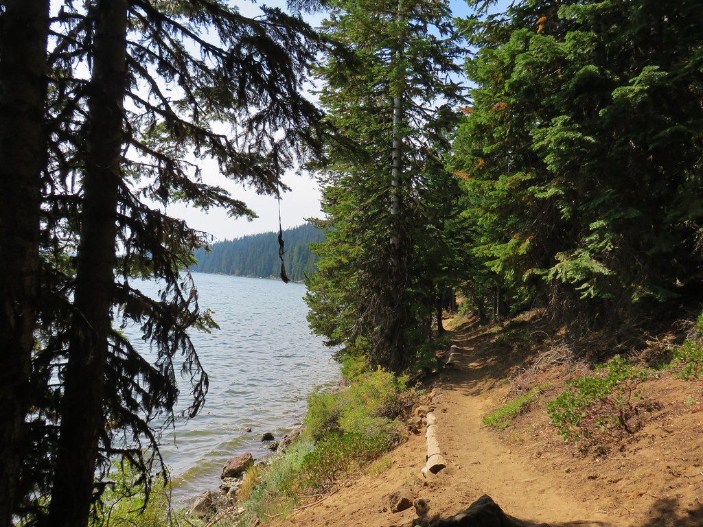
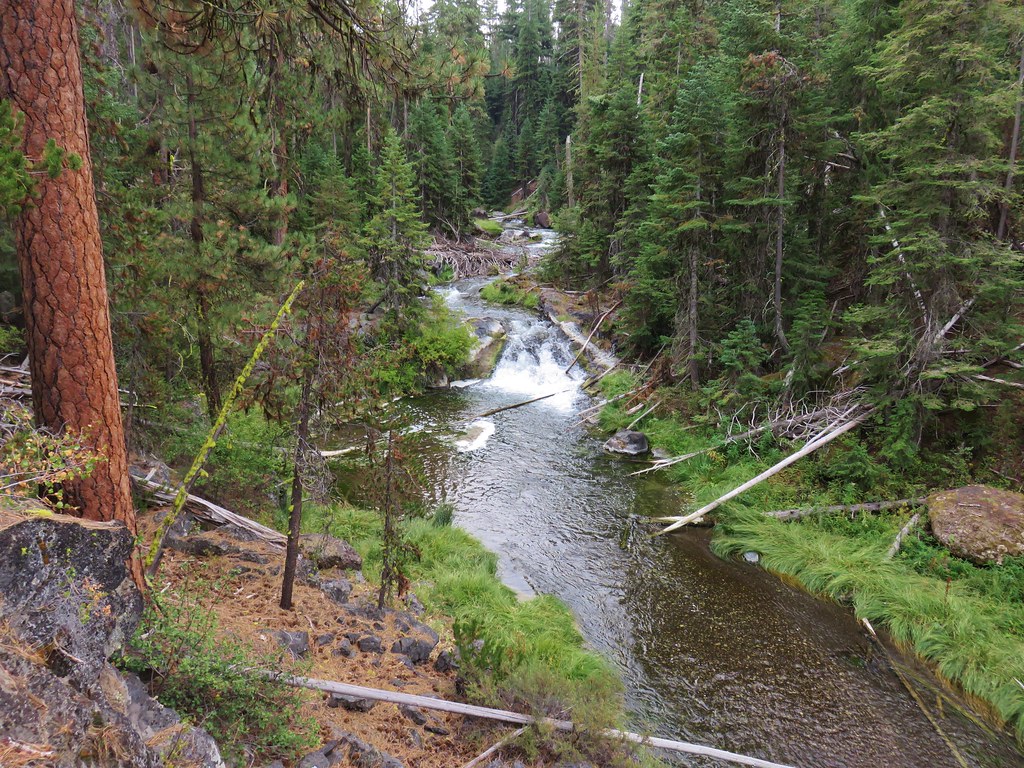
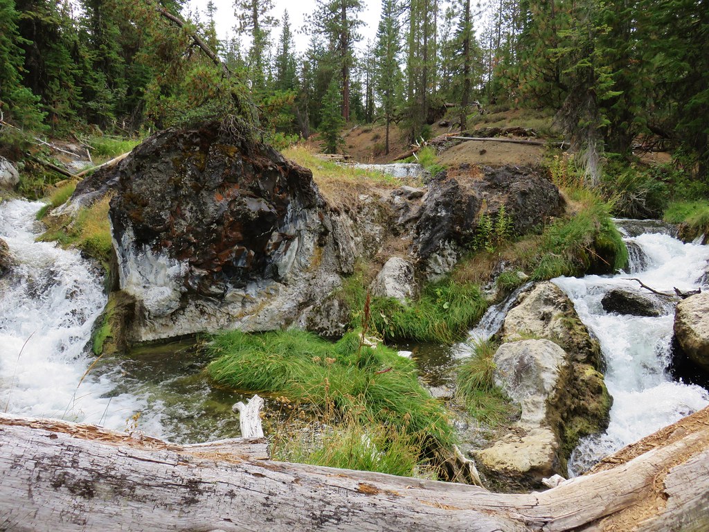
Unlike the Ponderosa Trail this trail offered many glimpses of Paulina Creek. Much like the lower section of the creek we had hiked along previously there were many small cascades to admire along the way.
IMG_9083

IMG_9092

IMG_9104

IMG_9113

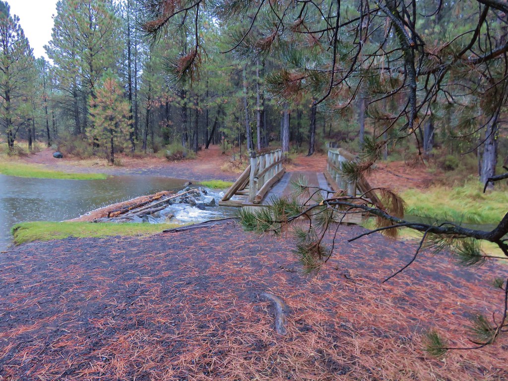
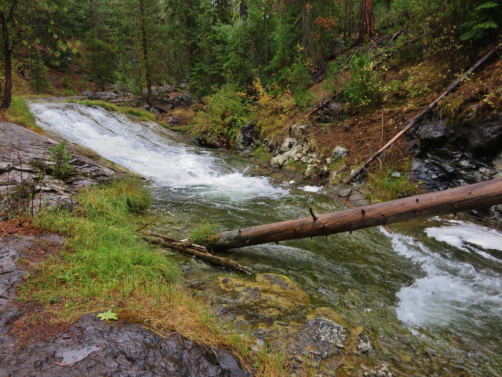
Three miles beyond the viewpoint we arrived at the footbridge we had been looking for that morning. A trail sign indicated that it was 1/8 mile to Road 500 and 3/4 to the sno-park.
IMG_9115

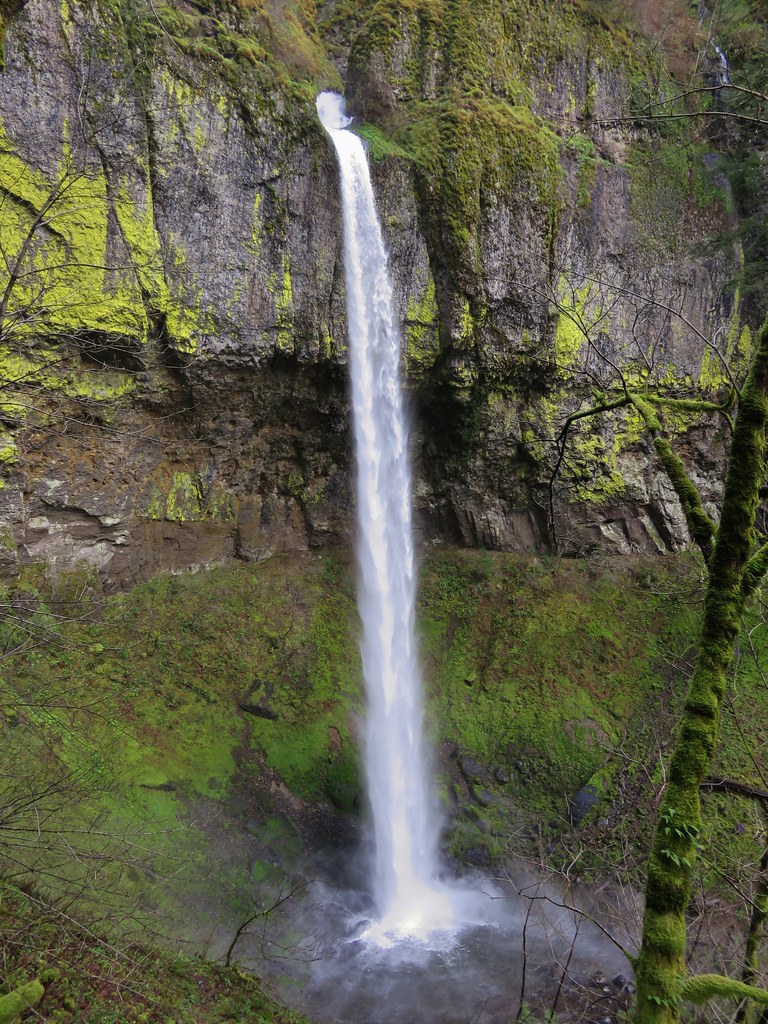
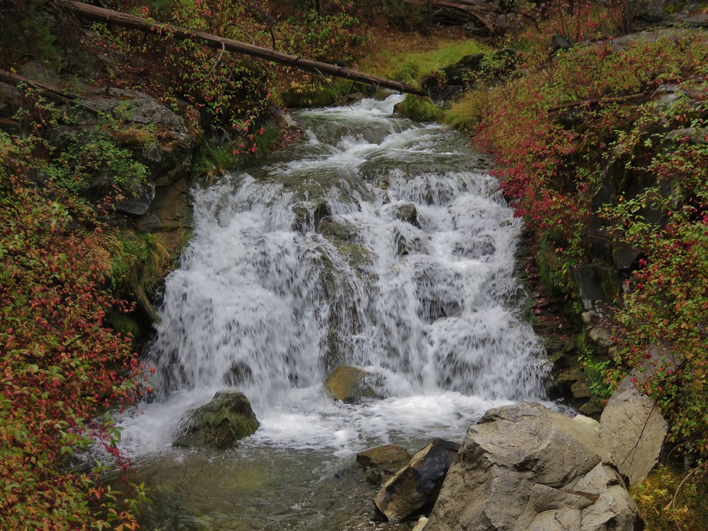
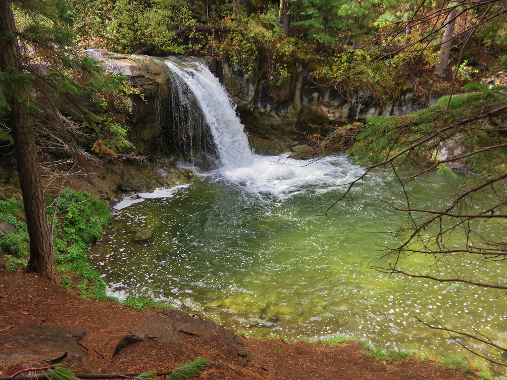
The view from the bridge upstream was now obscured by a fallen tree.
Paulina Creek

IMG_9118

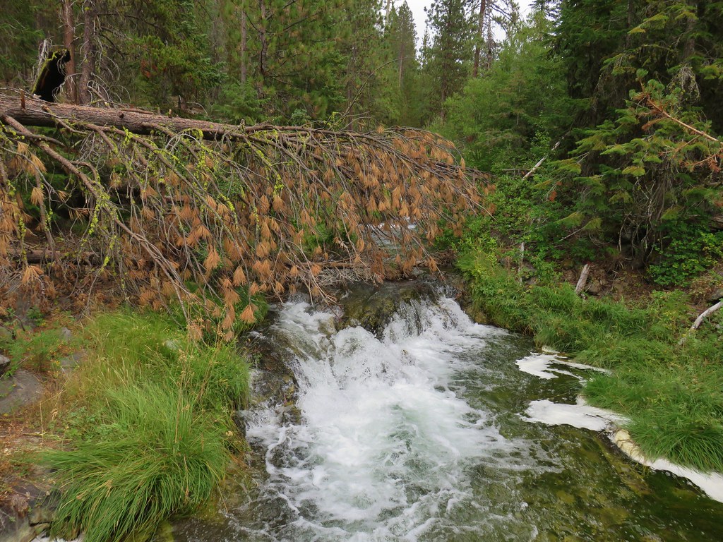
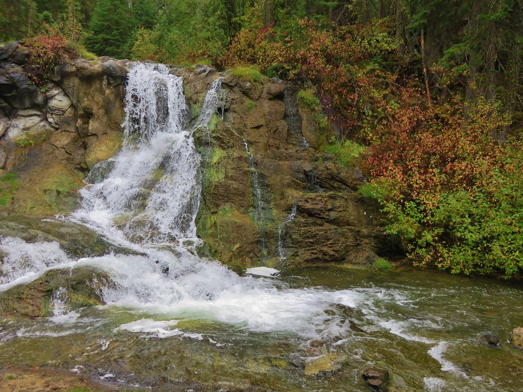
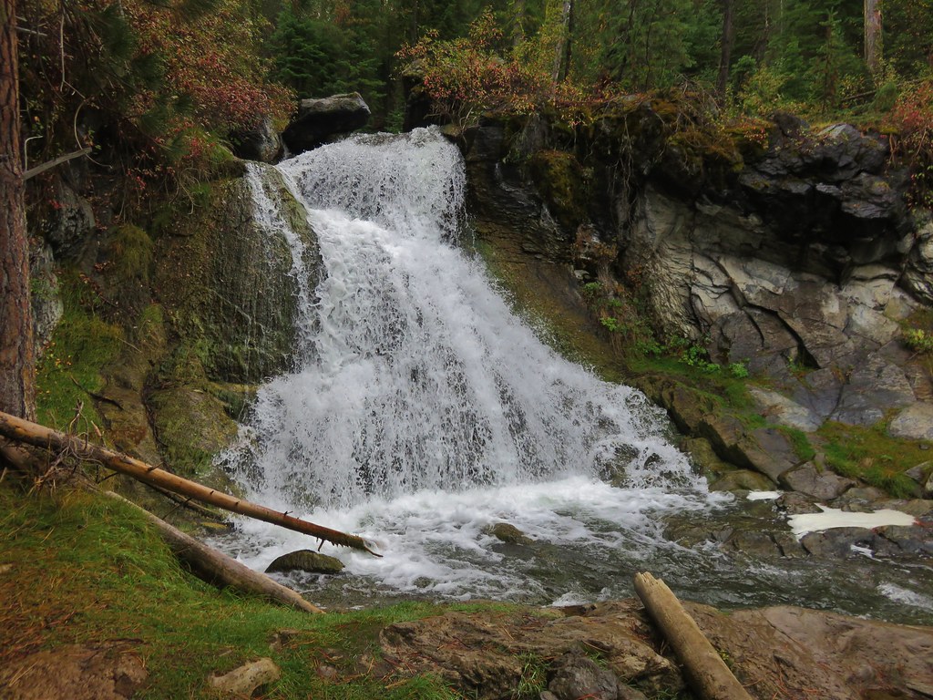
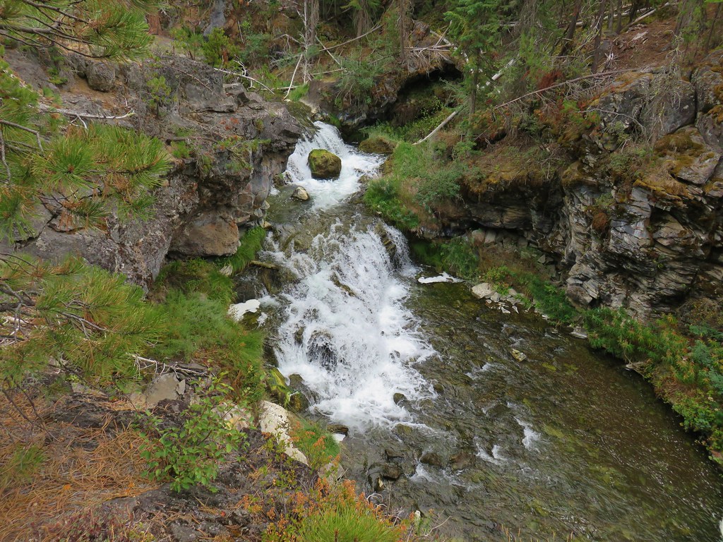
We crossed the bridge and passed a view of the waterfall just downstream from it.
IMG_9120

We briefly followed Road 500 but then veered right onto what appeared to be a mountain bike trail
IMG_9125

IMG_9126

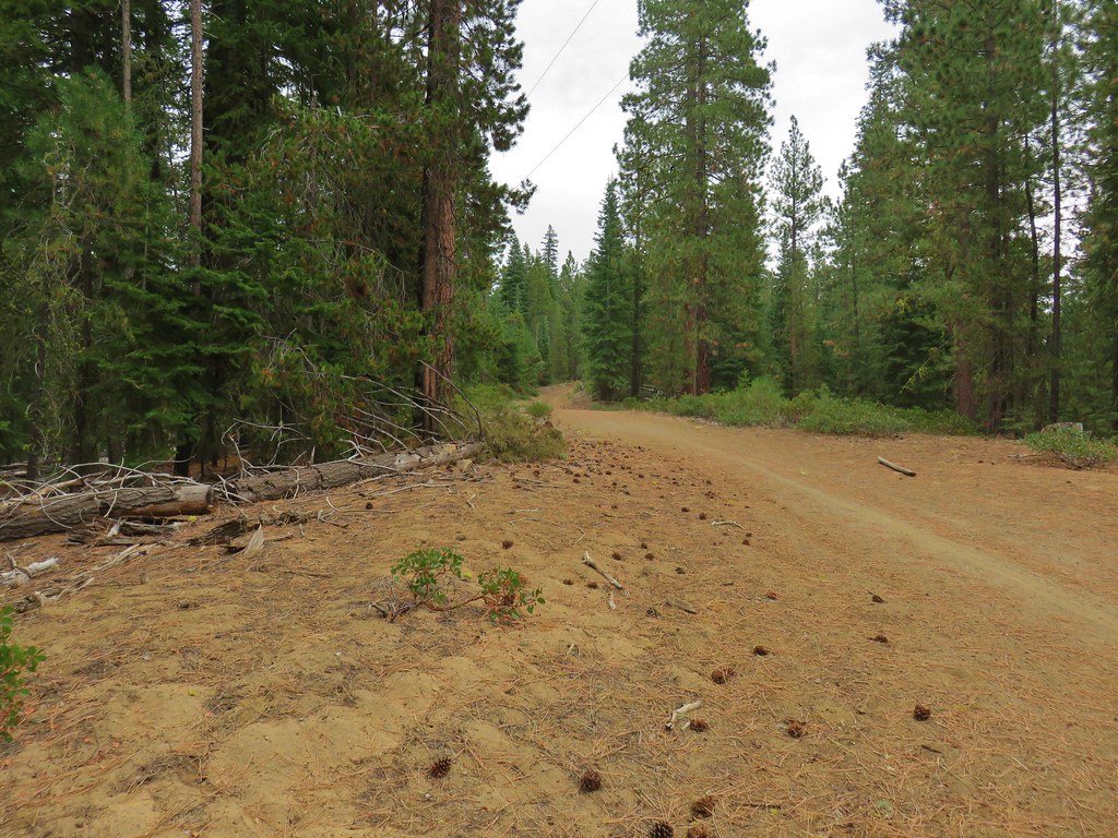
We followed the mountain bike trail for half a mile before arriving at a dirt road which we recognized from that morning. We turned right on the road and followed it back to the sno-park which was only a tenth of a mile away.

The end result of the hike was a 15.8 mile loop on what turned out to be a very pleasant day. It was hard to imagine that the area would likely be seeing snow in the next 48-72 hours.

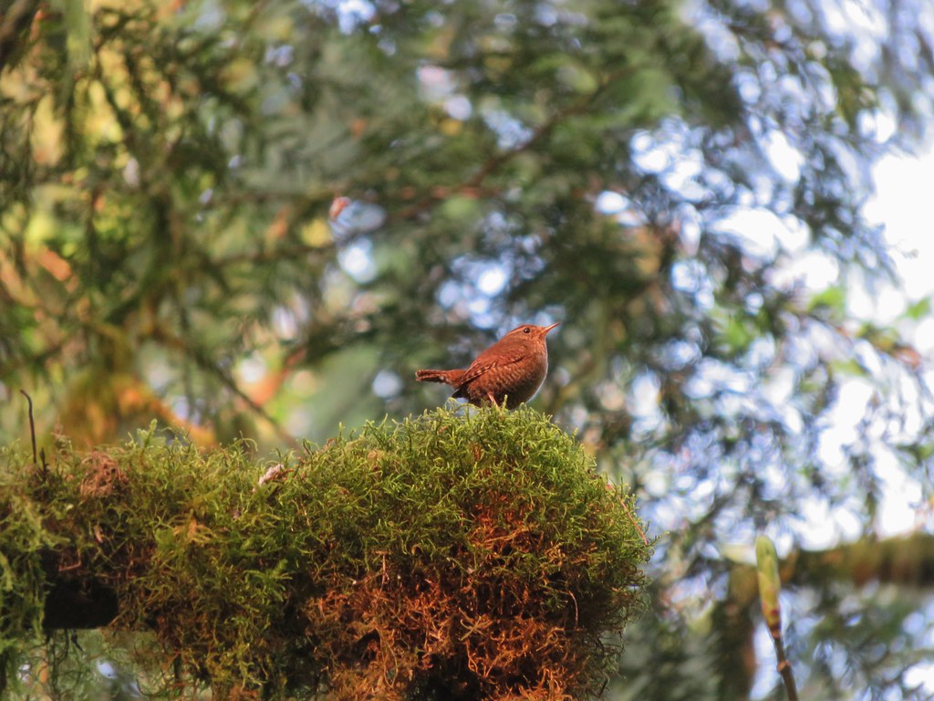
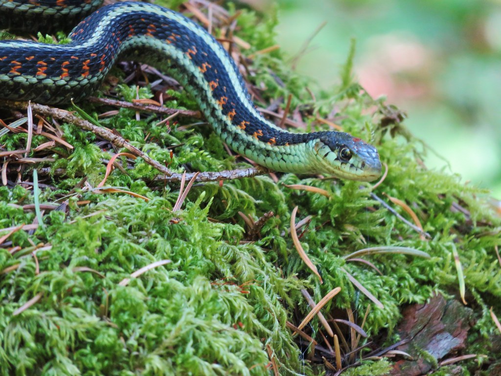
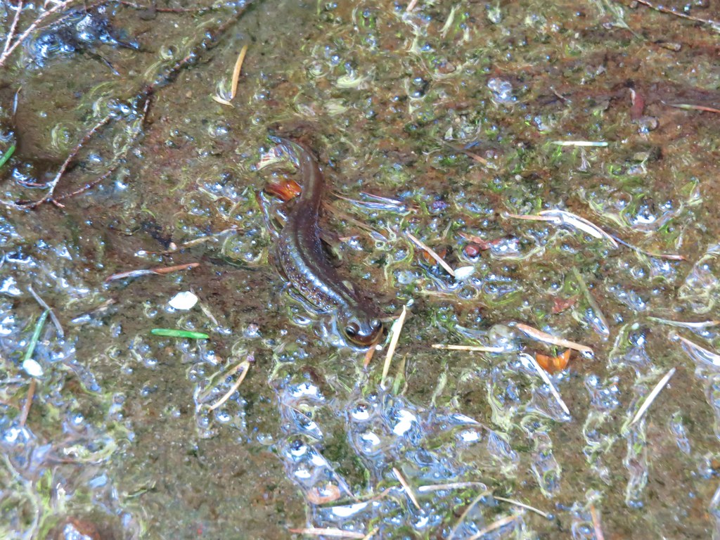
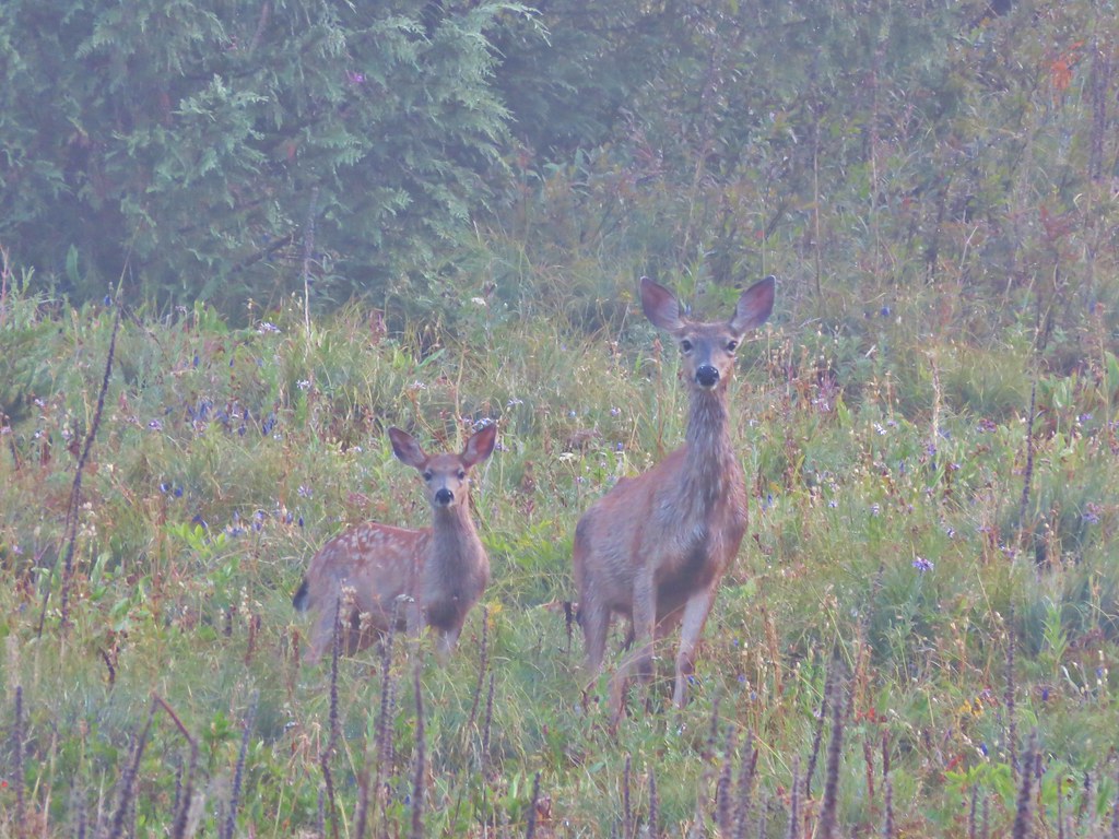
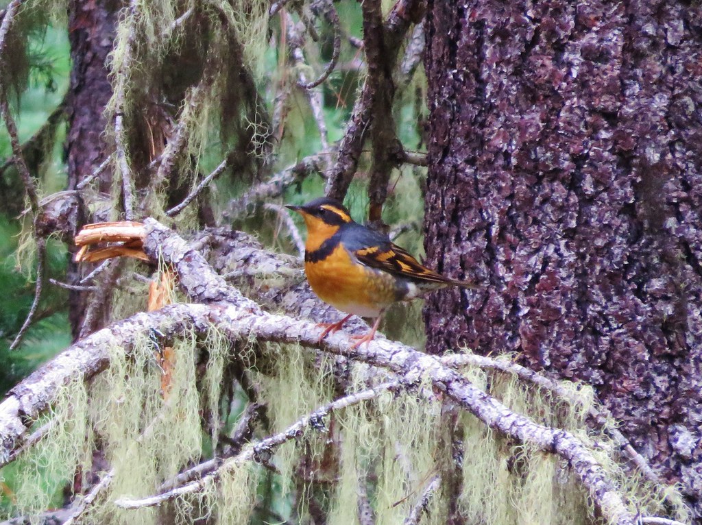
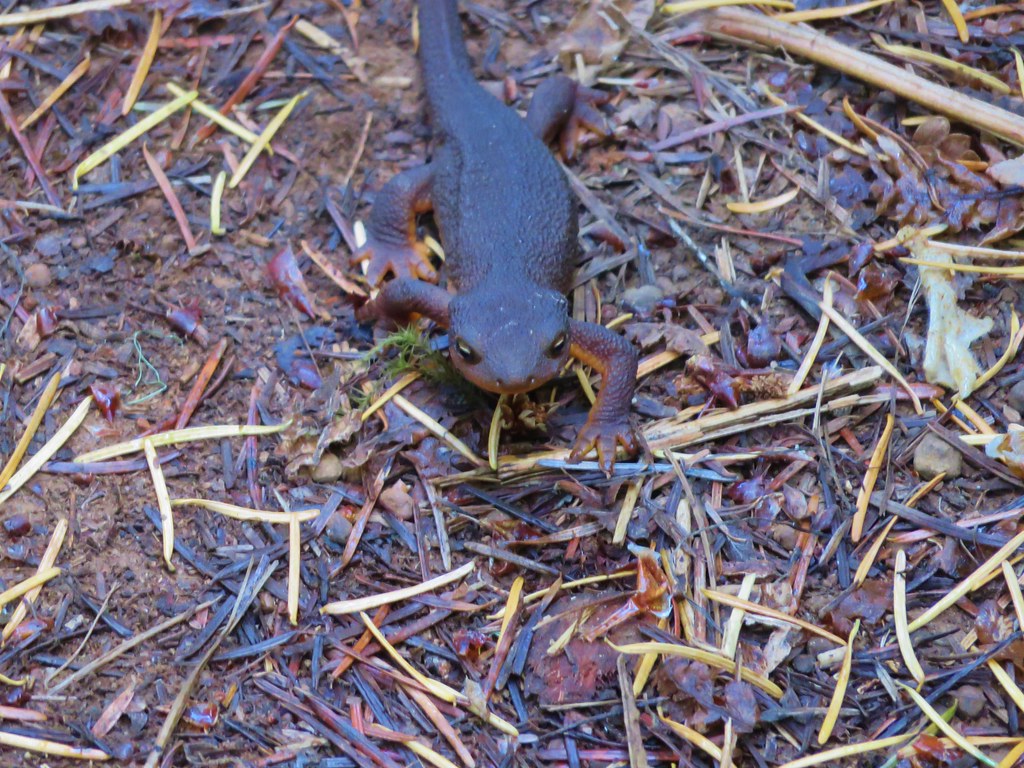
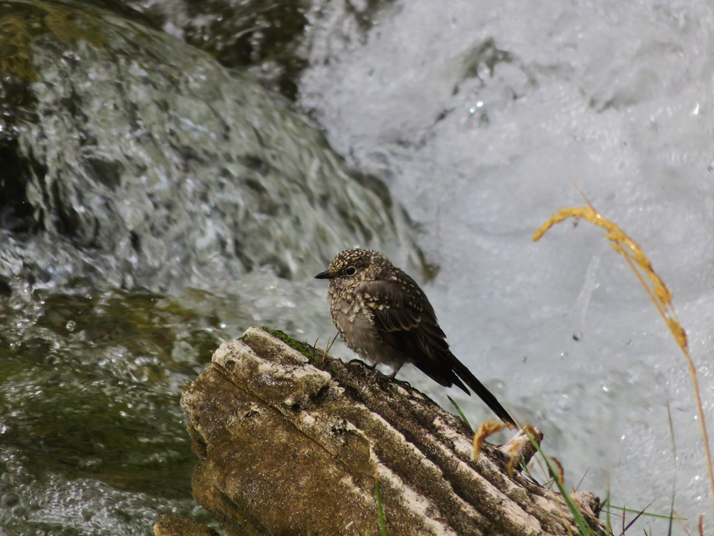
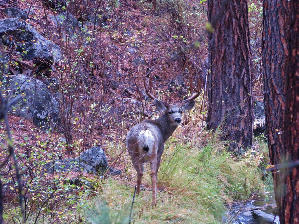
It was a great start to our vacation with lots of wildlife, decent views despite the haze, and a wonderful soak in the hot springs. We were anxious to see what the next 6 days of hiking would bring. Happy Trails!

Flickr: Paulina Lake

Categories
Year-end wrap up

The Hikes of 2015 – A Look Back

Another year of wandering the trails of the Pacific Northwest has come to an end. Since 2010 we have been on over 200 hikes covering over 2200 miles and we continually find ourselves in awe of God’s creation.

We managed to hit the trails at least once every month ending with 56 hikes for myself and 55 for Heather. I was able to sneak an extra one in by meeting my parents at Columbia Hills State Park in April while Heather was still running. These were the most hikes we’d done in a single year which also led to our highest mileage totals – 660.4 for myself and 652.6 for Heather. The hikes ranged from 2.9 miles (Butte Creek & Abiqua Falls) to 19.1 miles (Green Lakes Loop). Below is a link to a Google map showing the various trailheads and campsites (denoted by picnic tables).
2015

https://www.google.com/maps/d/edit?mid=zIiZZDXeDJAs.kn3sBy2gxhI8&usp=sharing

In addition to my Columbia State park hike we met my parents for hikes at McNeil Point and Jefferson Park. We also met a couple of regular contributors to Oregonhikers.org out on the trails, miah66 on Silver Star Mountain and justpeachy in Jefferson Park. In December we attended the Trail Keepers of Oregon/Oregon Hikers annual Winter Meet-n-Deet in Portland where we were able to put a few more faces to the names we’ve gotten to know on the hiking forums.  It was a blast and we’re hoping to continue attending the event in future years.

As in previous years our primary focus was to visit new places and spend time on trails we had not previously hiked.  We continued to expand the area in which we’ve hiked by spending 4 days hiking the Northern Loop Trail in Mt. Rainier National Park and spending some time hiking in California around Crescent City and in the Red Buttes Wilderness.  Other areas which were brand new to us included the area around Ashland, OR, Indian Heaven Wilderness, and The Oregon caves National Monument.  In all 43 of our 56 days of hiking were spent on sections of trails we had never been on before. The remaining 13 days were spent on trails that we had visited in prior years, but we managed to do something different this time around on each trip allowing us to see something new every time out.

This year just reinforced what has become one of our favorite aspects of hiking, the variety.  In visiting so many new trails we were able to see flowers, trees, animals, and even mountains that we had not previously encountered on our hikes.  Even in the familiar areas there always seems to be something new to experience.  It’s not just the sights that provide the variety though, the smells, sounds, and even the feeling of the air and the forest can change multiple times on any given hike.

Although the camera cannot adequately capture the beauty of nature a look back at some of this year’s pictures will hopefully give some indication of the many different sights we were blessed with.

Views:
Oregon Dunes Overlook
View from Oregon Dunes day use area

Rowena Crest
Rowena Crest from the Tom McCall Point trail.

Mt. Hebo Trail
Sunlight penetrating the clouds in the Siuslaw National Forest

View from Boccard Point
Looking west from Boccard Point

French Pete Creek
French Pete Creek

Smith Rock State Park
Smith Rock State Park from the summit above Burma Road

Mt. Hood from the McNeil Point Trail
McNeil Point Trail

Middle & South Sister from Eileen Lake
Middle and South Sister from Eileen Lake

Middle & South Sister from Linton Meadows
Middle and South Sister from Linton Meadows

Pacific Ocean from Salishan Spit
Low tide heading toward Salishan Spit

Mt. Jefferson from Russell Lake

Sluiskin Mountain
Sluiskin Mountain in the morning

Mt. Rainier
Mt. Rainier

Olallie Lake Scenic Area
View from Double Peaks

Indian Heaven Wilderness
Lemi Rock

Mt. Washington Wilderness
Mt. Washington and Three Fingered Jack from Belknap Crater

Belknap Crater
Belknap Crater

South Sister from the Green Lakes
South Sister from the first Green Lake

South Sister from Denude Lake

Wind and Dog Mountain from Indian Point
Wind and Dog Mountains from Indian Point

Bull of the Woods Wilderness
Lake Lenore and Mt. Hood from Big Slide Mountain

Pacific Ocean near Damnation Creek
Sunsetting over the Pacific Ocean from the mouth of Damnation Creek

Redwoods in Jedediah Redwoods State Park
Redwoods along the Boy Scout Tree Trail

Red Buttes Wilderness
Red Buttes and Kangaroo Mountain

Kangaroo Mountain
Marble outcrop below Kangaroo Mountain

Paradise Lost, Oregon Caves National Monument
Looking up in the Paradise Lost room of the Oregon Cave

Waterfalls:

University Falls
University Falls

Lower Butte Creek Falls
Lower Butte Creek Falls Upper Butte Creek Falls Upper Butte Creek Falls

Abiqua Falls
Abiqua Falls Upper McCord Falls Upper McCord Falls

Wahclella Falls
Wahclella Falls Elowah Falls Elowah Falls

The Potholes
The Potholes Woodburn Falls Trillium at Woodburn Falls

Rodney Falls
IMG_1665 Upper Kentucky Falls IMG_1840

Lower Kentucky Falls
Lower Kentucky Falls North Fork Falls North Fork Falls

Munson Falls
Munson Falls

Unnamed waterfalls along Linton Creek Waterfalls along Linton Creek

Waterfall on Linton Creek

Waterfall on Linton Creek

Waterfall along Linton Creek

Duncan Falls Duncan Falls

Upper Portion of Linton Falls
Upper portion of Upper Linton Falls

Some of Upper Linton Falls

Indian Holes Falls
Indian Holes Falls Unnamed waterfall – Mt. Rainier National Park IMG_7614

Garda Falls
Garda Falls Another unnamed fall in Mt. Rainier National Park IMG_7972

Van Horn Falls
Van Horn Falls

Waterfalls along Fall Creek IMG_9592

Fall Creek

Fall Creek

IMG_9604

IMG_9612

Falls along Crater Creek

Falls along Crater Creek

Waterfall on Crater Creek

Corner Falls Corner Falls

Fall River Falls
Fall River Falls

Waterfalls along Paulina Creek Small waterfall on Paulina Creek

Falls on Paulina Creek

Small waterfall on Paulina Creek

Small waterfall on Paulina Creek

IMG_0567

Waterfall on Paulina Creek

McKay Falls

Waterfall on Paulina Creek

Waterfall on Paulina Creek

Waterfall on Paulina Creek below Ten-mile snopark bridge

Wildlife
Mallard at Lacamas Lake

Bullfrogs in pond near Lacamas Lake

Turtles at Lacamas Lake

Greater Yellowlegs

IMG_1287

IMG_0993

IMG_1059

IMG_1134

IMG_1821

IMG_1851

IMG_1987

Douglas Squirrel

IMG_2493

Frog

Northern Pacific Treefrog

Western Bluebird

Wood duck

IMG_2915

IMG_3057

Owl

Rabbit

IMG_3651

IMG_3868

Green-tailed Towhee

IMG_4179

Hummingbird

IMG_4223

IMG_4249//embedr.flickr.com/assets/client-code.js

Butterfly along the Crooked River

IMG_4727

Butterfly along the Blair Lake Trail

IMG_4898//embedr.flickr.com/assets/client-code.js

Butterfly along the Bluff Mountain Trail

Mountain Parnassian

IMG_5507

Deer visting a meadow behind our campsite

Small fish in a little stream near Linton Meadows

IMG_6760

Gray Jay//embedr.flickr.com/assets/client-code.js

IMG_6769

Grasshopper invasion

IMG_6939

Harbor Seals

Seagull

Pika

Black Bear

IMG_7342

IMG_7376

Mountain Goats on Burroughs Mountain

IMG_7760

Chipmunk enjoying a berry

Deer in the meadow below Yellowstone Cliffs

Lounging marmot

Varied Thrush//embedr.flickr.com/assets/client-code.js

IMG_1122

Rough Skinned Newt

Sea Lions

IMG_1544

Cormorant

IMG_1601

Anenomes

IMG_1691

Ouzel

IMG_0156

Great Blue Heron

IMG_0267

IMG_0397

IMG_0440

IMG_0551

Buck

Last butterfly of the year

Hawk

IMG_2588

Barred Owl

Americn Kestrel

Acorn Woodpecker

Wildflowers
IMG_0578

IMG_0591

IMG_0708

IMG_0797

IMG_1012

IMG_1014

IMG_1040

IMG_1062

IMG_1098

IMG_1172

Bachelor Button

IMG_1375

IMG_1382

IMG_1428

California Poppy

IMG_1682

IMG_1686

IMG_1699

IMG_1854

IMG_2011

IMG_2101

IMG_2107

IMG_2163

IMG_2263

IMG_2327

Columbine

Wild Iris

IMG_2484

036

051

070

Henderson's Stars

228

213

Elegant Brodiaea

Popcorn Flower

Common Madia

IMG_2972

IMG_2987

mariposa lily

IMG_3208

IMG_3322

Scarlet gilia

IMG_3431

IMG_3314

IMG_3557

IMG_3667

Monument Plant aka Elkweed

IMG_3688

IMG_3772

Striped Coralroot

IMG_4048

IMG_4074

IMG_4202

IMG_4219

IMG_4225

smoothstem blazing-star Mentzelia laevicaulis

IMG_4340

IMG_4407

IMG_4428

IMG_4458

Bog Orchid and Elephants Head

Tiger Lily

IMG_4523

Beargrass Meadow

IMG_4640

IMG_4728

Orange Agoseris

Elegant Brodiaea

IMG_4925

IMG_5096

Cat's ear lily

IMG_5230

IMG_5270

IMG_5327

Aster

IMG_5620

IMG_5654

IMG_5694

IMG_5797

IMG_5823

IMG_6333

IMG_6516

IMG_7809

IMG_7934

We are already looking forward to next year’s hikes. I freely admit that I already have a preliminary schedule laid out (I will not admit to how far out it extends though 😉 ).  As it currently stands we will be visiting 6 new wilderness areas, another national monument, and summiting three peaks over 9000′ tall.  If history is any guide the list of completed hikes at this time next year will look vastly different from this preliminary one, but then that’s just part of the adventure.  One thing is for sure though, we are sure to see some amazing sights along whatever trails we wander.  Happy Trails!

Categories
Central Oregon Hiking Newberry Crater Oregon Trip report

Paulina Creek – Ogden Group Camp to Tenmile Sno-Park

Sometimes it’s the hikes that we don’t expect a lot from that really surprise us. According to the forecast the Thursday of our vacation week was going to be the wettest day of the bunch. We chose Paulina Creek as our destination since mountain views were likely out of the question and rivers or creeks are good rainy day hikes. We began our hike at the Ogden Group Camp just 2.8 miles from Highway 97 on Road 21 to the Newberry Caldera.
IMG_0441//embedr.flickr.com/assets/client-code.js

The Peter Skeen Ogden Trail covers over nine miles along Paulina Creek from the group camp to the Paulina Lake Lodge at Paulina Lake, the creeks source. Our plan was to hike approximately 6 miles up the trail to a waterfall near the Tenmile Sno-Park. According to the guide book we would see McKay falls near the 2.5 mile mark and the other fall near our turnaround spot. Other than that we didn’t have a lot of information on what to expect from this hike.

It was raining when we arrived at the trailhead so we threw on our rain gear before setting off across a footbridge over Paulina Creek.
IMG_0443//embedr.flickr.com/assets/client-code.js

We spent much of the hike to McKay Falls off of the official trail as it often veered away from the creek. The creek put on a nice show along the way including several small waterfalls.
IMG_0457//embedr.flickr.com/assets/client-code.js

IMG_0461//embedr.flickr.com/assets/client-code.js

IMG_0489//embedr.flickr.com/assets/client-code.js

IMG_0507//embedr.flickr.com/assets/client-code.js

IMG_0514//embedr.flickr.com/assets/client-code.js

IMG_0518//embedr.flickr.com/assets/client-code.js

There was plenty of wildlife as we spotted several deer including a small buck that was lying dead near a second footbridge where the trail recrossed the creek. A little beyond the second bridge we spotted a good sized buck grazing by the creek.
IMG_0464//embedr.flickr.com/assets/client-code.js

IMG_0478//embedr.flickr.com/assets/client-code.js

IMG_0481//embedr.flickr.com/assets/client-code.js

IMG_0503//embedr.flickr.com/assets/client-code.js

When we reached McKay Falls we were already impressed with the number of smaller waterfalls we’d seen along the way.
IMG_0524//embedr.flickr.com/assets/client-code.js

IMG_0530//embedr.flickr.com/assets/client-code.js

IMG_0534//embedr.flickr.com/assets/client-code.js

Beyond McKay Falls the trial entered an area that appeared to have been burnt by fire at some point leaving young trees and manzanita.
IMG_0556//embedr.flickr.com/assets/client-code.js

IMG_0572//embedr.flickr.com/assets/client-code.js

IMG_0573//embedr.flickr.com/assets/client-code.js

The trail was quite a way above the creek in this section but the lack of large trees made it easy to see.
IMG_0578//embedr.flickr.com/assets/client-code.js

IMG_0567//embedr.flickr.com/assets/client-code.js

IMG_0594//embedr.flickr.com/assets/client-code.js

The trail then reentered forest that had not been affected and new trees were added to the mix including various firs. IMG_0601//embedr.flickr.com/assets/client-code.js

IMG_0599//embedr.flickr.com/assets/client-code.js

The waterfall action picked up again and we spent more time off-trail searching for views.
IMG_0602//embedr.flickr.com/assets/client-code.js

IMG_0606//embedr.flickr.com/assets/client-code.js

IMG_0612//embedr.flickr.com/assets/client-code.js

We began to wonder if we would know which fall was marked in our guidebook as our turnaround point. Our solution was to watch the elevation on our GPS unit since the book showed the waterfall at 5400′. This turned out to be a good plan because we came to a nice waterfall that would have been worthy of being marked in the book around the 5100′ elevation.
IMG_0616//embedr.flickr.com/assets/client-code.js

IMG_0618//embedr.flickr.com/assets/client-code.js

IMG_0636//embedr.flickr.com/assets/client-code.js

IMG_0640//embedr.flickr.com/assets/client-code.js

Just upstream from that fall was another nice pair of falls.
IMG_0644//embedr.flickr.com/assets/client-code.js

IMG_0658//embedr.flickr.com/assets/client-code.js

IMG_0662//embedr.flickr.com/assets/client-code.js

IMG_0664//embedr.flickr.com/assets/client-code.js

We still hadn’t reached the 5400′ elevation according to the GPS so we continued up the trail even further where we came to the largest fall of the day.
IMG_0676//embedr.flickr.com/assets/client-code.js

IMG_0683//embedr.flickr.com/assets/client-code.js

We could see an additional fall upstream through the trees and kept going. This one turned out to be Island Falls, the only other fall with an official name.
IMG_0690//embedr.flickr.com/assets/client-code.js

IMG_0694//embedr.flickr.com/assets/client-code.js

There was a footbridge just beyond Island Falls leading to Tenmile Sno-Park. We walked out onto the footbridge as our official turnaround point but couldn’t help wondering how many more falls lay between us and Paulina Creek Falls a little over 3 miles away.
IMG_0697//embedr.flickr.com/assets/client-code.js

IMG_0700//embedr.flickr.com/assets/client-code.js

On the return trip we stuck to the official trail until we reached the footbridge near the dead deer. Instead of crossing the creek we stayed on the north side following a clear path back to the group camp.
IMG_0713//embedr.flickr.com/assets/client-code.js

IMG_0721//embedr.flickr.com/assets/client-code.js

Despite being the wettest day of the week it had been the perfect day for hunting waterfalls along the creek. Happy Trails!

Flicker: https://www.flickr.com/photos/9319235@N02/albums/72157658448480299