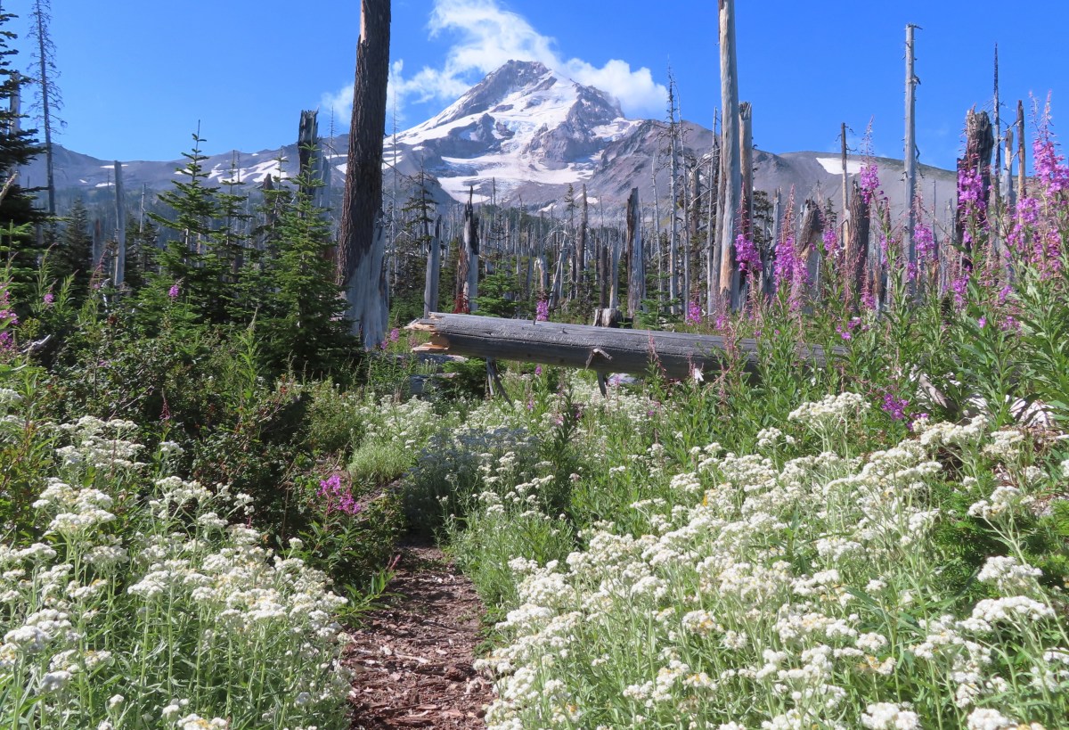
Heather was able to join me for the final hike of my vacation which we’d decided would be the Elk Cove Trail on Mt. Hood. Located on the north side of the mountain the Elk Cove Trailhead was the only trailhead providing access to Mt. Hood’s Timberline Trail that we had not yet been to. Most of the others we’d used as trailheads while a couple we’d hiked through as part of a loop.

Be aware that high clearance vehicles are currently recommended to access this trailhead and Laurence Lake due to the access road having been washed out by the Eliot Branch. Our Outback had no issues. We made the two-and-a-half-hour drive from Salem arriving shortly after 7am and set off on the trail.


The trail begins by crossing Pinnacle Creek.

Pinnacle Creek
For the first 1.25-miles the trail follows an old roadbed to the former trailhead. The trail also passes through the 2011 Dollar Lake Fire scar for its entire length.


Black cap raspberries

Signs of the 2011 fire.

Scouler’s bluebells
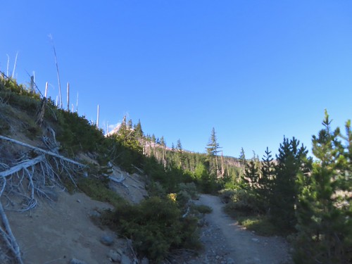
First view of Mt. Hood. One result of losing nearly all the trees in the fire is the trail now offers numerous excellent views of the mountain.

Woodland beardtongue

The location of the former trailhead. Here the trail leaves the old roadbed a switchbacks up to gain the ridge.

Trail sign announcing Elk Cove is just 3.9-miles away.

On the lower portion of the ridge some of the trees avoided crowning and survived the fire.

Mt. Adams was also visible to the north.

Mt. Adams

Mt. Hood from the ridge.
The trail followed the ridge which provides no cover from the sun, but the views are spectacular.


Fireweed


Mt. Adams again.

Probably Cascade aster.

Lupine along the trail.

To the right is the namesake pinnacle of Pinnacle Ridge. We hiked that ridge to Elk Cove in 2014 (post), but recent reports indicate that it is in rough shape and in need of maintenance.

Owl Point (post) to the NW.
There are two saddles along the ridge which provide some downhill on the way up to Elk Cove which also means uphill on the way back down to the trailhead.


Yarrow

Bird on a snag with the Coe Glacier behind.

The ridge to the right across the Hood River Valley is Surveyors Ridge (post) with Bald Butte (post) the hump toward the left end.

Both Compass Creek and the Coe Branch flow down the valley to the left (east) of the ridge. Straight ahead about 3/4 up this photo is Cannon Ball Falls, a.k.a. Lower Compass Creek Falls.

Blurry attempt at zooming in on the falls in the afternoon.

Starting down the second saddle.

Mountain bluebird


The Coe Glacier on Mt. Hood.
Once we had successfully climbed out of the second saddle we stopped for a short break where we were visited by an inquisitive hummingbird.


Beyond the second saddle the ridge widened and flattened considerably, and the number of blooming wildflowers also increased considerably.


Barrett Spur (post)

There was also more blowdown on the upper portion of the trail but nothing that was too difficult to navigate.

The fireweed was in full bloom higher up.

More aster

False hellebore

Pearly everlasting and fireweed

Goldenrod
Just over 4-miles from the trailhead the trail crosses Cove Creek, the first water source along the trail since the Pinnacle Creek crossing at the trailhead.


These logs provided a dry crossing.

Lewis’ monkeyflower. We stopped here on the way down and Heather topped off her water.

Monkeyflower

Paintbrush
After a short break at the creek we continued on.

The trail up from the creek.

Orange agoseris

Dark-eyed junco


One-sided wintergreen with a dwarf bramble blossom behind.

Robin

Valerian
The trail soon entered a dry gully that was at one time a creek bed and followed it for a bit before climbing out and entering meadows shortly before arriving at the Timberline Trail.

 Purple sanicle


Campsites at the edge of the meadow.

Sub-alpine fleabane

Sign ahead at the junction of the Timberline and Elk Cove trails.

We headed right on the Timberline Trail to Cove Creek where Heather was going to take a break. I decided to continue up the Timberline Trail from Elk Cove to visit a talus field where I hoped to spot a pika (or two). Even if I didn’t see a pika I knew from previous trips that there was yet another good view of the mountain from the trail as it descended into Elk Cove.


The Timberline Trail crossing at Cove Creek.

Monkeyflower and a couple of lupine

Mt. Hood from the crossing.

There was a lot of aster blooming in Elk Cove.

Western pasque flower seedhead.

Bistort


Monkeyflower lining Cove Creek.


As I approached the talus slope I could hear multiple pikas.

I was able to spot one of the little guys.

Surveyors Ridge from the talus slope.


Waterfalls on the mountain.

Barrett Spur in front of Mt. Hood.
I continued a little further up the Timberline Trail to visit a wildflower filled hillside before returning to Elk Cove.


After meeting back up with Heather and showing her to the monkeyflower lined section of Cove Creek we returned to the Elk Cove Trail junction, but continued a little further on the Timberline Trail for another view of the mountain.

A spur trail next to a no camping sign leads to this view from Elk Cove.

Flowers along the spur trail.
We finally decided it was time to head back so we returned to the Elk Cove Trail and started down.

It was a fairly uneventful but pleasant descent. We had passed by backpacker on her way out during our climb up to Elk Cove and passed 9 or 10 hikers on their way up the trail on our way back. Those are pretty small numbers for a weekend. We did see a number of people while at Elk Cove, but the north side of the mountain is much less crowded than other areas around the mountain.

Sickletop lousewort


Checkerspot on pearly everlasting

Felt-leaved pearly everlasting


A cinquefoil

Penstemon


Golden chinquapin

A duskywing

A sulphur

Laurence Lake from the trail before descending to the old trailhead.

Laurence Lake

Back on the old roadbed.

Ripe thimbleberries!

Back at the trailhead.
My exploring brought this hike for me to 11.1-miles with approximately 2500′ of elevation gain making it the most milage I’d done since January and the most elevation gained since December 2025. While I’m not back to 100% it seems, I’m heading the right direction.

This was one of our favorite approaches to the Timberline Trail. The combination of big views and fewer people was a big plus. The lack of shade on the ridge would make it less appealing on a hot day though. Whatever route you take Elk Cove is a worthwhile goal. Happy Trails!
Flickr: Elk Cove

