**Note the 2017 Separation Fire burned a portion of this hike.**
In 2015 we did an off trail exploration of Linton Creek from Linton Meadows down toward Linton Lake. That day we cliffed out on the south side of the creek somewhere along Linton Falls. The Northwest Waterfall Survey gives Linton Falls a total height of 615′ consisting of 7 drops. We were unable to reach the final drop which is the tallest and most impressive so we vowed to return someday and try coming up from Linton Lake on the north side of the creek.
That day had finally come. We started at the Linton Lake Trailhead which is located 11 miles east of Highway 126 along Highway 242 near the Alder Springs Campground.
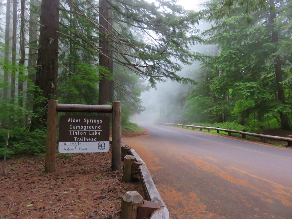
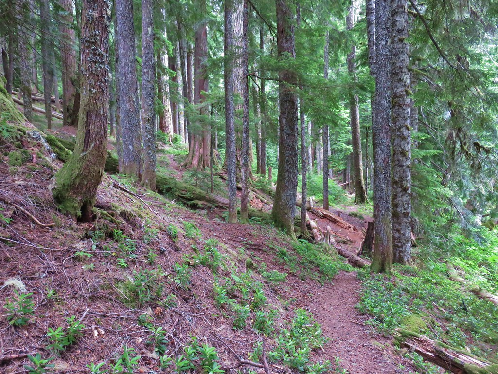
Then we crossed the highway and set off on the Linton Lake Trail which quickly entered the Three Sisters Wilderness.

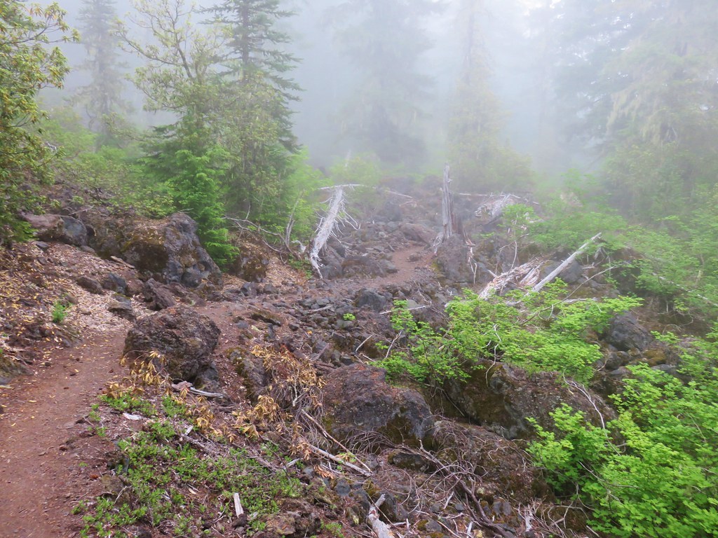
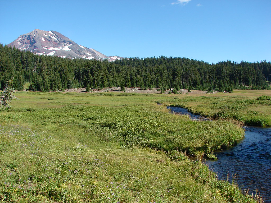
Linton Lake is just under 1.5 miles from the trailhead. The trail spends that time passing through the forest before crossing a lava flow and then descending via a series of switchbacks to the lake.
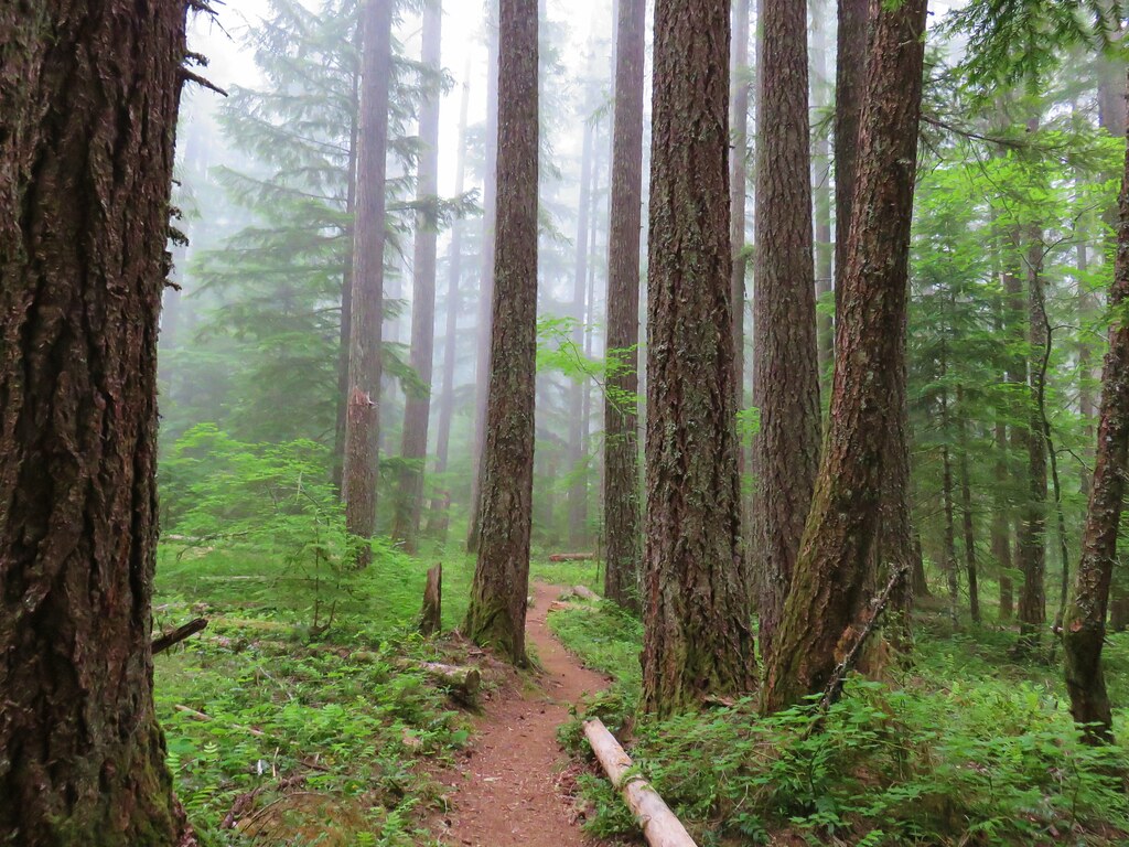
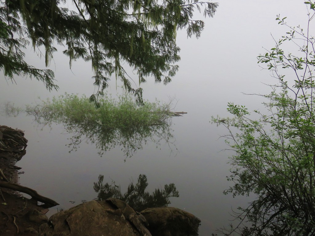
The trail stays above the lake at first and on this morning there was enough fog to keep us from getting any kind of a decent look. The trail descended to Obsidian Creek after a half mile which marked the end of the official trail.
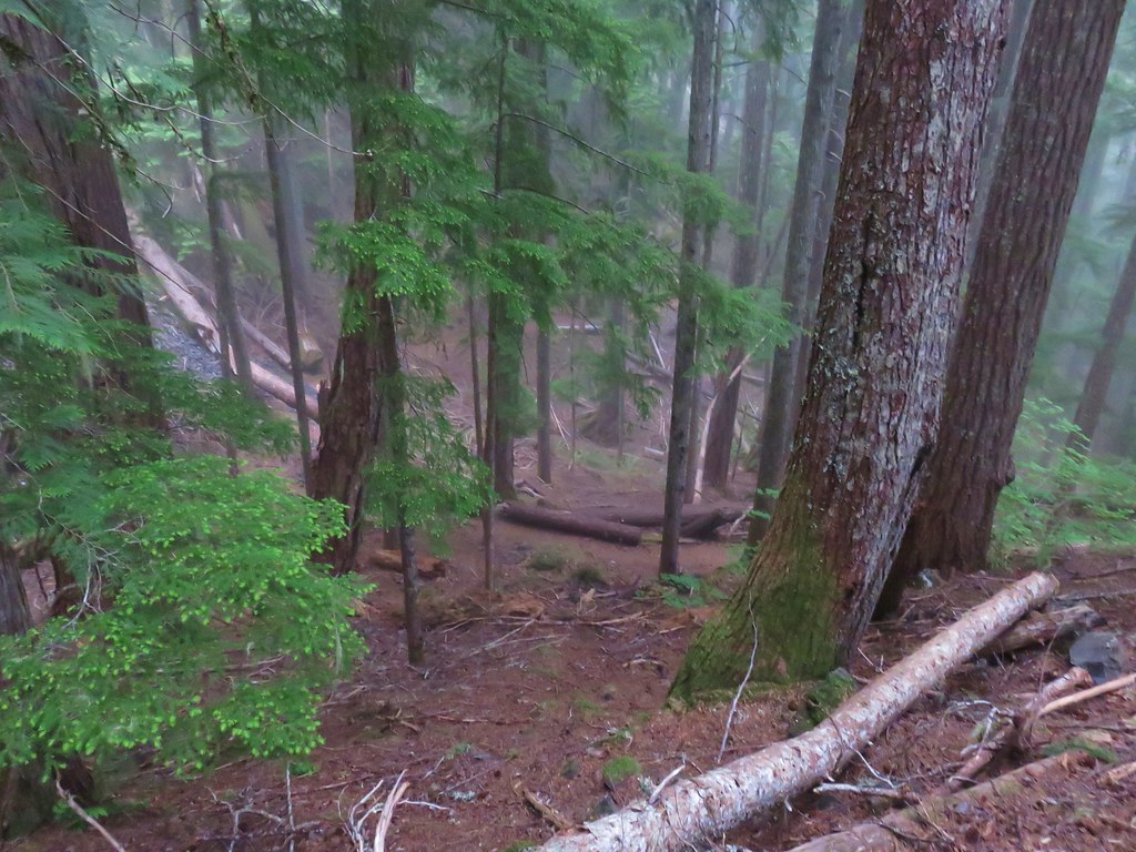
We crossed the creek and continued on use trails around the lake. We were now able to get down to the shore even though we still couldn’t really see anything.
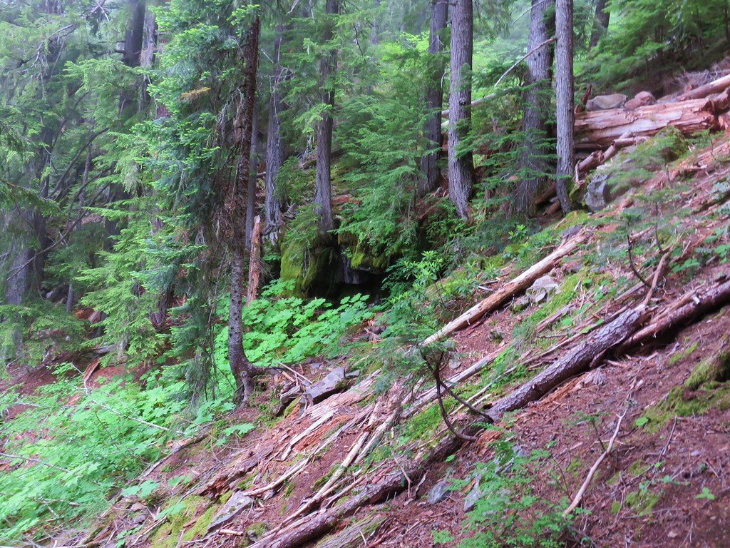
Since the use trails are not maintained there was a bit of blowdown to navigate but nothing too daunting.

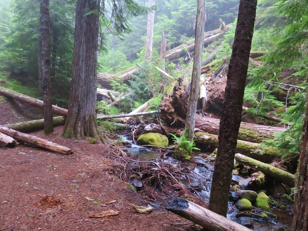
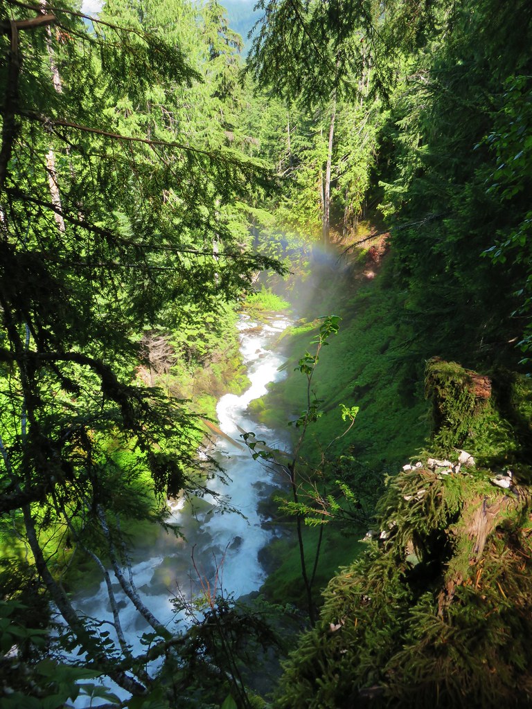
We reached Linton Creek just over a half mile from Obsidian Creek.
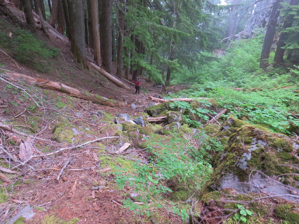
At the creek we headed uphill continuing to follow fairly obvious use trails as we climbed along the creek.

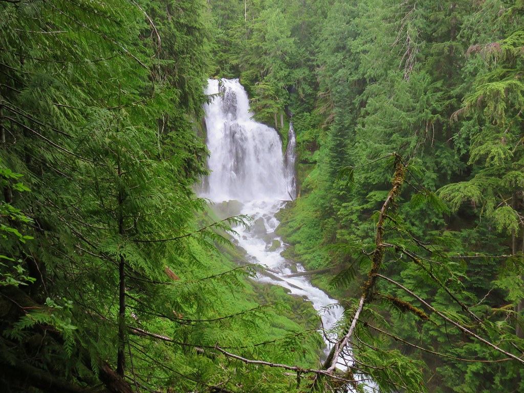
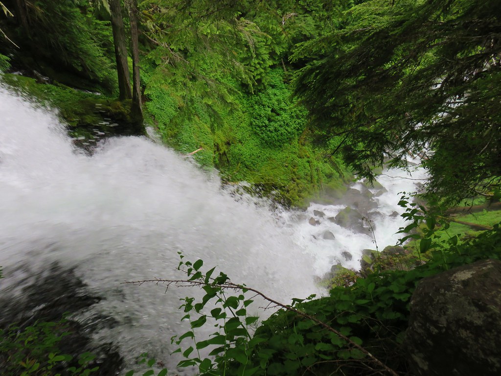
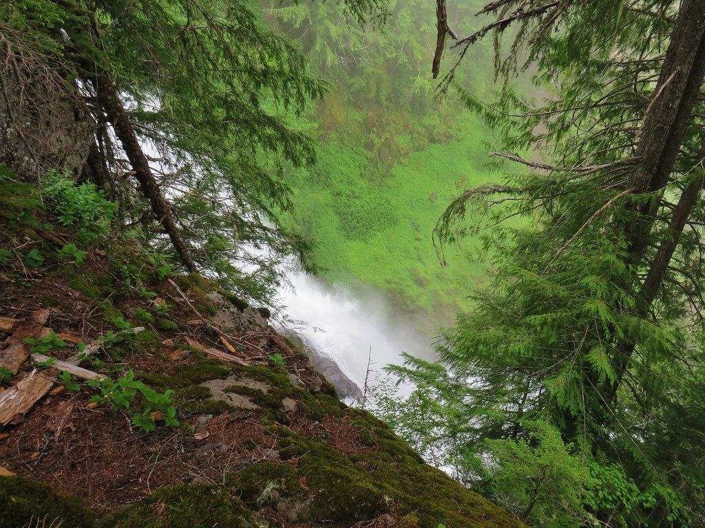
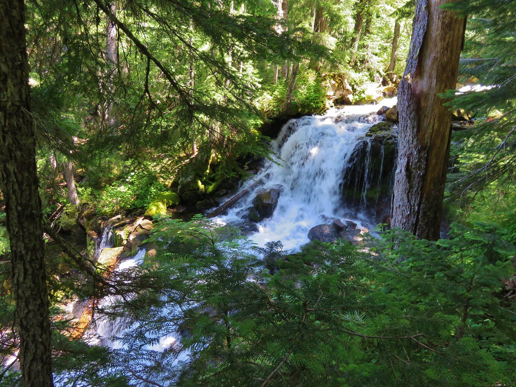
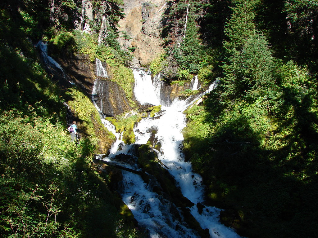
The climb was fairly steep in places but after approximately .4 miles we arrived at a viewpoint of 85′ Lower Linton Falls.

The use trails became increasingly faint as we climbed away from Lower Linton Falls. We stopped at the top of the falls to get a look down before continuing on.

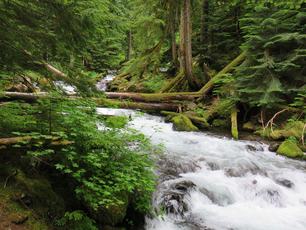
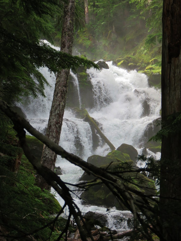
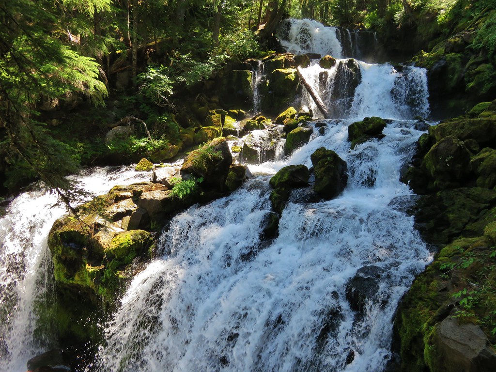
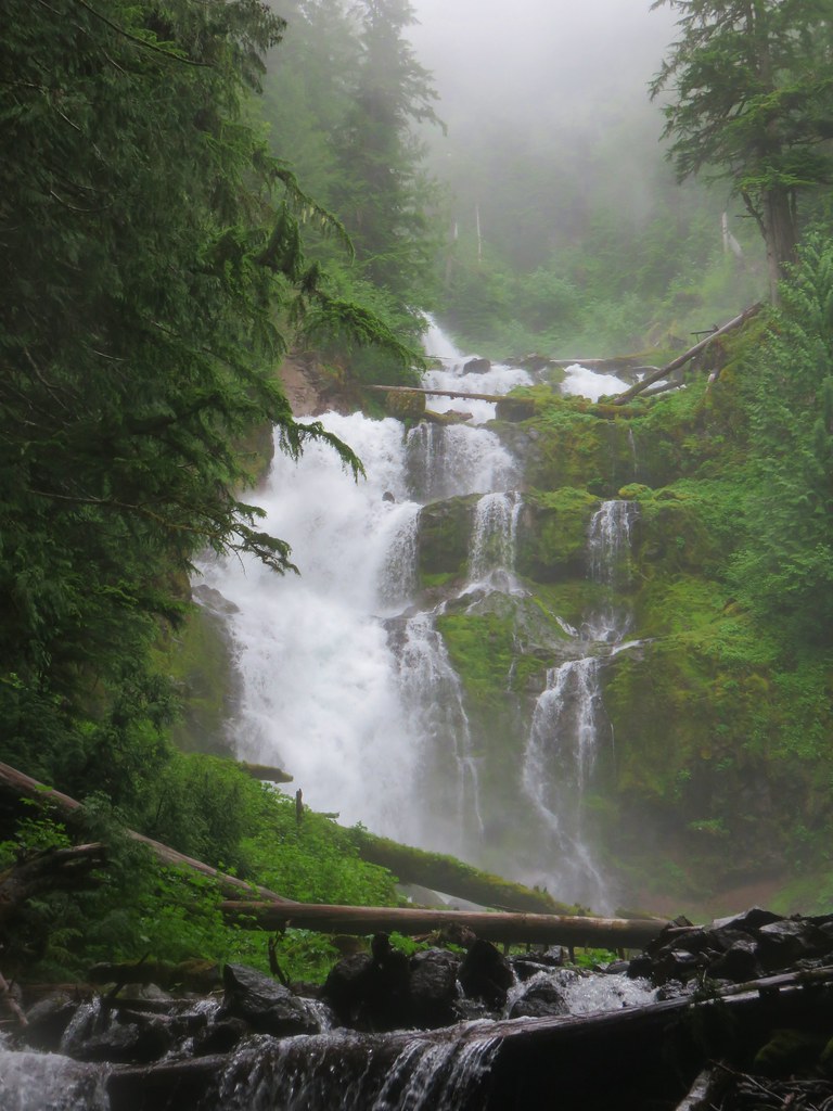
Not only did the use paths get fainter but the terrain continued to steepen as we climbed. Four tenths of a mile from the viewpoint of Lower Linton Falls we got our first glimpse of the final drop of Linton Falls.

This portion of Linton Falls did not disappoint. The only issue with it was the massive amount of spray from the falls made it nearly impossible to keep the camera lens dry.

After admiring the view we continued uphill. Our goal was to get far enough up the creek to at least be across from where we’d cliffed out in 2015 on the opposite side. To continue we knew from a 2012 trip report by Wild Umpqua that things were going to get even steeper as we continued. We veered away from the creek and followed an old creek bed uphill.
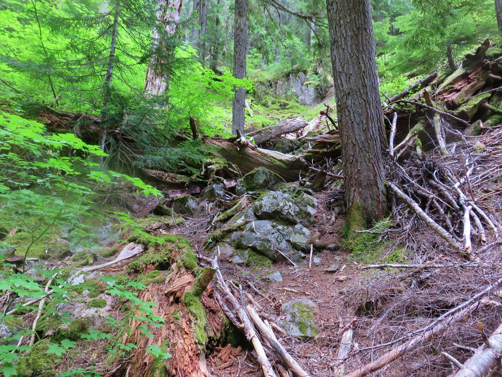
We knew we were on the right course when we spotted a small cave that was mentioned in that report.
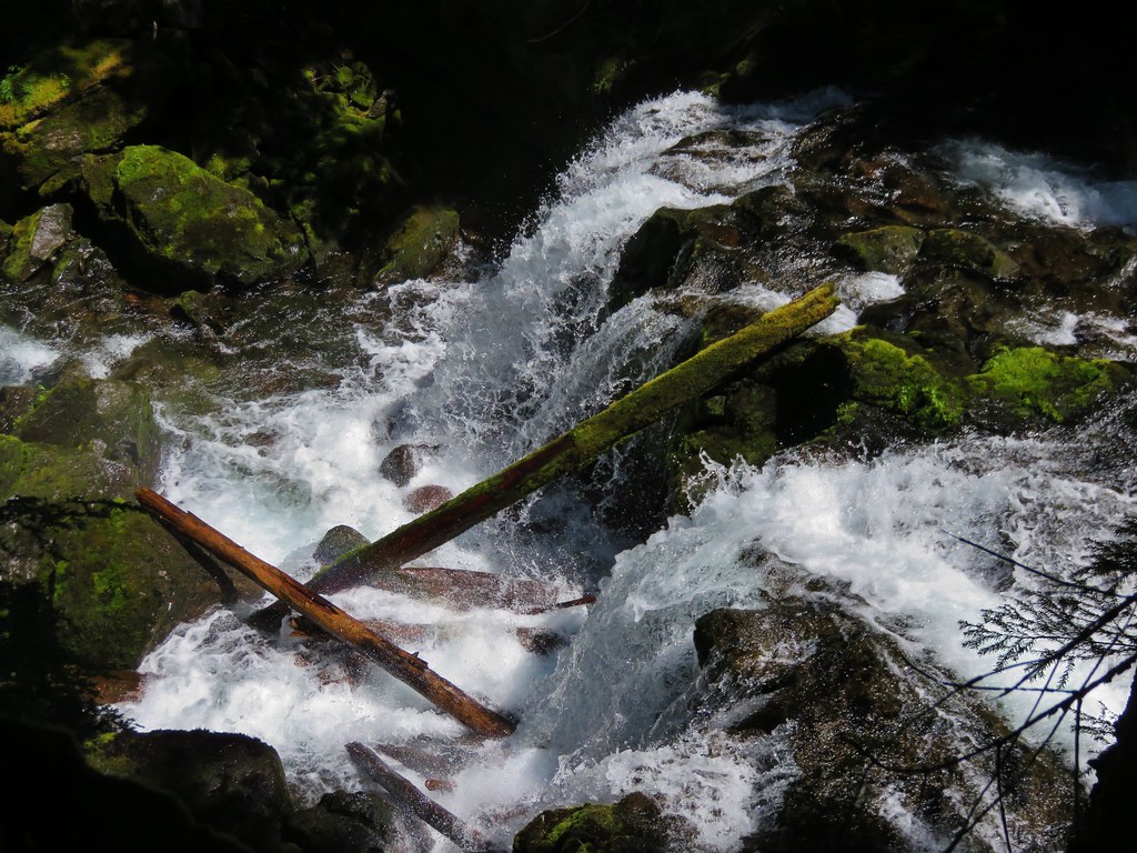
We cut back over to the creek when the terrain made that a more attractive option than trying to continue up the dry creek bed. As luck would have it that happened to be almost directly across from our GPS track from 2015 and just above the top of a large drop of Linton Falls.

I was a little confused by the drop we were above because it didn’t look like what I would have expected from anything we’d seen from below. I think the answer is that this was actually the top of a drop that only the very bottom was visible of from below coming from the left around a bend. I was able to follow the ridge down a bit to get a somewhat limited look at the side of this drop.
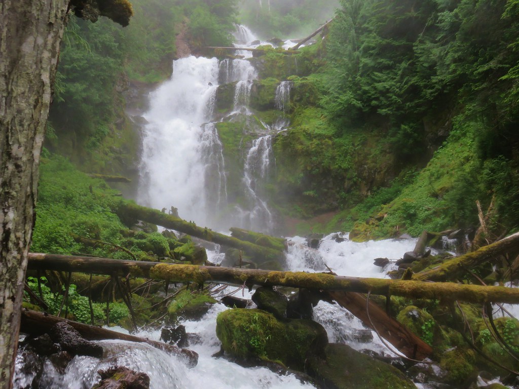
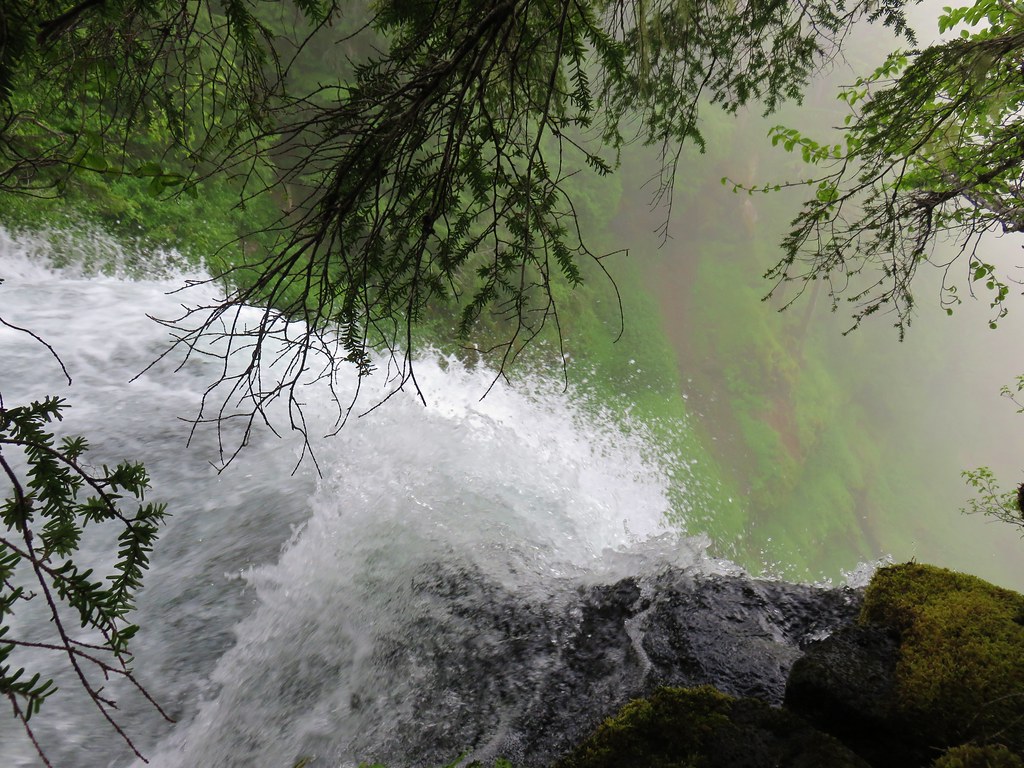
Looking up the creek from this drop revealed more of Linton Falls.

We walked up along the creek a very short distance where we saw a very familiar looking drop with a log in the middle of the creek.

We’d seen the same log from the other side in 2015.
We now felt like we had seen most of Linton Falls between the two visits. As far as we can guess it goes something like this.


This is a complicated fall and it’s quite possible that there is something between the final drops and the big drop we were above that we were never able to see. It’s also difficult to say for certain where the actual start of Linton Falls is, but that is part of what makes this such a spectacular waterfall.
As we began our descent the Sun finally started to make an appearance.

Coming down was harder than going up but we managed to make the descent without incident stopping back by the viewpoints below Linton Falls and above Lower Linton Falls to see how the emerging Sun had changed the views.

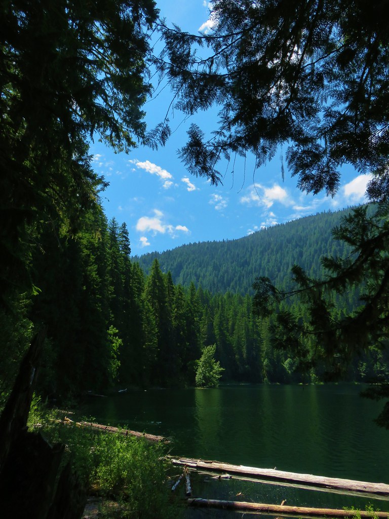
Linton Lake was fog free when we made it back.

As we made our way around the lake it was possible to see some of Linton Falls on the hillside. The view didn’t do much to clear up the makeup of the falls though.
This was actually our third time encountering Linton Creek, our first was in 2014 on a backpacking trip around the South Sister. which has cemented itself as our favorite creek. From it’s beginnings at Linton Springs and Linton Meadows it puts on one amazing and scenic show on it’s way to Linton Lake.
With nearly all of the creek being off trail it makes for a challenging goal but the rewards are great. Happy Trails!
Flickr: Linton Falls from Linton Lake

17 replies on “Linton Falls from Linton Lake”
While I am totally partial to California as the best waterfall state (Yosemite alone is practically unbeatable and that is just the beginning), I am firmly convinced that Oregon is the undisputed runner up. A couple of weeks ago we made a loop around the Oregon Cascades, hitting Silver Falls, the Gorge and some of the falls on the east side. It was absolutely awesome. When you post things like this, Oregon’s stature only continues to increase! Well done!
That is great stuff and reminds me I need to go back this summer and explore that area some more. Surprising how the water looks a little low at Linton Falls but Lower Linton is heavy. Comparing old pictures to yours shows slightly differing flows for the two falls.
Linton is a weird waterfall. I only glanced over the edge from the top while taking a very short video. After watching it again just now, I was surprised how flat it was after that drop. Much flatter than I remember. All of those waterfalls above the big one are great in their own way. #1 and #3 are really nice.
The dry creekbed route gets a little sketchy at the top (just past the pikas), but it’s completely flat for a ways once you get over the hump.
I enjoyed your comment about it being harder coming down than going up. I can remember some early trips in there and being in more physical pain (hips and knees) heading back around the lake than any trip I’ve ever been on.
We relied quite a bit on your reports, they were very helpful.
After looking at a few other photos of Linton Falls I thought the same thing you do, they do seem a little low comparatively.
Those falls are gorgeous!
[…] Three Sisters – 2011, 12, 13, 14, 15, 16, 17 […]
I couldn’t even find the falls guess I didn’t go high up enough, next time
That would be my guess, unless you accidentally turned up Obsidian Creek (the first one that the trail comes to).
I heard that the fire last summer really did a number on the trail to both waterfalls. It wasn’t always straightforward before, but I believe it might be mostly gone now.
Good point, I’m sure it had a major impact.
I was sure that was Linton Creek to my right when we hiked straight up but there was no obvious trail like everyone was saying. We are planning to go back to find this trail that leads up to the lower falls. Any suggestions where to look for this trail?
I’d look on the south side of the creek. There’s a way to cross the Linton Creek delta. Big log, then island hop. Sort of a trailish thing over there that leads up the creek. Not exactly sure how far it goes up. There’s no safe way (outside of rappelling) down from the north side. Going straight up the creek from by that campsite is probably more trouble than it’s worth.
We spoke to the people who were spending a couple of nights at the campground. All they said was not to cross Linton Creek and it should be on the right side when hiking up and something about an obvious trail you can follow for a while. We had to walk next to the lake on some rocks so as not to get muddy to get to Linton Creek and then headed up from there next to the creek? Thanks for the your reply.
We found the trail to lower Linton falls. Looking at all your photos, there’s the next falls up from the lower Linton falls that looked very impressive which we did not get to today. How far up from the lower Linton falls to the next impressive falls? We did hike up a little further from the lower Linton falls but the scrambling over big logs and branches got very tiresome quickly! May be our next attempt with more time would get us there?
It was about a quarter of a mile (maybe a third) from the top of the lower falls to where we could see the next big one. Even before the fire it was slow going and I’m guessing there are quite a few more obstacles now.
We have now gone to lower Linton falls half a dozen times. I am obsessed about finding Linton falls so I decided to head out today. I don’t know what I did wrong, think I went high enough (and yes it was very steep up). I tried hiking close to the creek but that was impossible due to the huge rocks, bushes, huge logs that were in the way. So I retraced my step and hiked uphill away from the creek and came close to a small rock face but it still looked impossible to see the falls so I decided to turn back. I would love to go back one more time before the snow comes, any suggestions which route to take uphill next time since you have done it several times? Any suggestions would help. Thanks.
Here is a link to our GPS track that might be useful. It’s a bit of a jumble but you can see we were a little below 4000′ in elevation when we went over to the creek below the upper falls.
https://drive.google.com/file/d/1IZ80OZw7Au7Ws_AFOUYhJv3BthqBQ1Rv/view?usp=sharing
If you can’t use the actual GPX track above here is a JPEG of the track (just from Linton Lake to the falls). The gray track is from our visit down from the opposite side.
https://drive.google.com/file/d/11zGnu1gKdhxJ_Wd9H6y2oxf1XRc2u_SS/view?usp=sharing
[…] – Poxy Falls and Linton Lake 5/3/2014(Proxy Falls) & 6/25/2017(Linton Lake) Burned (Linton Falls) 2017 Separation Fire Proxy […]