
For the final hike of our trip we’d chosen Aneroid Lake. This would be our 99th featured hike out of the 100 in William L. Sullivan’s “100 Hikes Eastern Oregon” 1st edition (2022) and our 499th out of the 500 featured hikes that we’ve been working on for a number of years now (post). Sullivan gives two options for this hike, a moderate hike gaining 1150′ of elevation in just under 4-miles (round trip) to a waterfall on the East Fork Wallowa River, or the difficult hike to Aneroid Lake gaining nearly 3000′ of elevation in what he lists as a 12-mile round trip. Other reports put the hike to Aneroid Lake at just over 13-miles RT but agree on the elevation gain. Our plan for the day was to once again split up and go our own paces with Heather’s goal being the waterfall and mine being the lake. Heather would return to the trailhead and then head to the Trailhead Coffee stand and do a little shopping in the Wallowa Lake community while she waited for me to get back. We figured that the hike to Aneroid Lake would take me anywhere from 6 to 8 hours depending on how long the hike really was and how well my legs were working after four days of serious hiking.
We began at the Wallow Lake Trailhead which we’d started two other previous hikes from, a five-day backpacking trip (post) and a short hike to B.C. Creek Falls (post). For both of those hikes we’d taken the West Fork Wallowa Trail. Today we would be using the East Fork Wallowa Trail.

 Map at the trailhead signboard and wilderness permit station.
 Trail sign at the split of the East and West Fork trails.
The trail began by following a rocky roadbed uphill.


 Trail sign for the East Fork Wallowa Trail at a junction with a gravel road.
The roadbed soon became a proper trail as it continued uphill.

 Ghost pipe
 Entering into the Wallowa-Whitman National Forest.
A little over three quarters of a mile from the trailhead I came to a junction with a connector trail to the West Fork Wallowa Trail used as a loop for horse tours.

Beyond the junction the trail passed through some rocky hillsides with views across Wallowa Lake.

 Chief Joseph Mountain and Wallowa Lake
 I never saw any but I heard a number of pikas in the rock fields.
 Switchback
 Rock clematis seed heads.
When Heather came through the rock fields she did spot a pika.

 Bridge at the upper end of the access road that I had passed earlier.
 The lower section of the waterfall from the bridge.
After checking out the lower portion of the falls from access road bridge I returned to the trail and continued up to a switchback with a view of the upper section of the falls.


 The access road bridge from the switchback.
From the switchback the trail continued its steady climb arriving at a damaged bridge after a little over 2 miles.

 East Fork Wallowa River Forebay
 Interpretive sign at the forebay.
 Aster
Aster
 The trail entering the Eagle Cap Wilderness.

Shortly after entering the wilderness the trail passed through some small meadows with fireweed and various berries.

 Elderberry and baneberry
As I was pondering which animals if any might eat the different berries I spotted something brown in the fireweed below the trail. It took a moment to register what I was seeing. I had my camera out and was zooming in to try and identify it, but as soon as it lifted its head I realized it was a bear.
 Zoomed in photo.
It didn’t seem to notice me so I quietly and quickly continued on trying to put some distance between myself and it. I wasn’t too thrilled when the trail suddenly made a switchback and I was headed back toward where the bear was, albeit I was now higher up the hillside. I continued with a bit of a quicker pace until I felt that I’d gotten a decent distance away then slowed a bit to avoid missing the scenery. I passed a couple of hikers on their way down who I mentioned the bear to just in case it was still there.

 Small meadow along the trail.
 Aneroid Mountain in the distance.
 Mountain larkspur
 Pika underneath some raspberries.
 Pika
Pika
 A few lupine were still blooming along the trail.
 Doe in a small meadow along the trail.

 Tall mountain bluebells
 The damaged footbridge.
While the climb had not been steep beyond the footbridge the climb became even more gradual. Just under a quarter mile from the bridge the trail split with inbound traffic staying right.


The inbound trail traversed an exposed hillside with views down to the East Fork Wallowa River.


 East Fork Wallowa River
 The inbound and outbound forks rejoining.

 East Fork Wallowa River flowing through a meadow along the trail.
 Goldenrod
 Unnamed creek crossing.
 American sawort
 Another doe in a meadow.

 A hazy view of Aneroid Mountain.
 Pearly everlasting along the trail.
 East Peak (post)
 A closer look at East Peak.
I arrived at Roger Lake at what my GPS said was the 6-mile mark.

It was another half mile of climbing to reach Aneroid Lake.


Sullivan’s description said to ignore a use trail on the right leading to a campsite and to continue on to another fork that led to the private cabins at Camp Halton. I passed what I believed to be the right-hand fork Sullivan mentioned just before reaching a pair of wooden benches along the trail.
 The benches.
Beyond the benches I came to a second fork which I mistook for the trail to the cabins. Sullivan mentioned that despite the cabins being on a small parcel of private land the caretakers accepted respectful visitors.

There were no signs posted at all at this fork, so I proceeded steeply downhill and wound up in a campsite.
I still wasn’t sure if this was the trail to the cabins or the one Sullivan had said to ignore so I continued to follow the trail to the lakeshore.
 Groundsel along the trail.

 A boat docked on the lakeshore in the distance.

I decided to follow the trail along the lake shore and eventually wound up at the boat dock. At that point I realized that I for sure had taken the wrong fork and backtracked.
 An inlet creek to the lake near the boat dock.
 East Peak from Aneroid Lake.
I followed a different use path that climbed up from the lake a bit more gradually and wound up on the path down to the private cabins.


I started down the trail but when I got into view of the cabins I decided not to bother anyone and took some zoomed in photos and headed back uphill.


 Signs for Camp Halton at the actual junction with the East Fork Wallowa Trail.
I headed back on the East Fork Trail and detoured down the first righthand fork to visit the lakeshore one last time before heading back to the trailhead.


I kept a pretty quick pace on the way back down stopping for a few photos and to let a handful of uphill hikers pass.
 Hammond’s flycatcher
 East Peak

 Lewis monkeyflower
 Aneroid Mountain
 Pollinator on a flower.
 The split trail.
 The outbound trail dropped quite steeply before meeting back up with the inbound trail.
 The damaged bridge from the other side.
 Fritillary butterfly
 A comma butterfly

 Golden-mantled ground squirrel
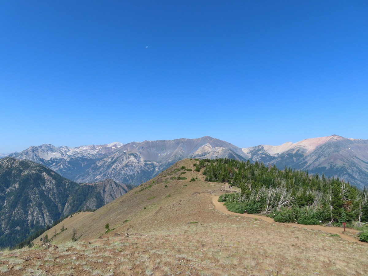
 Mount Howard
 Coneflower

 Wallowa Lake
 Quaking aspen
 Arriving back at the trailhead.
According to the GPS my hike was 14-miles which lines up better with the reported 13.1-mile roundtrip vs Sullivan’s 12. The extra milage is mostly due to my taking the wrong righthand fork and then backtracking before heading down toward the cabins.

I finished in just over 6 hours and located Heather at the Little Alps Day Use Area near where we’d parked. After taking a break at the picnic table she was sitting at I changed my shoes and socks and we drove down to the Khao Neaow Food Cart to get some tasty Thai food to take back to our room.
This was yet another great hike in the Eagle Cap Wilderness which is easily our favorite wilderness area in Oregon. We’re excited that the final hike in our quest for the 500 featured hikes will be in this wilderness, hopefully a little later this year. Of course there are many other hikes in the Wallowas that we’ve yet to do so that won’t be the last time we visit. Happy Trails!
Flickr: Aneroid Lake


 View after coming back down.

 The tramway from the top.
 Pointer for the Royal Purple Overlook (right) and Summit Overlook (left).
 Penstemon
 Heading out to the Royal Purple Overlook.
 They do hold weddings up on the mountain.
 Lewis flax
 Mountain coyote mint
 The Hurwal Divide, Point Joseph and Ruby Peak from left to right.
 Pete’s Point, West Aneroid Peak, Eagle Cap the furthest away (
 Closer look at Eagle Cap.
 Craig Mountain and the Matterhorn (
 East Peak
 Pano that Heather took with her phone.
 Buckwheat
 Pointer for the Summit Overlook.
 View from the Summit Overlook. Heather is standing on the Royal Purple Overlook.
 Buek’s groundsel
 Point Joseph
 East Peak as I neared the Summit Overlook.
 The Seven Devils poking up above the smoke from Idaho.
 Seven Devils
 Mount Melissa to the left and East Peak straight ahead.
 The 4-way junction.
 East Peak from the 4-way junction.

 Mountain bluebird
 Climbing to the saddle.
 The view from the saddle.
 Wood blocking the lower end of the “short-cut”.
 Looking back at the Summit Overlook during one of my several breaks during the climb up.
 There were a few obstacles to avoid along the climb as well.
 The Royal Purple Overlook from the trail.
 Up, up I go.
 Golden-mantled ground squirrel watching me navigate some blowdown.
 The views helped keep my mind off the climbing.
 The second saddle in sight.
 The angle was enough different from the saddle that I could see a couple of additional peaks.
 The Matterhorn on the left and now Sacajawea Peak behind the Hurwal Divide to the Matterhorns right.
 The saddle provided a brief level stretch before the trail launched steeply uphill again.

 East Peak
 Lots of buckwheat along this section.
 Buckwheat and lupine above the trail.
 The fork. According to Sullivan the righthand fork peters out in about 0.2-miles and then it’s possible to scramble up East Peak in another three quarters of a mile. I went left heading for the spring.
 The McCully Creek Trail which we hiked a couple of days earlier (
 A phacelia
 Lyall’s Goldenweed
 Wallflower
 Looking back at the trail.
 Flowers near the springs.
 Shrubby cinquefoil surrounded by bistort and mountain death-camas.
 Mountain death-camas and bistort
 Looking up at the springs.
 Monkeyflower
 There were several smaller streams below East Peak.
 Aneroid Mountain
 Ground squirrel
 View from my turn around point.
 Looking back at my route to the second saddle.

 Dusty maidens near the springs.
 Heading down to the saddle.
 Cairn at the saddle.
 Milbert’s tortoiseshell
 Pale agoseris
 Climbing back up to the 4-way junction.
 Back on the Summit Loop.
 Crossing the service road coming up from McCully Creek.
 Mountain Heather
 Pointer for the Valley Overlook.
 Spur trail to the Valley Overlook.
 Flag at the Valley Overlook.
 Wallowa Lake below the Valley Overlook.
 Wallowa Lake
 East Peak peaking up over the trees.

 Wallowa Paintbrush
 The upper terminal.
 Apparently Heather was busy making a friend while I was visiting the springs even though she did not feed any animals.
 The straight line is the tram ride.

 We managed to get started about ten minutes before 6am.


 Bugbane and paintbrush
 A 2022 wildfire burned the first 3-miles of the trail and left the old footbridge damaged. A steep scramble trail led down to it.
 Big Sheep Creek

 Paintbrush and lupine
 Wildfire smoke filling the valley behind us.


 Phacelia
 Butterfly on buckwheat.
 Some of the trees survived the fire.
 White mariposa lilies in a meadow along the trail.
 Junction with the Wing Ridge Trail.
 North Fork Big Sheep Creek
 Lewis Monkeyflower along the creek.


 Canada milk-vetch
 Grass-of-parnassus
 Bog orchid
 Checker-mallow
 Bee heading for some monkshood.
 Me in some fireweed.

 Getting eyed by a western tanager.


 When fires burn too hot they damage the soil which makes it difficult for all plants to obtain the necessary nutrients to grow.
 A few plants had been able to take hold.
 A healthy patch of paintbrush.
 Middle Fork Big Sheep Creek
 Monkeyflower
 Brook saxifrage
 Another severely burned section.
 The Bonny Lakes Trail forking to the right off of the Tenderfoot Wagon Road Trail.
 Wildflowers along the Bonny Lakes Trail.
 The wildflowers were profuse along this stretch of trail.
 American sawwort
 Police car moths
 Larkspur and fleabane
 The trail recrossed the Middle Fork Big Sheep Creek.
 Orange agoseris


 Taper tip onions
 White mariposa lilies


 False hellebore
 Checker-mallow
 Penstemon on the outcrop.
 Mountain larkspur
 Pika!
Pika! Gathering plants for the Winter store.


 On the steep climb.
 Mountain heather
 Ground squirrel
 The creek was below between the ridges here.

 Stonecrop
 Swamp onions

 Wallowa paintbrush
 Aneroid Mountain and Lower Bonny Lake.
 Aneroid Mountain to the right and an unnamed peak on the left.


 Shrubby cinquefoil
 Cutleaf anemone seed heads.
 Possibly a sandwort.

 Upper Bonny Lake
 Lower Bonny Lake
 Aneroid Mountain from the knoll.

 Spotted sandpiper
 Elephants head

 White mariposa lily and buckwheat
 Jacob’s ladder
 Checker-mallow and white mariposa lilies along the trail.
 Scouler’s woolly-weed

 Gentians

 Goldenrod and yarrow
 Nuttal’s linanthus


 North Fork Big Sheep Creek
 The haze from the morning had improved now that the Sun had moved on from the east.
 Looking down at the un-damaged bridge over a side stream.
 Yellow columbine
 Big Sheep Creek.
