My brother and his families last full day visiting from Missouri was Saturday, so we wanted a nearby hike for the morning to give us more time to visit later in the day. We turned to nearby Minto-Brown Island Park where a family of otters had recently been seen. We were excited to have our niece join us for the outing.
We began our hike from Parking Lot #1 (closest to the park entrance).
Map at the parking lot.
We took the paved path from the parking lot across Willamette Slough then turned right along the slough on the Brown Squirrel Loop.
Willamette Slough
As we were passing between the slough on our right and a field on our left, we spotted a buck.
The otters had been seen in the slough, so we detoured to a couple of viewpoints where the slough widened. We failed to spot any otters but did see a number of ducks, birds, and a family of nutria.
When I first spotted something in the water, I got excited, but I quickly realized it was nutria and not the otters.
Unfortunately, the nutria are highly invasive, regardless the family was kind of cute.
The silhouette of a cedar waxwing.
Swallows
Great blue heron
Ducks
We took a paved spur to the right when the trail forked to get a couple more views of the slough.
This spur spends much of the year submerged.
I’m not sure when/if this viewpoint is accessible on dry ground.
More ducks but no otters.
We returned to the main path and turned right when we reached the Osprey Loop and followed this loop to the Willamette River.
Oregon grape with perennial peavine behind.
One of many rabbits we would see during our hike.
Hardhack
Common madia
Robin
The Willamette River
A heron and ducks on the far side of the river.
We continued along the river and stuck to the paved path when it turned away from the river.
Shortly after leaving the river we spotted not one but two does.
The first doe was coming up the trail toward us.
The second doe was in the brush to the right of the trail.
The second doe.
Yarrow and chicory
The path brought us to the Shelter Parking Lot (lot #3) where we left the Osprey Loop in favor of the Blue Heron Loop. We followed the paved path across Oxbow Slough and continued to a split in the trail where the Blue Heron Loop continued on a dirt path to the left.
Female wood duck and ducklings in Oxbow Slough.
Coming up on the split in the trail.
Woodpecker
Wasp nest
Oxbow Slough
Goose and ducks at Oxbow Slough.
Great blue heron
When the Blue Heron Loop came within sight of the paved Purple Rabbit Loop we cut over to that path and turned left.
This trail brought us to Homedale Road which it briefly followed before veering away to complete a loop around Oxbow Slough.
Bindweed
We were slowed a bit on this stretch by the presence of ripe thimbleberries.
Old abandoned car along the path.
Squirrel
Self-heal
We turned right on the Yellow Duck Loop then took a left on a paved path along the western end of the dog park which brought us to the entrance road where we turned right.
An upside-down cedar waxwing.
We followed the entrance road back toward the entrance to cross the road on the Brown Squirrel Loop and returned to our car. This hike was 6.8-miles with minimal elevation gain.
Despite not seeing the otters we all had a good time. There was plenty of other wildlife to see and some tasty ripe berries to snack on. We were back home before 10am which gave us plenty of time to visit before we had to say goodbye to my brother’s family. Happy Trails!
For several years Heather has volunteered with our local running store, Gallagher Fitness Resources, Princess Steps, a Women’s Beginning Walking Running Clinic. They meet on Tuesday nights but have “homework” walks throughout the week which she and I have been doing together. The longer walks are set for Saturdays and for three of the last four weeks we’ve taken those walks at Minto-Brown Island Park. The park has also been part of a couple of urban hikes that we’ve taken in previous years (2017 & 2020).
Despite the numerous visits there were still sections of trails that I hadn’t been on. I decided to use my second day off of work to check a few of those off my to-visit list. Minto-Brown is even closer to our house than Baskett Slough Wildlife Refuge which I’d visited the day before (post). In fact, it’s less than a mile away as the crow flies, but it is on the other side of the Willamette River so I had to drive a little over 3.5-miles to Riverfront Park where we’d been starting all of our walks.
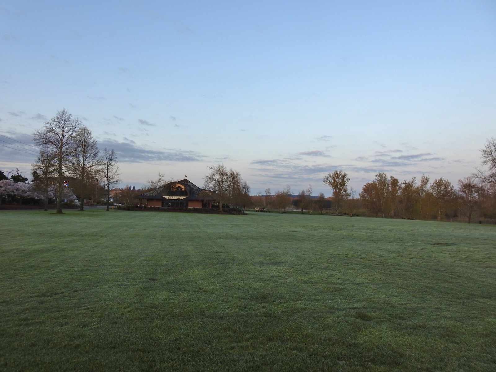
Heather’s plan from the walking group had us increasing distance each week starting with 5.3 miles on 3/19 then 6.6 on 3/25 and 9 miles on 4/8. (Heather wanted more hill practice before the hiking season and since Minto-Brown is mostly flat we did a 7.5 mile “hilly” hike through the West Salem neighborhoods on 4/1.) For this visit I was planning on going a little further again by visiting Eola Bend County Park which borders Minto-Brown to the NW along the Willamette River. I wasn’t sure what my actual route would be though. Minto-Brown is full of both pave and dirt trails, some of which parallel one another just feet apart. Numerous loop options are possible, but closure due to flooding or nesting birds can block access to certain trails at times. All of the visits this year started the same as we first passed the Gerry Frank Salem Rotary Amphitheater in Riverfront Park and took the Peter Courtney Minto Island Bridge over the Willamette Slough and into Minto-Brown Island Park on the Minto-Island Conservation Trail. The amphitheater and bridge on 3/19 23.
The amphitheater and bridge on 4/14/23.
On the first three visits we took the first paved right (one mile from Riverfront Park) and stayed right at the next junction to walk along the Willamette River and eventually arrive at the Lot 3 Trailhead. On this final visit I was unable to access the path along the river due to high water from recent rains so I forked left on a gravel that is often closed during bald eagle nesting season. Wetland near the bridge on 4/8.
The wetland on 4/14.
Signs at the 2nd junction – 3/19.
The path to the Willamette River on 3/19.
The path on 4/14.
April 8th along the Willamette.
April 14th on the inland gravel path.
Beyond Lot 3 is where our visits began to differ. On our first (shortest) visit we continued South from the lot and took the second left (Brown Squirrel & Yellow Duck Loop) looped around the South and East ends of the Dog Park to Lot 2 where we crossed the entrance road and followed the 10k path back to the junction where we had taken our first right that morning. From there we retraced our steps back to Riverfront Park.
For the second hike we continued South from Lot 3 then forked right and crossed Oxbow Slough on a footbridge before turning back after another 0.75-miles at a “T” junction with the Blue Heron, Purple Rabbit, and 10k Trails. We retraced our steps, passing the shared Squirrel & Duck Loop section that we’d taken the previous week turning instead at the next right (We were coming from the opposite direction as the previous week. This was also part of the Yellow Duck Loop and took led us along the North side of the dog park to Lot 2 where we turned left and again followed the 10k path back as we had the week before.
On our third outing we followed our route from the week before to the “T” junction but turned left and continued on the shared Purple Rabbit/10k Loop to return to the junction near the bridge over the slough. This time we returned through Lot 3 taking the right fork of the Red Osprey Loop at the North end of the lot. This loop brought us through an open field with an old cherry orchard to the 10k Loop where we took a left and followed the familiar route back to Riverfront.
My route was most similar to our third outing. It varied in that I had to stay inland instead of hiking along the river and I turned onto the dirt Blue Heron Loop path shortly after crossing the bridge over the slough. The Minto-Island Conservation Trail (Used during all four hikes.)
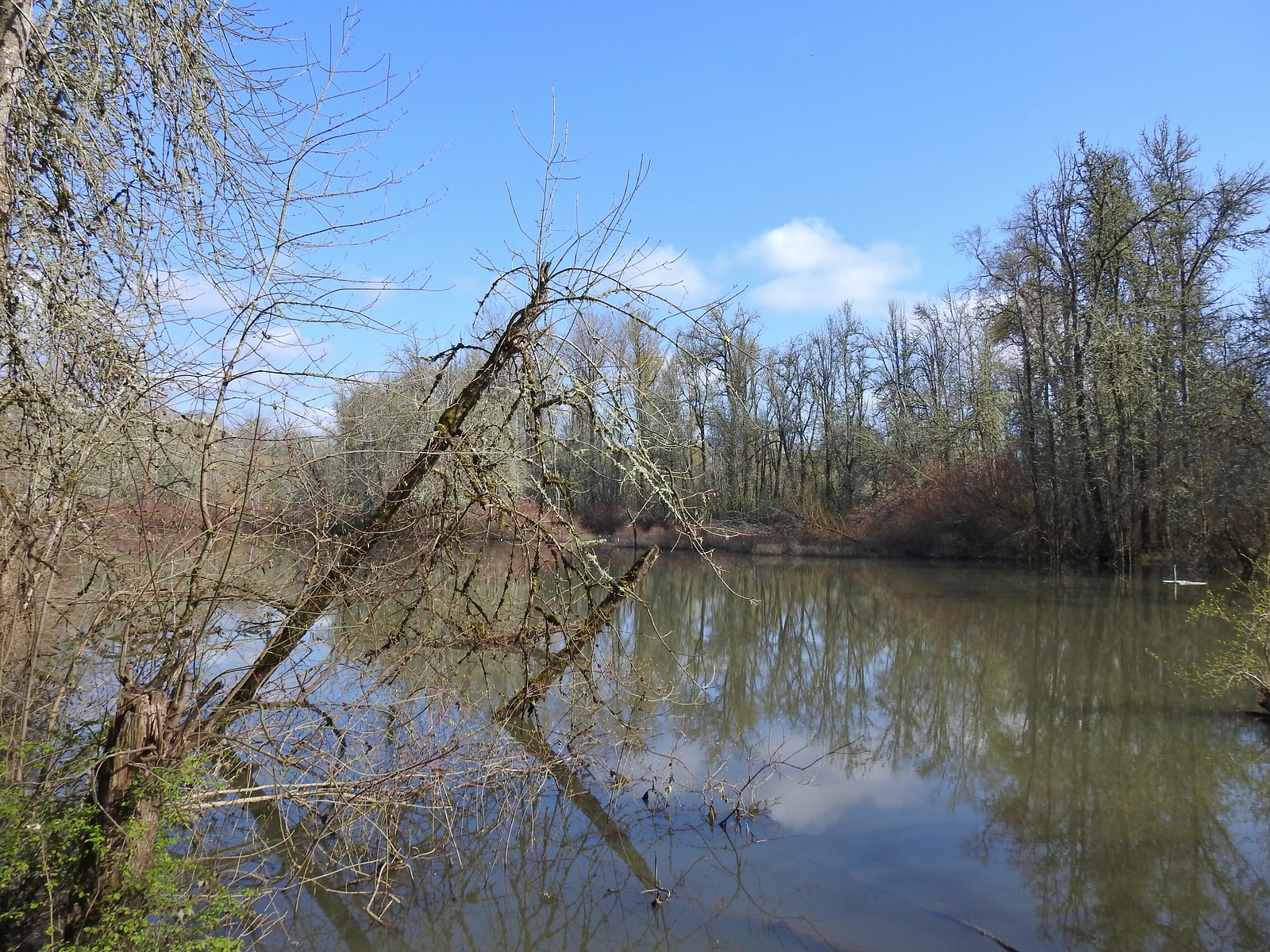
Oxbow Slough is accessible near Lot 3. Oxbow slough 3/19.
April 14th
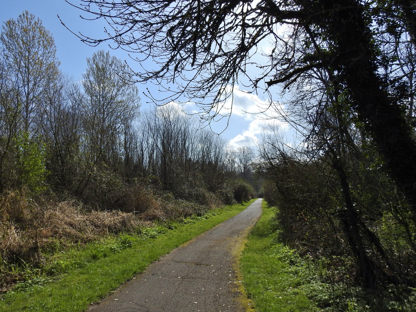
Just South of Lot 3 the paved path is shared by the 10k, Purple Rabbit, Blue Heron, Green Deer, Yellow Duck and Brown Squirrel Loops.
The footbridge over Oxbow Slough is part of the 10k, Blue Heron, and Purple Rabbit Loops.
The Blue Heron Loop ran parallel to the paved path and at times nearly touched. Blue Heron Loop running parallel to the 10k/Purple Rabbit Loops.
Field along the Blue Heron Loop
The biggest difference, and most of the extra mileage came when I continued straight toward the Brown’s Island Demolition Landfill when the Blue Heron Loop turned left. At the landfill I turned right and followed a gravel roadbed around it to the Orange Turtle Loop onto which I turned right following counterclockwise into Eola Bend County Park. The “T” junction where the 10k/Purple Rabbit Loops turn left from the Blue Heron Loop.
Most of the junctions are well signed with maps which helped keep me on track.
Willamette River from the Orange Turtle Loop.
Orange Turtle Loop
The boarder between Minto-Brown Island Park and Eola Bend County Park.
A bit of the history of Eola Bend County Park.
Nice map of the Willamette River watershed.
Eola Bend County Park
I took advantage of this picnic table to take a short break.
After completing the Orange Turtle Loop I went back along the landfill (Admittedly one of the least exciting things to experience on a hike.) passing the path I’d arrived at the landfill on and continued just over a tenth of a mile on the gravel road which brought me to the end of a paved road at the landfill. The landfill behind the map.
Arriving at the road.
I turned left here and in less than a tenth of a mile was back on the Purple Rabbit/10k Loop which uses a 0.3-mile section of the road. The 10k/Purple Rabbit Loop on the left.
I was now back on the route of our third visit and followed the Purple Rabbit/10k Loop just over a half mile to a junction with the Green Deer Loop, with a short detour to a bench along Oxbow Slough.
The Green Deer Loop junction.
I made my one mistake of the day here thinking that I could turn right (we’d gone left the week before) and do this loop. Just over 0.4-miles in though I came upon a small pond in the middle of the trail.
I backtracked to the Purple Rabbit/10k Loop and again followed our third visit route until coming to the Brown Squirrel/Yellow Duck/10k Loop where I turned right. This was the path we’d taken on our first visit to loop around the dog park. I followed the paved path around the South side of the park but then instead of staying on the trail the loops follow I hoped onto a rougher dirt path that paralleled it and followed that to Lot 2 where I hopped back onto the 10k Loop. The paved 10k/Yellow Duck/Brown Squirrel Loop.
The rougher dirt path.
The dog park (possibly the happiest place in Salem, at least for dogs).
The 10k Loop on the opposite side of the entrance road from Lot 2.
I deviated once more from our earlier visits when I left the 10k Loop just before it joins the Red Osprey Loop. I crossed that paved path and onto a faint dirt path that led past the Old Cherry Orchard. I followed this dirt path just under a half mile to the paved 5k/10k/Red Osprey/Brown Squirrel Loop where I turned right and climbed a small hill to the Minto Island Conservation Trail. From our 3/19 hike on the 10k Loop. The path running from left to right is the Red Osprey Loop. On this last trip I took the path on the left down to the sign below at the junction and continued straight.
At the sign heading toward the old cherry orchard.
The old cherry orchard.
Sign in the distance along the paved path where I turned right.
I turned left onto the Conservation Trail and returned to Riverfront Park to complete my hike.
Cherry blossoms.
One constant throughout all of the hikes was the abundant wildlife. Deer – 3/19
Bald eagle – 3/19
Cormorant on the Willamette – 3/25
Sparrow – 3/25
Lesser goldfinch – 4/8
Mallard – 4/8
Wood ducks up in a tree – 4/8
Osprey – 4/8
Green-winged teal – 4/14
Mallard – 4/14
Golden-crowned sparrow – 4/14
Robin – 4/14
White-crowned sparrow – 4/14
Squirrel – 4/14
Rabbit – 4/14 (This was one of several dozen bunnies that I encountered on this day.)
Woodpecker – 4/14
Lot 3 also had its share of wildlife. Scrub jay – 3/19
Dove – 4/8
Killdeer – 4/14
Red breasted sapsuckers – 4/14 (Males peck the sign to make noise to either attract mates or establish territory.)
Pied billed grebe in Oxbow Slough – 3/19
Ring-necked ducks from the bridge over Oxbow Slough – 3/25
Buffleheads from the bridge over Oxbow Slough – 3/25
Geese from the bridge over Oxbow Slough – 3/25
Hummingbird along the Blue Heron Trail – 4/14
Orange-crowned warbler along the Blue Heron Trail – 4/14
Dark-eyed junco at Eola Bend County Park – 4/14
Northern flicker at Eola Bend County Park – 4/14
Swallows at Eola Bend County Park – 4/14
Red-tailed hawk near the landfill – 4/14
Great blue heron at Oxbow Slough across from the bench viewpoint near Lot 4 (Homestead Road) – 4/14
Wood duck drake in Oxbow Slough – 4/8
Ruby-crowned kinglet – 4/8
Rabbit – 4/8
Egret between the Red Osprey and 10k Loops – 4/8
Turkey vulture near the old cherry orchard – 4/14
We’re lucky to have this park nearby and it seems crazy that we still haven’t checked out all of the trails yet. It at least gives us a reason, besides the abundant wildlife, to keep going back. That being said we are really looking forward to some more remote hiking in quieter forests. Happy Trails!


 The amphitheater and bridge on 3/19 23.
 The amphitheater and bridge on 4/14/23.
 Wetland near the bridge on 4/8.
 The wetland on 4/14.
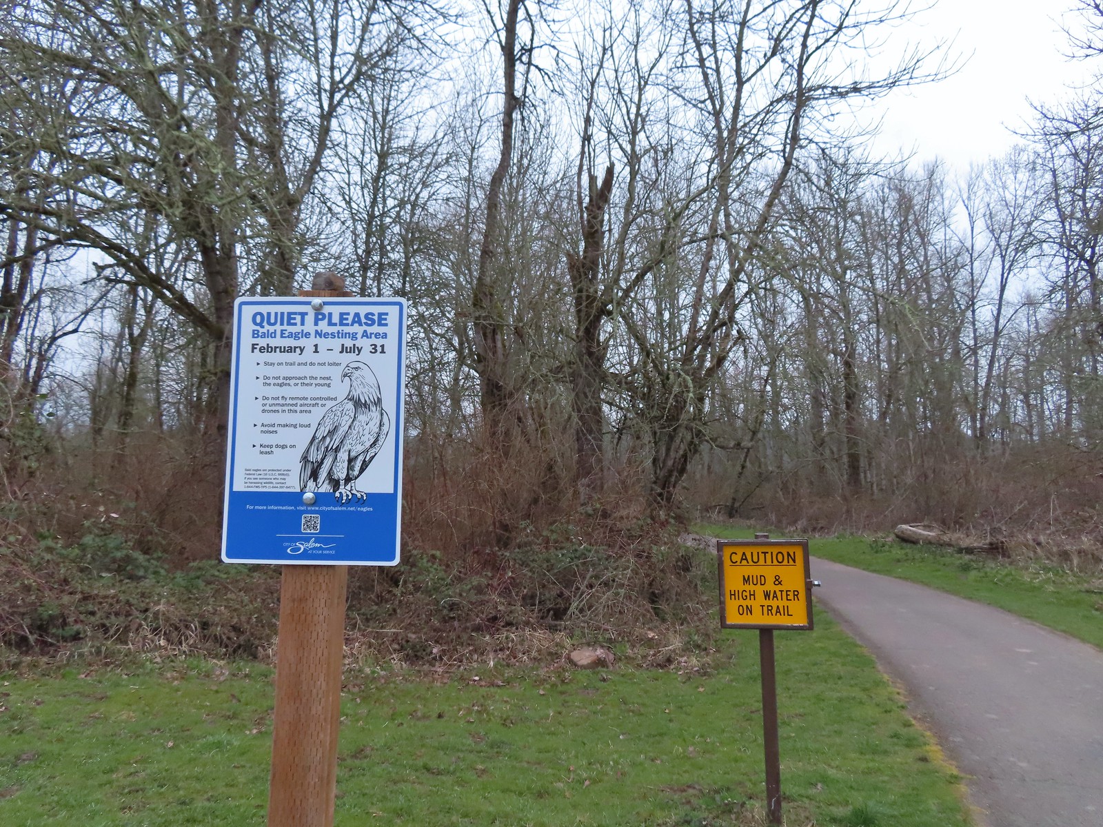 Signs at the 2nd junction – 3/19.
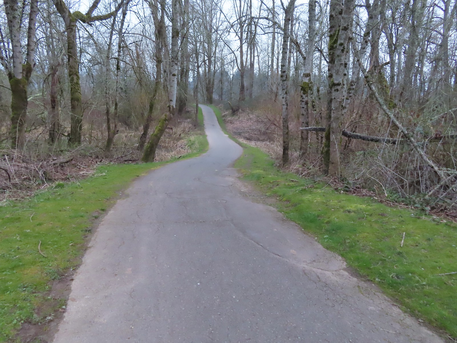 The path to the Willamette River on 3/19.
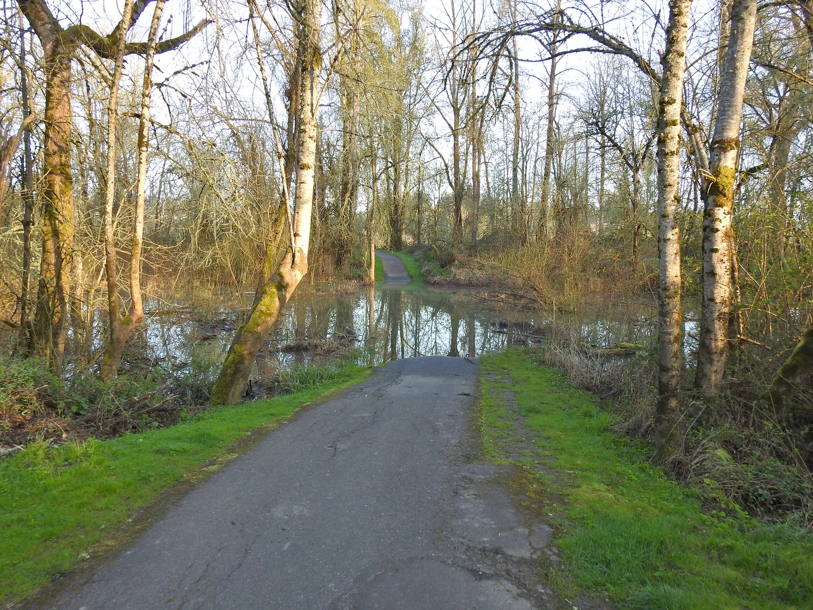 The path on 4/14.
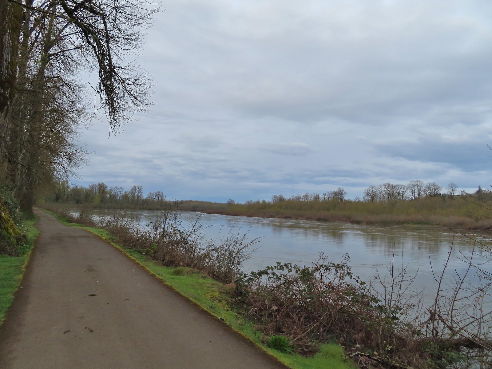 April 8th along the Willamette.
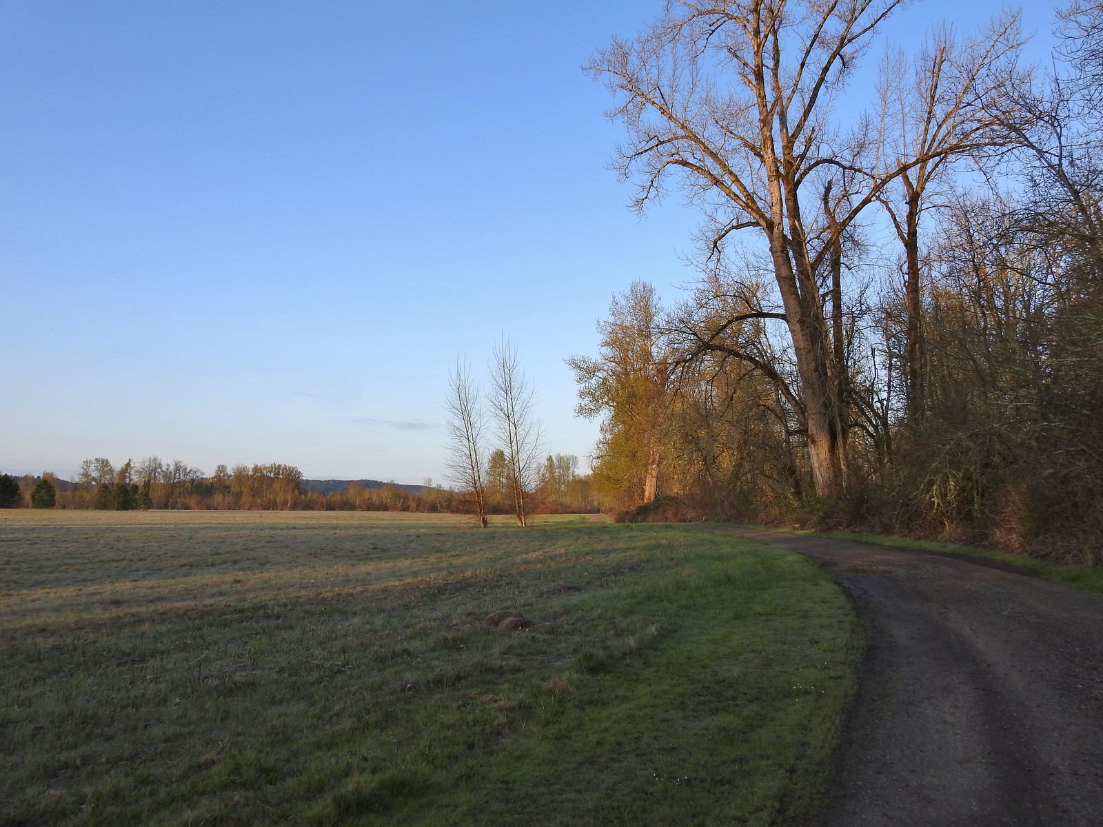 April 14th on the inland gravel path.
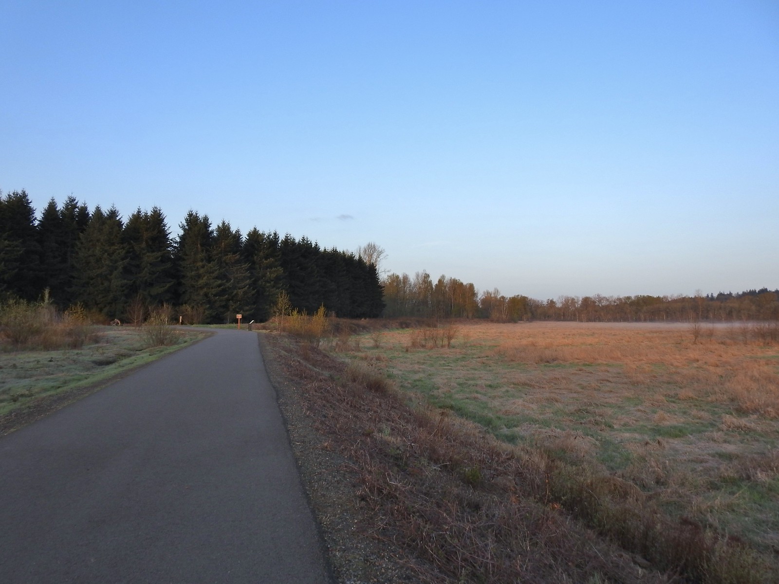 The Minto-Island Conservation Trail (Used during all four hikes.)
 Oxbow slough 3/19.
 April 14th
 Just South of Lot 3 the paved path is shared by the 10k, Purple Rabbit, Blue Heron, Green Deer, Yellow Duck and Brown Squirrel Loops.
 The footbridge over Oxbow Slough is part of the 10k, Blue Heron, and Purple Rabbit Loops.
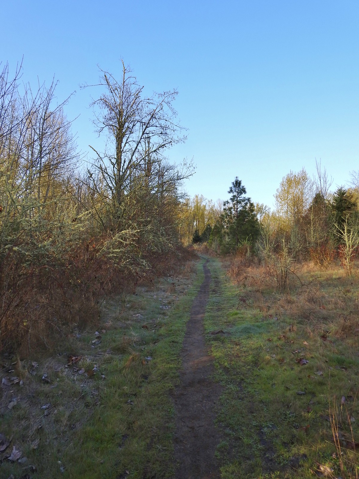 Blue Heron Loop running parallel to the 10k/Purple Rabbit Loops.
 Field along the Blue Heron Loop
 The “T” junction where the 10k/Purple Rabbit Loops turn left from the Blue Heron Loop.
 Most of the junctions are well signed with maps which helped keep me on track.
 Willamette River from the Orange Turtle Loop.
 Orange Turtle Loop
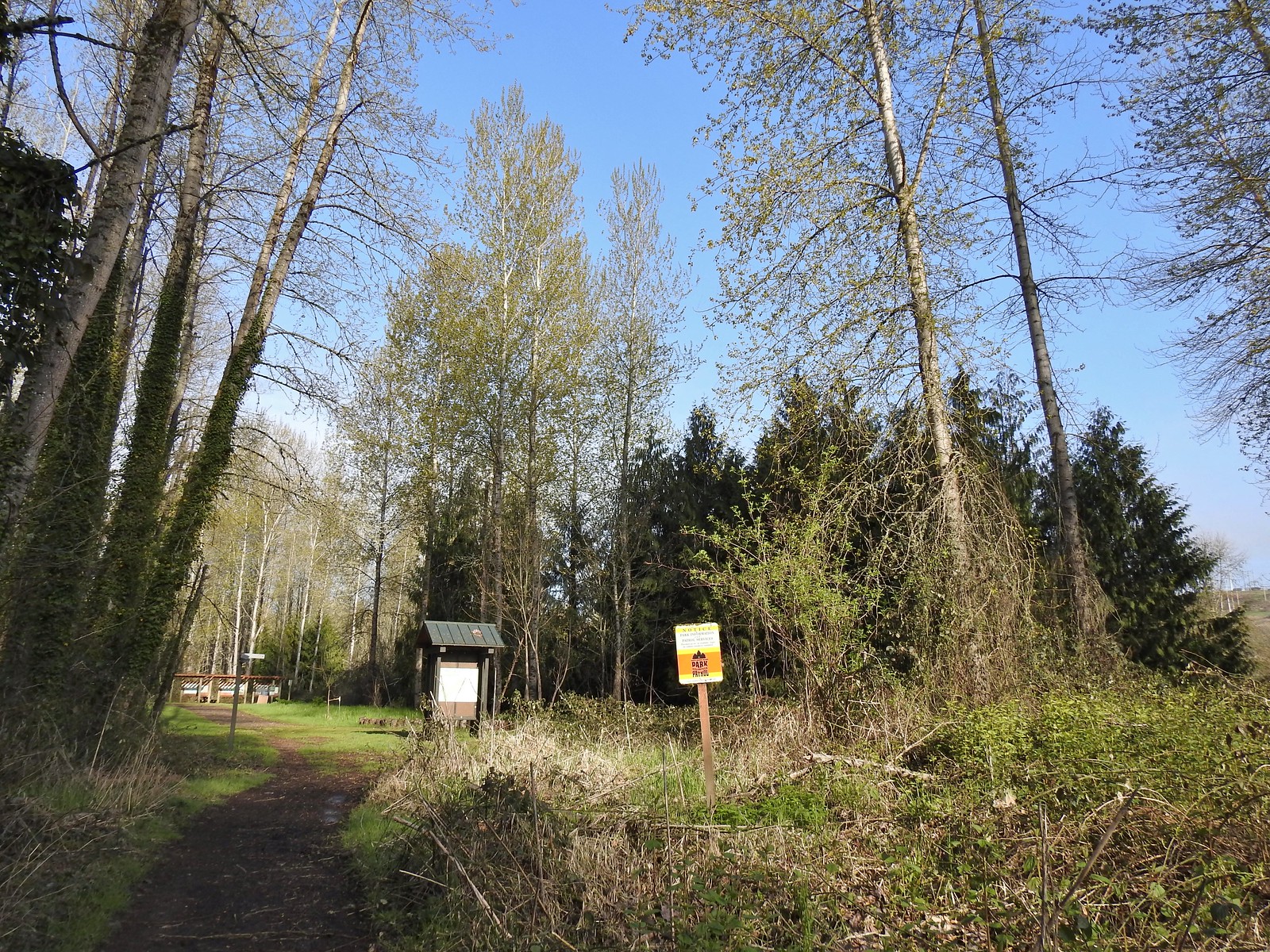 The boarder between Minto-Brown Island Park and Eola Bend County Park.
 A bit of the history of Eola Bend County Park.
 Nice map of the Willamette River watershed.
 Eola Bend County Park
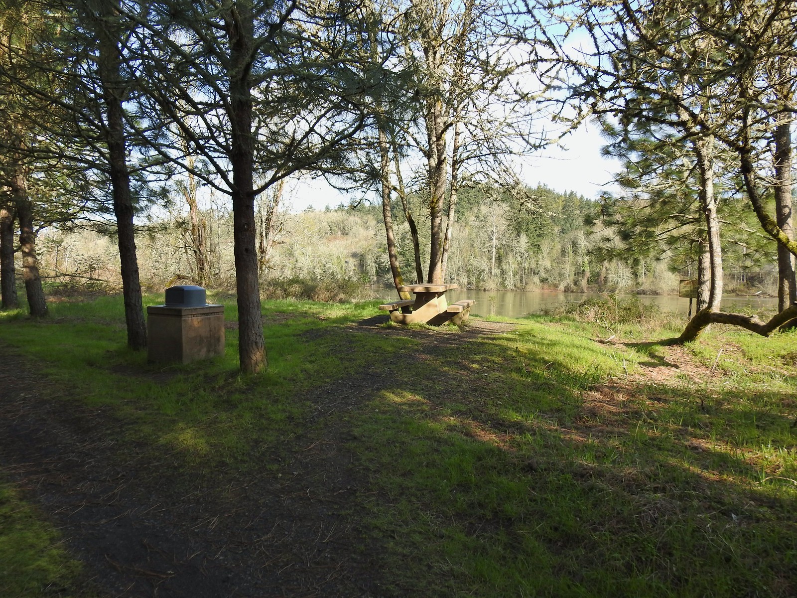 I took advantage of this picnic table to take a short break.
 The landfill behind the map.
 Arriving at the road.
 The 10k/Purple Rabbit Loop on the left.
 The Green Deer Loop junction.
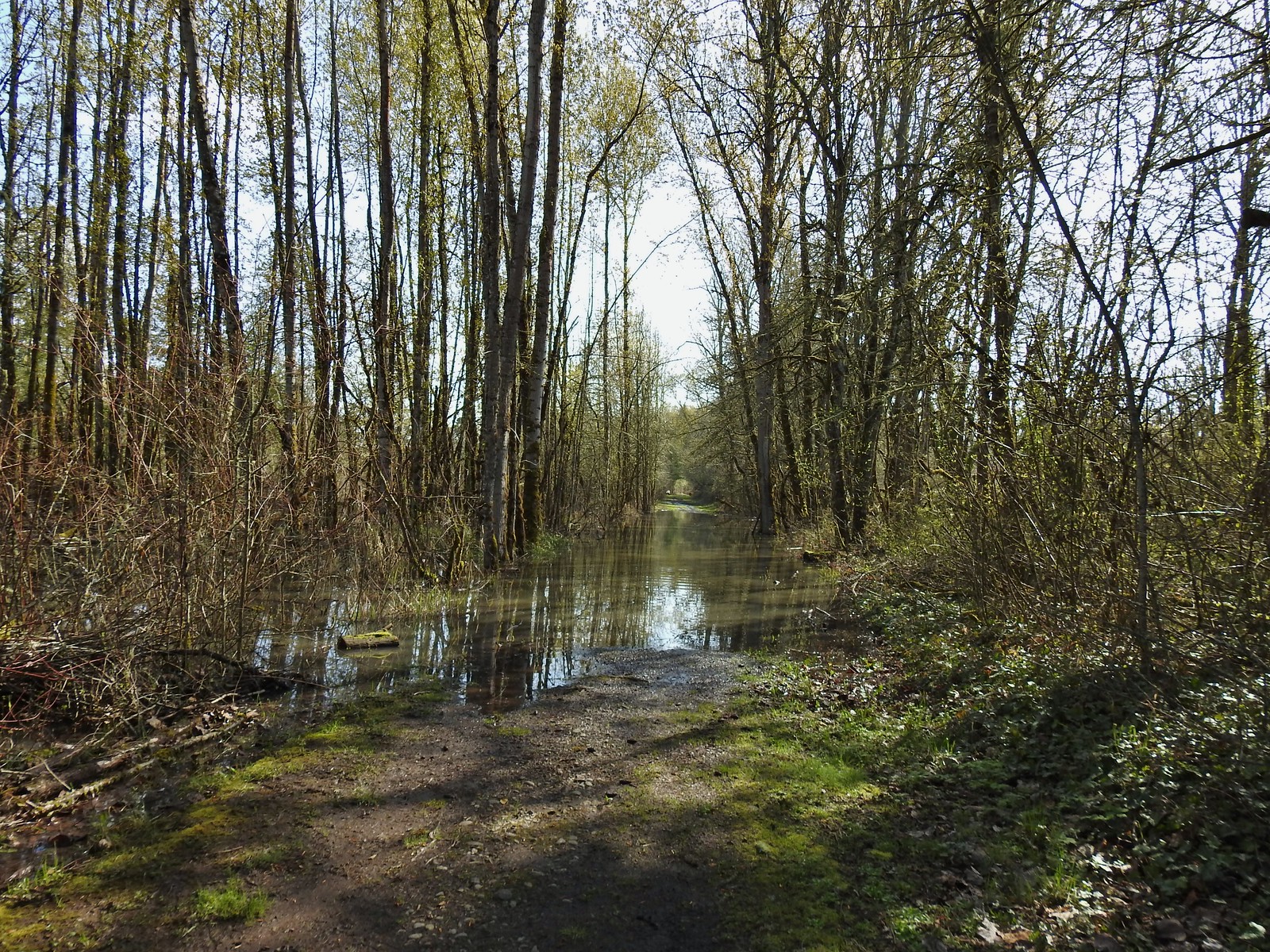
 The paved 10k/Yellow Duck/Brown Squirrel Loop.
 The rougher dirt path.
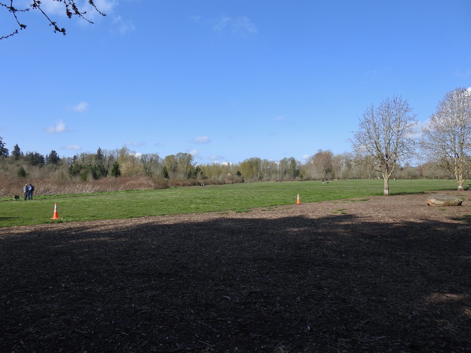 The dog park (possibly the happiest place in Salem, at least for dogs).
 The 10k Loop on the opposite side of the entrance road from Lot 2.
 From our 3/19 hike on the 10k Loop. The path running from left to right is the Red Osprey Loop. On this last trip I took the path on the left down to the sign below at the junction and continued straight.
 At the sign heading toward the old cherry orchard.
 The old cherry orchard.
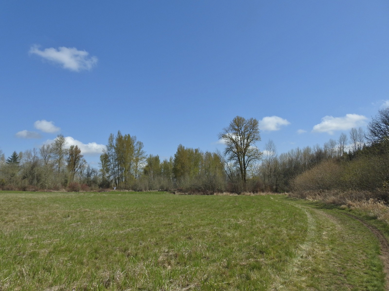 Sign in the distance along the paved path where I turned right.
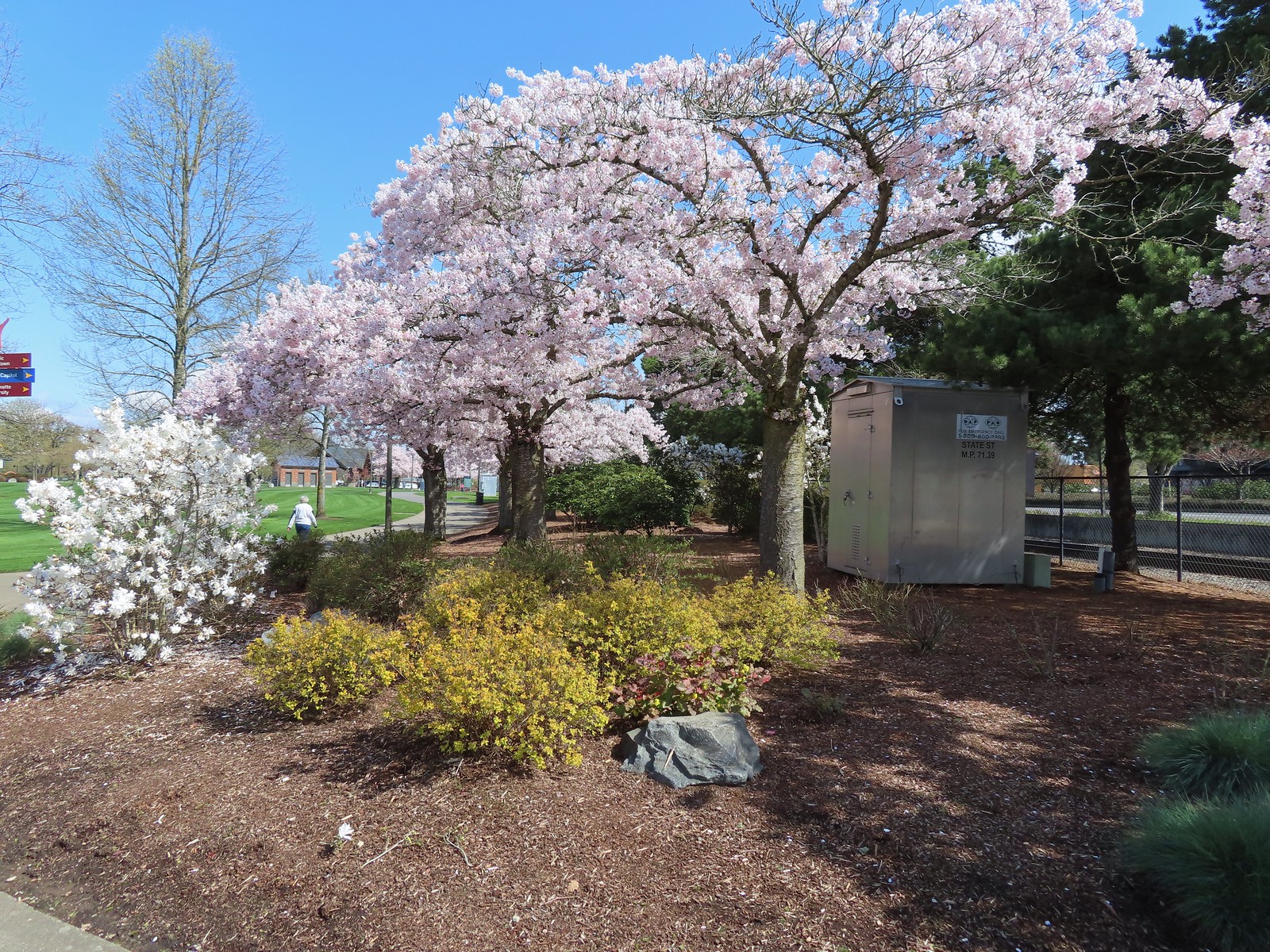 Cherry blossoms.
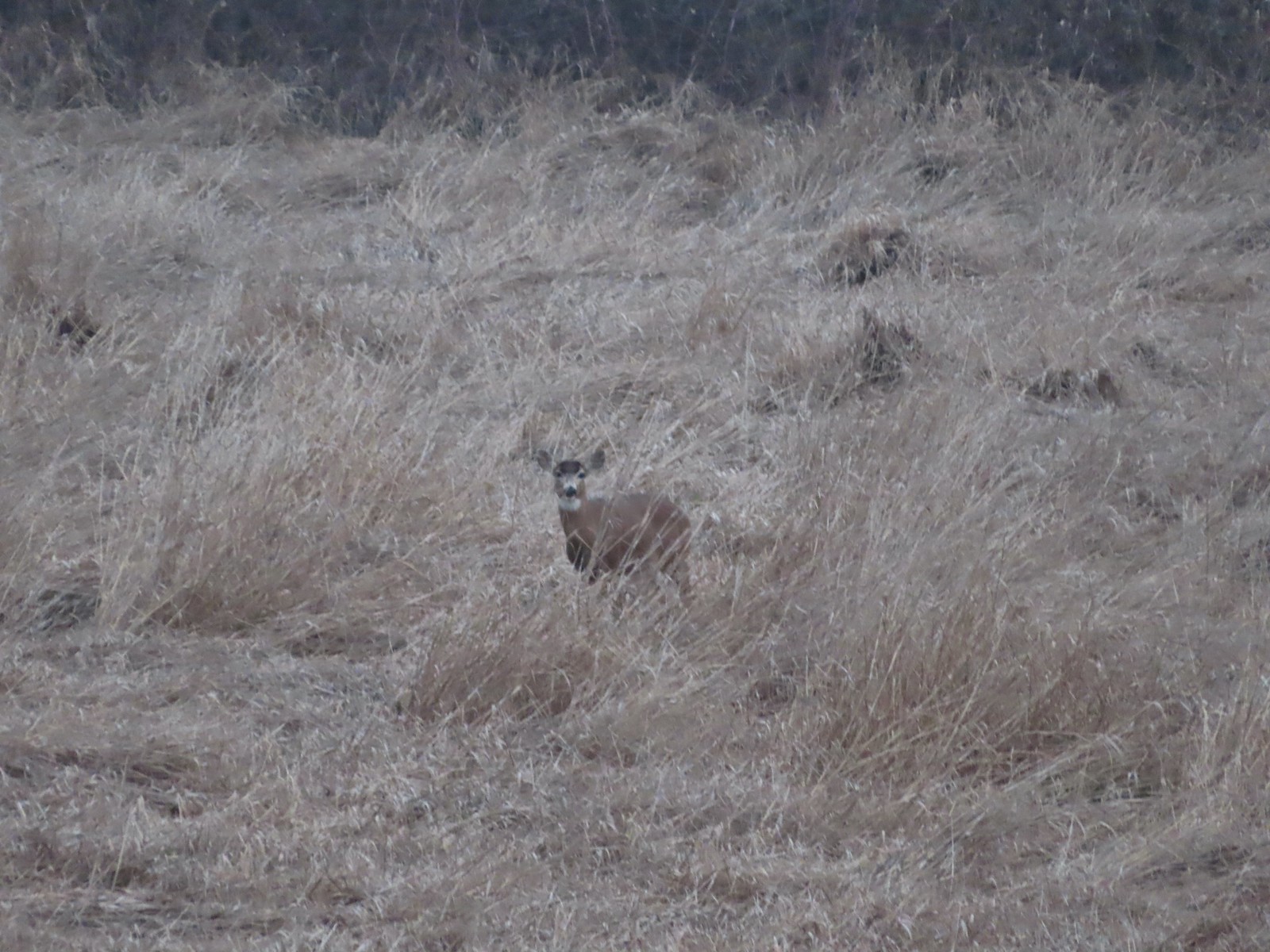 Deer – 3/19
 Bald eagle – 3/19
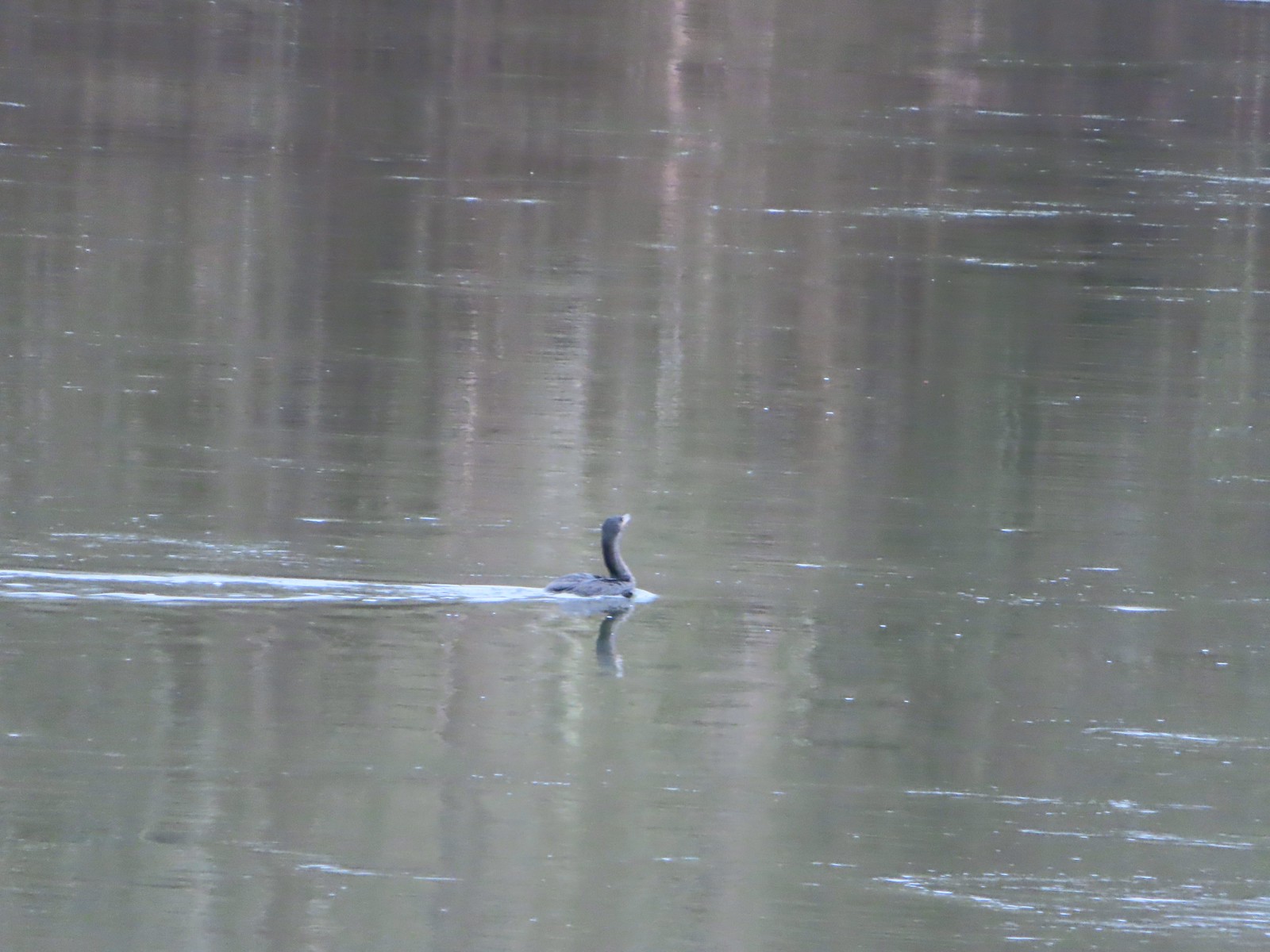 Cormorant on the Willamette – 3/25
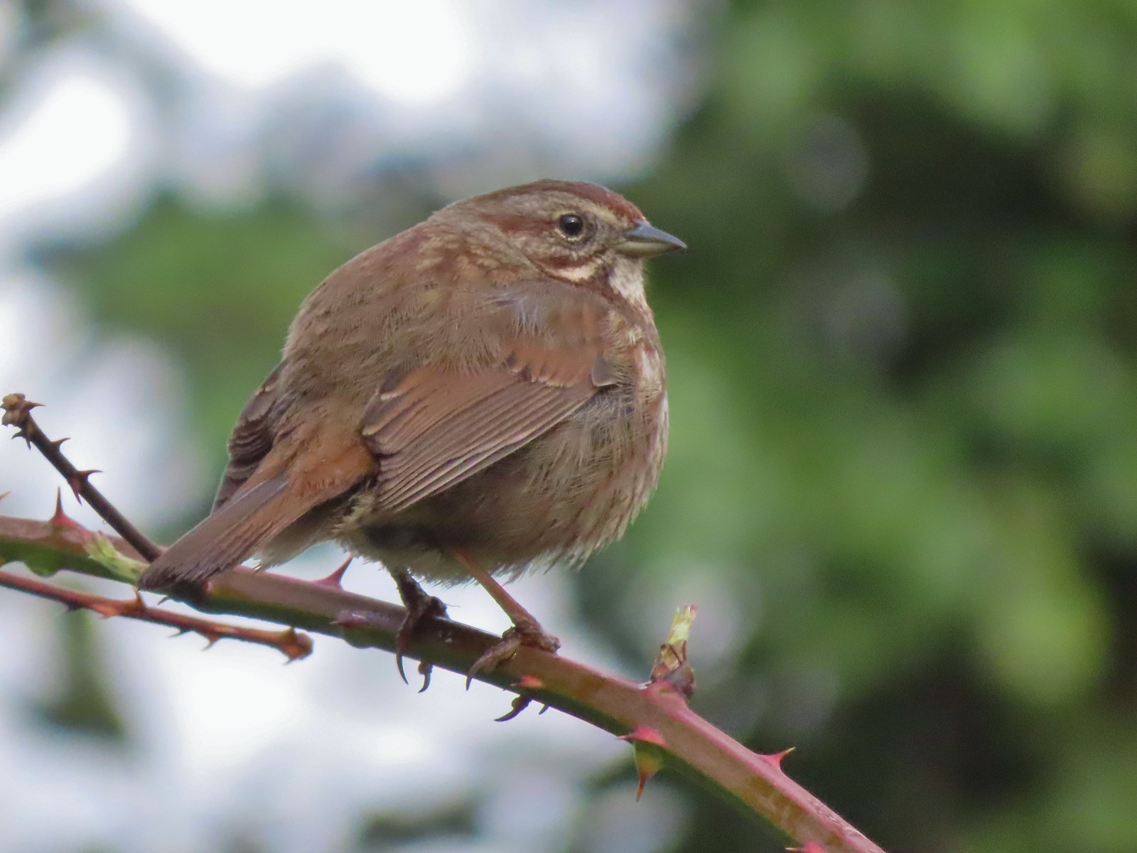 Sparrow – 3/25
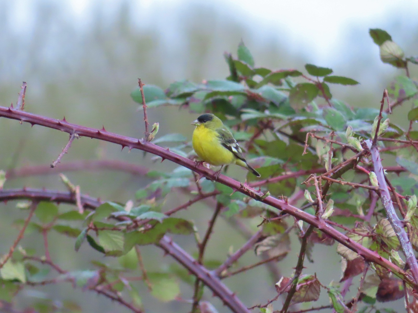 Lesser goldfinch – 4/8
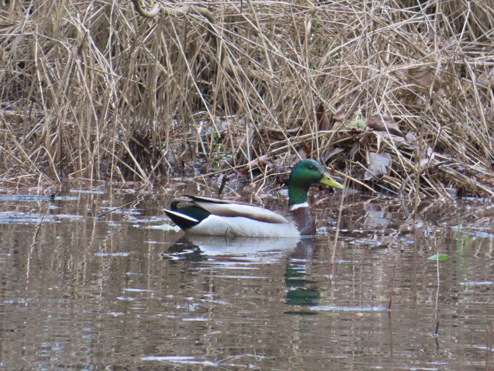 Mallard – 4/8
 Wood ducks up in a tree – 4/8
 Osprey – 4/8
 Green-winged teal – 4/14
 Mallard – 4/14
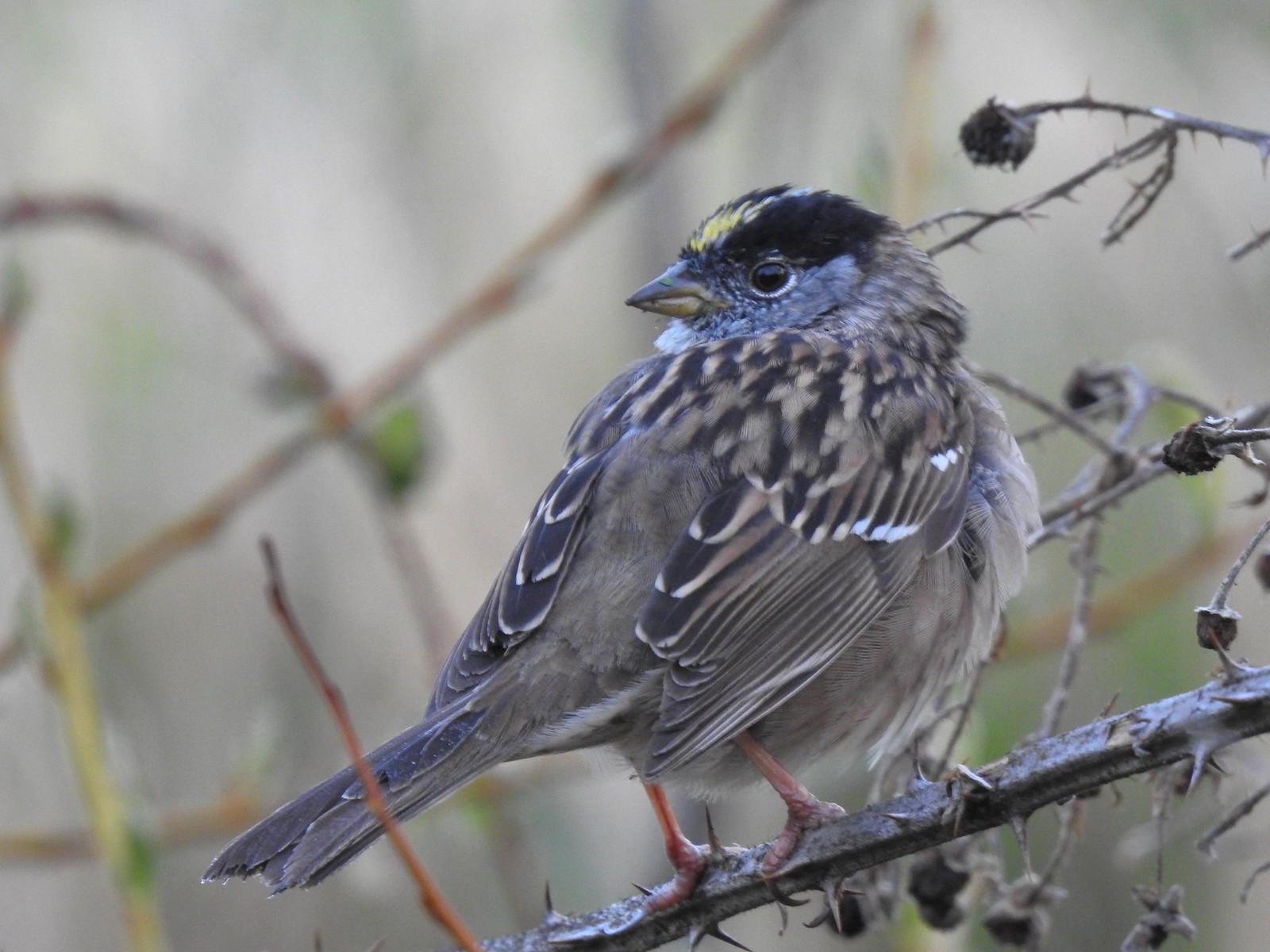 Golden-crowned sparrow – 4/14
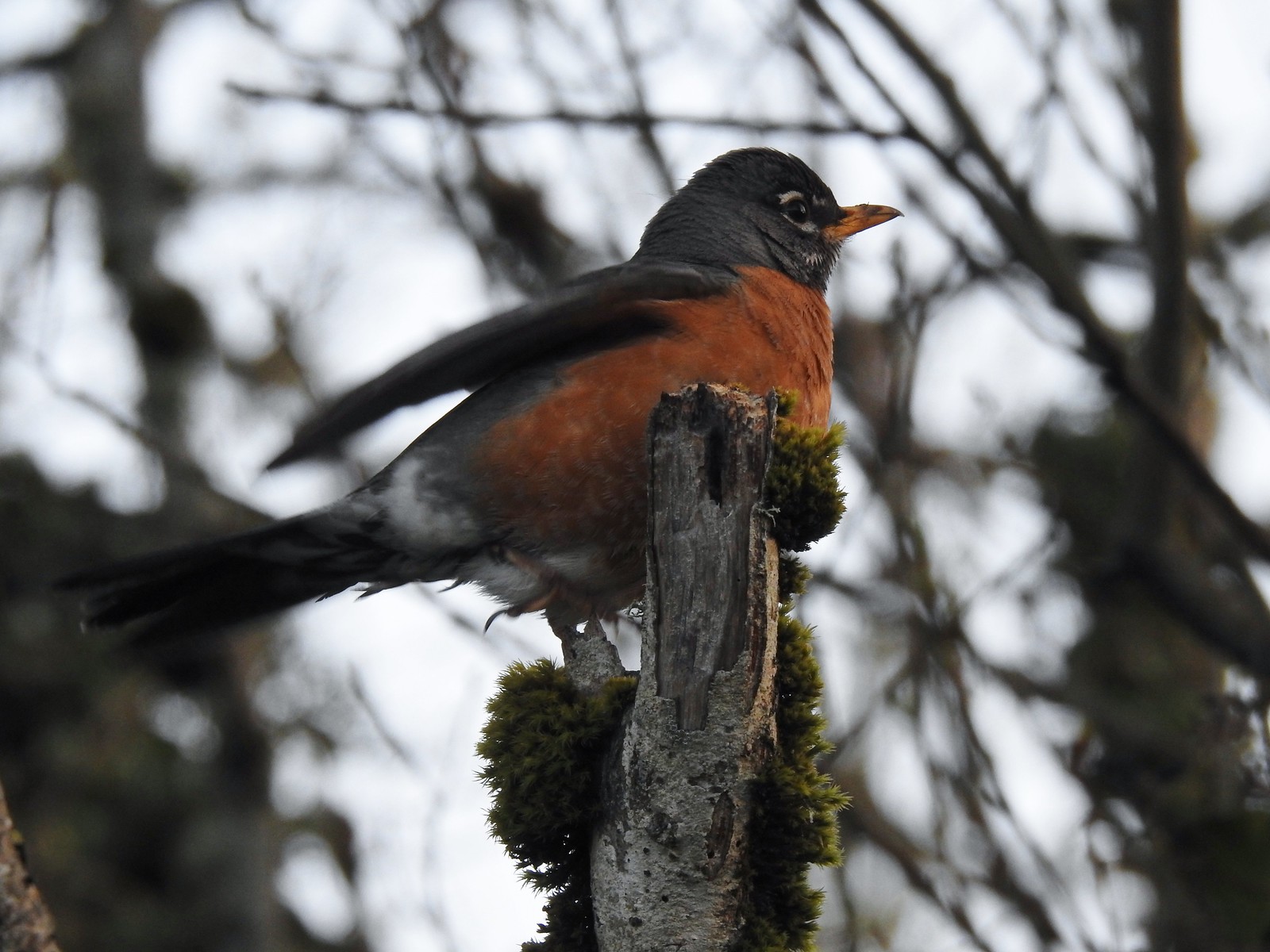 Robin – 4/14
 White-crowned sparrow – 4/14
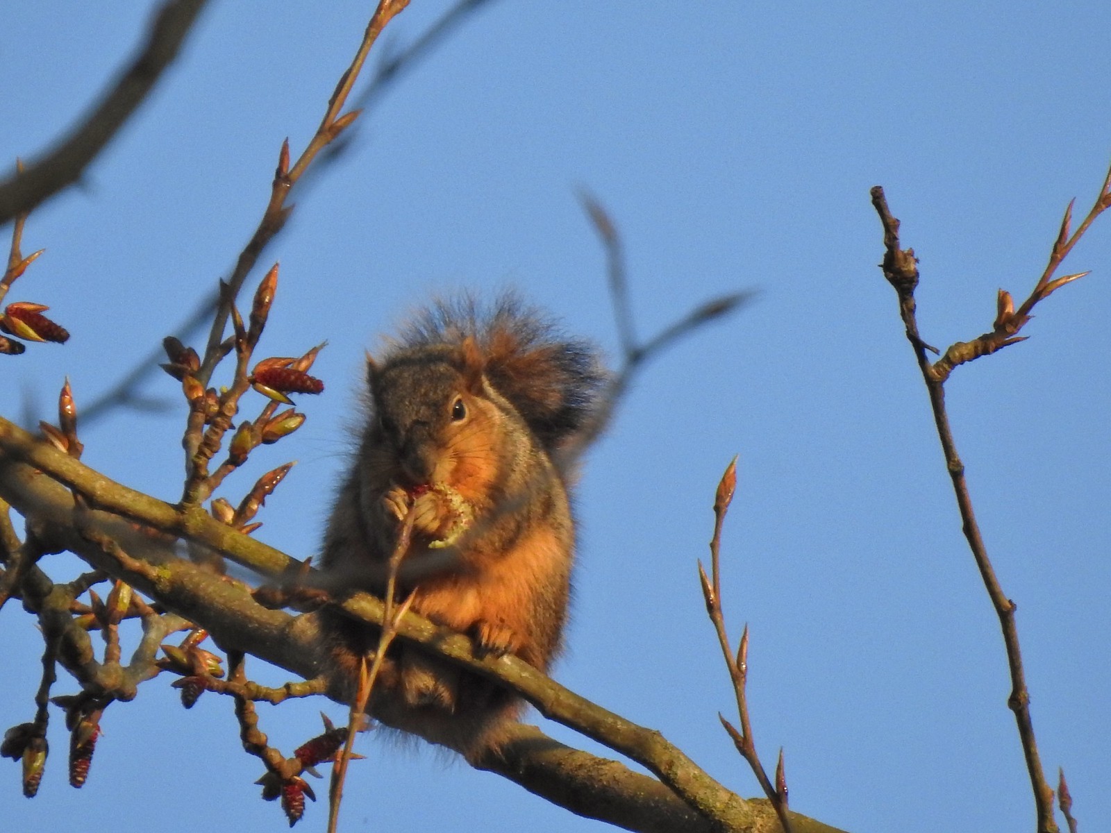 Squirrel – 4/14
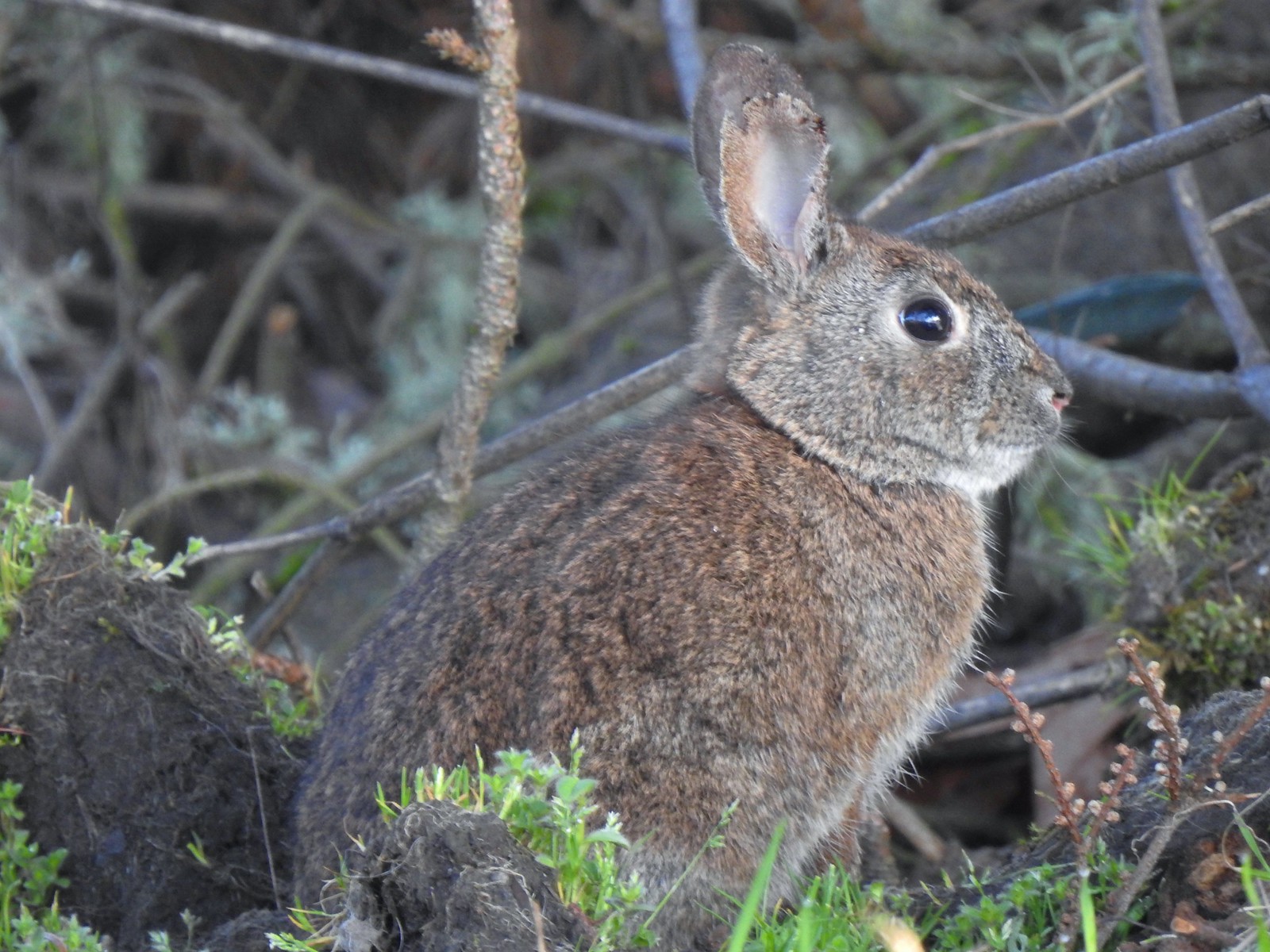 Rabbit – 4/14 (This was one of several dozen bunnies that I encountered on this day.)
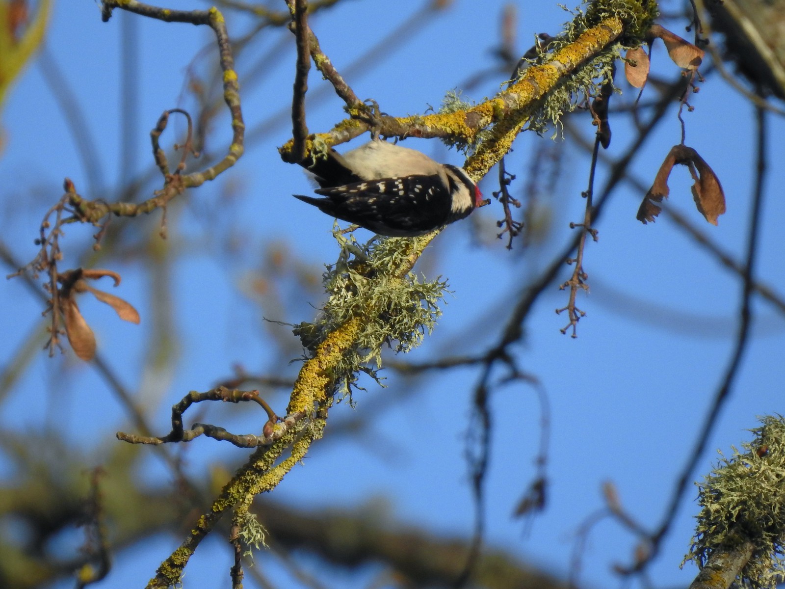 Woodpecker – 4/14
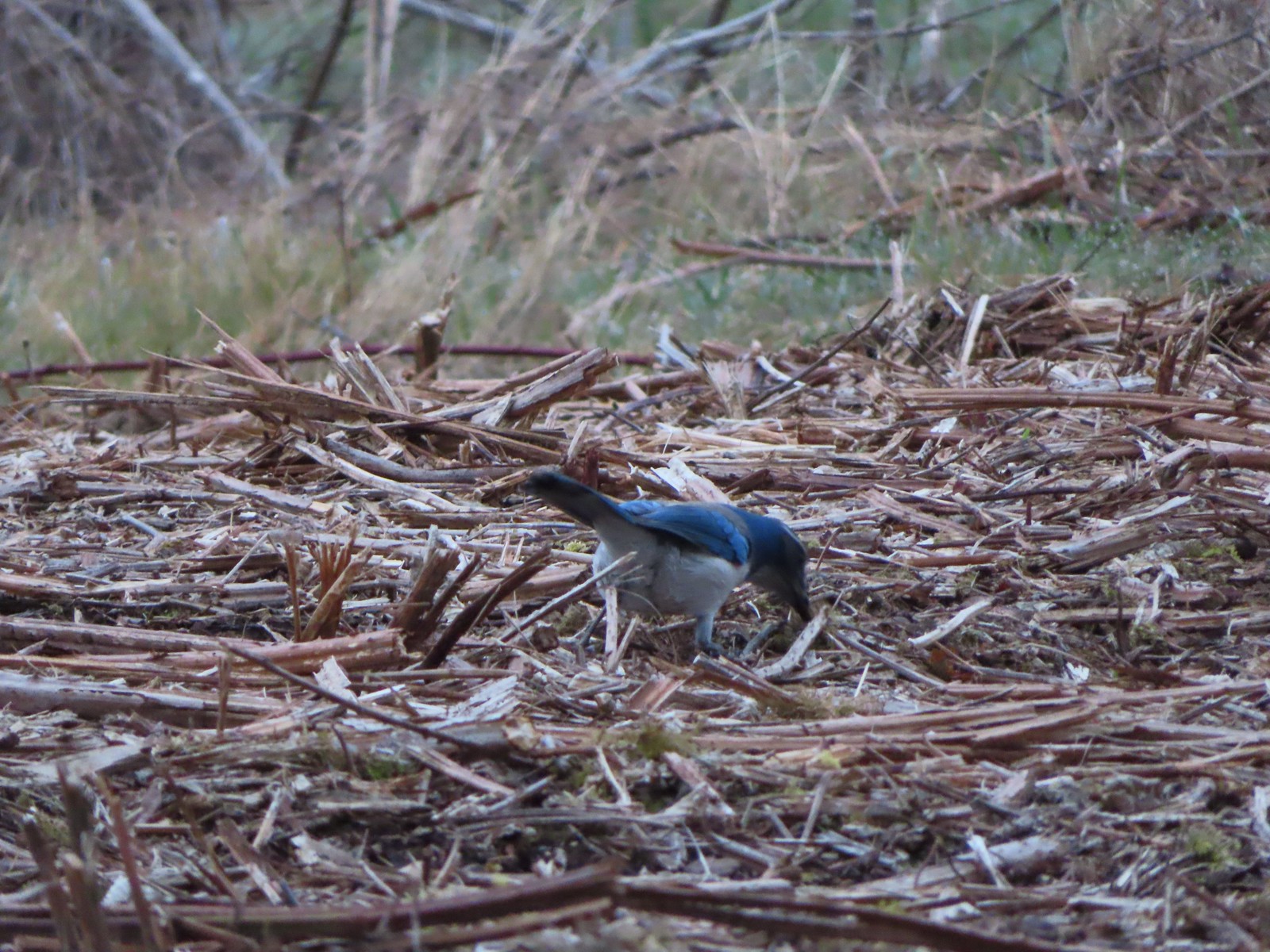 Scrub jay – 3/19
 Dove – 4/8
 Killdeer – 4/14
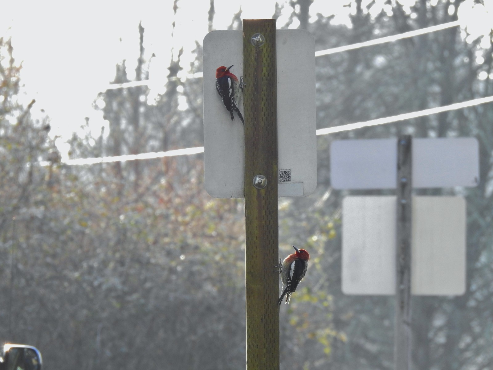 Red breasted sapsuckers – 4/14 (Males peck the sign to make noise to either attract mates or establish territory.)
 Pied billed grebe in Oxbow Slough – 3/19
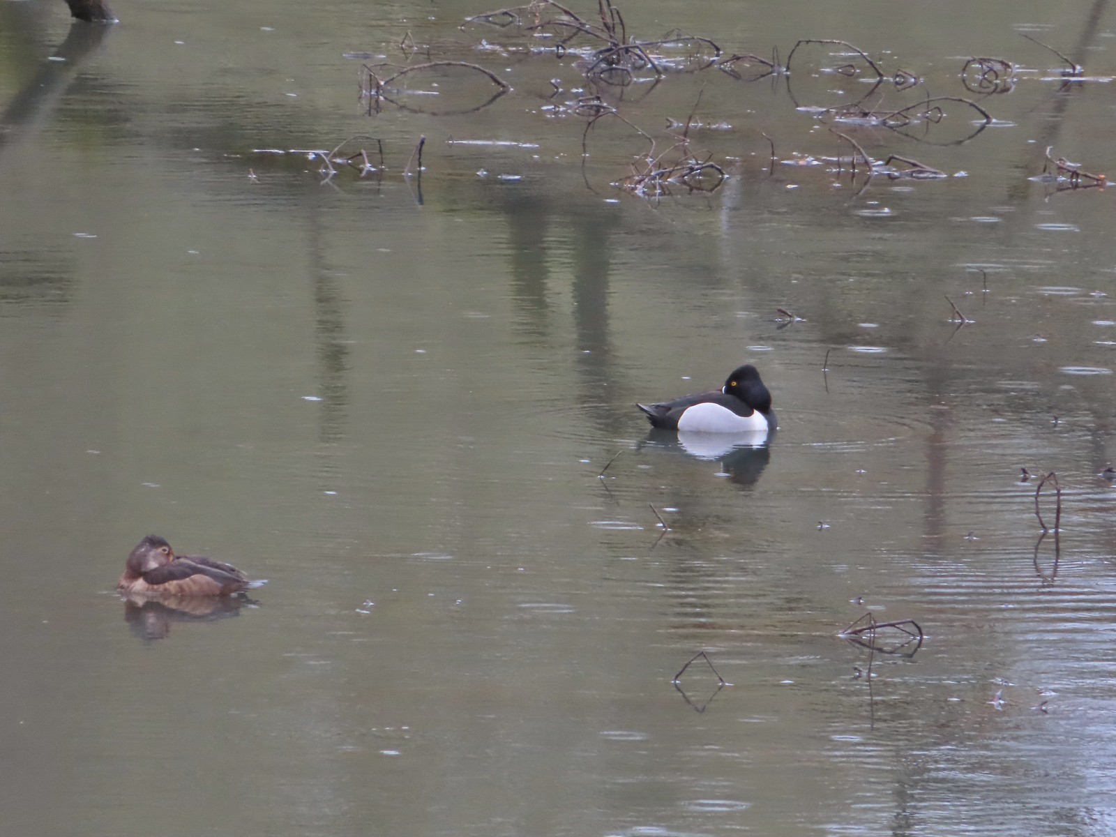 Ring-necked ducks from the bridge over Oxbow Slough – 3/25
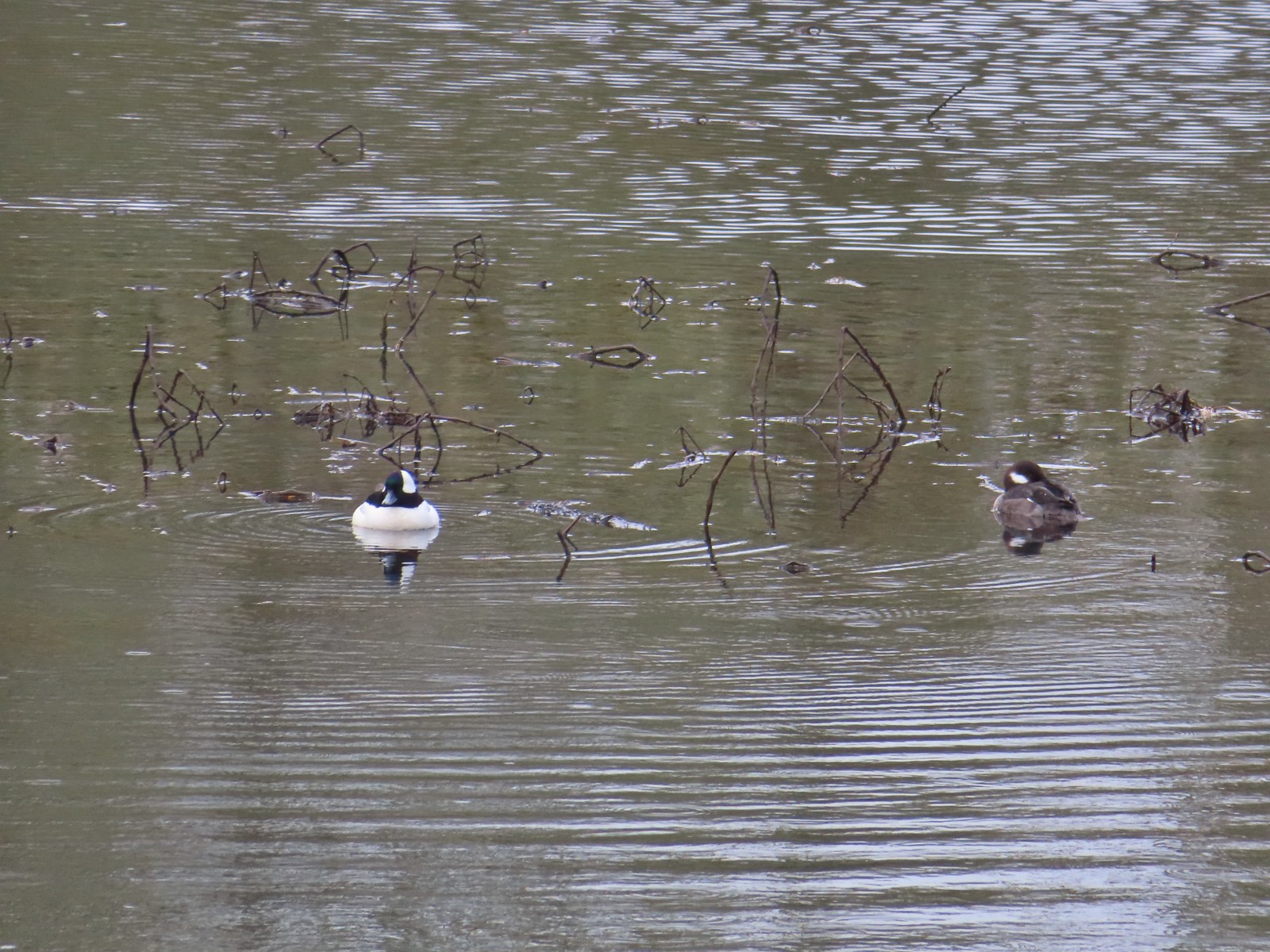 Buffleheads from the bridge over Oxbow Slough – 3/25
 Geese from the bridge over Oxbow Slough – 3/25
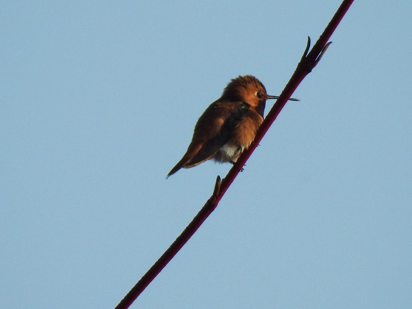 Hummingbird along the Blue Heron Trail – 4/14
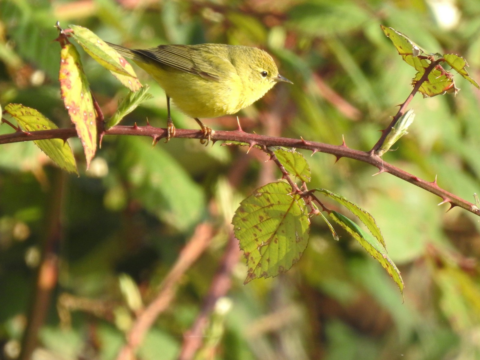 Orange-crowned warbler along the Blue Heron Trail – 4/14
 Dark-eyed junco at Eola Bend County Park – 4/14
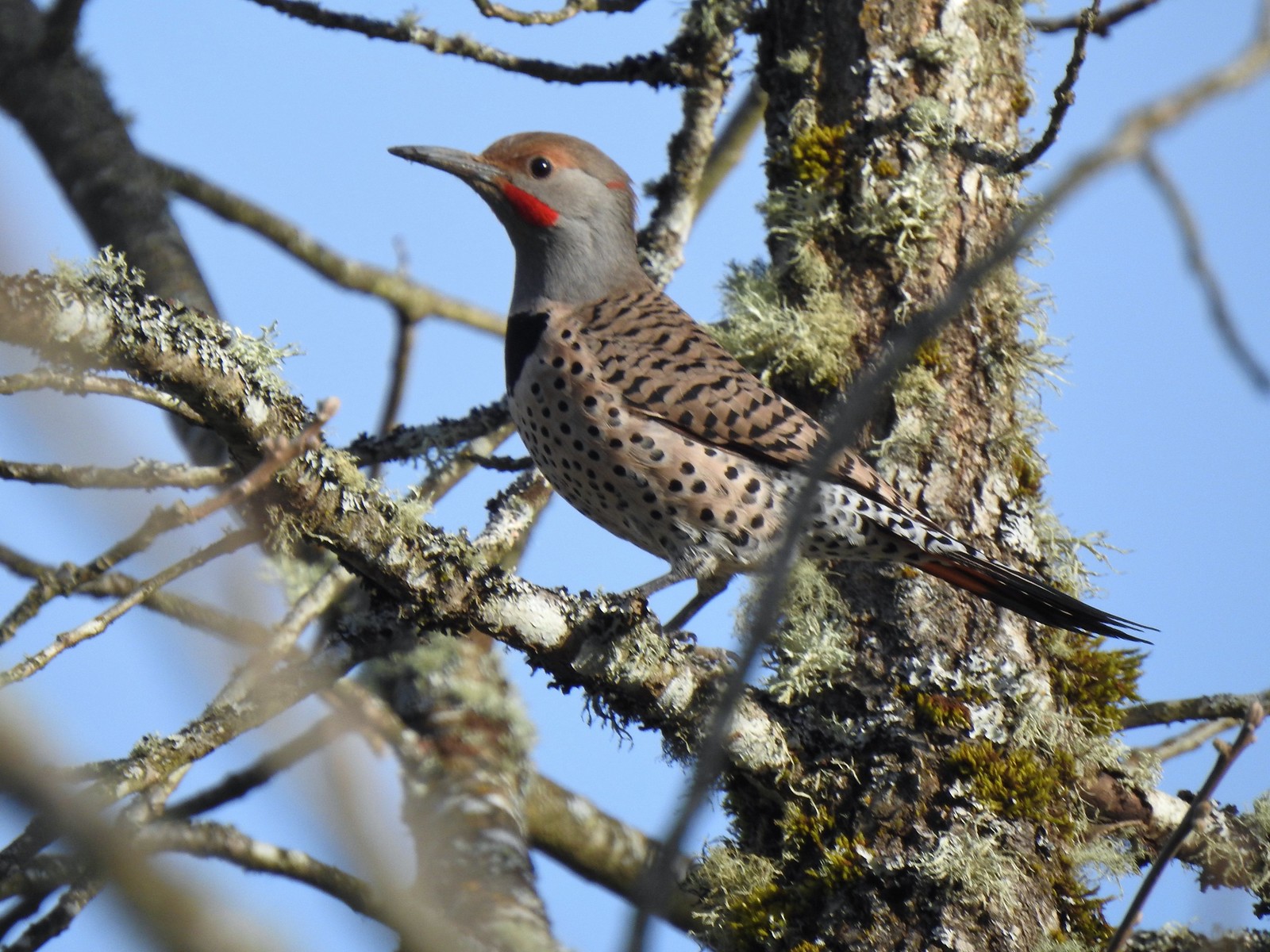 Northern flicker at Eola Bend County Park – 4/14
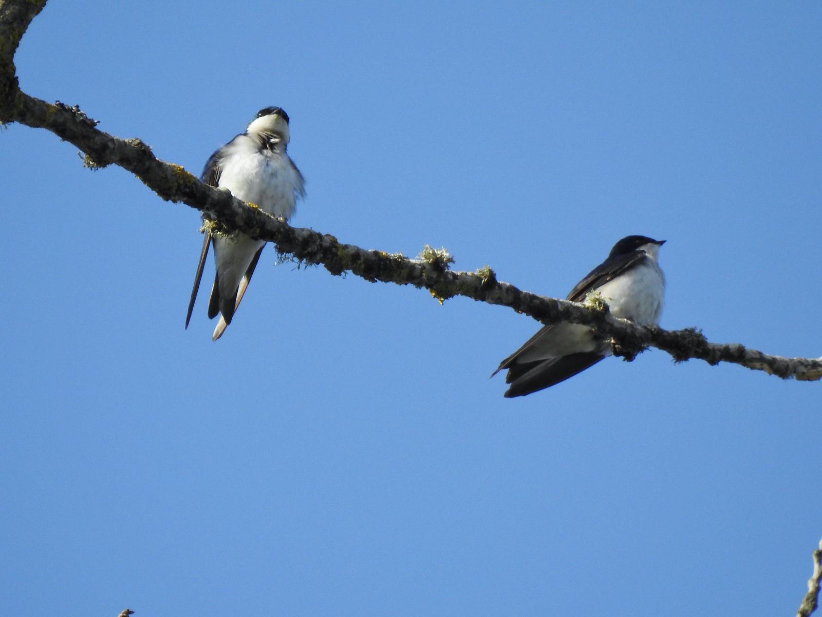 Swallows at Eola Bend County Park – 4/14
 Red-tailed hawk near the landfill – 4/14
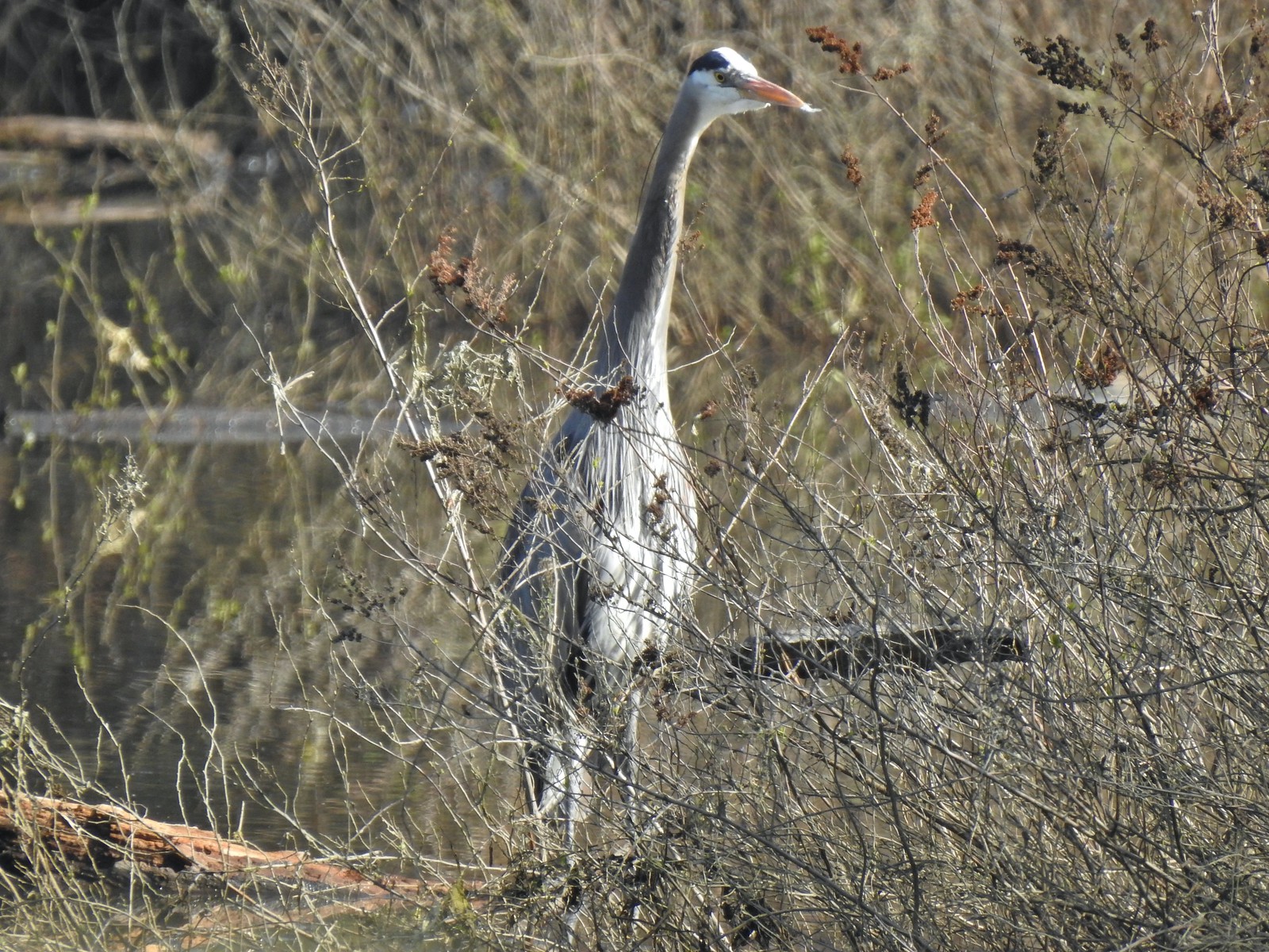 Great blue heron at Oxbow Slough across from the bench viewpoint near Lot 4 (Homestead Road) – 4/14
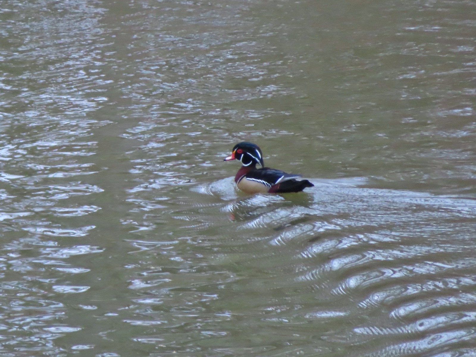 Wood duck drake in Oxbow Slough – 4/8
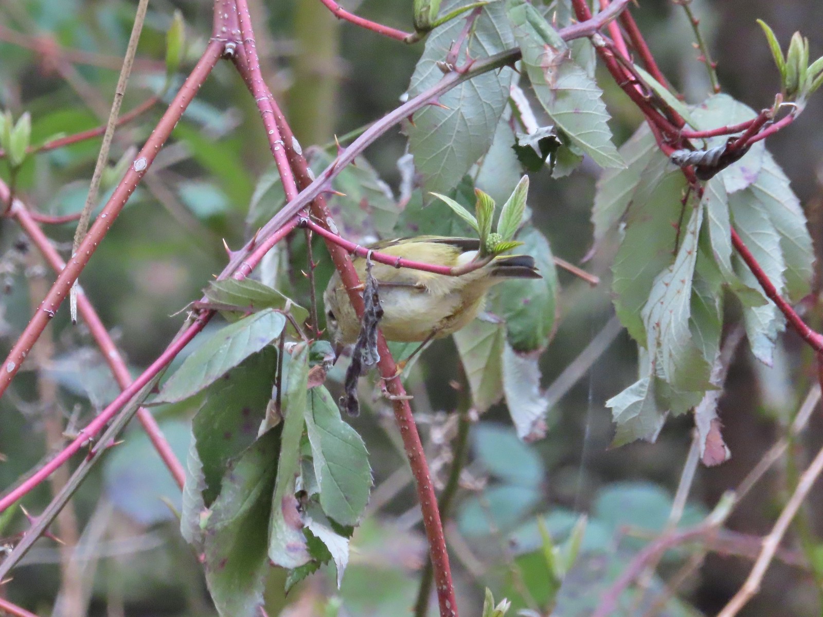 Ruby-crowned kinglet – 4/8
 Rabbit – 4/8
 Egret between the Red Osprey and 10k Loops – 4/8
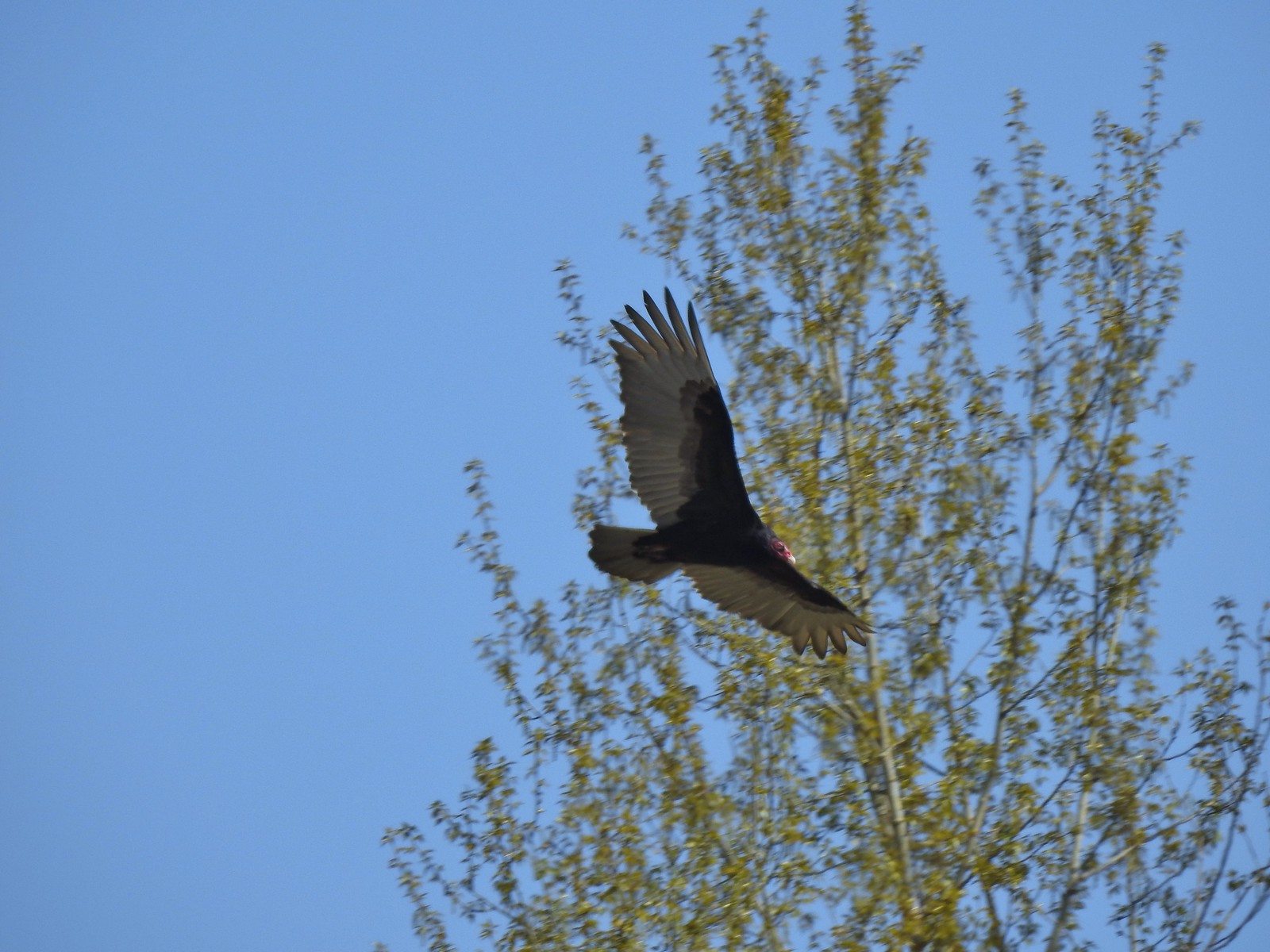 Turkey vulture near the old cherry orchard – 4/14
