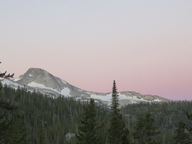
All good things must come to an end and it was time for our visit to the Eagle Cap Wilderness to end on the fifth day. We were up before 5am and were rewarded with a soft alpenglow.
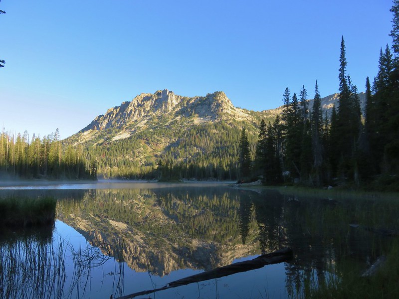
We ate some breakfast, packed up, and then made our way down to Horseshoe Lake.
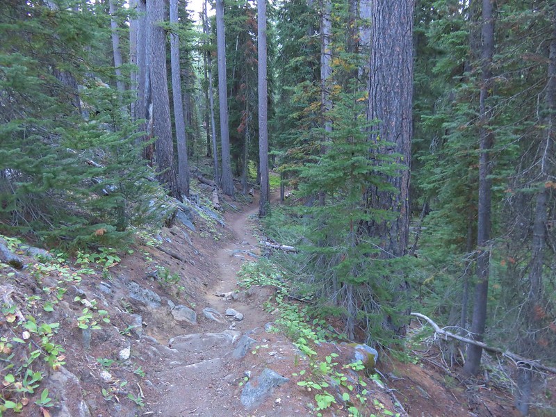
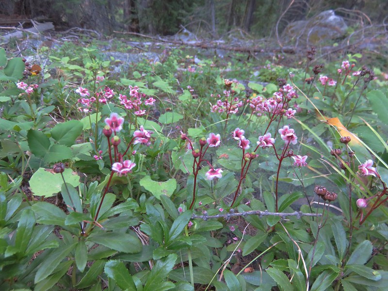
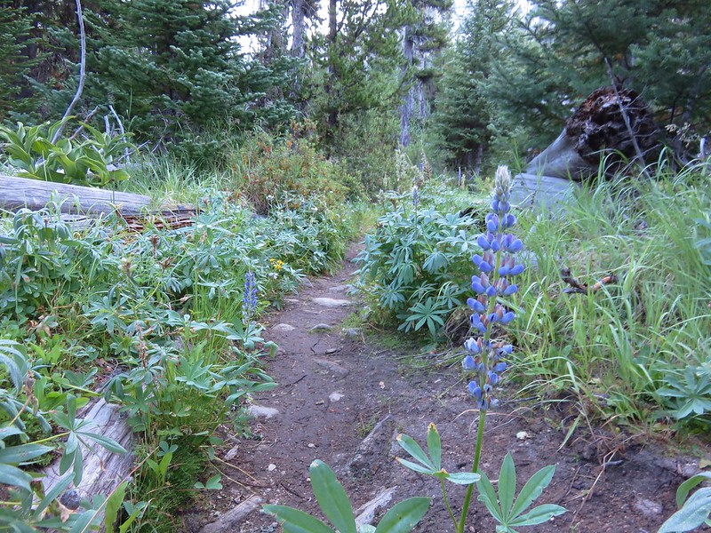
We then began a 3 mile descent to Sixmile Meadow along the West Fork Wallowa River. The trail up the river to Frazier Lake had been lined with wildflower meadows but this trail passed through a forest.
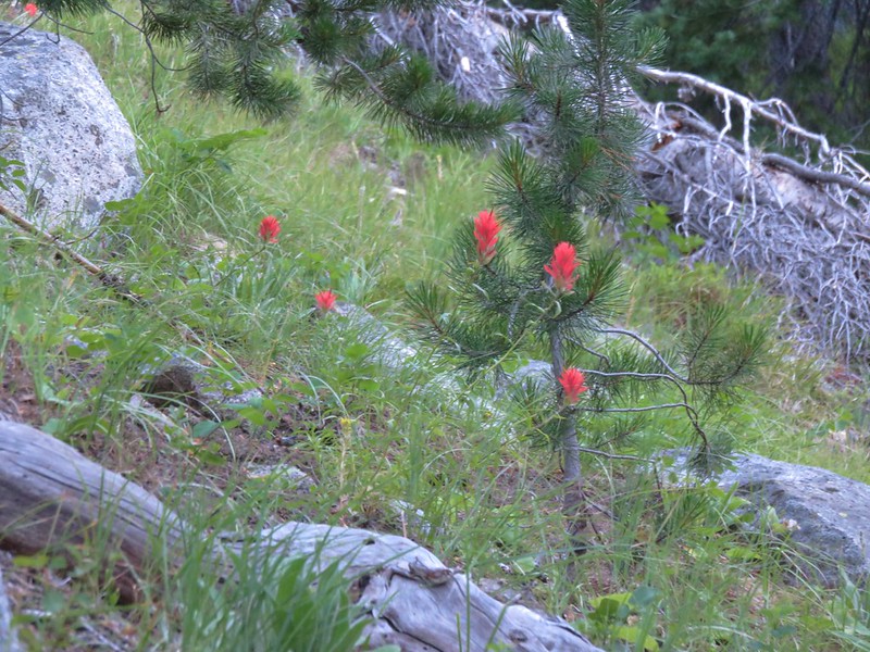
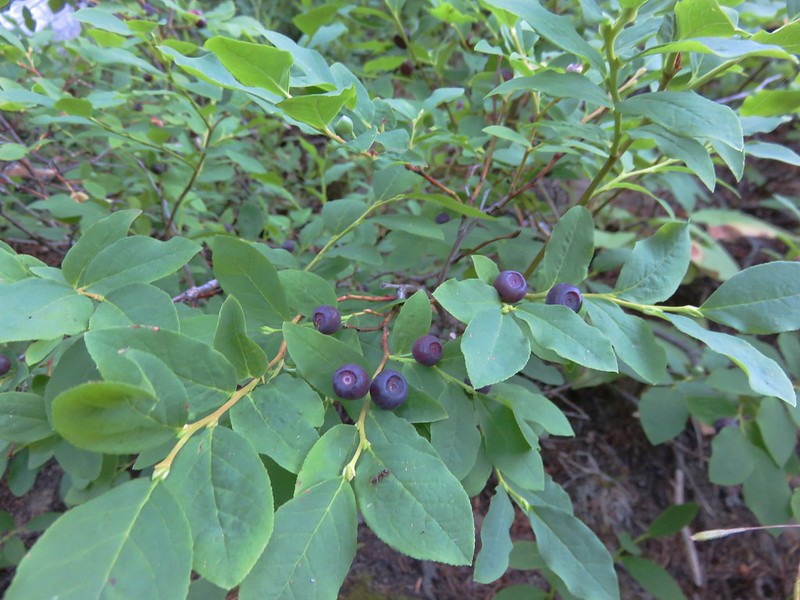
A few flowers were present as well as some ripe oval leaf blueberries.
Prince’s pine
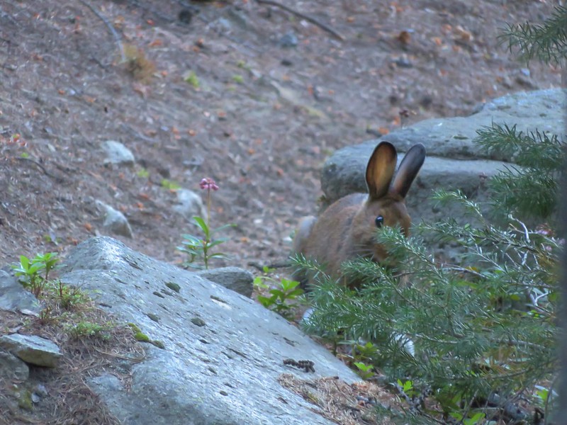
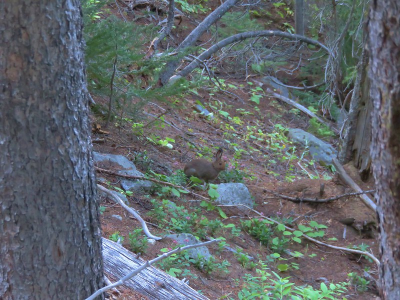
We had been discussing the fact that we hadn’t seen quite as much wildlife as we thought we might. A doe and her fawn had walked right past our tent on the first night and we’d seen a pair of mountain goats on the second day while heading up to the Matterhorn, but otherwise it had been a lot of birds, chipmunks and squirrels. As we came around a switchback we spotted a snowshoe hare.
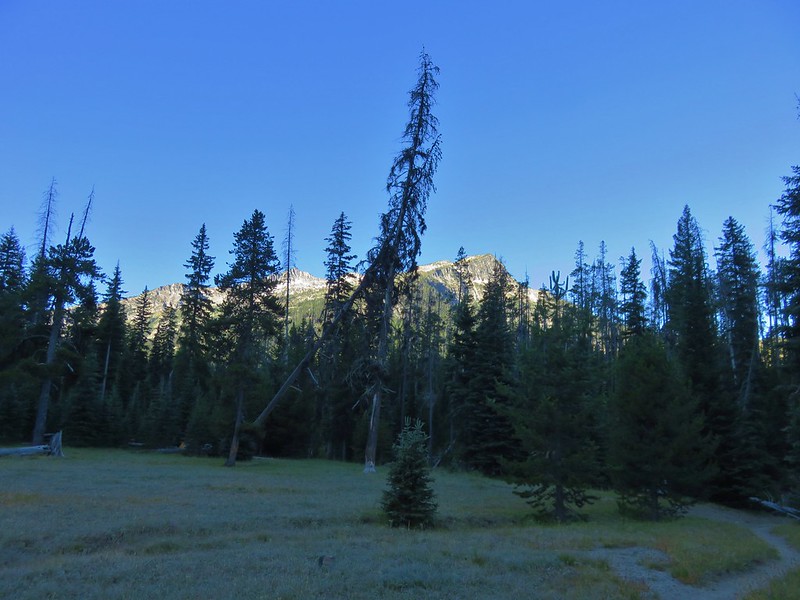
The trail leveled out as we neared Sixmile Meadow and the temperature dropped. A light frost covered the plants along the path.
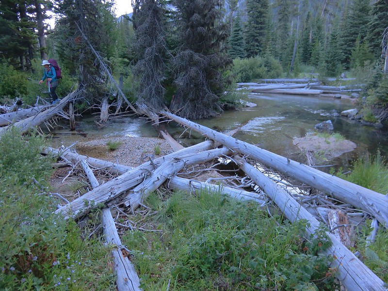
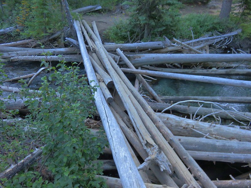
Logs allowed us to cross 2 branches of the river.
We passed through Sixmile Meadow before turning left on the West Fork Wallowa Trail.
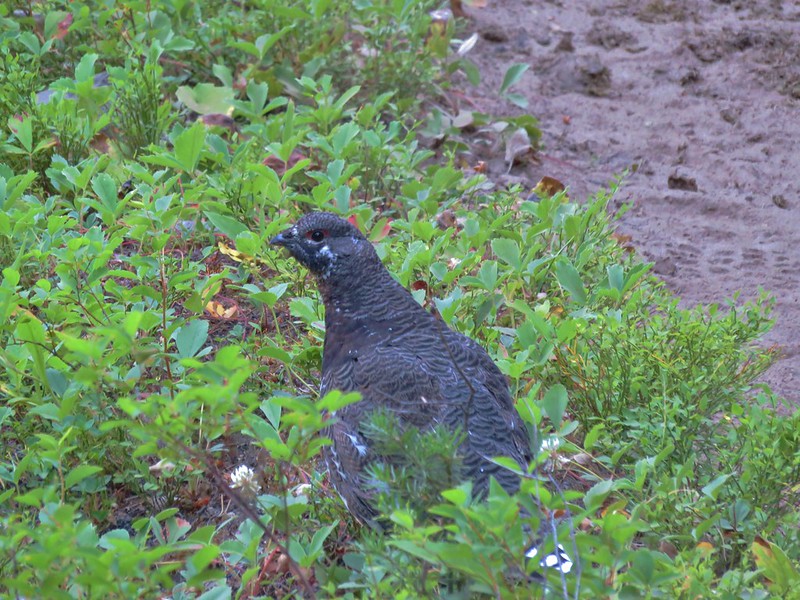
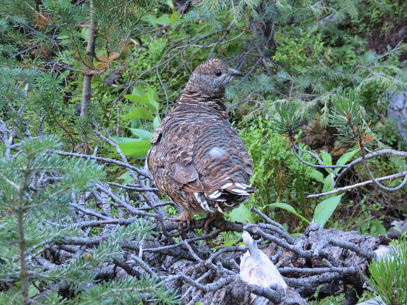
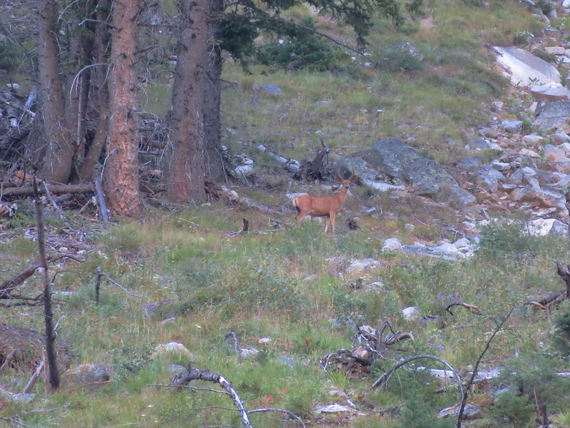
We were now on a familiar trail but despite having seen the scenery there were some new sights in the form of wildlife.
Grouse
Buck
All in all it had been a great trip. We had had a couple of hiccups with Heather being ill the first night and having trouble finding a campsite the second and fourth nights but the weather had been wonderful and the scenery superb. After changing and doing a little bit of cleanup at the car we stopped for lunch in Joseph at the R & R Drive-In which really hit the spot. We each had a Zeke Burger and split an order of some spectacular tater-tots.
We were able to take I84 on the way home but decided to leave the Interstate at Hood River in an attempt to avoid driving through Portland during rush-hour on a Thursday. We drove past Mt. Hood on Highway 35 to Highway 26 then took State Highways through Estacada, Mollala,and Woodburn to avoid traffic. Happy Trails!
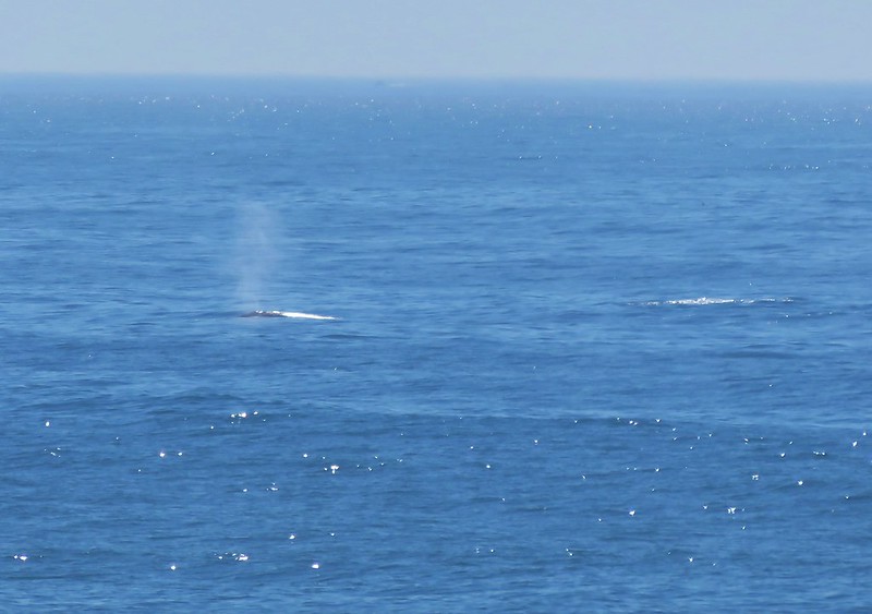
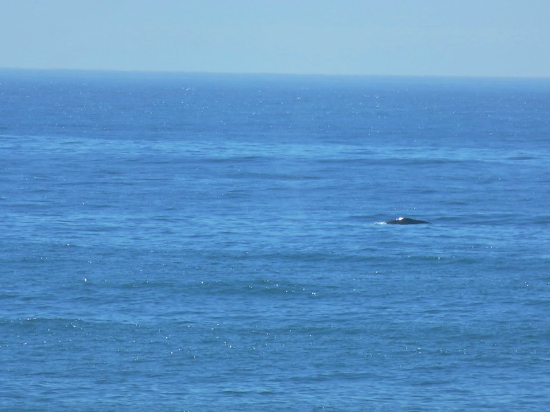
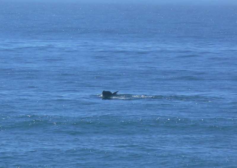
Epilogue – After spending five days in the Eagle Cap Wilderness of NE Oregon we found ourselves at the beach for our annual family reunion in Gleneden Beach, OR. For the first time we brought our camera and for the first time we spotted whales off the coast.
In the course of a week we’d gone from seeing mountain goats on the way up a 9826′ peak to watching whales surface from sea level. Just one of the reasons why we love living in the Pacific Northwest.
After a short break following our vacation in Central Oregon we were back on the trails exploring the north side of Mt. Hood. Our scheduled hike was the Mazama Trail which climbs to the Timberline Trail along Cathedral Ridge. From the Timberline Trail we would head clockwise around the mountain passing through Cairn and Wy’East Basins to a viewpoint overlooking Elk Cove. Then the plan was to head up to Dollar Lake then on to the 7300′ knoll on Barrett Spur and go cross-country back down to Wy’East Basin and back to our car, possibly visiting Eden Park on the way back. If that sounds like a lot it’s because it was. 🙂
The forecast called for isolated thunderstorms beginning at 1pm so we made sure we got our usual early start. There had been a nice storm that came through the previous night and clouds lingered near the mountain as we drove toward the trail head.
Mt. Hood from Lolo Pass Rd.
When we arrived at the parking area a group from the Mazamas was camped there. We found out they had been doing trail maintenance for 4 days. One of the group informed us that Search and Rescue had come down the trail the day before looking for a hiker that was missing from the Ramona Falls area and that we should keep on the lookout (We found out later that he was found after the S&R team had spoken with the Mazama group). From the trail head we had a great view of Mt. Hood with Barrett Spur just below and to the left and Cathedral Ridge to our right.
The Mazama Trail was reconstructed by the Portland Mazama Club and they also maintain the trail. The group that had been doing the recent trail work had done an excellent job and the trail was in great shape. The trail sets off in a forest of Rhododendron but quickly comes to a rock slide which it switchbacks up through. After reentering the forest a second series of switchbacks ensue. This may have been the most switchbacks we’ve encountered in such a short distance but they made the climb a bit easier than it would have been otherwise. Near the bottom of the switchbacks we met a snowshoe hare on the trail.
Once we had completed the switchbacks the trail climbed more gradually sometimes through burnt forest and others in the green trees. The previous days rain kept the dust and ash from being an annoyance in the burnt sections and the 4.2 miles of the trail went by surprisingly quickly.
When we reached the Timberline Trail we took a left and headed for Cairn Basin. We had been on this section of the trial the previous year when we had hiked up the Top Spur Trail to McNeil Point. It was interesting to find that even though we were visiting almost two weeks earlier in the year the flowers were already at a later stage due to the low snow pack and early Spring. Still the displays were impressive.
We crossed Ladd Creek, passed through Cairn Basin, crossed another branch of Ladd Creek, and made our way to Wy’East Basin.
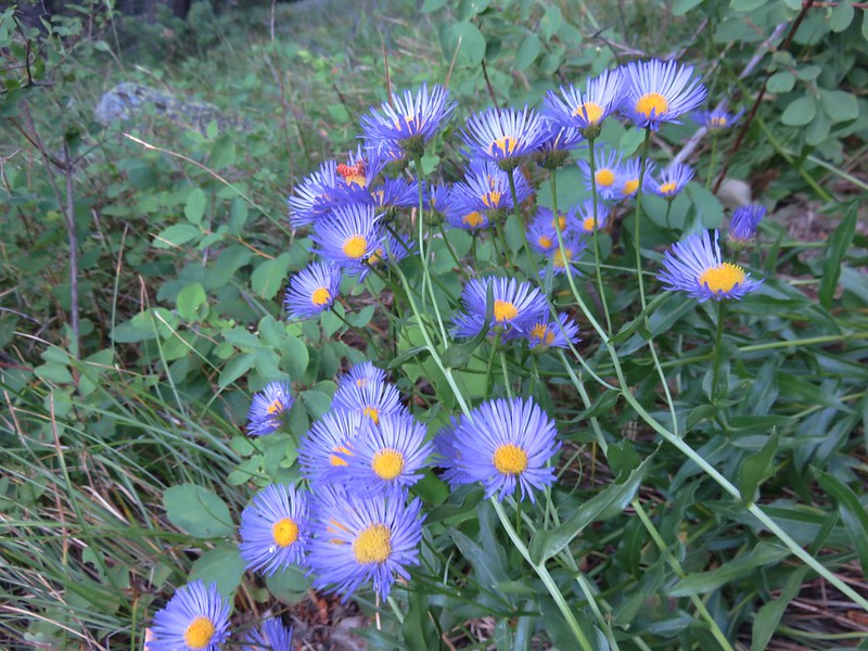
Aster field in Wy’East Basin
It would have been possible to head up to Barrett Spur from here, but we were unsure of the path so we decided to go on to the Elk Cove viewpoint and then up past Dollar Lake and try and come down to this point instead so I marked it on the Garmin for later reference.
The “unofficial” trail to Dollar Lake is approximately .7mi from Wy’East Basin, but we wanted to check out the Elk Cove viewpoint which was just an additional .2mi according to William Sullivan’s description. I didn’t do a very good job of reading his description though so we walked past the viewpoint and continued down the Timberline Trail toward Elk Cove a ways before I realized we had dropped further than we had intended. We consulted our topo maps, the garmin, and Sullivan’s book and climbed back to the correct viewpoint then walked back to find the path to Dollar Lake just as it was described in the guide book. The saving grace of the extra descent and subsequent climb was a nice field of western pasque flowers and paintbrush with a mountain view.
We took the path up to Dollar Lake and easily spotted the trail heading up Barrett Spur on the opposite side. We took the sometimes faint path up along the edge of Elk Cove’s Canyon. Flowers dotted the ridge adding color to the climb and below in Elk Cove a vibrant display of flowers surrounded a patch of melting snow.
At one point we heard an odd noise that we couldn’t place at first. We paused looking back down toward Elk Cove where the sound had come from when we heard it again. This time it was clear as a bell as it rose up the canyon walls, it was a Bull Elk bugling. 🙂
As we neared the knoll, clouds began to cover Mt. Hood and by the time we had reached the wind break atop it we were in the clouds and Mt. Hood was hidden.
We settled in at the wind break to have lunch and hopefully have the clouds pass which they quickly began to do. As they lifted we were gifted with some spectacular views of the mountain.
When it was time to head back down we could see the Timberline Trail below and after once again consulting our maps we decided on the correct ridge to follow down to Wy’East Basin. On the way up we’d spotted a small cairn that seemed to mark a possible path we could follow so when we reached it we veered left. A series of cairns led us along the ridge past several snow fields. Clumps of lupine and paint managed to grow amid the rocks in the gully.
We followed the path down through the gully and wound up right where we had hoped in Wy’East Basin.
Back on the Timberline Trail I threw out the idea of taking a slightly longer return route by dropping down into Eden Park. We decided a different path was worth the extra .7 miles and took the Vista Ridge Trail for .3 miles and then turned right on an unmarked trail toward Eden Park. More floral displays greeted us along the way and Eden Park did not disappoint.
From Eden Park we climbed back up to the Timberline Trail at Cairn Basin and hung a right to get back to the Mazama Trail. This time the trail felt all of the 4.2 miles despite the fact we were going downhill. When it was all said and done we had covered 16.2 miles and climbed a cumulative 5089′. The weather had remained nice despite the forecast and we still had a good view of the mountain as we prepared to drive home.
Happy Trails.