
During the week a shift in the wind brought wildfire smoke from the numerous wildfires in Pacific NW and British Columbia to the Willamette Valley. After several days of unhealthy air quality another shift began pushing the smoke out of the valley which was good for us but not for the unlucky folks now in the smokes path. Some progress has been made on several of the fires, but new ones keep popping up. One of these was incident 282 in the Willamette National Forest approximately 4.5-miles north of Waldo Lake (post) which was detected on Friday afternoon. Our planned hike for Saturday had been to revisit nearby Bobby Lake (post). While the new fire was relatively small, we felt it was best to avoid the area and began looking for an alternate hike.
We decided that our best bet, based on weather forecast and proximity of fires, was to head to Washington’s Mt. St. Helens. For the main hike we picked the Ape Canyon Trail which we had hiked twice before, but the not since 2013 (post). Before the 2013 hike we had stopped at Ape Cave to explore the lava tube there. There is another short interpretive trail near Ape Cave, the Trail of Two Forests, that we had not visited yet, so we decided to stop there first this time.


A NW Forest Pass is required to park at the TH.
The hike is a short loop on a boardwalk with a number of interpretive stops where lava casts remind visitors of the previous forest that existed before the lava flow.


A tree stood here when the lava arrived.
A highlight is “The Crawl” where you can descend into a tree mold and crawl through a lave tube to a nearby exit.


For the sake of my knees, and the longer hike to come, I opted not to make the actual crawl and stuck to the boardwalk.

The sign for the exit from the entrance.

The exit
This was a fun little hike that would be great for kids as it is just under half a mile in length. There are also several picnic tables at the trailhead.
From the Trail of Two Forests we drove to the Ape Canyon Trailhead.


Map at the trailhead. This becomes important later at the end of our hike.
The hike to Ape Canyon is straight forward in that there are no junctions, it is just a 4.5-mile mostly uphill hike along a ridge to a rock chasm above Ape Canyon with a view of Mt. Adams to the east.


Pearly everlasting

The lower portion of the trail passes closely to the Muddy River’s lahar left created by the melting of much of the Shoestring Glacier during the 1980 eruption.

Red huckleberries, yummy.

Bunchberry, not edible.


Paintbrush

It was quite a bit smokier than we’d expected based on the forecast. The smell of smoke was prominent over the first couple of miles of trail.

Sickletop lousewort

Thimbleberry, extra yummy.


Oregon grape, apparently this makes good jelly but not pleasant off the plant.

Chipmunk

Ghost pipe

Baneberry, not edible.

Beardtongue

Scouler’s bluebells

We eventually climbed above the smoke.

Red elderberry, not edible raw and potentially dangerous even when processed.

Fireweed

Candyflower
The trail alternates between the SW and NE sides of the ridge providing views of Mt. Adams and Mt. Ranier and Mt. St. Helens.

Mt. Rainier through some haze.

Mt. Rainier

Mt. Adams


Pumice Butte


Mt. Adams amid the wildfire smoke.


Lupine

Paintbrush


Butterfly on aster

Ape Canyon


Golden-mantled ground squirrel with an itch.

Mountain heather

The chasm with Mt. Adams in the distance.

The trail is a little sketchy opposite the chasm and a reroute may soon be needed.

Just ahead to the right the tread gets pretty narrow.
Just beyond the chasm the trail arrives at a junction with the Loowit Trail.


We turned right onto the Loowit Trail and continued 0.8-miles to a currently dry spring-fed creek in the Plains of Abraham. Heather had spoken to a couple of hikers who mentioned that they had seen mountain goats on one of the hilltops from the trail closer to the spring. Last September I had seen goats on Pumice Butte during my hike from June Lake (post).


Dwarf lupine


Dwarf lupine on the Plains of Abraham.
When we got far enough around to look back at the hills above the Loowit Trail I took several pictures of what looked like they might be mountain goats to the naked eye.

One of them paid off.


The Loowit Trail crossing the Plains of Abraham.

Mountain goat fur.

Heading for the spring with Mt. Adams in the distance.

This area would have had a nice wildflower display if we had visited a few weeks earlier.

Above Ape Canyon.

The springs are back there but there was no flowing water today.

There were two small pools holding water in the creek bed.
On the far side of the creek bed two mountain bikers that had passed us earlier mentioned that they thought they’d seen a couple of bear cubs in the canyon below but weren’t certain. They continued on and I scanned the hillside.

It didn’t take long before I spotted what I thought could be a bear. When I zoomed in with the camera though I couldn’t tell at first if it was a bear or the shadowed end of a log. Then the head moved. It was the momma bear. A few moments later we had spotted the cubs as well.

We got to watch them forage for quite a while. The distance made it hard to get pictures but that didn’t stop me from trying (a lot).


Momma making sure the kids were following.
When we finally lost sight of the bears I decided to continue on the Loowit Trail to a viewpoint at the far end of the plains while Heather opted to break out her camp chair and relax a little longer.


Oregon sunshine

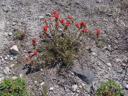
Paintbrush


Curious golden-mantled ground squirrel.

Alpine Butte

Coming up on the viewpoint at the junction of the Loowit and Abraham Trails. The peaks along the ridge from left to right are Coldwater Peak (post), The Dome, and Mt. Margaret (post). The top of Mt. Rainier is visible to the right.

Mt. Rainier

Penstemon
I turned around at the junction and headed back. Along the way I spotted a bear walking up the ridge of the butte that the bears had been below.


I assumed this was momma bear again but I didn’t see the cubs and the bear dropped over the far side of the ridge soon after I’d spotted it.
I reconnected with Heather and we headed back. The visibility of Mt. Adams was much improved and the smoke that had been present over the lower portion of the morning hike and moved on.


There were also clearer views of Mt. Rainier too.

Stonecrop

Fritillary on pearly everlasting.

Nuthatch

Marble Mountain across the lahar.
Circling back around to the trailhead head map. I was a little ahead of Heather and got back to the trailhead first. When I arrived there was a group of ladies and kids gathered around the map. One of them asked me if this trail went to the “canyon” and I said yes. I thought to myself it was crazy to be trying to get to Ape Canyon with such little kids and starting after 3pm to boot. A few moments later as I was putting my pack into the car I realized that she may not have been referring to Ape Canyon when she asked about the canyon, and she had probably meant nearby Lava Canyon (post). It was too late to catch them so I hoped that Heather might say something to them, but they didn’t ask her any questions, and she just assumed they were just exploring. I felt really bad and hopefully the figured it out sooner rather than later but in my defense I did give the correct answer to the question that was asked. The trail sign also named it the Ape Canyon Trail and the map was right there.
Aside from probably having sent a family on a wild goose chase the hike was great. Hiking to the far end of the plains put my hike at an even 13-miles.

There is some contention with the elevation gain as both Washington Trails Association and William L. Sullivan list the elevation gain as 1400′ while the Oregon Hikers Field Guide says 2485′. The GPS was much closer to the latter and by the way both Heather and I felt by the end the higher number seemed more realistic. It appears that the lower number is simply the difference in the high point and trailhead elevation and doesn’t account for the uphill sections on the way back.
Regardless of the actual elevation gain any hike that includes both mountain goats and bears (oh my) is a great one. Happy Trails!


3 replies on “Trail of Two Forests & Ape Canyon – 08/08/2026”
Exciting hike!
Quite an eventful hike!
What a wonderful hike, some amazing mountain views.