After spending a second night in The Dalles it was time to return home, but before we headed to Salem we had one more hike to do in the area. There was one more hike on the east side of the Badger Creek Wilderness featured in Matt Reeder’s “Off the Beaten Trail” (2nd edition) guidebook – Tygh Creek. His recommended hike on the trail is a 4-mile out-and-back gaining 1700′. If that sounds steep, it is!
We left The Dalles and drove south on Highway 197 and made our way to the unsigned Tygh Creek Trailhead along Forest Road 27.
 The Tygh Creek Trail across FR 27 from the Tygh Creek Trailhead.
The trailhead is just 1.4-miles from the School Canyon Trailhead where we had started our hike two days earlier (post). It is theoretically possible to combine the two trails into a 13.7-mile loop, but the upper portion of the Tygh Creek Trail is reported faint and prone to heavy blow down. Even if the trails were clear we didn’t have time for a long hike today, so the 4-mile option was perfect.
For the first half mile the trail did a little up and down along Tygh Creek.

 The only two trees down that needed to be climbed under/over.
 Tygh Creek
At the half mile mark the trail left the creek and began the steep climb to the ridge above.

Heather had opted to not tackle the climb after already having done two challenging hikes this weekend so I had left the car before her and was on my own heading uphill when I spotted something moving in the forest ahead. I noticed the black first but then saw white as well and realized it was a skunk on the trail ahead.
 Distance + low light + moving animal = blurry photo.
 The skunk had been at the far end of this section of trail which was lined with lupine.
I stopped and watched the skunk head uphill until it was out of sight and then proceeded carefully not wanting to wind up smelling of skunk for the entire ride home. (I’m sure Heather would not have appreciated that either.) It was a good thing I was being cautious because after a short distance I noticed the skunk in some brush just off the trail.

 The little stinker had a pretty cute face.
We stared at each other for a minute, and I politely requested it move along. When that didn’t work I left the trail in an attempt to swing out wide and pick up the trail further uphill. My moving again prompted the skunk to run off deeper into the forest with its tail in “firing position”. I hoped it wasn’t randomly spraying the air which might still get me but fortunately the safety was kept on and I was in the clear to continue the hike.
Reeder mentioned the middle third of the 0.9-mile climb as being “some of the steepest, dustiest trail in the Badger Creek Wilderness.” From the sample of trails we’ve hiked in this wilderness I’d agree with that statement. The first and final third were no picnic either. There were however great views and a lot of wildflowers to look at as I slowly trudged uphill.
 The trail is to the right in this photo.
 Paintbrush, balsamroot, and a strawberry blossom.
 Ball Point
 Rough eyelashweed
 When a trail looks steep in a photo that tells you something.
 More paintbrush and balsamroot.
 Townsend’s solitaire
 Buckwheat
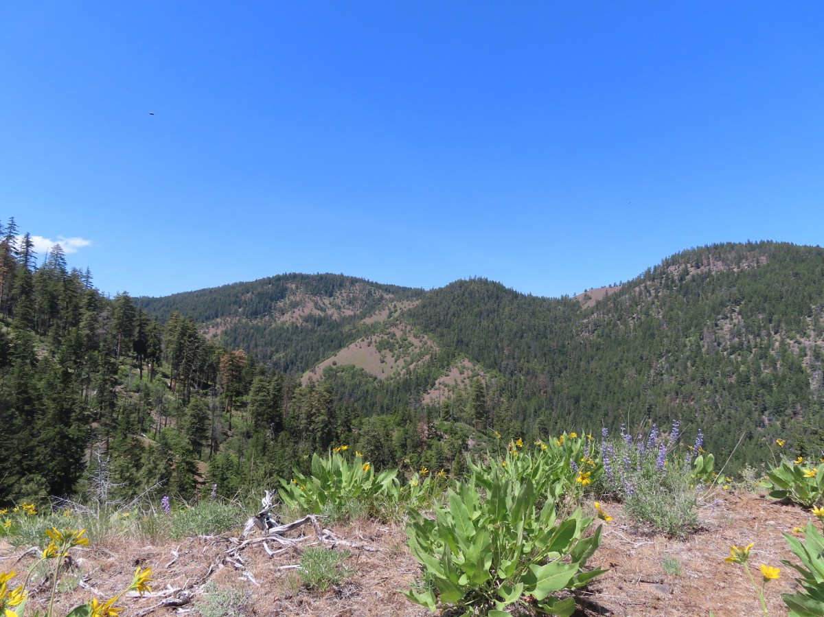
 My goal, the turn around point, was up on the crest of that ridge ahead.
 Lupine, balsamroot, and a death camas.
 Dogwood tree among the ponderosa pines.
 Mahala mat
 Getting close to the ridge and still steep.
 The trail got less steep near the ridge.
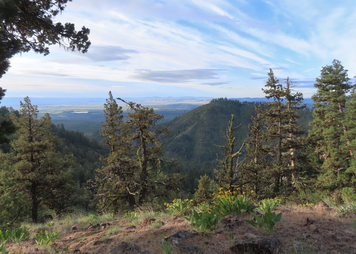
 Gordon Butte to the right. Broken Top, the Three Sisters, and Mt. Jefferson would also have been visible if not for the clouds.
 Level trail on the ridge!
The hike describes cresting a “small” ridge and finding a user trail on the left that leads to a viewpoint sometimes used as a helispot. I headed out the ridge and quickly realized that my definition of “small” and Reeder’s were not the same.
 Looking ahead at the trees atop the “small” ridge.
 Sandwort
 Oregon sunshine
 Wildflowers on the “small” ridge.
 Almost to the crest.
While I never actually spotted a use trail it was easy to see the opening where a helicopter could land just to the left of the trail, so I made my way out to the opening.

 The clouds here are hiding Mt. Hood which should be visible behind the ridge. What is visible is Flag Point (post) in the middle with the Flag Point Lookout Tower.
 Looking toward Mt. Jefferson.
 Parts of Mt. Jefferson peeking out through the clouds.
After catching my breath at the viewpoint I began the steep descent back to Tygh Creek. I had been so focused on the climb up that I saw a few flowers that I’d missed on my first pass.
 I’d seen a couple whitestem frasera going up but coming down I realized just how many there actually were, although none of the plants were quite blooming yet.
 Groundsel
 Broken Top and some of the Three Sisters were visible on the way down.
 Tam McArthur Rim (post), Broken Top with Green Ridge (post) and Black Butte (post) in front, and parts of the Three Sisters.
 I missed this whole patch of silvercrown earlier.
 Pine Hollow Reservoir and Central Oregon.
 Elkhorn clarkia aka ragged robin.
 Threadleaf phacelia
 Paintbrush with Ball Point in the background.
 Vetch
Vetch
 Penstemon
 Bastard toadflax

Buttes in Cental Oregon.
 Back in the forest near Tygh Creek.
 Tygh Creek
 Squirrel
 Starflower
 Coral fungus
 The trailhead in sight.
The hike was just under 4-miles with 1700′ of elevation gain.
 The Tygh Creek track along with a portion of Saturday’s hike on the School Canyon Trail at the bottom.
Tackling this hike when my legs were already tired from the previous two days wasn’t ideal, but its length was which allowed us to get home to Salem before 11am. It was a little disappointing not having clearer views from the helispot given the effort to get there, but the wildflowers and views that I did have made for a good hike regardless.
In a crazy twist I posted a few photos on Instagram and Matt Reeder himself commented having also hiked the trail a little later that same morning. Happy Trails!
Flickr: Tygh Creek


 We headed off through the trees here.
 Mt. Jefferson and Olallie Butte (
 Gordon Butte in the foreground.
 Balsamroot and oak trees.
 Buckwheat and balsamroot
 Whitestem frasera with Mt. Jefferson in the background.
 Rough eyelashweed
 Paintbrush
 We picked up a faint path, not sure if it was a game or use trail.
 Lupine and ponderosa pines.
 The trailhead is on the opposite side of FR 2710 from the trail.
 Sign at the start of the Little Badger Trail.
 Badger Creek Wilderness sign next to Little Badger Creek.
 Groundsel
 Woodland stars
 Little Badger Creek
 Fairy slipper
 American vetch
 Bastard toadflax
 Duskywing on sagebrush false dandelion.
 Balsamroot
 Bee coming in for a landing on phacelia.
 Sticky cinquefoil
 Western wood-pewee
 Madia
Madia Brown elfin (and another pollinator) on Oregon sunshine.
 Starflower
 Mahala mat along the trail.
 Duskywing on blue-eyed Mary
 Largeleaf sandwort along the trail.
 Skunk cabbage
 Red-flowering currant
 Duskywing on arnica
 Silvercrown
 Oregon grape
 Last of the trillium.
 Plumed solomonseal
 What’s left of the cabin.
 Little Badger Creek at the cabin site.
 Anemone
 There was a short climb before reaching the spur trail.
 Spur trail to the mine.
 The old mine. We did not go in as wildlife do sometimes use it for shelter.
 Ballhead waterleaf near the mine.
 Western tanager
 A stand of oaks ahead.
 Balsamroot along the trail.
 Paintbrush
 Buckwheat
 Juniper trees
 Threadleaf phacelia


 Signpost ahead for the trail junction.
 Wildflowers along the trail.
 The spur trail on the left to the Helispot.
 Penstemon

 Pine Hollow Reservoir in Central Oregon.

 Woodland star
 This was the most significant obstacle we had to navigate on the entire loop.
 Yarrow
 A dogwood on top of the rocks and penstemon below.
 First view of Ball Point.
 Penstemon
 From the ridge we could faintly make out Broken Top and the Three Sisters.
 The Three Sisters on the right and Broken Top with Tam McArthur Rim (
 Pen Point across the Tygh Creek Valley.
 Passing through the 2009 Ball Point Fire scar.
 Pen Point toward the center and the taller Hootnanny Point to the right.
 Death camas
 View east as we came around Ball Point.
 Desert yellow fleabane.
 Prairie smoke aka Old Man’s Whiskers


 Heather coming down the ridge.
 I think this is a western racer.
 Looking up at the ridge.
 A clarkia
 Lewis’ woodpecker
 Lizard


 On last view of Mt. Jefferson
 Ball Point
 Butterfly on whitestem frasera
 Signs at the trailhead.
 Orange is the road + cross country portion.