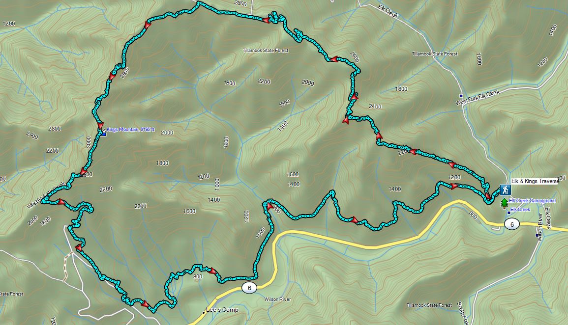
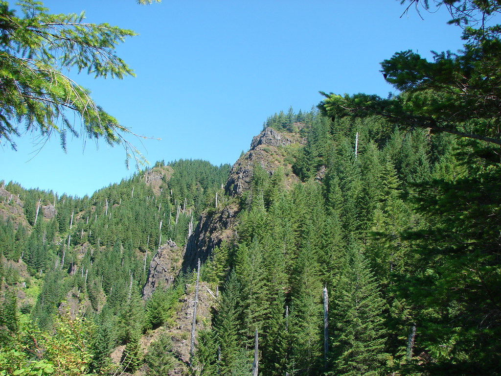
The Wilson River Trail currently runs 24.6 miles, with its western end beginning at Muesial Creek Road and its eastern end at Idiot Creek Road. We previously hiked two sections of the trail – the Kings Mountain TH to the Elk Creek TH segment twice (2010 & 2022) and the Footbridge TH to Jones Creek TH segment (2014). It was time to check out another section of the trail and we set our sights on the Elk Creek TH to Idiot Creek Road TH segment.
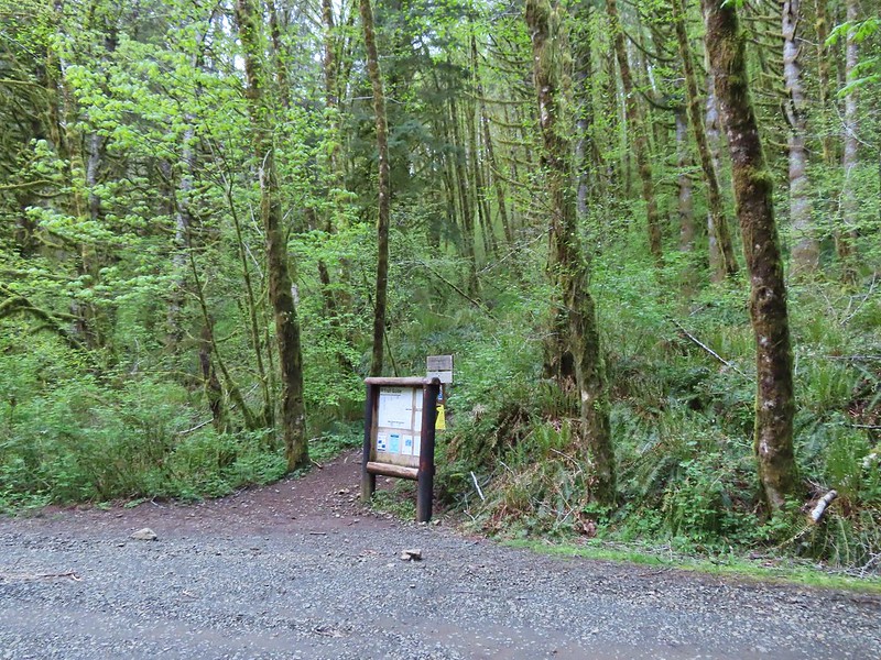
We parked at the Elk Creek Trailhead since it is the more convenient of the two trailheads to reach. There are a small number of parking spots across from a signboard where we had begun both of our Elk/Kings Mountain loops which is where we once again parked. The first signboard near the small parking area.
We hadn’t fully woken up yet, so we didn’t think to simply take the trail here uphill 100 feet to the Wilson River Trail. Instead walked along the shoulder of Elk Creek Road to a much larger parking area at roads end. Elk Creek Road from the small parking area.
The larger parking area.
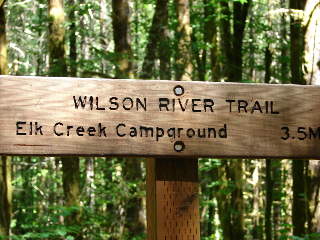
There was another signboard at this trailhead which we stopped at to study the map.
After confirming our route, we set off past a Wilson River Trail sign and came to a junction where we realized we could have avoided the 500′ road walk.
We turned right following a pointer for Idiot Creek Loop Road (note the road is currently not a loop due to a washed-out section). The trail quickly joined the old bed of Elk Creek Road.
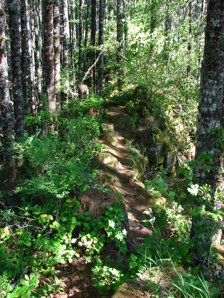
We followed the old roadbed along Elk Creek for approximately a half mile to a well signed junction.
Bleeding heart
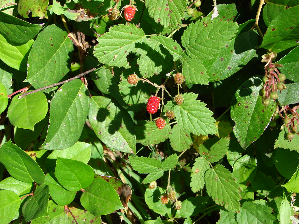
Salmonberry
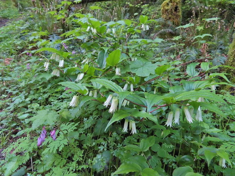
Fairy lanterns
Largeleaf avens
Scouler’s corydalis
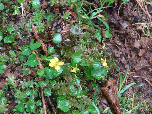
Coastal monkeyflower
At the junction we turned right and crossed the seasonal footbridge over Elk Creek. (In place May thru September.)
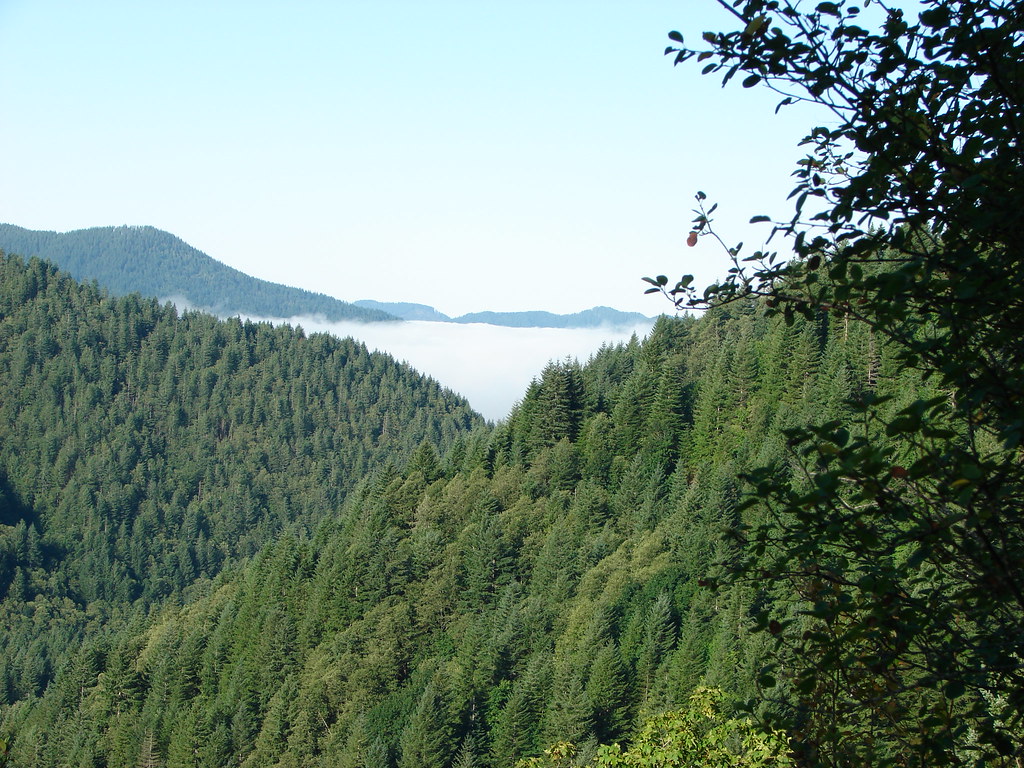
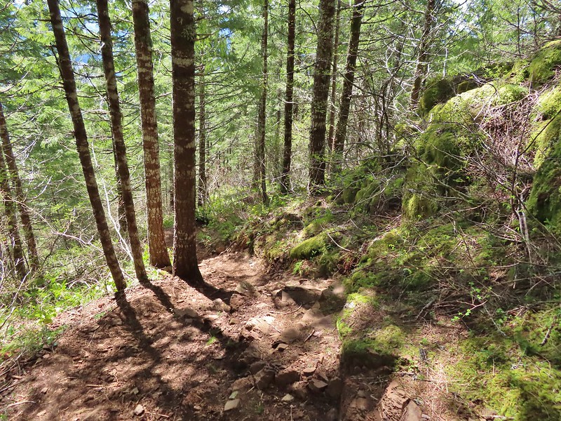
The trail traversed a hillside above Elk Creek for three quarters of a mile before heading uphill.
Fringecup
Trillium
Star flower
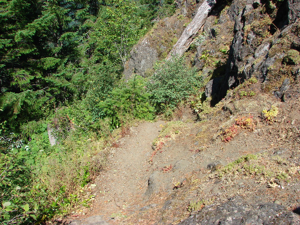
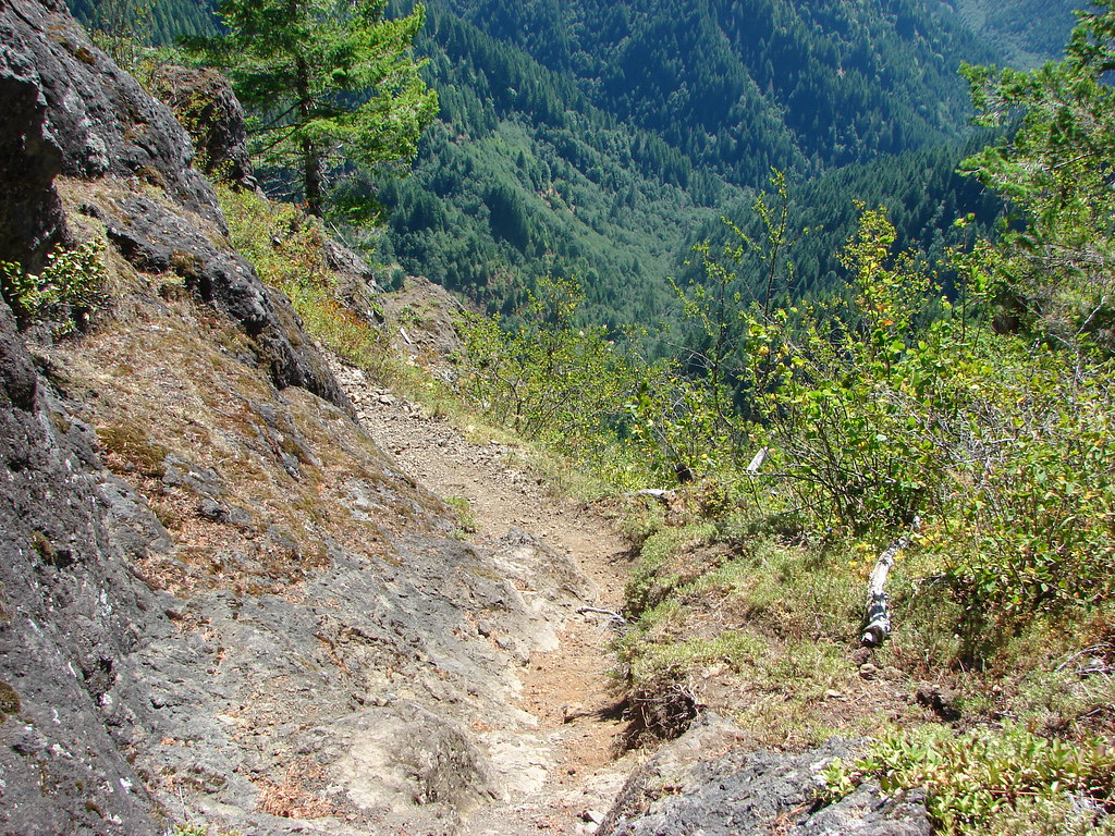
The well graded trail uses a combination of switchbacks and long traverses to climb over 1000′.
Looking down at the trail below.
Vanilla leaf
Spotted coralroot
Anemone
Western buttercup
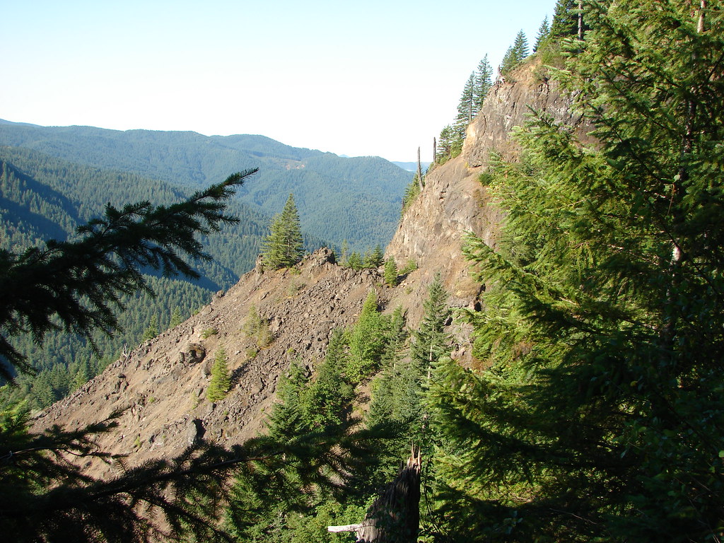
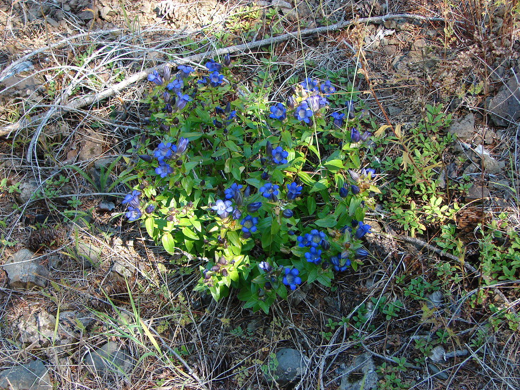
Near the 2.7-mile mark we took a short spur trail to a rocky viewpoint.
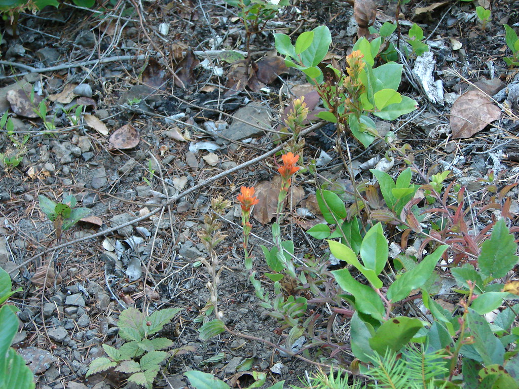
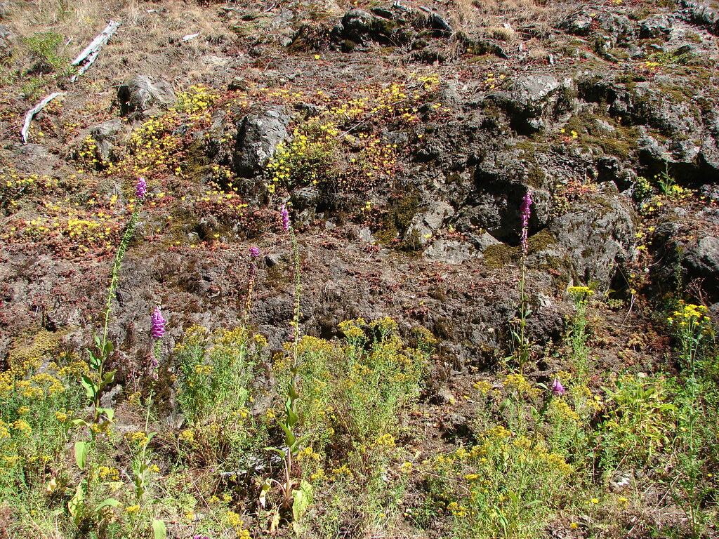
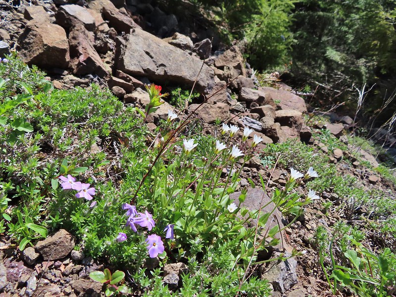
Paintbrush, parsley, and blue-eyed Mary
From the viewpoint it was another third of a mile up to Idiot Creek Loop Road.
Fairy lanterns and paintbrush
I did just a bit of exploring along the road in each direction before we headed back down.
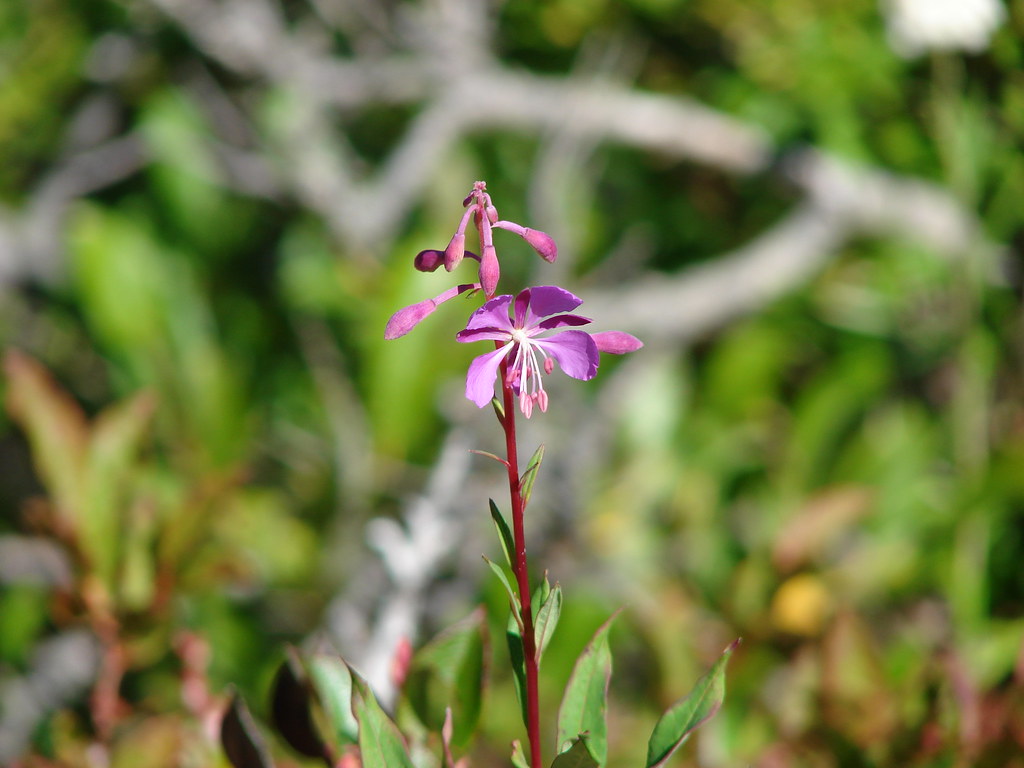
Lupine was just beginning to bloom along the road.
On the way back down.
We had briefly considered following the Elk Creek Trail from the junction near the footbridge before heading back to the car but decided to save that for another time.
West Fork Elk Creek to the left and Elk Creek to the right from the bridge.
The junction with the Elk Creek Trail.
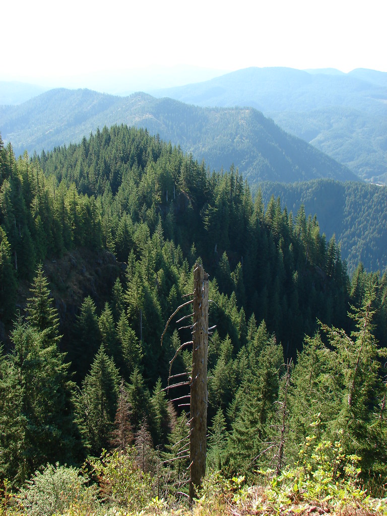
We returned to the car by sticking to the actual Wilson River Trail this time ending the morning at 7.7 miles with a little under 1500′ of elevation gain. We missed a section of leafy mitrewort on our earlier pass.
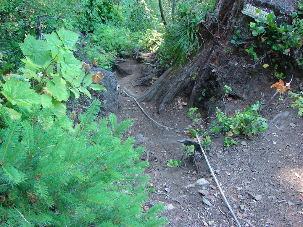
On the section of the trail we missed by taking Elk Creek Road.
The small parking area from the trail.
While there was a number of cars in the parking areas, we only passed 5 other hikers this morning. Mountain bikers would have gone out the Elk Creek Trail and most hikers were likely headed to Elk Mountain or tackling the full Elk/Kings Mountain Loop. The hike to Idiot Creek Loop Road was pleasant and the gently graded trail made for a nice climb through the green forest. The lack of any major “wow” sights along the trail keeps this a quieter option for the area, but the creek, flowers, and forest make it worthy of a visit. Happy Trails!
The weather finally cooperated enough for us to get back to our originally planned 2022 hikes. For this outing we were heading back to one of our earliest hikes, Elk & Kings Mountains (post) to see how much we remembered from that first visit. When we made the conscious choice to take up hiking in 2010 the loop over Elk and Kings Mountains was our eighth hike. One of only a handful of hikes rated “Very Difficult” in all five of Sullivan’s “100 Hikes” guidebooks, and the only one in the Oregon Coast book, this had been quite the challenge for us. We were curious how nearly 12 years of additional hikes, and age, might change our experience this time around. We were also hiking the trail at a better time of the year having tackled it in the heat of mid-August the first time around. Our hope was that the earlier visit would provide a different experience with wildflowers and with the streams and creeks along the route.
Before we started the difficult loop though we stopped at Killin Wetlands Nature Park just outside of Banks, OR for a short warmup hike on the 0.7 mile loop. An unintended result of having altered the plan for our two previous outings was that this stop would mark our third straight outing visiting an Oregon Metro managed park. (Orenco Woods)(Chehalem Ridge)
We set off on a clockwise loop on the Peat Swamp Trail then stayed left at its junction with the Waterfowl Way Trail.
Peat Swamp Trail.
Our 6am start time paid off as we were not only the only ones at the park but we spotted a deer (too quick for a photo), two otters, several families of Canada geese, and a gadwall and a mallard.
One of the two otters that were swimming in the wetlands.
Mallard
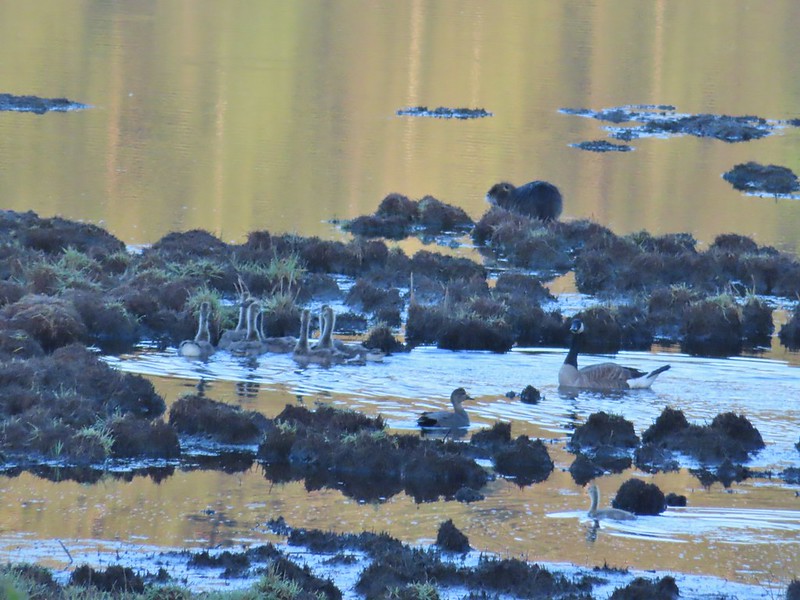
The gadwall amid a family of Canada geese. When we got home and looked closer at the picture we realized that one of the round shapes we took for a clump of mud was actually an animal. We can’t make out the tail to know for sure whether it was a beaver or a nutria but we’d like to think it was another beaver.
The beaver? turned a bit in this photo but we still couldn’t make out the tail. It does appear relatively large when compared to the adult goose though.
Waterfowl Way made a 180 turn and headed uphill through some small trees to return to the Peat Swamp Trail.
We stayed left again and completed the short but eventful loop.
From Killin Wetlands we headed west on Highway 6 to Elk Creek Campground and the Elk Mountain Trailhead.
We set off on the Wilson River Trail which began a 0.2 mile climb to a junction with the Elk Mountain Trail.
Fairy bells and bleeding heart.
Elk Creek below the trail.
Junction with the Elk Mountain Trail
While it had been sunny at the wetlands we had dropped under some clouds as we descended to the Wilson River Valley and found ourselves hiking steeply up into fog.
Paintbrush
Parsley
Blue-eyed Mary
Viewpoint along the Elk Mountain Trail.
The blue sky is up there.
Snow queen
The trail was as steep and rough as we’d remembered.
We did climb out of the cloud to find that blue sky again.
White service berry blossoms and a huckleberry plant.
The trail made a series of ups and downs along a ridge crossing four saddles before climbing to the 2788′ summit of Elk Mountain.
Violet
Red-flowering currant
Trillium
Anemone
Monkeyflower
One of the saddles.
Chocolate lily
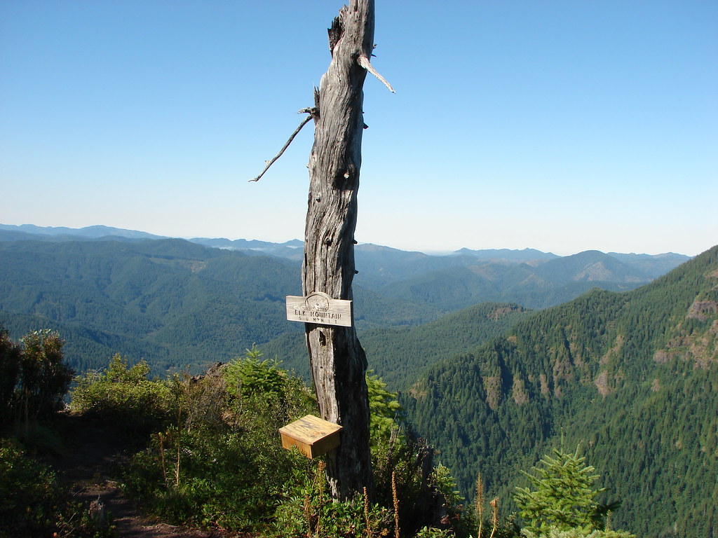
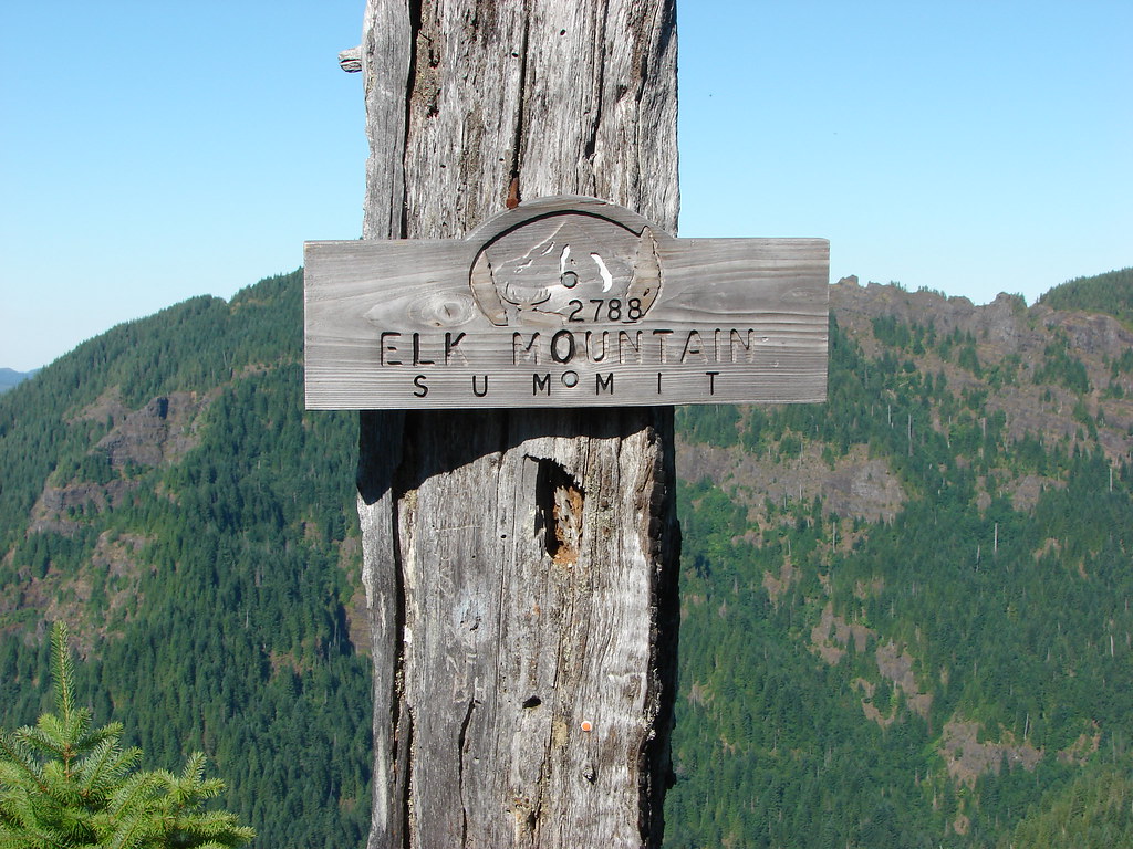
Elk Mountain summit.
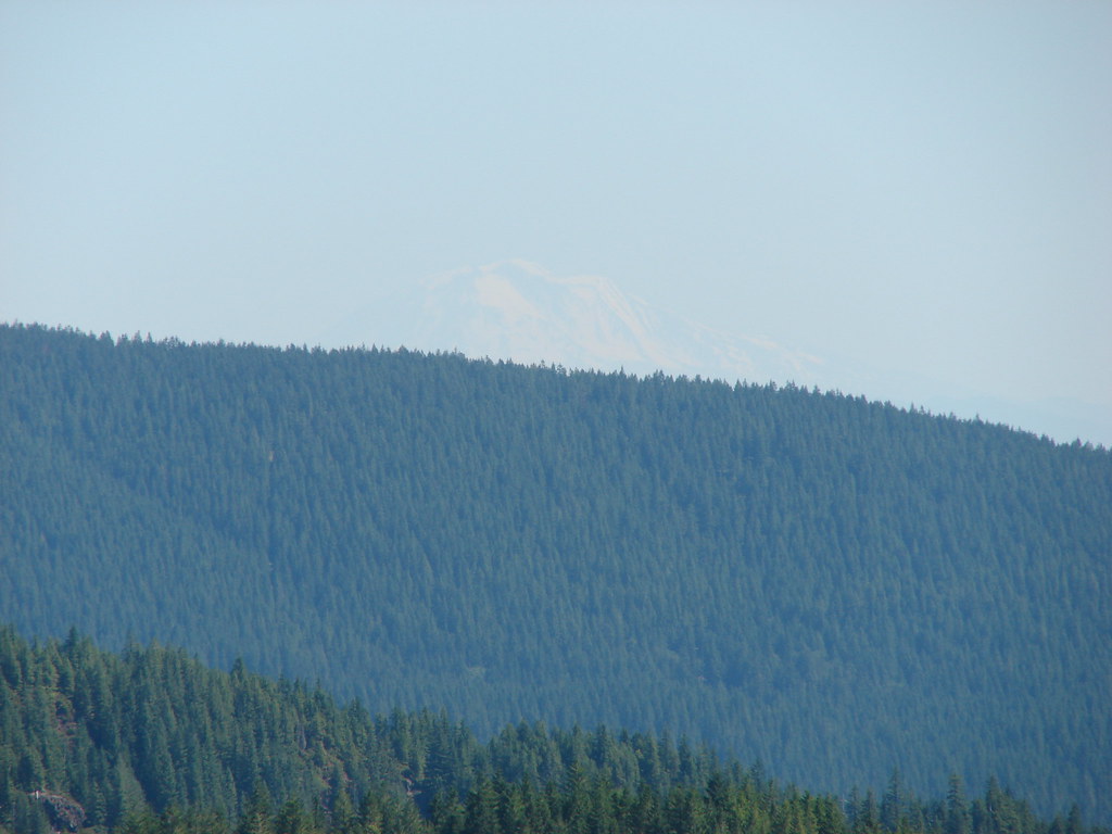
We spent a little time resting at the summit where we found a lone blooming beargrass with more to come. Kings Mountain from Elk Mountain.
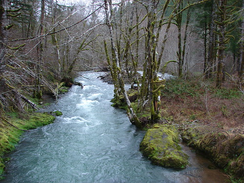
Wilson River
Pacific Ocean
The blooming beargrass below some red-flowering currant.
Beargrass
While the 1.5 mile climb to this summit had been hard the next mile of trail beyond the summit took it up a notch. The trail dropped nearly straight down the rocky west face of Elk Mountain requiring us to use our hands as we climbed down the damp rocks. Looking down the trail.
Heather on her way down.
After navigating the rocky descent the trail passed along some cliffs then climbed atop a narrow rocky ridge which it followed to an old roadbed where the hiking became temporarily much easier.
On the ridge.
Dropping down to a saddle along the ridge.
Near the start of the road bed we spotted a hermit warbler eating something off of some huckleberry bushes.
This was the first time we’d seen one of these pretty little birds, at least that we are aware of. Who knows how many we’ve seen fly by and not been able to identify them.
Mercifully on the old roadbed.
We followed the old roadbed for about a mile as it climbed to a junction at a saddle.
A clump of trillium.
Little moth.
Getting closer to Kings Mountain.
Paintbrush
Coming up to the junction.
We turned left onto the Kings Mountain Trail which according to the pointer was 1.3 miles away.
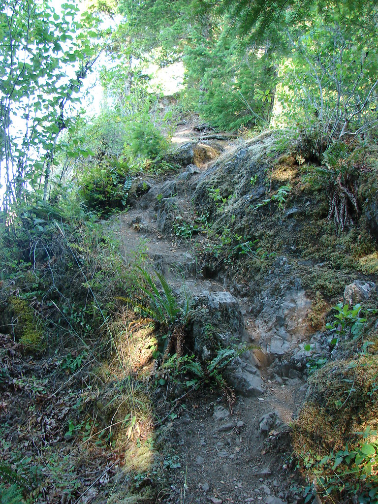
The trail continued to follow an old road bed for a little over half a mile before dropping steeply to a ridge and switchbacking around an outcrop and finally crossing over a saddle.
Phlox, paintbrush, and chickweed.
Still on the old road.
At the ridge end above the saddle, the trail dropped down to the left then through the saddle.
Below the outcrop headed to the saddle.
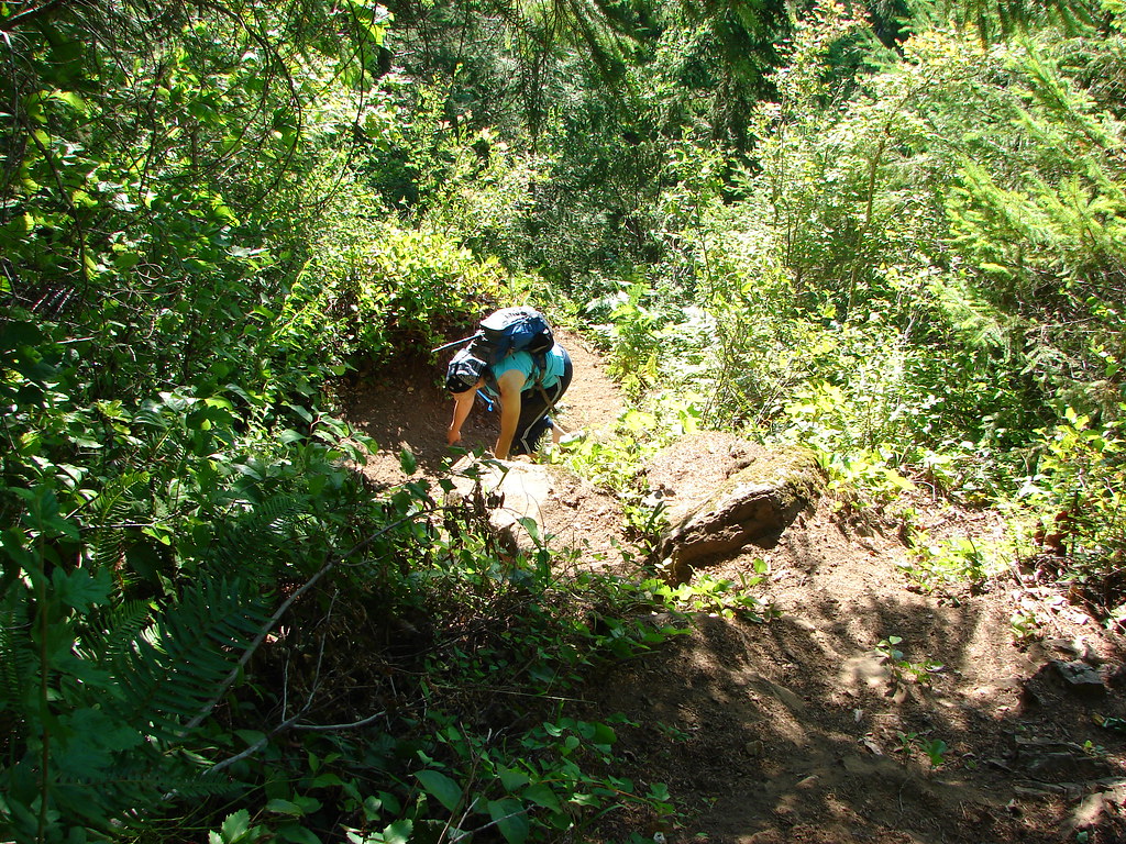
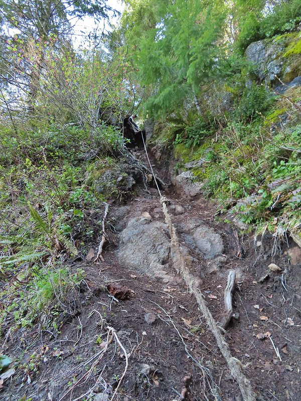
Probably the most memorable part of our first hike here was needing to use a rope that had been affixed to a stump to descend a steep chute. While we both remembered that we had forgotten at what point we’d encountered the rope and after the steep drop off of Elk Mountain we convinced ourselves that the rope had been there. As we passed over the saddle we realized our mistake as the stump and rope were here and the 12 years had not been kind to the trail here.
Heather getting ready to start down.
The chute in 2010.
The rope was quite a bit longer this time, out of necessity, but we made it down and continued on. From here the trail passed below some sheer cliffs which had been a very nerve wracking experience in 2010. Apparently somewhere during the 549 outings that we’d done between visits I’d gotten much more comfortable with narrow trails with steep drop offs because this time there were no nerves but there were a couple of spots that required the use of hands to get up.
The trail is down there somewhere.
Trillium
Bleeding heart
Fringed kitten-tails
Glacier lily
The trail then climbed to a high point along the ridge which Heather initially mistook for the summit of Kings Mountain. She was less than thrilled when I pointed out the actual summit a short distance, and one saddle, away. Coming up to the high point.
Kings Mountain
View SE from the high point.
We dropped down to the saddle then made the final climb to Kings Mountain. We had seen a small number of other hikers up to this point but found several others here having come up from the Kings Mountain Trailhead. Dropping to the last saddle.
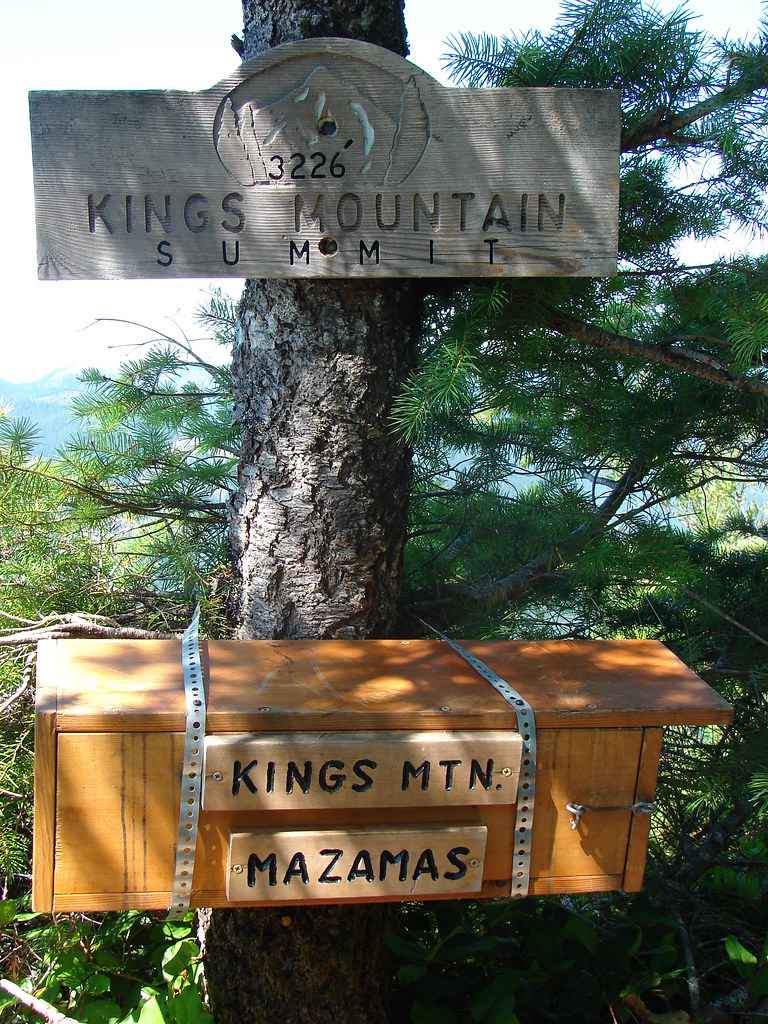
Summit register at Kings Mountain.
Pacific Ocean in the distance.
View north.
Other hikers at the summit.
Valerian
Saxifrage, possibly Saddle Mountain saxifrage.
Phlox, paintbrush, parsley, blue-eyed Mary, and chickweed.
From Kings Mountain the Kings Mountain Trail dropped steeply downhill for 2.5 miles to a 4-way junction with the Wilson River Trail. While the trail is steep and rough in a couple of spots it’s nowhere near as gnarly as the Elk Mountain Trail. We had remembered the descent as having given us trouble but in those days we hadn’t used hiking poles. Armed with proper poles this time the descent went much smoother.
One of the rougher sections.
Wood sorrel
Woodland buttercup and candy flower.
The 4-way junction.
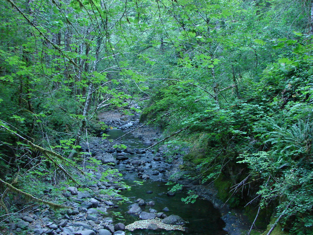
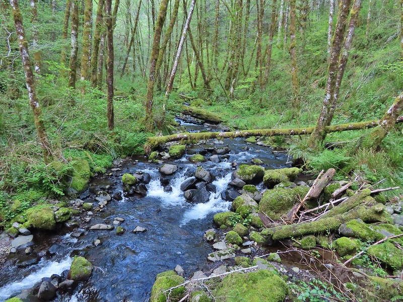
We turned left on the Wilson River Trail to make the 3.5 mile hike back to the Elk Mountain Trailhead. While the hike had been challenging we’d been doing pretty well but we’d forgotten to bring any electrolytes with us and while we had plenty of water we both started feeling a bit off. We paused at Dog Creek which is right near the junction for a bit of a break before continuing on the final stretch.
Dog Creek
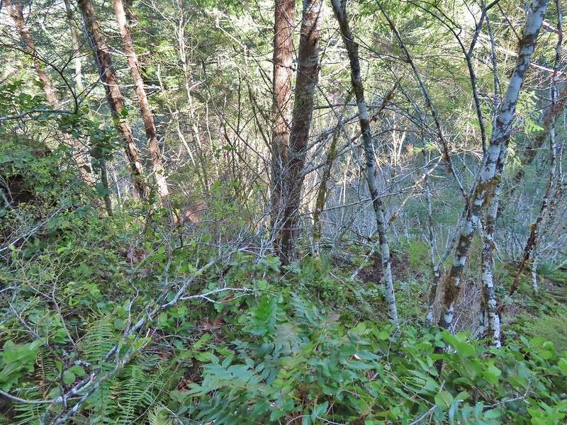
The Wilson River Trail passed a wetland fed by several small streams before making a long gradual climb up to the junction with the Elk Mountain Trail.
The wetlands
One of the smaller streams.
Monkey flower
Lily that will bloom in a few weeks.
Fringecup
Coming up on a footbridge across Big Creek.
Big Creek
Pacific waterleaf
Steadily climbing.
A pea or vetch.
Unnamed stream crossing.
Miterwort
Rosy Birdsfoot Trefoil
The third type of monkey flower we saw on the day.
The junction is on the saddle ahead.
From the junction we dropped down to the trailhead where we thankfully had some meat sticks waiting that provided some much need salt and protein. Cars to the left through the trees, we made it.
So what did we learn revisiting this challenging hike after 12 years? One is that we are more comfortable with sketchy trails and exposure after having experienced both many times since then. Secondly our bodies are 12 years older and they reminded us of that toward the end of the hike. Finally we were reminded that as much as we have learned about hiking such as the advantage that trekking poles can provide we are still prone to making mistakes and underestimating what we might need such as the electrolytes. It will likely be quite a while before you find us on a hike without some handy.
Aside from both stops being loops our two hikes for the day couldn’t have been much different from one another. The 0.7 mile loop at Killin Wetlands was short with a well graded trail that gained a total of 60′ of elevation while the Elk and Kings Mountain Loop and been over 11 miles (It’s just under 11 if you don’t wander around with over 4000′ of elevation gain. The gains were often steep, as were the losses, requiring the use of hands at times and included steep exposed drop offs. It was obvious from the number of other trail users that we encountered that most people stick to the out and back up to Kings Mountain but if you’re an experience hiker looking for a challenge or an early season training hike this is a great option. Happy Trails!
This week’s Throwback Thursday hike features one of the most challenging hikes in the Oregon Coast Range. On 8/16/2010 we headed to the Elk Creek Trailhead located just off Highway 6 twenty-four miles west of it’s junction with Highway 26 near Banks, OR.
This was one of our earliest hikes so we were still on a steep learning curve and in hindsight August probably wasn’t the best time of year for this particular hike but not knowing any better we arrived at the trailhead for an early morning start. After reading the information posted at the start of the trail we began wondering exactly what we were getting into.
Our plan was to do the nearly 11 mile loop which came with nearly 4000′ of elevation gain. We set off at a sign for the Wilson River Trail which crossed Elk Creek then split after .2 miles. The Wilson River Trail continued to the left and would be our return route. We veered right continuing onto the Elk Mountain Trail.
We were, as usual, following William Sullivan’s guidebook in which he describes the the Elk Mountain Trail as having “all the subtlety of a bobsled run”. The nearly 1.5 mile climb was certainly deserving of that description and was unlike any trail we’d experienced to that point. In fact this hike was the impetus for looking into and eventually getting trekking poles as we were at times forced to use our hands to make it past sections of loose scree.
The trail did have some positive attributes including some views that were not for folks made nervous by heights.
Only a few flowers remained along the trail which is one of the reasons that our timing wasn’t great, the other being the exposed sections of trail were really warm in the August sun.
A nice sign and summit register greeted us at the summit letting us know that we’d made it.
From the summit we were able to get a good look at the days second summit, Kings Mountain, to the west.
We continued on the loop which dropped steeply off the far side of Elk Mountain.
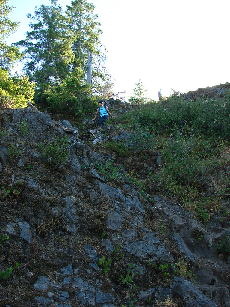
For the next half mile the trail traversed a ridge that was rather narrow and rocky in spots.
We were relieved when we reached an old roadbed which we then followed for the next mile and a half. This section was much easier on the nerves (and knees). Berries and wildflowers lined the old roadbed.
At a pass two miles from the Elk Mountain summit we arrived at signed junction where we followed pointers for the Kings Mountain Trail.
The old roadbed soon gave way to another narrow rocky section of trail.
Soon the trail came to a series of pinnacles which forced the trail from the south side of the ridge to the north side. The vertical face of the pinnacles also forced the trail to drop in order to get far enough below them to traverse the hillside. If we thought the trail couldn’t get any more nerve wracking we were wrong. A small caution sign on a stump tipped us off that the next section was going to be a doozy.
A rope was in place here to assist with the descent.
The traverse below the pinnacles was the by far the scariest section of trail we had been on and remained so until 2014 when the section of the Pacific Crest Trail known as The Knifes Edge took that title. There was a vertical rock wall along the trail and the drop on the other side of the trail seemed nearly as vertical. Thimbleberry bushes lined the trail on the down slope side making the trail feel even narrower than it was. No pictures were taken along this stretch as I was too busy using my hands to grab whatever I could along the rock wall.
Upon reaching the far end we briefly distracted ourselves with the view to the north which included a vary hazy Mt. Hood and Mt. Adams.
After we recovered our wits we continued on the much less stressful section of the trail and shortly arrived at the Kings Mountain summit.
We had only gone 1.3 miles from the junction at the pass but the traverse below the pinnacles had made it seem much longer. An interesting oddity near the summit was a picnic table placed by Troop 299 of the Eagle Scouts.
From the summit the Kings Mountain Trail simply headed straight down a steep ridge.
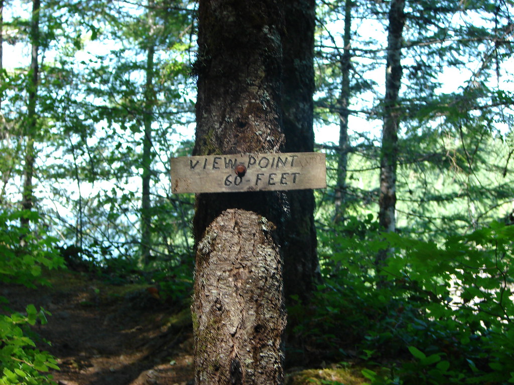
We managed to slow our descent long enough to visit a signed viewpoint on the way down.
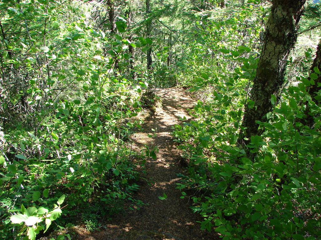
Again trekking poles would have been wonderful on the 2.5 mile descent. As it was we did our best to stay upright as we bounced from tree to tree using them in an attempt to control our speed. As we neared the bottom the trail mercifully began to level out in the forest.
We turned left onto the Wilson River Trail when we came to the junction near the Kings Mountain Trailhead.
It was a fairly easy, but warm, 3.5 mile hike back to the Elk Creek Trailhead. The Wilson River was on the opposite side of Highway 6 but the trail passed through a nice meadow and crossed Dog Creek on a footbridge in the first mile and a half.
The final two miles were more exposed allowing the mid-day sun to beat down us so we were glad when we finally made it back to Elk Creek. It had been a pretty amazing hike, definitely unlike anything we’d done up to that point and we are looking forward to going back in the not too distant future to see what it’s like now that we’ve been hiking for a much longer time. Happy Trails!
So far so good. We managed to get a hike in each month leading up to the marathon in April. Our recent visit to the Wilson River in the Tillamook State Forest was our final hike until after we’ve raced and recovered. We picked this hike because it provided a fairly level 8 miles which seemed like a reasonable outing at this point in our training. We chose Saturday morning for the trip based on a forecast showing no rain until that afternoon versus rain all day on Sunday. Yep, I fell for it again. The drunk monkeys that come up with the weather forecast weren’t even close as the 0% chance of precipitation was more like 95% as it rained or drizzled on us almost the whole time. Fortunately it didn’t rain hard since we hadn’t put our rain gear back into our packs.
The Wilson River trail extends over 26 miles, but for this trip we planned to hike out and back along a 4 mile section from the Jones Creek Day Use area to Bridge Creek Falls. It was great to get back on the trail and especially nice to see some signs of Spring. We set off from the parking area following the river west toward the Tillamook Forestry Center. Since the center opens at 10am the gate on the suspension bridge was still closed so we passed by and headed toward Wilson Falls after taking a quick peak back at Kings Mountain. Heather and I had done a loop hike in 2010 up neighboring Elk Mountain and down Kings Mountain. It remains to this day one of the toughest hikes we’ve tackled.
Kings Mountain
The forest was beginning to transition from Winter to Spring as buds were showing or already opening on many plants and several varieties of early flowers were blooming trailside.
The river was running quickly due to heavy recent rain which had also swelled the creeks and runoff streams feeding into the river. Even if it hadn’t been raining there was no way our feet were going to stay dry. 🙂
Wilson River
Cedar Creek
Runoff flowing over the trail
Trail crossing below Wilson Falls
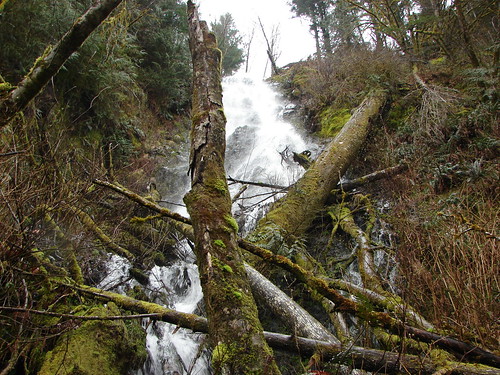
We had two waterfalls to visit on this portion of the trail. The first was Wilson Falls which lay hidden right beside the trail until we were almost directly below it.
Nearing Wilson Falls
Wilson Falls
The second falls was also our turnaround point. We had to leave the river and cross Highway 6 to find the short trail to Bridge Creek Falls. An impressive fall in a narrow canyon.
Sign for Bridge Creek Falls along Hwy 6
Bridge Creek Falls
Trying to give an idea of the size of the falls.
We hadn’t had any company on the trail and had only seen a handful of fishermen on the way to Bridge Creek Falls, but things got more crowded on the trail on the return trip.
Slow traffic
Another slowpoke
This one moved to the side to let us pass
Finally we came to a standstill
We didn’t wind up going into the Forestry Center. The rain had picked up and we were wet and muddy when we arrived back so we decided to pass on this trip. We did cross the suspension bridge in an attempt to return to the car from the opposite side of the river but washouts had closed that portion so we backtracked across the bridge and returned the way we had come that morning. The hike worked out just the way we’d hoped. Good scenery, no crowds, and not too taxing physically. Truly a hike that says “Happy Trails”.

 The first signboard near the small parking area.
 Elk Creek Road from the small parking area.


 Bleeding heart
 Salmonberry
 Fairy lanterns
 Largeleaf avens
 Scouler’s corydalis
 Coastal monkeyflower


 Trillium
 Star flower
 The well graded trail uses a combination of switchbacks and long traverses to climb over 1000′.
 Looking down at the trail below.


 Anemone
 Western buttercup


 Paintbrush, parsley, and blue-eyed Mary


 Fairy lanterns and paintbrush
 Lupine was just beginning to bloom along the road.
 On the way back down.
 West Fork Elk Creek to the left and Elk Creek to the right from the bridge.
 The junction with the Elk Creek Trail.
 We missed a section of leafy mitrewort on our earlier pass.
 The small parking area from the trail.


 Peat Swamp Trail.

 One of the two otters that were swimming in the wetlands.
 Mallard
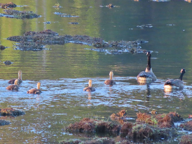
 The gadwall amid a family of Canada geese. When we got home and looked closer at the picture we realized that one of the round shapes we took for a clump of mud was actually an animal. We can’t make out the tail to know for sure whether it was a beaver or a nutria but we’d like to think it was another beaver.
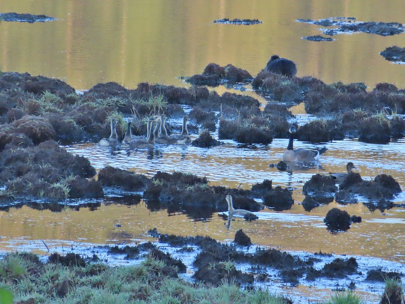 The beaver? turned a bit in this photo but we still couldn’t make out the tail. It does appear relatively large when compared to the adult goose though.


 Fairy bells and bleeding heart.
 Elk Creek below the trail.
 Junction with the Elk Mountain Trail


 Paintbrush
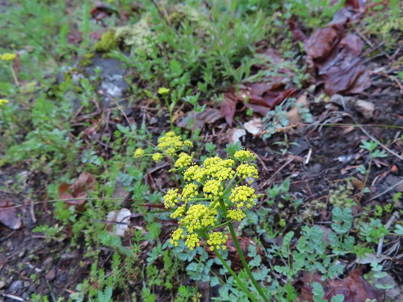 Parsley
 Blue-eyed Mary
 Viewpoint along the Elk Mountain Trail.
 The blue sky is up there.
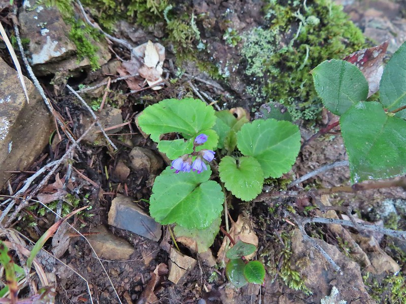 Snow queen
 The trail was as steep and rough as we’d remembered.

 White service berry blossoms and a huckleberry plant.
 Violet
 Red-flowering currant
 Trillium
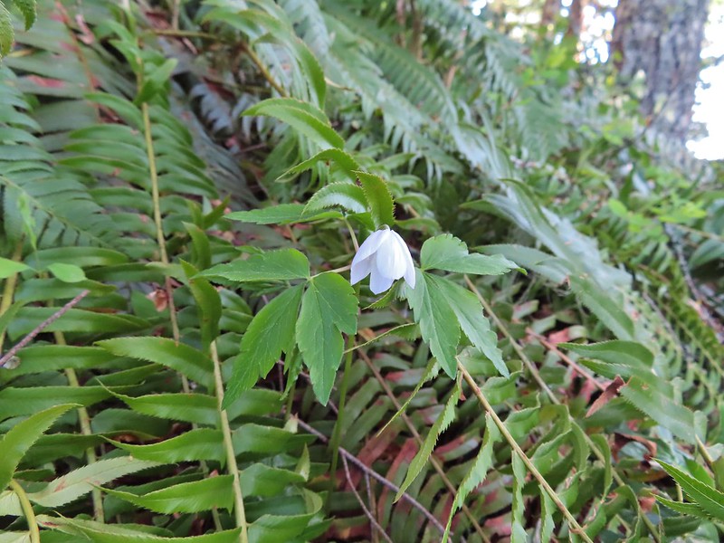 Anemone
 Monkeyflower
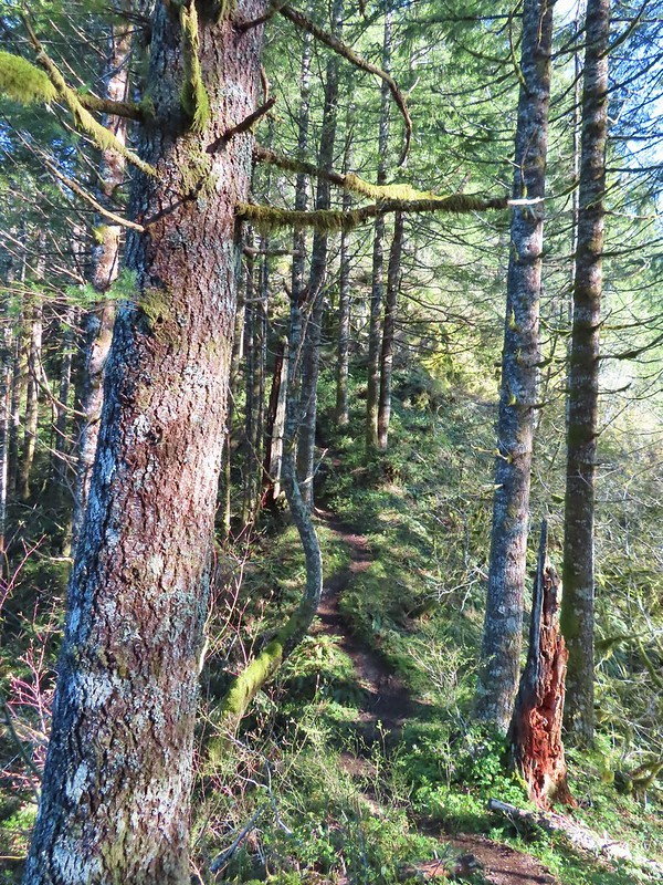 One of the saddles.
 Chocolate lily
 Elk Mountain summit.
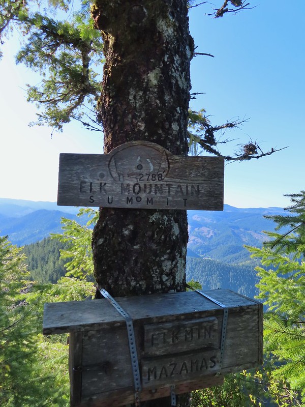
 Kings Mountain from Elk Mountain.
 Wilson River
 Pacific Ocean
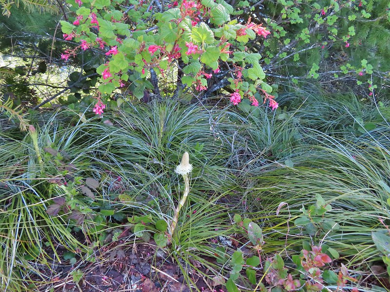 The blooming beargrass below some red-flowering currant.
 Beargrass
 Looking down the trail.
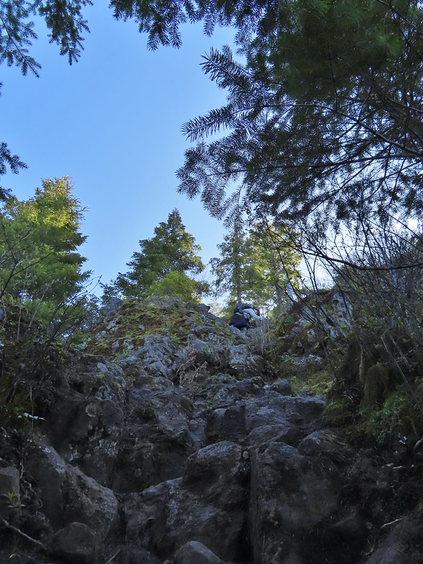 Heather on her way down.
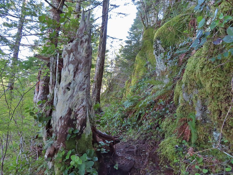
 On the ridge.
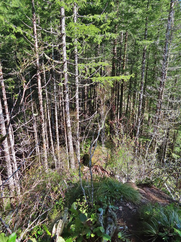 Dropping down to a saddle along the ridge.
 Mercifully on the old roadbed.
 A clump of trillium.
 Little moth.
 Getting closer to Kings Mountain.
 Paintbrush
 Coming up to the junction.
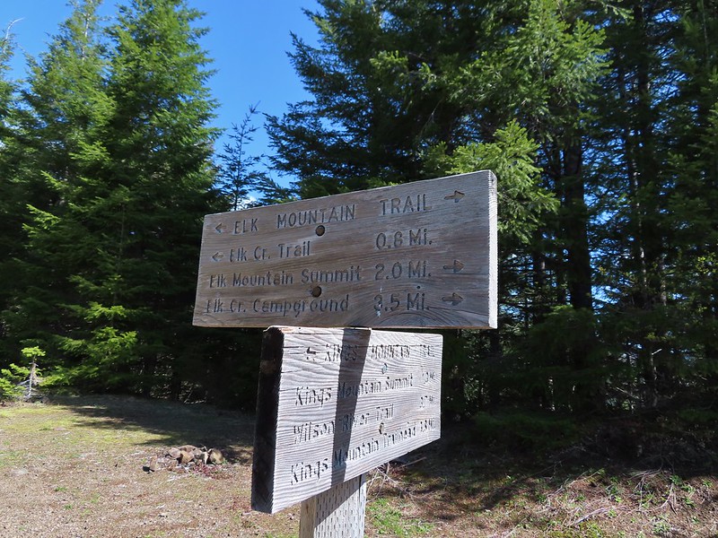
 Phlox, paintbrush, and chickweed.
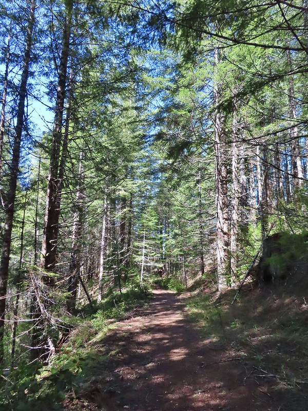 Still on the old road.
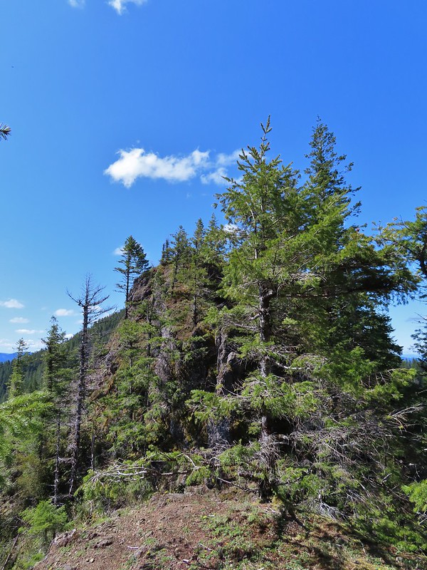 At the ridge end above the saddle, the trail dropped down to the left then through the saddle.
 Below the outcrop headed to the saddle.
 Heather getting ready to start down.
 The chute in 2010.
 The trail is down there somewhere.
 Trillium
 Bleeding heart
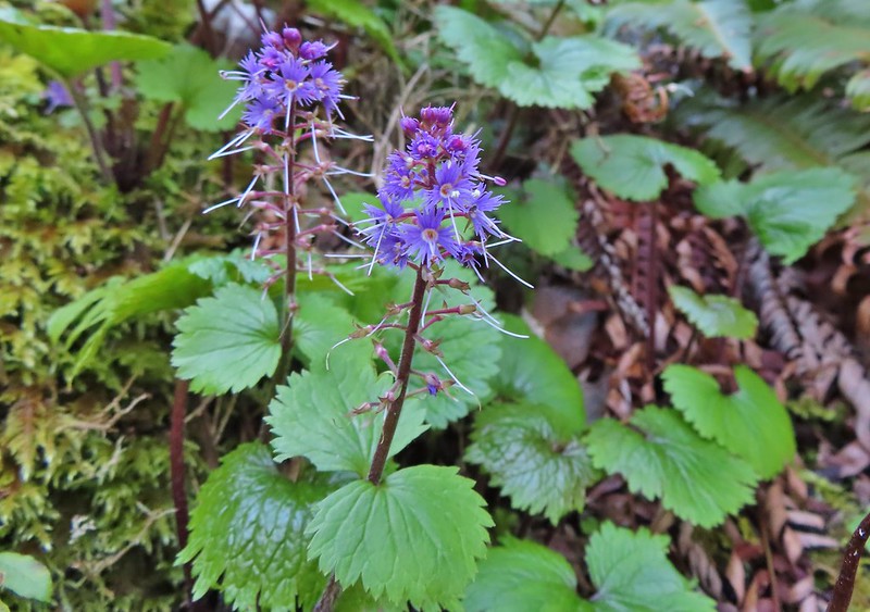 Fringed kitten-tails
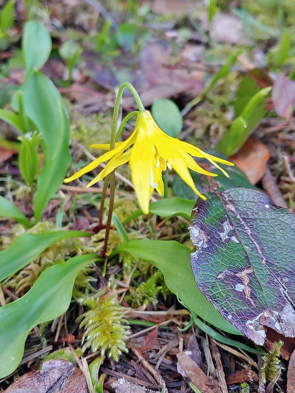 Glacier lily
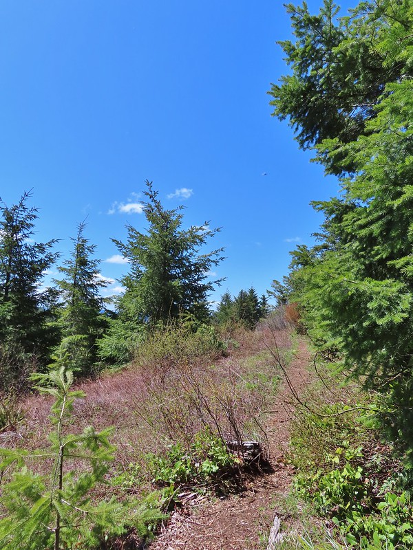 Coming up to the high point.
 Kings Mountain
 View SE from the high point.
 Dropping to the last saddle.
 Summit register at Kings Mountain.
 Pacific Ocean in the distance.
 View north.
 Other hikers at the summit.
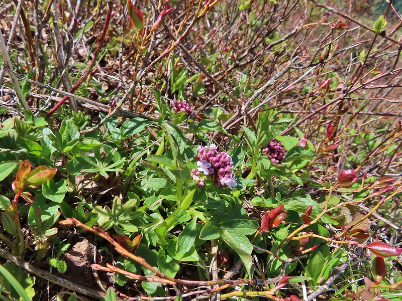 Valerian
 Saxifrage, possibly Saddle Mountain saxifrage.
 Phlox, paintbrush, parsley, blue-eyed Mary, and chickweed.
 One of the rougher sections.

 Wood sorrel
 Woodland buttercup and candy flower.
 The 4-way junction.
 Dog Creek
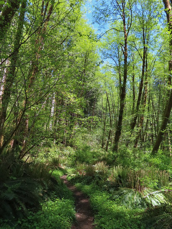


 One of the smaller streams.
 Monkey flower
 Lily that will bloom in a few weeks.
 Fringecup
 Coming up on a footbridge across Big Creek.
 Big Creek
 Pacific waterleaf
 Steadily climbing.
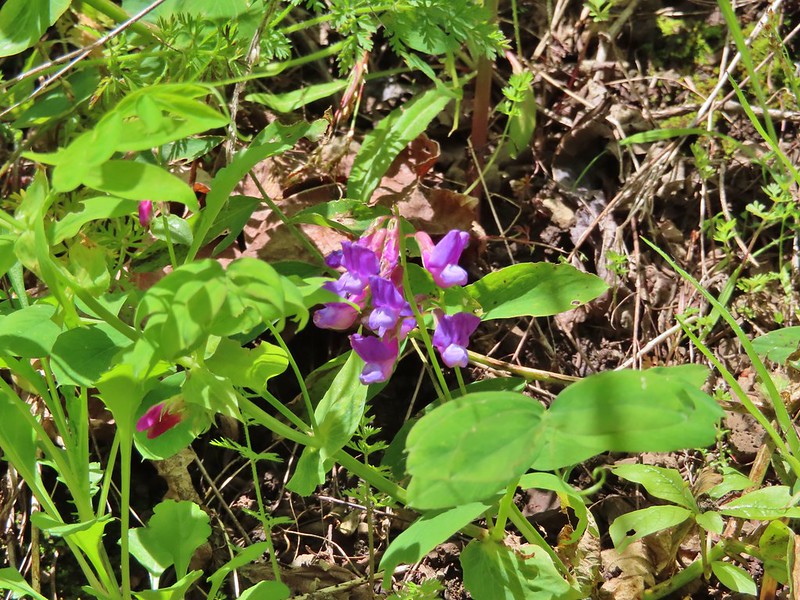 A pea or vetch.
 Unnamed stream crossing.
 Miterwort
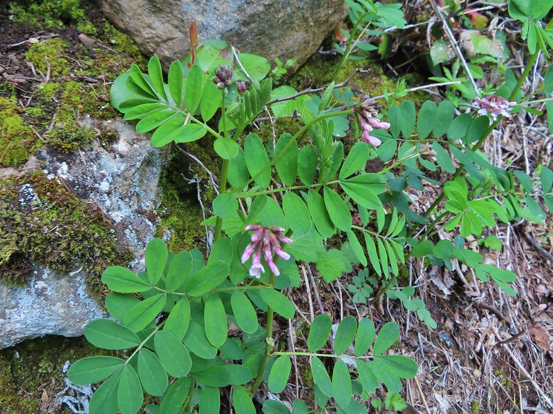 Rosy Birdsfoot Trefoil
 The third type of monkey flower we saw on the day.
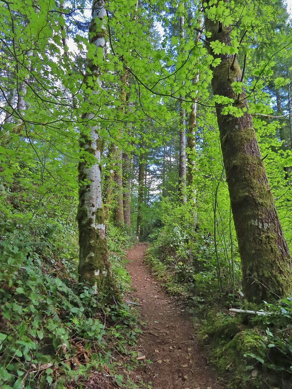 The junction is on the saddle ahead.
 Cars to the left through the trees, we made it.