
A wet weather system along with a small chance of thunderstorms led us to look for a plan “B” for our second outing in May. Looking ahead to the hikes on our 2023 list for April/May gave us a suitable alternative so we moved a 2022 hike to next year and moved up an outing to visit four parks, two in Hillsboro and two SE of McMinville. These hikes were all located within an hour of Salem allowing to stay relatively close to home and we figured that the less than ideal weather might make for less crowded trails. We decided to start at the northern most trailhead and work our way south.
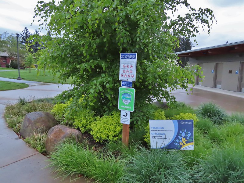
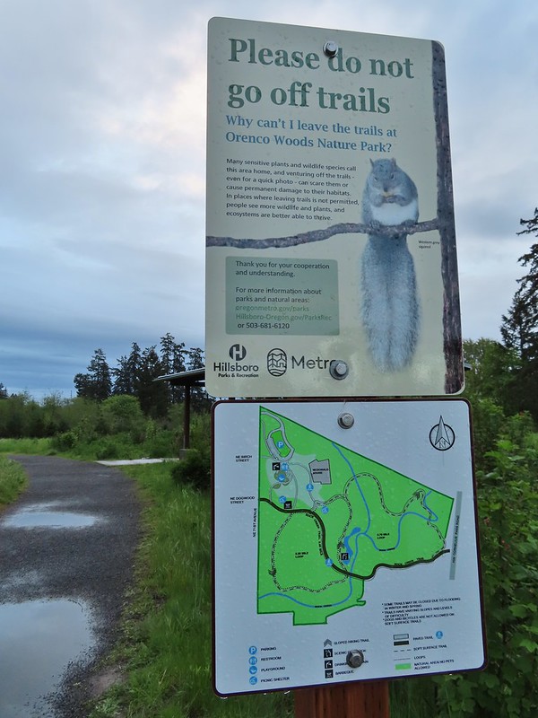
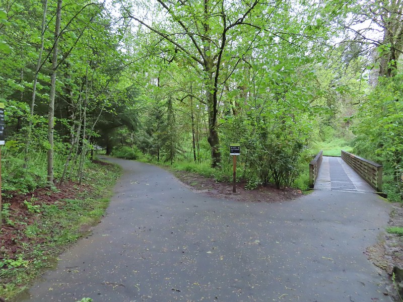
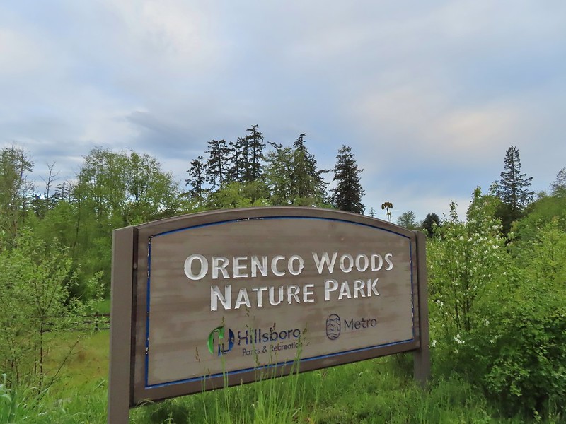
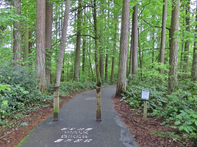
We arrived at the Orenco Woods Trailhead (open dawn to dusk) just before 6am and headed past the restrooms to an interpretive sign in front of the McDonald House.

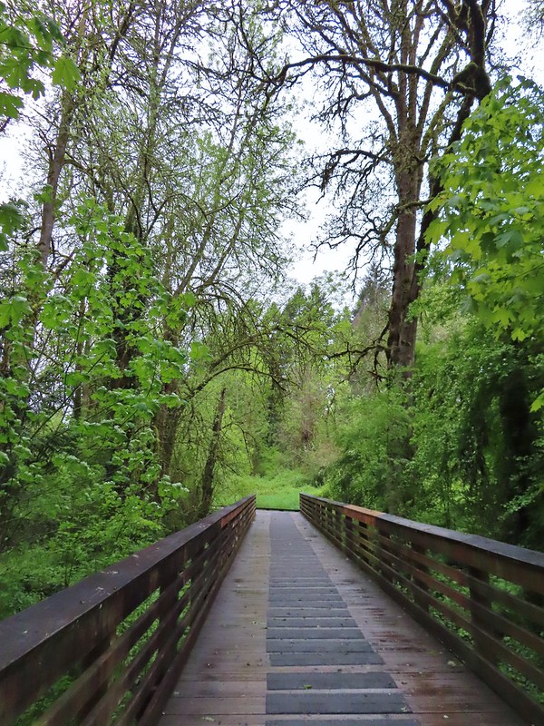
Beyond the house the path forked with the right hand fork leading to the Rock Creek Trail while the left fork led to the Habitat Trail which is the way we went.
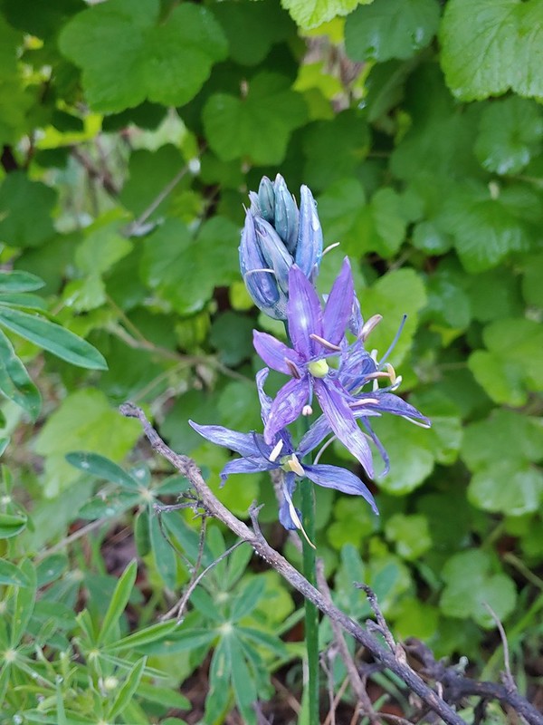 Camas
Camas
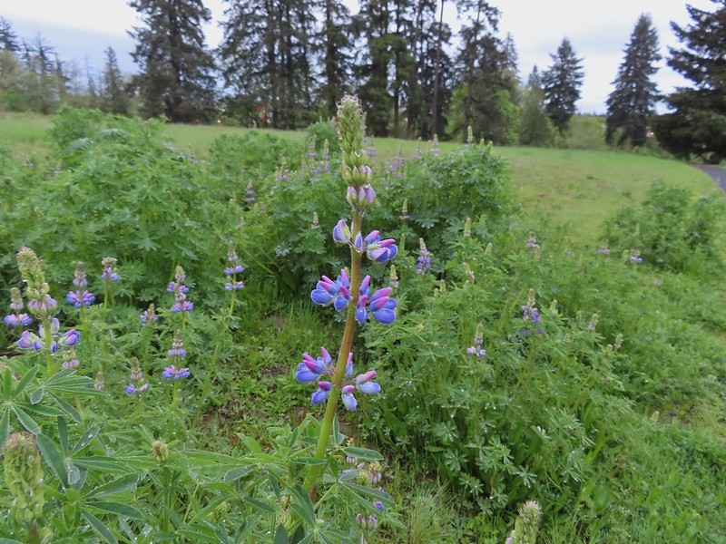 Lupine
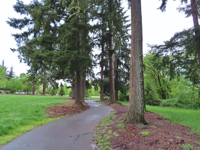
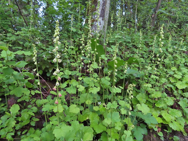
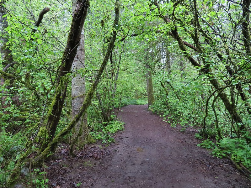
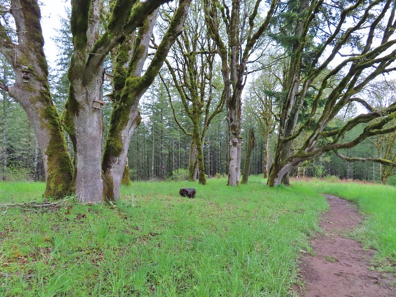
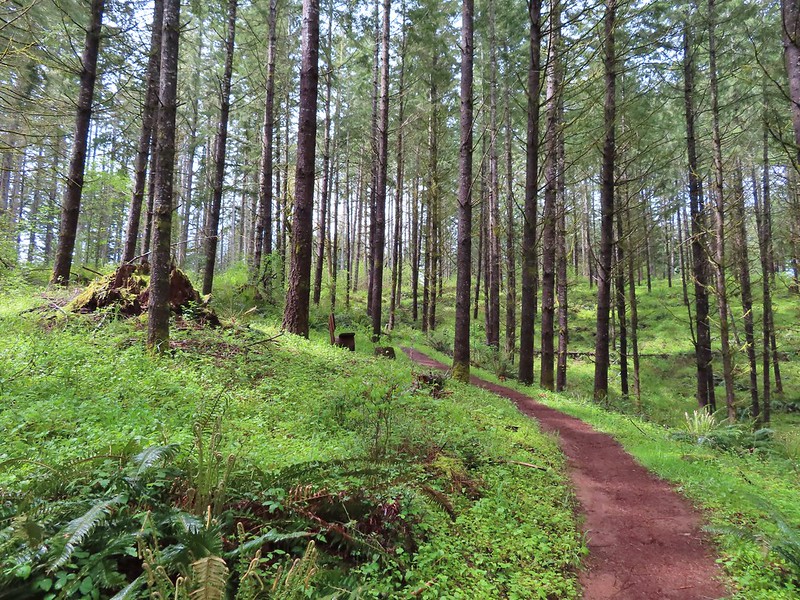
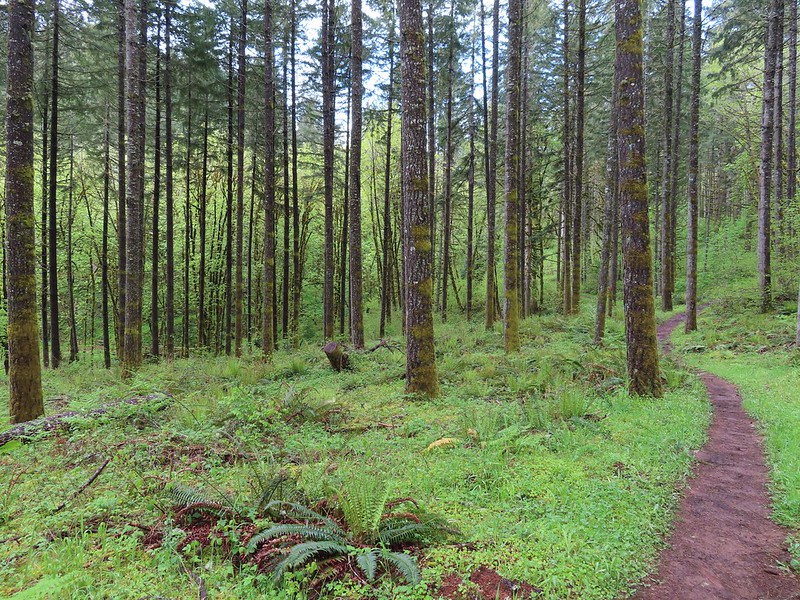
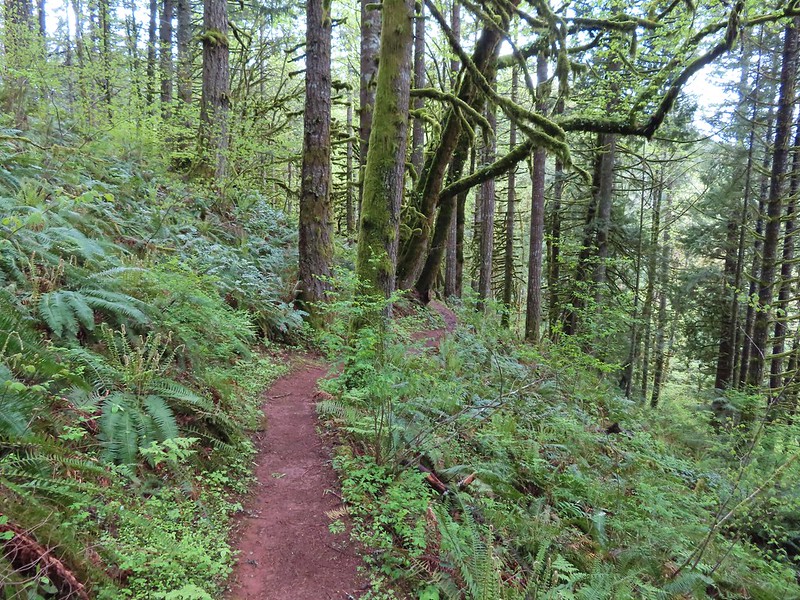
 Habitat Trail

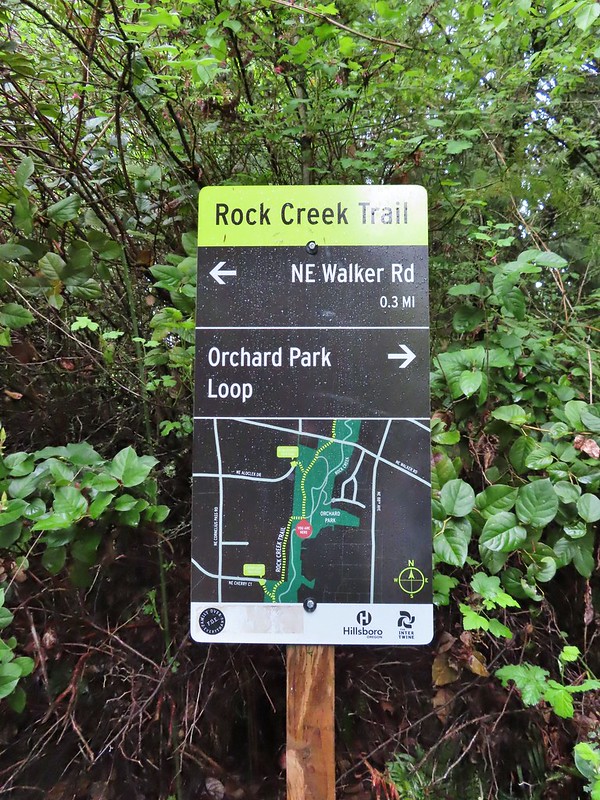
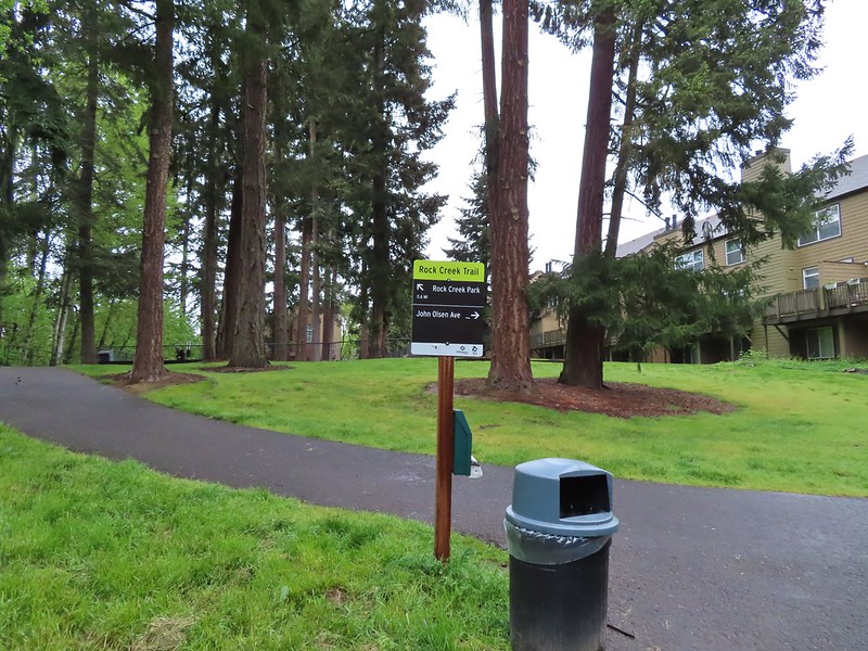
After a third of a mile we arrived at the Rock Creek Trail near NW Cornelius Pass Road where we made our first wrong turn of the morning. We initially turned right which would have led us back into Orenco Woods.
 We’ll blame our inability to read this sign on it still being early in the morning. We started down the path ahead before quickly questioning the direction and correcting course.
 He probably knew which way he was going.
 Heading the right way now.
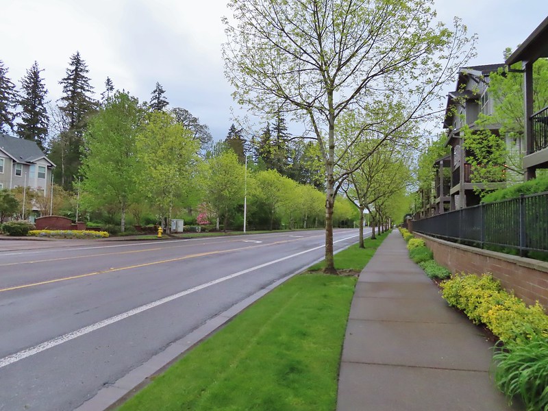
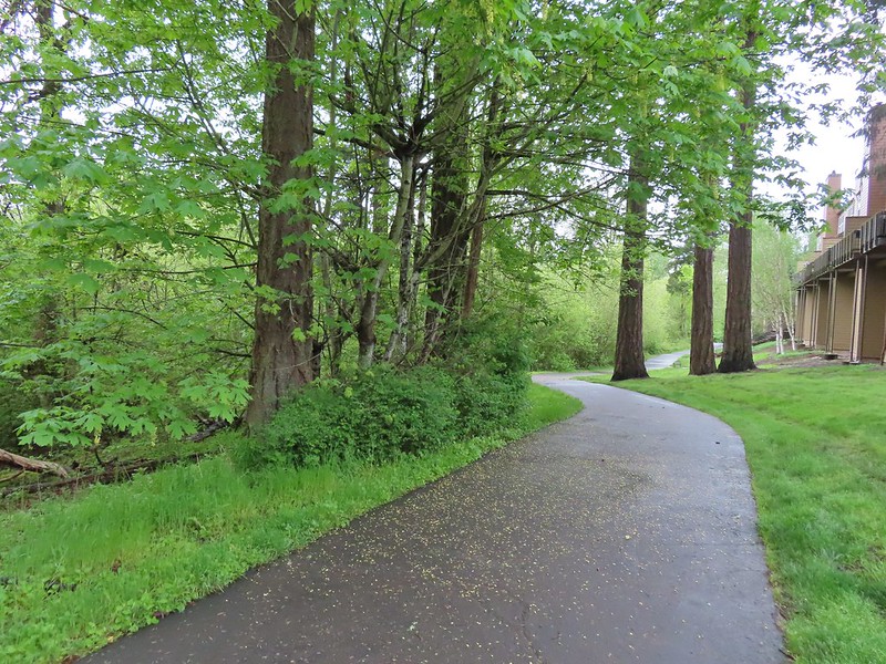
From Orenco Woods the Rock Creek Trail follows the sidewalk along NW Cornelius Pass Road north 150 yards to a crosswalk where it crosses the road and follows NW Wilkins Street west another third of a mile.
 NW Wilkins
The trail crosses NW Wilkins St below some power lines at a crosswalk and resumes as a paved path.


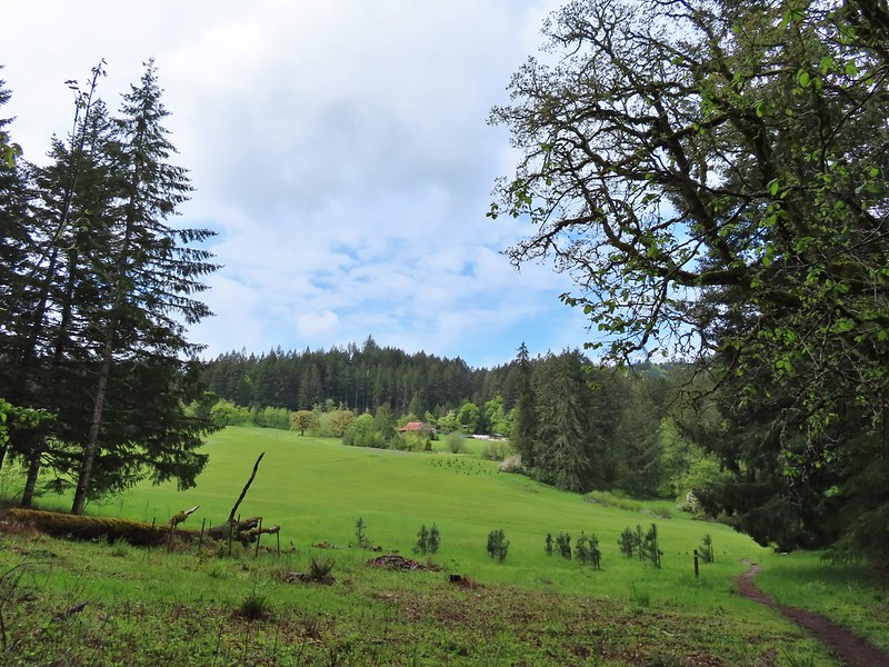
While there are no more sidewalk stretches of the trail until the Rock Creek Trailhead at NE Rock Creek Boulevard there are three other road crossing; NE Walker, NE Cornell, and NE Evergreen Parkway. Fortunately all of these road crossings are at signaled crosswalks.
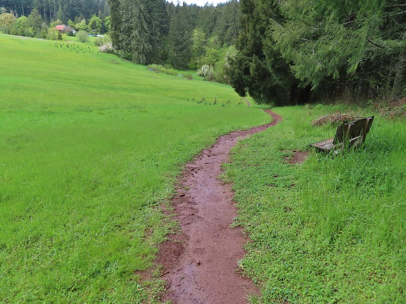
A little over a half mile from Wilkins Street we arrived at the start of a loop in Orchard Park


We stayed left planning on completing the loop on our return.
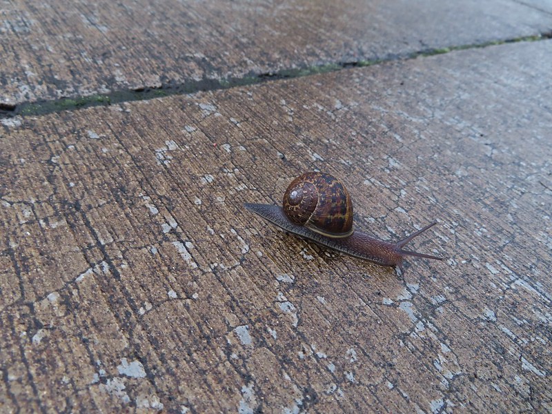
 Another trail user
Two tenths of a mile from the start of the loop the trail split. We didn’t see a sign/map here and didn’t consult the maps we had on our phones and mistook the left hand fork as simply a spur trail to a parking lot in the park and we stayed right. This was our second wrong turn of the morning.

This path led downhill and crossed crossed Rock Creek without realizing that we had curved a full 180 degrees.


 Fringecup
The trail split again two tenths of a mile later and here we veered left thinking it was the continuation of the Rock Creek Trail.
After a short distance the pavement ended at a circle of stone benches.
A well worn dirt path picked up here along a fence line behind some apartements

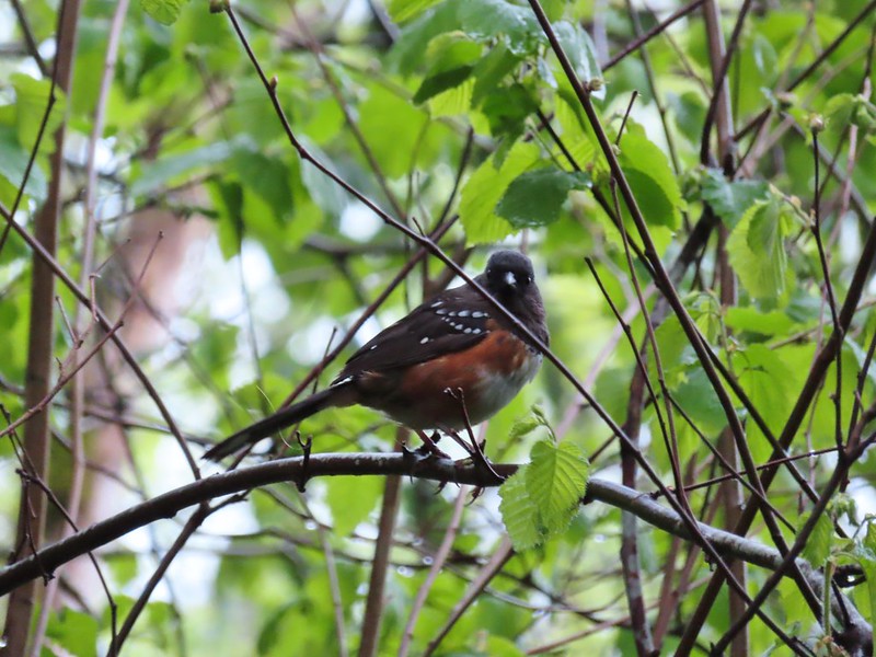 Spotted towhee
 Stellar’s Jay
This dirt path ended after a tenth of a mile at what turned out to be NW John Olson Avenue but we didn’t figure that our right away. We didn’t see any signs for the trail here so we finally consulted the maps we had in our phones but even then didn’t realize our mistake. On the map there was a slight jog right coming out of Orchard Park before crossing NE Walker so we headed right to the next street corner where we read the street sign realized this was NE Walker. The full extent of our mistake still wasn’t clear though as we followed the dirt path back past the stone benches to the fork where we’d veered left. It was here that we made our third and final wrong turn of the morning. We were actually on the Orchard Park Loop and not on the Rock Creek Trail which had veered left up to the parking lot while we had gone downhill to the right. Not realizing this we took the right hand fork which recrossed Rock Creek and then climbed back up to the Rock Creek Trail at the start of the loop
We almost made our fourth mistake here as we didn’t initially realize that we had made the full loop. It wasn’t until we spotted some familiar looking camas nearby that the light bulb went off.
 Second time staring at this sign.
Having finally figured it out we headed north through Orchard Park again but this time hiked uphill through the parking lot to NE Walker.


 Not sure exactly how to interpret this scene – mourning, a murder, or breakfast?
 The slight jog right along NE Walker.
We crossed NE Walker and a tenth of a mile later crossed NE Cornelius Pass.


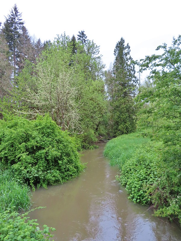
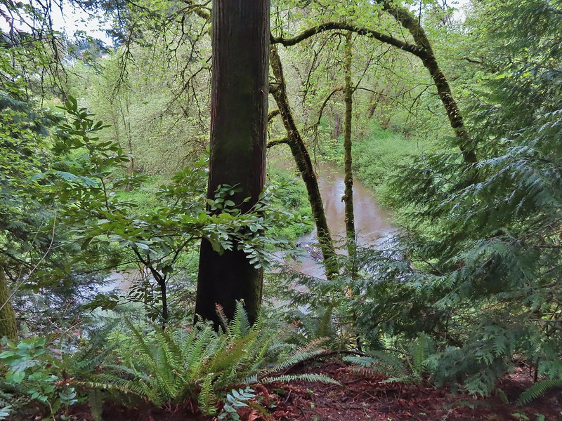
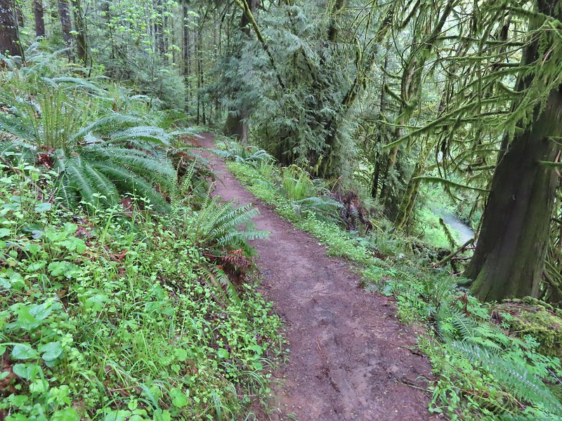
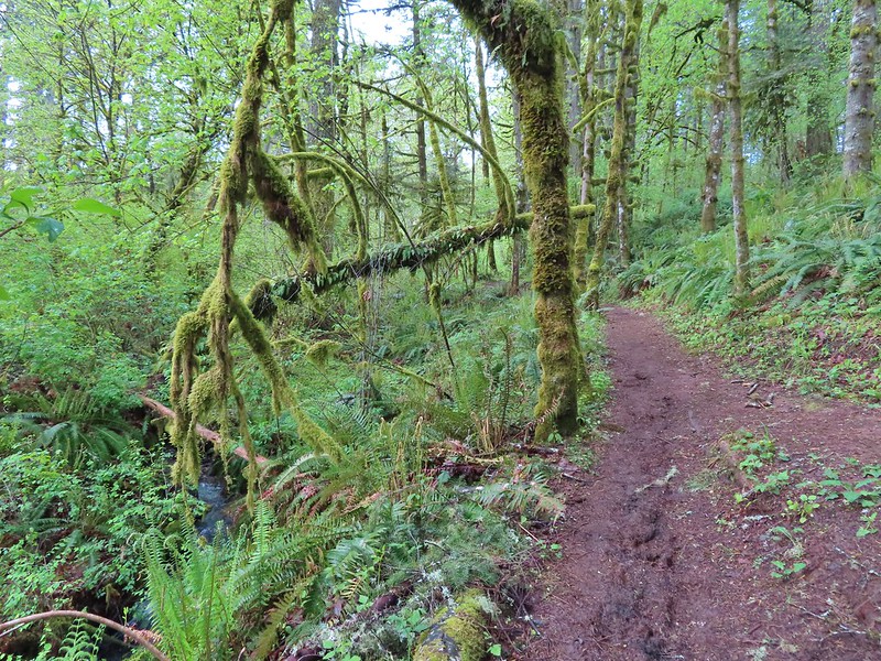
The next three quarters of a mile proved to be the most active for wildlife even though portions of it were between the creek and residences.

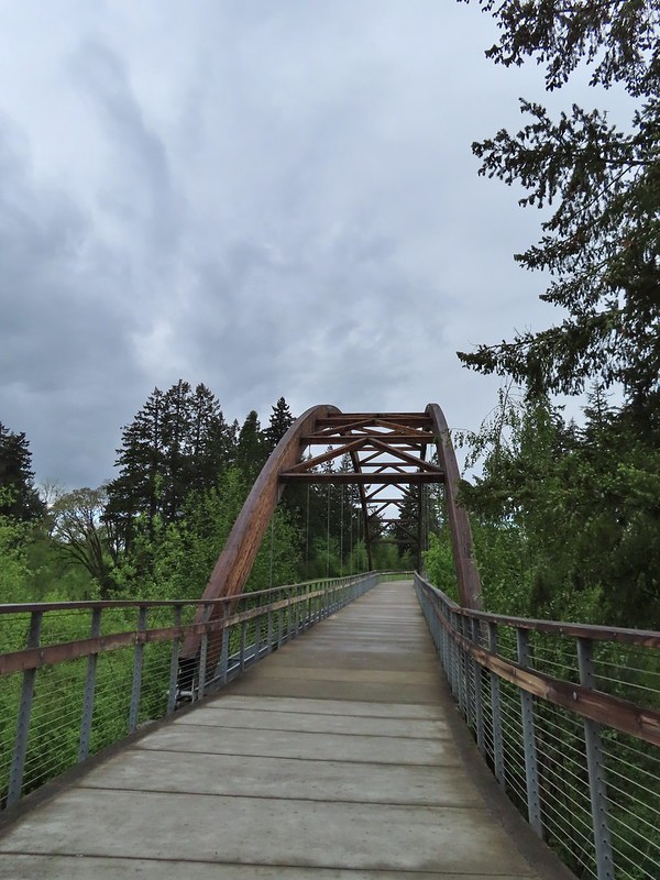
 Bridge of Rock Creek

 Look a pointer for John Olsen Avenue (just a lot further north).
 Mallards (A pair of wood ducks flew off at the same time the mallards headed downstream.)

We had stopped while I attempted to get a photo of a small yellow bird that was bouncing around in a tree when we heard a branch/tree crack nearby. While I continued to try and get a picture Heather went over to the creek to investigate. It turned out to be a beaver which had been one of the animals left on our list that we hadn’t yet seen on a hike (or drive to one). Before she could get my attention (or a photo) it disappeared underwater so I still haven’t seen one in the wild.
 Here is the only photo that I could even get with the little yellow bird visible at all.
 NE Evergreen Parkway
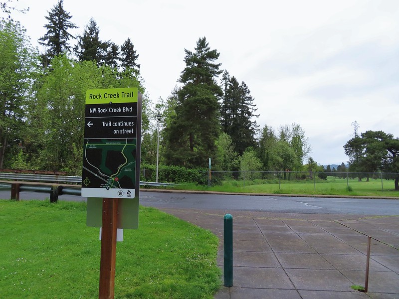
Two tenths of a mile beyond NE Evergreen the trail passed under Highway 26 and in another 400′ arrived at the Rock Creek Trailhead.

This was our turn around point so we headed back the way we’d come. We checked again for the beaver but it was no where to be found. Since we had inadvertently completed the Orchard Park Loop earlier we went straight back through the park and made our way back to Orenco Woods. At the entrance to the park we forked left staying on the Rock Creek Trail. (Retracing the short distance that we had hiked in the morning when we had made our first wrong turn.)
Two tenths of a mile into the park we came to a footbridge over Rock Creek.
After crossing the bridge we forked left and then took another left back on the Habitat Trail.

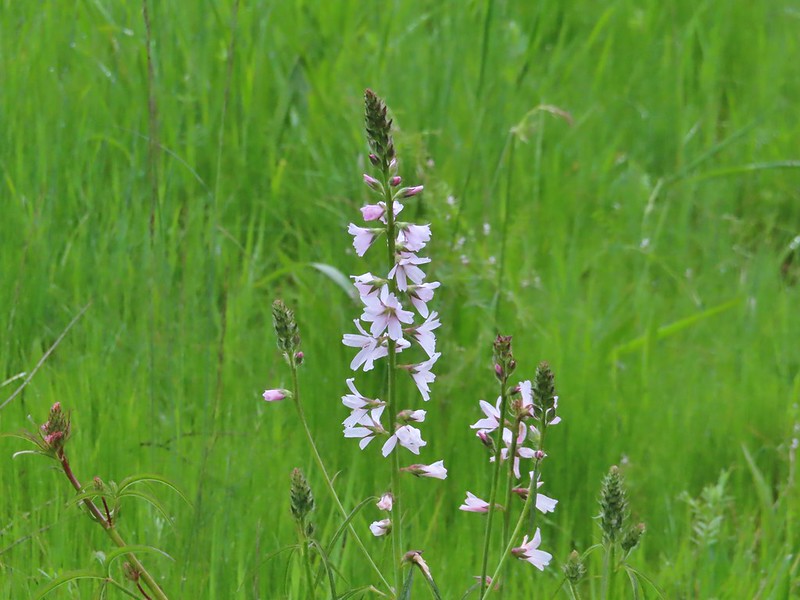 Checkermallow

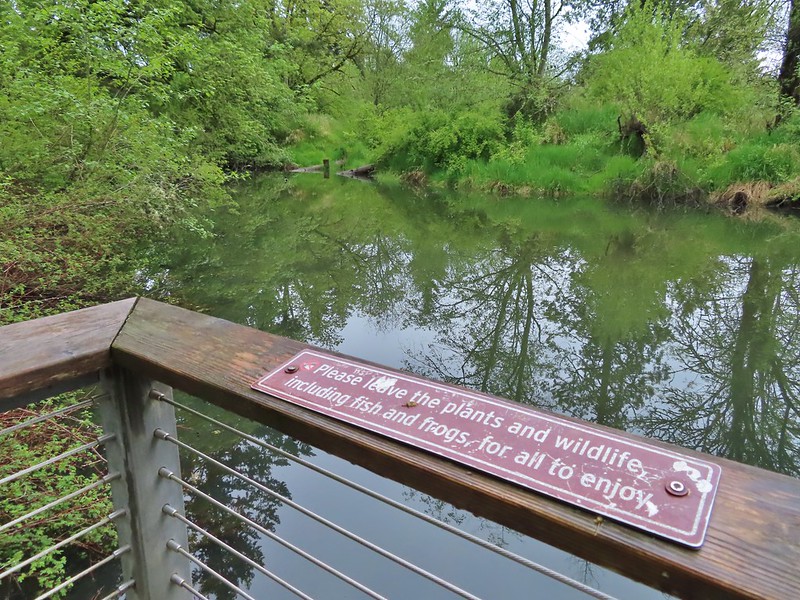
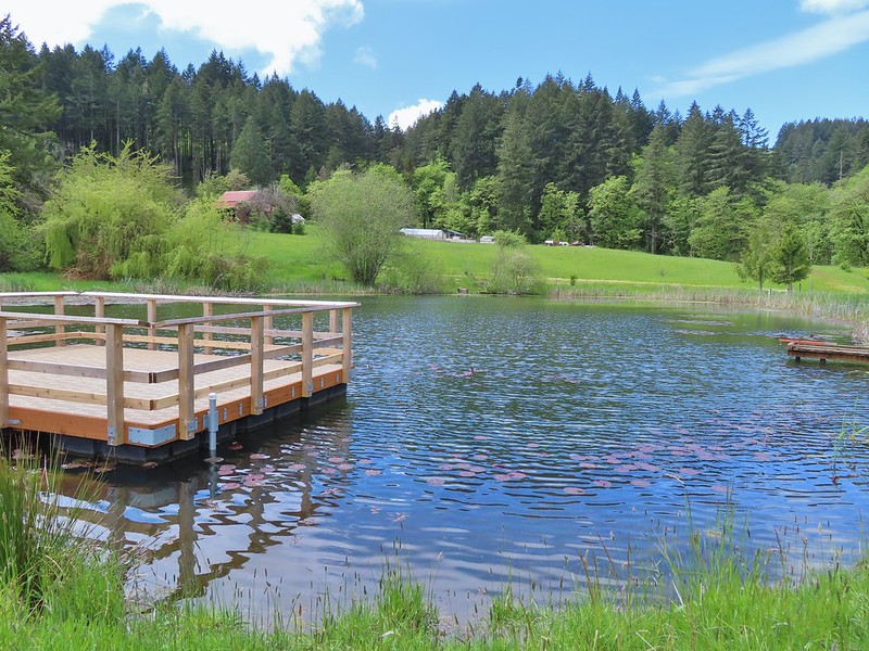
The trail looped around and downhill to pass under the footbridge before arriving at small pond with a viewing platform.

Beyond the pond the trail climbed back uphill near the McDonald House. We turned left here and made our way back to the trailhead.

While it had remained cloudy all morning there had not been any noticeable precipitation during our 7.5 mile hike here.

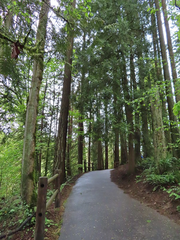
From Orenco Woods we drove to the Baseline Road Trailhead at nearby Noble Woods.

Our plan here was to make a counterclockwise loop using the outer most trails.

From the trailhead we headed downhill to the right behind the rest rooms.
Even though we were less than a mile from Orenco Woods we spotted a few flowers that we hadn’t seen during that hike.
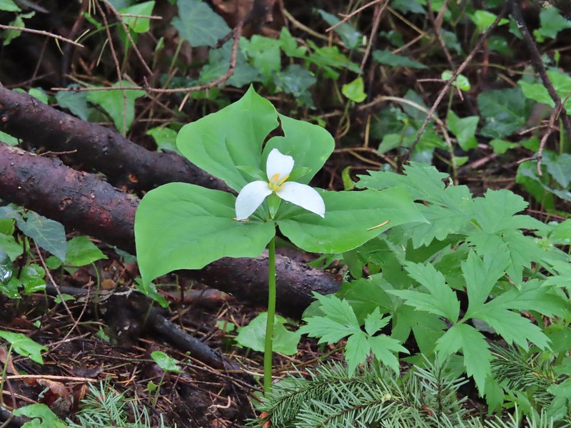 Trillium
 Solmonseal
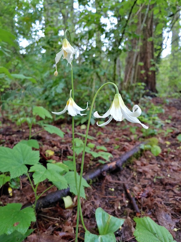 Fawnlilies
The trail leveled out to cross Rock Creek.

 Aven
Aven
A short spur trail on the other side of the creek theoretically led to Rock Creek but the recent rains had swollen it enough that the trail ended before the actual creek.

We continued on the loop climbing toward Borwick Road Trailhead but before reaching the grassy park at that trailhead we turned right leaving the paved path for a compacted gravel/dirt trail

This trail swung to the west before making a 180 degree turn and leading to the Borwick Road Trailhead. Near a viewpoint and bench Heather spotted a barred owl being harassed by a robin.


 Rock Creek from the viewpoint.
 The back of the owl (middle tree 2/3 of the way up)


The viewpoint was near the turn of the trail so we got some more glimpses of the owl through the trees after the turn. A second owl began hooting and this one wound up flying off to have a conversation. We hiked past the parking area at the Borwick Road Trailhead and hopped on a the trail the map called a “wood-chip” trail. In truth it was mostly mud at this point.
 Violets
We stuck to the outer trail when this trail forked.

We arrived back at the paved loop near Rock Creek. We turned right onto it, crossed Rock Creek, and then climbed back up to the Baseline Road Trailhead.
 Swollen creek
 Fairy bells
 Cinquefoil
 Nearing the trailhead.
The loop here was just over a mile.

We had once again been sparred any precipitation and as we drove to our next stop at Miller Woods found ourselves under blue skies and bright sunshine. Miller Woods however was under cloud cover but we were feeling pretty confident and put all our rain gear into our packs before setting off from the trailhead. While it had been our first visit to Orenco and Noble Woods we had hiked here in March, 2020 (post).

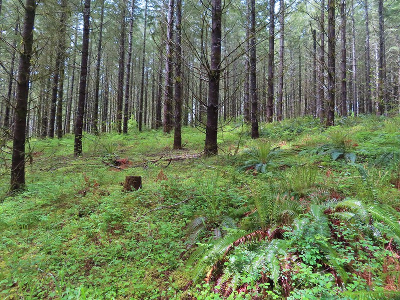
On our previous visit we had taken the yellow Outer Loop and had considered taking one of the other trails this time but a portion of the Discovery Loop was closed due to hazardous conditions (appeared to be a slide/washout) and the Oak Summit Trail didn’t look as interesting as the Outer Loop so we followed our route from 2020 except for a short section that had been rerouted.

From the kiosk we followed the yellow pointers downhill through the grass passing camas and birds along the way down.


 A wren and a white-crowned sparrow
 American goldfinches
 Tree swallows

As we neared the tree line the precipitation finally arrived and a light rain began to fall.
We stopped in the trees to put our rain jackets on and then began descending through the forest to an unnamed stream.

 Bleeding heart near the stream.
The trail then turned NNW leveling out a bit above Berry Creek as it traversed the hillside.
 Berry Creek down to the right.
 There was a lot of wild ginger on the hillside.
Not long after donning our rain jackets the rain stopped and sunlight began to break through again.
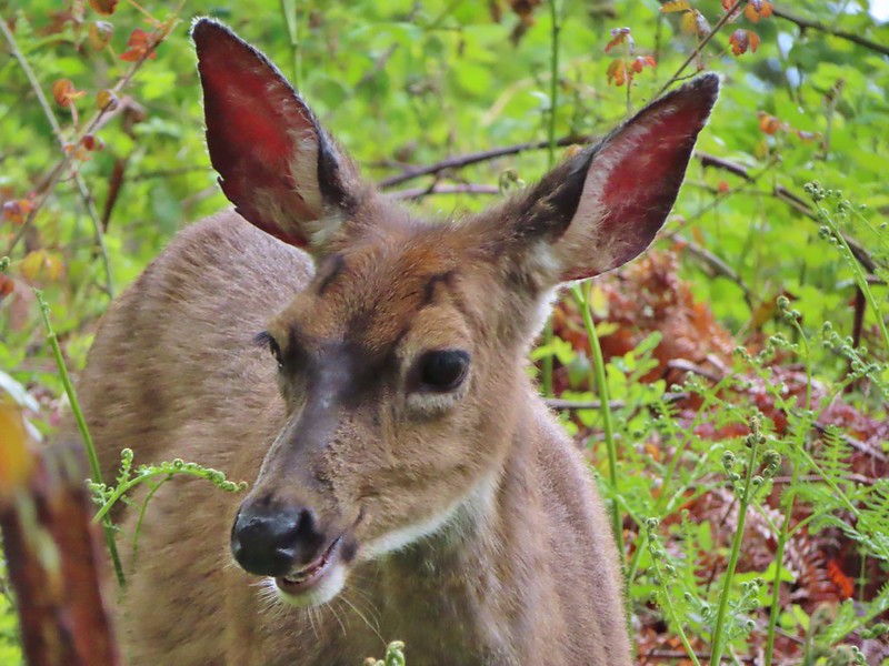
The trail climbed as it came around the hill and we spotted a deer in the distance.

It was a young one that was munching on plants along a service road. As we made our way by on the trail Heather noticed the mother bedded down on the road.

After leaving the deer the trail soon began to descend and leave the trees.
It was here that the trail had been rerouted since our 2020 visit. In 2020 the trail veered left to a service road and made a right turn along the road back to the tree line before reaching a bridge across a creek. Now the trail simply headed downhill sticking to the treeline.
 Iris
Iris
 Buttercups
One of the neat features at Miller Woods is the wildlife survey covers which are liftable metal covers that could house wildlife. We had yet to lift one and see anything more than ants though until the cover near the creek. Lifting this cover revealed a small snake.

 Small garter snake
We gently replaced the cover and continued on the loop which reentered the trees after crossing the creek.
 Approaching the bridge and creek.
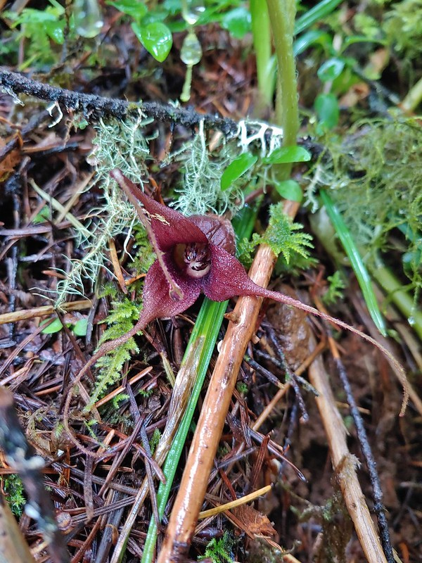
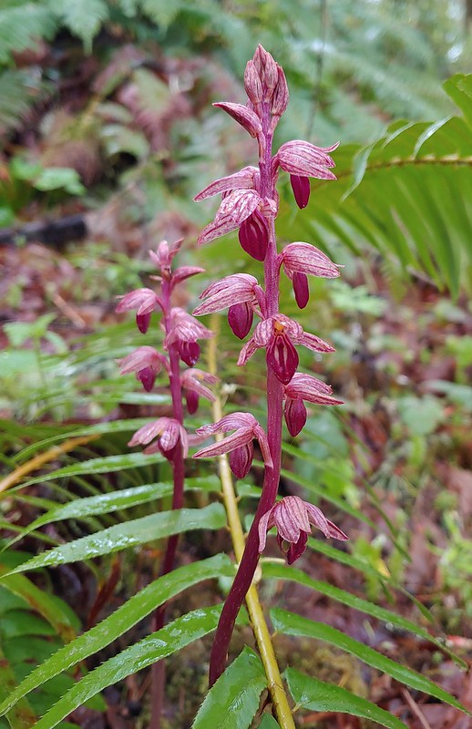 Striped coralroot
It was shortly after crossing the bridge that we discovered the trail closure which ended the question of whether we would do the different, shorter loop this time or repeat our previous hike.

Doing the longer 4.5 mile loop turned out to be great as the weather stayed dry and we spotted several more deer and some birds along the way.
 Sparrow
 Doe just hanging out in a patch of poison oak. (It doesn’t bother deer.)

 Nearing the high point of the trail at K.T. Summit
 Spotted coralroot
 K.T. Summit
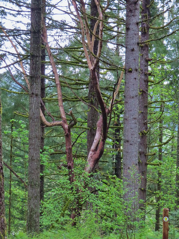 A very cool madrone tree.
 Two more deer with a third off camera.
Another neat feature that was new for us this visit were a number of signs along the trail identifying different evergreen trees in the Miller Woods Diversity Area.
 There was at least one identifier for each tree listed on this sign. The signs were particularly nice because many were next to younger trees which made it easier to see the needles and bark instead of just look at a trunk and having to look up to try and see other details of the trees.
A couple of examples.
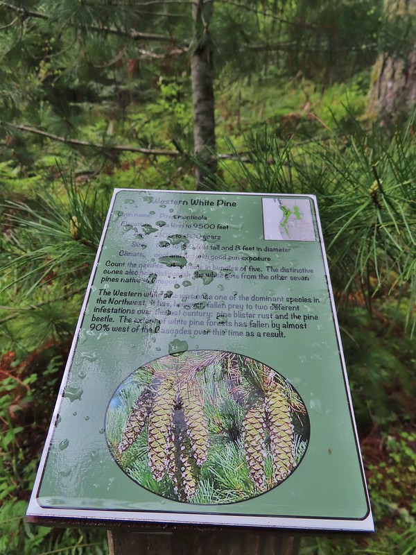 Western white pine
 Western larch
 Vanilla leaf
 Fairy slippers

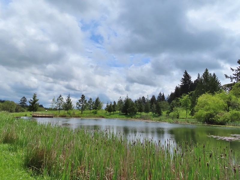
The trail passes above the entrance road and swings out before dropping down to what you expect to be the parking area (there is a signed short cut to it along the way) but the Outer Loop actually loops back behind the parking area and pops out of the trees near a the pond that the Discovery Loop goes around.


 Frog near the pond.
Another new feature was a platform over the pond.
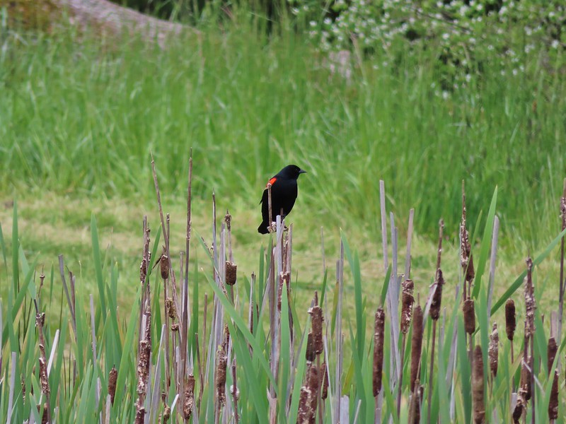 Red-winged blackbird

After taking a break on the platform we hiked uphill to the parking area and headed for our last stop.

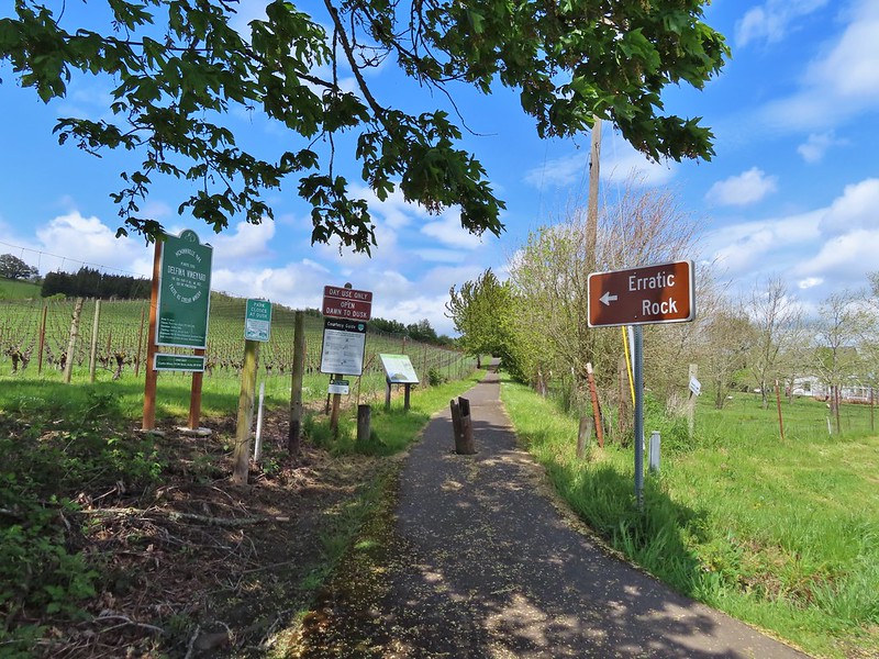
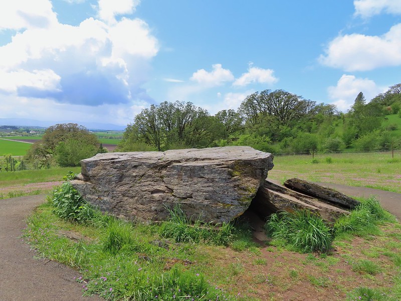
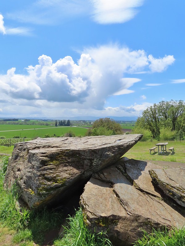
The Erratic Rock State Natural Site is located just off Highway 18 between McMinville and Sheridan. There are no amenities at the site, just a quarter mile paved trail uphill to the rock from a small pullout along Oldsville Road. While it is less than 30 miles from our house that is a stretch of highway that we never find ourselves on. I realized when I was planning this outing that it would only add about 10 minutes to our drive home from Miller Woods to detour to the site so I added it to the plans.
We missed the little pullout but found a wide section of shoulder to pull off on and walk back to the signed trail.
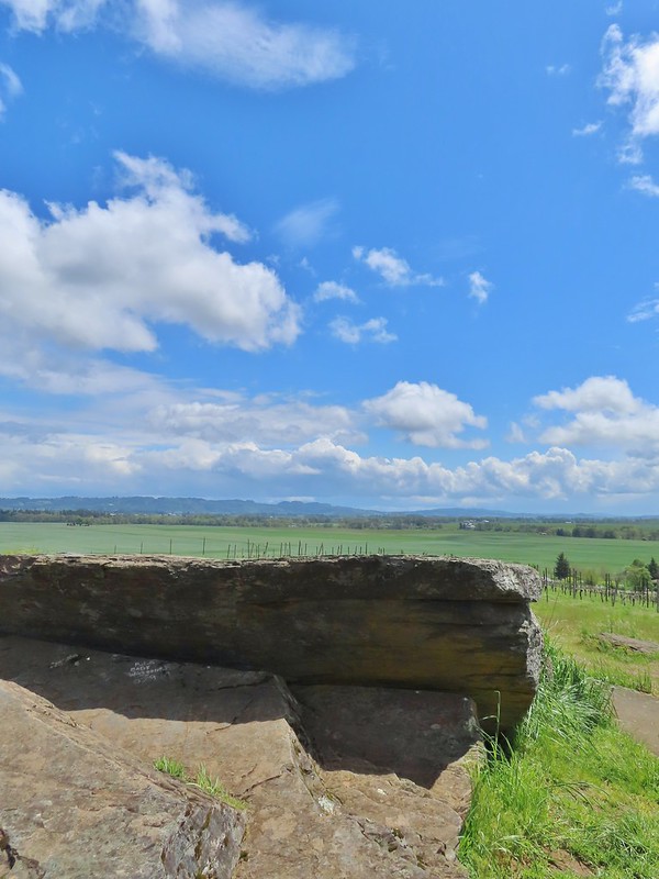
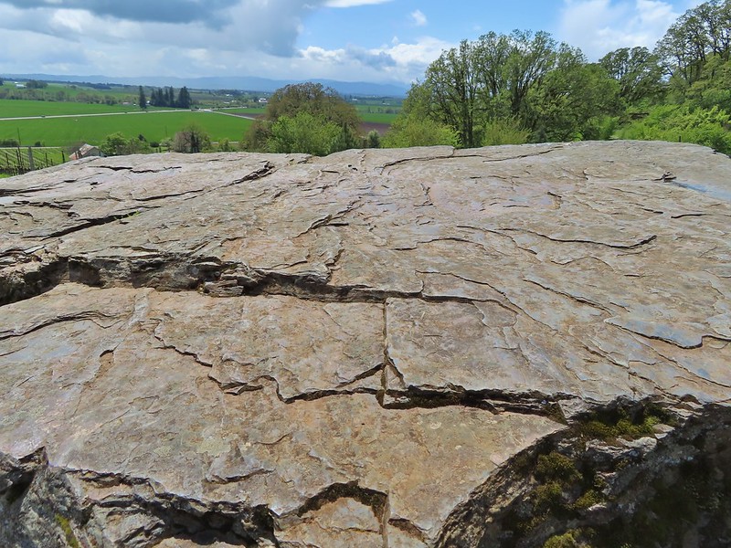
The Erratic Rock is a 90 ton rock from the Northern Rocky Mountains that wound up over 500 hundred miles away on a hill in Oregon after being deposited here after one of Lake Missoula’s floods.
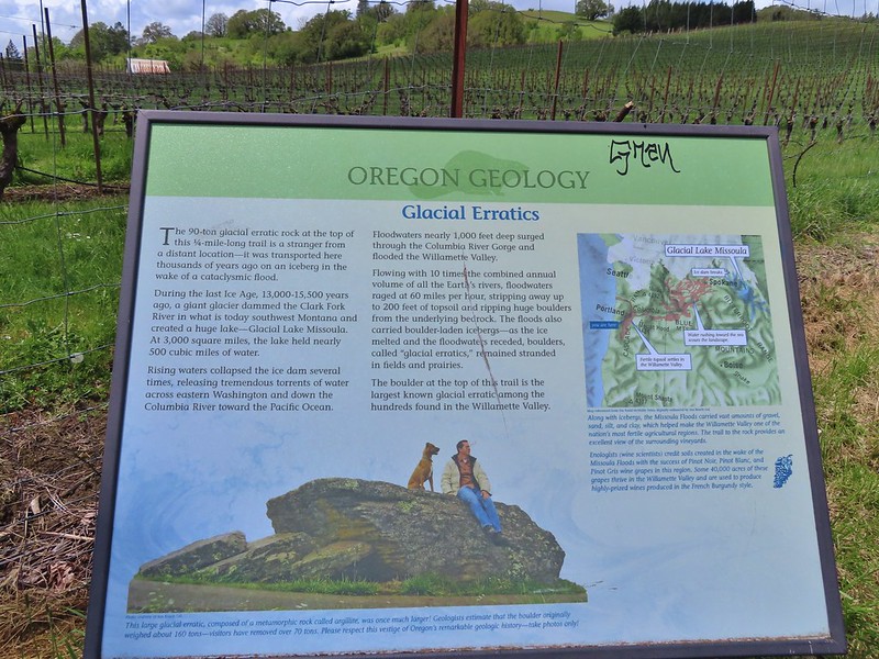 Interpretive sign at the start of the trail.
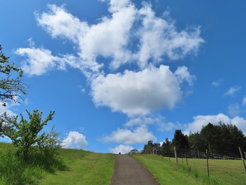
We were in a pocket of mostly blue sky as we headed up the trail.
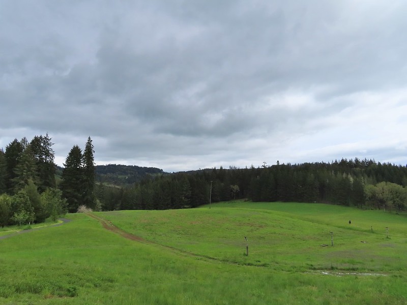
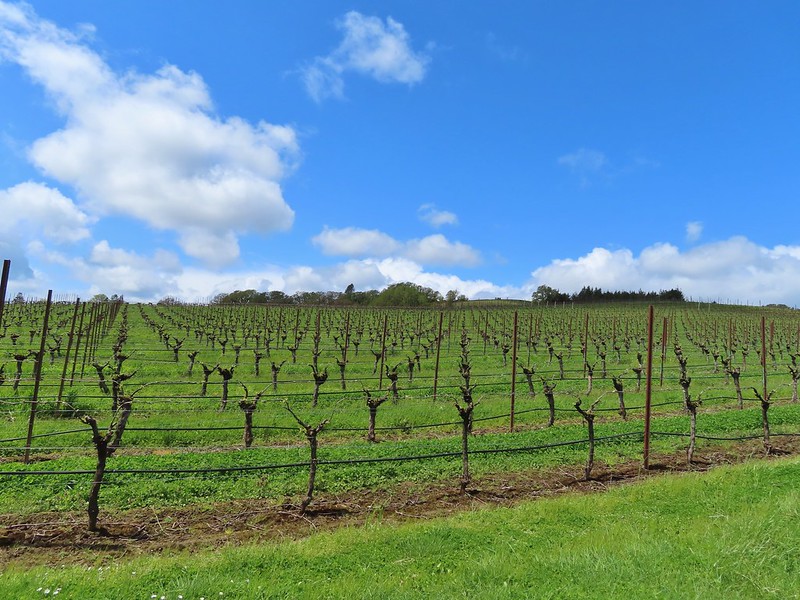 Vineyard along the trail.
Although short the trail gains over 100′ in the quarter mile to the rock and we had already hiked over 13 miles, we were relieved when we saw the trail begin to crest.
Seeing the rock there and knowing how far it had to travel to wind up there made it an impressive sight. The views from the hill were also quite nice making it a worthwhile detour.

Our total for the day came to 13.8 miles with only 920′ of cumulative elevation gain. Individually each of these hikes are worth a stop and they all have things to offer young hikers. It turned out to be a fun combination with a unexpected amount of wildlife sightings and aside from the 10-15 minutes of light rain had been a surprisingly dry day. Happy Trails!
Flickr: Orenco, Noble & Miller Woods and Erratic Rock State Natural Site

5 replies on “Orenco, Noble & Miller Woods and Erratic Rock State Natural Site – 05/07/2022”
[…] is managed by Metro which also manages Orenco Woods where we had started last week’s hike (post). Chehalem Ridge offers a network of hiking, biking, and equestrian trails but does not allow […]
I love the barred owl photo and all the bird pics. 🙂
[…] was that this stop would mark our third straight outing visiting an Oregon Metro managed park. (Orenco Woods)(Chehalem […]
[…] Erratic Rock (post) […]
[…] were familiar with the Rock Creek Trail having hiked its two other segments in May 2022 (post). The eventual plan is for the three current segments to be connected to make a single 8-mile […]