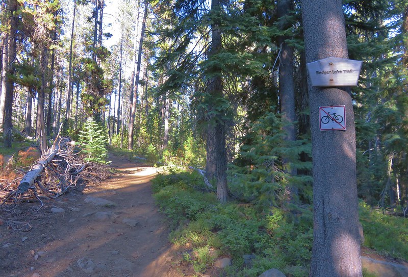
Our plan for the second day in the Sky Lakes Wilderness was to hike to the summit of 9495′ Mt. McLoughlin, the sixth highest peak in the Oregon Cascades. We were going to hike the 2.5 miles back to our car from Badger Lake then drive the approximately 3 miles to the Mt. McLoughlin Trailhead. It would have been possible to hike the whole way by going back to Fourmile Campground and taking the Twin Ponds Trail to the Pacific Crest Trail and then turning up the Mt. McLoughlin Trail, but that would have been a nearly 25 mile hike.
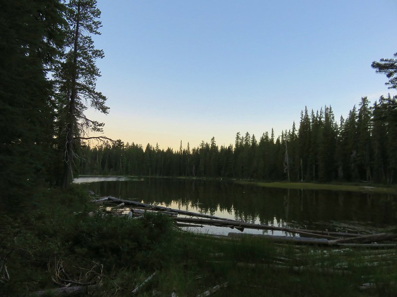
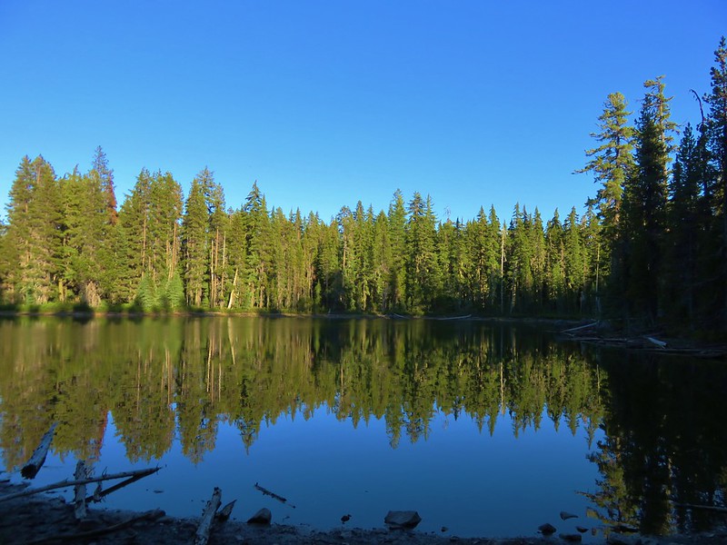
Before setting off we ate breakfast watching the sunrise from Badger Lake.
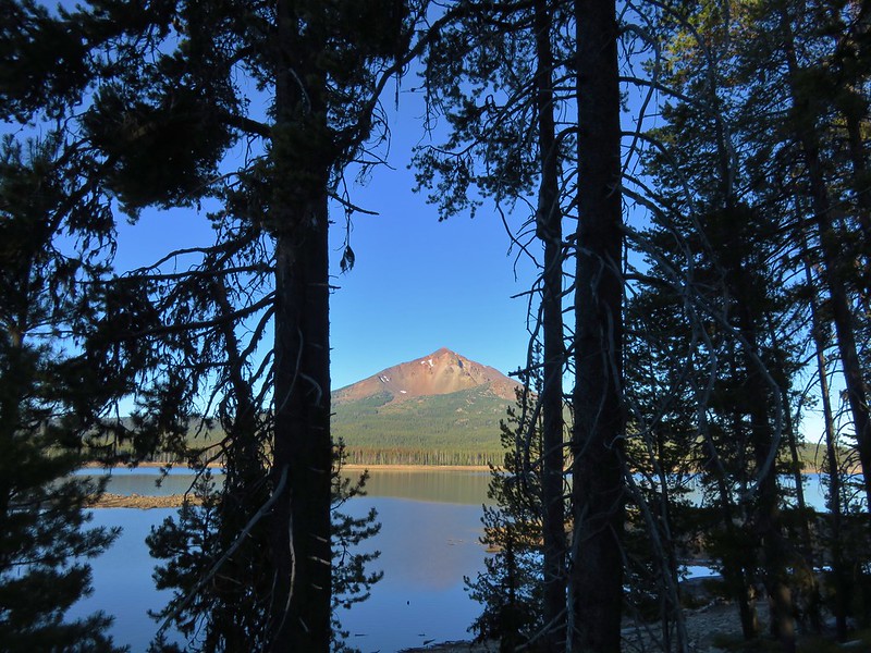
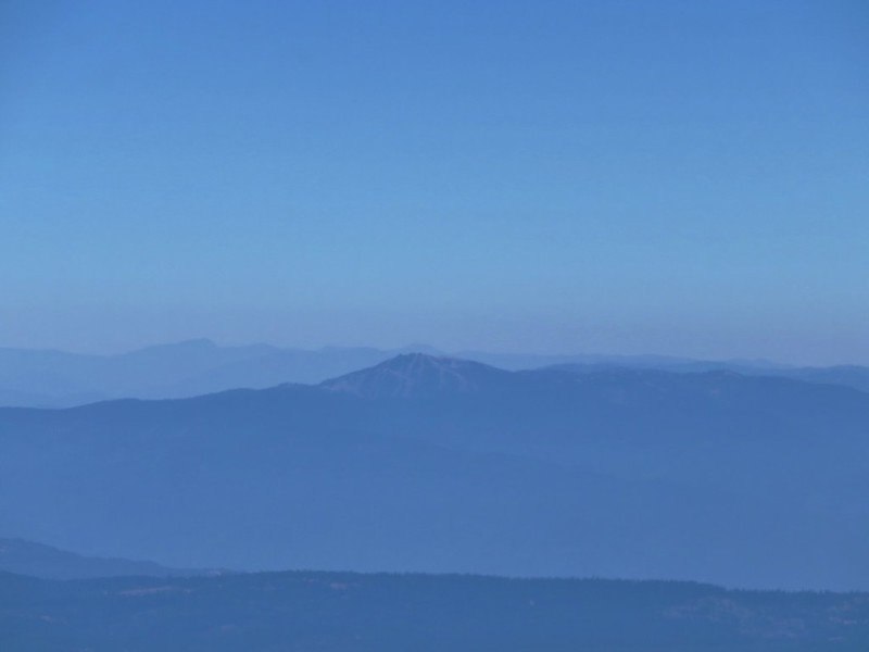
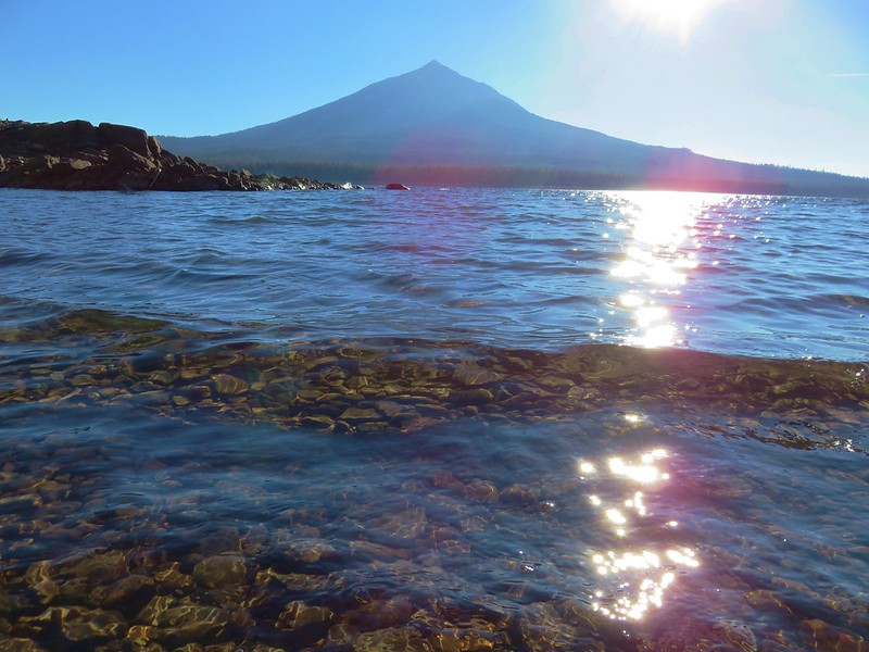
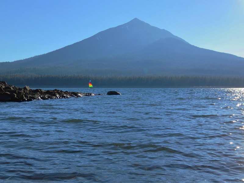
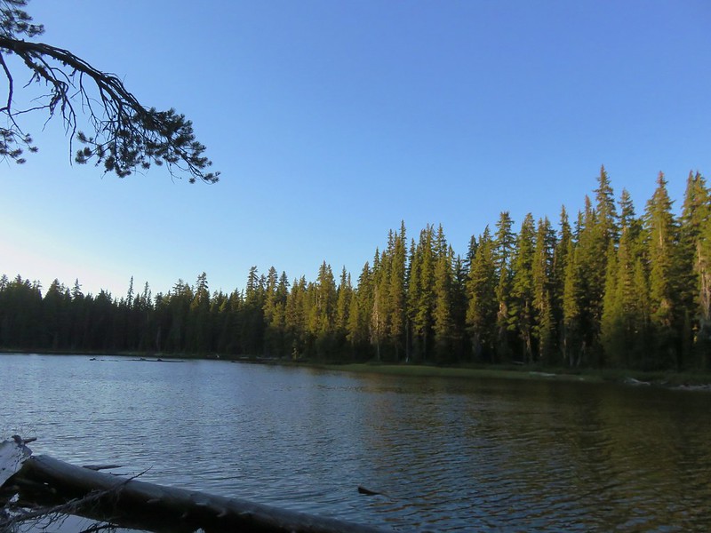
As we passed Fourmile Lake we got a nice view of our goal for the day.
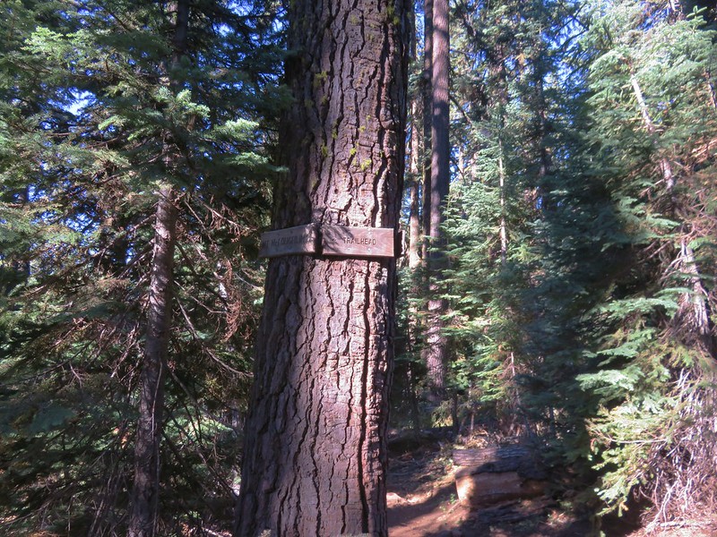
At the campground we took advantage of the water pump near the trailhead and filled our CamelBak bladders as well as our Hydroflasks. It was going to be another warm day and we wanted to make sure we had plenty of water for the nearly 4000′ climb. Heather also loaded her pack with little bags of Cool Ranch Doritos just in case we ran into any thru-hikers on the short section of the Pacific Crest Trail that the Mt. McLoughlin Trail shares. From the campground we drove back along Fourmile Lake Road and turned right near milepost 3. The Mt. McLoughlin Trailhead is located at the end of the maintained portion of this road.

It was around 8:30am when we arrived and the parking lot was already packed with cars. It was so full in fact that we had to loop around and park on the shoulder near the lot entrance. There is a large sign at the trailhead and, an identical sign near the wilderness boundary, warning of the dangers of Mt. McLoughlin. The main issue hikers run into is getting lost during their descent if they veer too far south in an attempt to take a short-cut.
The second sign near the wilderness boundary.
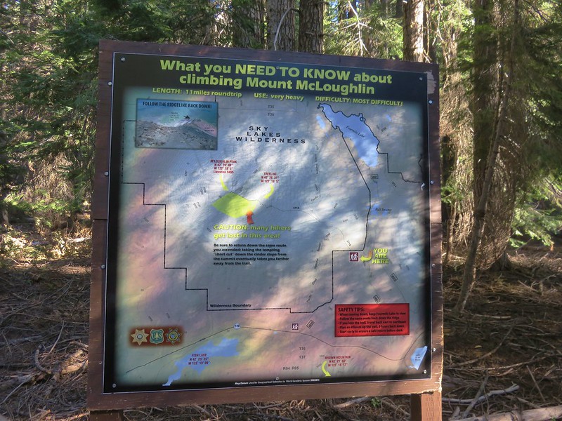
Sullivan has the same warning in his “100 Hikes in Southern Oregon” guidebook so we were already aware of the issue, but the sign added a tip to always keep Fourmile Lake in view on the way down.
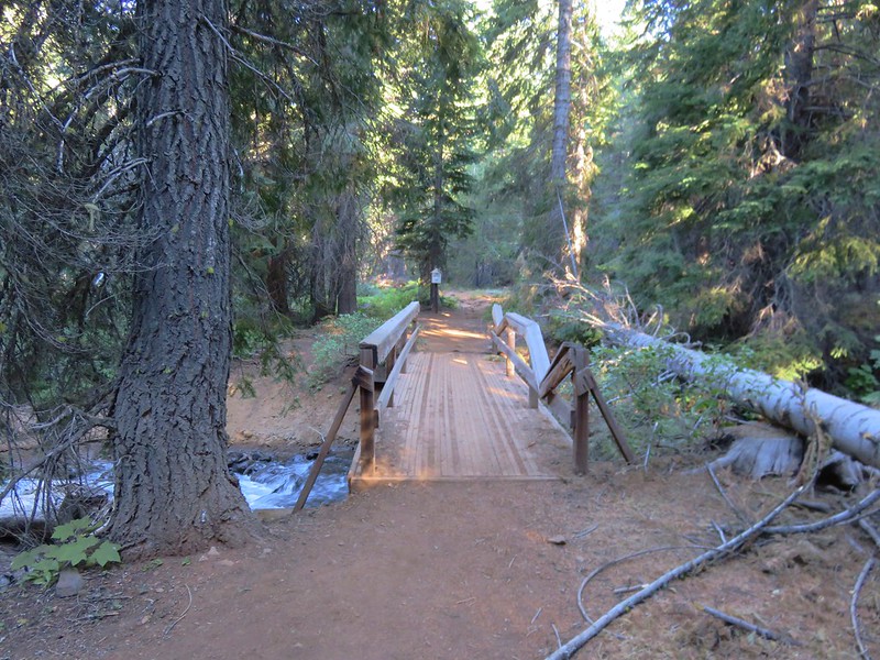
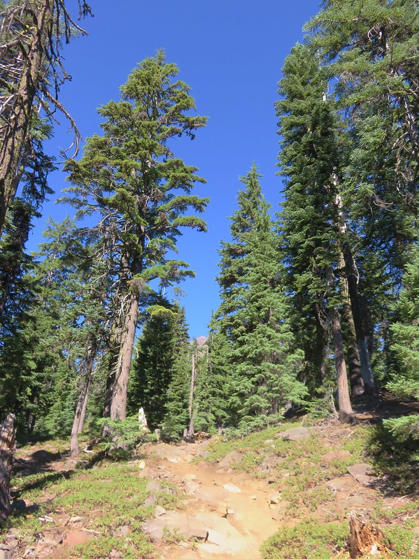
The trail set off through a forest of Mountain Hemlock and almost immediately crossed Cascade Canal which looked more like a creek here than it had near Fourmile Lake.


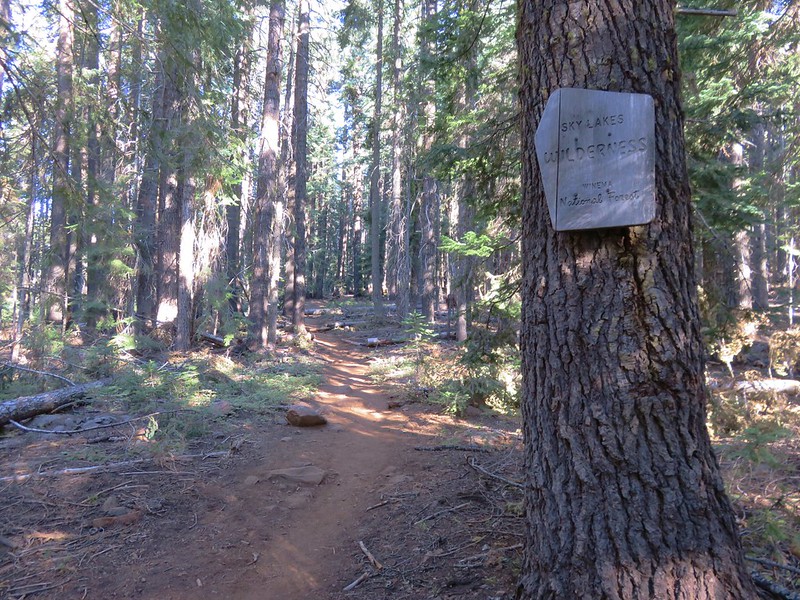
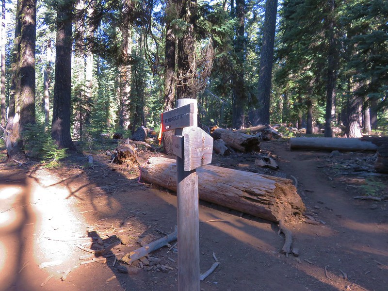
In the first mile the trail entered the Sky Lakes Wilderness and climbed gradually to a junction with the Pacific Crest Trail.
For a short distance the PCT and Mt. McLoughlin Trail were one and the same. Heather was on the lookout for thru-hikers to offer her Doritos to and I was looking for a side trail shown in our guidebook as well as on our maps that led down to Freye Lake. We were planning on visiting that lake on the way back down but I always like to make sure I am familiar with where I am going to be turning. According to the information we had the side trail was approximately .2 miles from the PCT junction. Then it would be another .2 miles to where the PCT and Mt. McLoughlin Trial parted ways. I never spotted the side trail and Heather hadn’t seen any thru-hikers when we reached the split.
I happened to look at the GPS which showed our location as being at the side trail down to Freye Lake and not the PCT split which on the GPS map was further ahead. We continued one wondering if the PCT had been rerouted at some point and was now sharing at least the first part of the trail down to Freye Lake. We kept an eye out for signs of a former trail in the area where the GPS showed the PCT splitting off but all we saw was blowdown.
We hadn’t seen the side trail or any thru-hikers but on the PCT but we did see something we hadn’t seen on either of the previous two days – a deer.
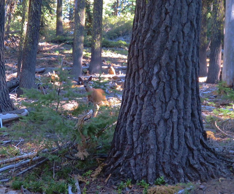
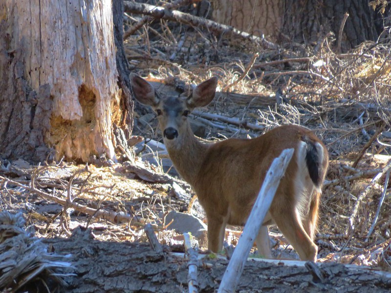
We’d been a little surprised that we hadn’t seen any on the trails yet, just a pair bounding off from near a horse corral in the Fourmile Lake Campground when we drove in the day before. After sizing one another up for a bit we went our separate ways. We were on a 1.5 mile section of the trail that climbed slowly away from the PCT toward Mt. McLoughlin. At times we were able to see the summit rising above the trees.
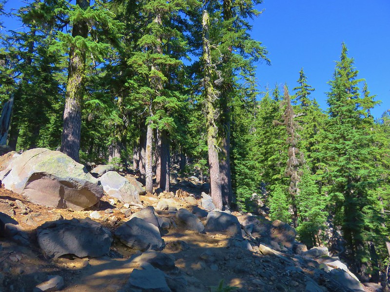
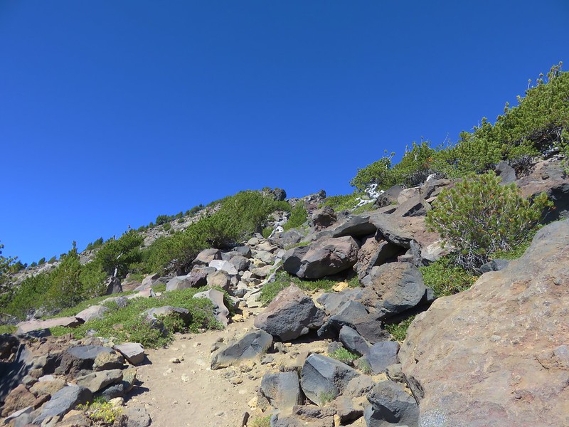
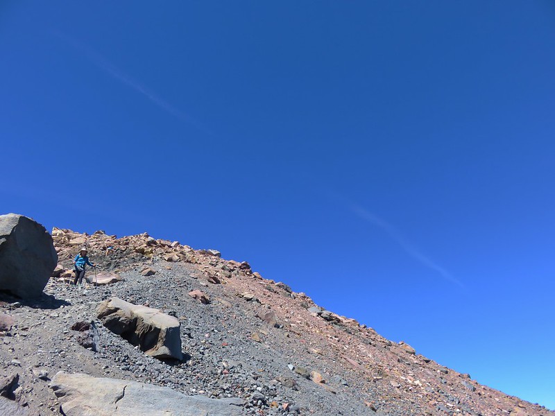
The easier 1.5 mile section ended when the trail finally realized that we had to go up to reach the summit. The trail steepened drastically as it began climbing up increasingly rocky terrain amid an ever thinning forest.
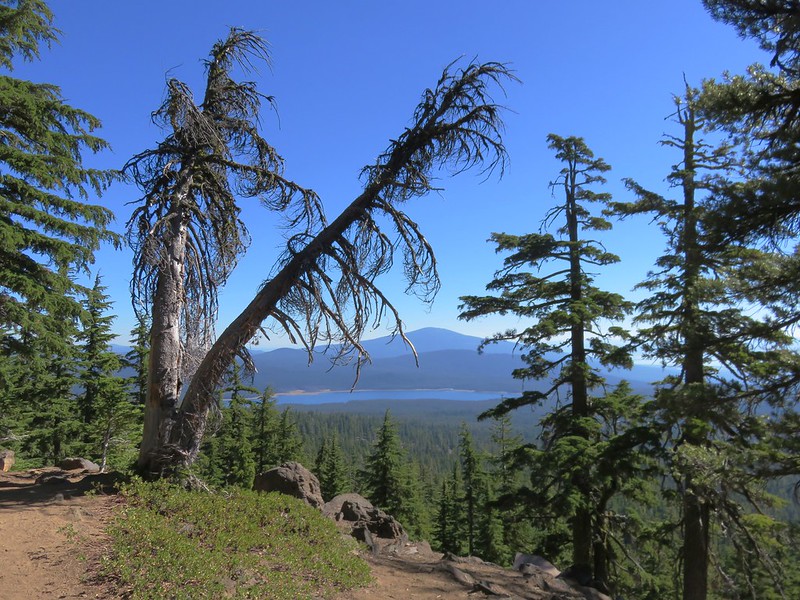
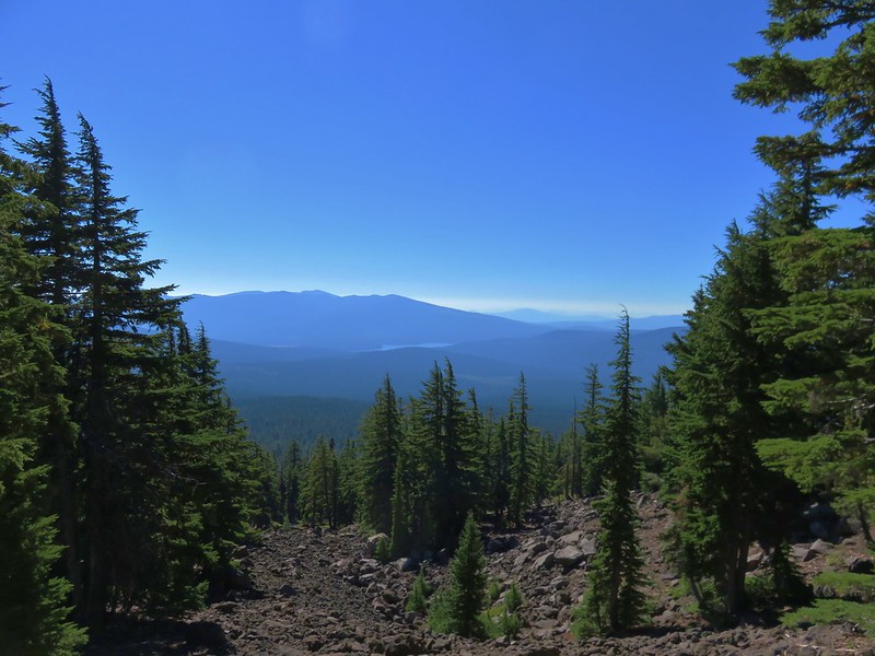
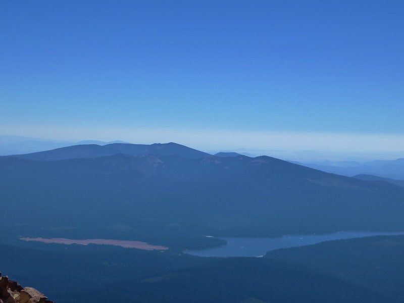
The thinning forest did allow for some views of the surrounding area.
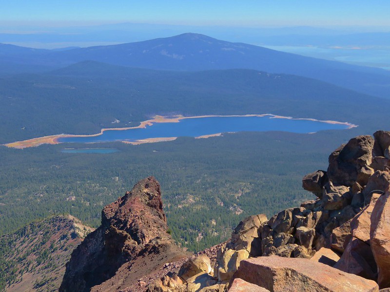
Pelican Butte and Fourmile Lake
Lake of the Woods and the Mountain Lakes Wilderness
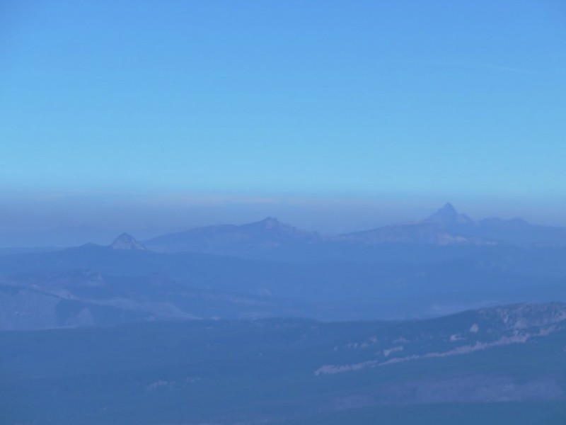
Mt. Thielsen beyond the Rim of Crater Lake and the Sky Lakes Wilderness
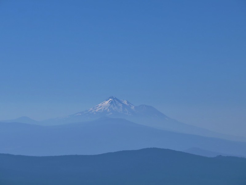
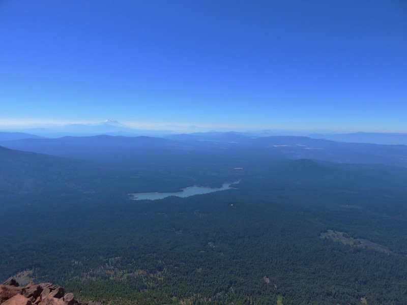
Brown Mountain and Mt. Shasta
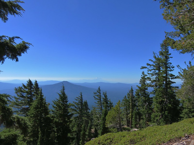
It was a little hazier than it had been two days earlier when we had climbed Aspen Butte in the Mountain Lakes Wilderness, but one improvement was the view of Mt. Shasta as sunlight reflected off the snow.
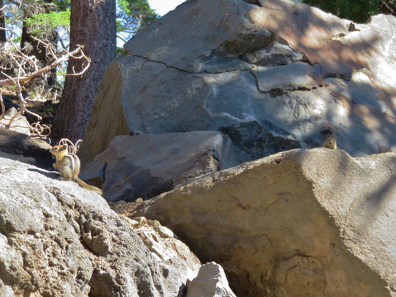
As we trudged uphill the locals kept a close eye on us.
As we gained elevation most of the trees gave way leaving Whitebark pines and some manzanita bushes.
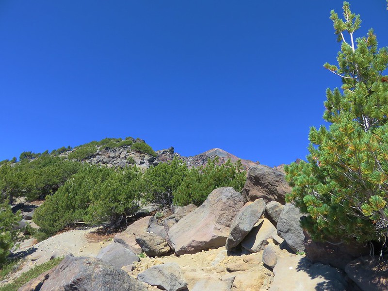
There were occasional glimpses of the summit which always seemed to be the same distance away – far.
About one and a quarter miles from the summit we reached a saddle where much of the remaining route was visible.
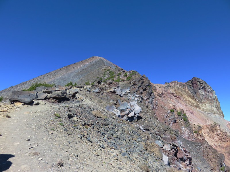
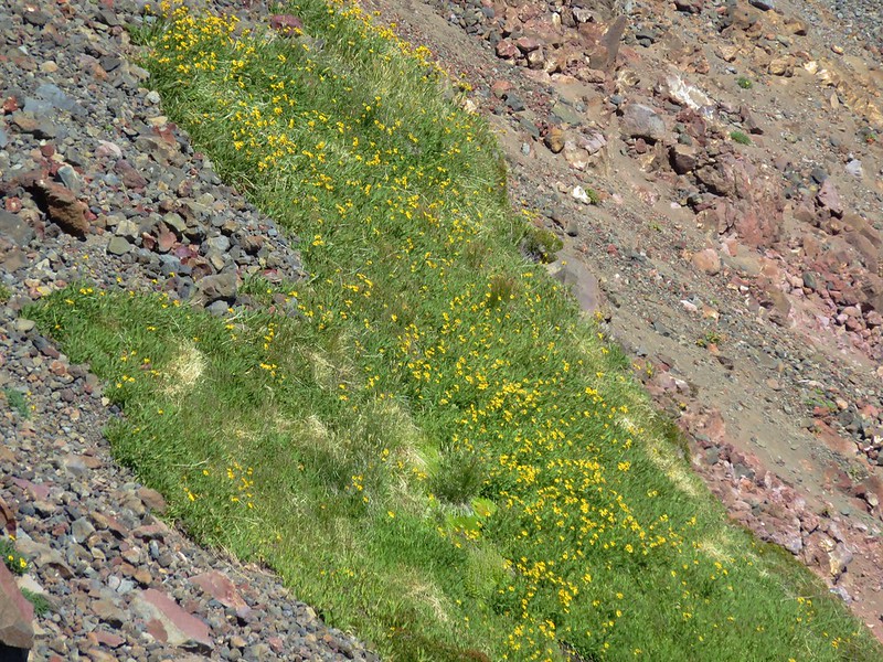
Along this final section a few alpine flowers added some color to the area while a couple of patches of snow attempted to make it through the year.


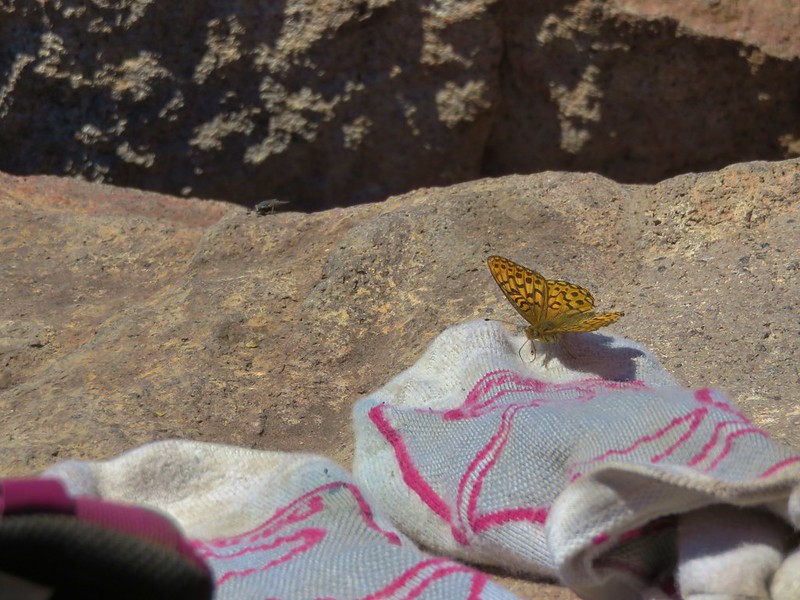
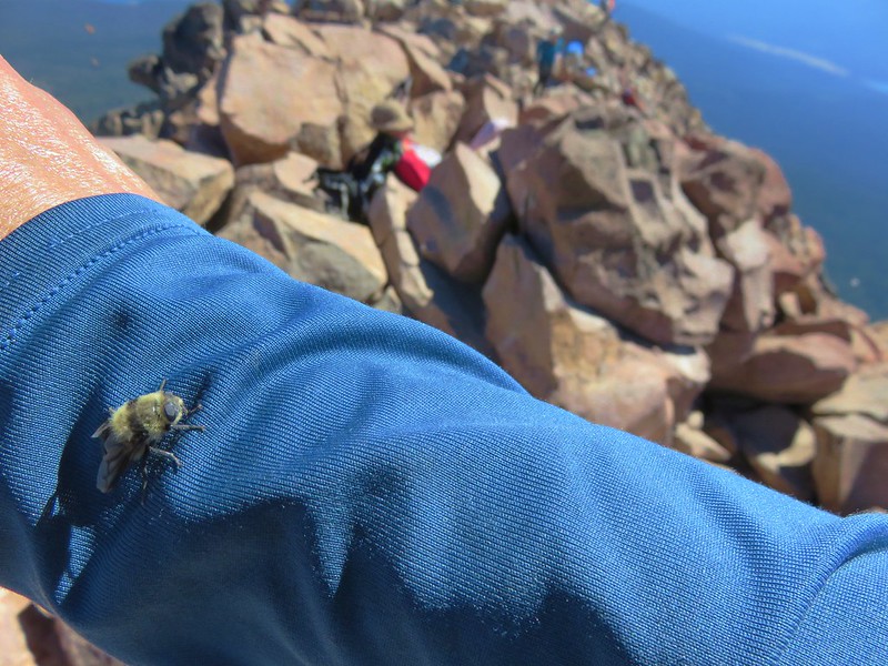
It was about noon when we arrived at the summit to find a decent sized crowd gathered.
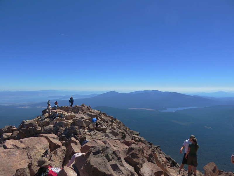
There was plenty of room though and we took a seat near the summit register.
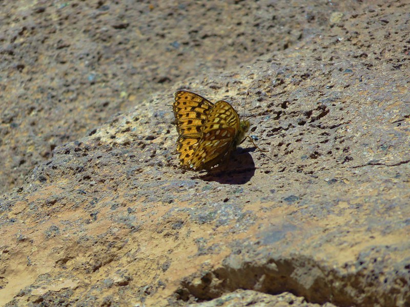
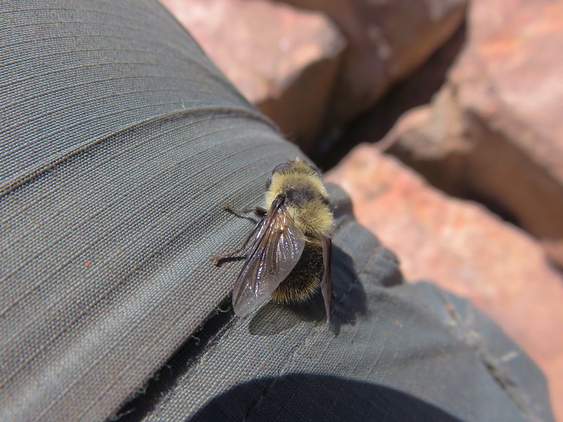
In addition to there being quite a few hikers at the summit there were numerous butterflies and bees who seemed to really like me.
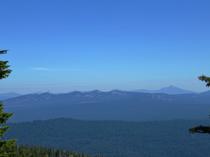
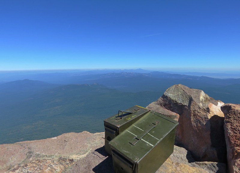
There was a heavy band of smoke possibly coming from the Trail wildfire that was visible from the north beyond Mt. Thielsen all the way south into California. Despite the haze on the horizon the skies above the mountain were bright blue and beautiful and there was still a decent view in all directions.
Pelican Butte, Fourmile Lake and Squaw Lake
Aspen Butte in the Mountain Lakes Wilderness
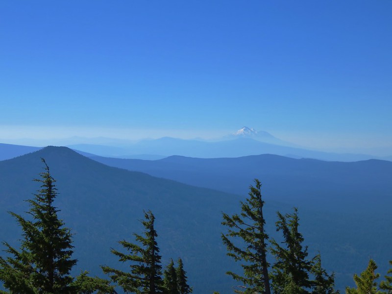
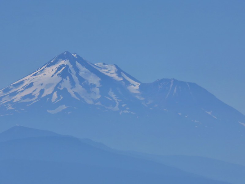
Mt. Shasta beyond Fish Lake
 <
<
Mt. Ashland
Union Peak, Hillman Peak and Mt. Thielsen
The Sky Lakes Wilderness with the peaks around Crater Lake and Mt. Thielsen beyond

We broke out our snacks including a couple of the bags of Doritos which we had forgotten would expand at that altitude. Luckily none of the bags exploded but they did look like little balloons. After sitting awhile we began to get a little warm. There had been a nice gentle breeze on the way up but oddly there was none whatsoever on top. We began our descent remembering not to drift too far south.
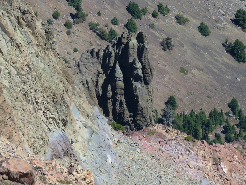
On the way down we took some time to study some of the volcanic rock formation in the mountains glacier carved north face.
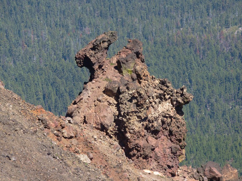
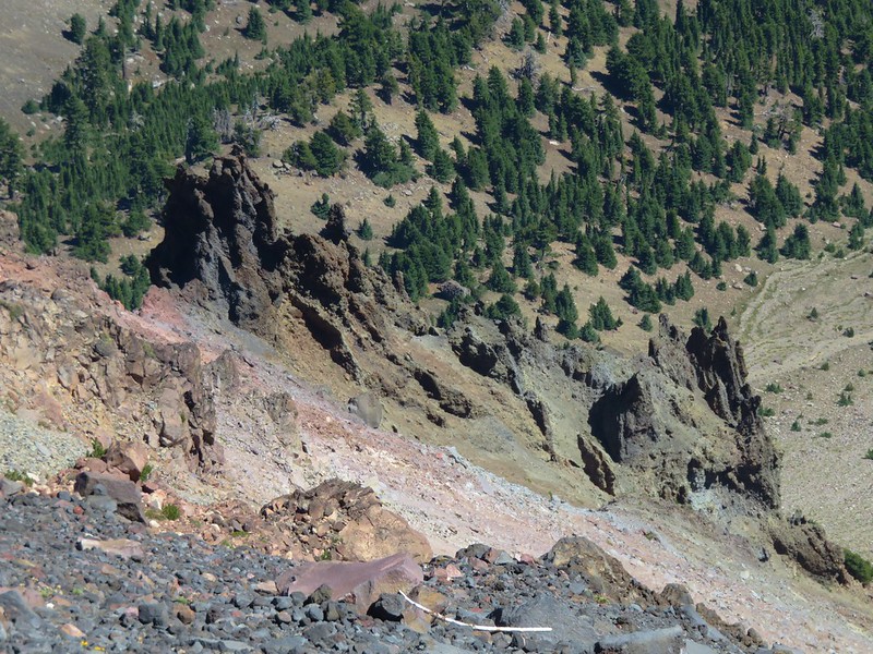
The loose volcanic rock was kind of nice to descend in. It was soft on the knees and kept us from picking up any unwanted speed. On the climb up though it was a different story as every step up came with a small slide backward. One way to eliminate having to deal with that issue is to climb the mountain while there is still some snow (post).
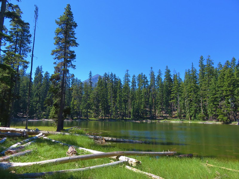
We still wanted to visit Freye Lake on the way back to the car so when we reached the Pacific Crest Trail we pursued our earlier theory of a possible reroute that used the existing trail to the lake. We kept an eye on the GPS and we could see we were quickly beginning to move away from the lake so our theory was blown. At that point there was only one sensible solution -off-trail bushwack. We left the PCT and followed a little gully down to the lake.
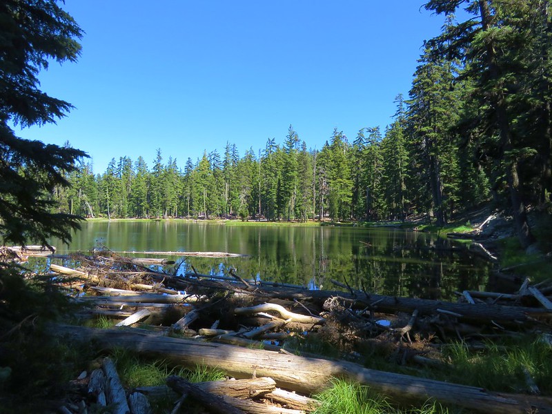
There was a use trail going around the lake so we followed it clockwise around to east side of the lake where there were a number of campsites and a view of Mt. McLoughlin.
After taking another break at the lake we continued around hoping to find the missing trail from this end. We weren’t able to locate it but we did find something. A large blue tarp was spread out on the ground surrounded by arraigned logs and rocks. Next to the tarp was a stone fire pit surrounded by a short log fence. Around the fire pit were several items including a gas can, pair of gloves, and several old looking tin cans.
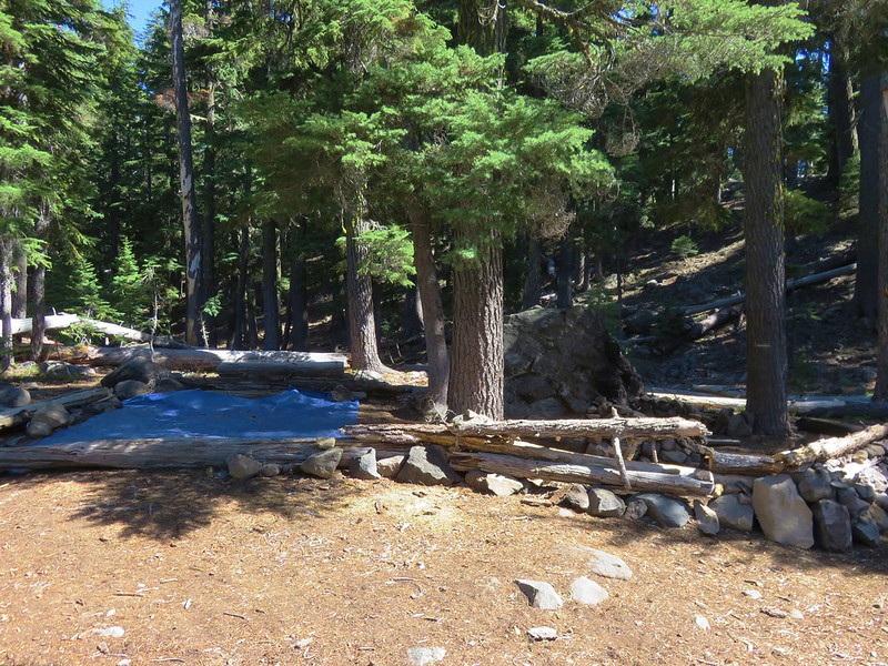
It all seemed very out of place for a wilderness area. I did send a message to the Forest Service about it, but have not gotten a response yet.
We tried to use the GPS to locate the trail as we climbed uphill from the lake to the PCT. If the GPS was right we crossed over it a couple of times but we never saw anything that was identifiable as a trail, just a couple of spots where tents had been sent up, probably by thru-hikers.
Speaking of thru-hikers when we were back on the PCT we spotted one approaching. Heather had her Doritos in her pack and then kind of froze and didn’t say anything as she passed. For whatever reason she suddenly had become shy about asking if they would like a snack. Luckily she got a second chance as another hiker was coming up the trail. She asked this one if he’d like some Doritos and his face lit up. He introduced himself as “Sobo”. It turned out that it had been his girlfriend who had passed us just before so Heather gave him a second bag for her. Another pair of thru-hikers followed and more chips were handed out and then we were off the PCT.
When we got back to the trailhead we found even more cars than there had been that morning. We freed up a spot by heading back to Fourmile Lake Campground where we refilled our water.(We had both emptied our CamelBaks and were glad we’d brought the additional water in the Hydro Flasks) We had brought our dinner for the night with us (Mountain House chicken and dumplings) and decided to cook it at the day use area near the Fourmile Lake boat ramp. We followed the Badger Lake Trail from the trailhead to the crossing of Fourmile Lake Road then turned down the road to walk to the day use area. At the campground entrance on a signboard was a trail conditions report.
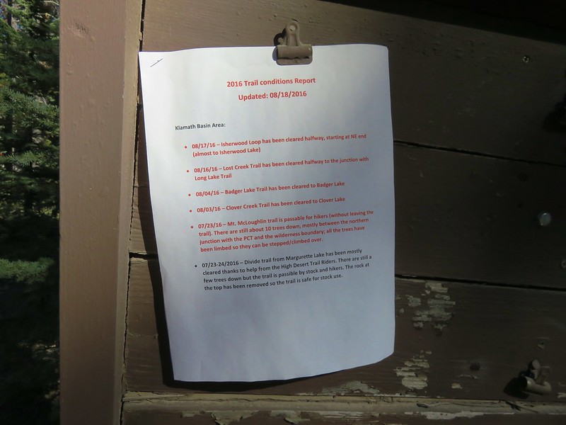
We thought it was kind of strange not to have a copy on the signboard at the trailhead as well, but at least it explained the blowdown beyond Badger Lake on the Badger Lake Trail. We ate dinner at the day use area and watched people doing whatever it was they were doing down by the lake.
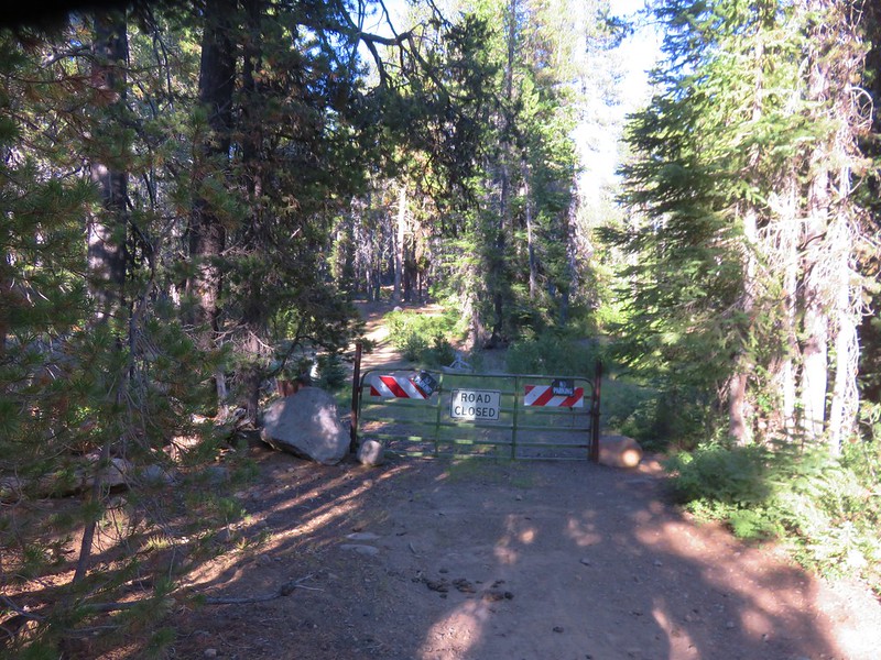
After dinner we returned to the Badger Lake Trail by hiking past a gated road at the end of the parking area near the boat ramp.
This time as we passed the little side trail .9 miles from the canal we turned down toward the lake to a rocky beach with a view of Mt. McLoughlin.
We sat on the beach and soaked our feet before continuing on toward our tent at Badger Lake. We took one final detour to look around the south side of Woodpecker Lake.
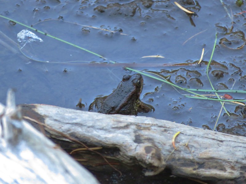
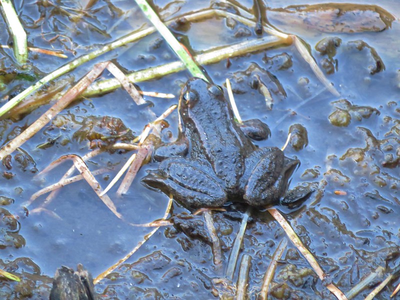
It was just us again at Badger Lake that night, well us and a couple ducks and some frogs actually.
Happy Trails!
Flickr: https://www.flickr.com/photos/9319235@N02/albums/72157673125210295

20 replies on “Mt. McLoughlin”
[…] inventory of my surroundings. The view was quite impressive having now climbed high enough that Mt. McLoughlin was visible to the south of Crater […]
[…] We could picture the route up to the summit that we’d taken a couple of years before (post). […]
[…] Sky Lakes – 2016 […]
[…] to notice a snowy mountain to the east which after some debate we determined to be Mt. McLoughlin (post). You can’t make the mountain out in the picture but it was out […]
[…] Mt. McLoughlin (post) […]
[…] Mt. McLoughlin (post) […]
[…] McLoughlin (post) came into view to the NE as we […]
[…] McLoughlin (post) dealing with a few […]
[…] Sun impacted the view to the south which on a clear day would have included both Mt. McLoughlin (post) and Mt. Shasta. Mt. McLoughlin is to the far right with some clouds over the top. Starting from […]
[…] of downed trees that were fairly easily navigated. This trail did provide a view of Mt. McLoughlin (post) albeit limited on this day due to the cloud […]
[…] Rim Drive ahead with the lower portion of Mt. McLoughlin (post) in between the trees to the […]
[…] McLoughlin (post) to the […]
[…] McLoughlin (post) to the […]
[…] McLoughlin (post) and Union Peak (post) to the […]
[…] Klamath Lake, Pelican Butte, Aspen Butte (post) over the right shoulder of Pelican, Brown Mountain (post) is the small cone on the right, and Mt. McLoughlin (post) […]
[…] Mountain to the North. Mt. McLoughlin (post) is out there too but the haze made it really hard to […]
[…] faint Mt. McLoughlin (post) in the distance on the […]
[…] Seven Lakes East-Hiked 9/9/2023 #40 Blue Lake Basin-Hiked 9/18/2022 #41 Mount McLoughlin-Hiked 8/27/2016 #42 Fourmile Lake-Hiked 8/26/2016 #43 Sky Lakes via Cold Springs-Hiked 9/24/2022 #44 Sky Lakes […]
[…] McLoughlin (post) and Union Peak […]
[…] After gaining approximately 500′ of elevation the trail leveled out for a bit before descending 100′ to the Puck Lakes. To the left through the trees is Mt. McLoughlin (post). […]