When we were working on our quest to complete at least a portion of all 100 featured hikes in William L. Sullivan’s “100 Hikes/Travel Guide Central Oregon Cascades” (post) there were several hikes that for one reason or another we did not hike the entire route described in the book. One of those hikes was Hand Lake.
Sullivan’s entry for Hand Lake is a 2.6-mile lollipop loop starting from the Hand Lake Trailhead along Highway 242 (McKenzie Pass). The highlights of the hike are the Hand Lake Shelter at the 0.5-mile mark, a short crossing of a lava field on a portion of the old McKenzie Wagon Road, and Hand Lake. The route of this hike shares a portion of another featured hiked, Benson Lake (the 9.7-mile loop option). When we did that hike we saw the wagon road, the lake and visited the shelter, so we counted that as enough to check off the hike. Today we planned on hiking the remaining portion of the hike and revisiting the sights along the Benson Lake Loop.
The trailhead is a pullout along the east side of the highway across from a hiker symbol.


Interpretive sign at the trailhead about bees.

Yarrow
The trail itself begins just to the NW on the opposite side of the highway.


Wilderness registration box, Central Cascade Wilderness Permit information, and a map.
From the signboard the Hand Lake Cutoff Trail leads into the Mt. Washington Wilderness, and the exits the wilderness, before arriving at the Hand Lake Shelter at the half mile mark.

Entering the wilderness area.

Sickletop lousewort


Goldenrod

Leaving the wilderness area.

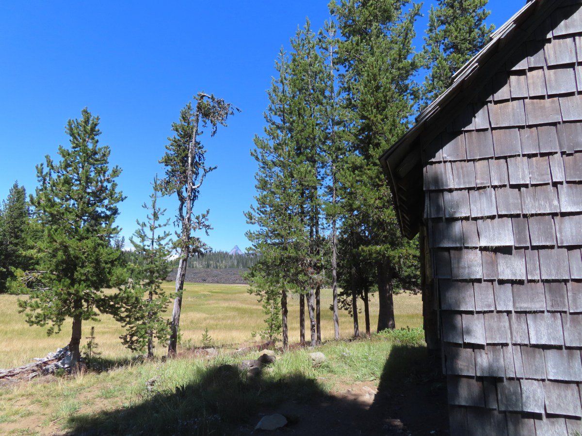
Meadow just before the shelter.

Alpine gentians. We planned on checking in on these on our way out knowing that they would be open once sunlight hit them.

The Hand Lake Shelter
At the shelter we had to decide which direction we wanted to hike the loop. In this case we considered the steepness of the trails, what time we thought it would be best to visit the summit of Scott Mountain, and how difficult finding the old Santiam Wagon Road would be. For this loop we knew going clockwise would be less steep and we were familiar with the location of the old Santiam Wagon Road junction with the Hand Lake Trail. It was also the longer route to the summit of Scott Mountain which would allow more time for the sun to move higher overhead creating a better view of the Cascade Mountains to the east. Clockwise it was. We took stock of the trail heading into the meadow at the shelter that would be our return route and continued on the Hand Lake Cutoff Trail to the Hand Lake Trail.

Our return route.

Wildflower near the Hand Lake Trail junction.

Aster
At the junction we turned left onto the Hand Lake Trail and followed it 1.5-miles to the Benson/Tenas Trailhead passing Scott Lake along the way.


Prince’s pine

Lupine


We had to be on the lookout for these little guys most of the day.

Hardhack

The northern end of Scott Lake.


North Sister from Scott Lake.

False hellebore


The Benson/Tenas Trailhead.
Just before the gate we turned right onto the Benson Lake Trail.

The Benson Lake Trail. The post was missing a sign.
The Benson Lake Trail climbs gradually for 1.3-miles to Benson Lake which sits just inside the Mt. Washington Wilderness.


Grouse whortleberry (Vaccinium scoparium) is a variety of huckleberry. The plant has small berries that are some of my favorites.

Pinesap unfurling.

Pinesap further along.

Pinedrops along the trail.

Pinedrops

Beardtongue

The trail entering the Mt. Washington Wilderness.

Benson Lake

Pond near Benson Lake.

I turned down this signed user trail to visit the lakeshore.

The best view from the lake is actually atop the rocks to the right across the lake. We visited that spot when we hiked around the lake on a backpacking trip in 2016 (post).
After visiting Benson Lake, we continued on the loop. The trail continued to gradually climb reaching a junction with the Tenas Lake Trail in just under a mile.


Fireweed

Red-breasted nuthatch making its way down a tree.


Blueberries

We detoured a tenth of a mile down the Tenas Lakes Trail to visit the first, and largest, of the Tenas Lakes.


We returned to the Benson Lake Trail and in another 0.2-miles arrived at the Scott Mountain Trail junction.


Scott Mountain from an unnamed lake/pond.

We stayed right at the junction and followed the Scott Mountain Trail 0.8-miles uphill to yet another junction. This time with the Scotty Way Trail.


Moth

Paintbrush


At this junction we faced a choice, stay on the Scott Mountain Trail and climb 0.6-miles to the summit or stick to the loop and turn right onto the Scotty Way Trail. The skies were too clear to pass up the view atop Scott Mountain, so we began the 320′ climb to the summit.


Arrowleaf groundsel


Subalpine mariposa lily

Thistle

Approaching the summit meadows.


The Three Sisters and The Husband.

Black Crater (post) straight ahead. To the left through the trees is Belknap Crater (post).

Mt. Jefferson with a cloud in front then Three Fingered Jack, Mt. Washington and Belknap Crater.

Diamond Peak (post) to the south from the summit.

In front of Diamond Peak from left to right are Mt. Ray (post), Fuji Mountain (post), and Waldo Mountain (post).

A tiny glimpse of Mt. Hood above the ridge to the left of Mt. Jefferson (still mostly hidden). Three Fingered Jack with Hoodo (rounded) and Hayrick (flat top) Buttes in front.

Proxy Point in between North and Middle Sister with Little Bother in front of North Sister.

Mt. Washington

Fritillary

Benson Lake from Scott Mountain.
After a nice break at the summit, we headed back down to the Scotty Way Trail. I detoured briefly on the way down to explore the crater area and found another nice view of the Three Sisters.

Small crater near the summit of Scott Mountain.

Orange agoseris


View west of the McKenzie River Valley.

Back on the Scott Mountain Trail.

California tortoiseshell

Mt. Jefferson almost came out as we were descending the Scott Mountain Trail.


On the Scotty Way Trail.
The Scotty Way Trail is steeper than either of the Benson or Scott Mountain Trails and in the next 1.7-miles we lost 720′ of elevation before arriving at the Hand Lake Trail.


Entering the 2010 Scott Mountain Fire scar.


Mt. Washington and Belknap Crater.

Fireweed and pearly everlasting.

Felt-leaf everlasting

The Three Sisters


Coming up to the Hand Lake Trail.

Members of the Scorpions Trail Crew worked on the tread here as well as clearing a few logs between the junction and the Hand Lake Trailhead on 7/30.
We turned right onto the Hand Lake Trail and continued descending.

The trail neared the lava flow which we would eventually be crossing on the old McKenzie Wagon Road.


It was approximately 1.2-miles from the Scotty Way Trail junction to the wagon road which is not signed nor was it currently marked by anything.

The unnaturally flat(ish) surface of the wagon road gives it away.
We turned left onto the old Wagon Road.

It wasn’t the easiest walking, but luckily it was only a tenth of a mile across the lava flow.


The Three Sisters and The Husband from the wagon road.

The end of the lava crossing.
At the far end of the wagon road we turned right along the lava flow.

While not an official trail there was a faint path, however there were also a number of downed trees.

At the end of the lava flow is the lakebed for Hand Lake. The lake’s water level drops each Summer and with the dry year we’ve had there wasn’t a lot of water left in the lake.


Butterfly on pusspaws.

Lupine


We picked up the trail we’d seen that morning in a rocky area and followed it to the shelter.


We stopped to check on the gentians before following the Hand Lake Cutoff Trail back to the trailhead.


My GPS showed 12-miles for the hike although two tenths of that was exploration on Scott Mountain. Total elevation gain was approximately 1400′.

This was a fun hike allowing us to finish Sullivan’s hike in its entirety and also revisit some places we’ve enjoyed in the past. Today’s view from Scott Mountain was also the best one we’d had in our three summits. We did get some sad hiking news later when it was confirmed that the Flag Point Lookout (post) in the Mt. Hood National Forest had been lost to the Grasshopper Fire. This was a sad loss and a reminder to us of why we have been so focused on visiting as many different trails and places as possible before they are lost.
Hopefully there is some relief in the fires soon, but until then stay safe and happy trails!
Flickr: Hand Lake
 wanderingyuncks