For our third day in Crater Lake National Park we had another four hikes planned. We continued to try to limit the crowds we would experience so we decided on an order of the short Castle Crest Wildflower Loop first followed by Garfield Peak then a section of the Rim Trail around Hillman Peak and finally the 1-mile Godfrey Glen Loop.
The Castle Crest Wildflower Loop is part of Sullivan’s Park Headquarters featured hike along with the Lady of the Woods Trail. That latter trail was listed as closed while the Park performs renovations on the historic buildings at Park Headquarters. The trails can be connected using a tie trail which we skipped due to the closure.


We hiked the loop counterclockwise. The wildflowers were in good shape and the pink monkeyflower was spectacular.


 Bog Orchid
 Bistort and monkeyflower


 Some sort of orchid?
 Yellow monkeyflower
 Monkshood


 Bistort
 Not sure if this is a robin or ?

After the completing the loop we drove up to Rim Village where we parked between the Visitors Center and the Crater Lake Lodge.
 Crater Lake Lodge
We followed a paved path along the rim of Crater Lake behind the Lodge to signs for the Garfield Peak Trail.


 Garfield Peak from behind the lodge.
 The Watchman and Hillman Peak
 Golden-mantled ground squirrel with a mouth full.


The trail passed a grassy meadow where a doe and her twin fawns were having breakfast.


The trail climbed steadily occasionally along the rim but more often along the cliffs below Garfield Peak.


 Mt. McLoughlin (post) and Union Peak (post) to the south.
 Mt. McLoughlin
 Union Peak
 Paintbrush
 Reservoir structure (built 1931).

 Mt. Bailey (post) to the left of Llao Rock and Mt. Thielsen to the right.
 Mt. Bailey
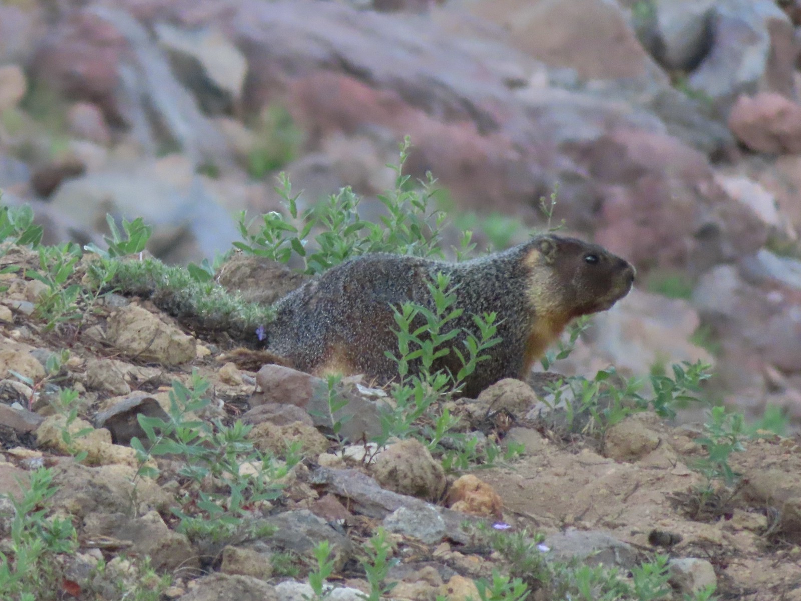
 Deer below the trail.
 Western pasque flowers

 Arnica
 One of several patches of snow at the higher elevations.
 Crater Lake Lodge below to the left.
 Mt. Scott (post)

 Clark’s nutcracker
 Buckwheat
 Beetle on sub-alpine fleabane.
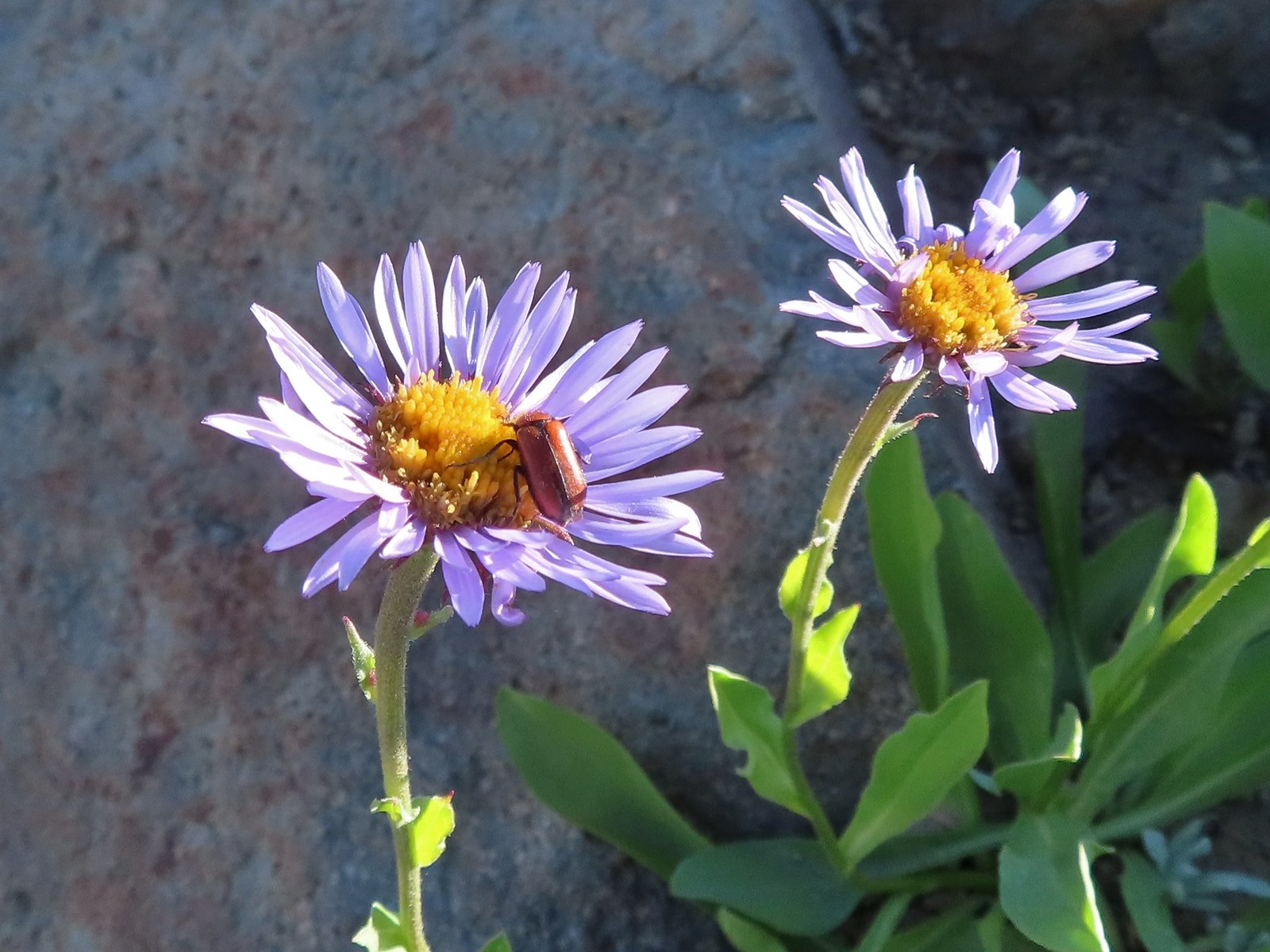
 Yellow-bellied marmot
 Bench below the summit of Garfield Peak.
 Partridge foot
 Applegate Peak to the left and Crater Peak (post) to the right.
 Arriving at the summit.
The 360-degree view from the summit was great even with a bit of haze from wildfire smoke.
 Mt. Scott above the Phantom Ship.


 It was a bit hard to make out but Mt. Shasta was visible to the south.
 Cowhorn Mountain (post) to the left of Mt. Thielsen and Howlock Mountain to the right.
 Crater Lake from the summit of Garfield Peak.
We were scanning the meadows between Garfield and Applegate Peaks and spotted what we think was a large bull elk bedded down near the tree line.

 Blurry photo due to the sheer distance away it was but it looked big.
We had the summit to ourselves, except for a few locals.
 Union Peak behind a marmot.

 Penstemon
After a nice break at the summit we headed back down passing a few more hikers making their way up.

 Painted lady
 There were a lot of marmots out.
 Paintbrush, phlox and buckwheat.
 Stonecrop, paintbrush and pearly everlasting.
 The clear blue water of the deepest lake in the United States.
 Yellow-rumped warbler
Near where we had seen the doe and fawns earlier I was startled by a doe who popped out of some trees right in front of me.


 False hellebore
After returning to the car we drove North on Rim Drive to The Watchman Trailhead. We’d started at this busy trailhead in 2012 when we visited the fire lookout atop The Watchman. Today we would be heading in the opposite direction hiking the Rim Trail around Hillman Peak.
 Viewpoint and The Watchman from the trailhead.

 Western pasque flowers above Crater Lake.
It was a short, stiff climb to start before the trail began a gradual descent passing behind Hillman Peak.

 Hillman Peak ahead.
There were quite a few different colors of paintbrush along the trail.


 Lounging on a rock.
 Shasta knotweed
 Rim Drive below the Rim Trail.
 Mt. Bailey and Diamond Peak with Diamond Lake (post) below.
 Red Cone with Sawtooth Mountain (post), Cowhorn Mountain, and Mt. Thielsen beyond.
Although barely visible we could make out the South Sister (post) through the haze between Cowhorn Mountain and Mt. Thielsen.
 Silvery Raillardella
 Snow patch on Hillman Peak.
 Penstemon
 Llao Rock
 It took us a moment to notice the two deer ahead along the tree line.
 We spotted the doe but she also had a pair of fawns nearby that bounded off.
 This buck had zero concern with us as we passed by.
 Phlox
Phlox
 Dwarf lupine
 Devil’s Backbone with Mt. Scott behind.
We ended our hike at Devil’s Backbone, an exposed lava dike.
 Wizard Island
 Devil’s Backbone
 Hillman Peak from Devil’s Backbone.
 Garfield Peak across Crater Lake.
After a short break we headed back.


 Saxifrage
 The Watchman
 If I stand perfectly still, they won’t see me.
 Hillman Peak and Llao Rock from the viewpoint at The Watchman Trailhead.
 Rock formations below Hillman Peak.
While the trailhead was packed with cars and people we only passed two others on our 3.7-mile hike to the Devil’s Backbone and back. We hopped back into our car and drove back toward Mazama Village stopping for one more short hike at Godfrey Glen.
 Godfrey Glen Trailhead
There were a couple of cars here but nothing like what we’d encountered at The Watchman. The 1-mile loop here passes views of Godfrey Glen and Annie Creek Canyon. Hiking clockwise is the shortest route to the viewpoints but we went the opposite direction to leave ourselves a shorter hike after finishing with the viewpoints.

 The ADA accessible trail made for a nice easy walk.

 Super-heated volcanic gas fused ash creating these pinnacles.


 First viewpoint of Godfrey Glen above Munson Creek.
 Godfrey Glen

 Another viewpoint.
 We could hear Munson Creek but it wasn’t visible in the canyon below.
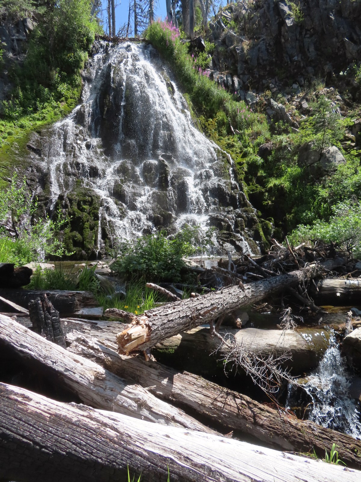
Near the last viewpoint we could see just a bit of some falls on Munson Creek.

 One waterfall.
 Another waterfall in the canyon.
 The end of the loop.
After finishing our hikes we returned to our cabin, showered, and changed then picked up a pizza from the Annie Creek Restaurant and took it back up to Rim Village. We hoped to visit the museum at the Visitor’s Center after eating some lunch but unfortunately it was closed. Instead we took the short paved path near the Center to the Sinnott Memorial Overlook.

We’d seen the overlook from the Garfield Peak Trail that morning.
 Sinnott Memorial Overlook on the rim to the left.
 View from the overlook.
 Mt. Scott and Garfield Peak from the overlook.
The overlook contained a number of informational signs including this one about the amount of water in the lake.
 These numbers blew our minds.
After reading all the signs in the overlook we climbed back up to Rim Village and made our way through the masses of tourists. We quickly decided that the crowds weren’t for us and retreated to the car and headed back toward our cabin. We did stop once more, at Park Headquarters since that was where the Lady of the Woods hike would have taken place if not for the construction.


 Swallowtail and a painted lady on penstemon.
Our day, including the walk down to the overlook came to 9.7 miles and a little under 1500′ of elevation gain. The majority of the elevation gain came from the Garfield Peak hike (just over 1000′) and it was also our longest at 3.8-miles roundtrip. The hike around Hillman Peak was 3.7-miles but only 250′ of elevation gain while Godfrey Glen only gained 100′. The wildflower hike at Castle Crest was approximately a half mile with just 70′ of elevation gain and the short path to Sinnott Memorial Overlook was about a third of a mile roundtrip requiring around 150′ climb back up to the rim.


It had been a great day of hiking and the pizza was surprisingly good. We did however come to the conclusion that we just aren’t good tourists. Happy Trails!
Flickr: Crater Lake Day 3


 There were pikas out there in the rocks but we only heard them this time.
 We did spot this western tanager though.
 Pink monkeyflowers. One of our favorite wildflowers.
 The trail climbed gradually along Sand Creek before rounding a corner to a view of Plaikni Falls.
 Paintbrush and columbine along with lupine and groundsel.
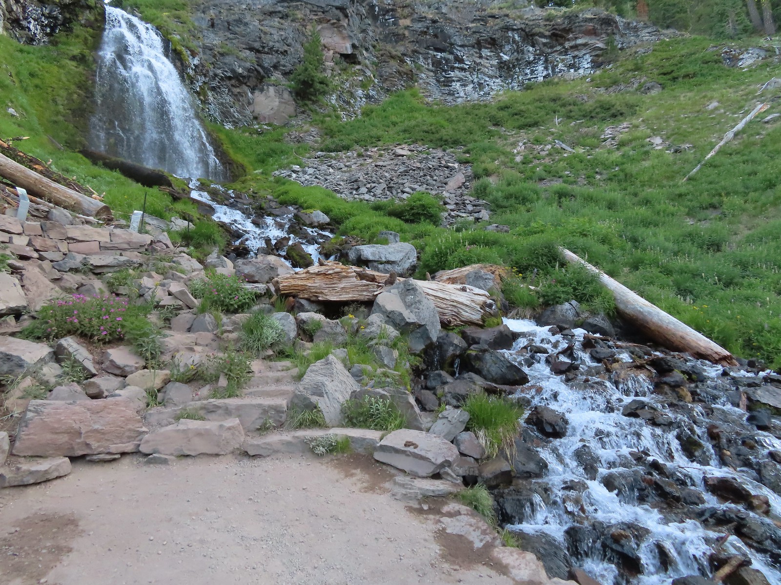

 Hummingbird visiting a paintbrush.
 Monkshood
 Yellow monkeyflower
 Applegate Peak from the Sun Notch Trailhead.

 There is a nice green meadow in the center of the loop.

 The Phantom Ship.
 Diamond Peak (
 The Watchman (

 Garfield Peak, The Watchman, and Hillman Peak.
 Heading back down to the start of the loop.
 Marmot

 Vidae Creek
 East Rim Drive was up above the trail.
 Crater Peak through the trees on the left.
 Paintbrush
 Stonecrop
 Setting off on the broad ridge.

 There was a very short steep climb to reach this small meadow with a view ahead to Crater Peak.
 Female western tanager
 Looking up Crater Peak.
 Little prince’s pine
 Union Peak (
 Mt. McLoughlin (
 Mt. McLoughlin behind Lee & Devil’s Peaks.
 Mt. Shasta was visible, barely, through wildfire smoke.
 Arriving at the crater.
 Scarlet gilia lining the trail around the crater.
 The Watchman to the left and Garfield Peak.
 Applegate Peak and Mt. Thielsen
 View south to Mt. McLoughlin with the Goose Nest to the closer to the right.
 Dutton Cliffs and Mt. Scott (
 Pussytoes
 The peaks around Crater Lake.
 Paintbrush
 Western pasque flowers
 Klamath Basin with haze from (most likely) the Golden Fire near Bonanza.
 The Rabbitt Ears and Hershberger Mountain (


 Signboard at the loop.
 Crater Peak from the trail.
 Ash pinnacles
 Getting ready to drop into the canyon.
 The trail had been closed for hazard tree removal and we could see that there had been some big trees that had to be cleared.
 Wildflowers in the meadows below.
 Annie Creek


 Monkeyflower and lupine
 Final pitch to end the loop.
 The Annie Creek Restaurant.


 Arriving at the highway.
 Trail on the far side of Hwy 62.

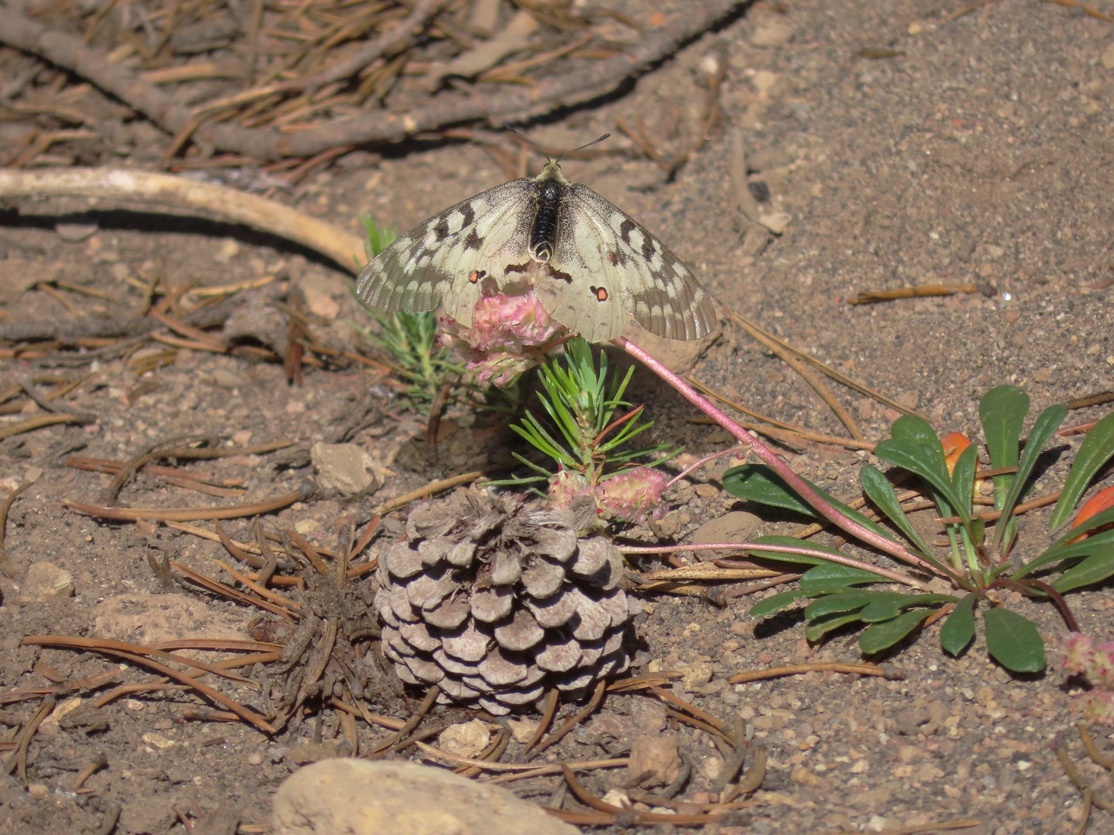 Clodius parnassian on a pussy paw.
 Much of the trail followed an old roadbed.
 PCT junction.
 Butterfly on the Crater Lake PCT register. While I was working on getting the butterfly photo a northbound thru hiker arrived. He mentioned not having had a shower in 10 days and being really excited to reach

 Older cut logs helped us locate the trail at times.
 Union Peak from the trail (
 It took a second to find the tread in this meadow.
 Once we found it though it was easy to follow.
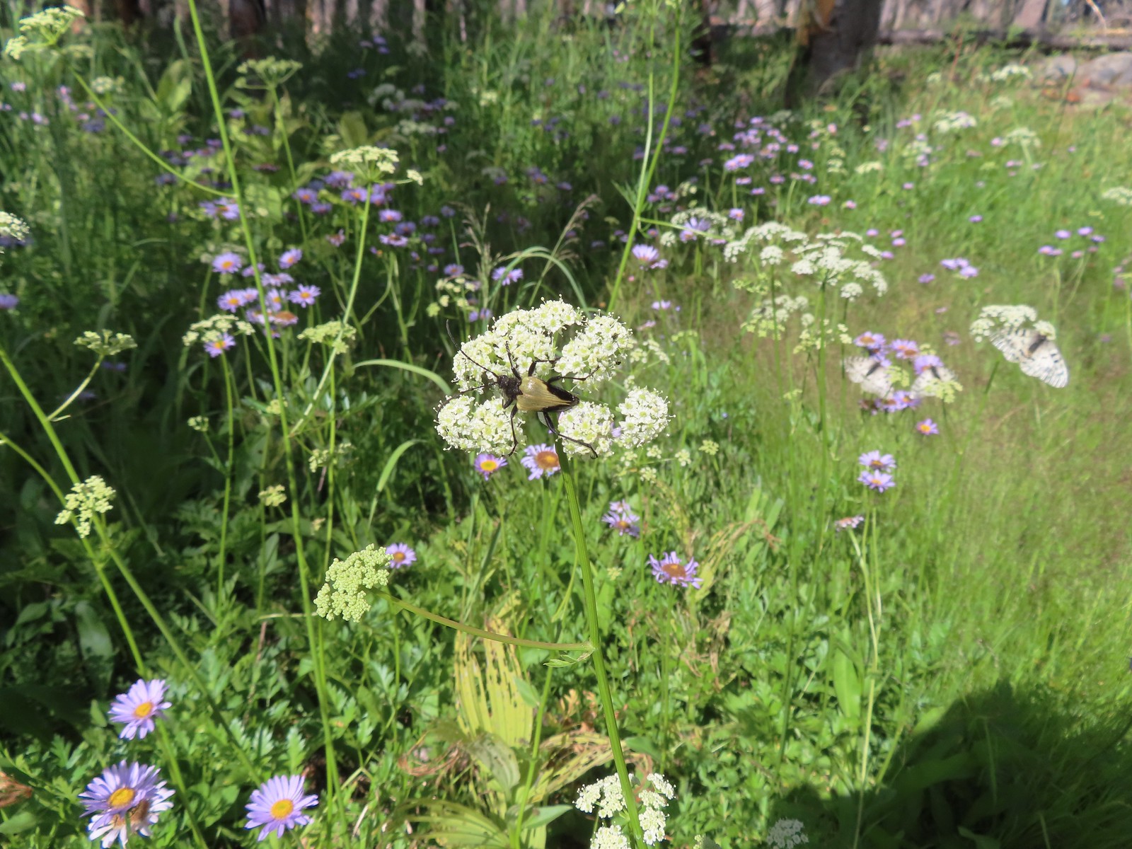 Big beetle. There are also three clodius parnassian butterflies behind to the right.
 Typical trail conditions. I spent a good deal of time removing limbs from the larger trees and pulled some of the smaller ones off the trail.
 Doe below the trail.
 More messy trail.
 There was one small stand of unburned forest which provided a brief break from the blowdown.
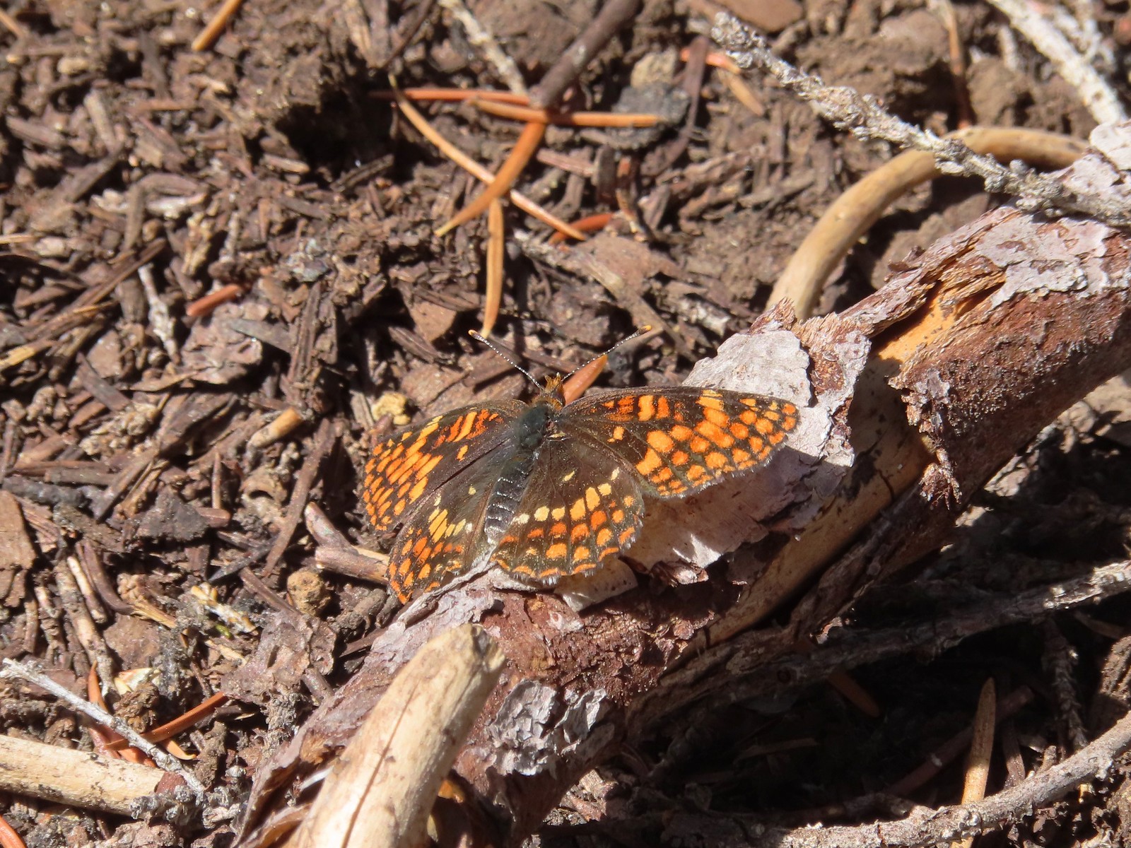 Checkerspot butterfly
 Mylitta crescent and a hoary comma on spreading dogbane.
 Paintbrush
 I believe that is Tom Mountain and Jerry Mountain.
 Bald Top to the right.
 Skipper
 Mt. McLoughlin
 Lorquin’s admiral
 This was the worst of the obstacles.
 We hadn’t seen a blue diamond since before the PCT but near the SW corner of the Park boundary we spotted a couple.
 Post ahead marking the boundary. The trail passed through a narrow gap here where the blowdown was heavy.


 Arnica below the falls and fireweed above the falls added some nice color to the scene.
 One-sided wintergreen


 Small falls on Red Blanket Creek.
 Pink monkeyflower
 I’d lost the trail here but headed for the patch of bright orange wildflowers to see what they were.


 Red Blanket Falls
 View down Red Blanket Creek
 A spring fed waterfall along Red Blanket Creek below the falls.
 A second and third tier of Red Blanket Falls just below the upper fall. I wasn’t able to get a clearer view of these two drops. I hiked a short distance down the creek but decided the poor trail conditions and loss of elevation weren’t worth going further down the trail with no guarantee of a better view.
 The three drops of Red Blanket Falls
 One more of Red Blanket Falls.
 Another little cascade.

 Along this rock outcrop I found switchbacks that I’d missed on the way to the falls.
 This might be a black backed woodpecker.
 This cairn was new to me as well. At this point I was quite a bit below our track from the morning and I was afraid that I might pass Heather without knowing it if she was sticking to the earlier route.
 Hummingbird
 Goose egg on the left.
 Painted lady
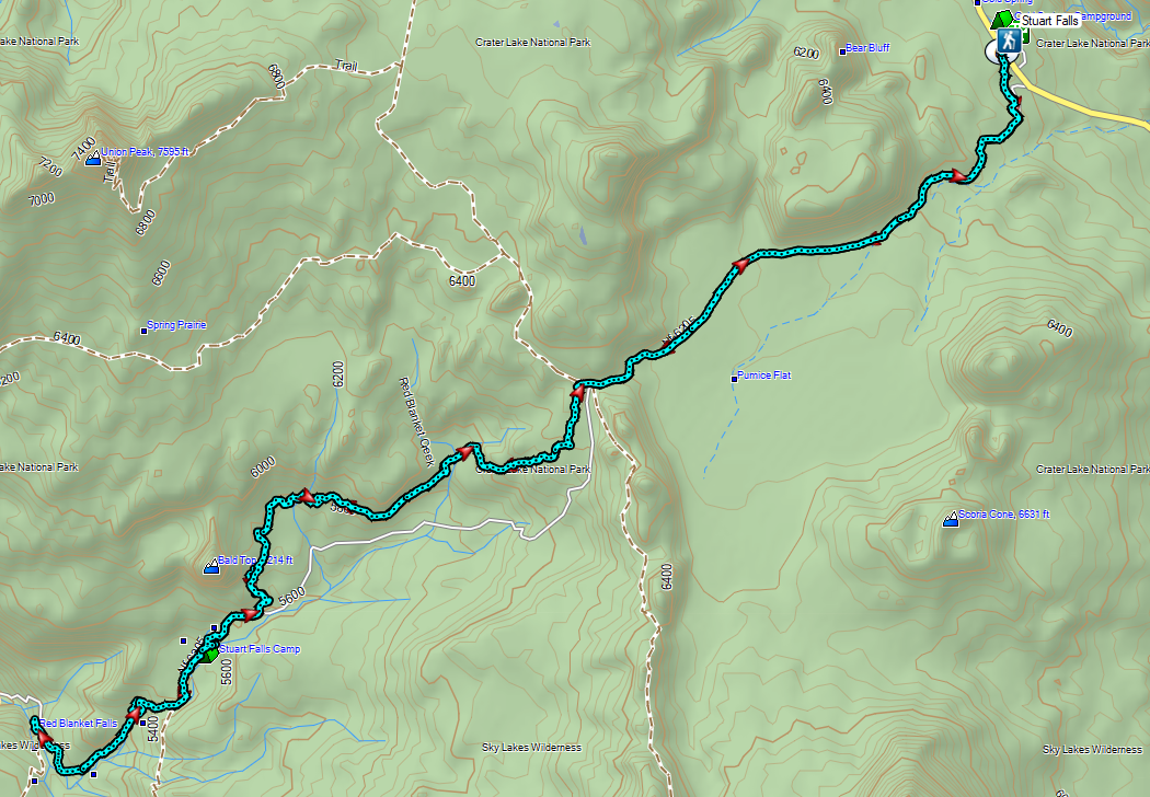
 A checkerspot and a copper on sub-alpine fleabane.
 Arriving back at the PCT. We again crossed paths with a thru hiker on the way to Mazama Village.
 Pussypaws
 Dwarf lupine