We’d spent five days hiking in the greater Mount Shasta area but it wasn’t until the sixth day that we made it to the mountain that we’d been seeing every day during our hikes. In truth we were holding out hope that the Everitt Memorial Highway might be opened by the end of the week so that we could drive up to the Panther Meadow Trail but that wasn’t in the cards this trip as there was just too much snow still left over from this past winter.
Our plan had always been to do multiple hikes on the day we visited Mt. Shasta and with our other two hikes a go we looked to Hike Mt Shasta for ideas for another trail on the mountain and chose the Horse Camp Trail.
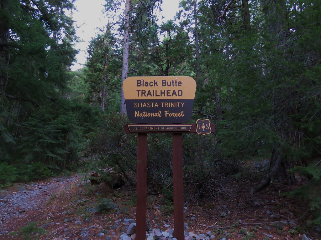
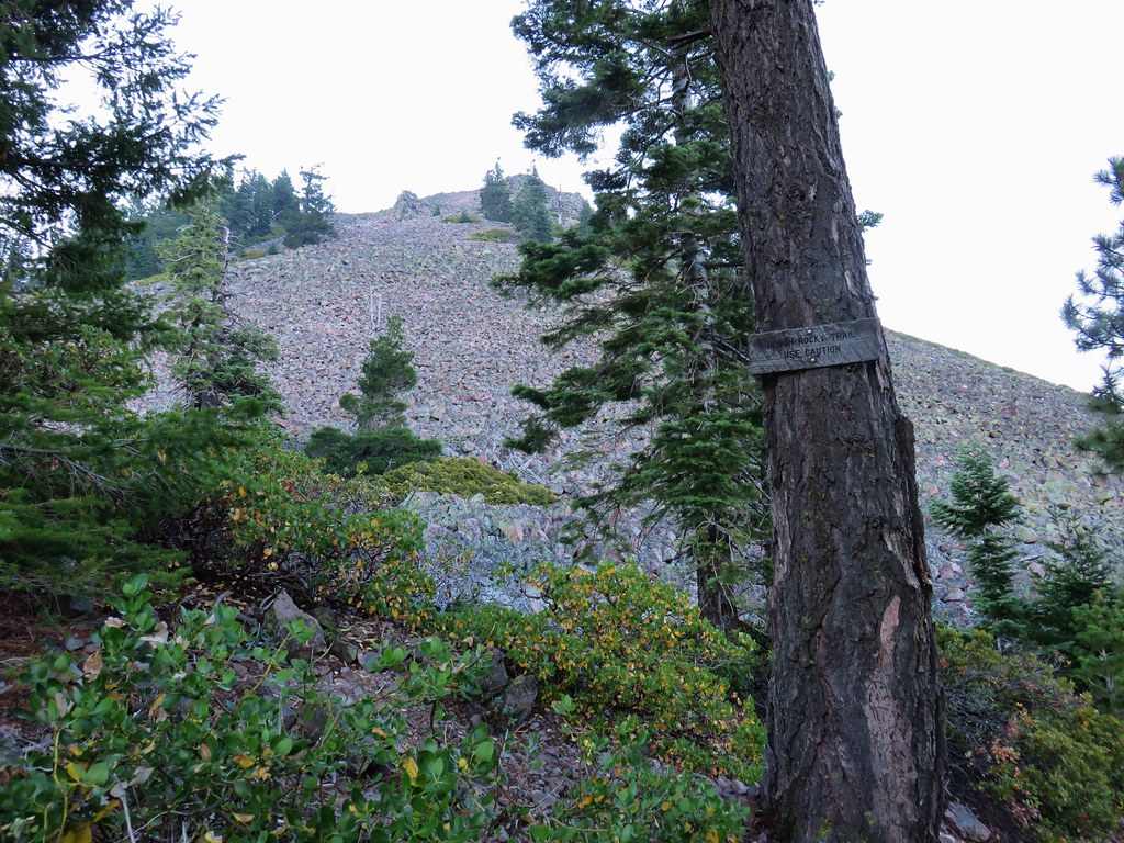
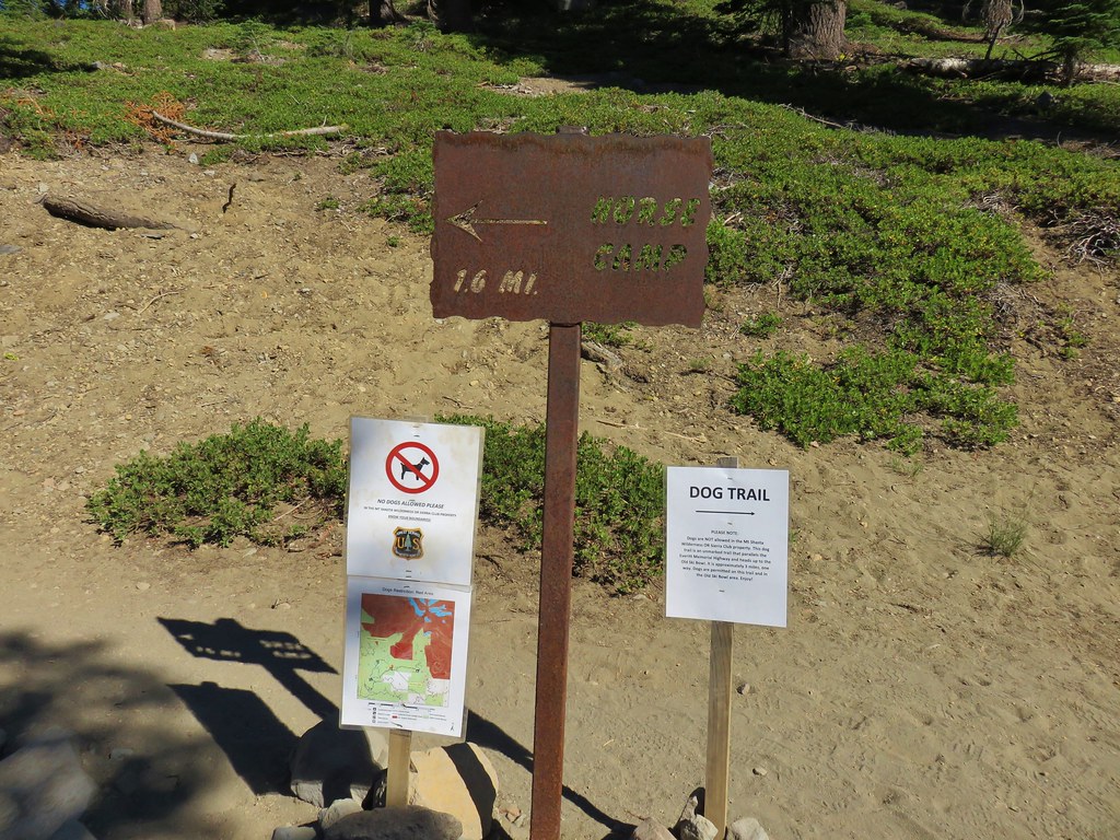
We started our day at the Black Butte Trailhead where we found a caution sign posted by the Forest Service.

The slide referenced in the notice was said to be a mile and a half up the the 2.6 mile trail so we figured we could at least get most of the hike in and if it didn’t look too dangerous we could do the whole thing.
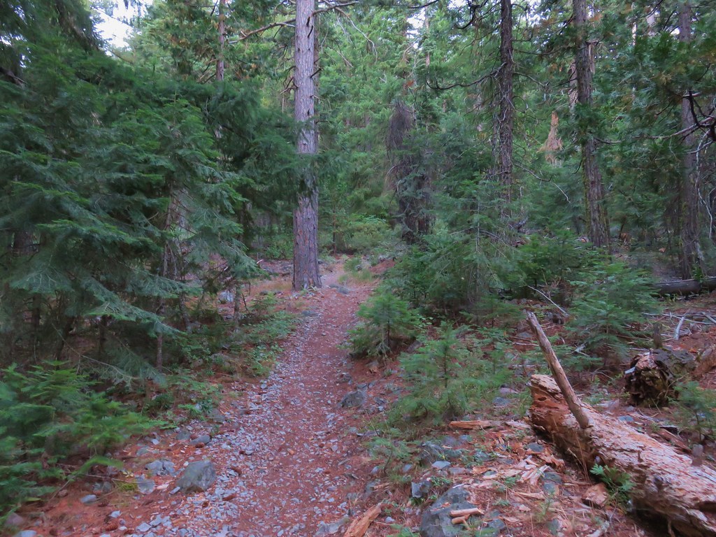
The trail began in a the forest climbing steadily as it wound around the cinder cone.
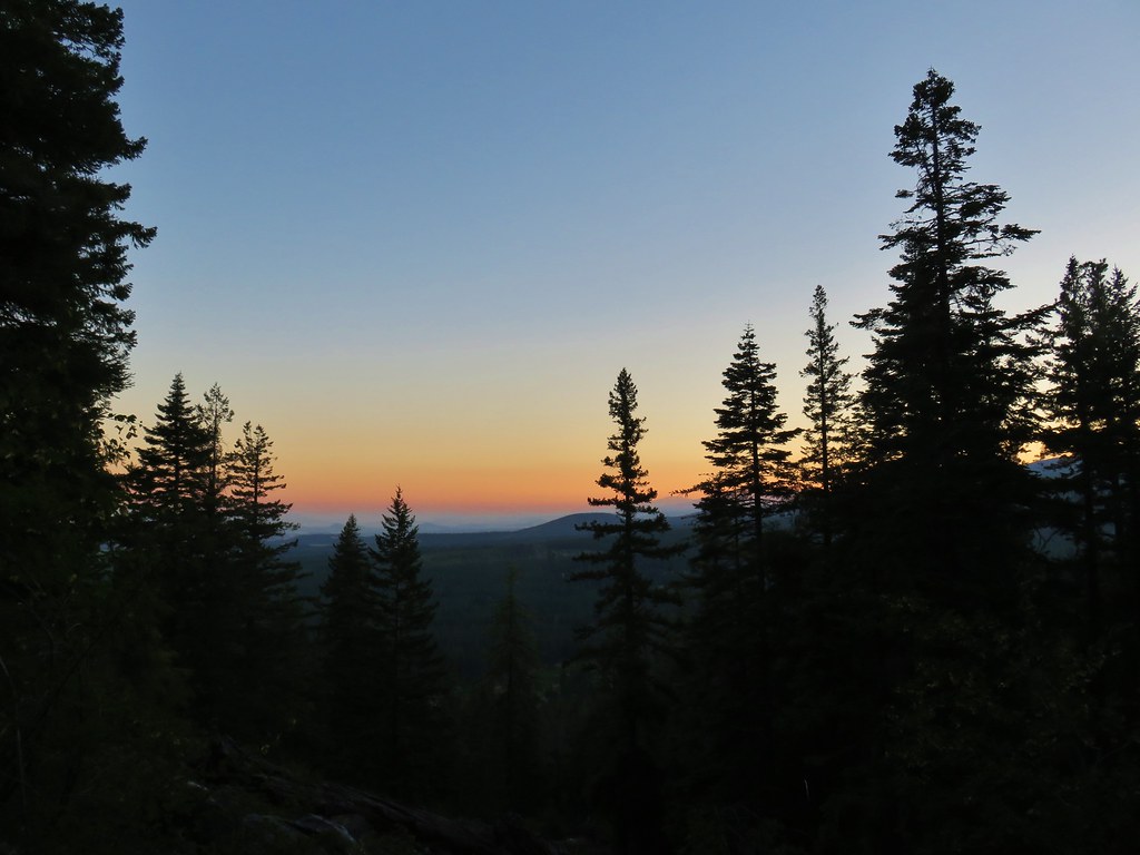
We’d gotten an early start which was nice not only for the views but for the temperature as well since we’d be gaining over 1800′ feet if we made it to the summit.
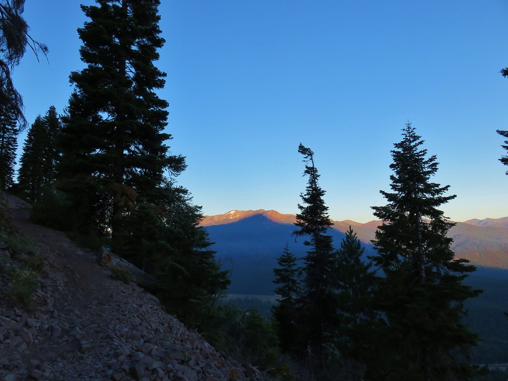
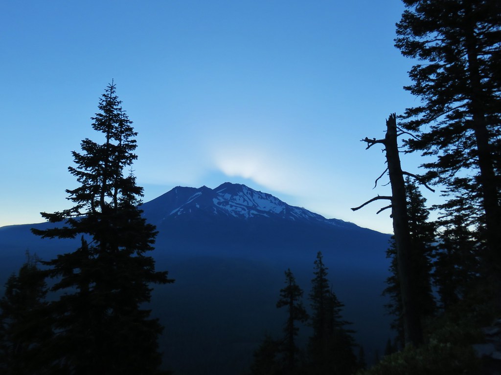
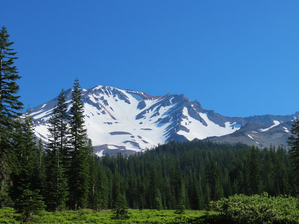
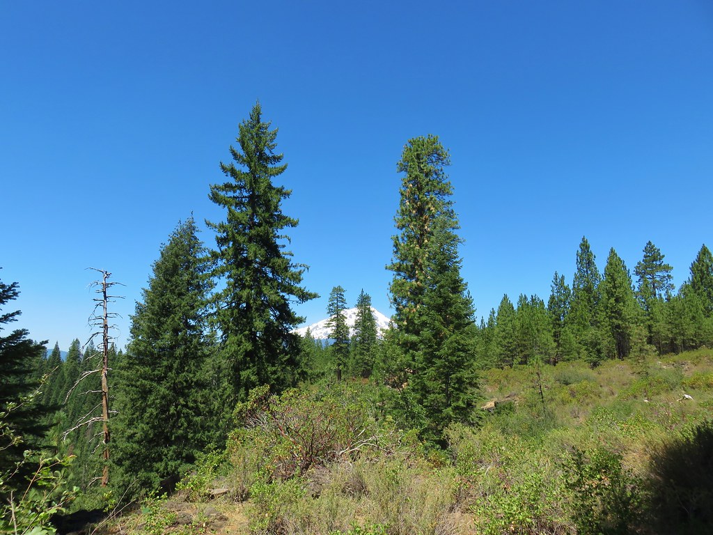
As we emerged from the trees we had a front row view of Mt. Shasta over our shoulders.

While Mt. Eddy lay straight ahead partly covered by the 14,180′ volcanoes shadow.
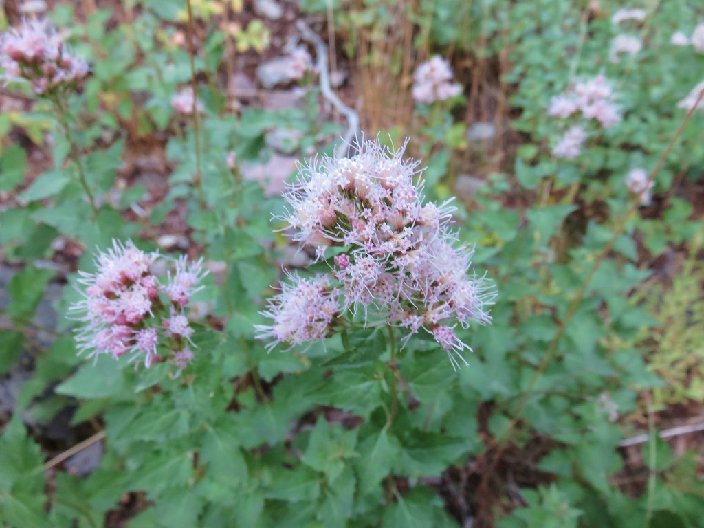
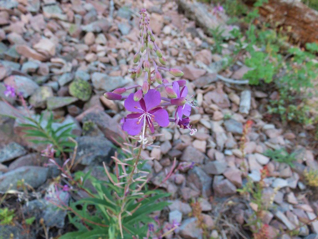
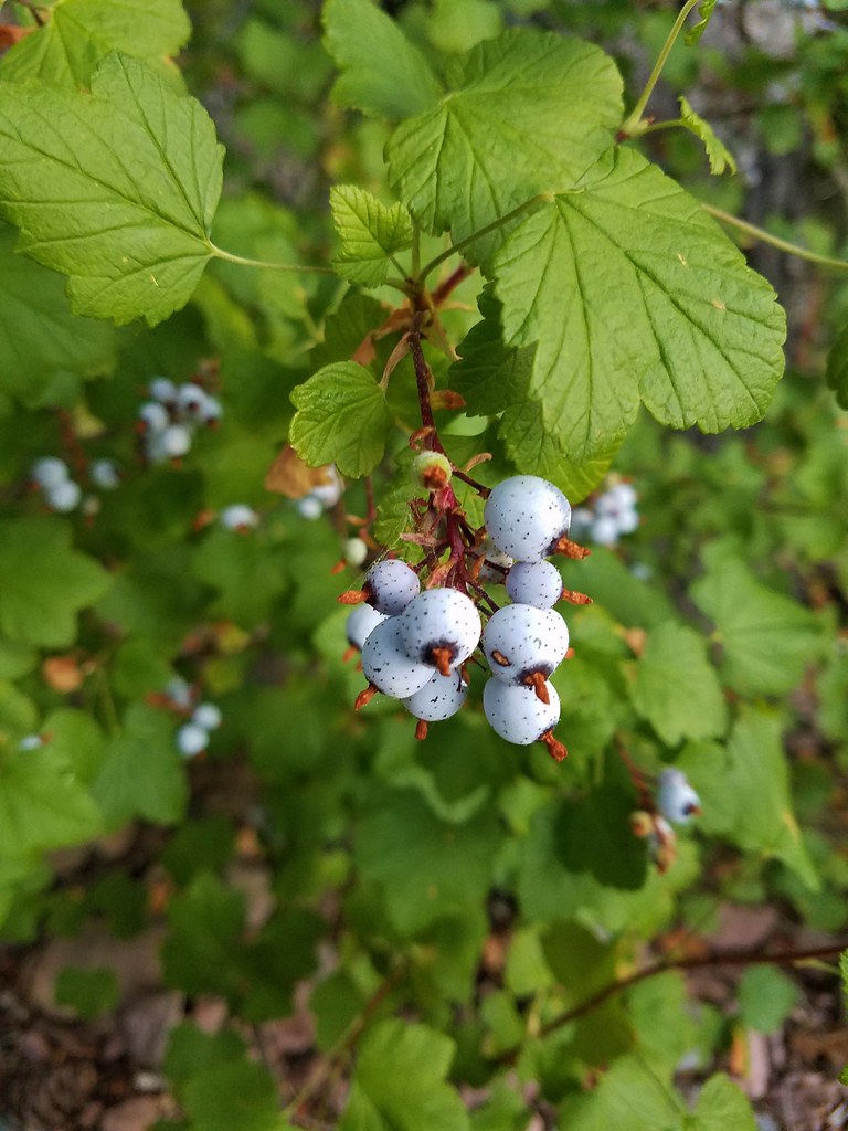
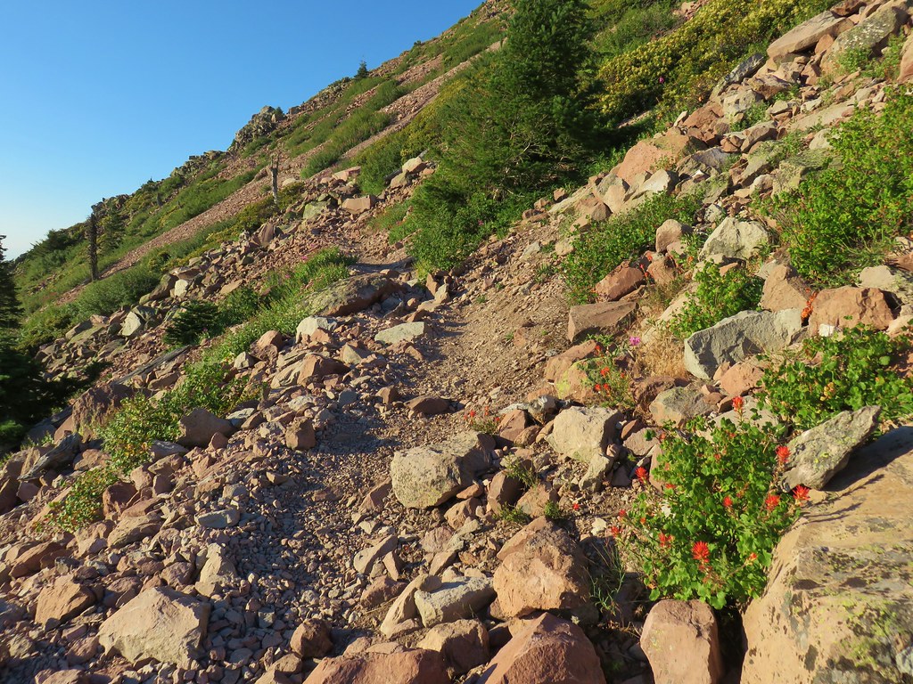
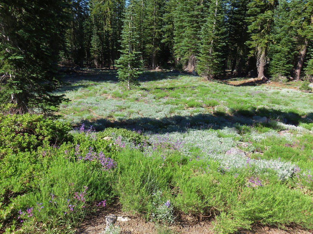
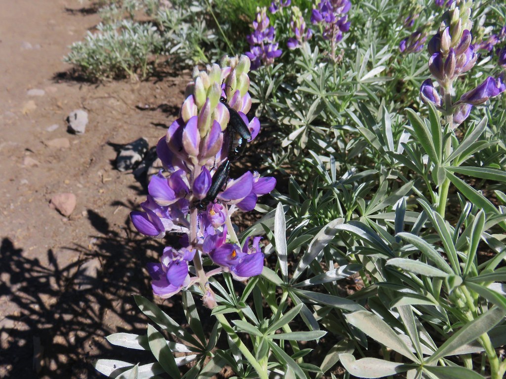
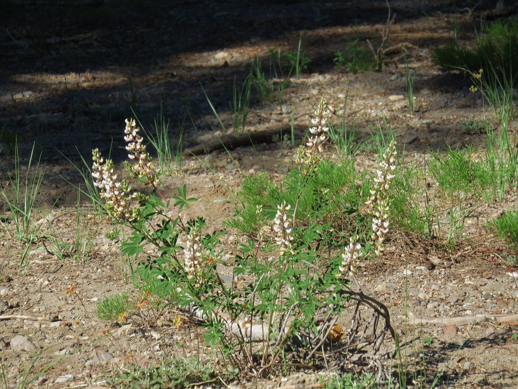
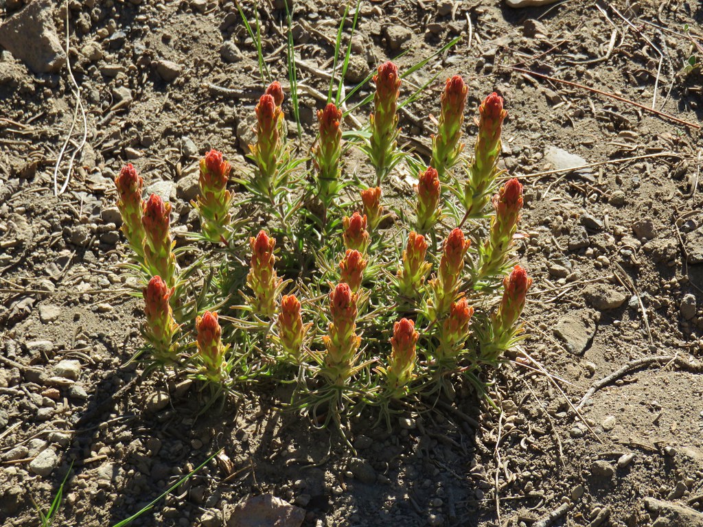
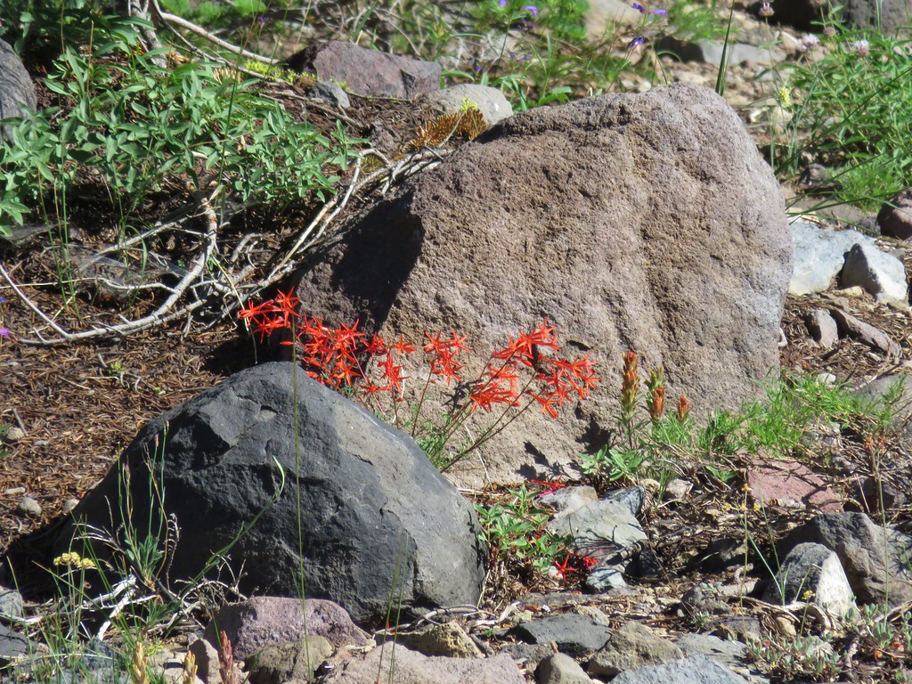
It was a little late in the year for many flowers along the trail but there were still a few as well as some other interesting plants.

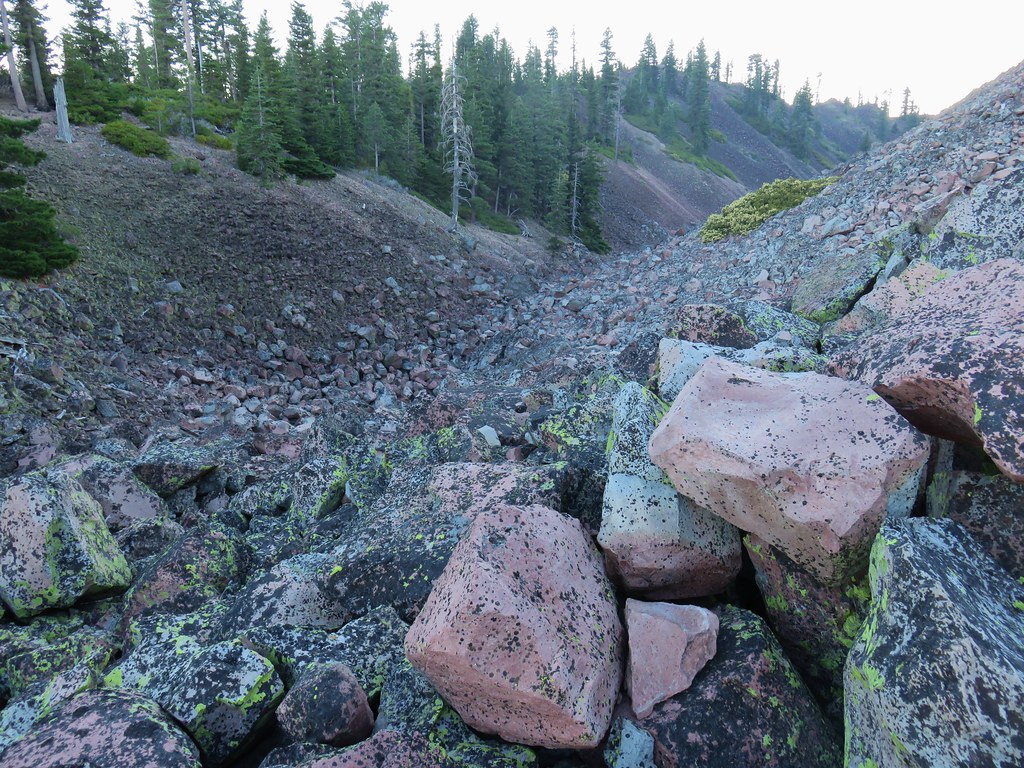
After 1.3 miles the trail came to a switchback revealing a small rocky gorge in the butte.
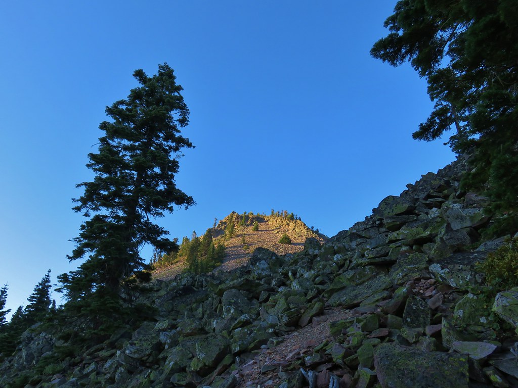
Mt. Eddy was now behind us as we continued to climb with the summit of Black Butte in the sunlight above.

Our timing was good as we were in a great spot to watch the Sun rise over Mt. Shasta.

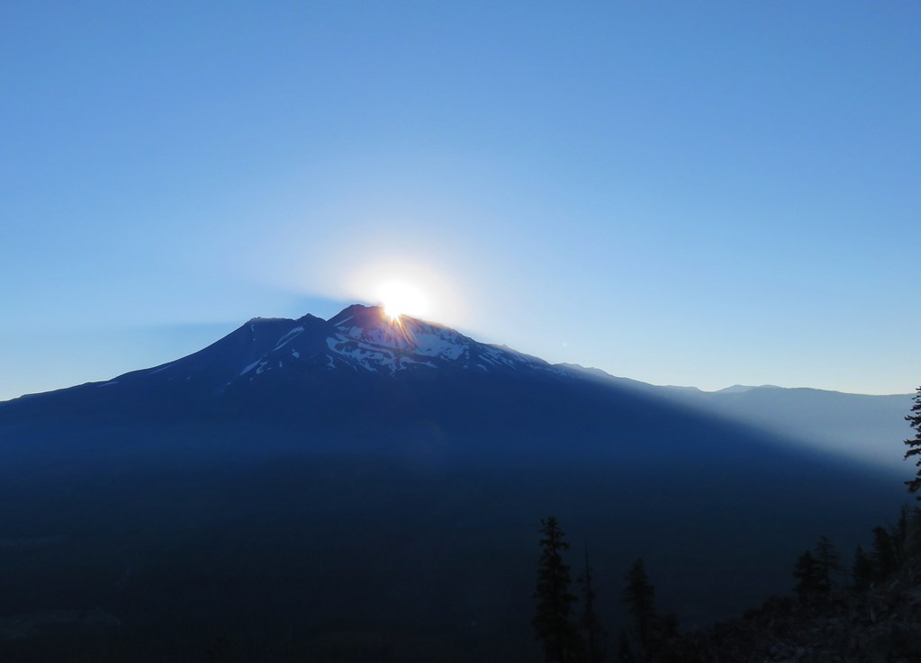
As neat as that was to see the Sun was soon directly on us and things heated up quickly as we clambered over the rocky trail.
We were beginning to wonder if the Forest Service had made up the slide because we’d been hiking long enough that we were sure we’d gone further than a mile and half and hadn’t seen anything yet. It turned out that the slide was closer to 2 miles along the trail.
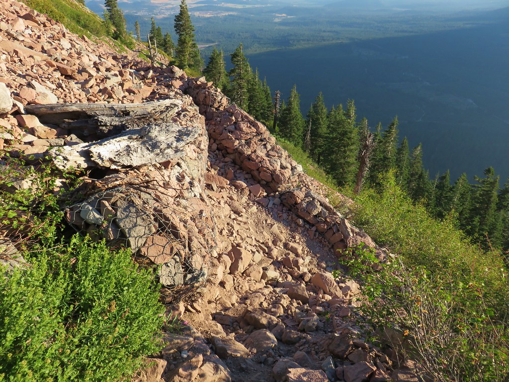
With a little caution it was passable but it didn’t look like it would take much for it to get a lot worse. After passing the slide we came to a second switch back where the trail began to climb more aggressively toward the summit.

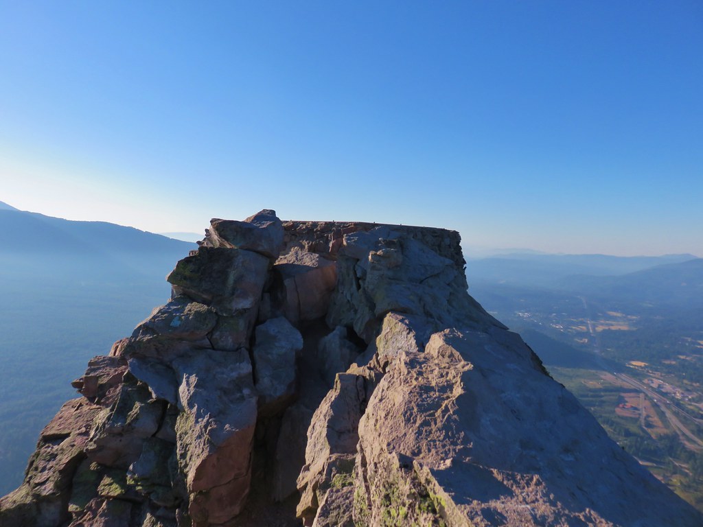
After a third switchback the trail began a series of shorter switchbacks up to the summit where the foundation remains of an old lookout tower.
Mt. Shasta’s shadow had been replaced by that of Black Butte, but the 6358′ butte couldn’t reach Mt. Eddy.
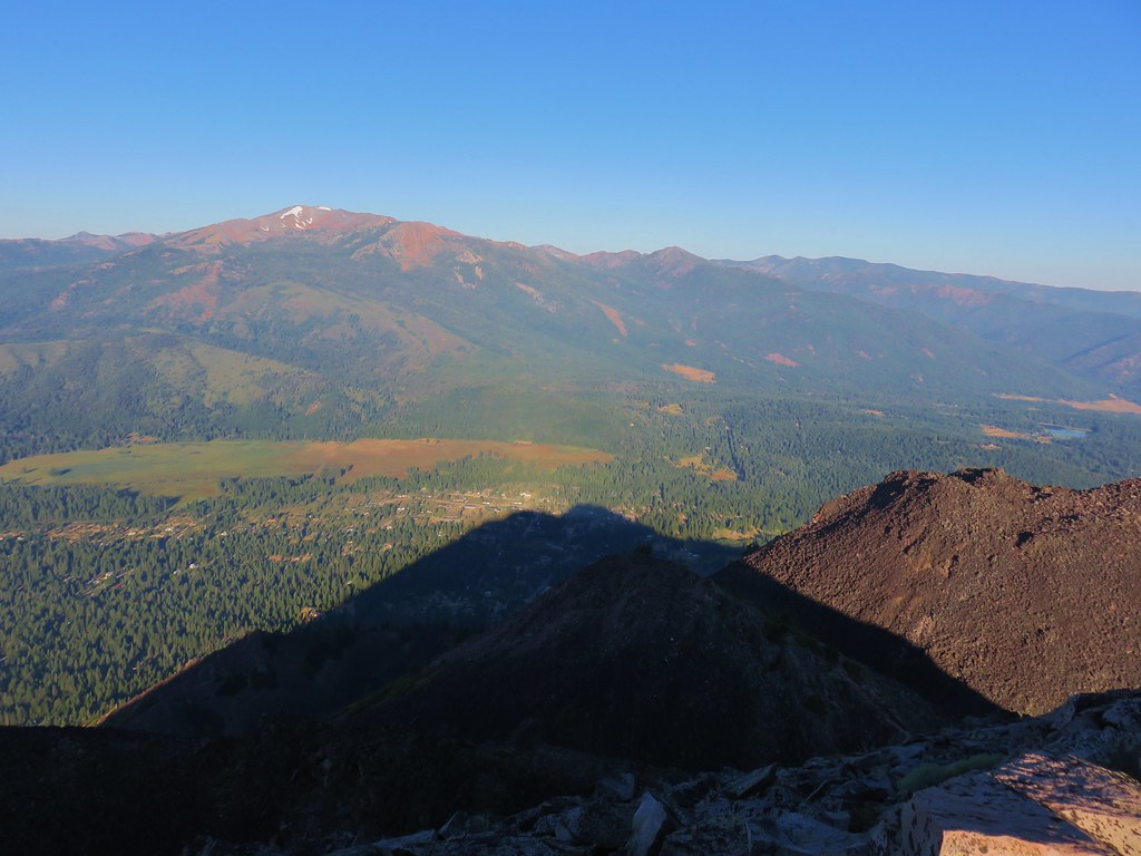
Meanwhile the position of the sun made it nearly impossible to look at Mt. Shasta.

There was a nice cool breeze at the summit and we lingered there awhile before heading down. After completing that hike we hopped in the car and drove to the Bunny Flat Trailhead which is where the Everitt Memorial Highway was gated closed.

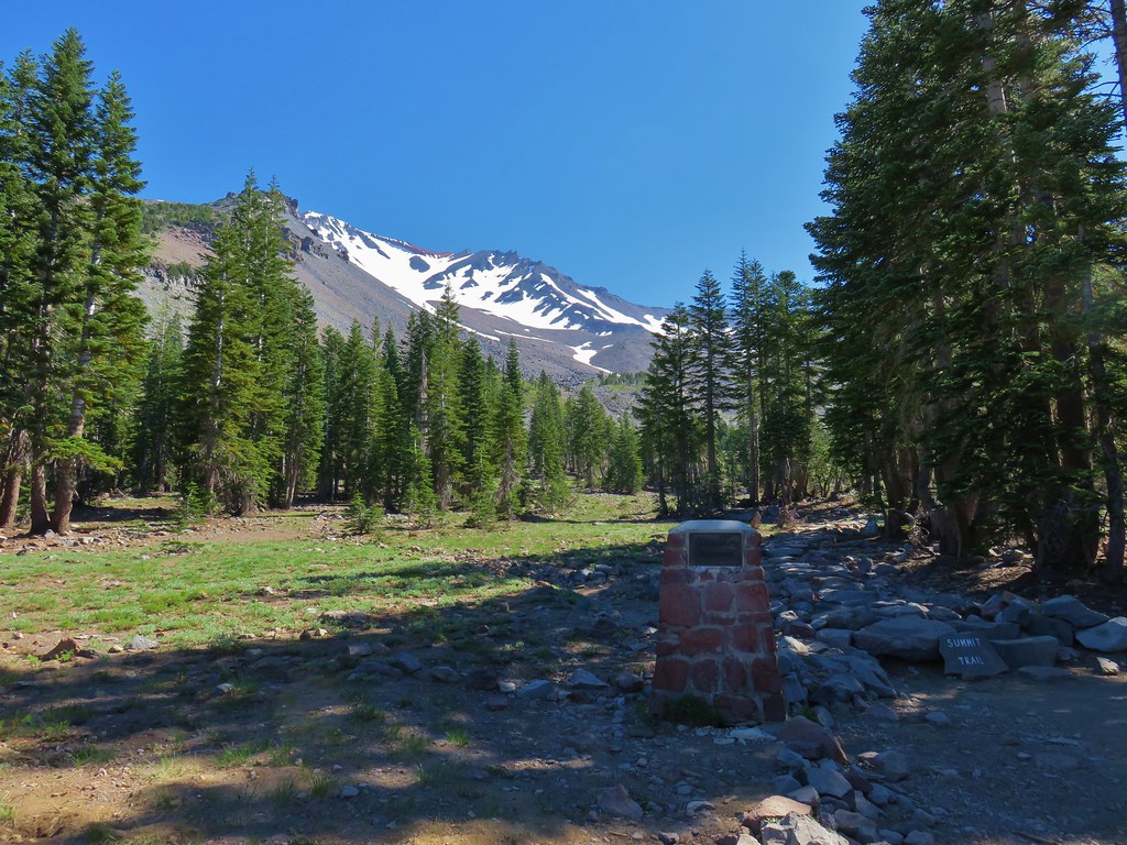
We had several options from this trailhead including Horse Camp, Green Butte, or a loop visiting both. Given the heat and the fact that we were beginning to run out of gas in our legs we opted for the short (1.6 mile) trail to Horse Camp, the site of the Sierra Club Foundation’s Shasta Alpine Lodge.
After filling out a wilderness permit we set off on the trail heading directly toward the mountain.
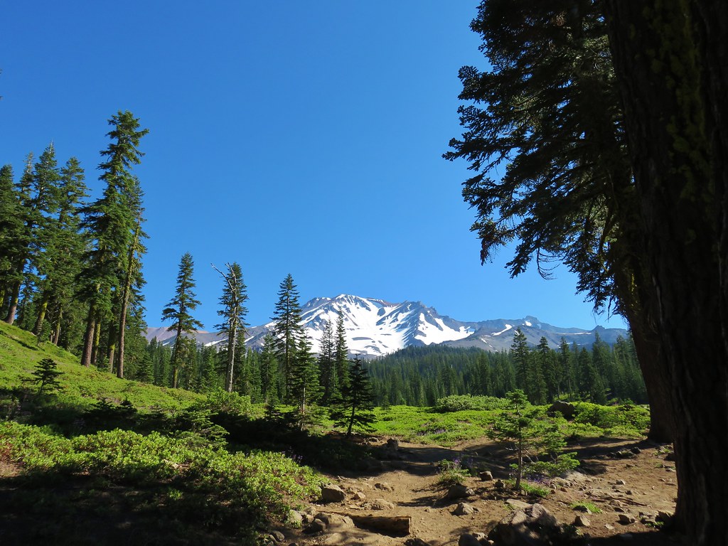
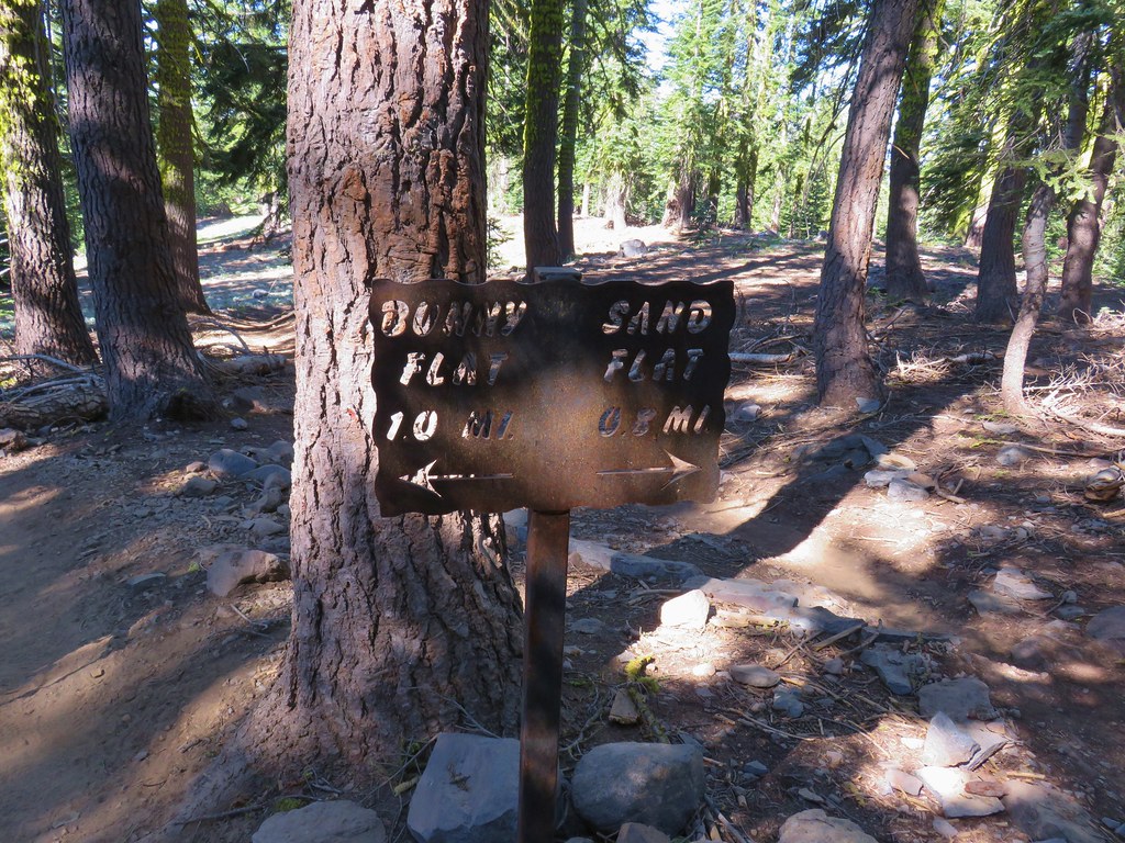
After a short distance we turned left following a pointer for Horse Camp.
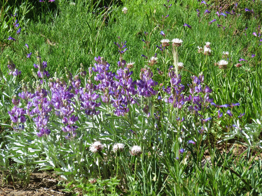
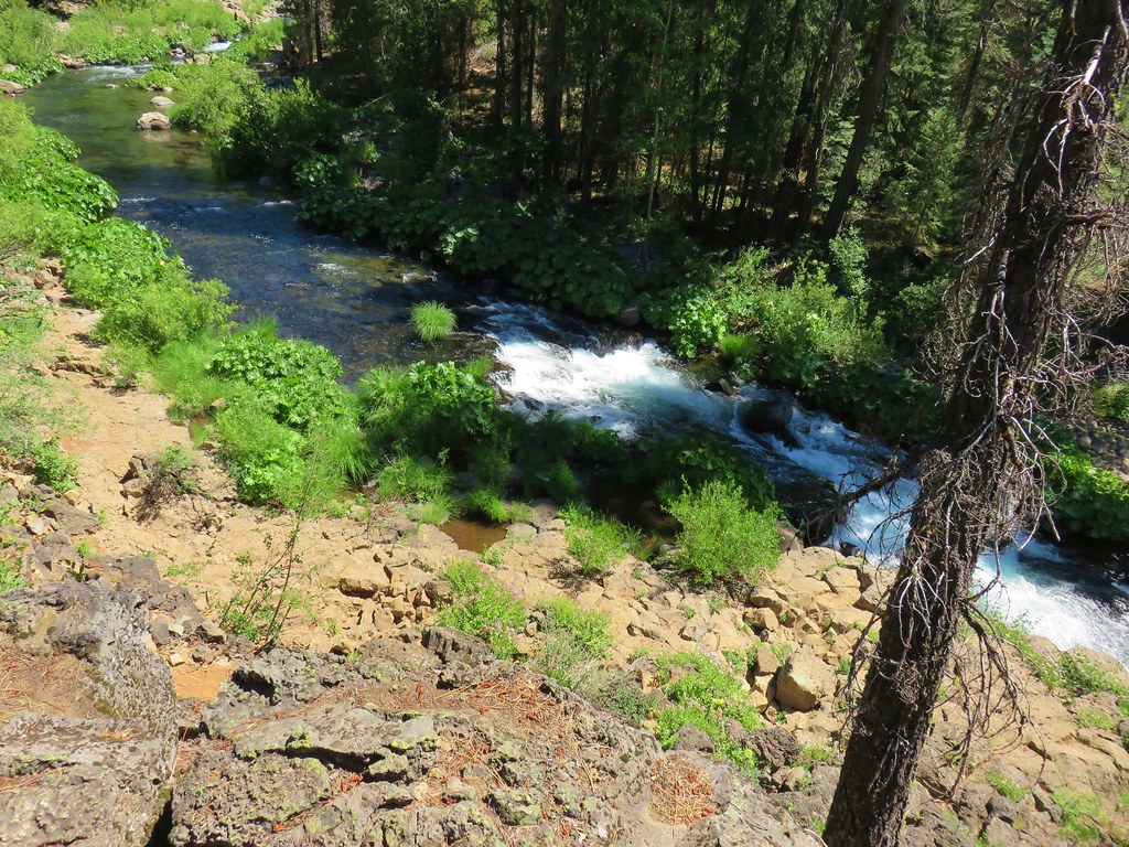
The wide trail passed some patches of wildflowers as it climbed for a mile to a junction with another trail coming from Sand Flat.


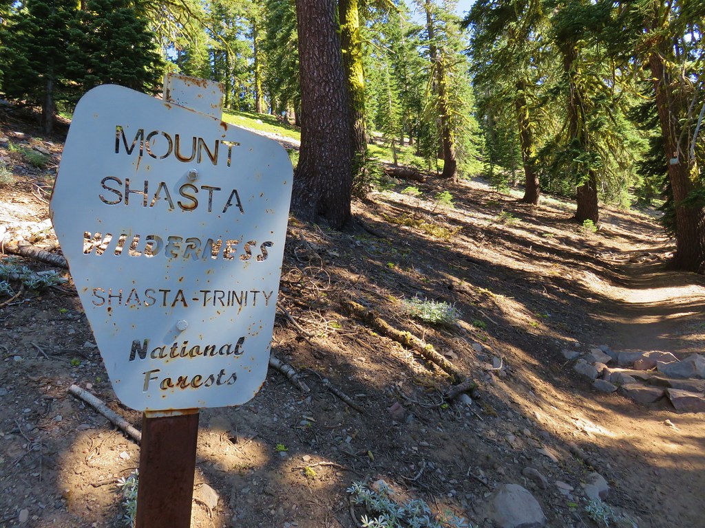
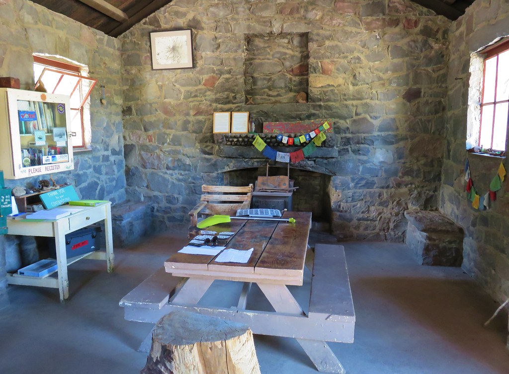
The trail steepened as we entered the Mt. Shasta Wilderness but leveled out some as we arrived at the Shasta Alpine Lodge.
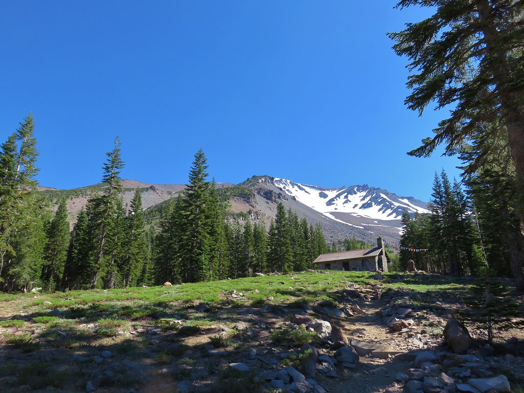
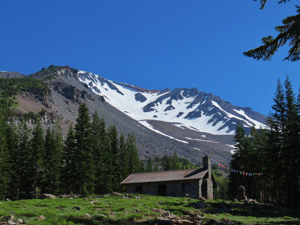
We sat in the shadow of the lodge for a moment then explored the area a bit.

Behind the lodge climbers were getting last minute instructions before heading up the summit trail.
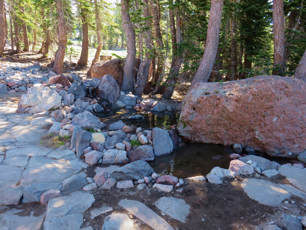
Next to the lodge was a spring and spigot for water.
We declared victory here deciding to leave any other hiking on the mountain for our next visit. We returned to Bunny Flat and headed for our final stop of the day at the Lower McCloud River Falls picnic area.
For this hike we were using a recently obtained guidebook written by Bubba Suess from Hike Mt. Shasta, “Hiking Northern California A Guide to the Region’s Greatest Hiking Adventures”. The book covers all of Northern California and has some amazing looking hike which we hope to get to at some point.
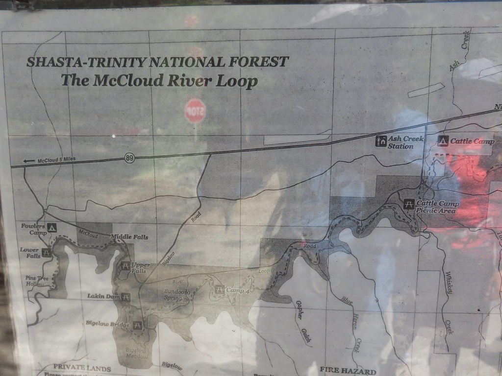
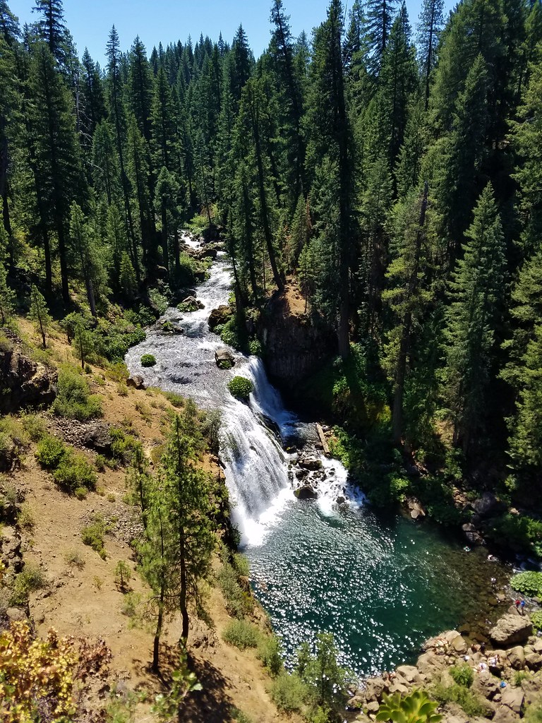
The picnic area is located off of Highway 89 about 15 miles east of Mount Shasta City. Similar to our visit to Castle Lake we were getting a late start due this being our third hike of the day and we found the parking area packed with people trying to escape the heat. We walked over to a signboard with a map and then set off towards a viewpoint of the Lower Falls.
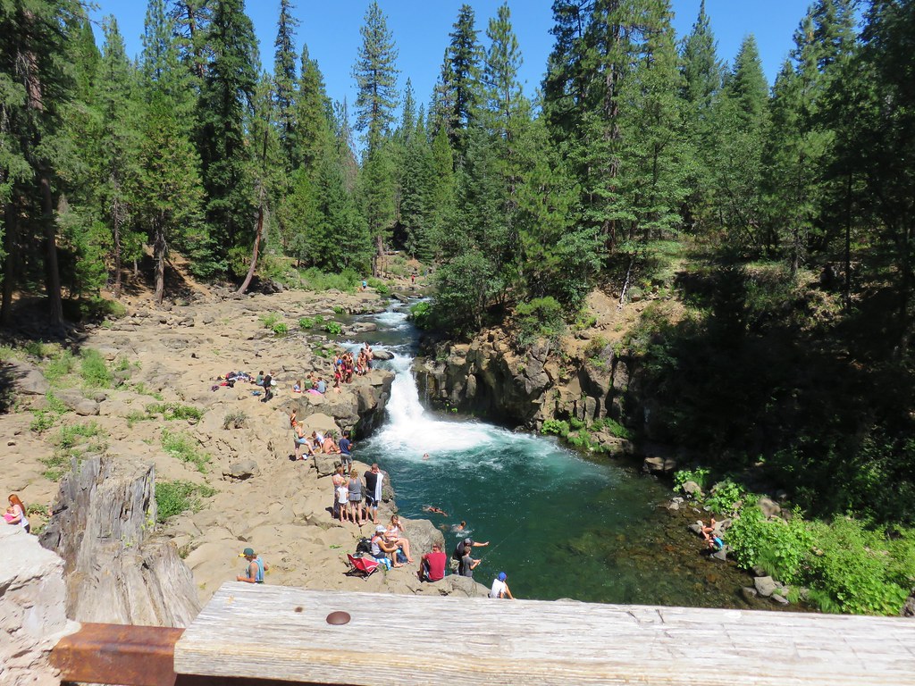
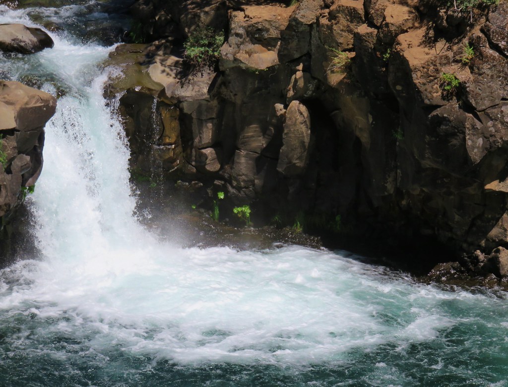
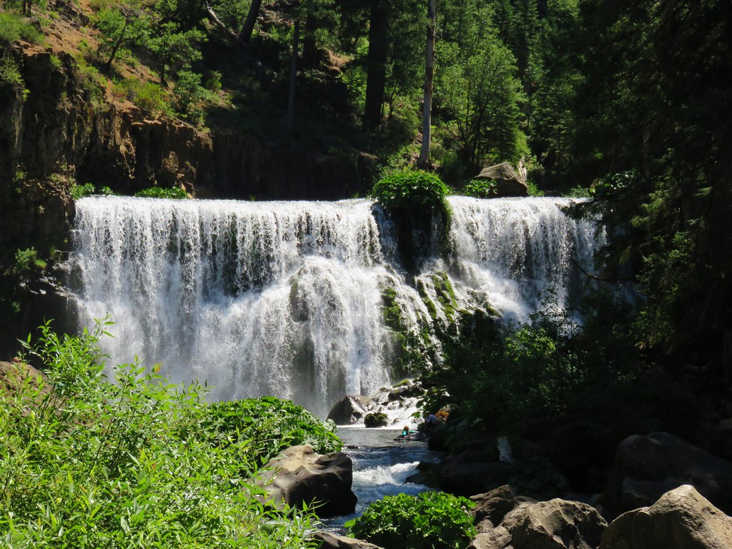
A little creative camera work produced a human free photo of the falls.
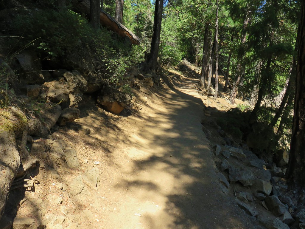
We left the crowds at the falls behind and followed the River Trail upstream toward the Middle Falls.
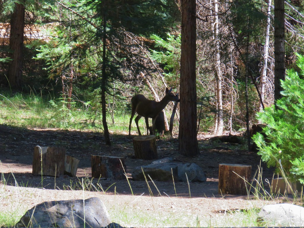
We passed by Fowlers Camp which was busy with campers as well as a doe searching for edibles.
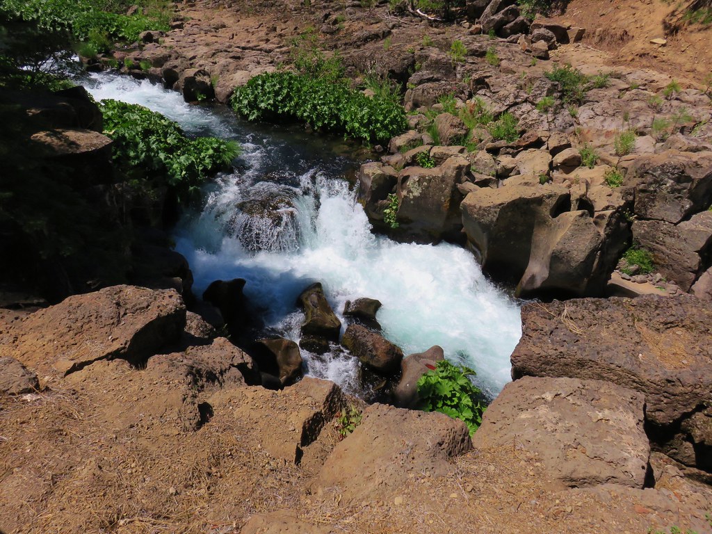
At the end of the camp was a pointer for Middle Falls.

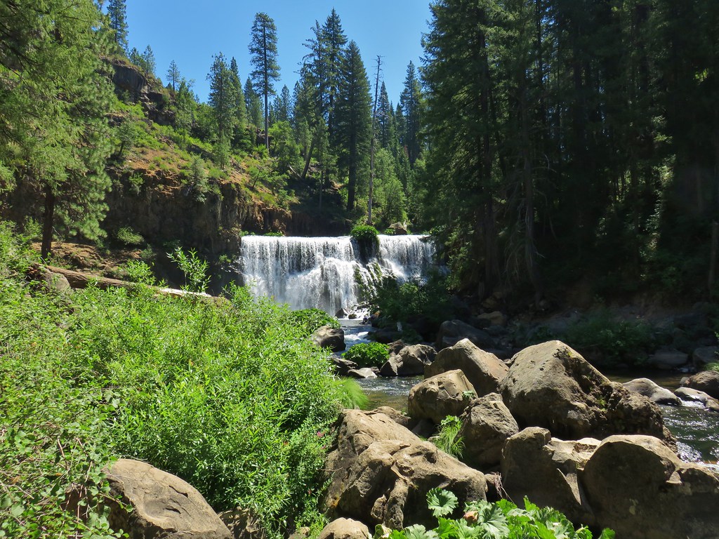
The Middle Falls were quite impressive and although there were a number of people around it wasn’t nearly as busy as the Lower Falls had been.

From the base of the Middle Falls the trail climbed via switchbacks above the river.
The next .3 miles were level offering a somewhat obscured view of Mt. Shasta.
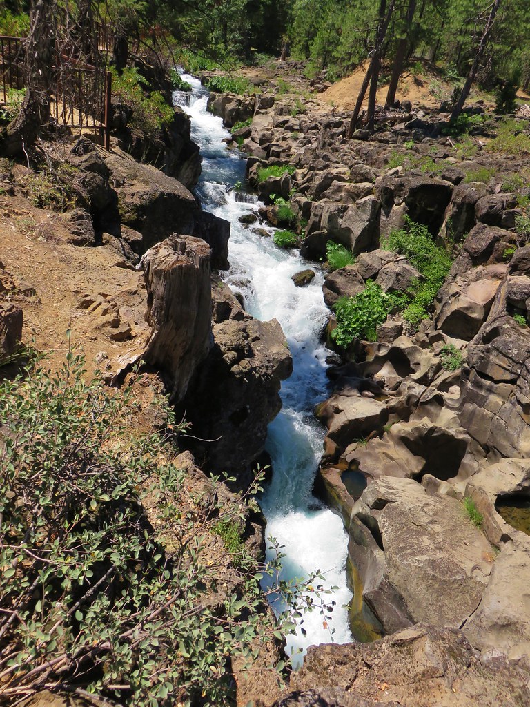
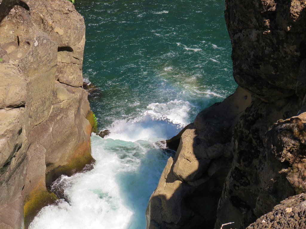
After a total of 2 miles we arrived at the Upper Falls.
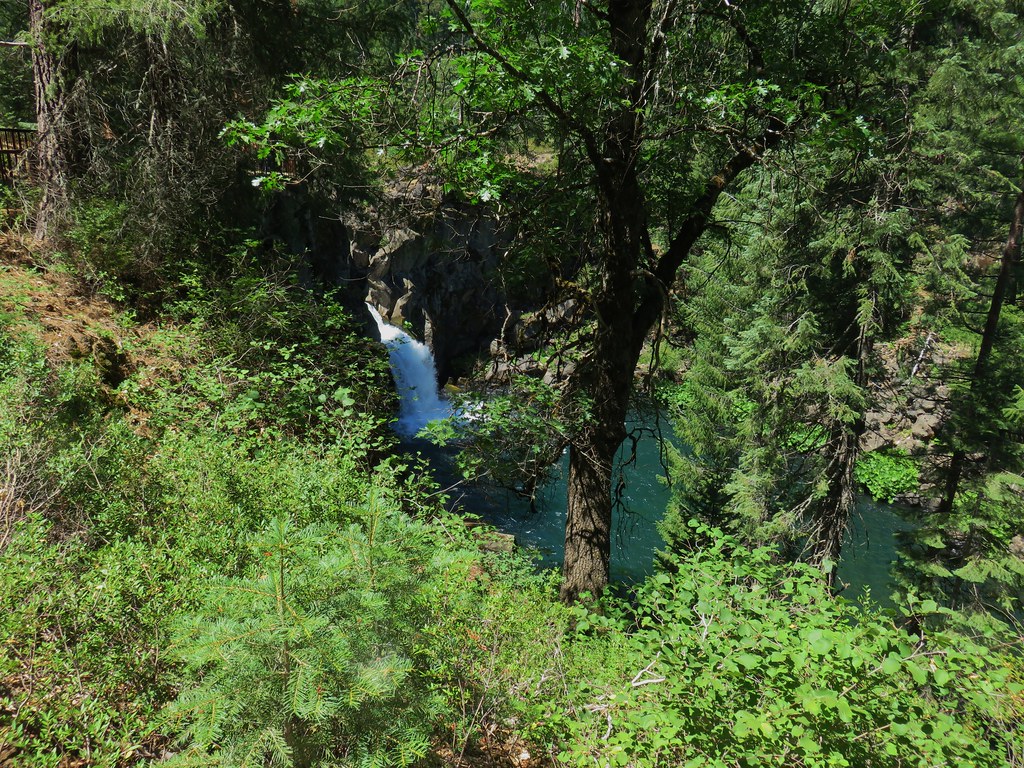

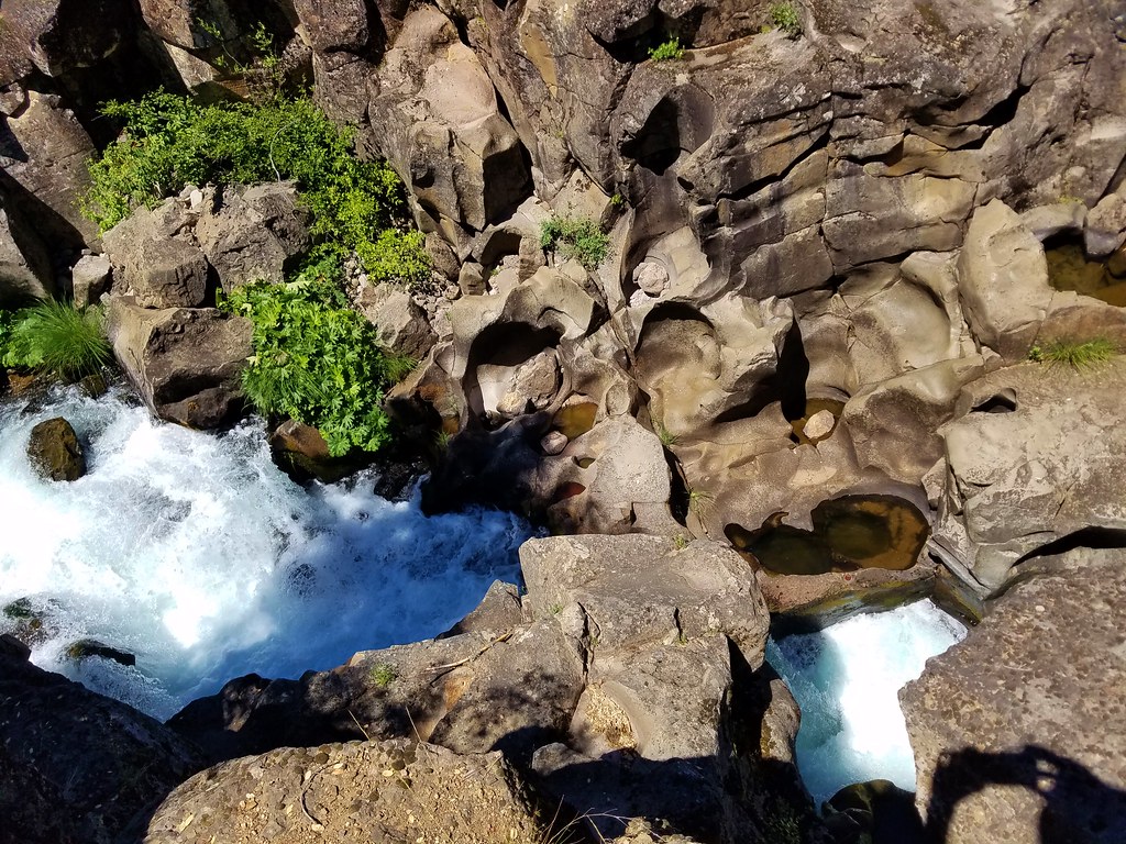
We continued on a short distance to admire the narrow gorge the river passed through above the Upper Falls.
We returned the way we’d come and drove back to Mount Shasta City having completed 10 hikes in 6 days in California including visiting 4 wilderness areas that we had not previously been to. We’d seen our first rattlesnake, a bear cub and its mom, several deer and lots of other wildlife. We had experienced amazing scenery on all of the hikes and really couldn’t have asked for a better trip. The one negative happened after we’d showered and changed and headed out for an early dinner.
We chose a small Thai restaurant (the food was excellent) and when we were greeted we were informed that they couldn’t serve us any water. It turned out that the city had issued a boil water warning the day before due to some tests of the city’s drinking water that came back positive for E-coli. We’d been drinking the water all week, lots of water. It’s been five days since our last drinks and so far we seem to have escaped unscathed but we could have done without that scare. Happy Trails!

6 replies on “Black Butte, Horse Camp, and McCloud River Falls”
Gorgeous!
[…] wilderness areas: Russian (post), Castle Crags (post), Trinity Alps (post), and Mt. Shasta (post). Our visit the the Trinity Alps brought us to the most southerly point while hiking to date. We […]
[…] Shasta above a layer of smoke that mostly hid Black Butte (post). Mt. Eddy (post) is the snowy peak to the […]
[…] Shasta and Black Butte (post). The layer of smoke from the day before seemed to have blown out […]
[…] When we reached Yreka, CA instead of taking Highway 3 to Etna we stayed on Interstate 5 and continued south to Mt. Shasta and made our way to the Upper Panther Meadows Trailhead. We had tried to do the hike here in late July 2017 but a late snow melt that year had kept the gate to this trailhead closed so we had hiked from Bunny Flat instead (post). […]
[…] 7/27/2017 #97 Castle Lake-Hiked 7/26/2017 #98 Castle Crags-Hiked 7/26/2017 #99 Black Butte-Hiked 7/28/2017 #100 Mount Shasta Meadows-Hiked […]