A rare August atmospheric river was forecast to hit the NW with a potential to drop 1-3 inches of rain in the mountains and an inch or more in the northern Willamette Valley. By Sunday the system was projected to be moving on and giving way to sunny skies. We adjusted our plans accordingly and had decided to visit Silver Falls State Park on Sunday after the rains subsided to see how the waterfalls looked with the additional rainwater.
We got a little rain on Friday, and more overnight, but by early Saturday morning it became apparent that the river had stayed to the north and mostly missed the Salem area. Around 9am we decided that there was no reason to wait an additional day and quickly packed up and were on our way to Silver Fall by 10am.
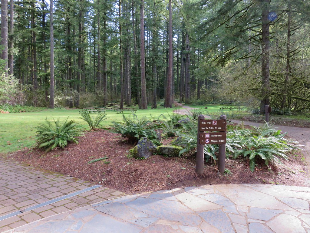
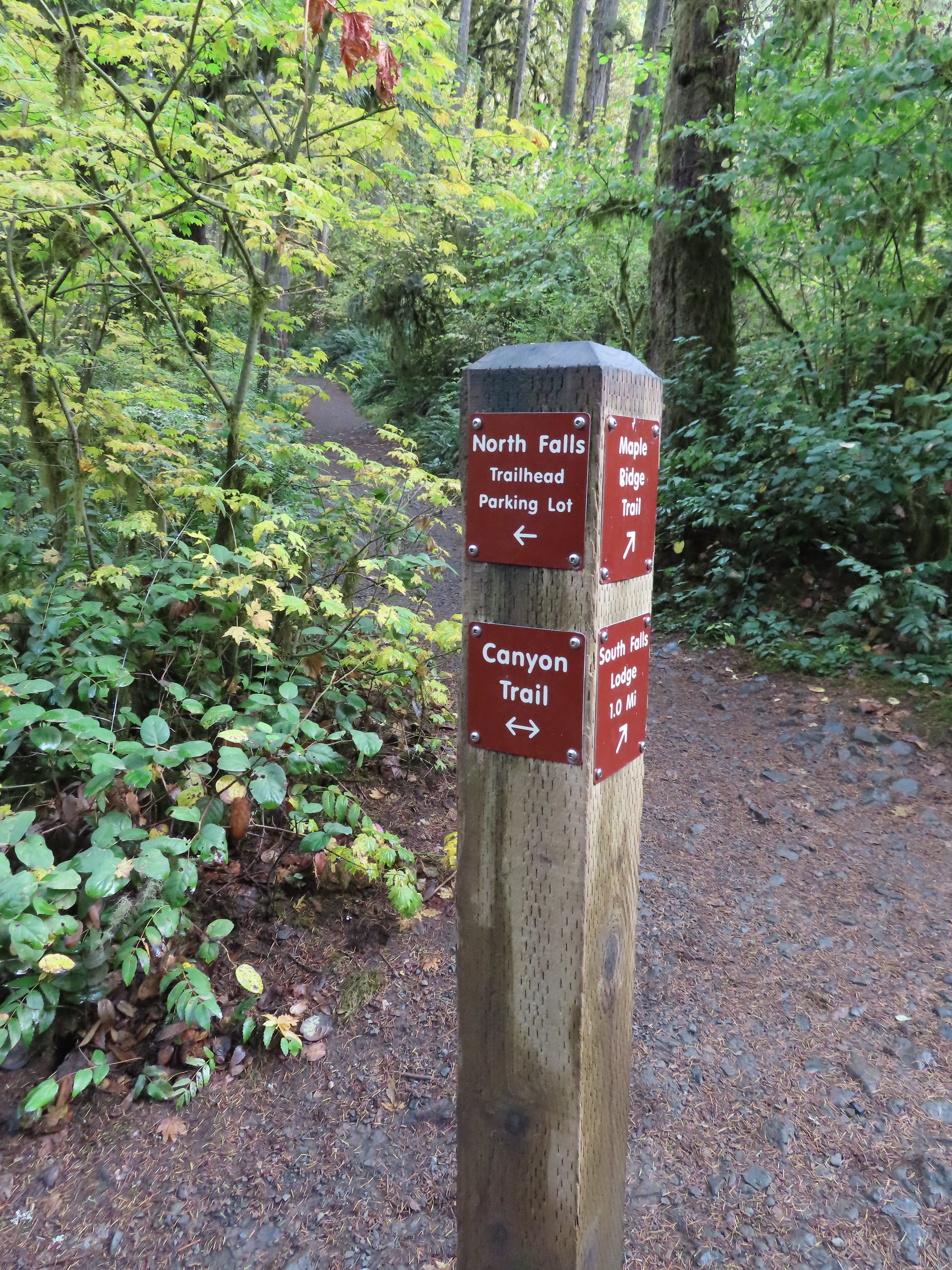
We parked in the busy South Falls Day Use Area and hung our State Park Day Use Parking Permit. (Parking is $10.00 for one day.)
Our plan was to hike the Trail of Ten Falls in a clockwise direction starting with South Falls.
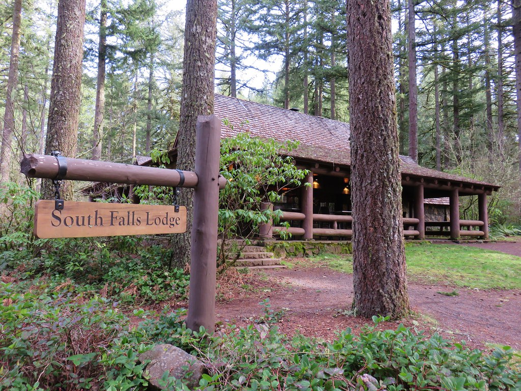
South Falls Lodge and Cafe
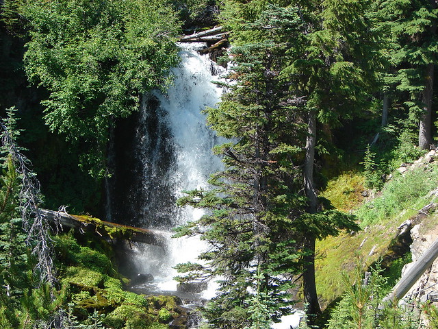
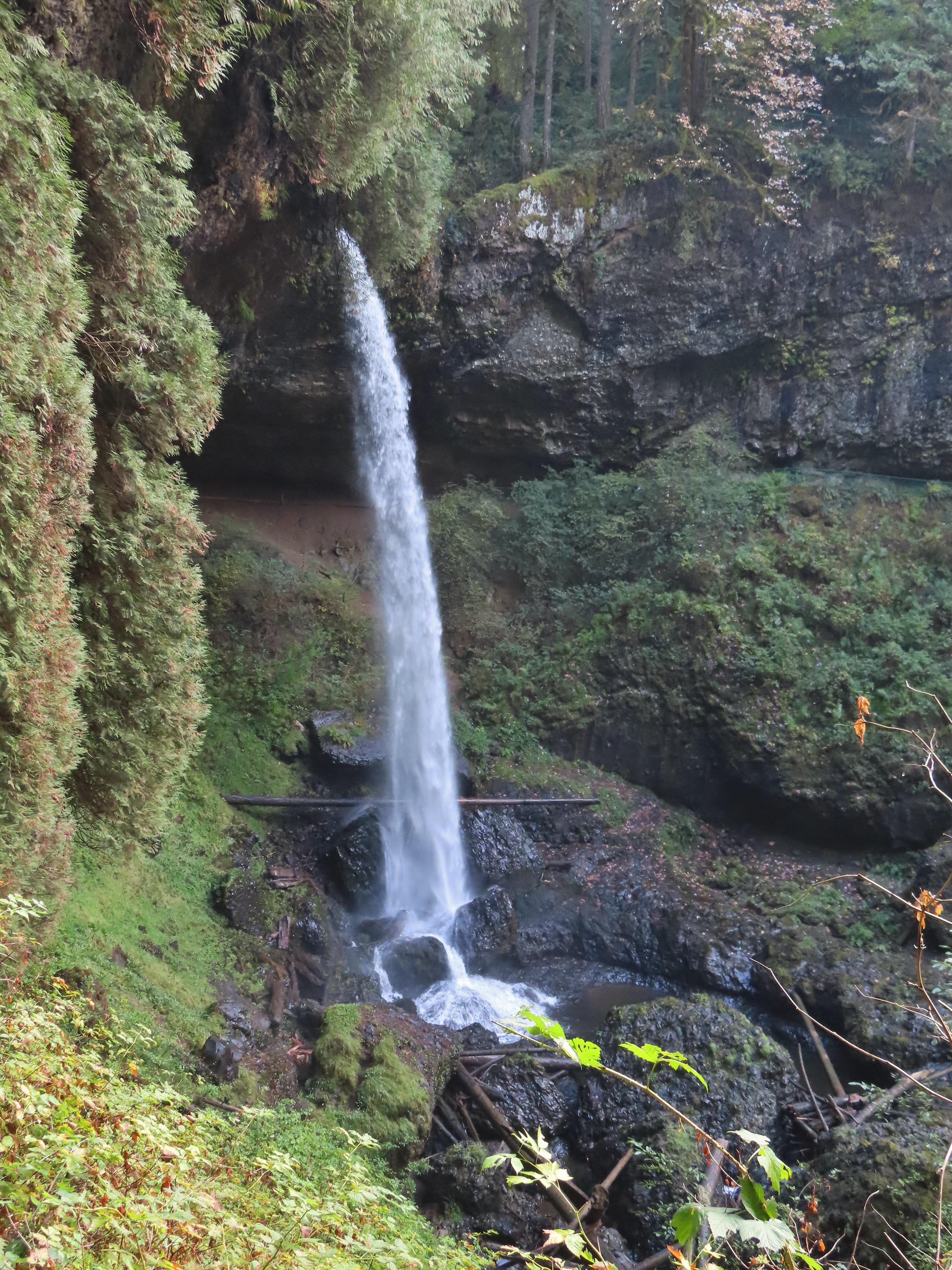
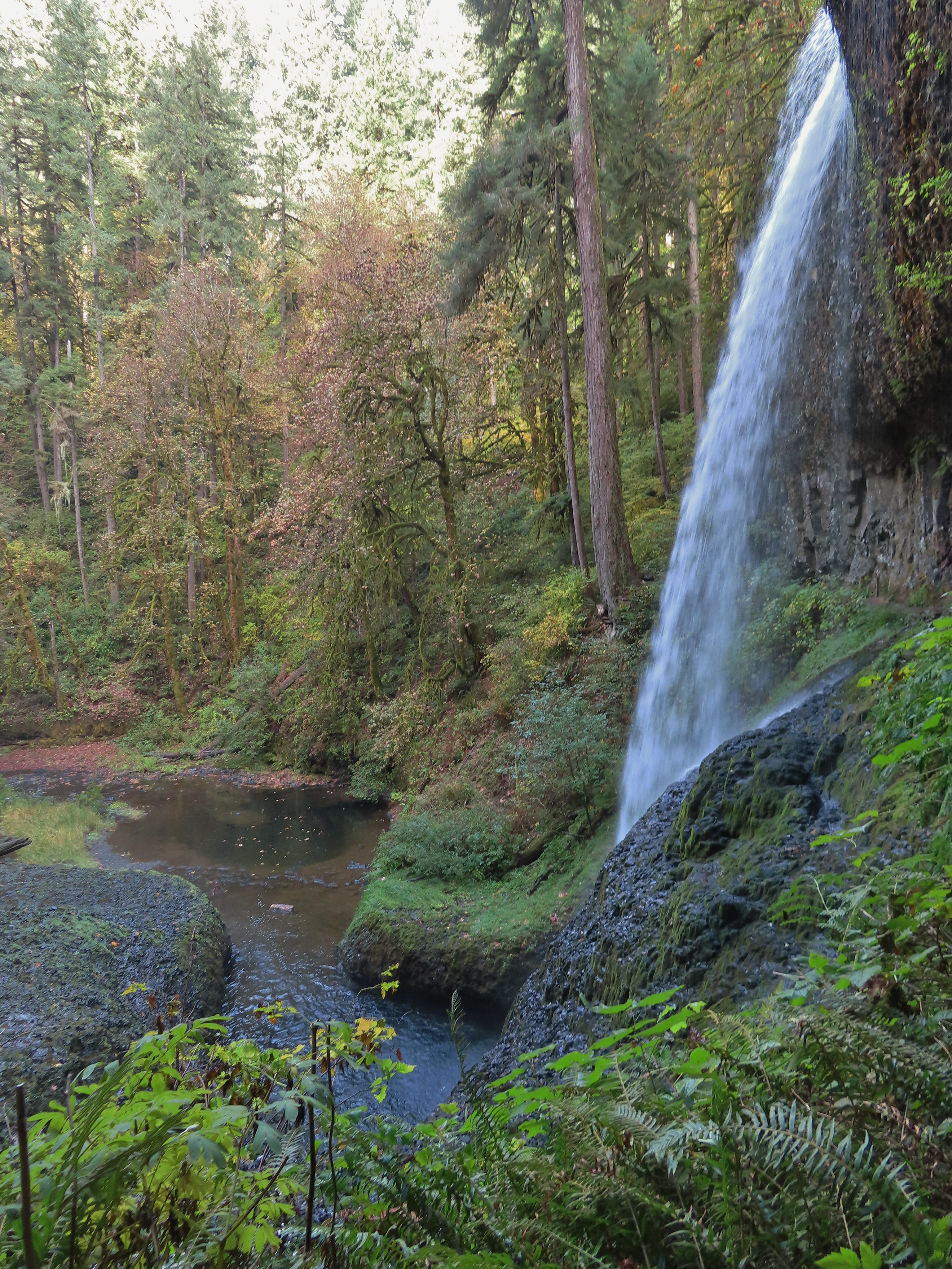
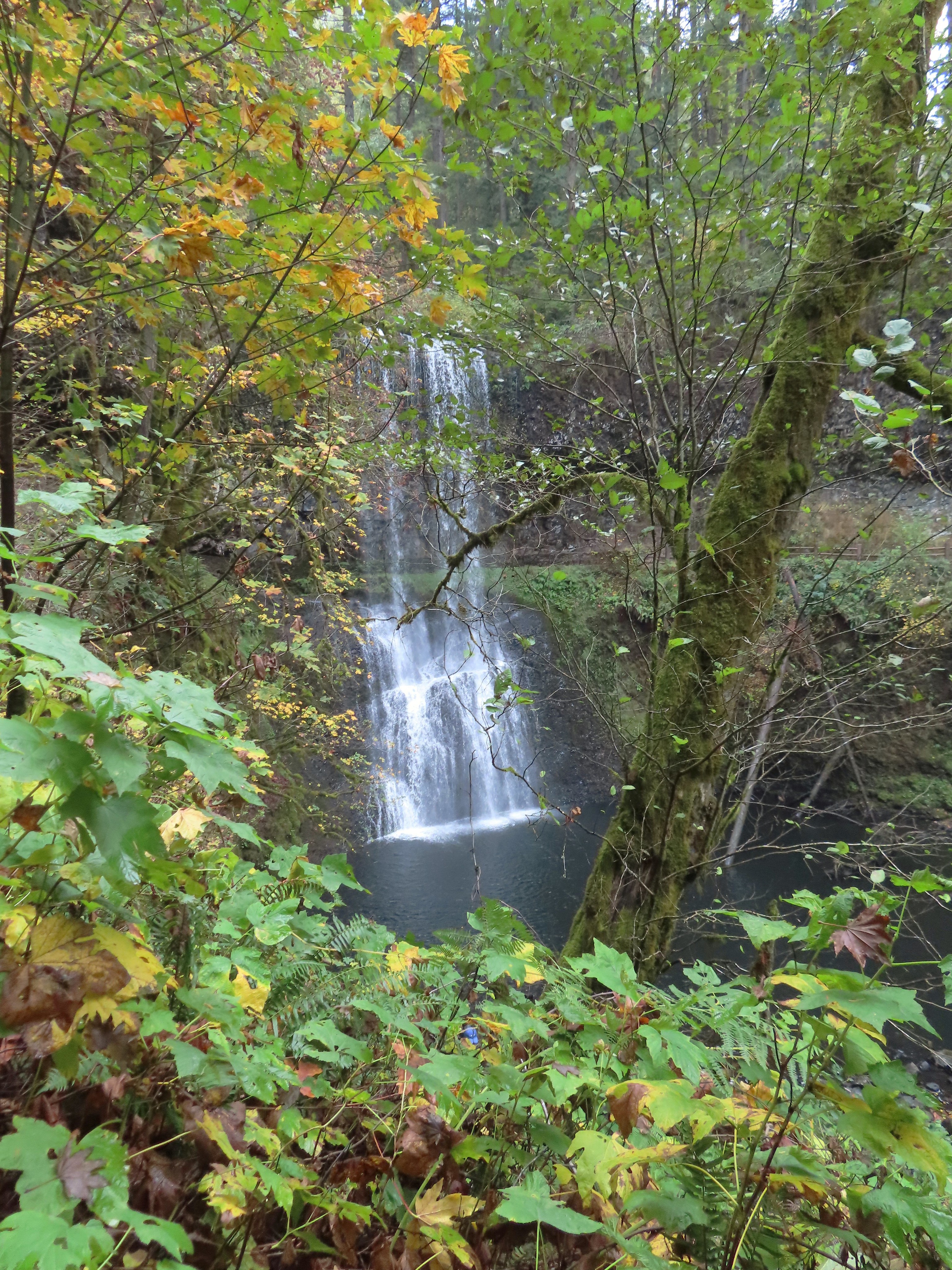
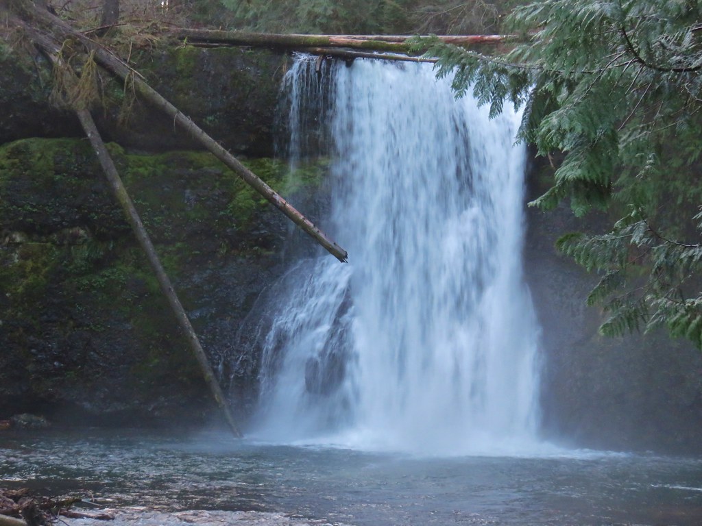
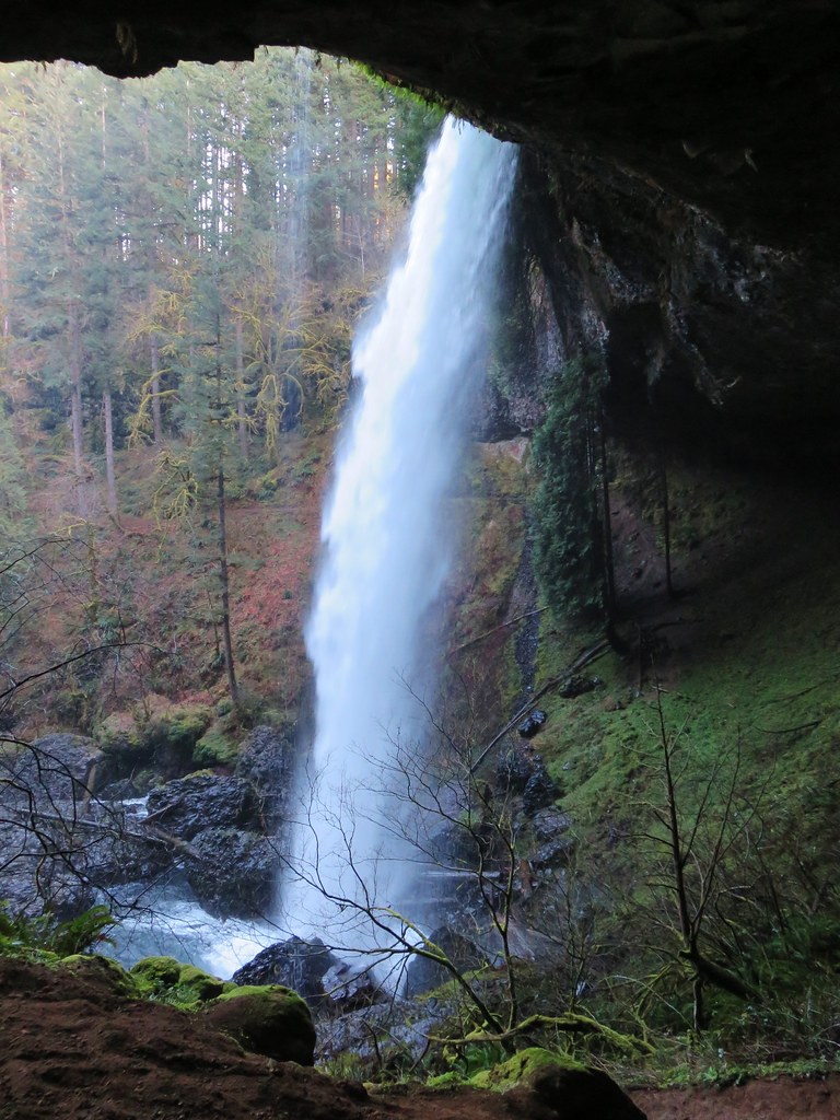
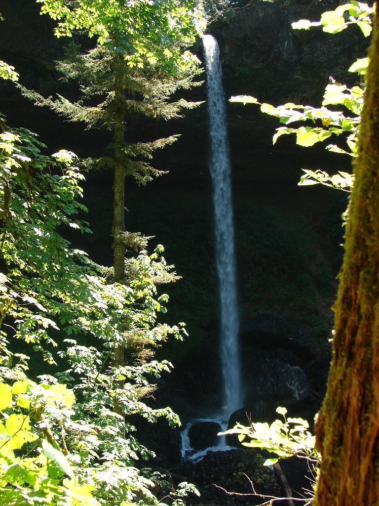
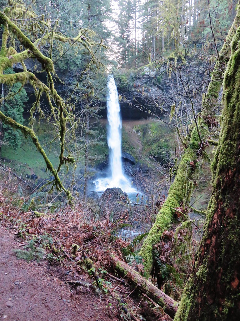
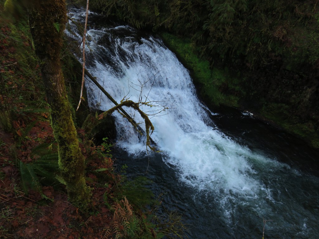
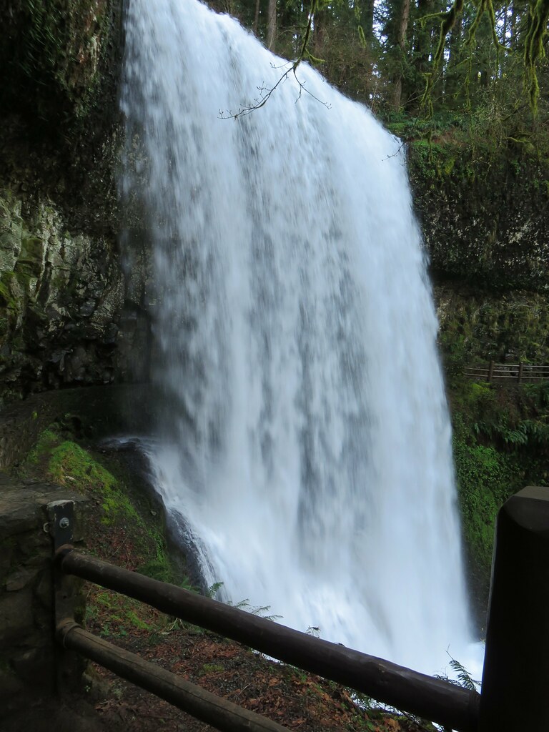
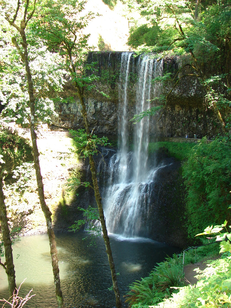
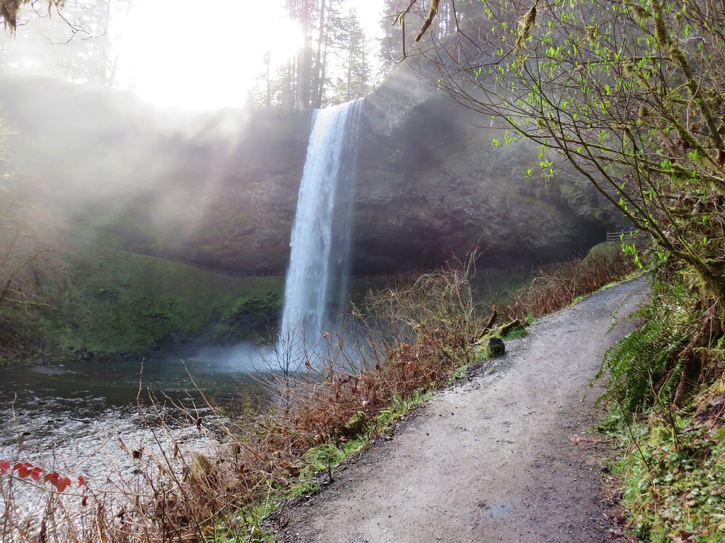
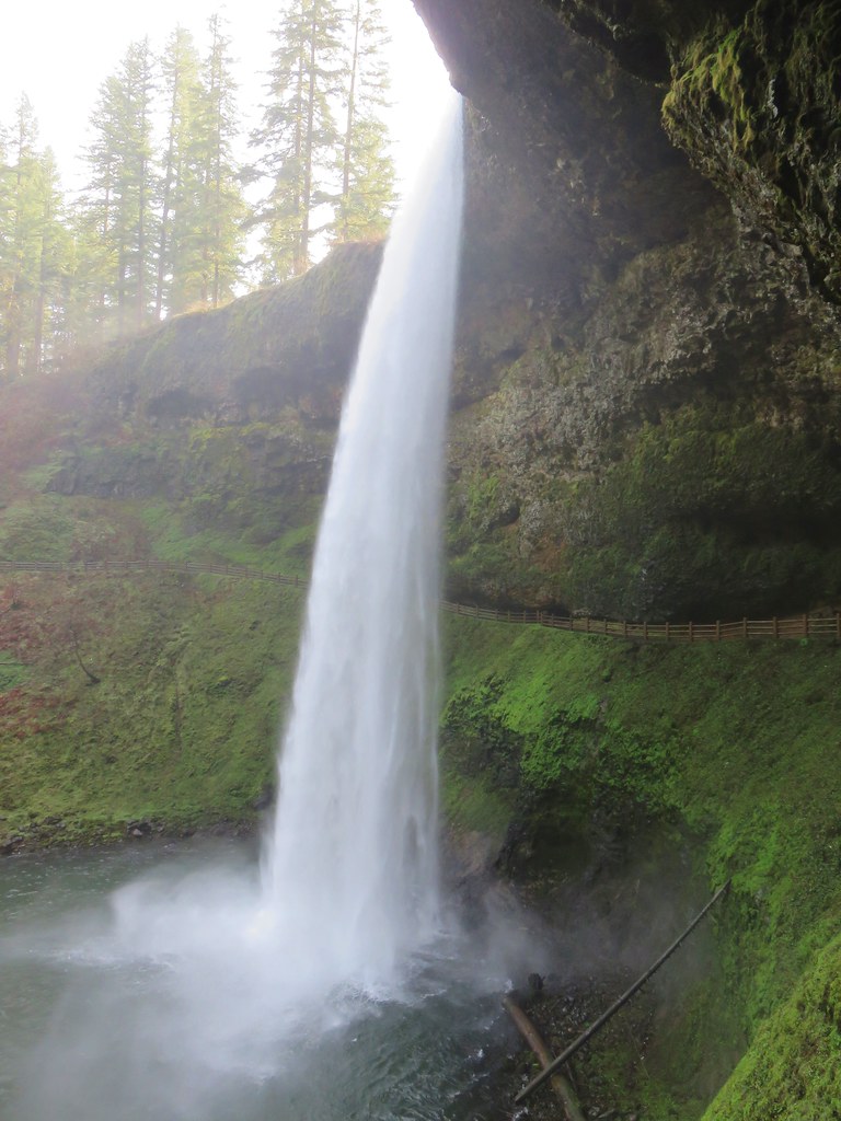
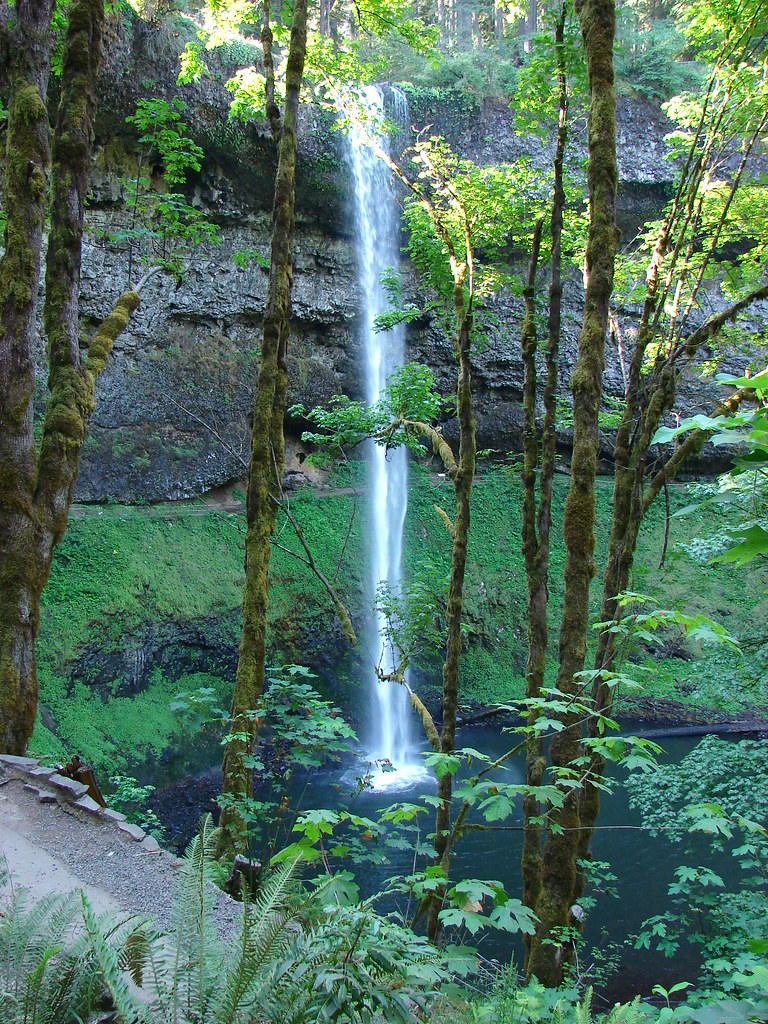
South Falls
South Falls
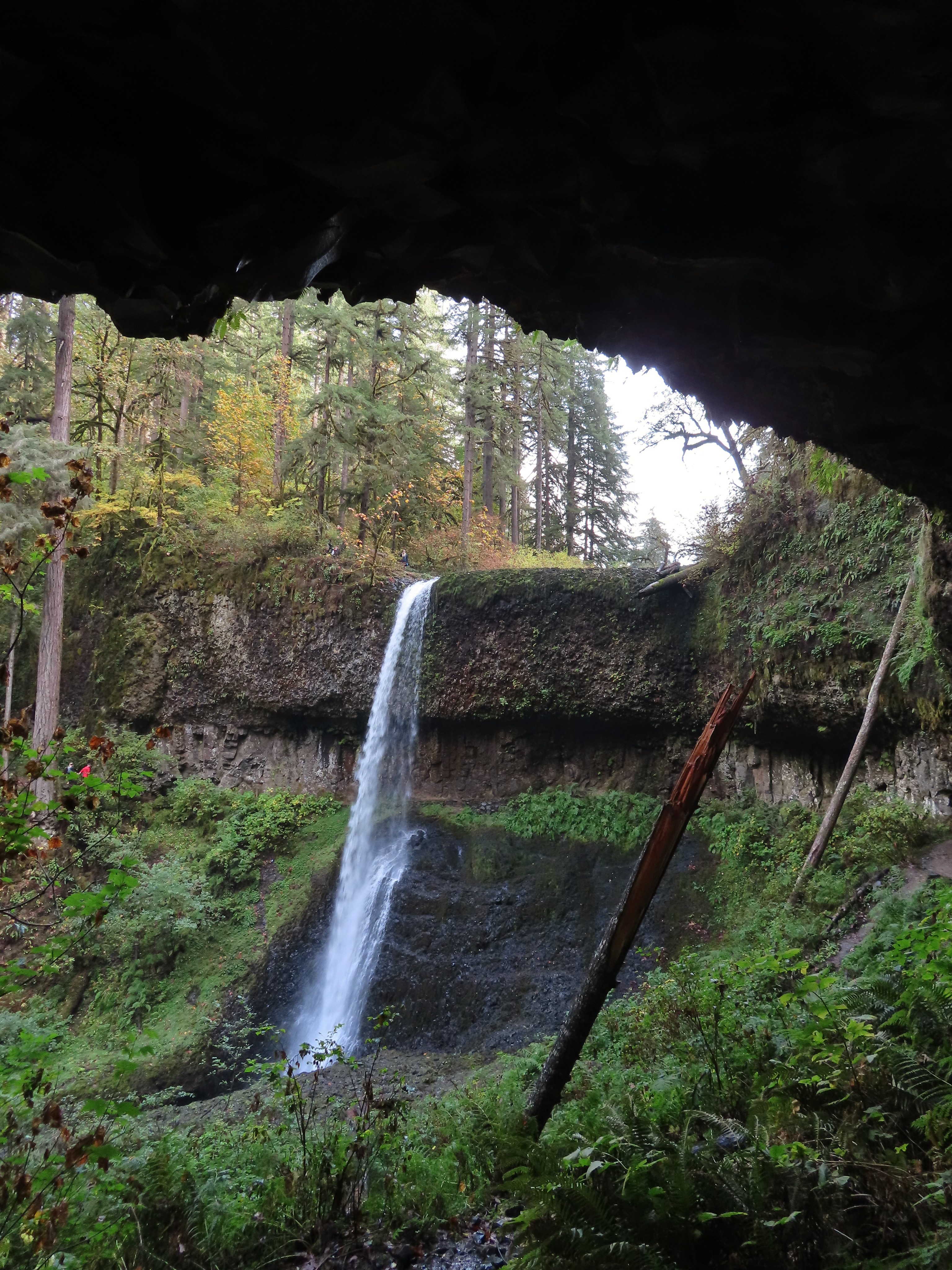
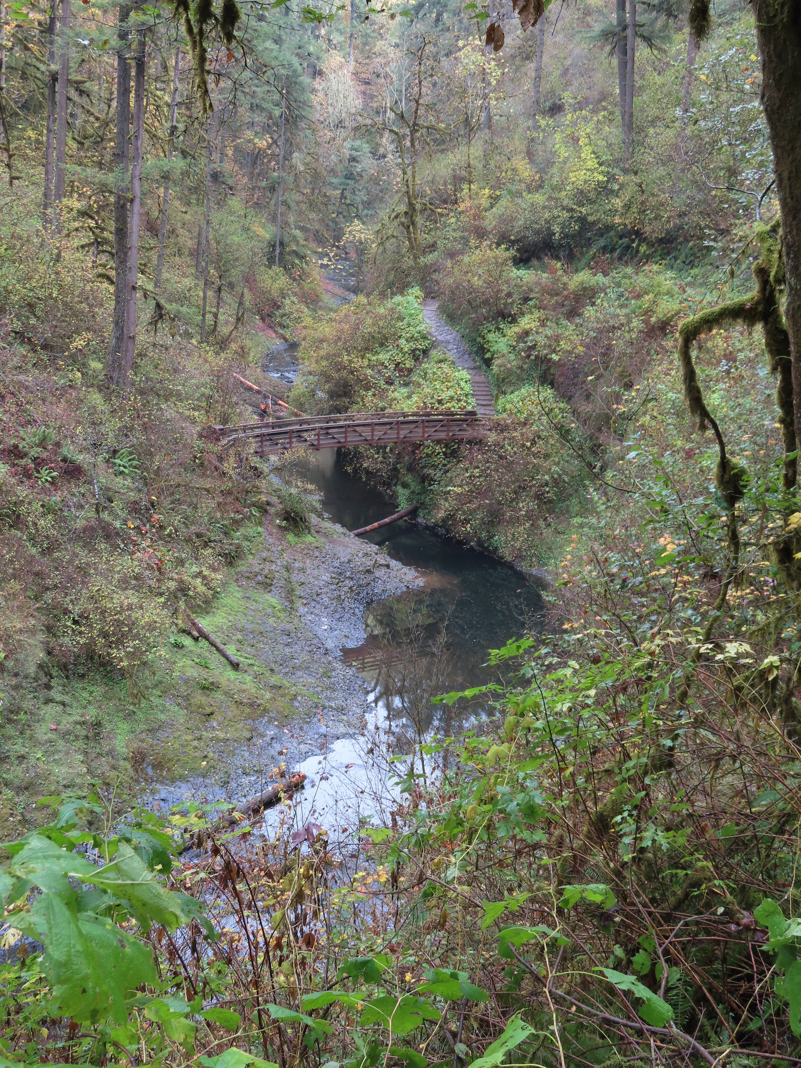
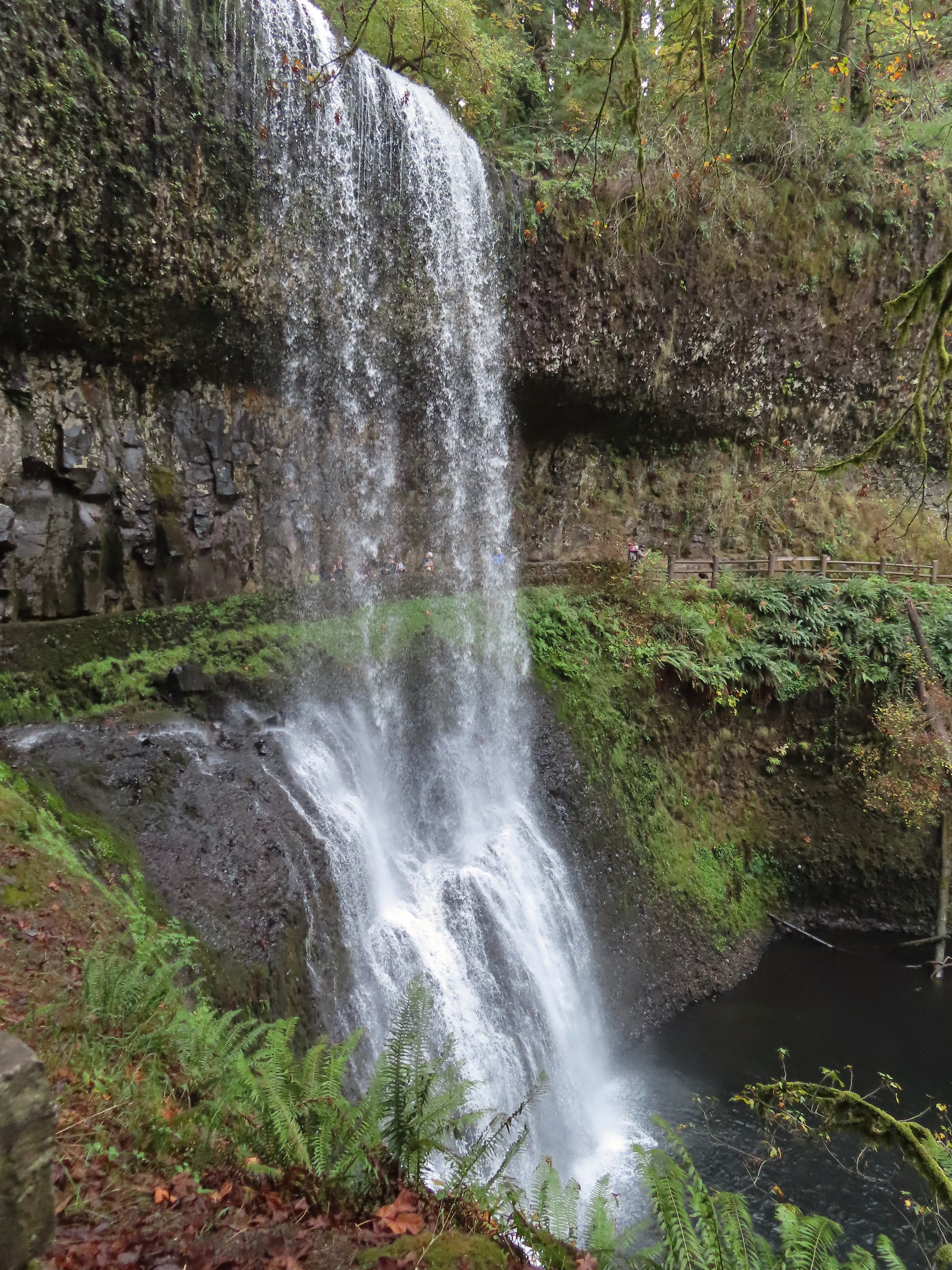
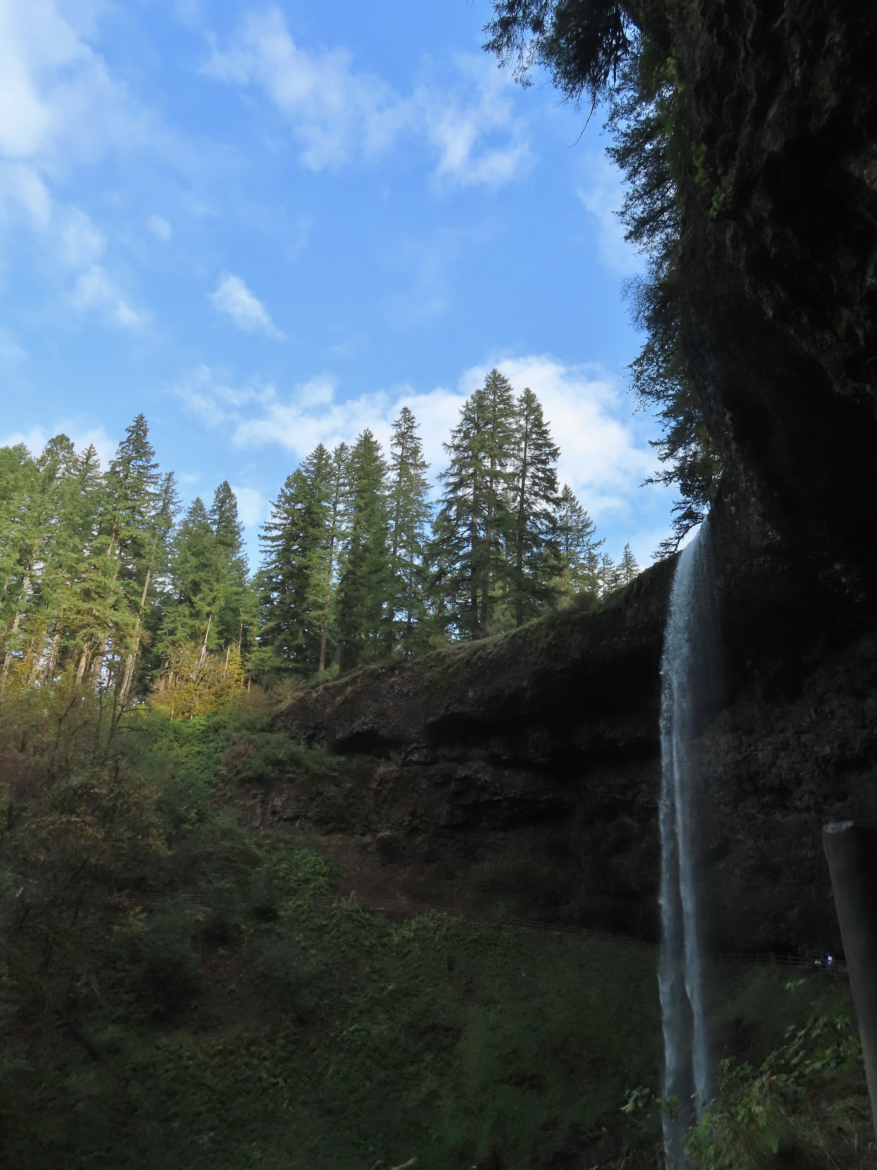
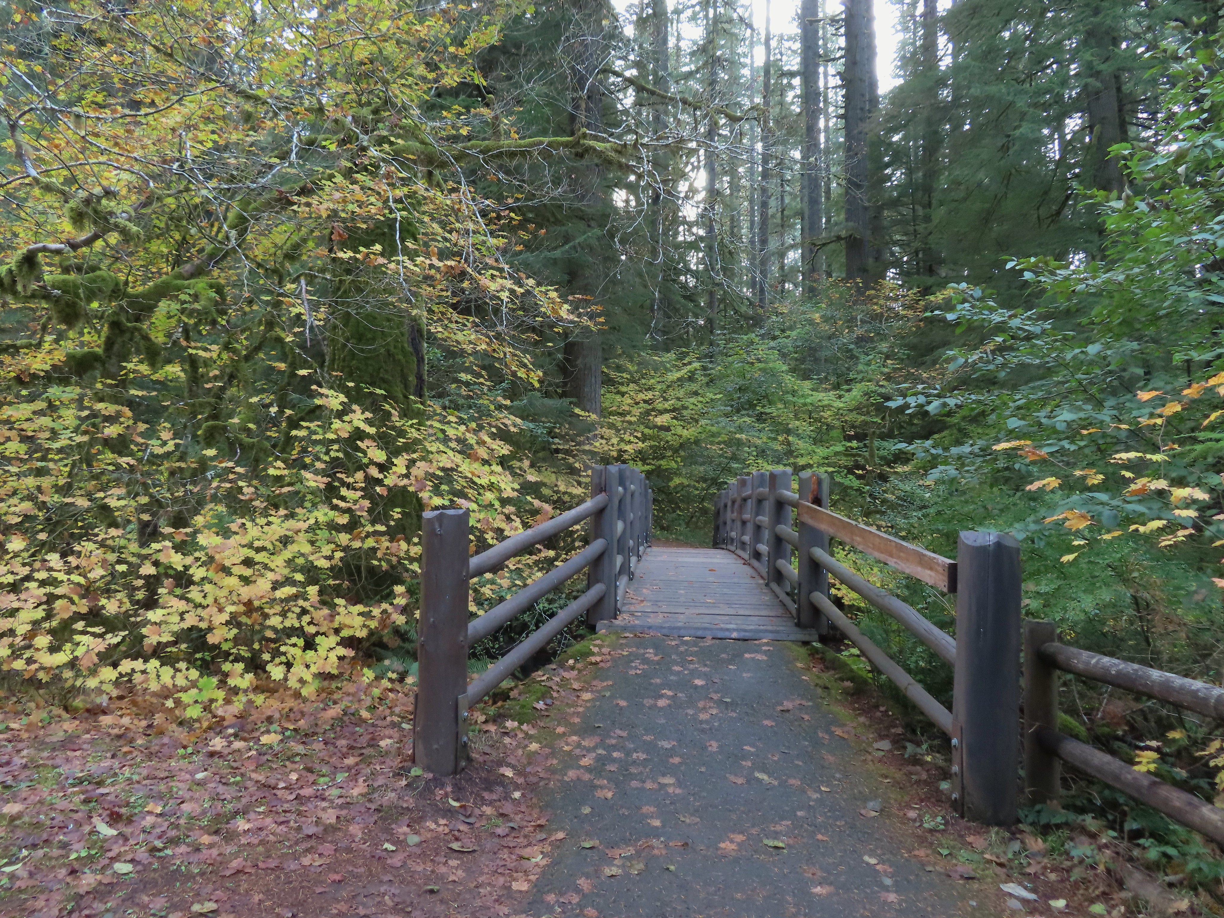
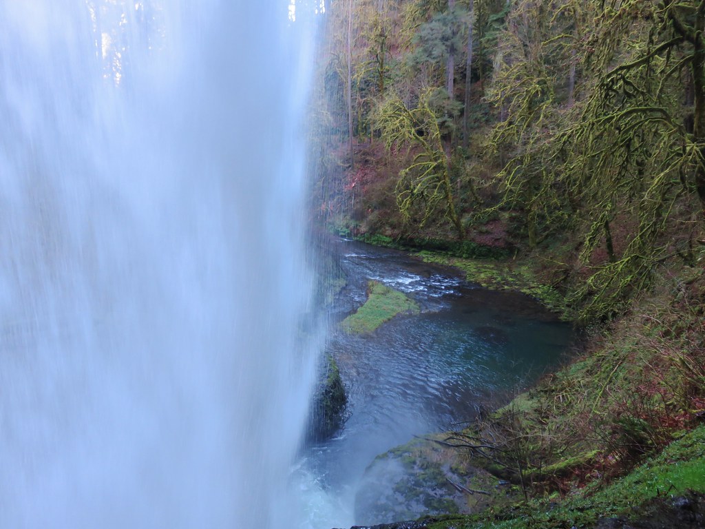
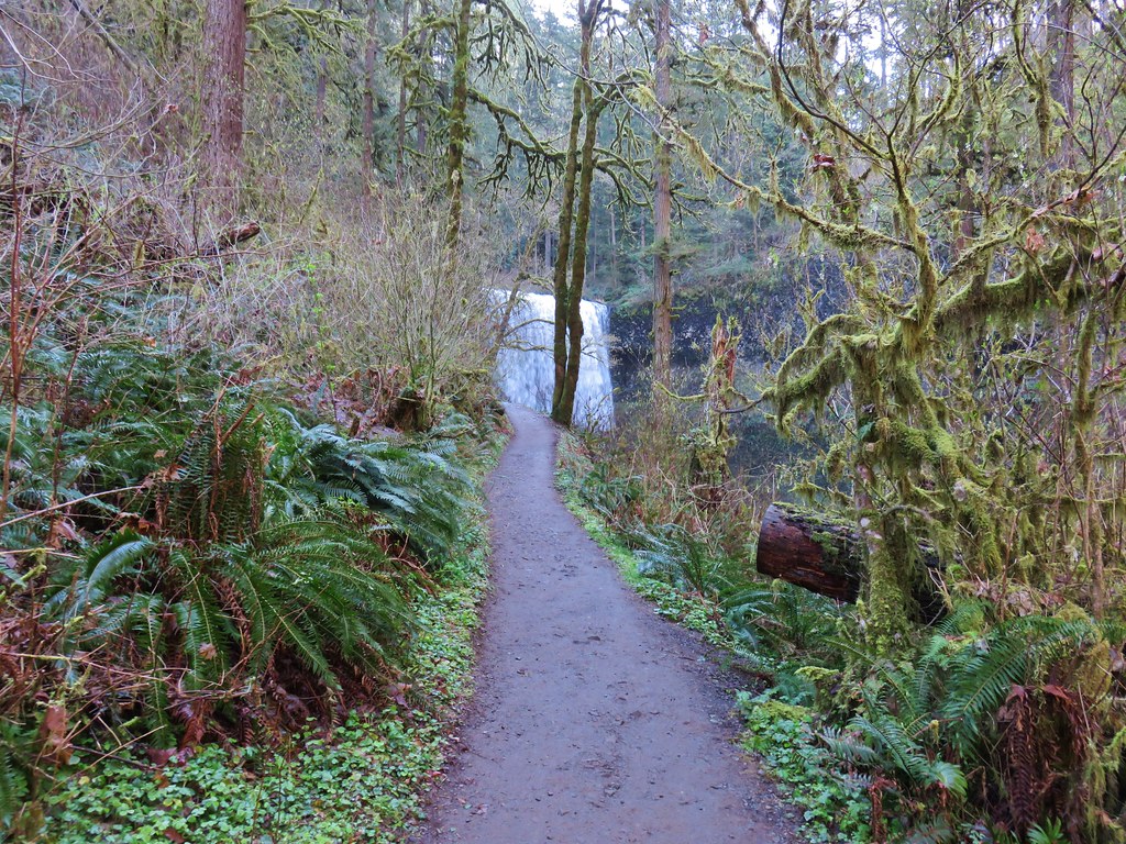
For the loop you can either hike behind South Falls or continue to a footbridge over South Fork Silver Creek below the falls. The majority of people go behind the falls which is normally the route we take as well, but it looked pretty busy behind the falls so we headed for the bridge.
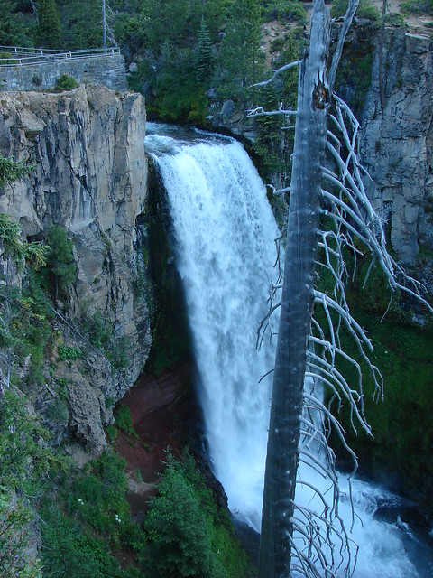
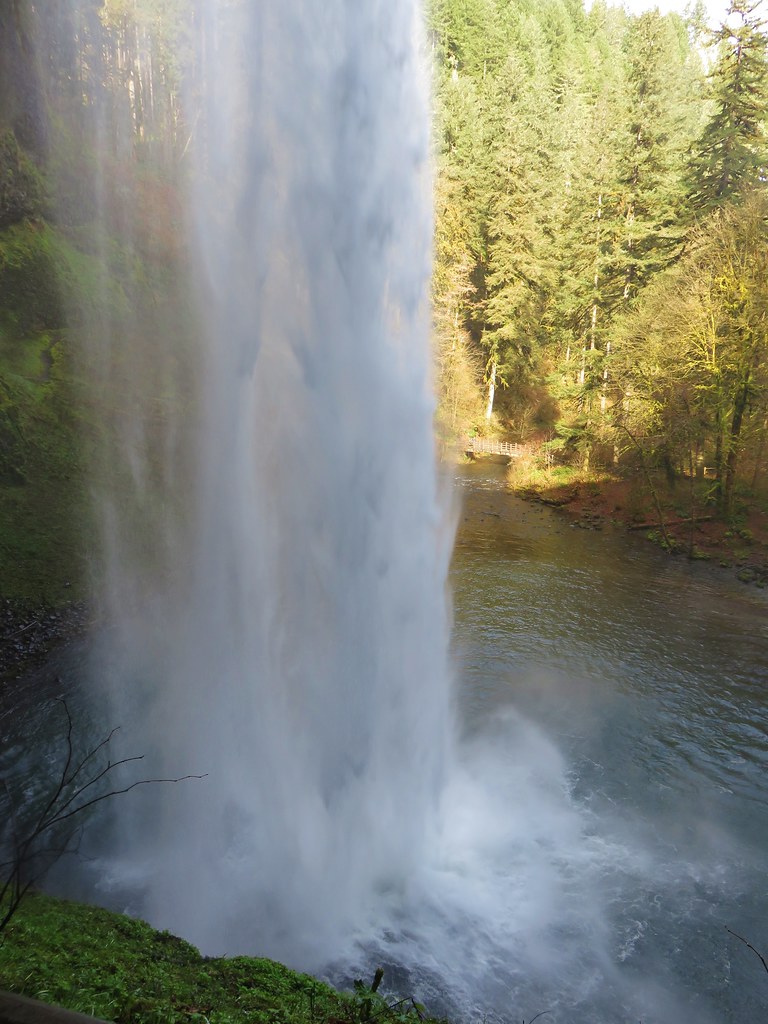
South Falls from the bridge.
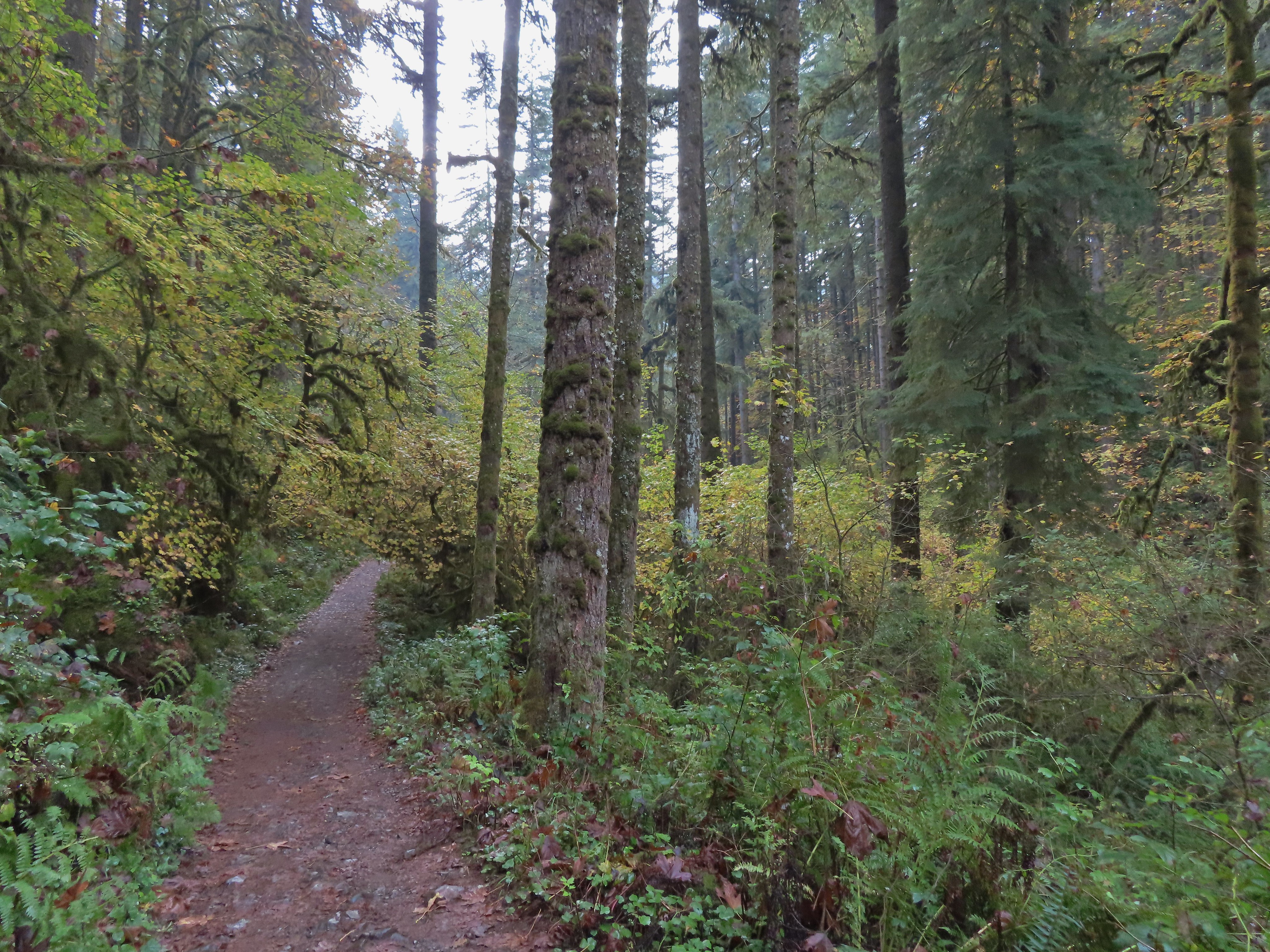
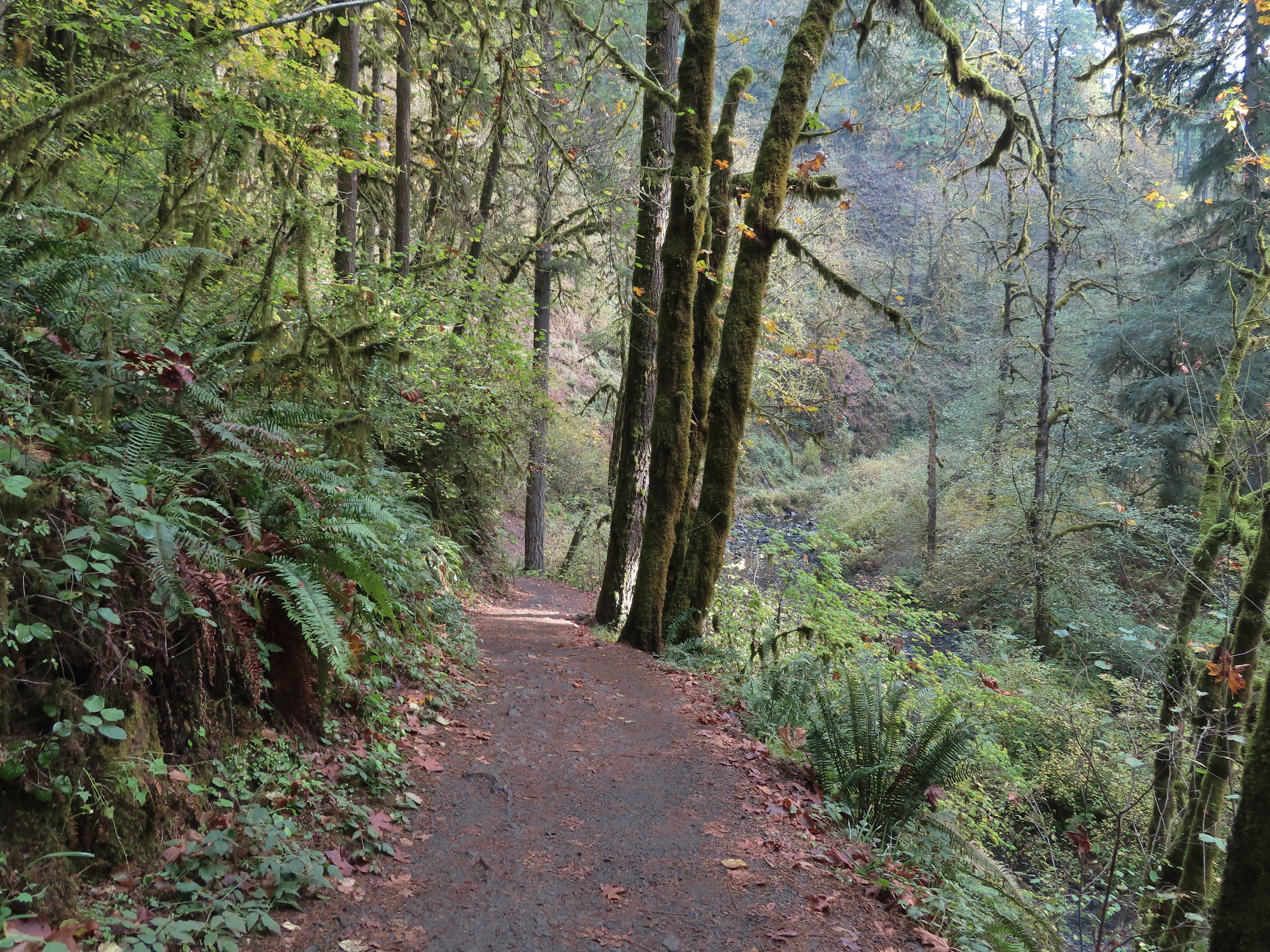
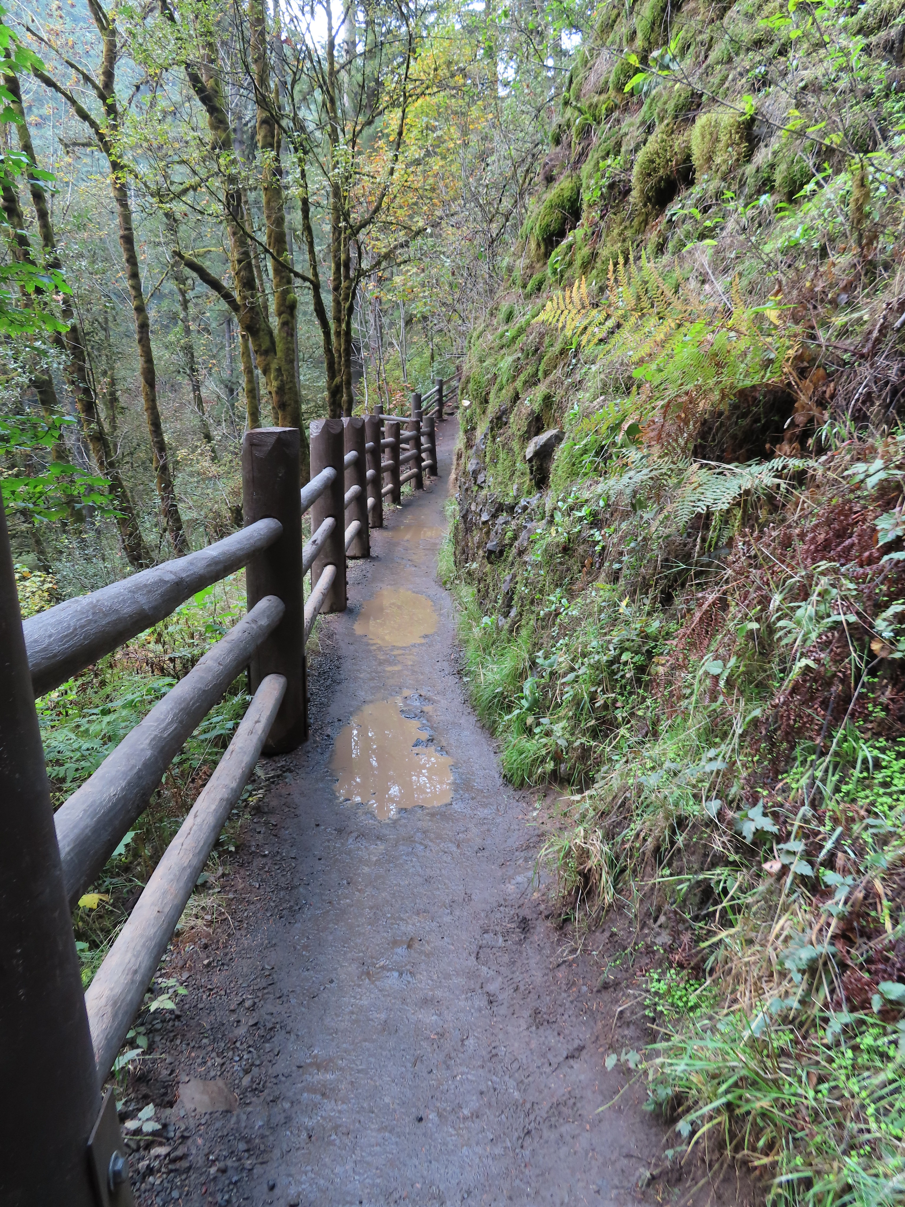
After crossing the bridge we turned right to continue on the Canyon Trail along the creek.
Hedgenettle
Largeleaf avens
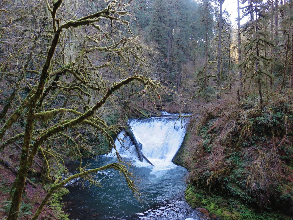
The next waterfall up was Lower South Falls, approximately a mile from South Falls.
<
Like South Falls the trail goes behind Lower South Falls.
Lower South Falls wound up being our favorite today.
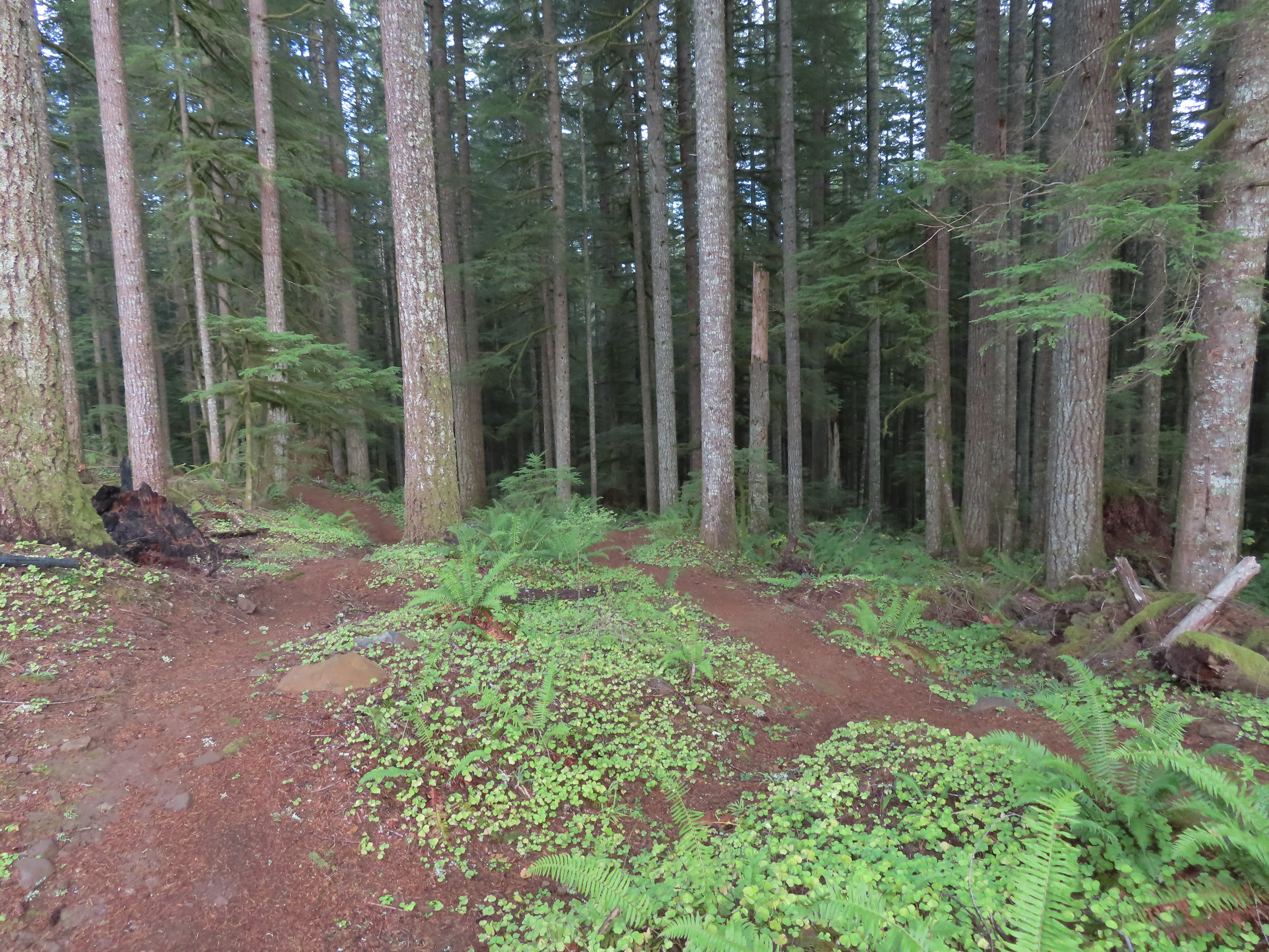
We continued on the Canyon Trail past a junction with the Maple Ridge Trail which provides an option for a shorter loop back to the South Falls Day Use Area.
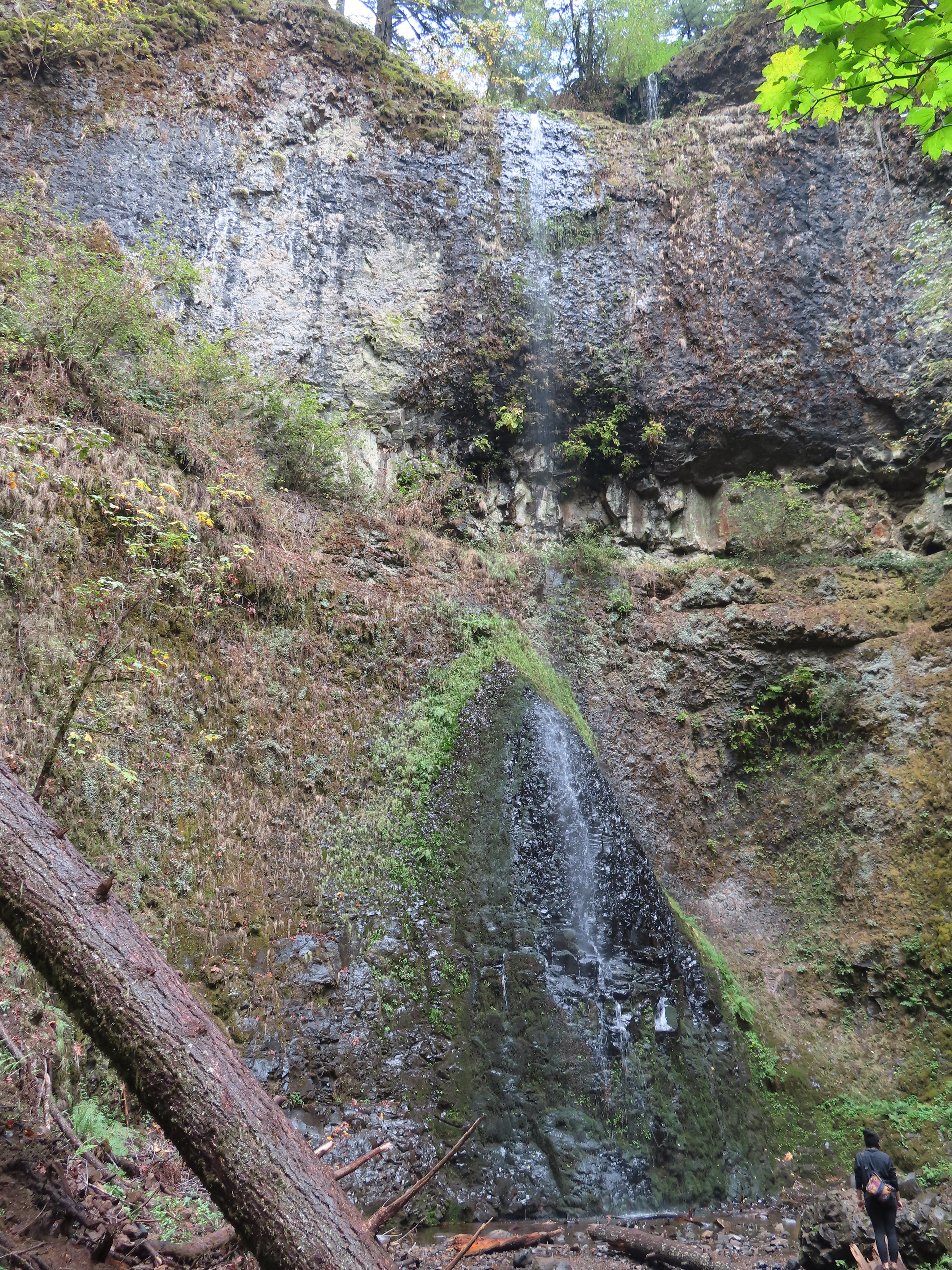
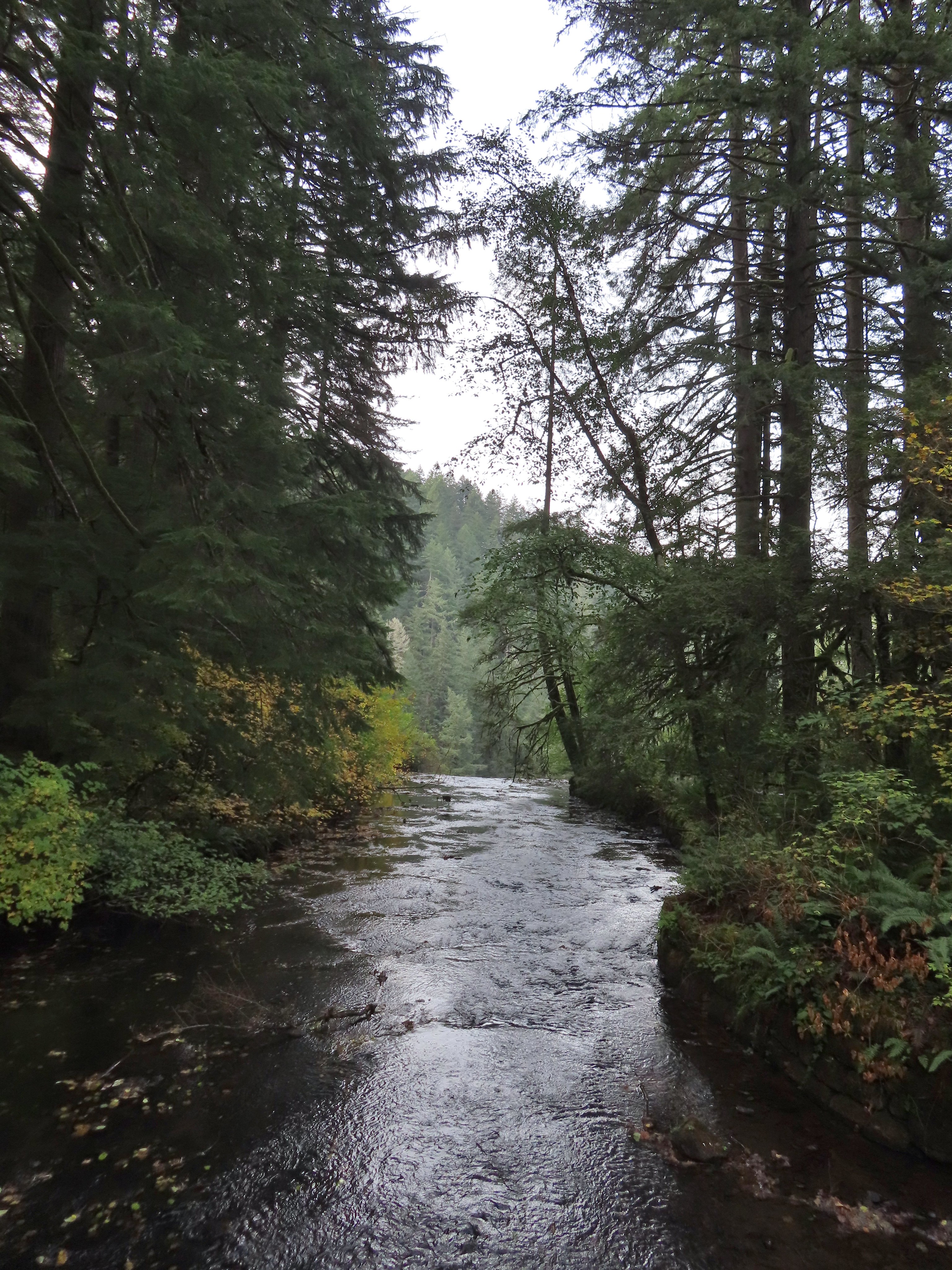
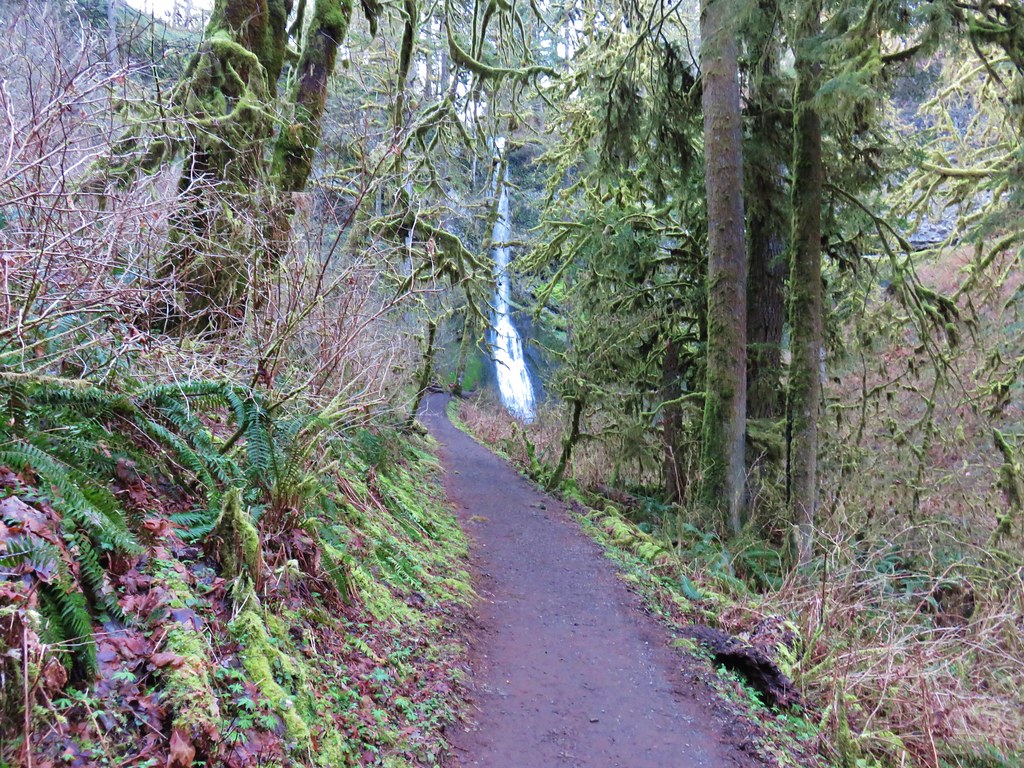
It was nearly another mile on the Canyon Trail to the third waterfall, Lower North Falls on the North Fork Silver Creek.
Self-heal
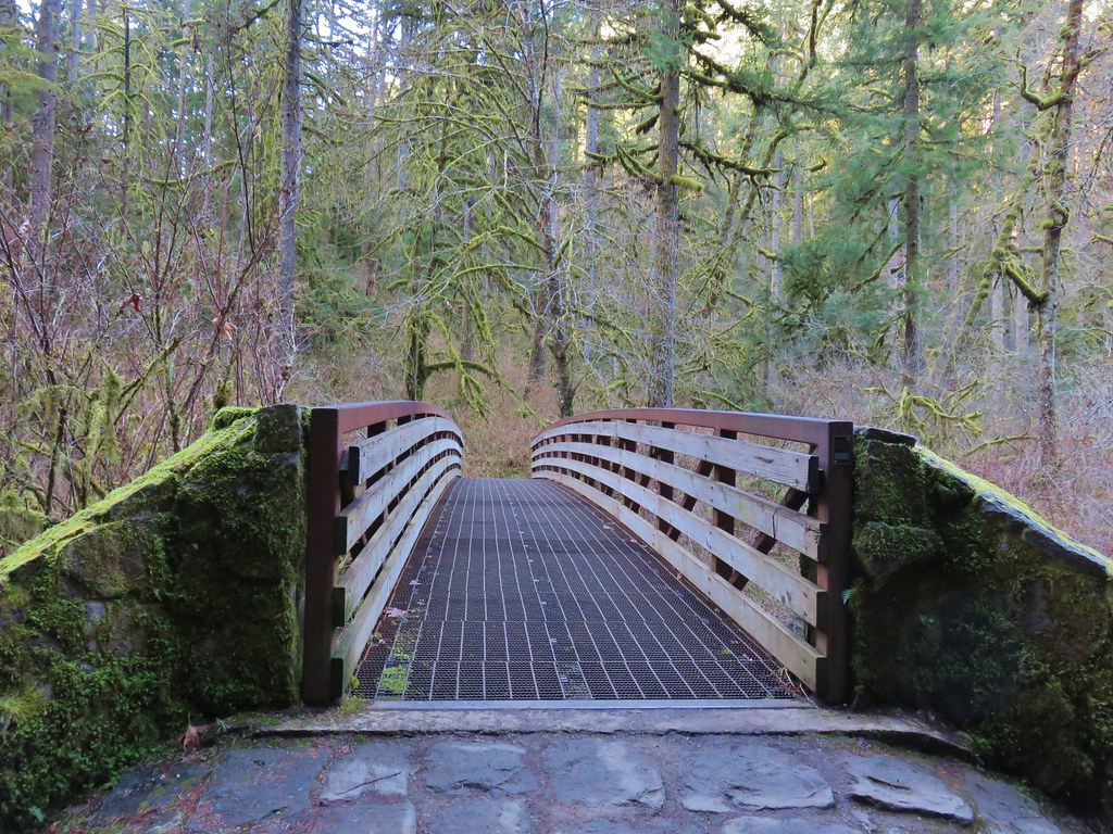
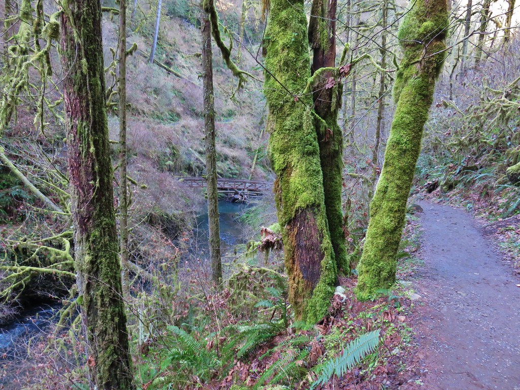
Footbridge over the North Fork Silver Creek.
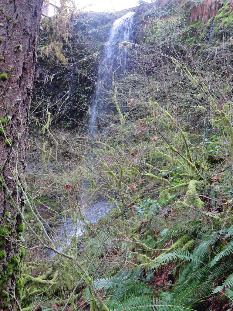
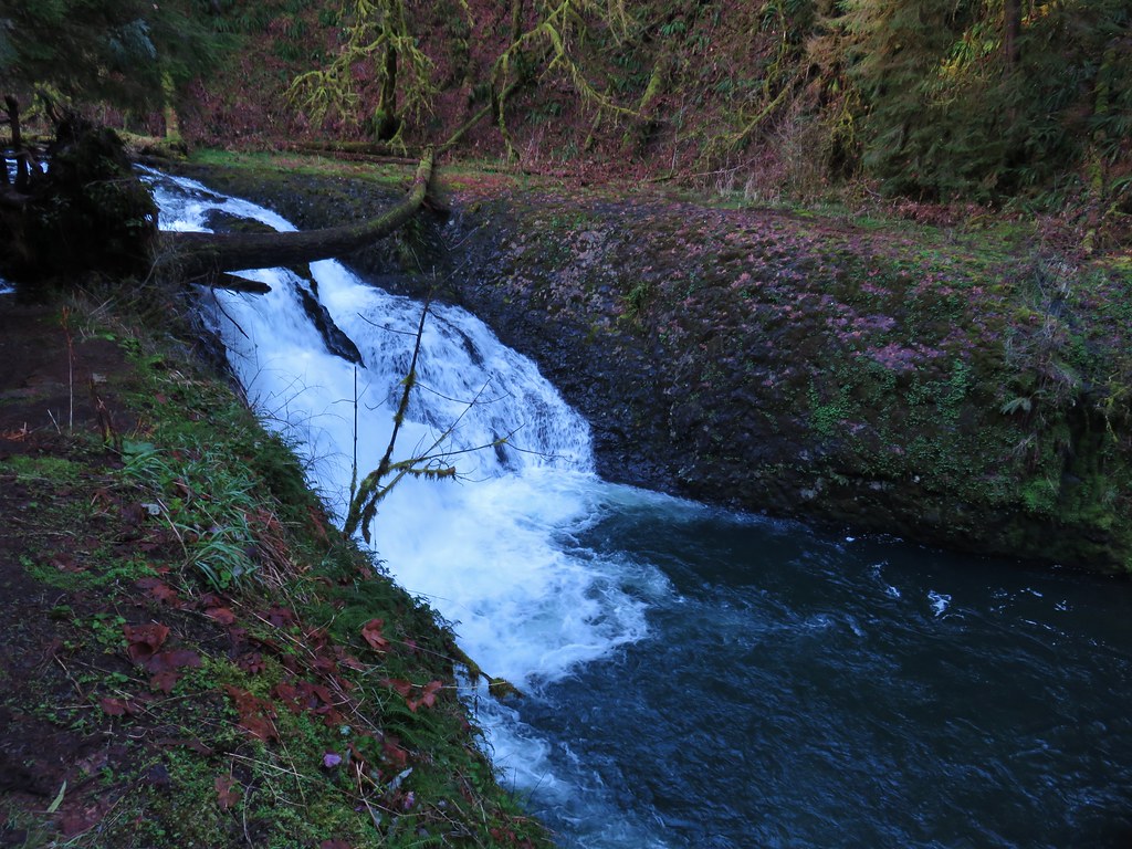
The recent rain was most obvious with this waterfall. We’ve visited the waterfall twice in July when it typically looks like this.
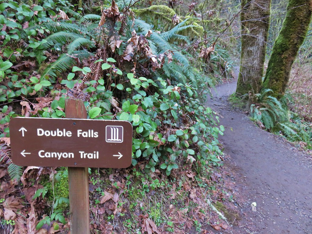
Just after passing Lower North Falls we detoured left on the short spur to Double Falls.
Double Falls
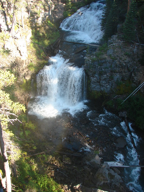
Back on the Canyon Trail the next waterfall up was Drake Falls followed shortly by Middle North Falls.
Drake Falls
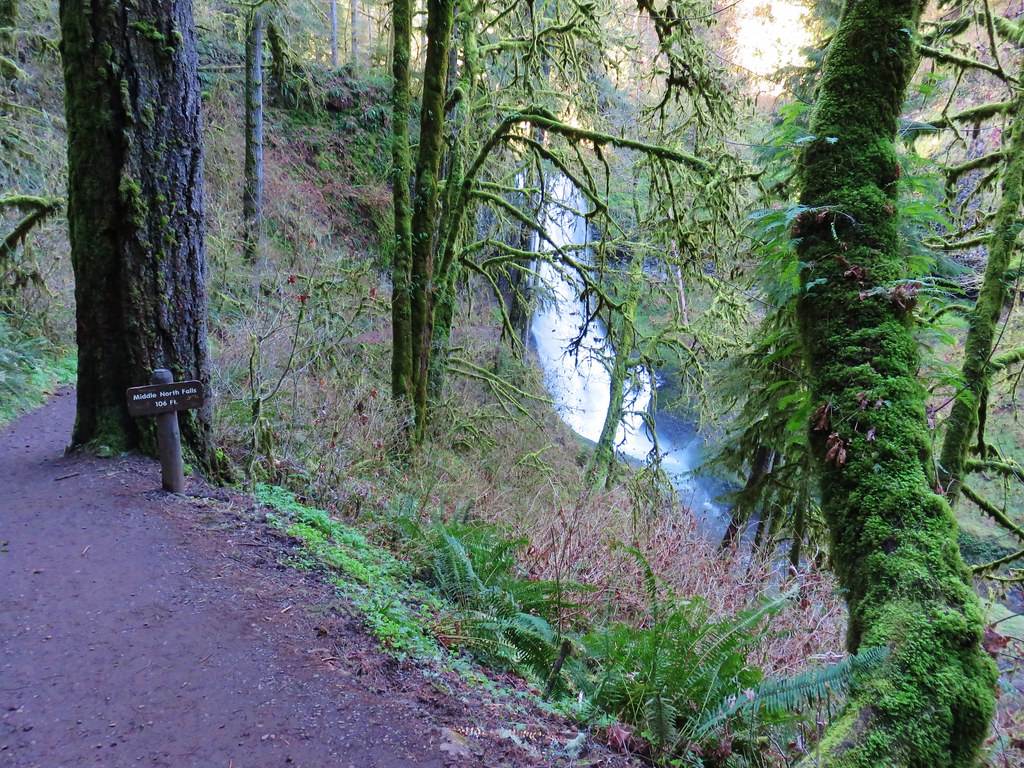
Middle North Falls
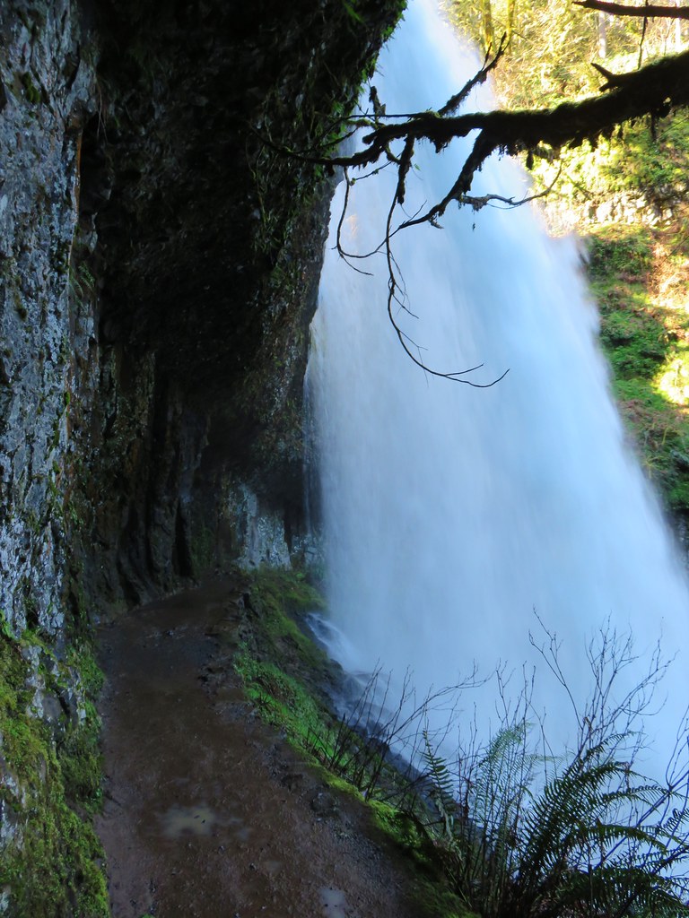
Middle North Falls is another waterfall that you can hike behind, but unlike South and Lower South Falls it is not part of the loop. We detoured on the spur trail that led downhill behind the falls.
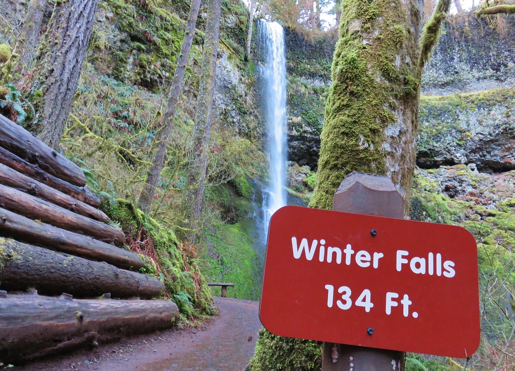
We returned to the Canyon Trail and continued on to a junction with the Winter Trail. Winter Falls all but disappears in the Summer and even with the recent rain we didn’t expect that there would be enough flow to make the half mile roundtrip detour worth it.
The Winter Trail footbridge through the trees.
A third of a mile beyond the Winter Trail we passed Twin Falls which is the most difficult of the waterfalls to get a good view of.
After the leaves fall off the trees there is a decent view of Twin Falls from the trail as you are coming from the Winter Trail junction, but today this was the best view we had.
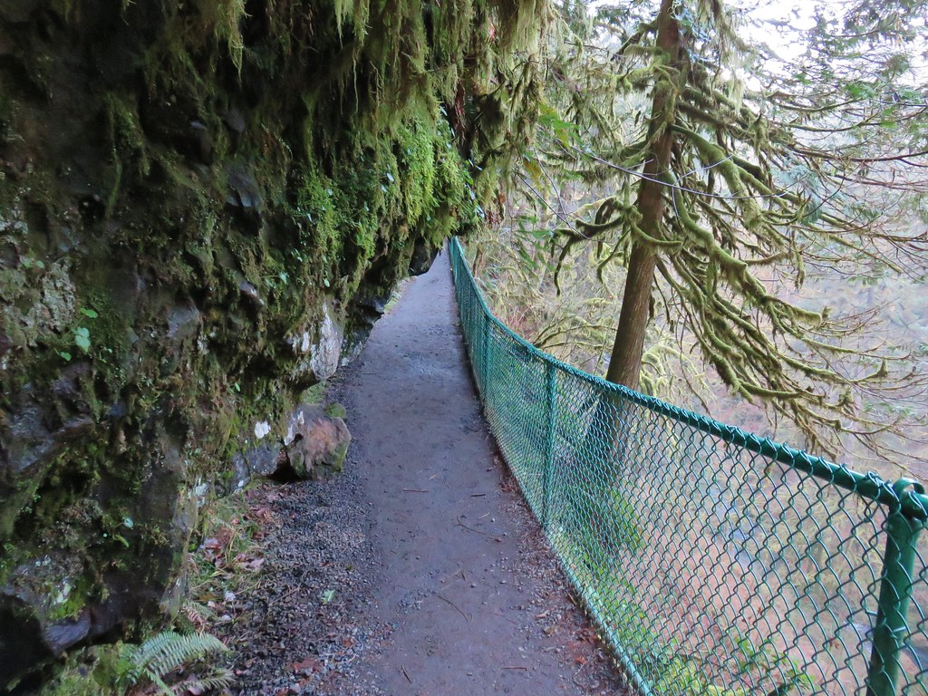
Near Twin Falls the Twin Falls Trail split off to the left which led uphill to the new North Canyon District (post). If you found the need for a restroom while you were on the loop the only one outside of the South Falls Day Use Area is located at this new trailhead.
We opted not to make the climb up to the new North Rim Trail and stuck to the Canyon Trail for another mile to North Falls.
Required picture of these large boulders in the creek.
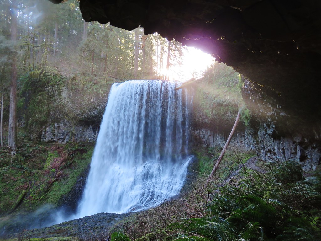
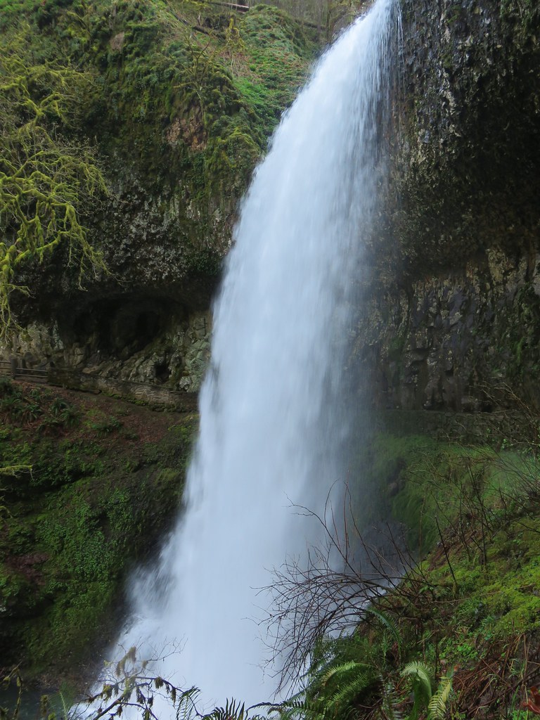
North Falls
North Falls
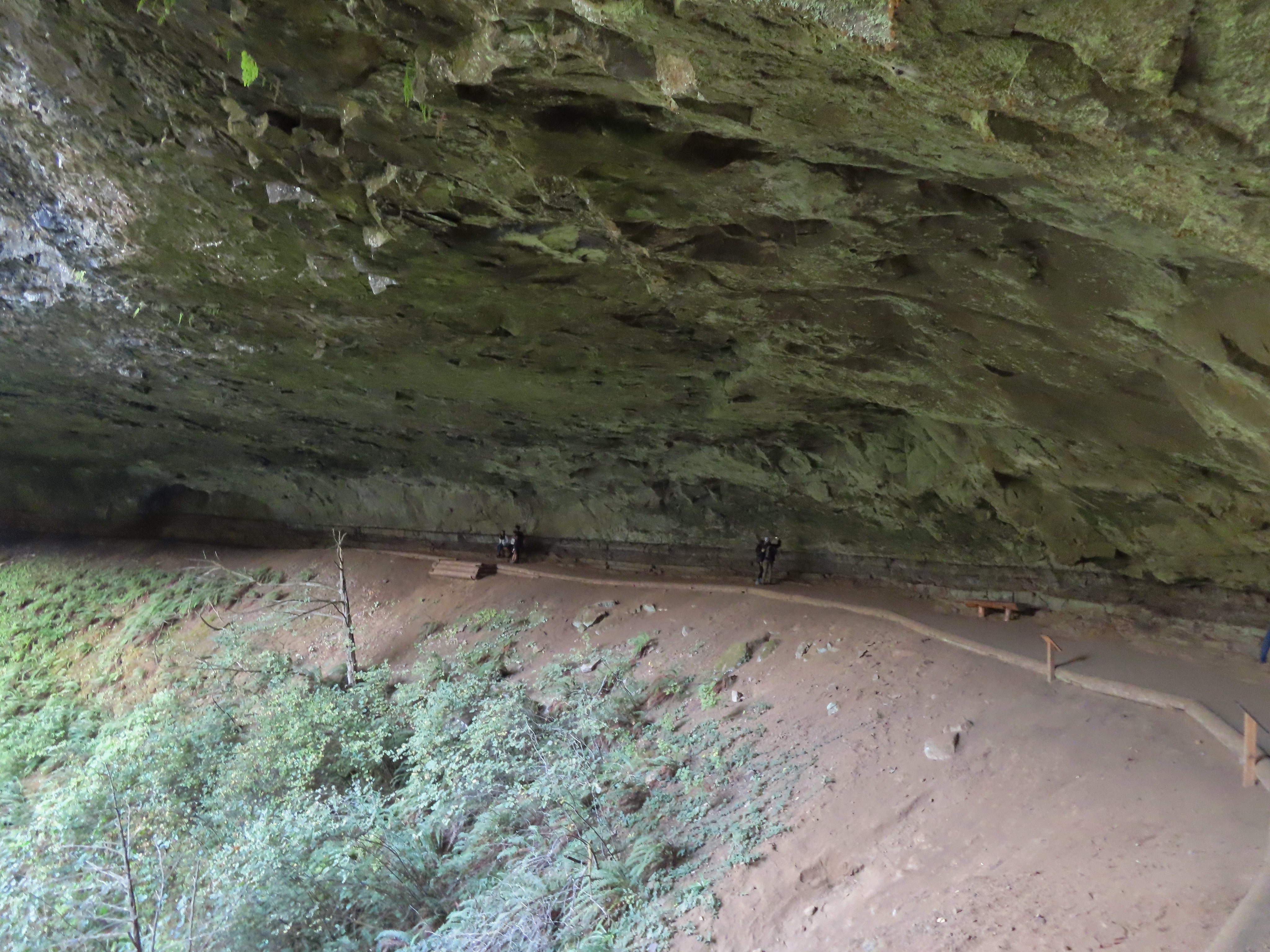
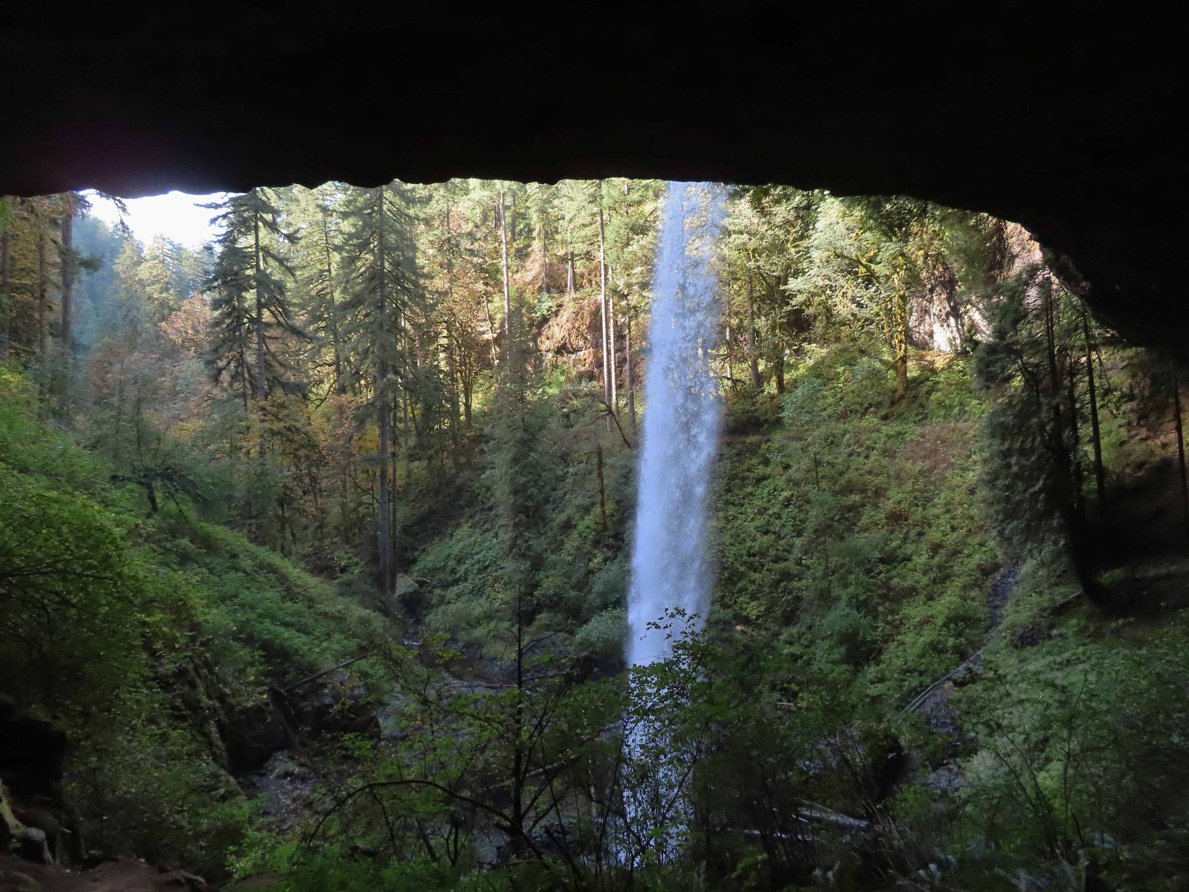
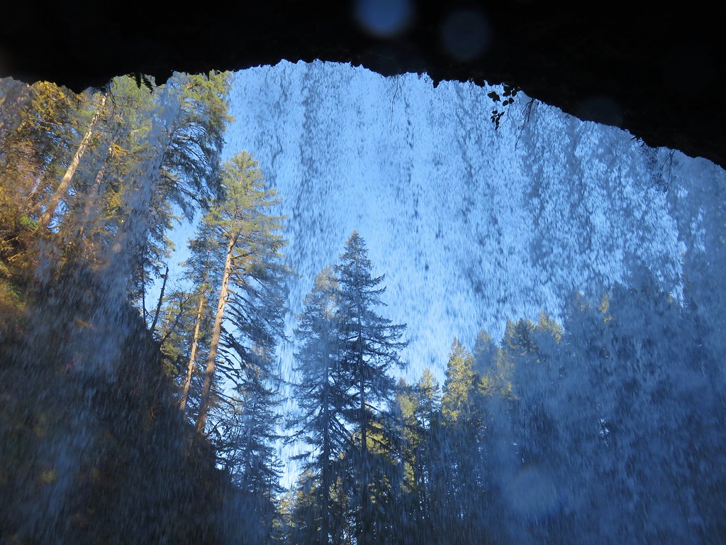
North Falls is the other waterfall that you can hike behind and we followed the Canyon Trail underneath.
Rainbow below North Falls.
Scouler’s corydalis
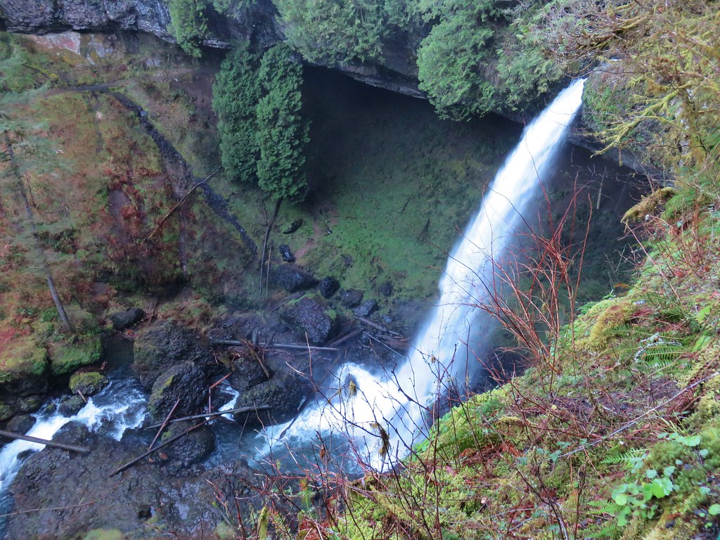
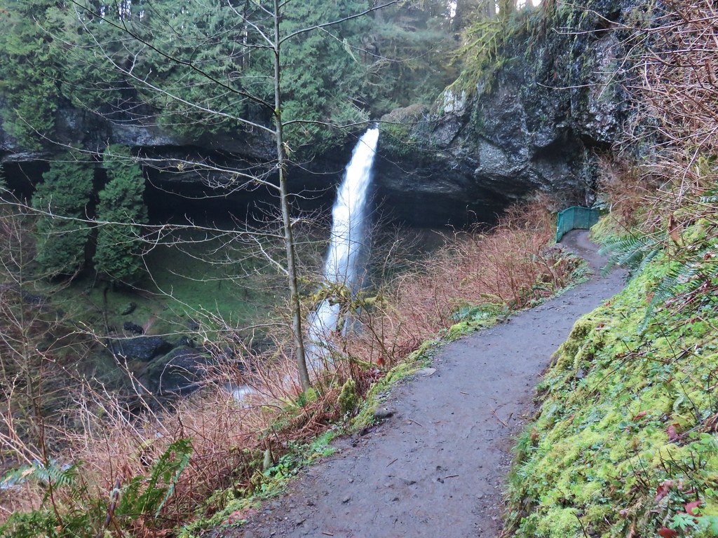
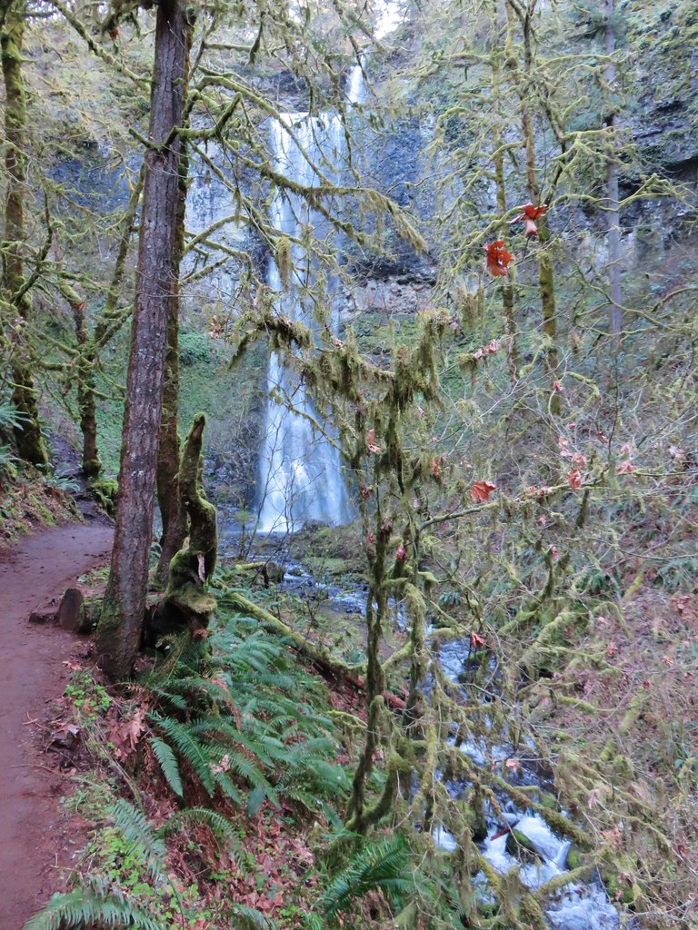
We climbed the steps on the far side of North Falls to the junction with the Rim Trail, but before continuing the loop we detoured to Upper North Falls. It’s approximately four tenths of a mile from the junction with the Rim Trail to Upper North Falls.
To reach Upper North Falls you pass under a footbridge coming from the North Falls Trailhead and Highway 214.
Bleeding Heart
Upper North Falls
Upper North Falls
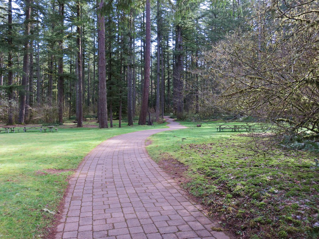
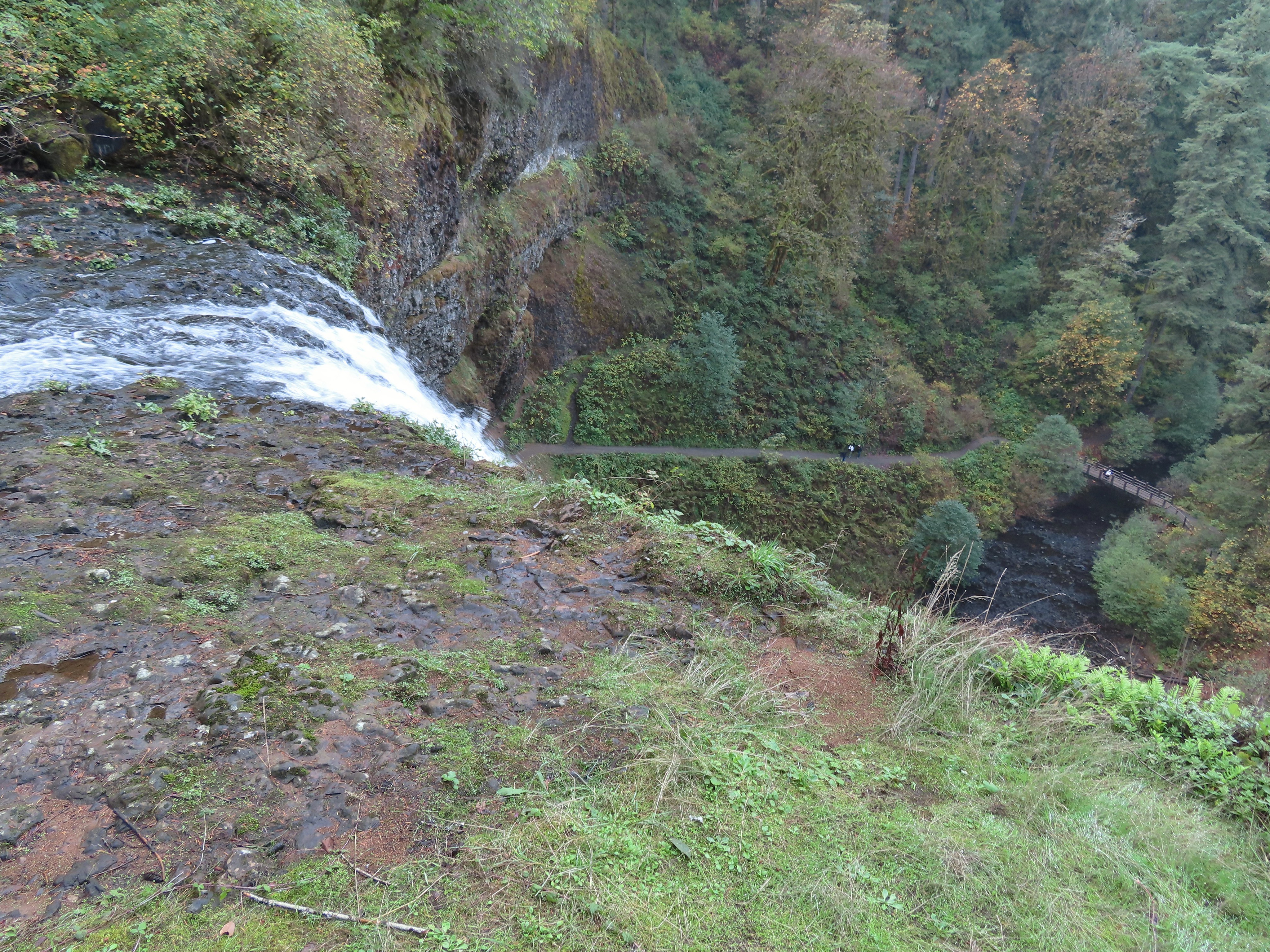
After visiting Upper North Falls we returned to the Rim Trail and followed it nearly 2-miles back to the South Falls Day Use Area where we had another half miles back to our parked car.
North Falls from the Rim Trail.
Salal berries. These were the only ripe edible berries that we came across. They aren’t the best trail berries, but these were fairly juicy and sweet prompting me to have a couple.
Winter Creek at the top of Winter Falls. Our suspicion of low water flow was confirmed.
Given where we parked and various detours our GPS showed an 8-mile hike with approximately 600′ of elevation gain.
Despite the atmospheric river being more of a seasonal creek in our part of Oregon there had been enough rain to make a noticeable impact on the falls which was fun to see. It was another reminder that Silver Falls State Park is worthy of a visit anytime of the year. Happy Trails!
With November quickly coming to an end we hadn’t managed to get out on a trail yet. We skipped the first two weekends due to poor weather and then spent most of the next week at theme parks in Southern California (post). While we got plenty of walking in at the parks, I didn’t consider those days as our monthly outing. Both Heather and I came down with head colds following our return home, so another weekend came and went without a hike. The forecast was dry for Thanksgiving which provided an opportunity to get a morning hike in. I was feeling better, but Heather was still dealing with a lingering cough, so I set out alone to check out the newest trailhead at nearby Silver Falls State Park.
The North Canyon Trailhead was opened in June 2023 followed by the North Rim Trail in July 2023. I was looking forward to checking out these new features, so I parked at the new trailhead and set off following pointers for the North Rim Trail.
The route I’d planned was to take the new trail 0.8-miles to the North Falls Trailhead then take a 0.6-mile out-and-back detour on the Upper North Falls Trail to visit Upper North Falls. After returning to the North Falls Trailhead I would take the Trail of Ten Falls down into the canyon passing behind North Falls and following this trail past Twin Falls to the Winter Falls Trail where I would turn left to visit Winter Falls and then climb out of the canyon to the Winter Falls Trailhead.
At the Winter Falls Trailhead I would again pick up the Trail of Ten Falls aka the Rim Trail where I would turn right and follow it past the Nature Store. Shortly after passing the Nature Store the Trail of Ten Falls heads down into the canyon again to pass behind South Falls. The trail is also known as the Canyon Trail between this point and where it heads into the canyon near the North Falls Trailhead. I would follow the Trail of Ten Falls/Canyon Trail behind South and then Lower South Falls on the South Fork Silver Creek. The trail eventually leaves the south fork behind and then later crosses the North Fork Silver Creek before passing Lower North Falls. A short spur trail just East of North Falls leads to Double Falls on Hult Creek. After crossing Hult Creek the Trail of Ten Falls passes Drake Falls followed by Middle North Falls. I would take another short spur trail leading behind Middle North Falls before continuing another half mile to a junction with the Twin Falls Trail. Finally I would take the Twin Falls Trail uphill a half mile back to the North Canyon Trailhead. This route resulted in an approximately 8.8-mile hike with close to 1000′ of elevation gain.
I chose the route because it included roughly 1.5-miles of trail that was new to me. The new-to-me trail included the North Rim Trail, Twin Falls Trail, and a short section of the Winter Falls Trail (between Winter Falls and the Winter Falls Trailhead). I chose the direction (clockwise) because the last two times I’d visited the waterfalls I’d been going the opposite direction, so I wanted a different perspective this time around.
Onward to the pictures! The North Rim Trail heads left at a fork with the Twin Falls Trail a short distance from the parking lot.
I stuck to the North Rim Trail here leaving another (short) trail to do next time.
The Nature Play Area along the loop trail I didn’t take.
One of two bridges along the North Rim Trail.
Railing near the North Falls Viewpoint.
North Falls from the viewpoint.
North Falls
Map located at the North Falls Trailhead.
Upper North Falls from the Upper North Falls Trail.
Upper North Falls.
The split in the Trail of Ten Falls where the Canyon Trail heads down to North Falls.
North Falls
Trail behind North Falls.
Behind North Falls.
I will always take pictures of these large boulders in the creek.
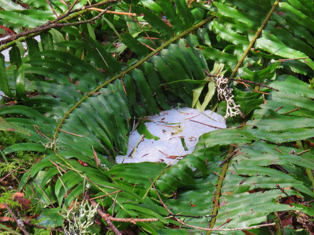
Hair ice, a phenomenon that only occurs on rotting wood when the correct mix of moisture, atmospheric conditions, and temperature combines with the fungus Exidiopsis effusa. There were quite a few occurrences this morning.
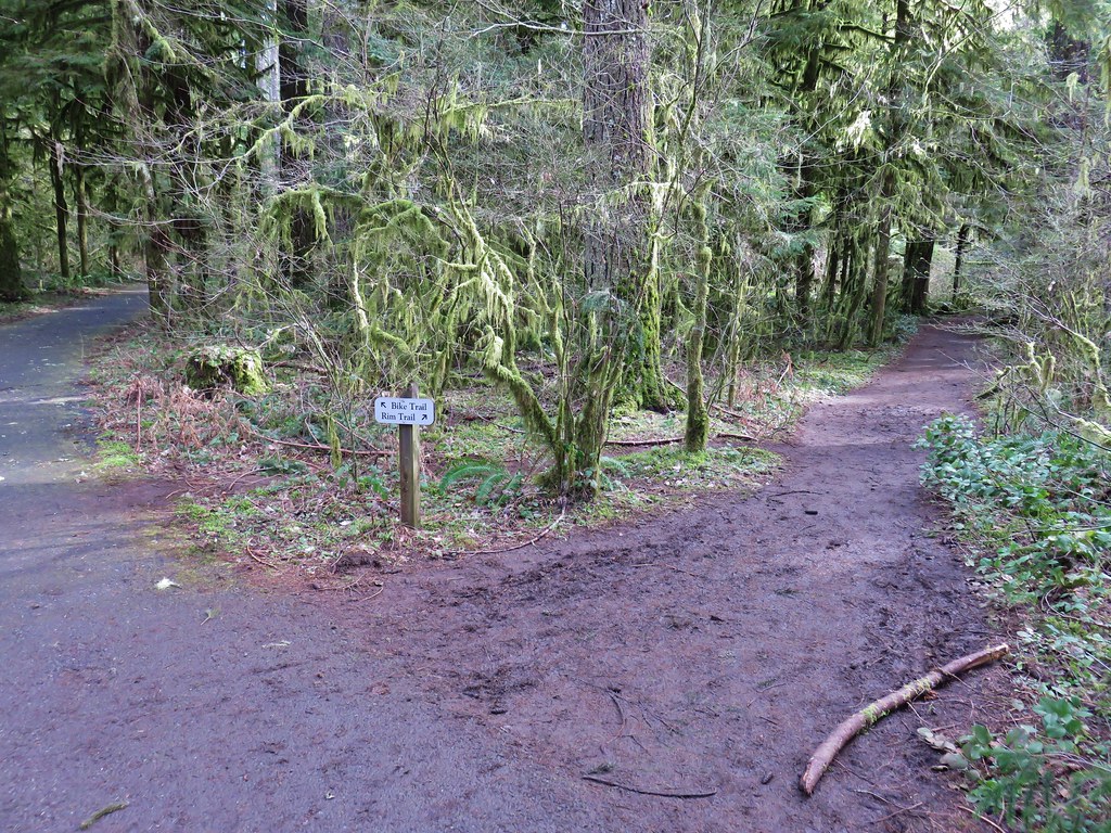
Trail marker at the Twin Falls Trail junction.
Twin Falls
Twin Falls is a tough one to get a good clear view of the full waterfall. Recent rainfall had provided good flow for this fall which helps with the visibility.
This is Twin Falls on July 7, 2006.
All the rain had the side creeks and falls flowing as well.
Nearing the Winter Falls Trail and its bridge over the creek.
The view from the bridge.
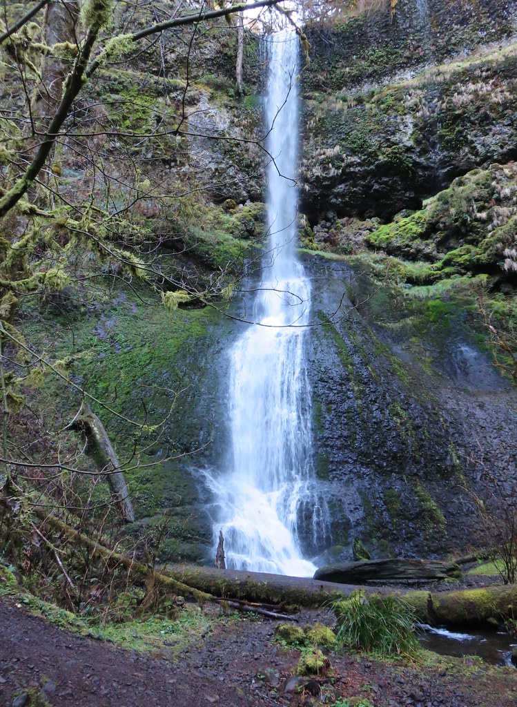
Winter Falls from the Winter Falls Trail.
Winter Falls
It’s a steep couple of tenths of a mile climb from Winter Falls up to the trailhead which warmed me up enough that I removed my beanie, buff, and made a switch to lighter gloves shortly after I’d turned back onto the Trail of Ten Falls/Rim Trail.
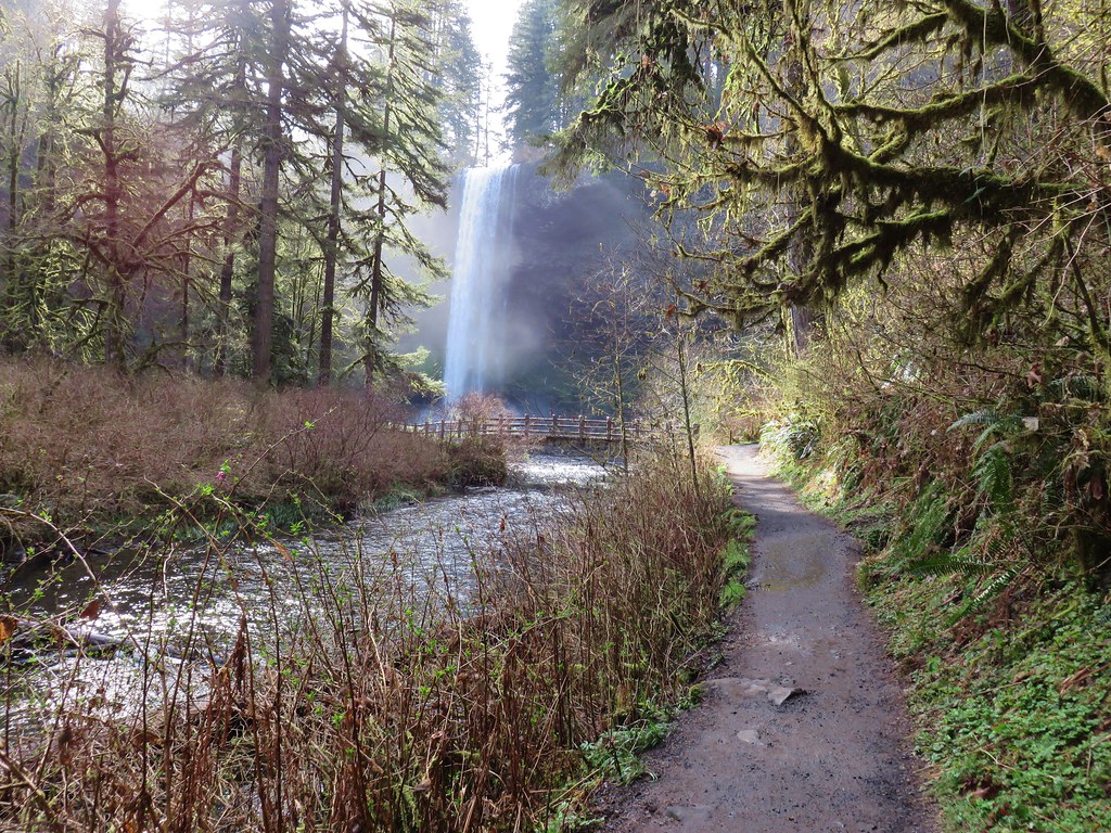
The forecast had called for sunny skies, but we were also dealing with an air stagnation warning. For a brief moment I thought the fog might burn off, but that never materialized and by the time I arrived at South Falls more fog had rolled in.
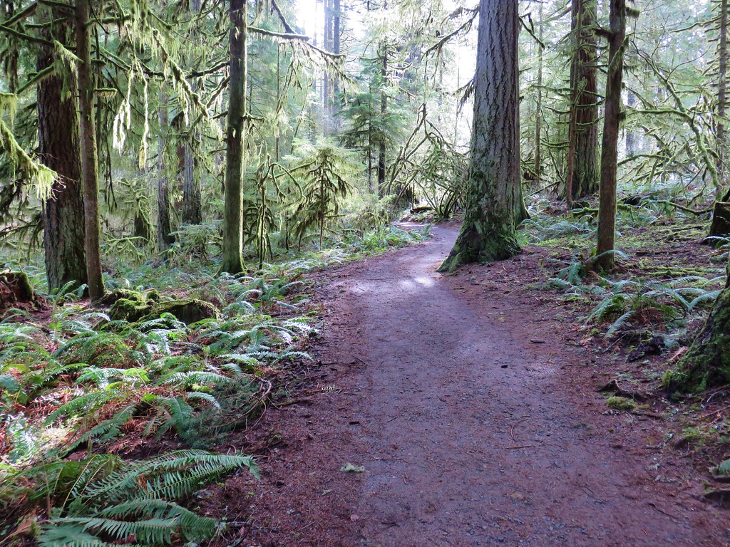
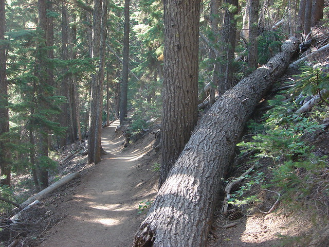
There are some nice big trees scattered throughout the park.
Trail of Ten Falls/Canyon Trail above South Falls.
South Falls
Behind South Falls
For a short loop just to South Falls you can cross the bridge and return to the rim.
The trail below heading for Lower South Falls.
From behind Lower South Falls. I scared a poor woman so badly as I neared the falls. She was setting her phone up on a tripod for a selfie and didn’t see me coming nor could she hear me with the roar of the falls until I was just a couple of feet away. When I said that I was just going to sneak behind her she let out the loudest scream I’ve heard in a while.
Ankle deep pools behind the falls.
Lower South Falls
The mile long Maple Trail (right) allows for a shorter loop to both the falls on South Fork Silver Creek.
This is now the North Fork Silver Creek.
Unnamed falls on a side creek.
The footbridge over the North Fork Silver Creek.
Pool below the bridge.
Lower North Falls
Footbridge over Hult Creek and the spur trail to Double Falls.
Double Falls
Back on the Canyon Trail.
More fog.
Drake Falls
Middle North Falls
Spur trail (right) to Middle North Falls.
Behind Middle North Falls.
Splash pool
The Winter Falls Trail footbridge spanning the creek ahead on the right.
Chipmunk.
I saw a few birds (and heard several more) and saw a deer on my drive through the park, but this was the only wildlife that I managed to even try and get a photo of on the hike.
Twin Falls again which meant I was nearly to the Twin Falls Trail.
Twin Falls Trail junction.
It was another stiff climb out of the canyon. There was a bench at a switchback with a somewhat obstructed view of Twin Falls.
The Twin Falls Trail leveled out near its end.
Arriving back at the junction with the North Rim Trail.
I spotted several ruffed grouse as I was driving out of the trailhead.
I really enjoyed this loop. It began and ended with waterfalls and saved Middle North Falls, which I’ve decided is my favorite of the ten, until near the end. It was also a great time of the year to visit to see the falls full from the recent rains. This was my seventh visit to the park and even with my 2022 perimeter loop (post) there are still a number of trails I’ve yet to explore away from the waterfall area. I’m already looking at possible routes for the next visit. Happy Trails!
With October and our official hiking season coming to an end I was hoping to go out with a bang by doing a long loop around Silver Falls State Park. I had gotten the idea during our 2021 hike in the backcountry of the park (post). While looking at the map for that hike I had started doing the math for the loop and it appeared to be a little over 20 miles which would be a long day but doable. Heather was not as enthused as I was about the possibility, so I had originally planned on attempting the loop on a day off while she was working. With her knee ending her season early it seemed like a good way to put an exclamation on the end of mine.
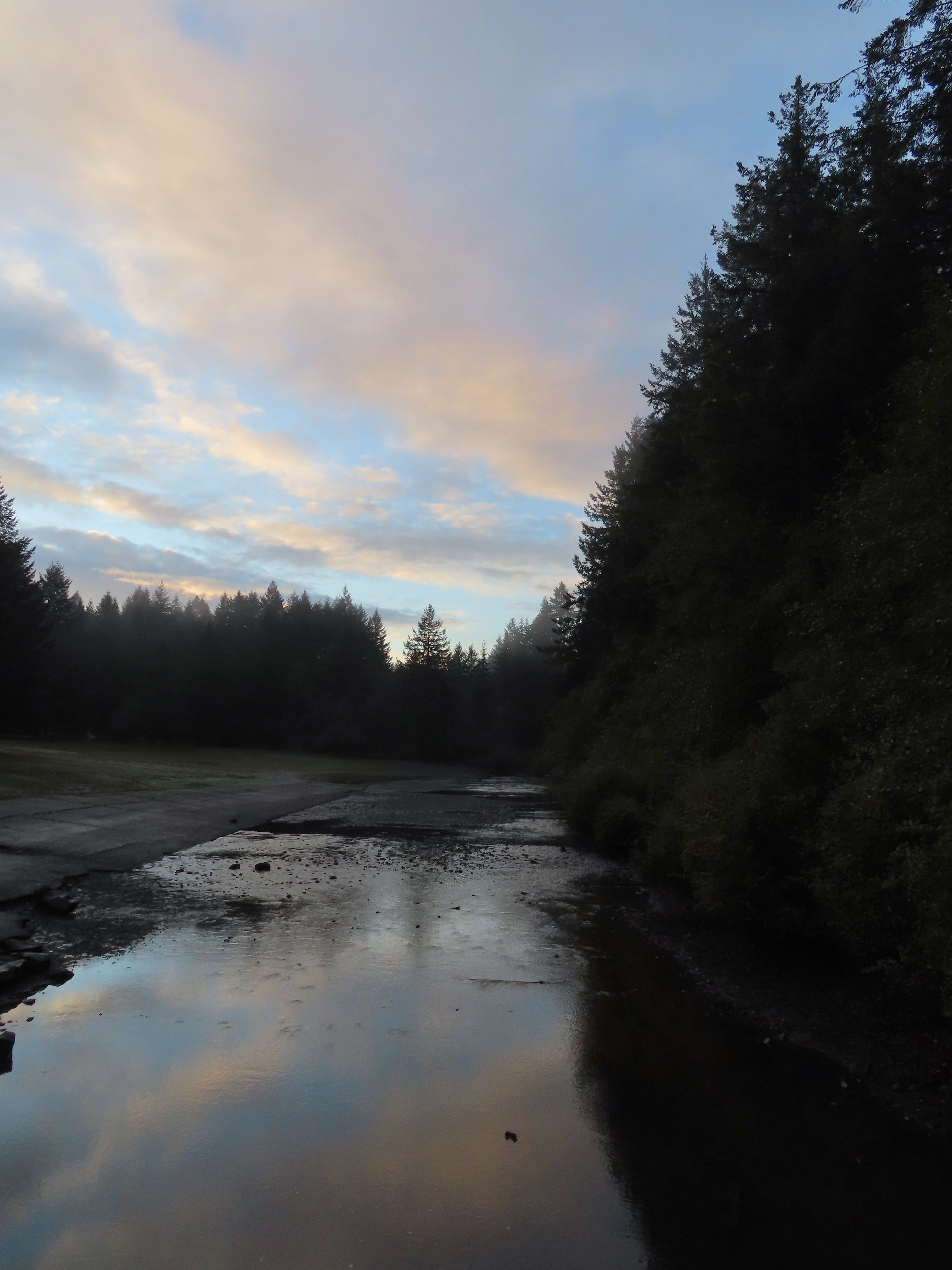
As the day neared I started second guessing myself. Some much need wet weather had moved in, and Friday was the wettest day we’ve had in months. The forecast for Saturday was for more rain in the morning, a 70% chance, followed by several hours of patchy fog then mostly cloudy skies. Twenty plus miles with wet feet wasn’t my ideal way to spend a hike but I decided to give it a try figuring I could cut the loop short by using one of the many trails running through the park. I packed some extra pairs of socks in a dry sack and had my rain gear ready as I made the 40-minute drive to the South Falls Trailhead.
It was a dark and raining when I left home but shortly after turning onto Highway 214 I popped out of the low clouds and left the rain behind. Things were trending positive. When I got to the South Falls Day Use Area entrance I was reminded that by the gate that the Park opens at 8am and not 7am from October through March and it was only 7:30am. I needed to purchase a pass so I drove to the North Falls Trailhead where I knew there was a pay kiosk, only I had forgotten that the station there only accepts cash which I didn’t have. After using the restroom there I drove back through the park to the campground entrance remembering that there was a station along the entrance road that did take cards. I decided that I would get a pass there and then park at the 214 Trailhead like we had in 2021 since there was no gate blocking that one. At the kiosk I immediately inserted my card into the cash slot. Things were trending down. I managed to retrieve the card using a pair of travel nail clippers and finally got my pass. It was nearly 8am as I came to the turn into the trailhead at Lookout Mountain Road. Given the time I changed my mind here and decided to revert back to my original plan and drove back to the now ungated South Falls Day Use Area. A lot more blue in the sky than I had expected to see.
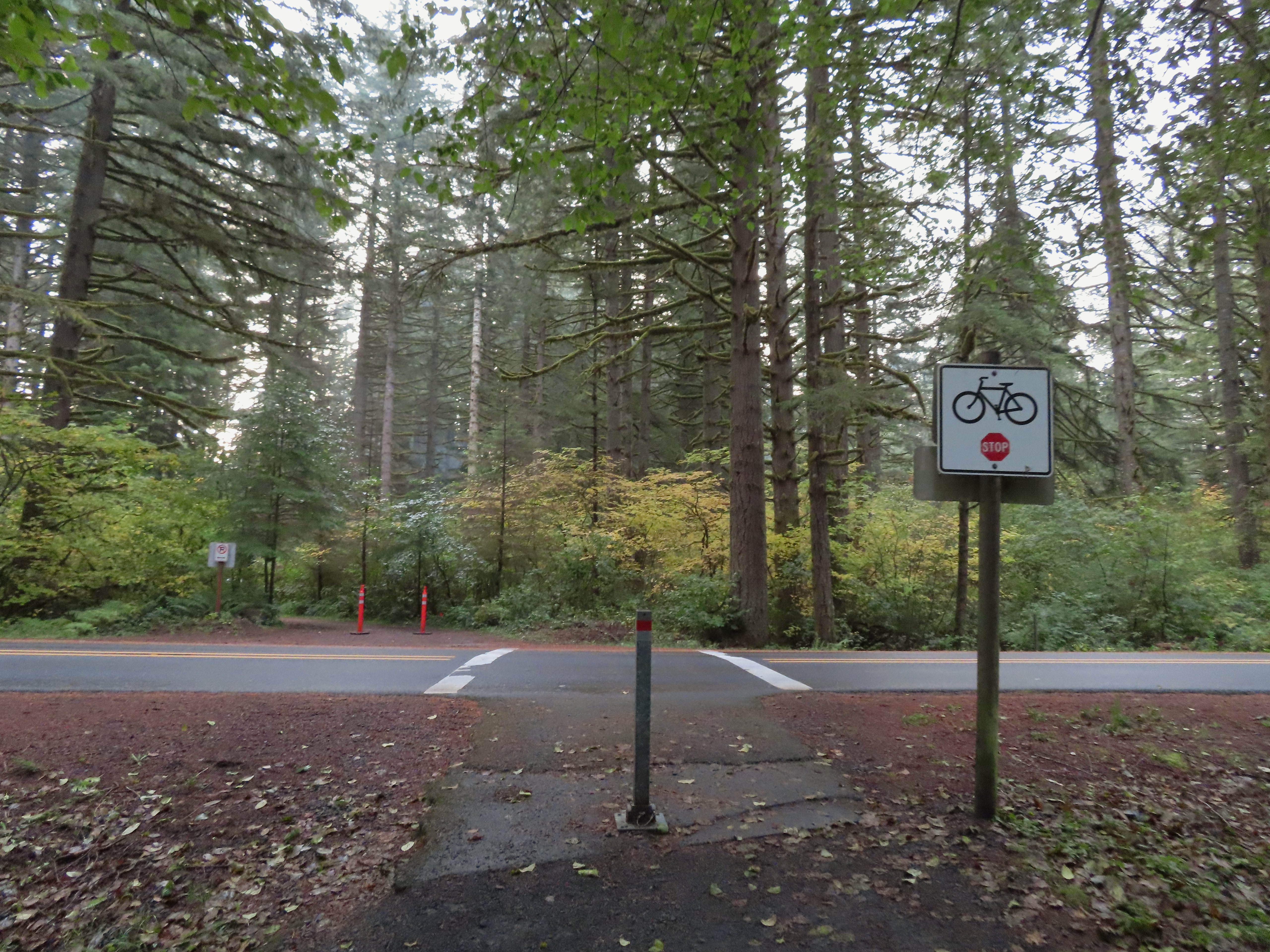
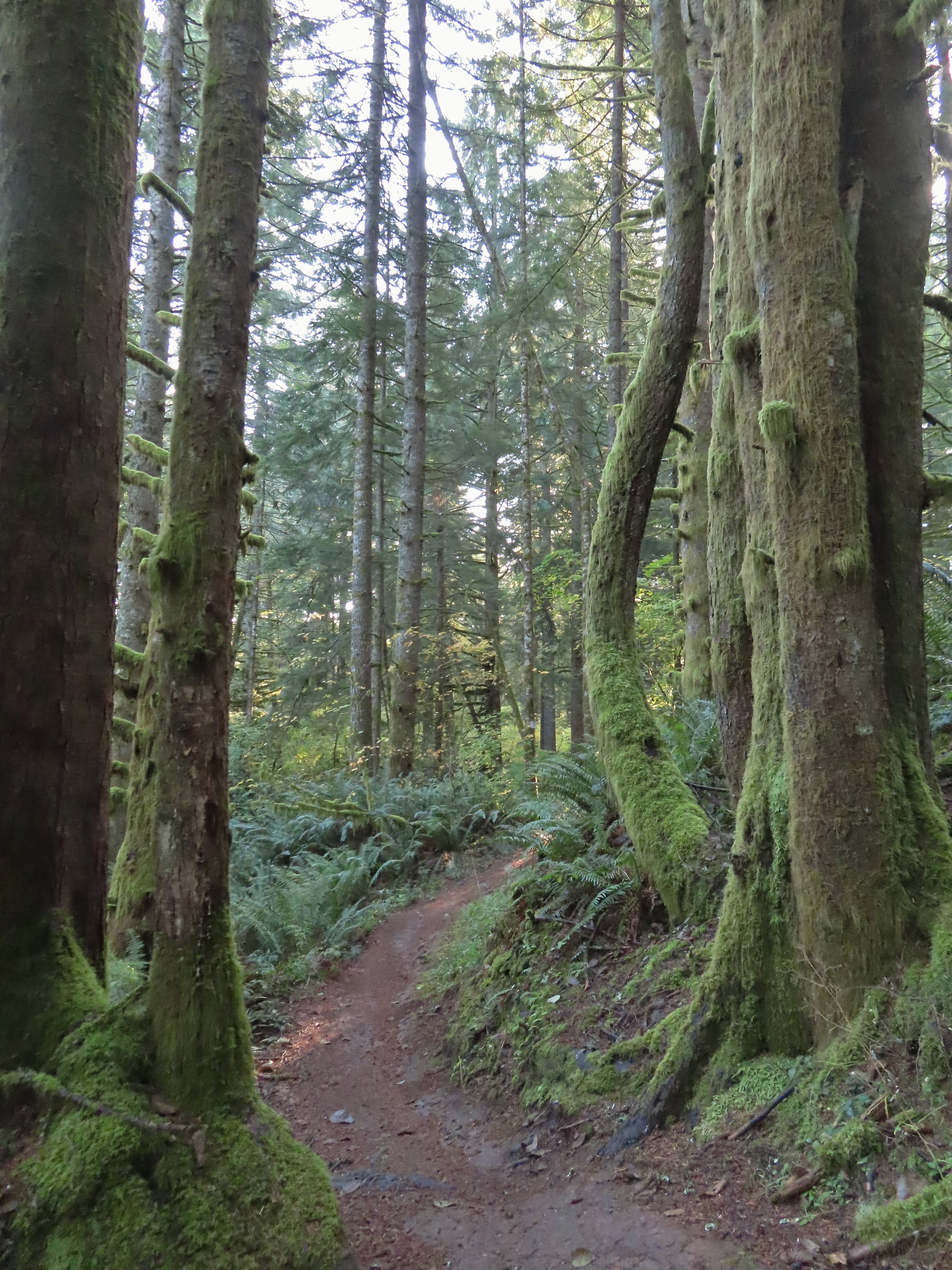
The route I had penciled out was to take the paved bike path from the parking lot to the campground where I would pick up the Nature Trail. I could take that trail to the 214 Trail followed by a portion of the Newt Loop to the Catamount Trail. I hoped to take that trail up to Buck Mountain then take the Perimeter Trail down to the Trail of Ten Falls near the North Falls Trailhead. I planned on visiting all ten falls and returning to the parking area via the Canyon Trail portion of the Trail of Ten Falls. I crossed South Fork Silver Creek on a footbridge to pick up the Bike Path on the far side where I turned left.
Crossing Highway 214 to the campground.
I detoured left to check out this bridge over Howard Creek.
Howard Creek
With the Nature Trail being a loop I could have gone either direction from the campground to reach the 214 Trail. Going left was a tenth of a mile shorter but I really wanted to make the loop as wide as possible so I went right at a pointer for the trail and Ampitheater.
We had been on the Nature Trail in 2021 so it was familiar surroundings as I made my way to the 214 Trail where I turned right.
Sign at the 214 Trail junction to let people know that there are no waterfalls in the backcountry.
I followed the 214 Trail for 1.3 miles to the Newt Loop. Just a little fog but no rain.
Passing the Smith Creek Trail (left) after 0.6 miles on the 214 Trail.
Rough skinned newt on the 214 Trail. (Probably headed for the Newt Loop too.)
Big nursery tree along the 214 Trail.
The trail post at the junction shows the Catamount Trail instead of the Newt Loop but the map at the junction labels it the Newt Loop.
Map check.
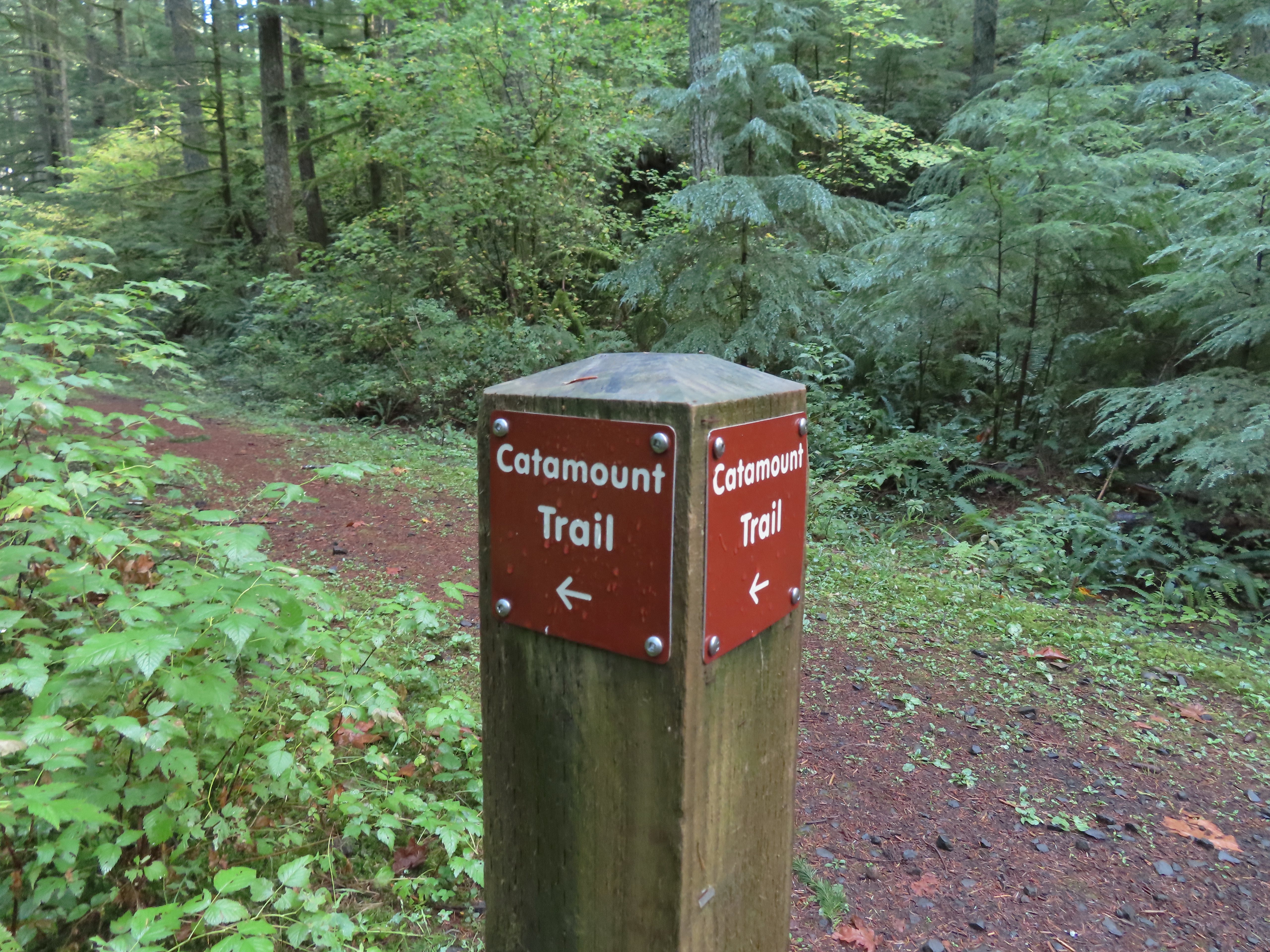
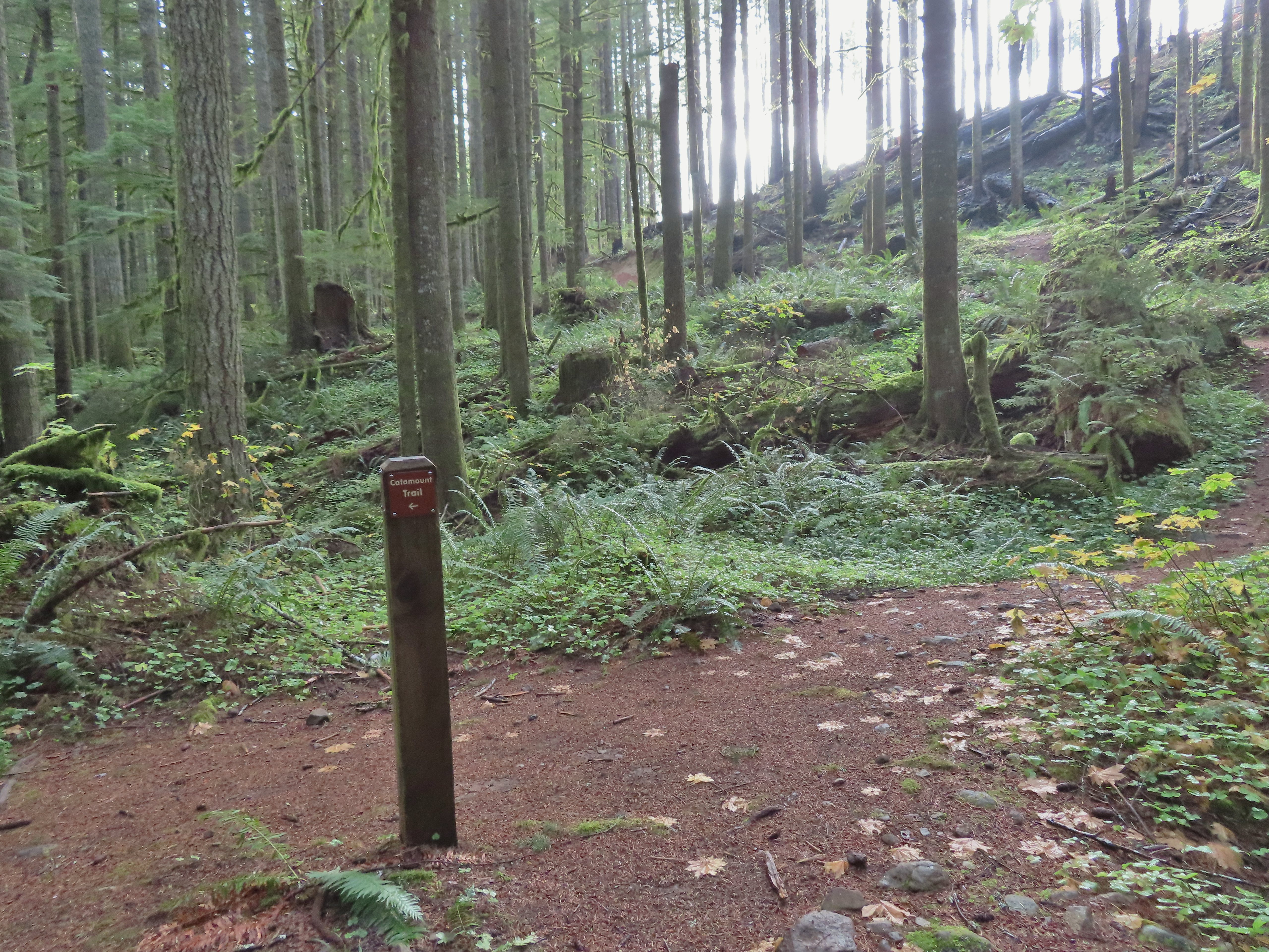
I turned right onto the Newt Loop and arrived at a junction with the Catamount Trail after 0.4 level miles. This second post included the Newt Loop along with a pointer for the Catamount Trail.
Crossing a CAT road along the Newt Loop.
Turning onto the Catamount Trail.
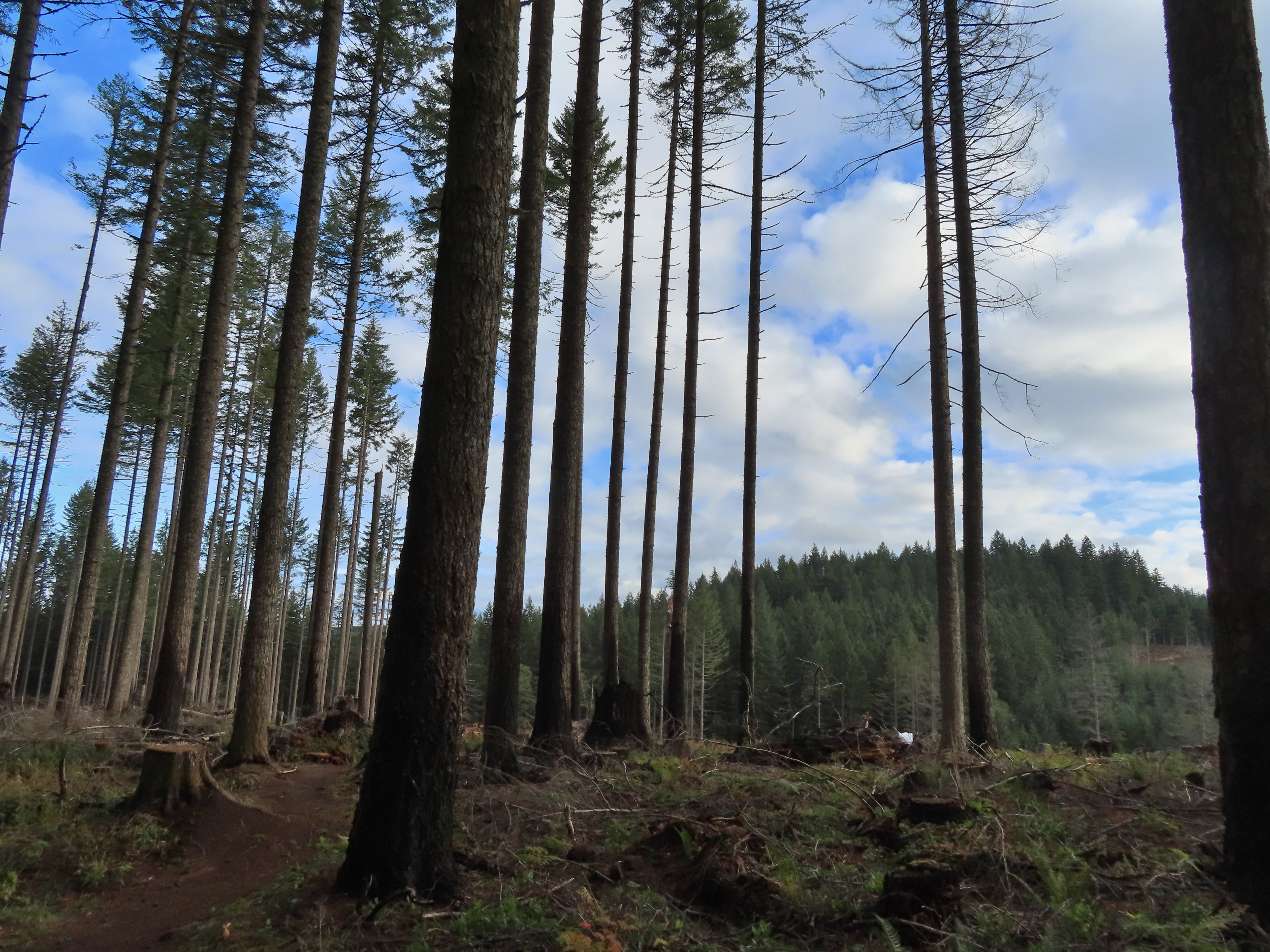
The Catamount Trail was new trail for me having not used it on our loop in 2021. The park map showed this trail extending 4.6 miles to a junction with the Lost Creek Trail then continuing another 0.9 miles to Buck Mountain. As a mountain bike trail the Catamount wound steadily uphill through the forest. Lots of nursery stumps along the trail.
Another nursery stump.
Side trails were well marked.
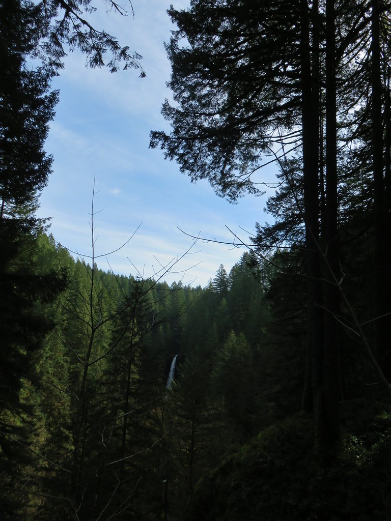
Did not expect to see that overhead today.
I believe this short section of fire scar was from the 2020 Beachie Fire.
After 3.8 miles on the Catamount Trail I came to a 4-way junction with a maintenance road.
The Catamount Trail continued on the far side the road only there was a “Do Not Enter One-Way” sign on the post.
This was the first I’d heard of the trail here being one-way and I haven’t had a lot of luck since my hike in finding that information online or maps, but I honored the sign and turned left on the maintenance road following a Catamount Trail pointer. Turning onto the road.
The opposite side of the post had a pointer for the Lost Creek Trail.
I followed the road for half a mile to the Lost Creek/Buck Mountain Trail junction.
I veered uphill to the right here.
The Lost Creek/Buck Mountain junction.
On our previous visit we had arrived at this same junction having come down the Buck Mountain Trail. To make this hike as different as possible (and to remain as far to the outside of the park as possible) I turned right on the Lost Creek Trail. The Lost Creek Trail doubles as a fire road.
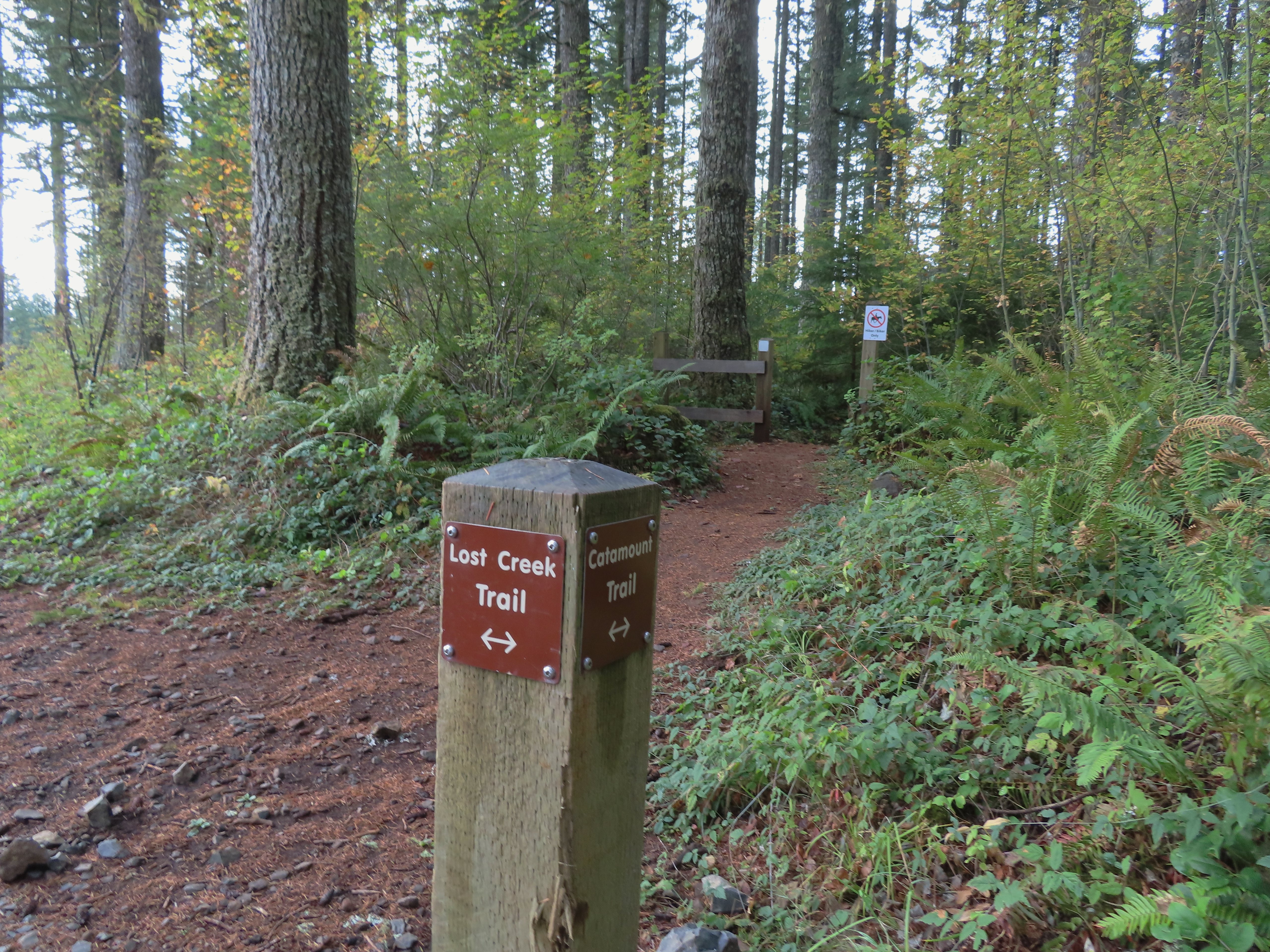
I followed this trail for 0.8 miles to a junction with the Catamount Trail at the edge of a clear cut.
Here is where I would have come up had the Catamount Trail did not have the on-way section. (Note that on some mountain biking maps the one-way section is labeled “Upper Catamount Trail.)
I turned left onto the Catatmount Trail at the junction and quickly found myself walking through the clear cut.
The treeless section wasn’t long. It appeared to have been an area impacted by the 2020 Beachie Fire.
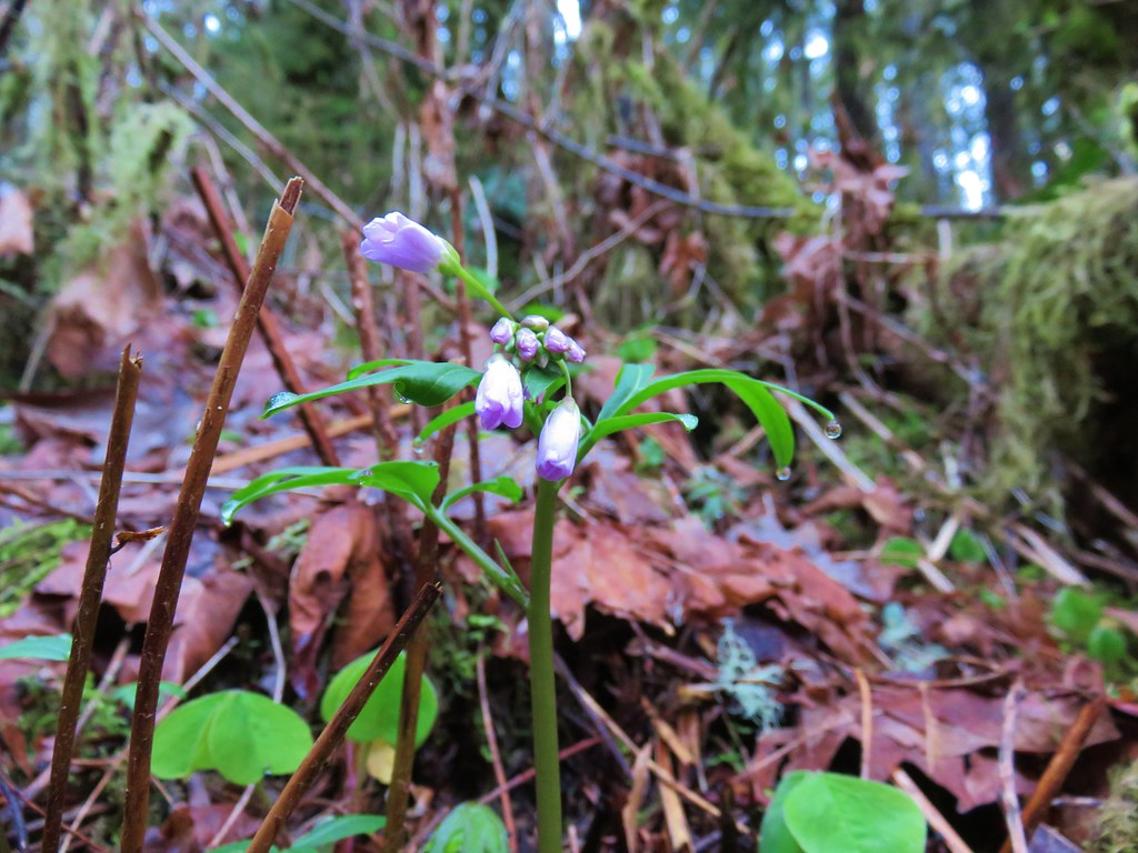
Still some bleeding heart blooming.
There wasn’t a lot of bright Fall colors in the backcountry, but this maple stood out.
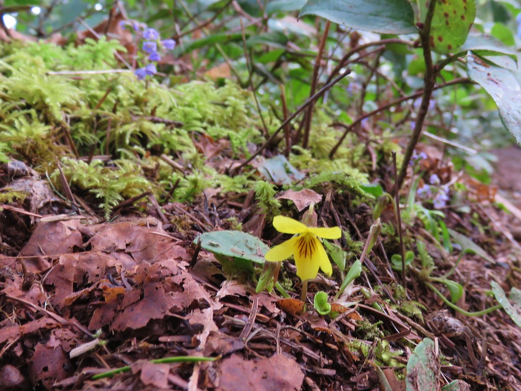
Was a bit surprised to see a few violets along this section.
Nearing the end of the logged area.
At the tree line the trail split unexpectedly (another feature not shown on the park map) into two one-way trails. The right hand fork (in this direction) was one-way uphill while the left down. I was going down at this point so I stayed to the left.
It wasn’t long before the two trails rejoined. The trail continued downhill to the Buck Mountain Loop near its crossing of Howard Creek. The rejoining of the trails.
There were several bridges along this section of the trail. I also ran into the only mountain bikers that I would encounter all day in this area, a group of five.
The Buck Mountain Loop junction.
I turned right at the junction and crossed Howard Creek then turned right again back onto the Catamount Trail. Bridge over Howard Creek.
The continuation of the Catamount Trail on the right.
The trail now climbed uphill for 0.2 miles to the large trail junction on Buck Mountain, a total of 1.1 miles from the Lost Creek Trail junction.
The map showed the section I had just done as 0.9 miles, but my track was a bit more twisty than the map.
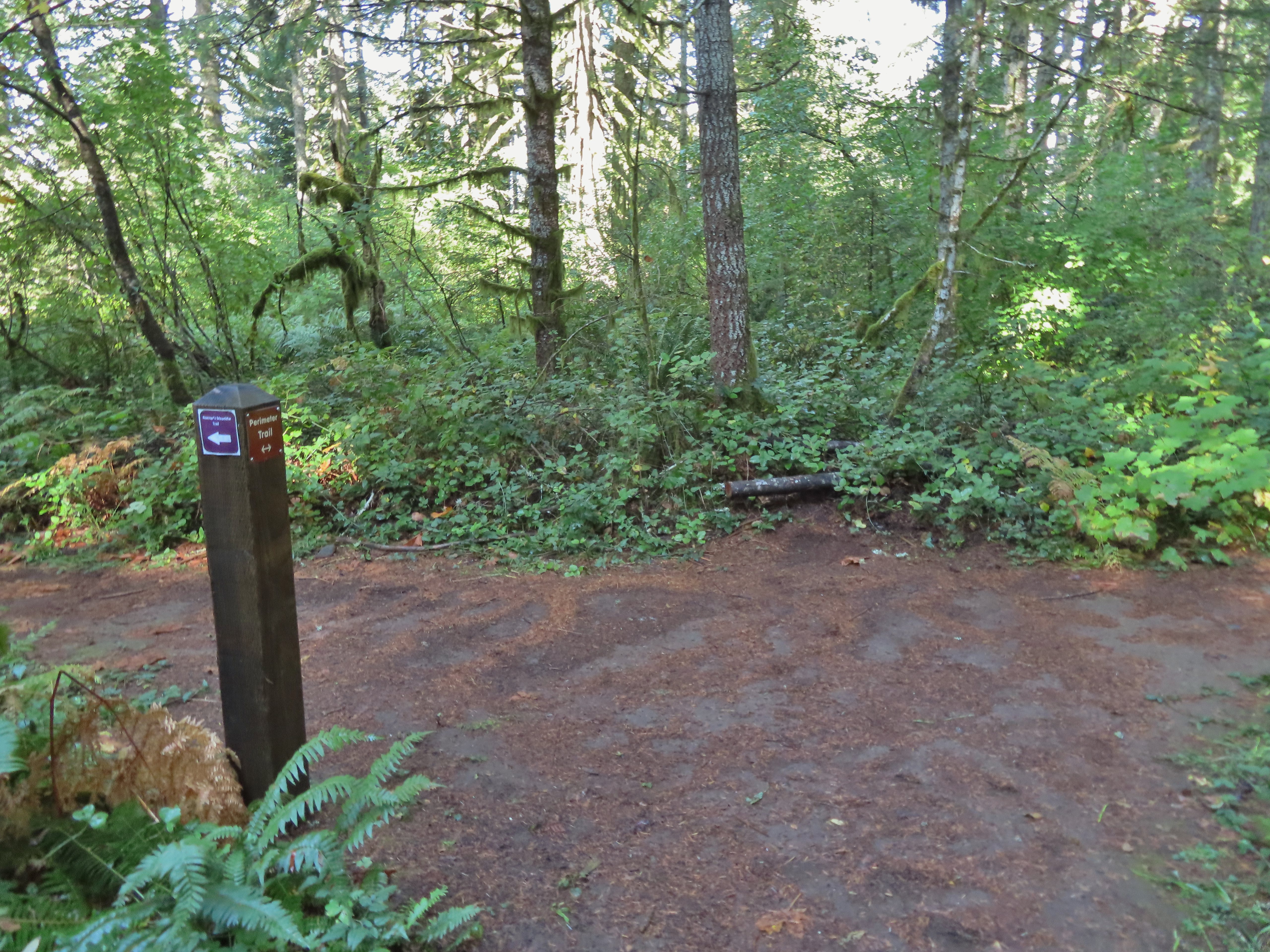
From the junction I took the Perimeter Trail.
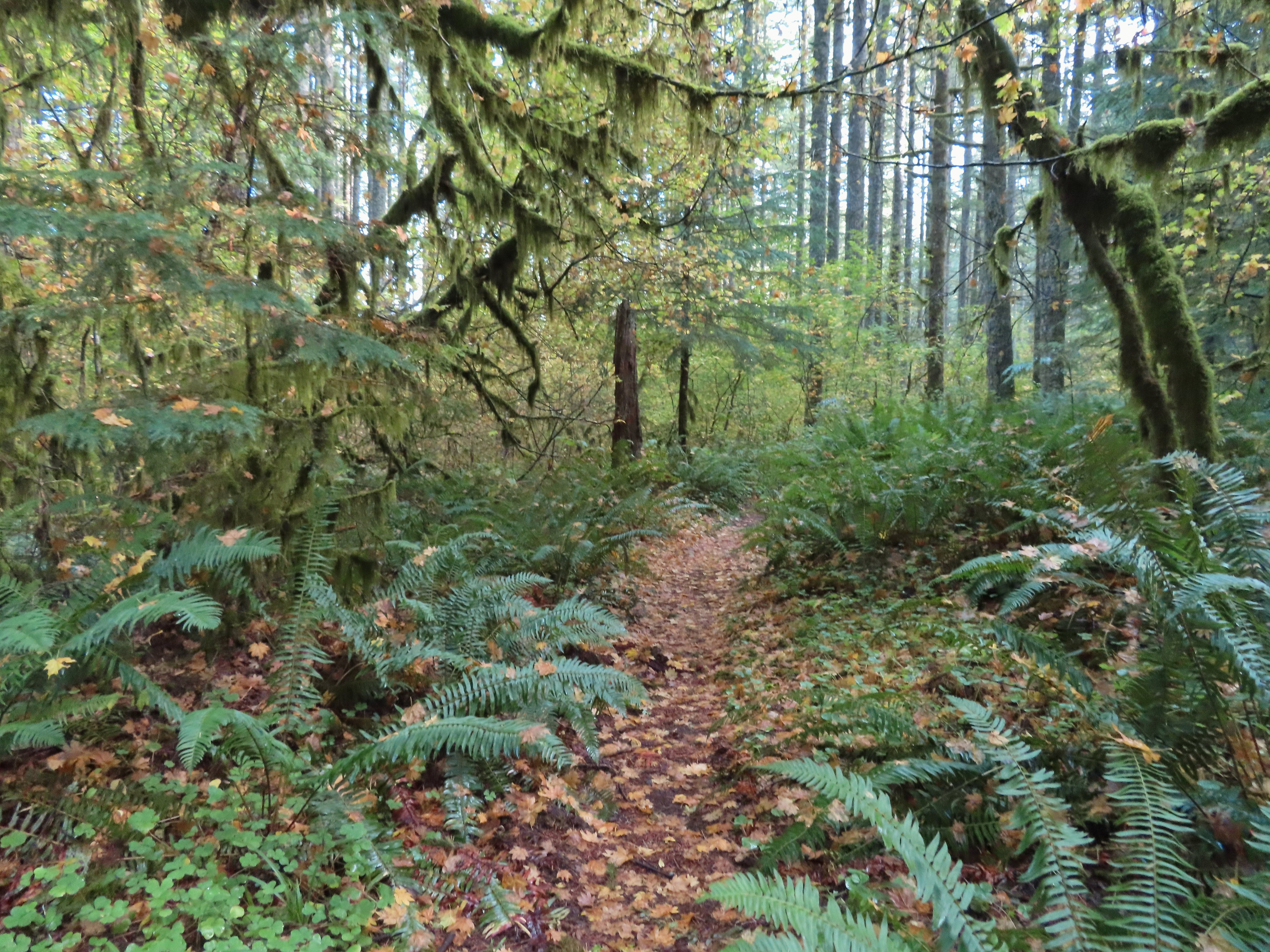
The park map lists this trail as 5.9 miles in length and has a “Steep” warning not far from the Buck Mountain junction. The trail was in good shape and although it lost over 350′ of elevation in just under a mile to a crossing of South Fork Silver Creek the grade was reasonable. Compared to some of the other trails we’d been on this year it didn’t seem all that steep.
A small opening on the way down.
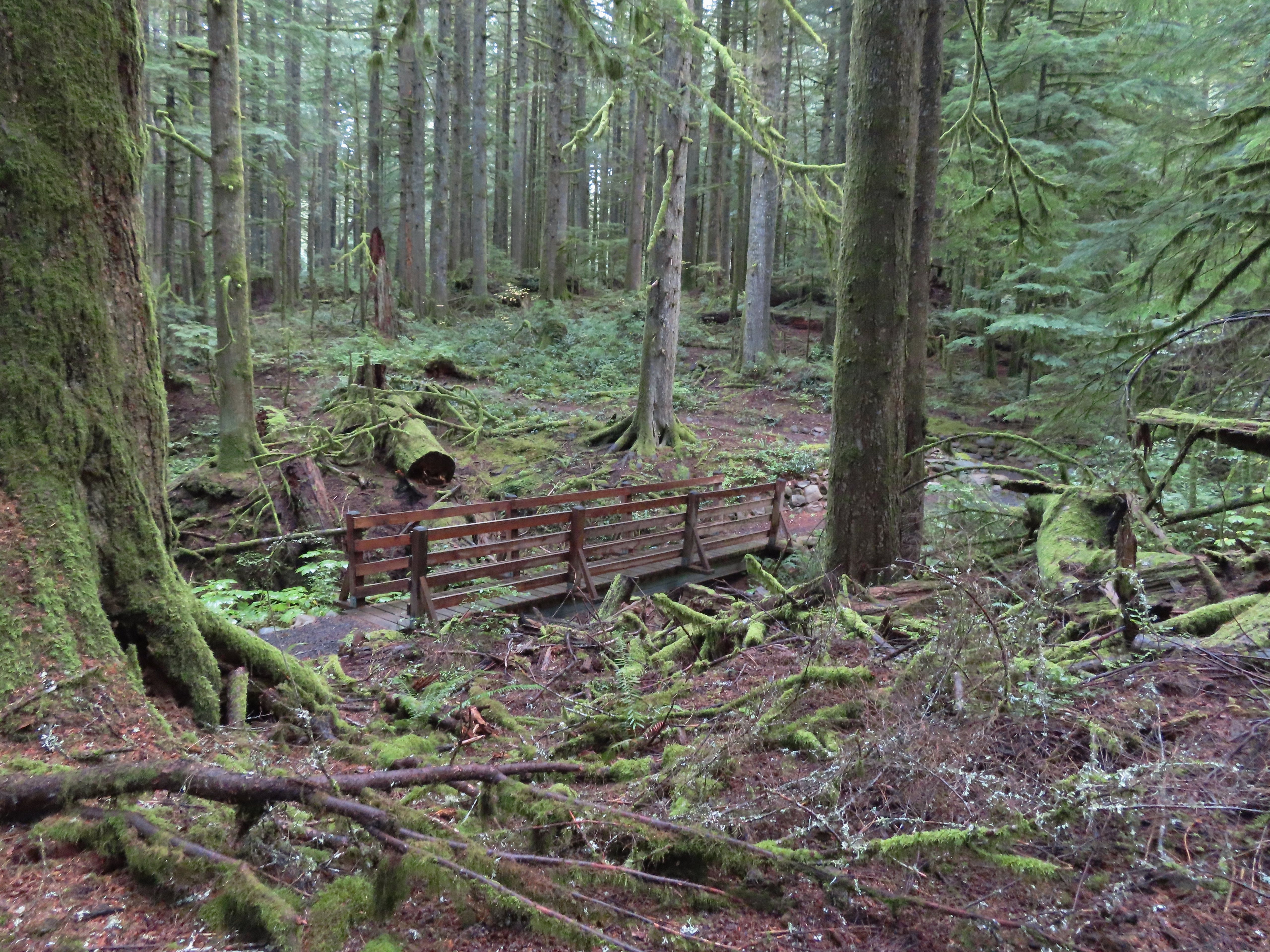
Footbridge over South Fork Silver Creek.
South Fork Silver Creek
If I had paid better attention to the elevation numbers shown on the park map I might not have been so surprised when the trail began to climb on the other side of the creek. Over the next 2.1 miles the trail gained over 650′ before arriving at junction with the Rackett Ridge Trail. Up until the Rackett Ridge junction I had only encountered 8 people, the group of 5 mountain bikers and three trail runners (one solo and two together). The number of people seen doubled at this junction.
I’m a hiker so I went right here.
Big fungus on the tree ahead.
Map at the Rackett Ridge junction.
I continued on the Perimeter Trail which now began a nearly 3-mile descent that was at least as steep as the section before with the warning. The use of switchbacks allowed the grade to stay reasonable though.
Another impressive nursery log.
I stopped in this area to change out of my sweaty socks and into one of the extra pairs I’d brought expecting rain.
The vegetation went through several changes as the trail lost elevation.
This was a big tree in the midst of much smaller ones.
Roemer’s Meadow Trail (left) isn’t shown on the park maps yet, but it was completed in 2021 with help from the Salem Area Trails Alliance. (They do a lot of good work in the park and the area.) The trail is approximately 1.7 miles from the Rackett Ridge junction.
The Trail of Ten Falls junction near Highway 214.
Looking back up the Perimeter Trail.
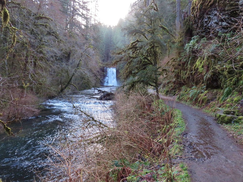
For the hike to be a true loop I would have turned left onto the Trail of Ten Falls, but in order to see Upper North Falls I needed go right for 0.3 miles so that’s what I did.
Upper North Falls
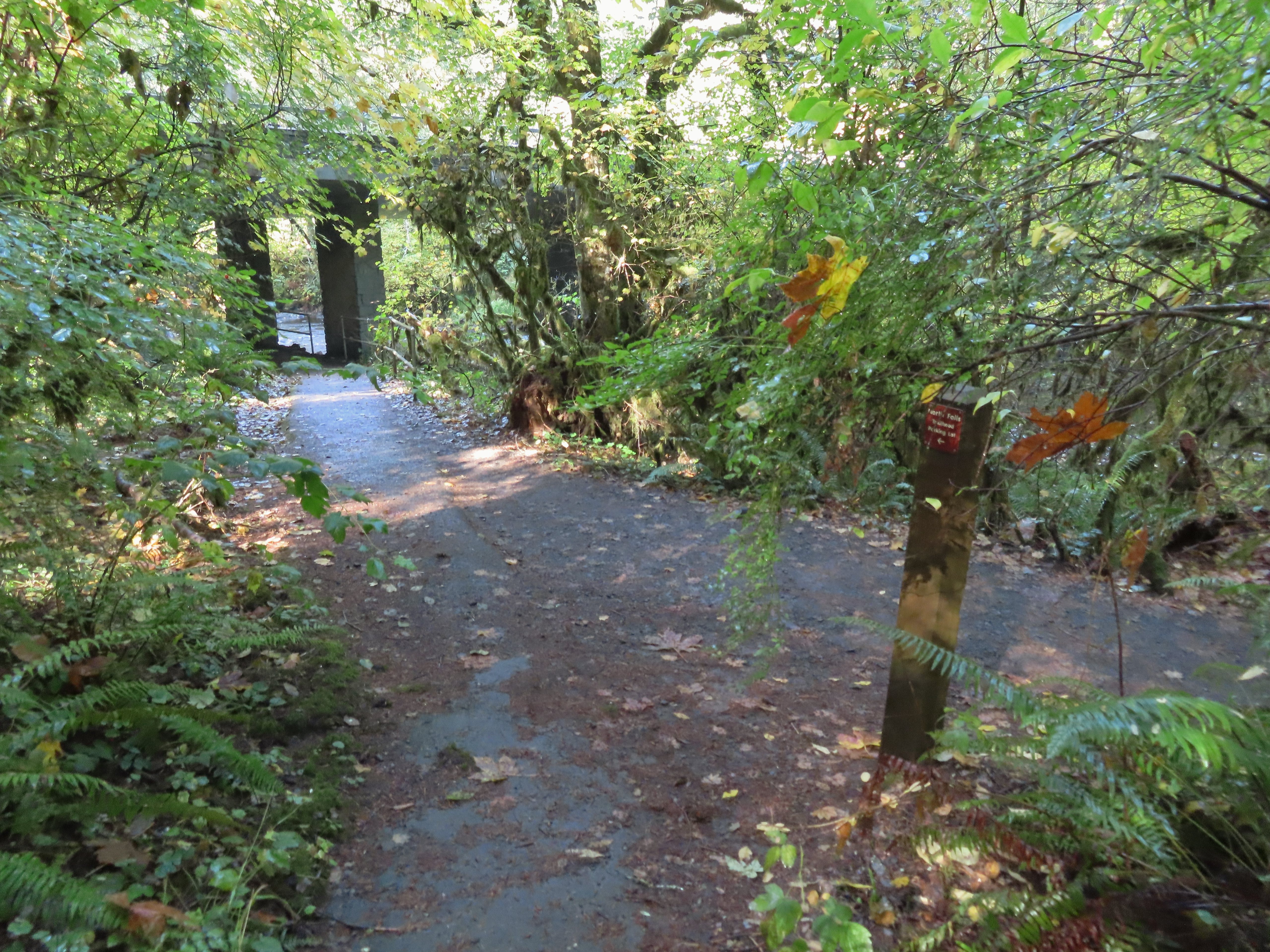
After visiting the falls I headed back and passed under the highway to a large map at a “T” junction.
A left would have taken me to the North Falls Trailhead.
I turned right at the signboard then veered right onto the Canyon Trail at a congested fork in the trail. The Rim Trail to the left and Canyon Trail to the right, both part of the Trail of Ten Falls.
The Canyon Trail descended some stairs then wound its way behind North Falls in approximately a tenth of a mile.
The trail followed the creek arriving at Twin Falls a little over three-quarters of a mile from North Falls.
I’m always impressed by the size of this rock in the creek.
Not Twin Falls, but a nice little cascade nonetheless.
This post could be a little confusing without a map. The Twin Falls Trail climbs uphill to a group camp and does not lead to Twin Falls. The falls are the opposite side along a very short spur trail that connects at either end to the Canyon Trail.
Twin Falls isn’t very easy to see from the spur trail either even though you’re right next to it.
I was able to find a better viewpoint of Twin Falls further along the Canyon Trail.
Twin Falls
My next detour came 0.3 miles beyond Twin Falls when I turned left onto the Winter Falls Trail.
The Winter Falls Trail crosses the creek on a footbridge then climbs gradually to the base of Winter Falls before steepening to climb up to the Rim Trail. I turned around before the steep part.
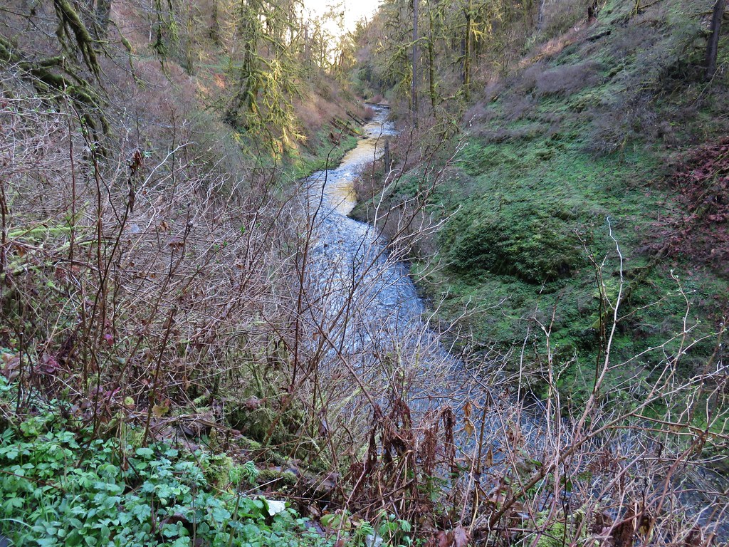
North Fork Silver Creek
Winter Falls, as the name suggests it’s not much of a waterfall outside of Winter when rain and snowmelt provide more water.
With the dry Summer it isn’t a great Fall color year but there was a decent display along this trail.
After saying hi to Winter Falls I returned to the Canyon Trail and continued toward the South Falls Day Use Area. Next up was Middle North Falls and another detour to go behind this one as well. I turned left here on the spur trail behind Middle North Falls.
I again returned to the Canyon Trail and quickly arrived at the Drake Falls viewing platform. Middle North Falls from the Canyon Trail.
The 27′ Drake Falls.
Approximately a quarter mile beyond Drake Falls I turned right onto the Double Falls Trail.
Much like Winter Falls, Double Falls is on a side creek which has a low flow much of the year. The hiker at the base gives a good idea of the fall’s height, you just have to use your imagination to add water.
On my way back to the Canyon Trail I ran into one of Heather’s friends which allowed me to pause for a moment to talk and update her on our new kittens. Just beyond the Double Falls Trail I passed the eighth waterfall of my hike, Lower North Falls.
It was about here that my feet started to let me know that this was a long hike. It was almost a mile from Lower North Falls to my next marker, a junction with the Maple Ridge Trail. The Canyon Trail crosses the creek just downstream from Lower North Falls then makes a short climb to get above the canyon cliffs.
A quarter mile from the Maple Ridge junction was Lower South Falls, another that the trail passes behind.
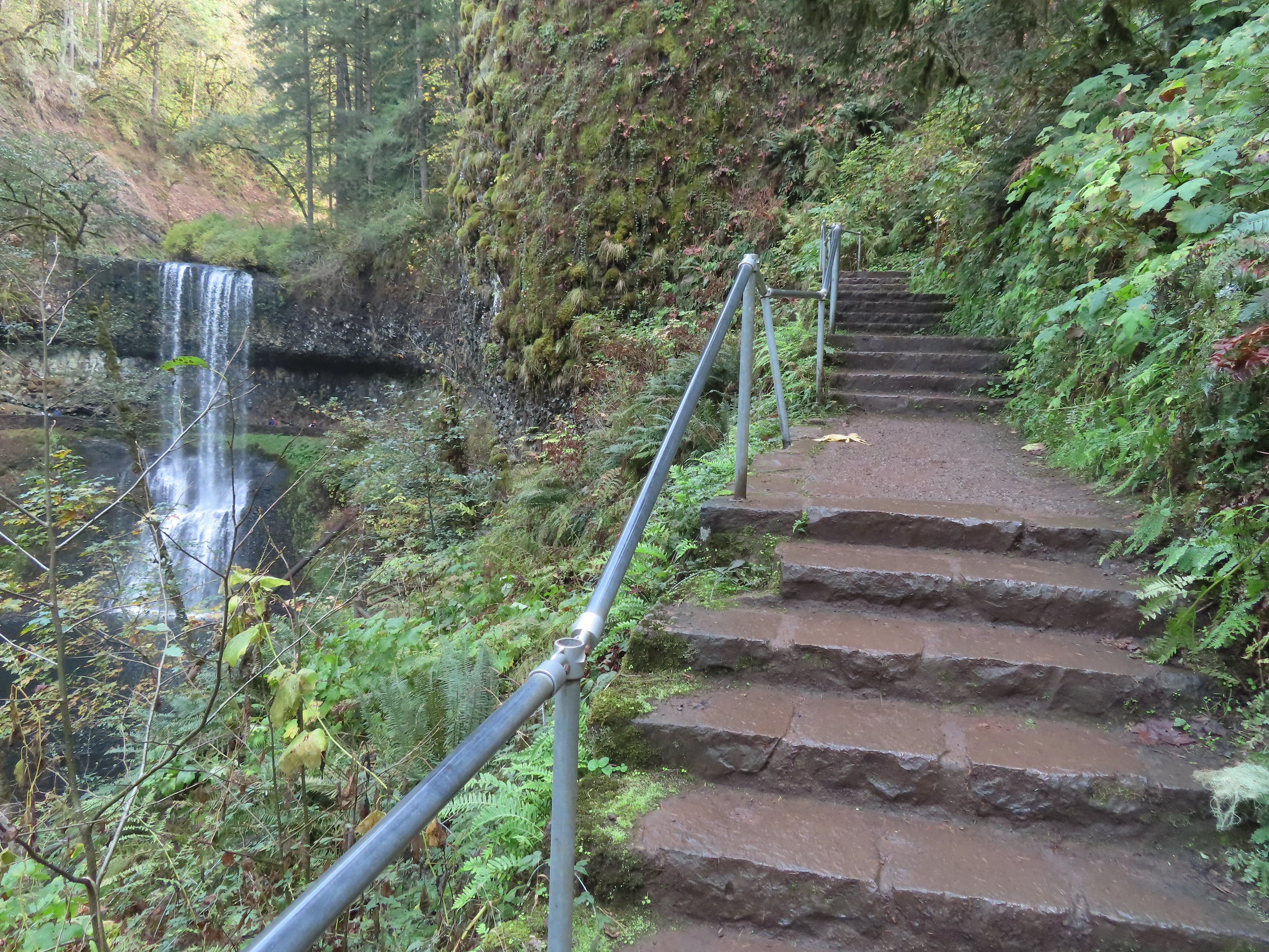
After passing behind the falls the trail climbs a number of stairs which at this point of the hike was a mean trick.
After conquering the stairs it was another 0.6 miles level miles to a footbridge at a fork in the trial within sight of the tenth and final waterfall, South Falls.
I walked out onto the bridge for the view then returned to the junction to take the right hand fork and go behind this fall as well.
I stayed right at junctions as I climbed to the top of South Falls then followed a paved path to a footbridge where I crossed the creek.
View toward South Falls from the footbridge.
I followed the paved path to the Bike Path where I recrossed the creek then made my way along the parking lot to the car.
Not sure what this old building was, possibly restrooms by the doors.
One of several picnic shelters in the park.
Approaching the Bike Path where I recrossed the creek.
I can see the car!
The hike turned out to be close to 22 miles with somewhere around 2900′ of cumulative elevation gain. The GPS originally said 22.4 miles but that was partly due to it jumping around when I was behind the different falls and it didn’t have a good connection to the satellites. Removing some of the points put the total down to 21.5 miles but doing that lost the out-and back behind Middle North Falls and some of the switchbacks up from South Falls. Whatever the actual distance it was a lot for me but overall everything held up pretty well. A couple of small blisters on one heel were the worst consequence. The fact that it hadn’t rained surely helped with the feet.
Track prior to trying to remove some of the jumps in data points.
The lack of people in the backcountry is almost a shame as the forest is lovely and the trails well maintained. I say almost a shame because for those of us who do take the time to explore it, the solitude only adds to the beauty. The Trail of Ten Falls was busy comparatively, but it wasn’t the zoo that it would have been on a Summer weekend which was nice. Doing the loop in reverse would have resulted in less folks at the falls but we’d been to the falls in the morning on all our other visits so this gave me a chance to see them with the Sun at a different angle. The only minor bummer was not being able to hike the full Catamount Trail due to the one-way section. If I were to do it over I would probably start at the North Falls Trailhead and go clockwise so that I would have been going the right way for that section and still would have ended with most of the Trail of Ten Falls. Happy Trails!
It’s been a while since we’ve had a recent trip report to post but we finally took our March hike on Heather’s birthday. We are in the midst of training for the Corvallis Half-Marathon so we were looking for something on the shorter end and without too much elevation gain. After our first plan was scrapped due to our most recent snowfall we turned to – Silver Falls State Park. We had done this hike a couple of times in the past before starting the blog. In fact our first visit to the park happened on a hot day in August, before we had started hiking, and resulted in us thinking we might die of heat stroke causing us to be unable to visit all the waterfalls. We returned slightly more prepared in July of 2006 and completed the hike which we consider our first true hike. We went back once again on 7/30/2010 when Dominique chose this hike as his pick during our vacation that year.
It turns out we were there a little early. The posted hours for the day use areas were 8am to 8pm which hadn’t been clear on the park website and the entrance to the South Falls day use area was still gated so we began our hike at the North Falls Trailhead.
There is a $5 day use fee which we attempted to pay but the envelope box had been removed, presumably for the night, so after filling out an envelope we left the stub on our dash along with a note that the box was not in place so we would drop our payment off on the way out. With that taken care of we took a footbridge over North Fork Silver Creek and followed a pointer for Upper North Falls.
The trail immediately passed under Highway 214 then in a quarter mile brought us to the 65′ Upper North Falls.
After admiring the fall we returned the way we’d come and after passing back under the highway faced a choice at a junction. To the left the Rim Trail headed uphill and would follow the highway along the canyon rim to the South Falls Day Use area while the right hand fork would lead us on a longer trek through the canyon and the other waterfalls.
The question was did we want to end with the more scenic trail through the canyon or start with the canyon figuring that there would be fewer people on the trails earlier in the morning. The prospect of fewer people won out and we took the Canyon Trail along the creek (please note dogs are banned on the Canyon Trail). Not far from the junction the trail descends past a sign for North Falls and passes under basalt overhangs.
North Falls came into view as we descended some stairs before turning back towards the falls and ultimately passing them.
The water was roaring as it crashed down into the splash pool. It was a stark difference from our July 2010 visit.
July 30, 2010
March 29, 2018
The trail was now on the north side of the creek and remained fairly level for over a mile as it passed through the canyon. We spotted quite a few flowers starting to bloom along this stretch.
Toothwort
Skunk cabbage
Salmonberry
Indian plum
The next waterfall up on the Trail of Ten Falls was 31′ Twin Falls.
A short distance from Twin Falls (and about 1.5 miles from the North Falls Trailhead) we came to a junction with the Winter Falls Trail.
The half mile Winter Falls Trail starts at the Winter Falls Trailhead along Highway 214 passing Winter Falls and ending at the Canyon Trail. We turned left onto a footbridge crossing North Fork Silver Creek and headed for Winter Falls.
The trail was fairly level as it led to the 134′ waterfall.
Later in the year Winter Falls all but dries up so this was the first time we’d gotten to see this waterfall.
After checking this fall off our list we returned to the Canyon Trail and continued downstream toward Middle North Falls.
In just .2 miles we came to the side trail down to Middle North Falls.
Here there was another opportunity to go behind the waterfall.
The side trail continued on the far side of the fall wrapping around the canyon to a great view of the cascade.
After oohing and ahhing at this waterfall we returned to the Canyon Trail which also had several nice views of this fall. Of all the waterfalls on this hike this one was probably the most visibly different from our previous visits. July 7, 2006
July 30, 2010
March 29, 2018
A little downstream from Middle North Falls we came to a viewing platform above little Drake Falls.
Less than a half mile from the Winter Falls Trail junction we arrived at another junction. This time with a very short spur trail to Double Falls.
Here again the difference in water volume was very apparent.
July 7, 2006
July 30, 2010
March 29, 2018
Just beyond the spur trail to Double Falls the Canyon Trail passed 30′ Lower North Falls.
After the flurry of waterfalls in the three quarters of a mile between Twin Falls and Lower North Falls things settled down. The trail continued on the north side of the creek for about a quarter of a mile before crossing over on a footbridge.
The trail then stayed on the south side of the creek passing an unnamed seasonal waterfall.
The trail soon veered away from North Fork Silver Creek and a mile from the spur trail to Double Falls we arrived at a junction with the Maple Ridge Trail.
The Maple Ridge Trail allows for a shorter loop option if you start at the South Falls Day Use Area but that loop only passes three waterfalls. It was however our escape route on our first visit when the heat of August and our lack of carrying water forced us to abandon our attempt at the full loop. The Canyon Trail here rejoined a creek but not the North Fork Silver Creek. This was now the South Fork Silver Creek. A short distance upstream we came to Lower South Falls.
Lower South Falls is another that the trail passes behind but before we headed behind the water a varied thrush landed on a branch just a few feet from us. I’ve mentioned before that these birds are my nemesis as I can rarely get a decent photo of one. This guy was no exception, despite his sitting on the branch for a good 15 seconds or more I could not get the camera to focus on him.
Having failed to get a clear picture of the bird we headed behind the waterfall and out the other side.
Again the difference in the appearance from our previous visits to this waterfall was obvious. July 7, 2006
July 30, 2010
March 29, 2018
Another series of stairs climbed up above Lower South Falls which was probably the most strenuous part of the hike. The trail then leveled out again for about a mile before arriving at South Falls.
A footbridge over the creek below the falls allows for a short loop from the day use area. We passed by the footbridge opting to pass behind this waterfall as well.
A comparison of our visits shows the difference that the timing of a visit makes. July 30, 2010
March 29, 2018
Doing the loop in the direction we’d chosen made South Falls the 10th of the 10 waterfalls along the Trail of Ten Falls but that didn’t mean it was the last waterfall we’d visit on the hike. That honor went to Frenchie Falls. A sign part way up the trail from South Falls pointed toward this little fall.
Even at this time of the year it wasn’t much more than a wisp of water and it lacks a good vantage point but it’s a named fall none the less.
After checking out Frenchie Falls we completed the climb out of the canyon to a viewpoint above South Falls.
We then looped around a picnic area and into the South Falls Historic District.
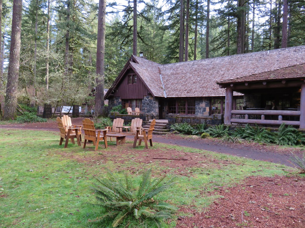
Here we passed the cafe, store and theater before arriving at a junction with the start of the Maple Ridge and Rim Trails.
We followed the Rim Trail through a picnic area and into the forest.
The last of the winter snow was melting as the first of the spring flowers were coming to life.
The Rim Trail passed through the Winter Falls Trailhead parking but offered no views of the waterfall. The only real view of any of the falls came near the end of the 2.1 mile trail when North Falls was visible down in the canyon below.
The pay box was in place at the trailhead (which was now full of cars) so we dropped off our $5 before driving back home. With all of our previous visits having come during the summer months it was great to visit when the water levels were higher. A few more weeks will bring out the flowers adding to the beauty of this hike. Happy Trails!
On 8/2/2011 during a week of vacation in Central Oregon we did a 6.8 mile loop hike visiting several waterfalls, most notably Tumalo Falls.
We began at an interpretive sign at the end of Tumalo Falls Road (Road 4603) on the North Fork Trail.
We kept right at junctions passing the lower viewpoint with its straight ahead look at the falls and continued to the upper viewpoint beside the falls which is less than a quarter mile from the trailhead.
The beauty of the falls and the easy access make it a very popular destination but we were there early and had the view to ourselves. Most people turn back after reaching the upper viewpoint but we continued on the North Fork Trail further into the forest.
The trail stuck close to Tumalo Creek passing Double Falls after .8 miles followed by Middle Tumalo Falls .9 miles later.
After passing a spring the trail crossed the Middle Fork Tumalo Creek on a footbridge.
Beyond the footbridge we took a brief detour toward the North Fork Tumalo Creek to see Lower North Fork Tumalo Falls.
After returning to the North Fork Trail we continued to follow the Middle Fork Tumalo Creek passing several more nice waterfalls. The names of some of which we are not certain of.
Middle Fork Tumalo Falls
Shortly beyond Middle Fork Tumalo Falls we arrived at a junction with the Swampy Lakes Trail which we turned left on and promptly crossed the creek on a log.
From this trail we could see part of snowy Tam McArthur Rim where the headwaters of Tumalo Creek originate.
We followed the Swampy Lakes Trail just over 2 miles from the creek crossing to a junction with the Bridge Creek Trail where we turned left along Bridge Creek to complete the loop. One final waterfall awaited along this final 1.3 mile section – Bridge Creek Falls.
A moderate to easy hike the loop is a great option for waterfall lovers spending time in the Bend area. Happy Trails!


 The North Rim Trail heads left at a fork with the Twin Falls Trail a short distance from the parking lot.
 I stuck to the North Rim Trail here leaving another (short) trail to do next time.
 The Nature Play Area along the loop trail I didn’t take.
 One of two bridges along the North Rim Trail.
 Railing near the North Falls Viewpoint.
 North Falls from the viewpoint.
 North Falls
 Map located at the North Falls Trailhead.
 Upper North Falls from the Upper North Falls Trail.
 Upper North Falls.
 The split in the Trail of Ten Falls where the Canyon Trail heads down to North Falls.
 North Falls
 Trail behind North Falls.
 Behind North Falls.
 I will always take pictures of these large boulders in the creek.
 Trail marker at the Twin Falls Trail junction.
 Twin Falls
 Twin Falls is a tough one to get a good clear view of the full waterfall. Recent rainfall had provided good flow for this fall which helps with the visibility.
 This is Twin Falls on July 7, 2006.
 All the rain had the side creeks and falls flowing as well.
 Nearing the Winter Falls Trail and its bridge over the creek.
 The view from the bridge.
 Winter Falls from the Winter Falls Trail.
 Winter Falls

 The forecast had called for sunny skies, but we were also dealing with an air stagnation warning. For a brief moment I thought the fog might burn off, but that never materialized and by the time I arrived at South Falls more fog had rolled in.
 There are some nice big trees scattered throughout the park.


 Trail of Ten Falls/Canyon Trail above South Falls.
 South Falls
 Behind South Falls
 For a short loop just to South Falls you can cross the bridge and return to the rim.

 The trail below heading for Lower South Falls.
 From behind Lower South Falls. I scared a poor woman so badly as I neared the falls. She was setting her phone up on a tripod for a selfie and didn’t see me coming nor could she hear me with the roar of the falls until I was just a couple of feet away. When I said that I was just going to sneak behind her she let out the loudest scream I’ve heard in a while.
 Ankle deep pools behind the falls.
 Lower South Falls
 The mile long Maple Trail (right) allows for a shorter loop to both the falls on South Fork Silver Creek.
 This is now the North Fork Silver Creek.
 Unnamed falls on a side creek.
 The footbridge over the North Fork Silver Creek.
 Pool below the bridge.
 Lower North Falls
 Footbridge over Hult Creek and the spur trail to Double Falls.
 Double Falls
 Back on the Canyon Trail.
 More fog.
 Drake Falls
 Middle North Falls
 Spur trail (right) to Middle North Falls.
 Behind Middle North Falls.
 Splash pool
 The Winter Falls Trail footbridge spanning the creek ahead on the right.
 Chipmunk.
 Twin Falls again which meant I was nearly to the Twin Falls Trail.
 Twin Falls Trail junction.

 The Twin Falls Trail leveled out near its end.
 Arriving back at the junction with the North Rim Trail.
 I spotted several ruffed grouse as I was driving out of the trailhead.
 A lot more blue in the sky than I had expected to see.

 Crossing Highway 214 to the campground.
 I detoured left to check out this bridge over Howard Creek.
 Howard Creek
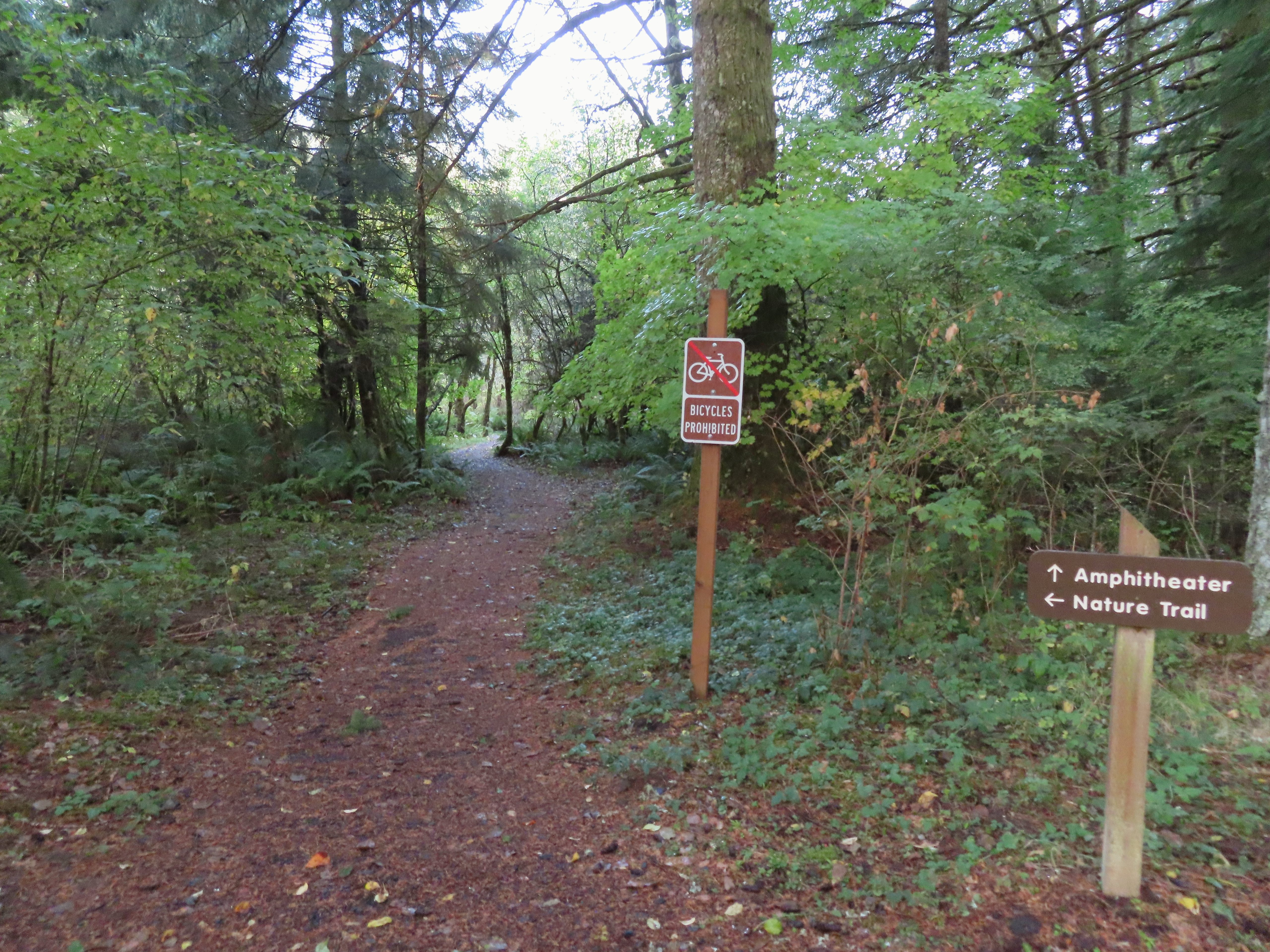

 Sign at the 214 Trail junction to let people know that there are no waterfalls in the backcountry.
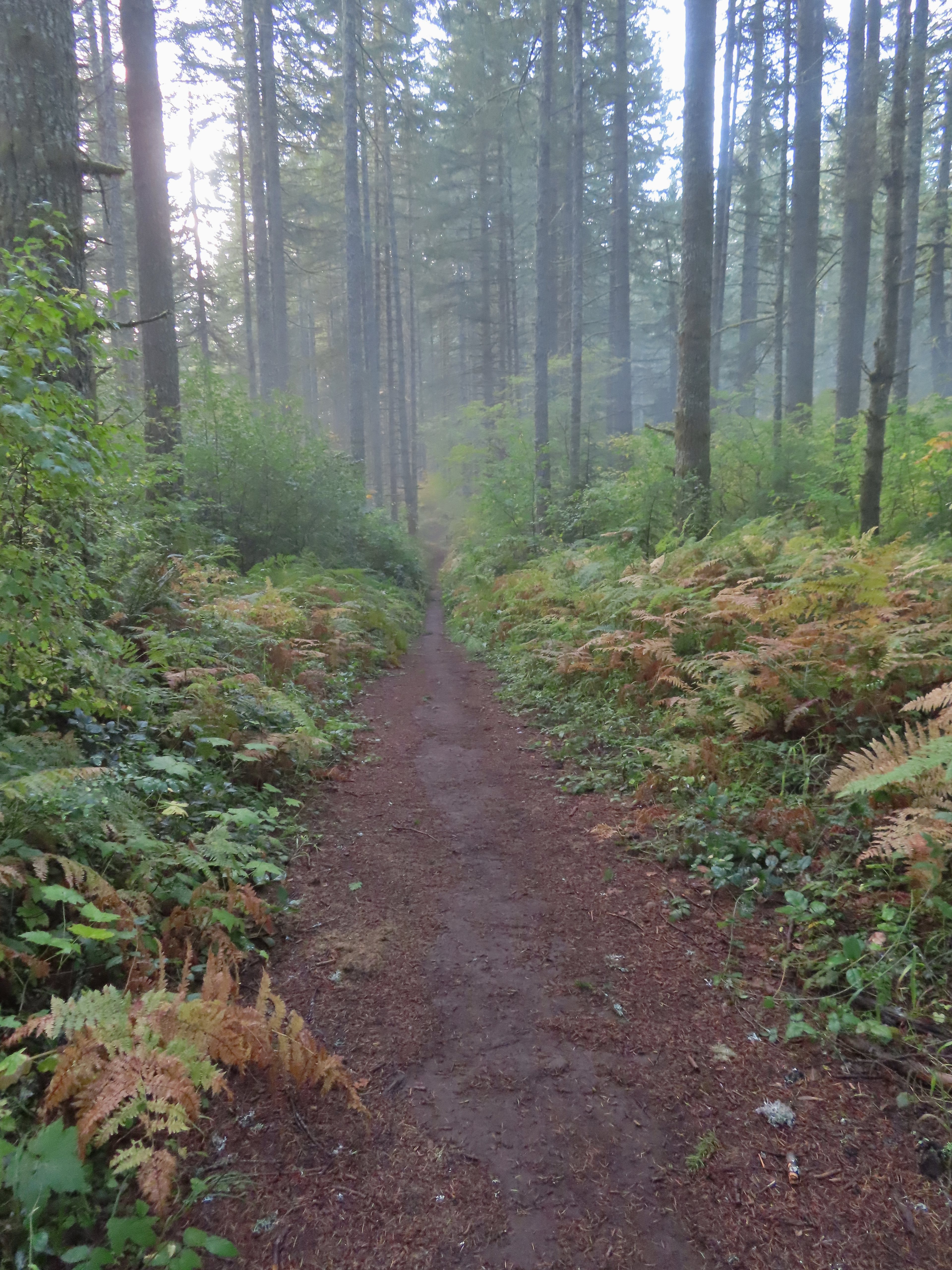 Just a little fog but no rain.
 Passing the Smith Creek Trail (left) after 0.6 miles on the 214 Trail.
 Rough skinned newt on the 214 Trail. (Probably headed for the Newt Loop too.)
 Big nursery tree along the 214 Trail.
 The trail post at the junction shows the Catamount Trail instead of the Newt Loop but the map at the junction labels it the Newt Loop.
 Map check.
 This second post included the Newt Loop along with a pointer for the Catamount Trail.
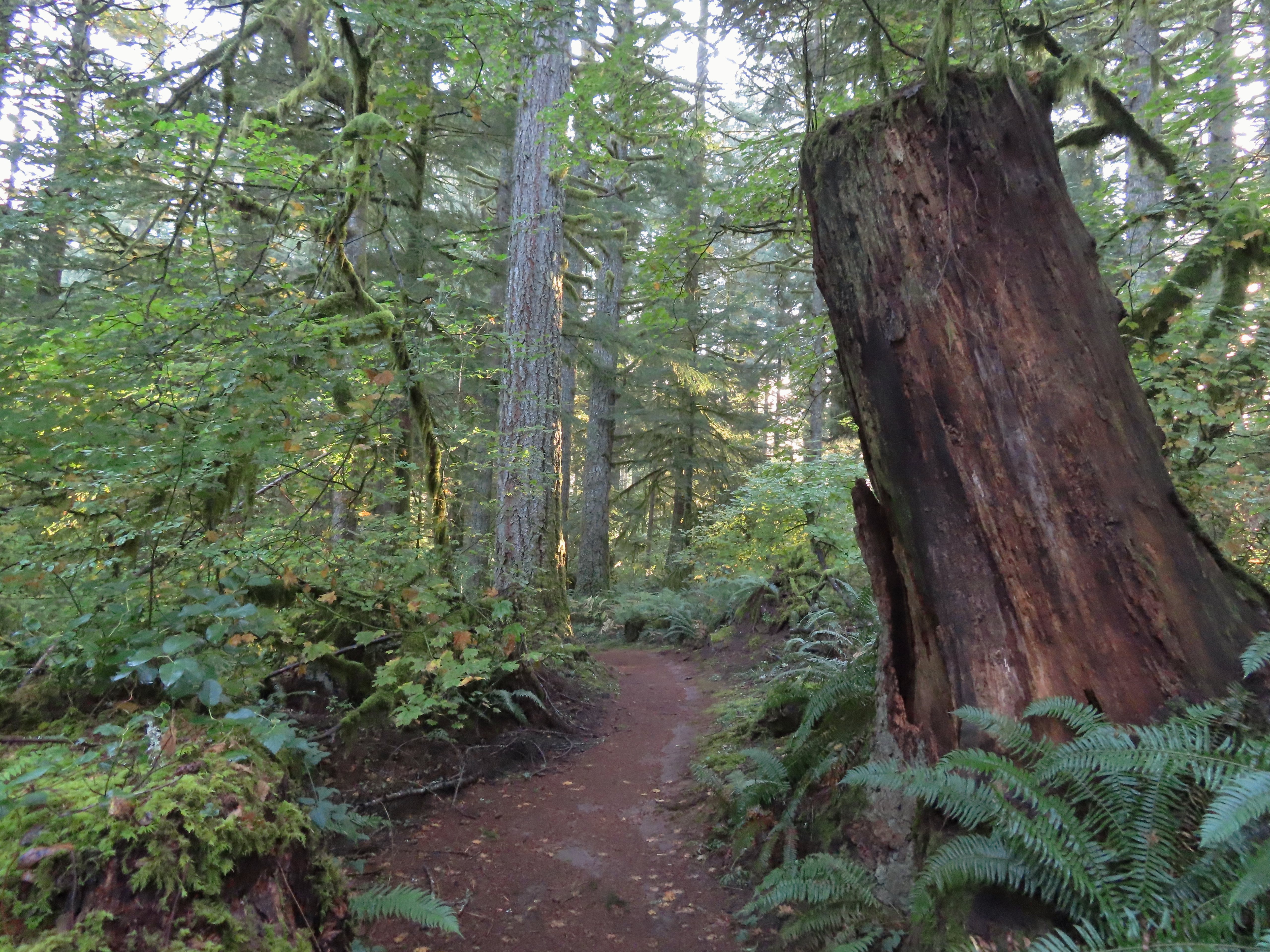
 Crossing a CAT road along the Newt Loop.
 Turning onto the Catamount Trail.
 Lots of nursery stumps along the trail.
 Another nursery stump.
 Side trails were well marked.
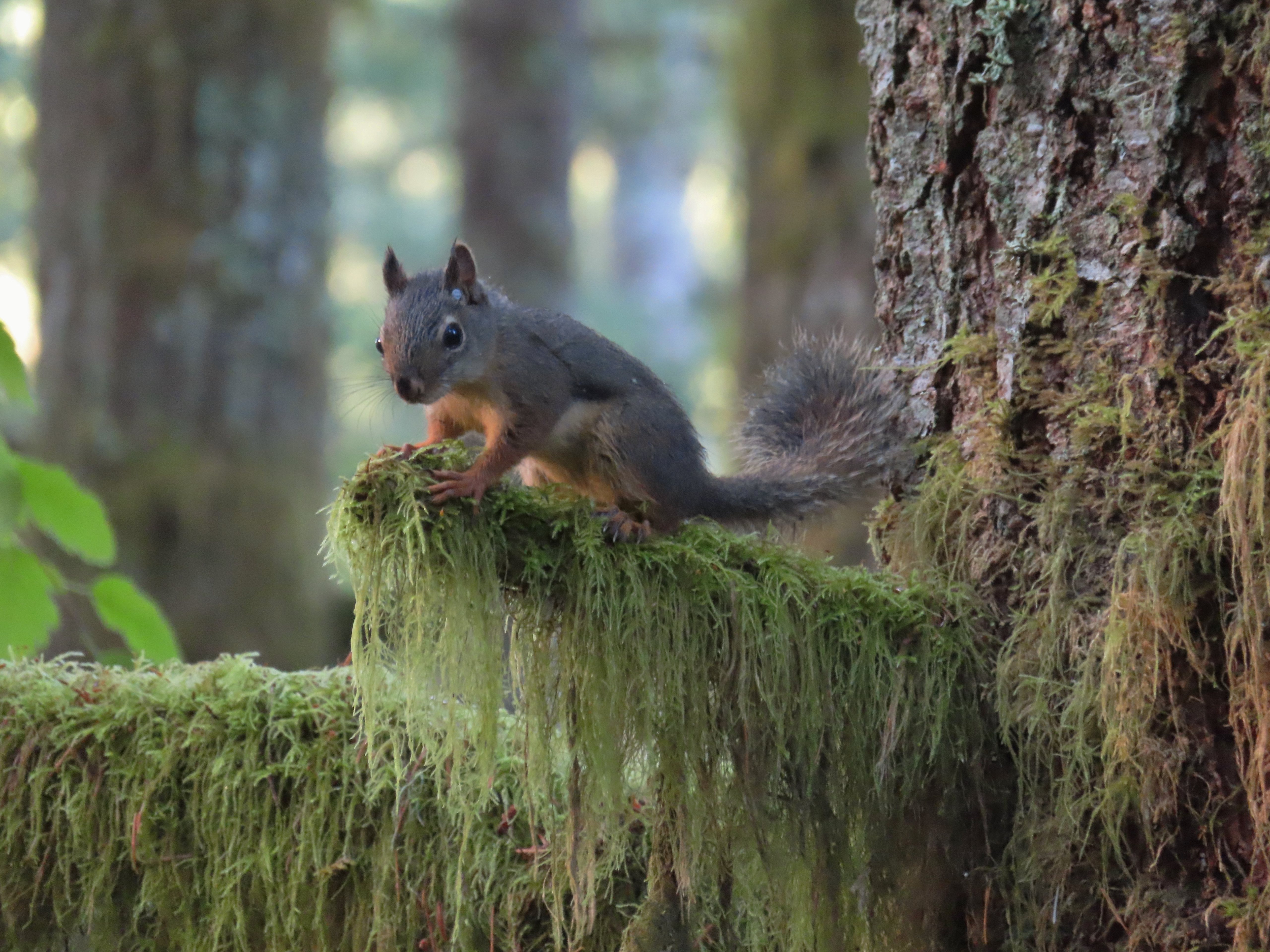
 Did not expect to see that overhead today.


 I believe this short section of fire scar was from the 2020 Beachie Fire.

 Turning onto the road.
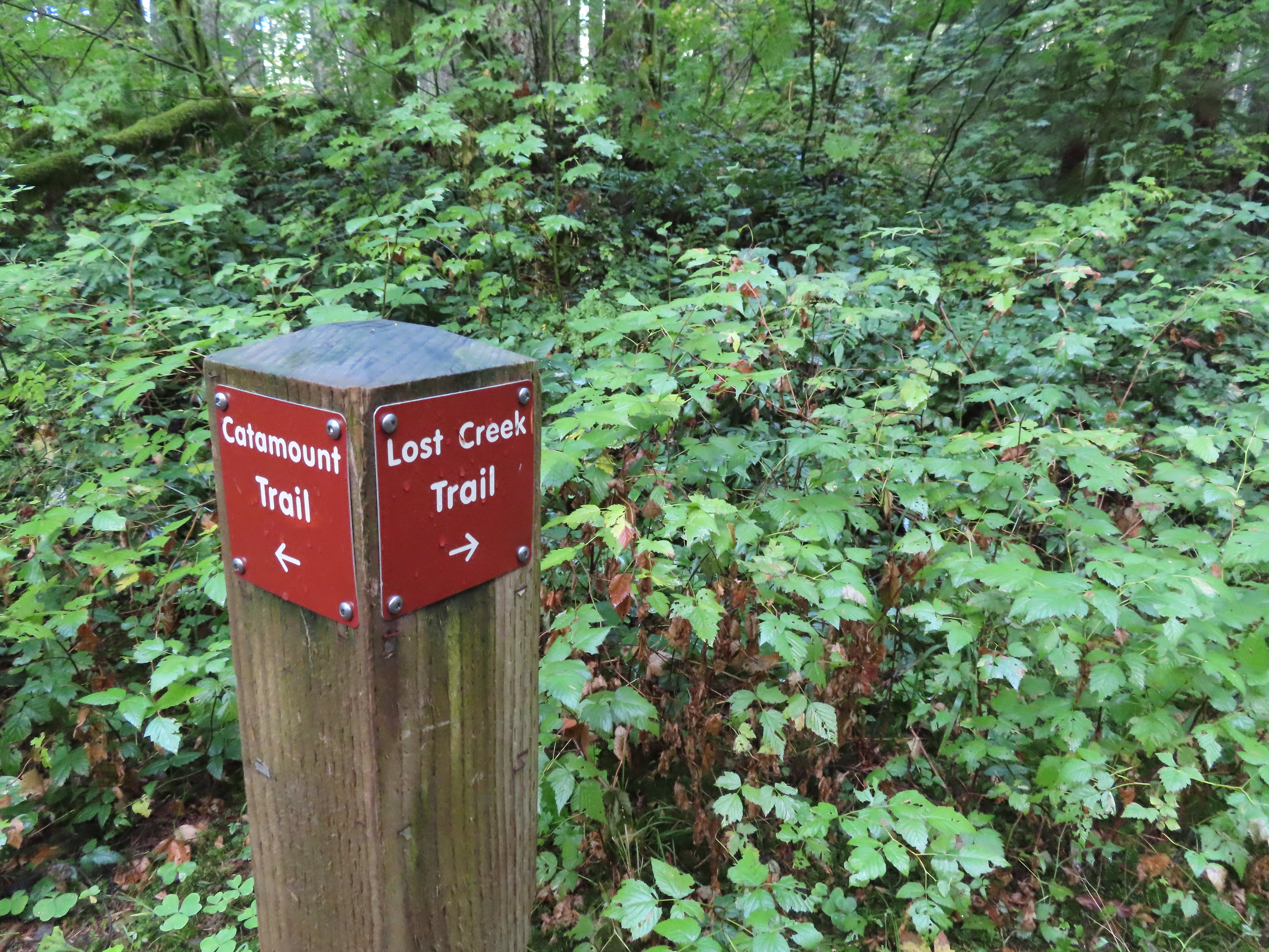 The opposite side of the post had a pointer for the Lost Creek Trail.
 I veered uphill to the right here.
 The Lost Creek/Buck Mountain junction.
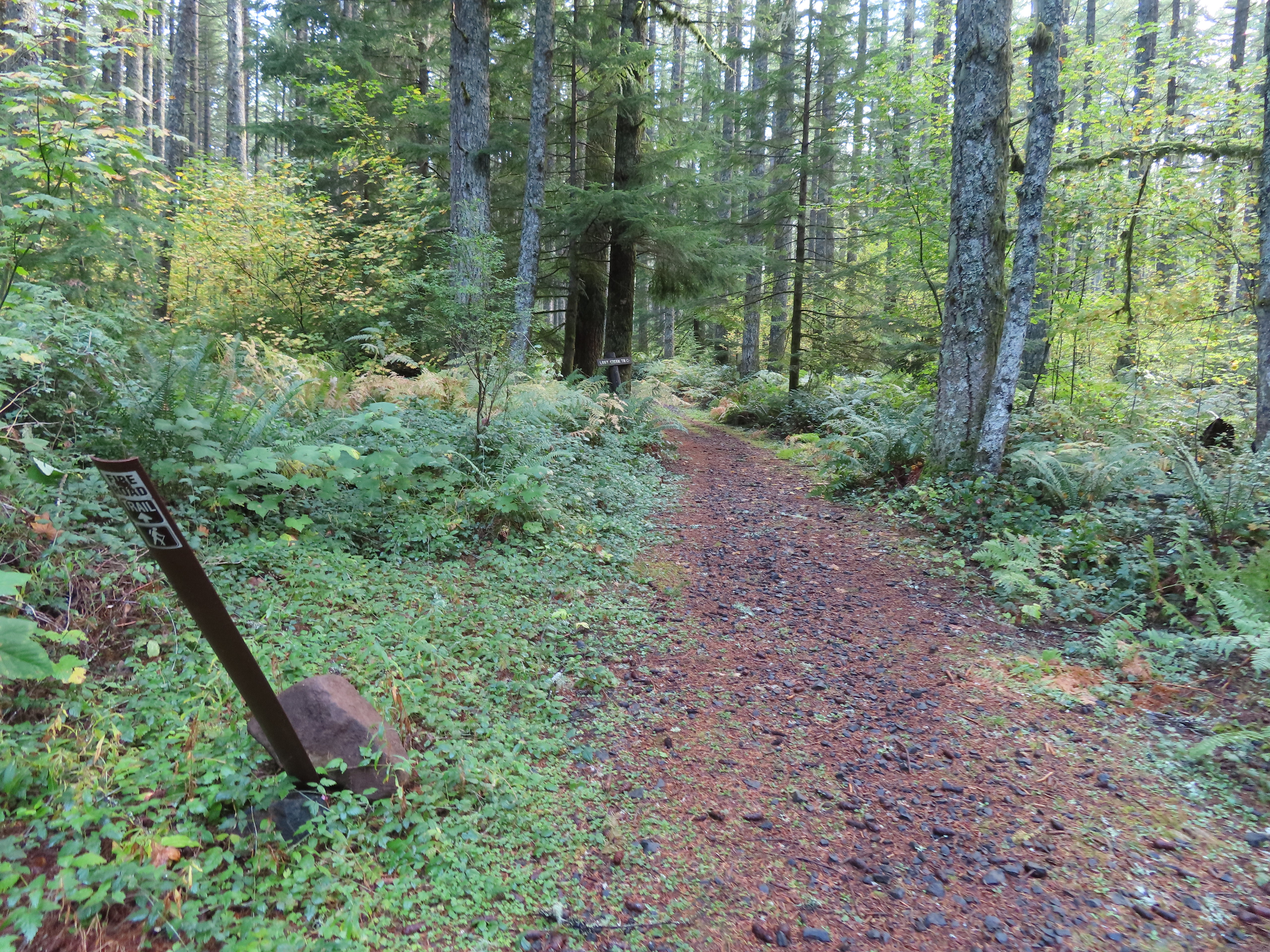 The Lost Creek Trail doubles as a fire road.
 Here is where I would have come up had the Catamount Trail did not have the on-way section. (Note that on some mountain biking maps the one-way section is labeled “Upper Catamount Trail.)
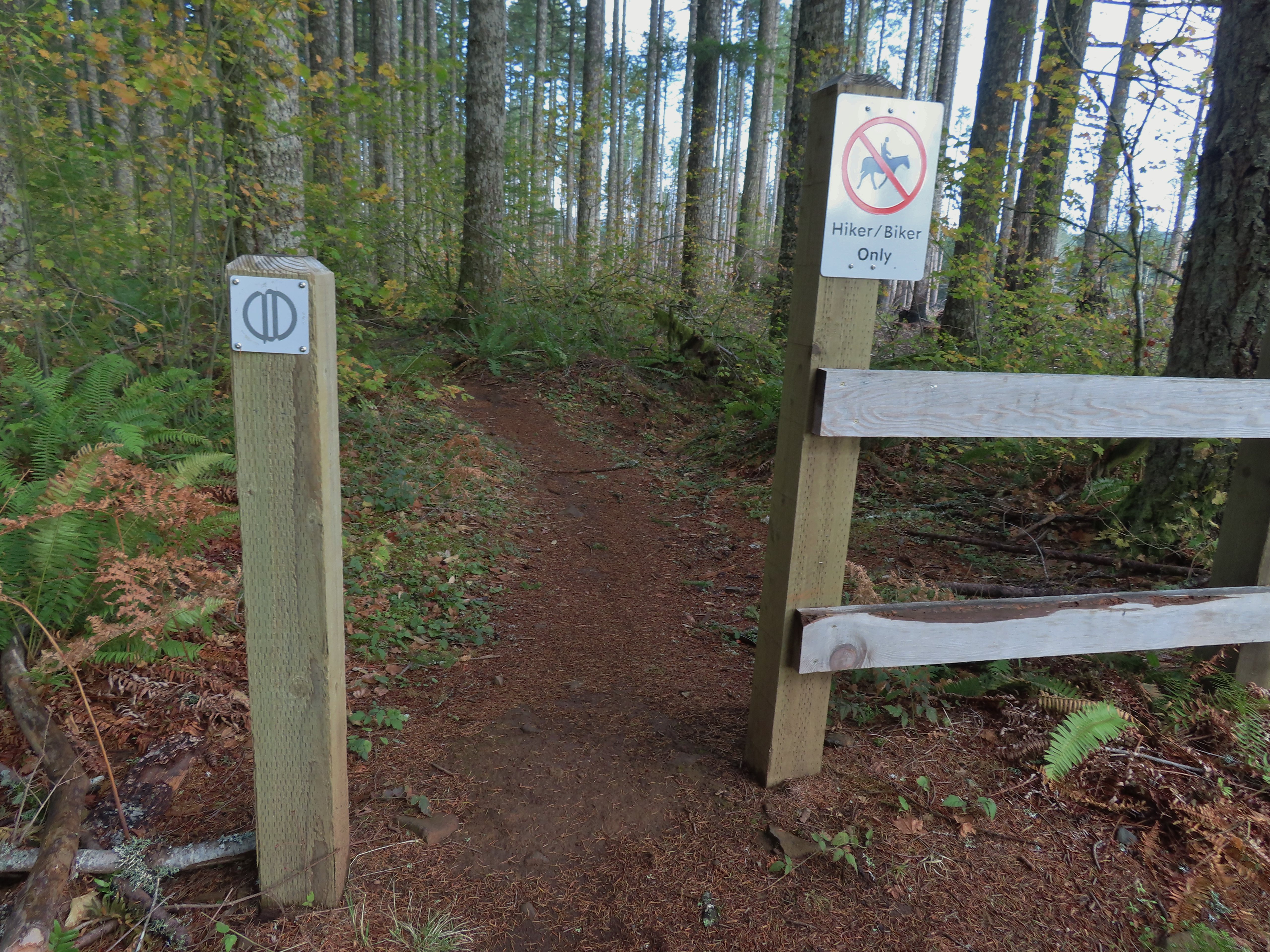
 The treeless section wasn’t long. It appeared to have been an area impacted by the 2020 Beachie Fire.
 Still some bleeding heart blooming.
 There wasn’t a lot of bright Fall colors in the backcountry, but this maple stood out.
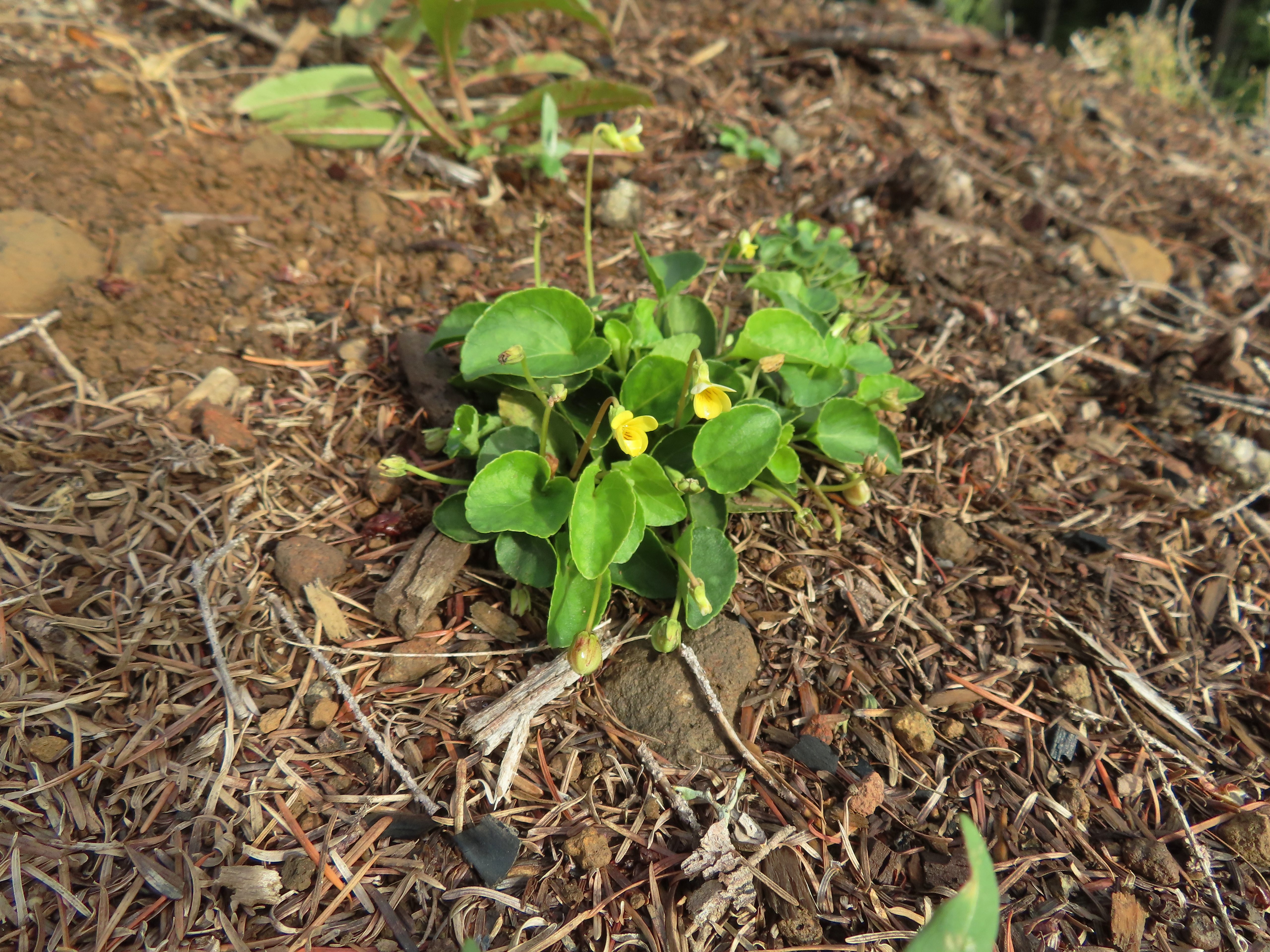 Was a bit surprised to see a few violets along this section.
 Nearing the end of the logged area.
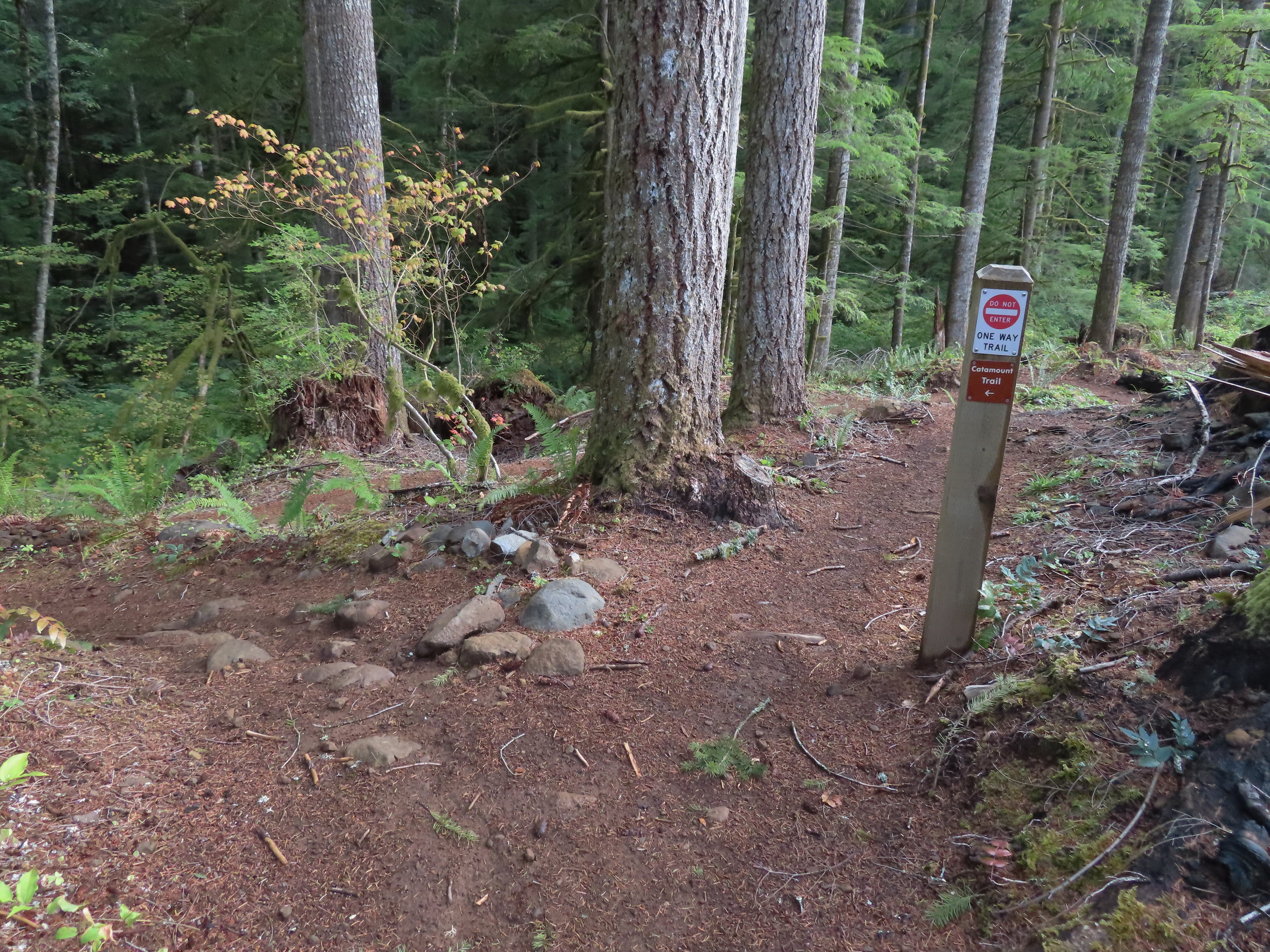
 The rejoining of the trails.
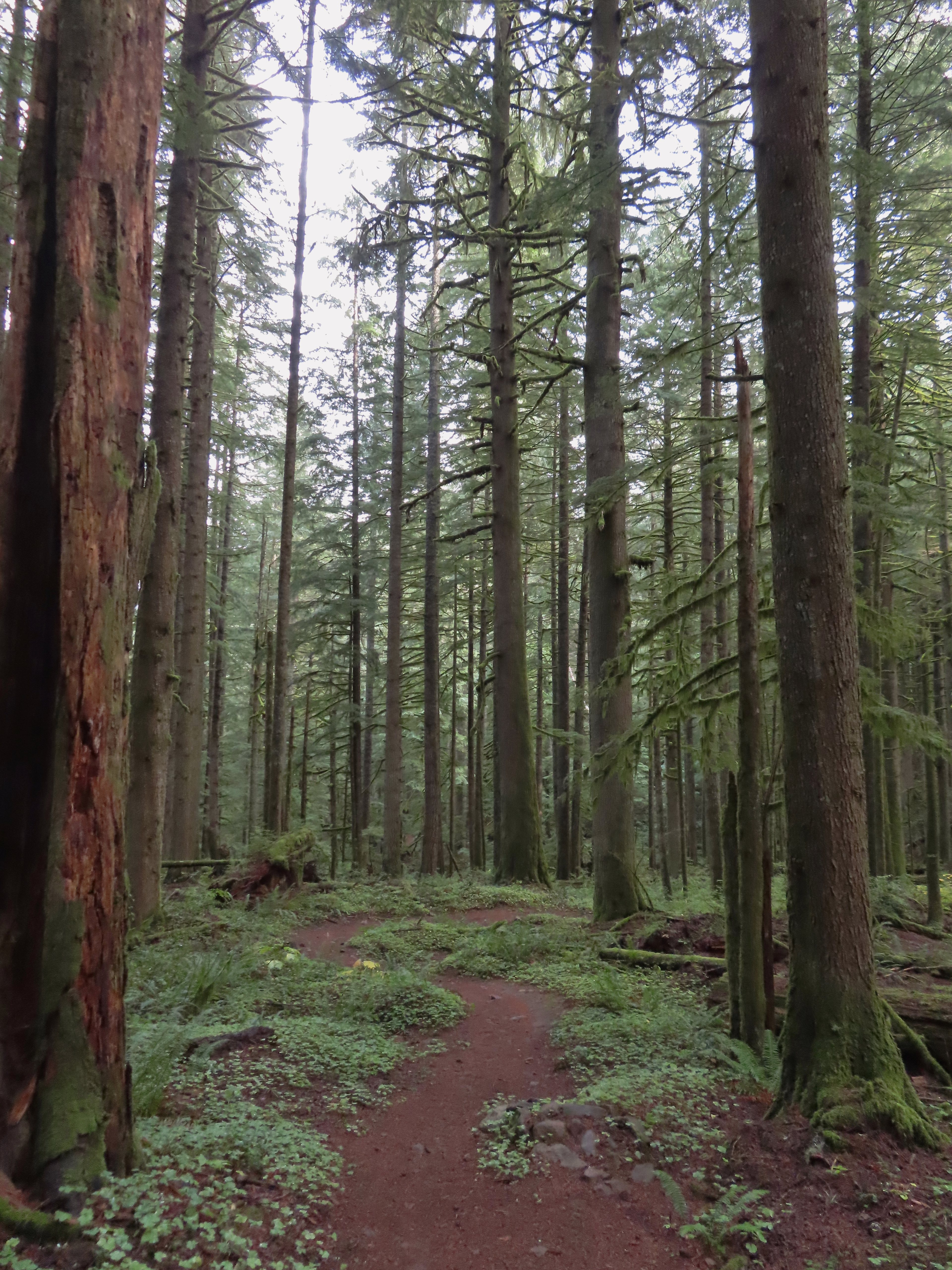
 There were several bridges along this section of the trail. I also ran into the only mountain bikers that I would encounter all day in this area, a group of five.
 The Buck Mountain Loop junction.
 Bridge over Howard Creek.
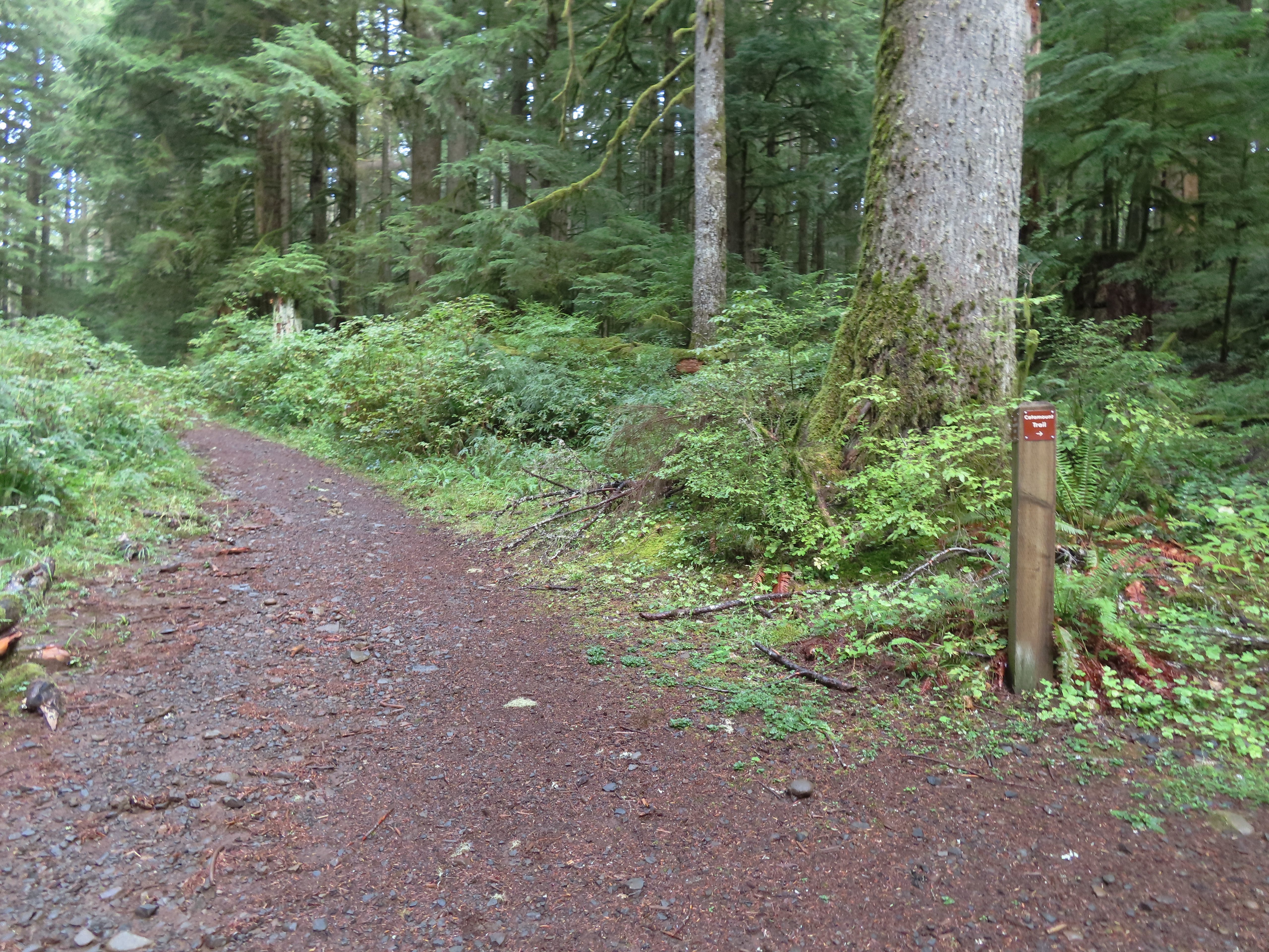 The continuation of the Catamount Trail on the right.
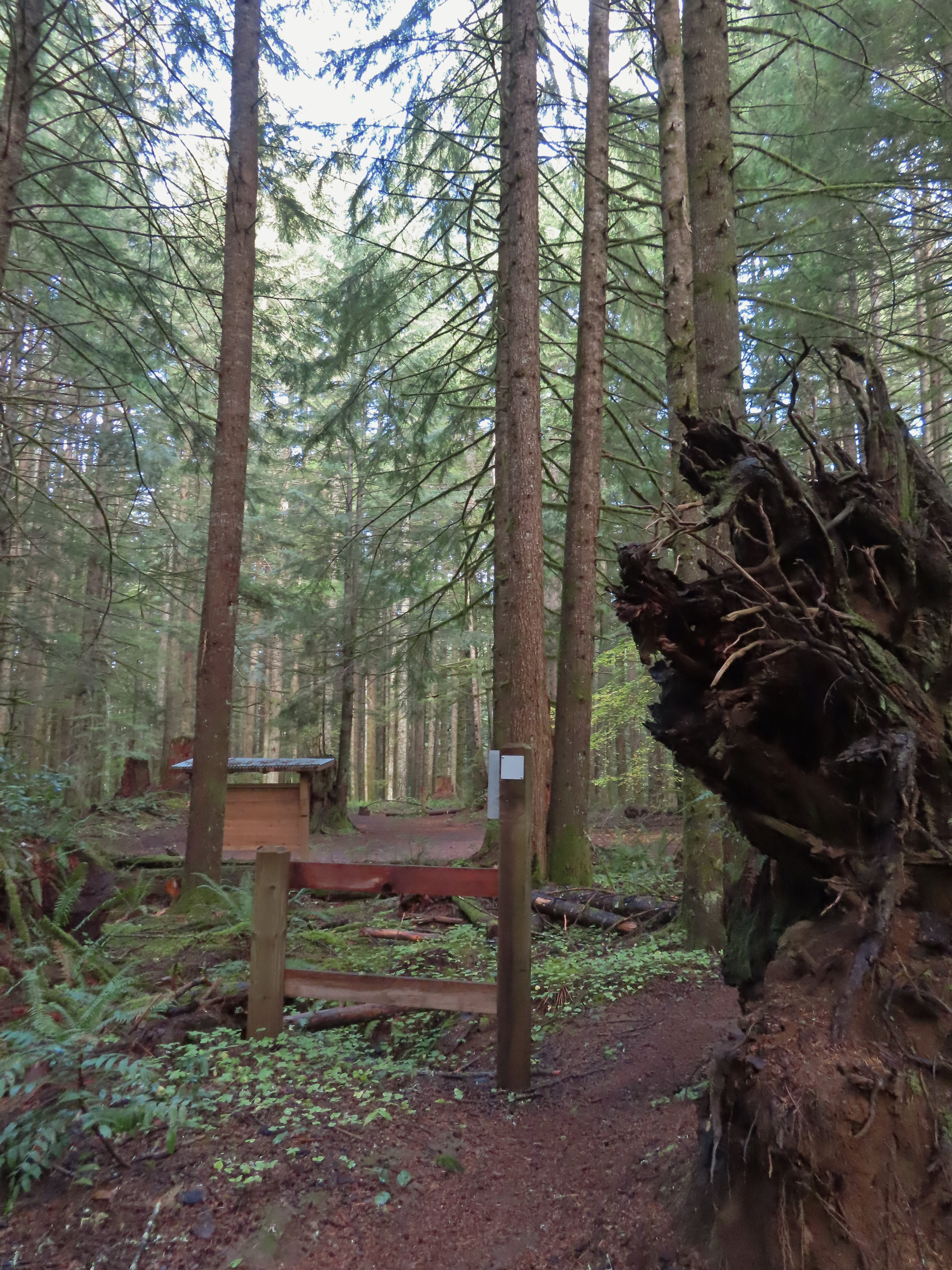
 The map showed the section I had just done as 0.9 miles, but my track was a bit more twisty than the map.
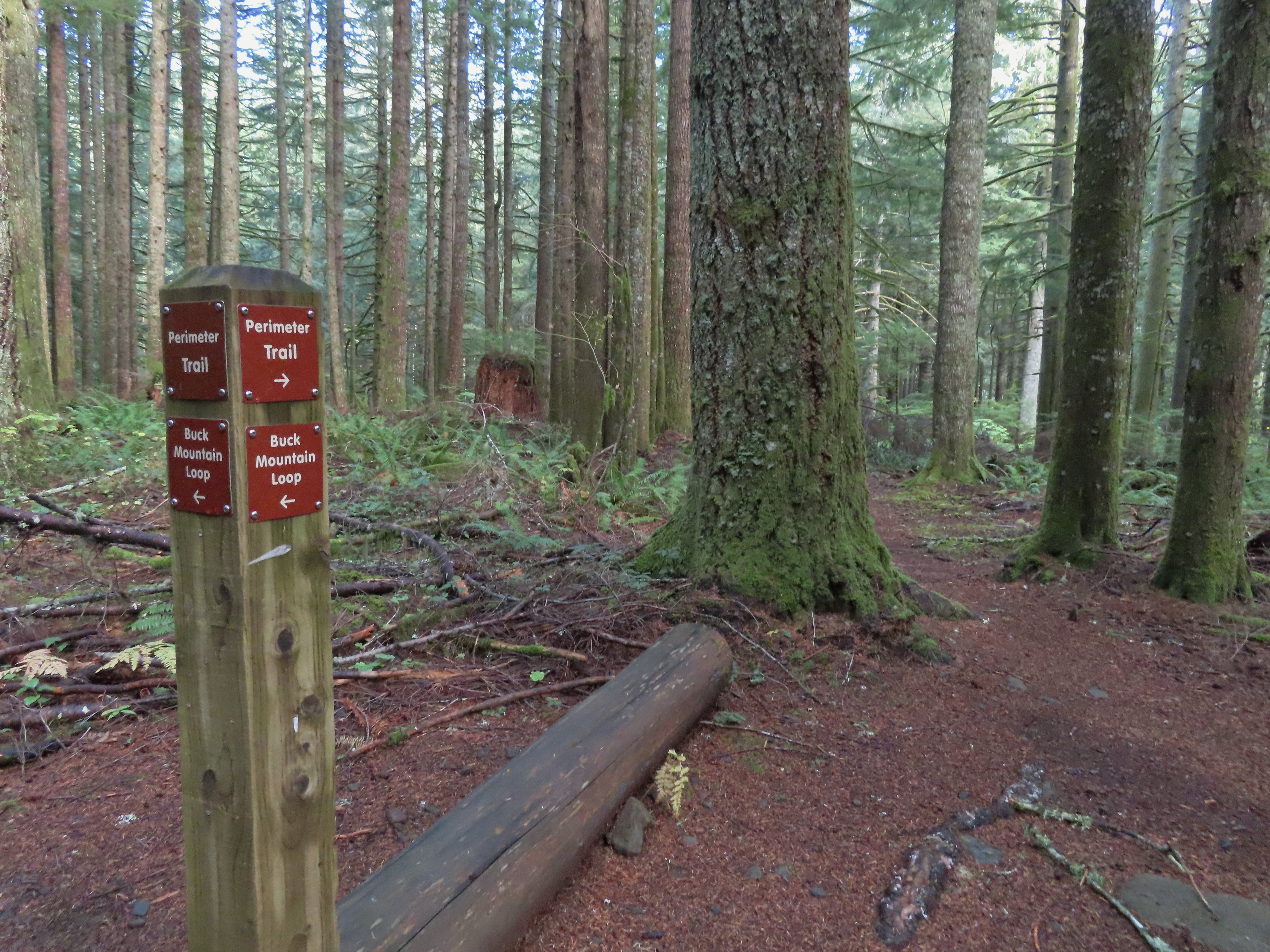
 A small opening on the way down.

 Footbridge over South Fork Silver Creek.
 South Fork Silver Creek


 I’m a hiker so I went right here.
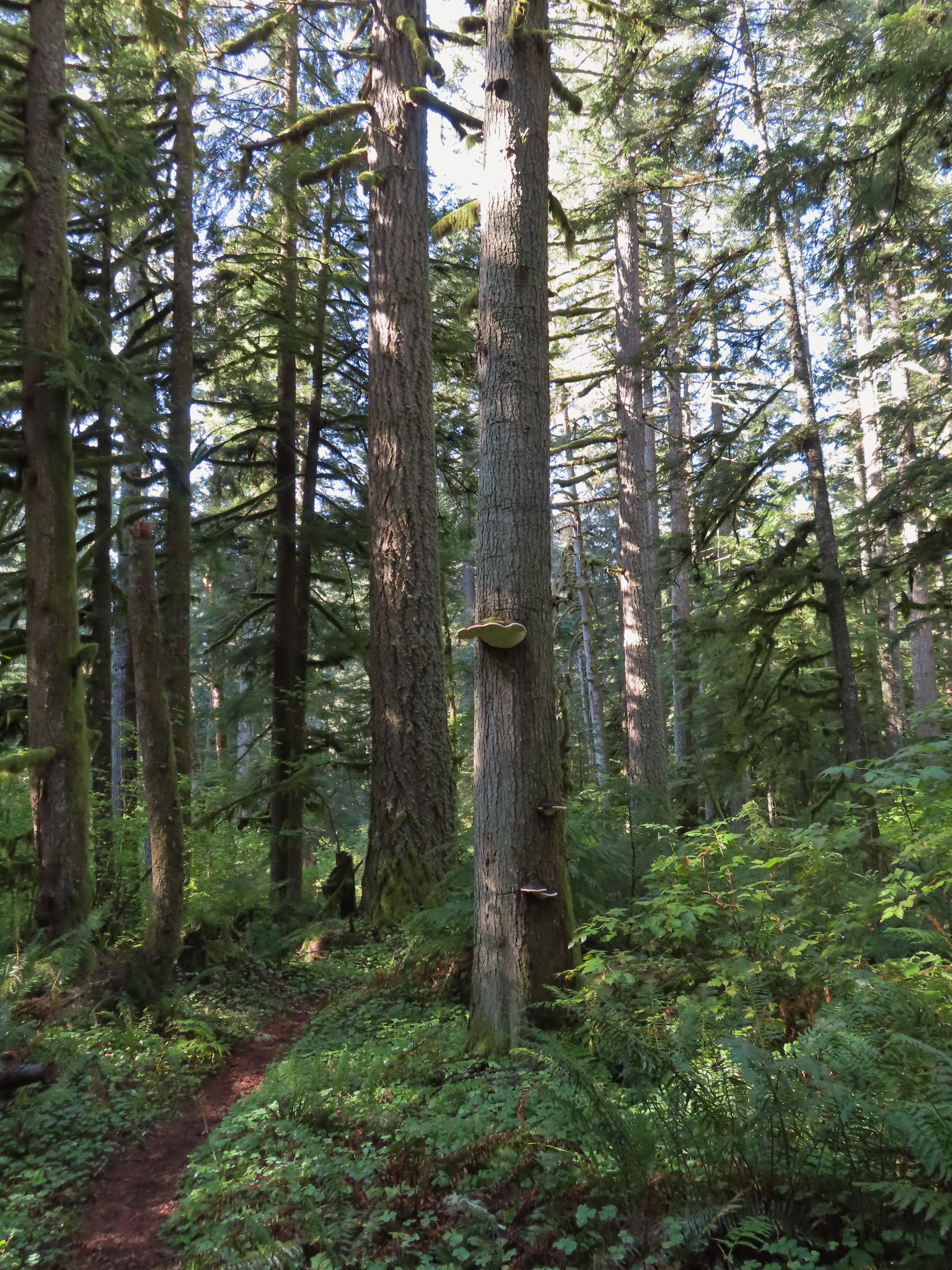 Big fungus on the tree ahead.
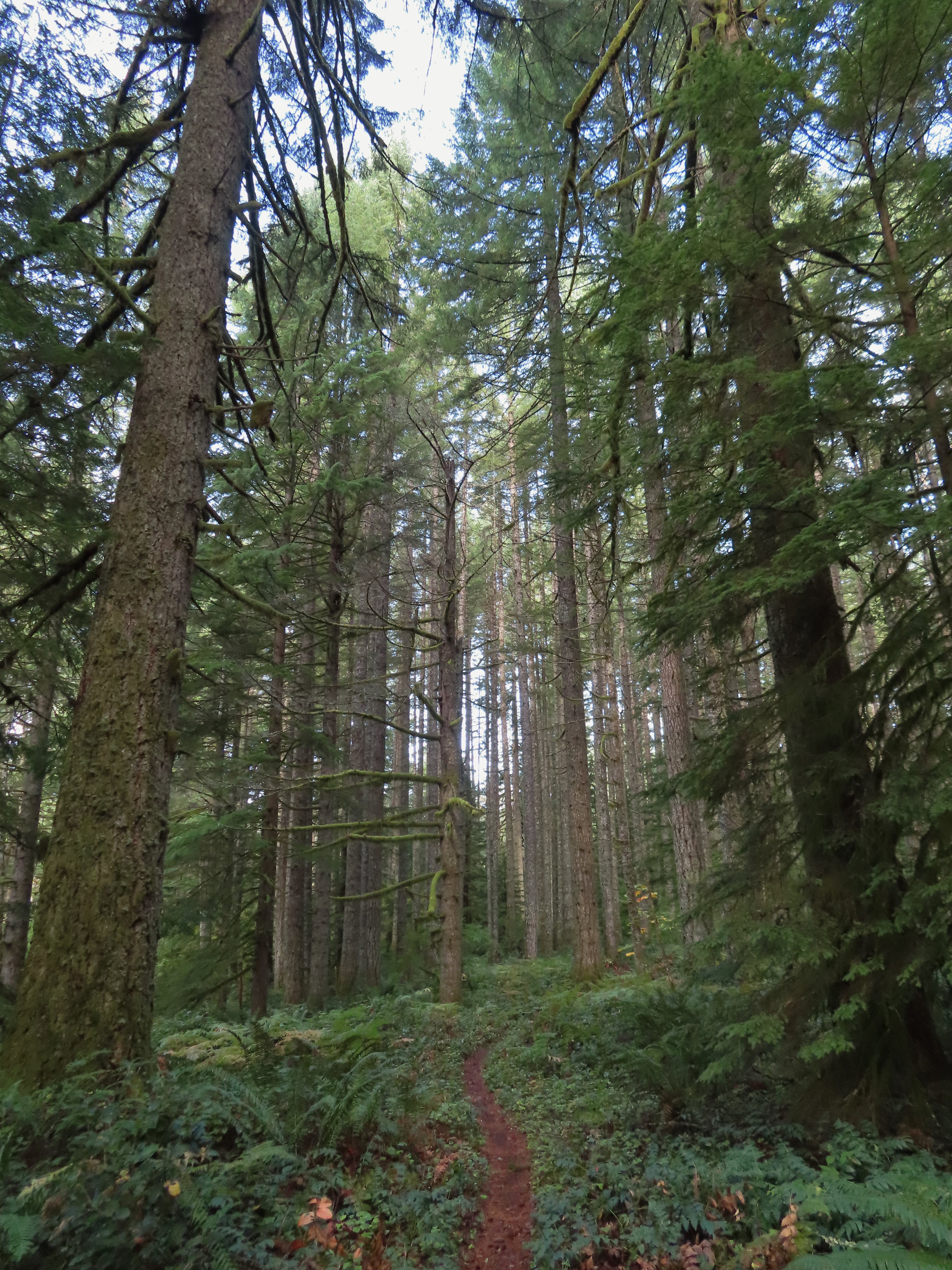

 Map at the Rackett Ridge junction.
 Another impressive nursery log.
 I stopped in this area to change out of my sweaty socks and into one of the extra pairs I’d brought expecting rain.
 The vegetation went through several changes as the trail lost elevation.
 This was a big tree in the midst of much smaller ones.
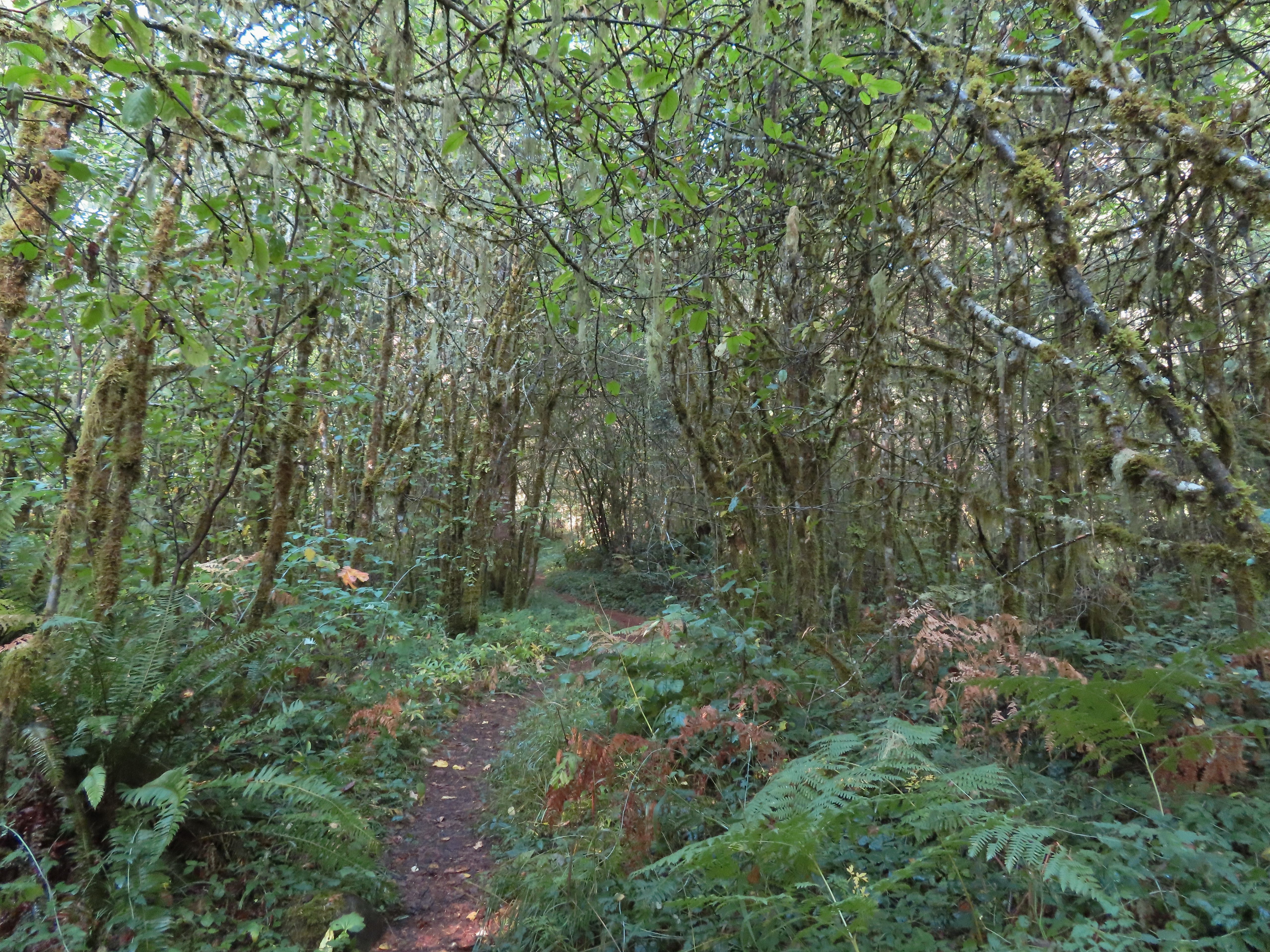
 Roemer’s Meadow Trail (left) isn’t shown on the park maps yet, but it was completed in 2021 with help from the
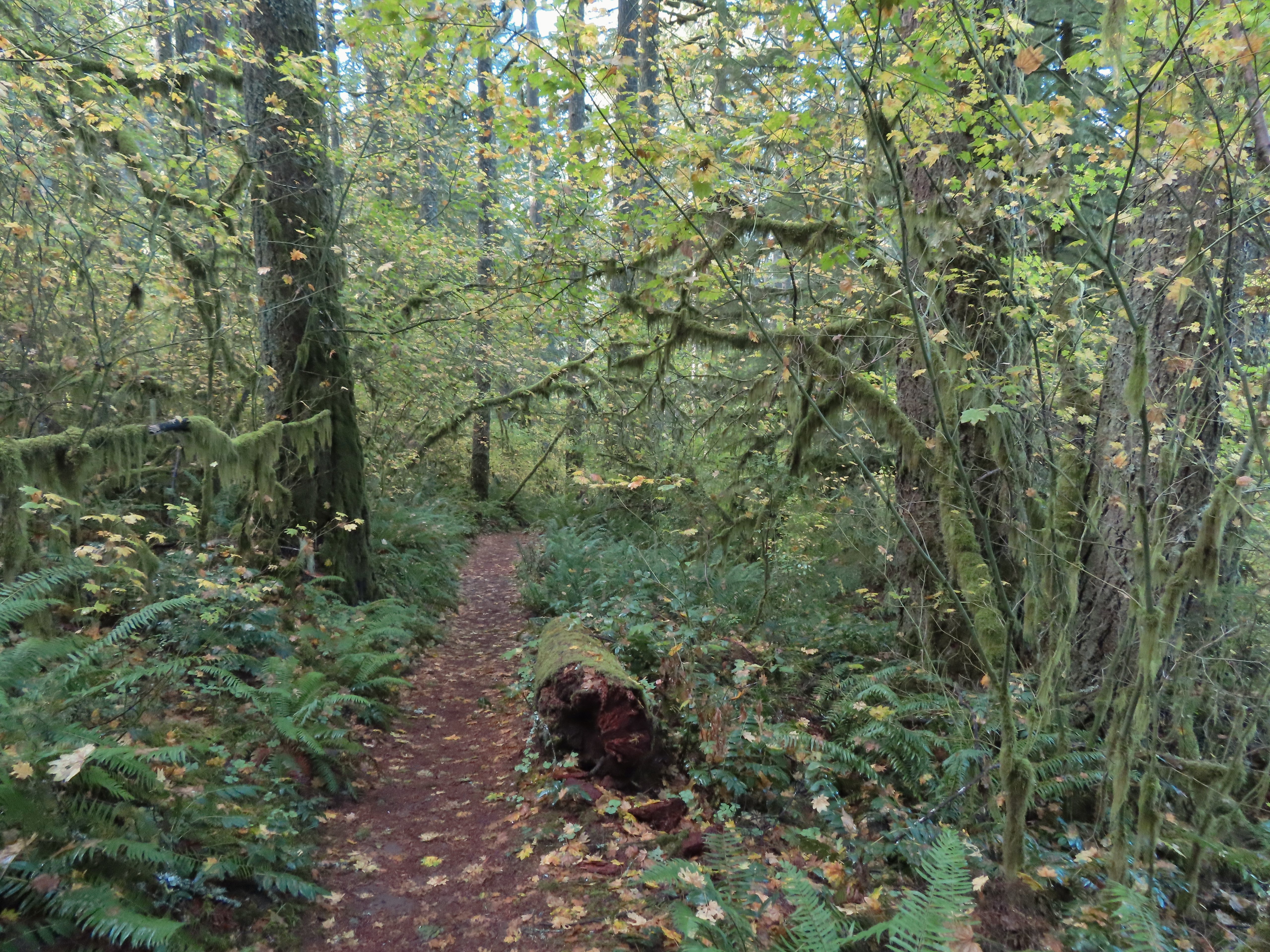
 The Trail of Ten Falls junction near Highway 214.
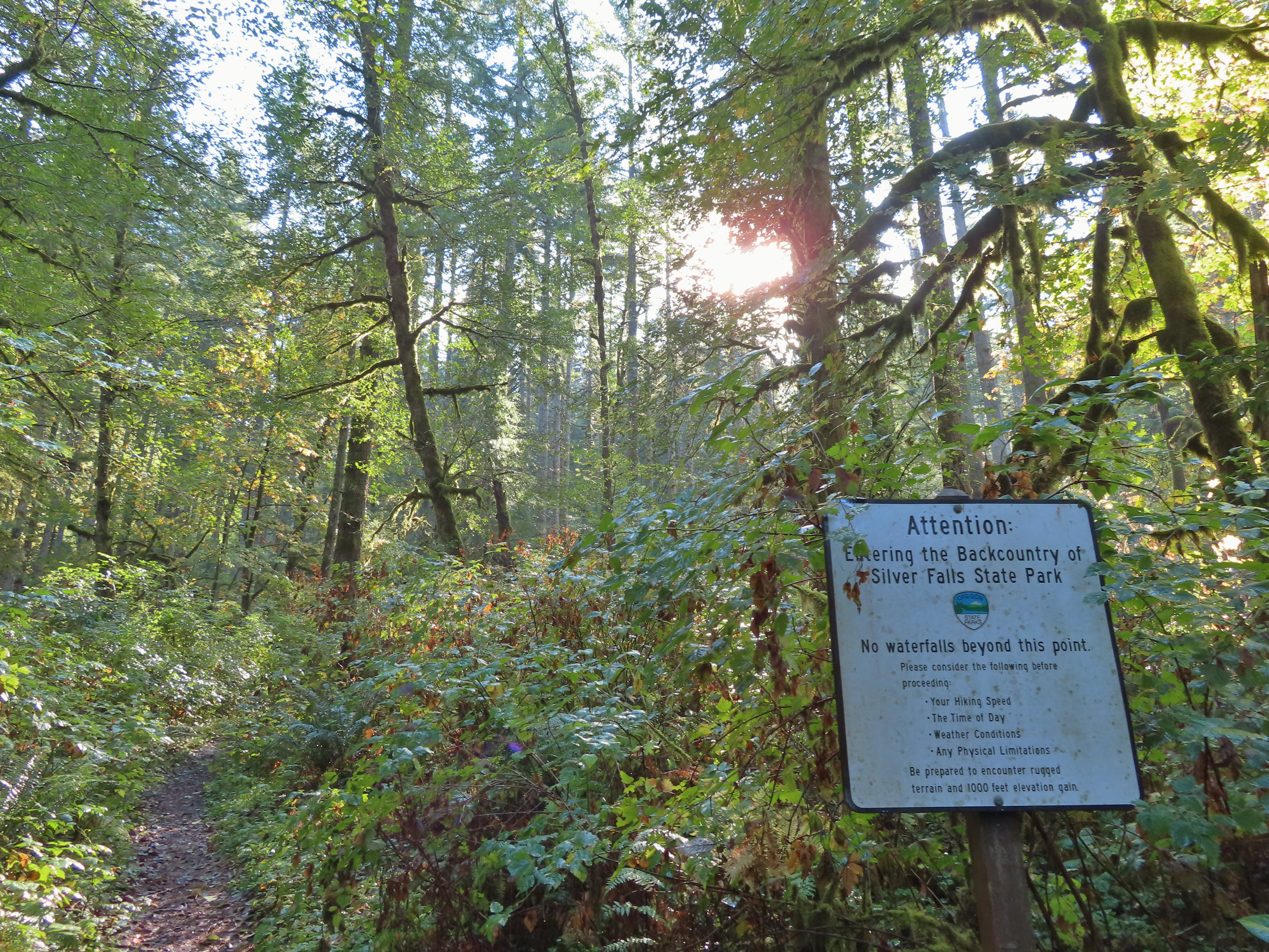 Looking back up the Perimeter Trail.
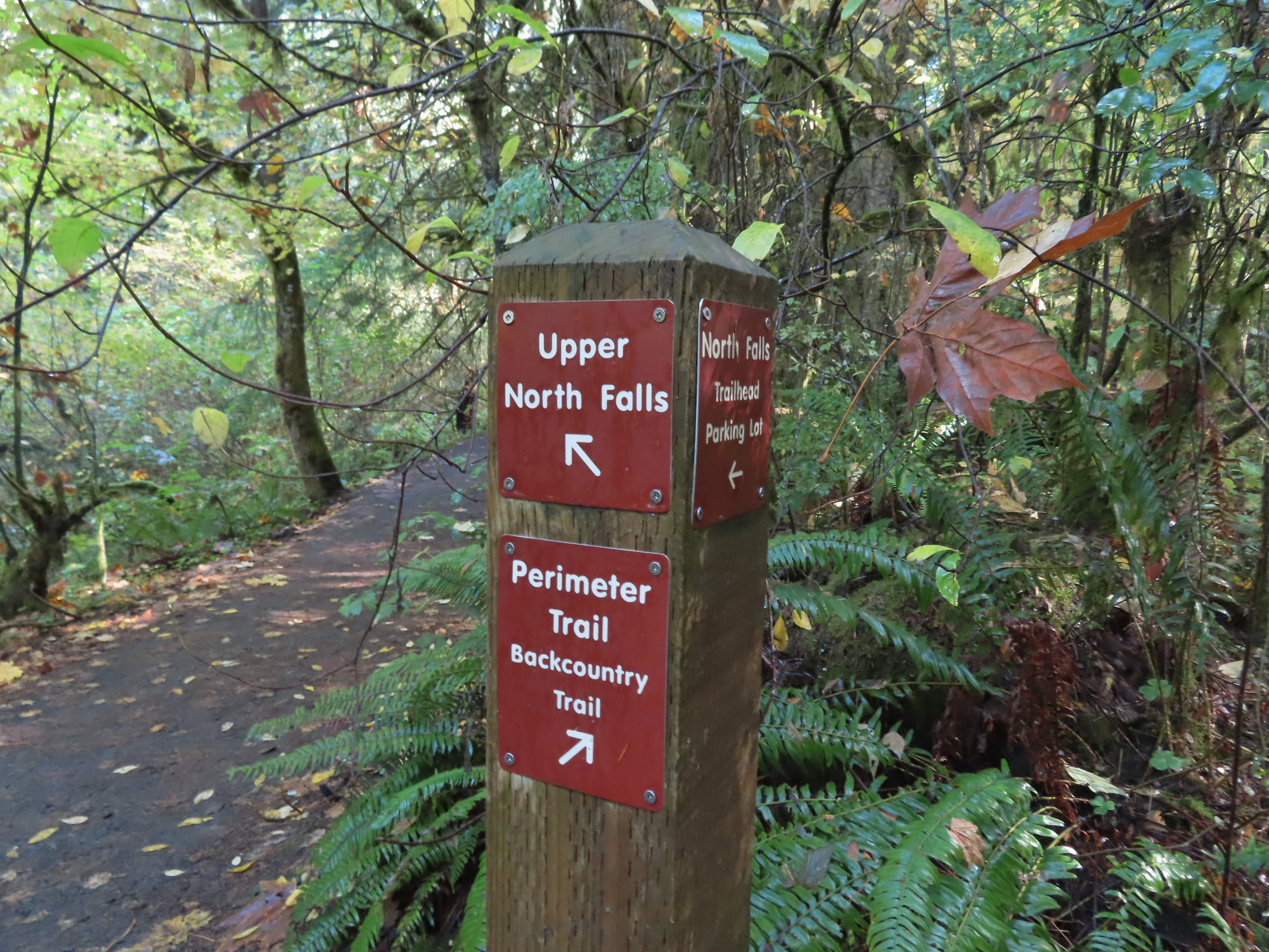
 Upper North Falls
 A left would have taken me to the North Falls Trailhead.
 The Rim Trail to the left and Canyon Trail to the right, both part of the Trail of Ten Falls.


 I’m always impressed by the size of this rock in the creek.
 Not Twin Falls, but a nice little cascade nonetheless.
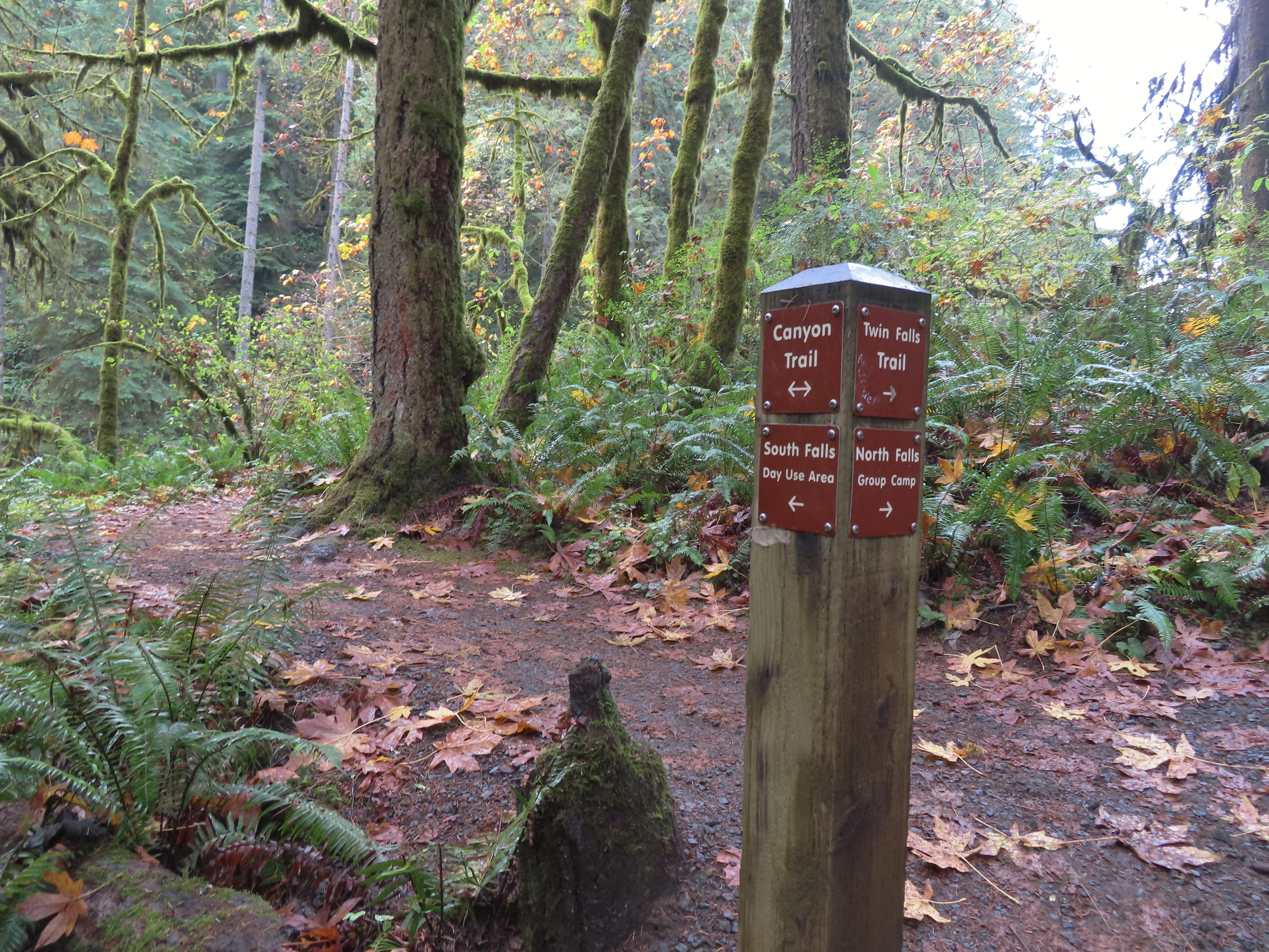 This post could be a little confusing without a map. The Twin Falls Trail climbs uphill to a group camp and does not lead to Twin Falls. The falls are the opposite side along a very short spur trail that connects at either end to the Canyon Trail.
 Twin Falls isn’t very easy to see from the spur trail either even though you’re right next to it.
 Twin Falls

 North Fork Silver Creek
 Winter Falls, as the name suggests it’s not much of a waterfall outside of Winter when rain and snowmelt provide more water.
 With the dry Summer it isn’t a great Fall color year but there was a decent display along this trail.
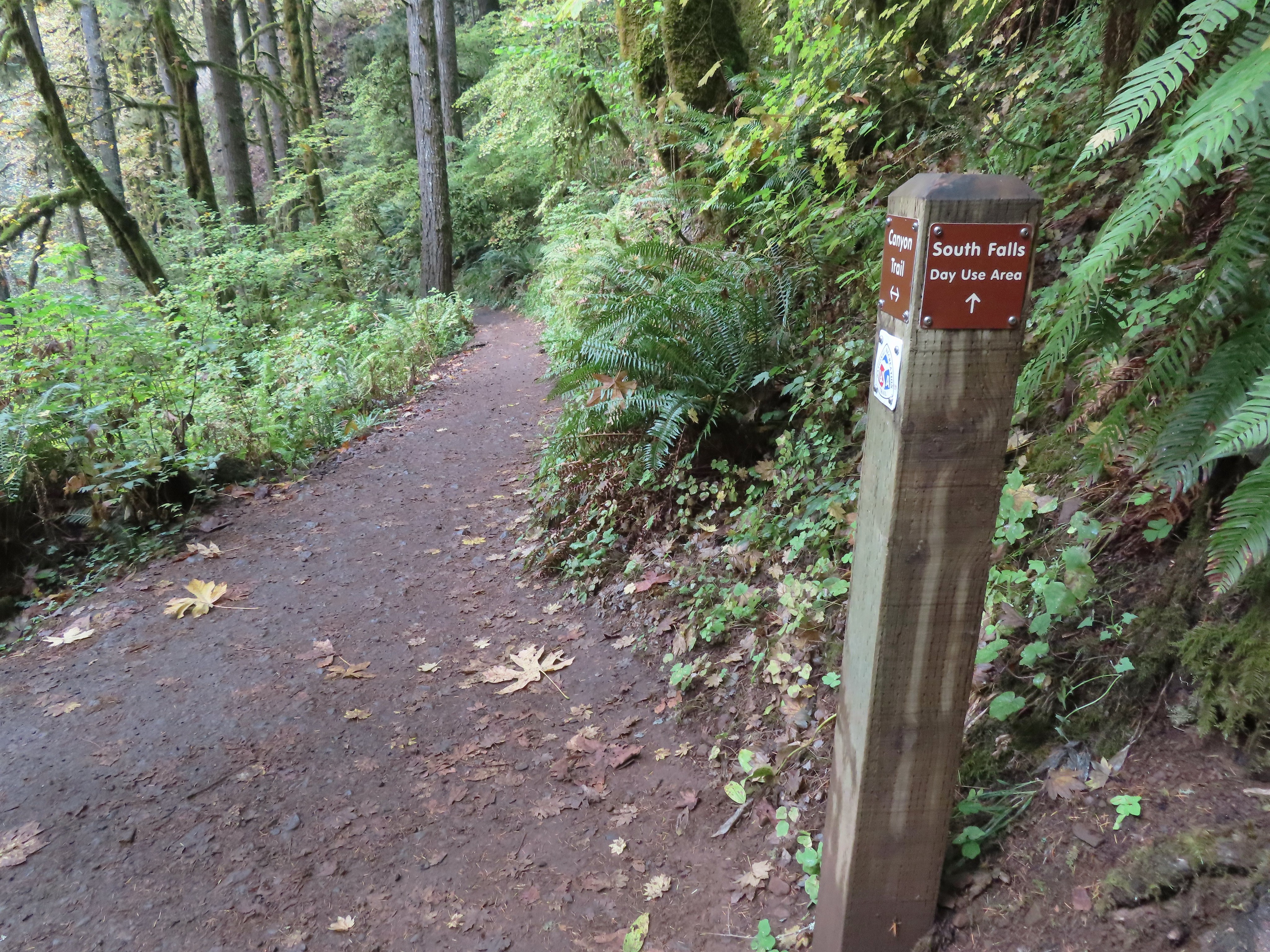 I turned left here on the spur trail behind Middle North Falls.


 Middle North Falls from the Canyon Trail.
 The 27′ Drake Falls.
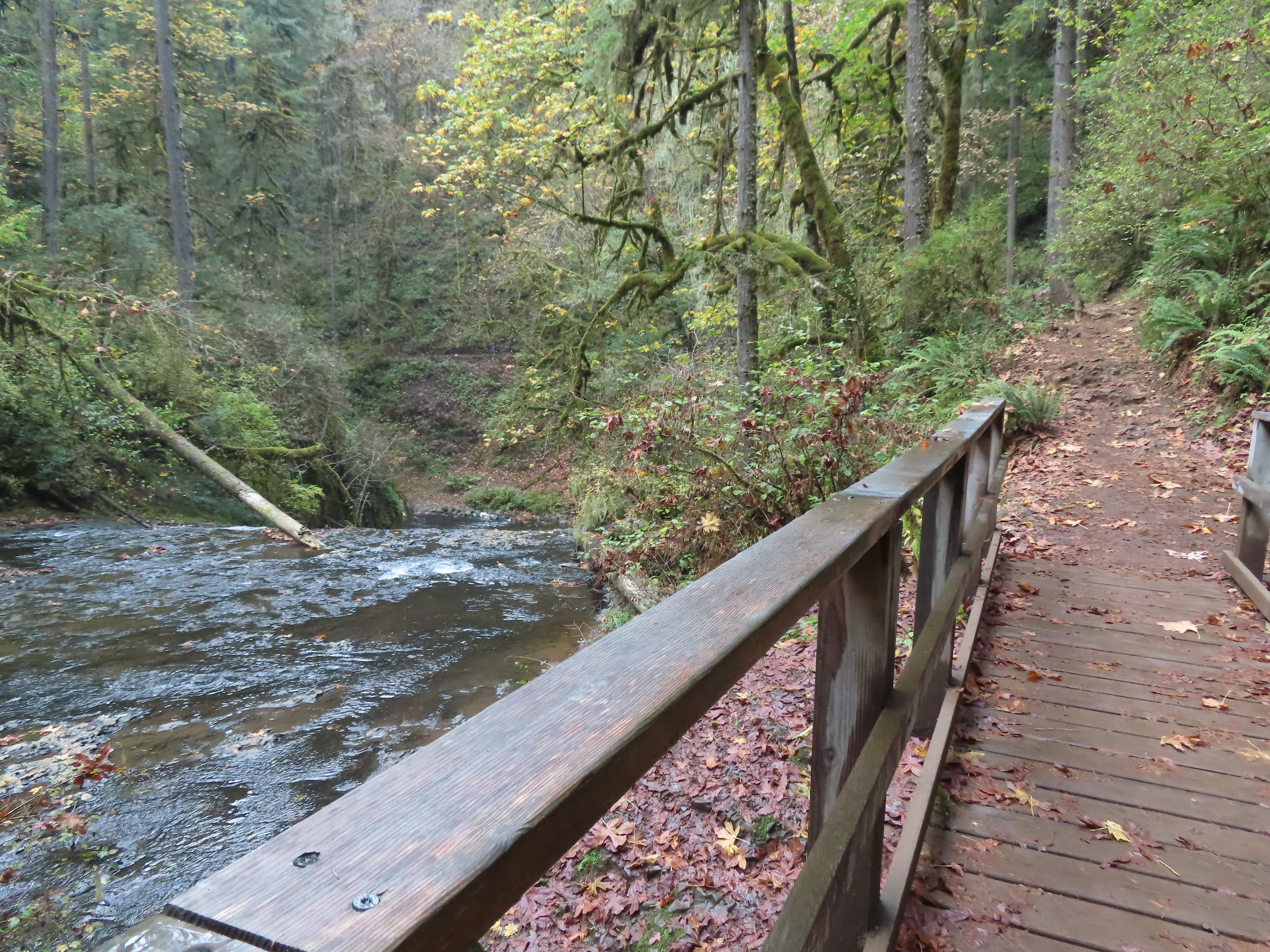

 The hiker at the base gives a good idea of the fall’s height, you just have to use your imagination to add water.

 The Canyon Trail crosses the creek just downstream from Lower North Falls then makes a short climb to get above the canyon cliffs.
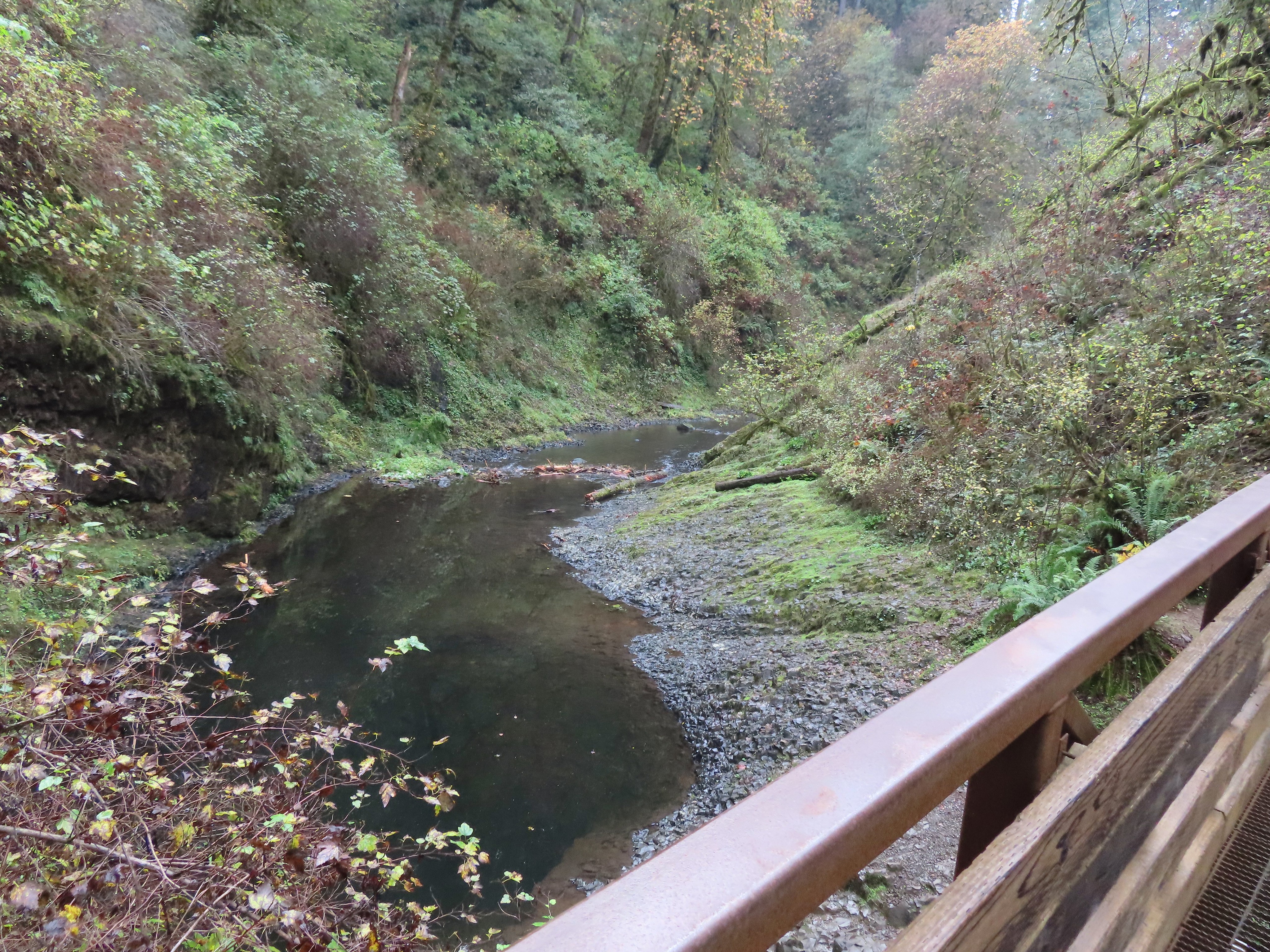


 I walked out onto the bridge for the view then returned to the junction to take the right hand fork and go behind this fall as well.
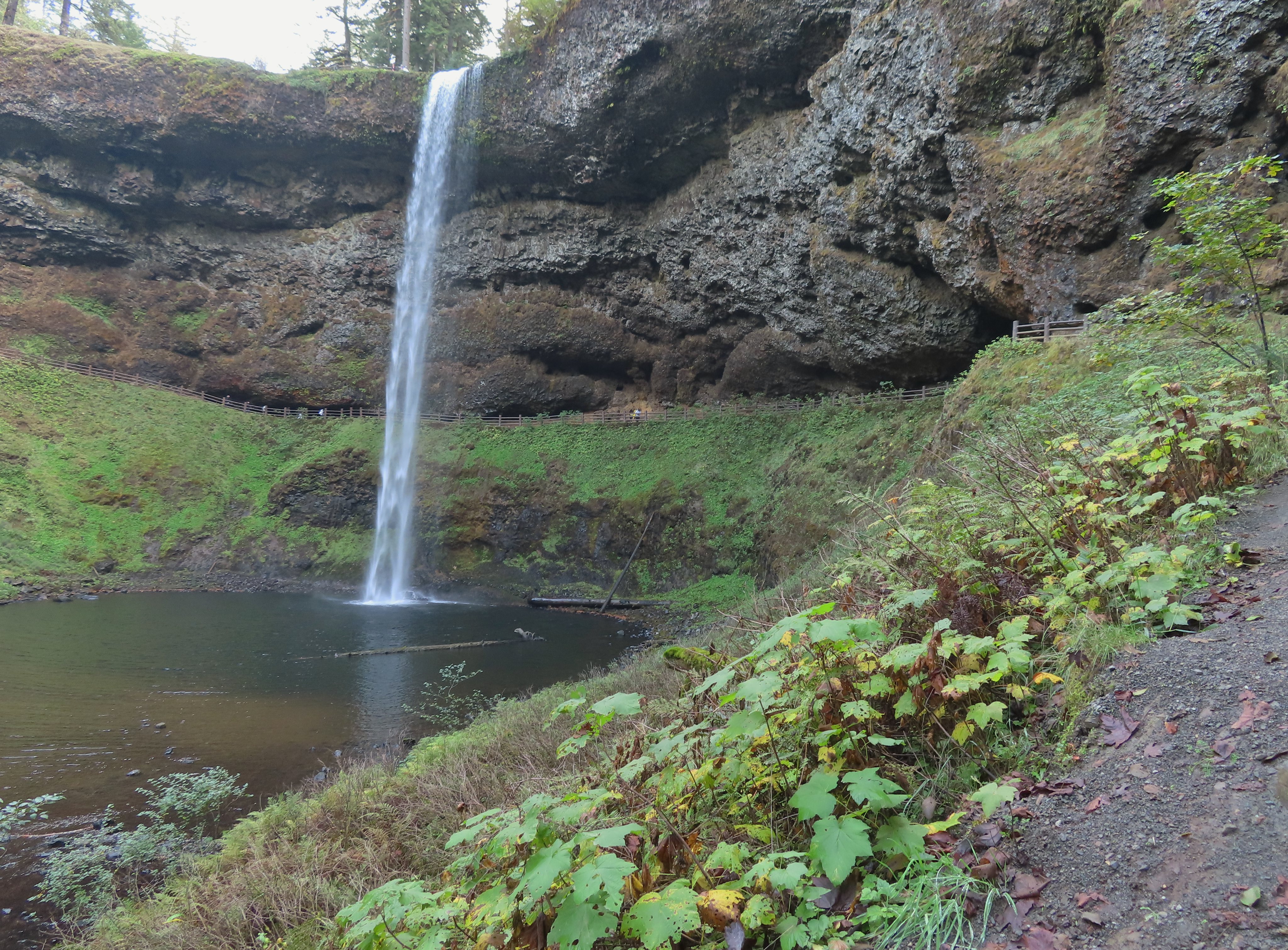


 View toward South Falls from the footbridge.
 Not sure what this old building was, possibly restrooms by the doors.
 One of several picnic shelters in the park.
 Approaching the Bike Path where I recrossed the creek.
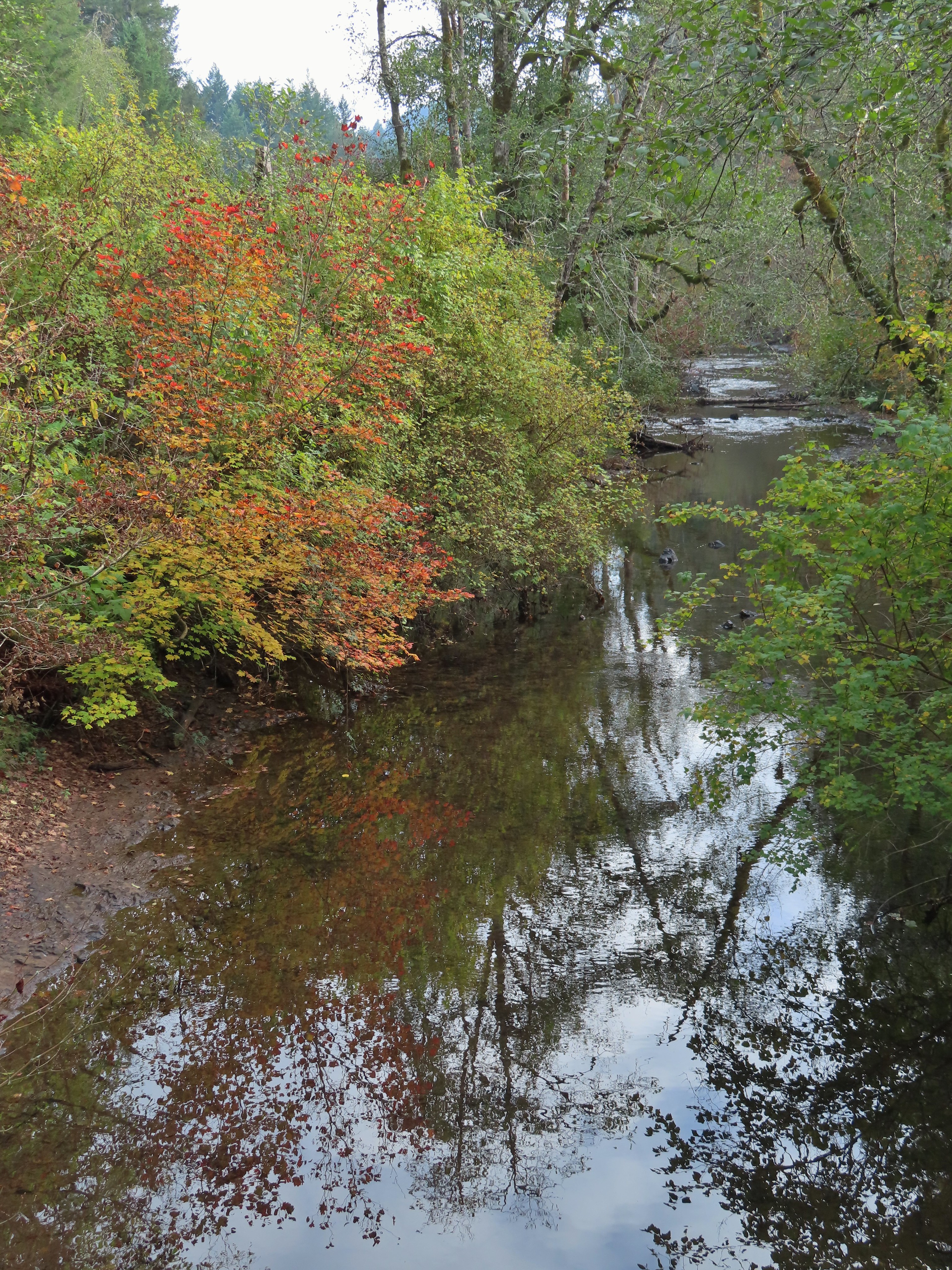
 I can see the car!


 March 29, 2018
 Toothwort
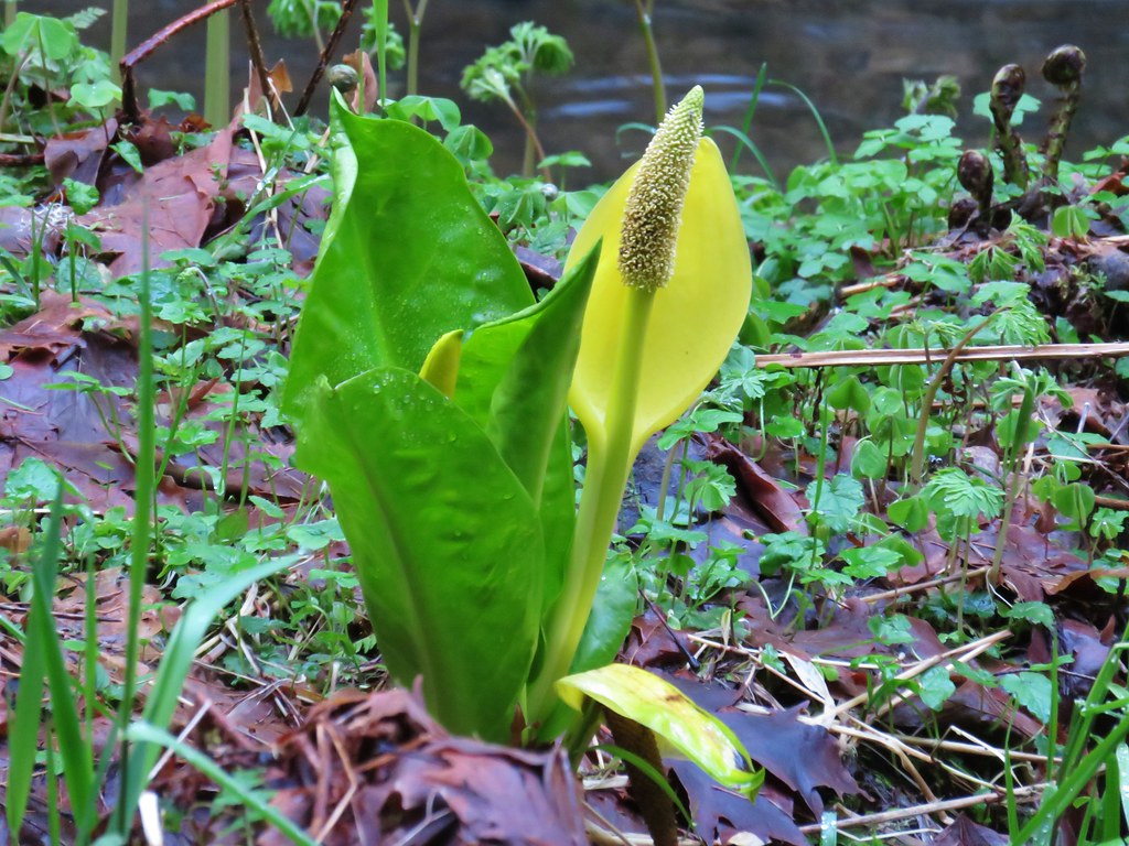 Skunk cabbage
 Salmonberry
 Indian plum


 July 7, 2006
 July 30, 2010
 March 29, 2018
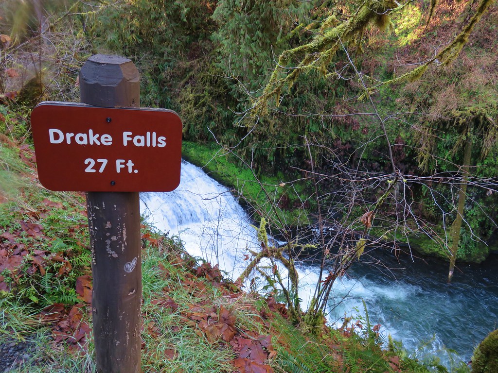
 July 7, 2006
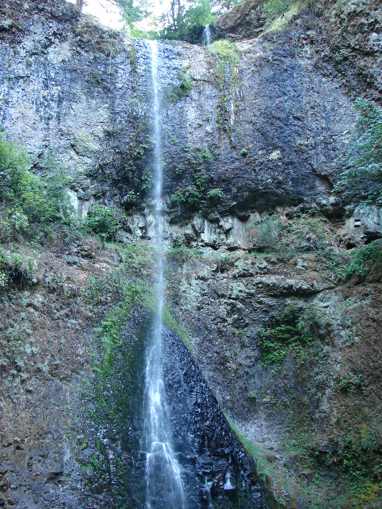 July 30, 2010
 March 29, 2018
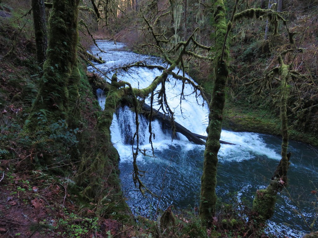


 July 7, 2006
 July 30, 2010
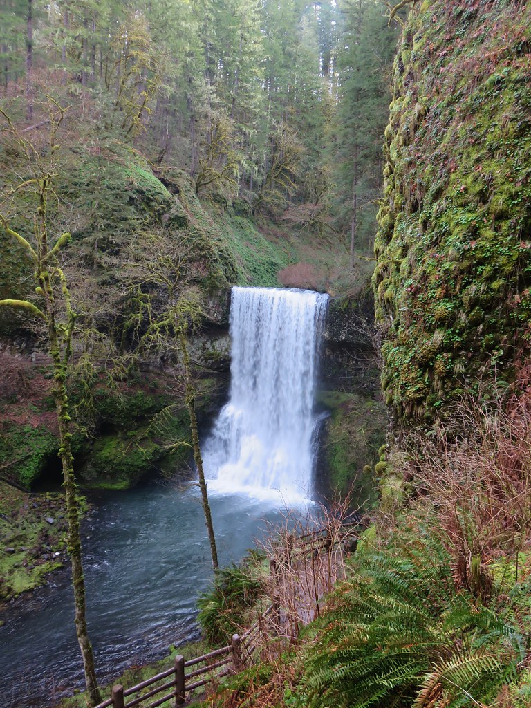 March 29, 2018
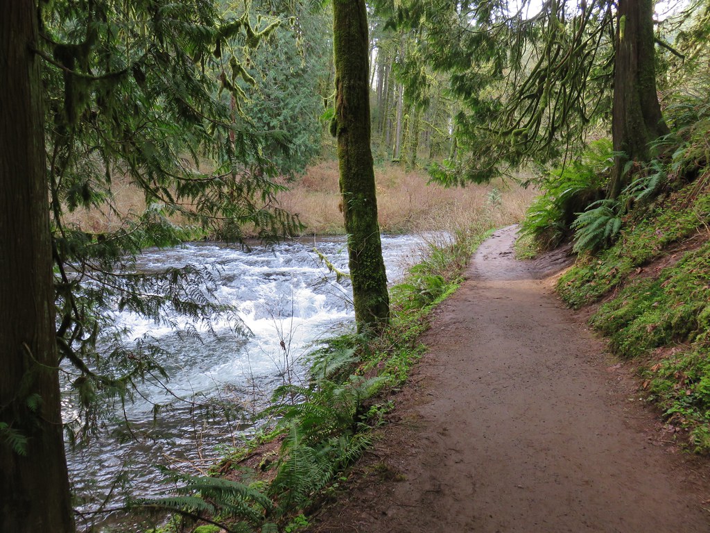
 July 30, 2010
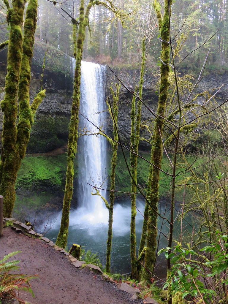 March 29, 2018