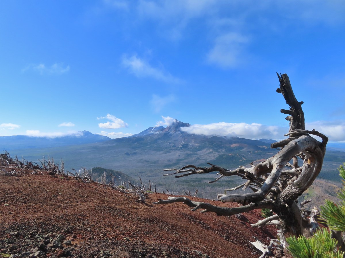
When we were working on our goal of hiking William L. Sullivan’s featured hikes (post) we had a few outings where we didn’t get a view from a viewpoint or summit due to the weather. Now that we’ve completed that goal we are revisiting some of those hikes in an attempt to get those views. One such hike was a 2016 outing to Black Crater in the Three Sisters Wilderness. We had tried several times in the past couple of months to re-hike this trail but either smoke from wildfires or possibly thunderstorms had stymied us. A mostly sunny forecast coupled with a high of just 49 degrees (Fahrenheit) meant it was finally time for a second visit.
Before tackling the climb up Black Crater we thought it would be a good idea to warm up with a short hike at nearby Dee Wright Observatory and the Lava River Trail.

While the plan was to “warm up” it was anything but warm as the cool morning air combined with a stiff breeze. We took advantage of the restrooms then visited the observatory where on a clearer day we would have had views of numerous Cascade peaks. Today however, despite the presence of some blue sky, nearly all of the peaks were hidden.

Black Crater, which is straight ahead, was one of the peaks covered by a cloud. We hoped that the mostly sunny forecast was still in the cards.

Mt. Jefferson through a break in the clouds.

Interpretive signs near the observatory.

Black Butte (post) to the right with Green Ridge (post) behind it.

Viewing holes are located around the observatory to help identify the peaks.

There is also a mountain finder atop the observatory.

List of what we could have been looking at.
After visiting the observatory, we walked to the east where the interpretive Lava River Trail leads into the Yapoah lava flow.

While we had visited the observatory before this was our first time hiking this short loop. The interpretive signs were very informative which more than made up for the lack of mountain views.


Little Belknap Crater (post).


Mt. Jefferson making another brief appearance.


There was no chance of spotting the Three Sisters.

Black Crater was still looking awfully cloudy.

The Dee Wright Observatory on the left.

As we concluded the hike it looked like the clouds might be breaking up over Black Crater.
After a rather chilly warm up hike we drove to the Black Crater Trailhead.

On top of not getting a view from the summit on that visit the 2017 lightning caused Milli Fire burned over the majority of the trail.
 Forest at the trailhead before the Milli Fire.
The sign at the trailhead states the summit is 4 miles away however it is really 3.6-miles. Either way the trail gains approximately 2300′.

The trail enters the Three Sisters Wilderness a short distance from the trailhead. In fact the wilderness sign is visible from the trailhead and as I was zooming in for a photo I realized there was a doe next to it.


The hike is about as straight forward as one can be. There are no trail junctions, no creek or river crossings, and no faint sections of trail. The climb is steady but rarely feels steep. There are plenty of views due to the Millie Fire but today the clouds were limiting those.


Mt. Washington hidden by a cloud.

Black Butte

Lupine

Cascade aster

Another aster, not sure which one.

Cloud hovering over Little Belknap and Belknap Craters.

The trail is well maintained.

Looking up toward the summit.

Rabbitbrush goldenweed
Junco

Yarrow

Bleeding heart and northwestern rabbit-tabacco

The fire spared the trees closer to the summit.

Beardtongue

One-sided wintergreen

Black Butte managed to stay out of the clouds for most of the morning.


Golden-mantled ground squirrel

Clouds passing by.

Cable for the former fire lookout.

The final stretch to the summit. There was a cloud passing over when I arrived and I wondered if there would be any views.
It was windy at the summit, but I took a seat on the rocks above the former lookout site hoping for the clouds to pass.

View to the NE into Central Oregon.

The summit of North Sister.

Scott Mountain in the center which we climbed a few weeks ago (post).
I had a snack while I waited but the clouds seemed to be getting worse and it was cold in the wind, so I decided to start back down.

Looking toward Broken Top and the North Sister.

Heading down from the summit.
I detoured to the western end of the summit where another rock outcrop sits.

Little Belknap and Belknap Craters beyond the rock outcrop.
It only took a minute or two to reach the other outcrop, but by the time I had the clouds had begun to finally open up.


Broken Top with Mt. Bachelor (post) behind to the right.

The summit from the second outcrop.


The Three Sisters. The summit of Middle Sister is just visible to the right of North Sister.


The west side of the Three Sisters Wilderness.

Collier Cone (post) below the North and Middle Sisters.

The Husband with Yapoah Crater (post) at the lower left of the frame.
I stuck around for a while as the clouds continued passing by, but when I started losing the view again I headed back.

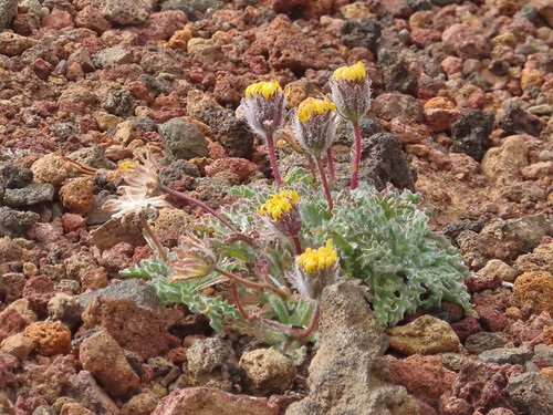
Dwarf alpinegold

The clouds coming in from the right were quite a bit darker than any had been so far.


Alpine mountain buckwheat

Mountain bluebird

Pussypaw

Fireweed and northwestern rabbit-tobacco.

It felt like it could start raining at any moment.

Beetle

Back at the trailhead.
The hike up Black Crater was 7.2-miles and we did about a mile at Dee Wright Observatory. Cumulative elevation gain was close to 2500′.

The two hikes for the day.
While it wasn’t quite a clear as we had hoped the views were vastly better than they had been on our first visit.

Dee Wright Observatory is a must stop if you are driving the McKenzie Highway and the Lava River Trail would be a great place to bring out of state visitors. The Black Crater hike is also a great hike providing a good workout and excellent views when the conditions are right. Happy Trails!
Flickr: Black Crater

