Categories
Hiking Trapper Creek Trip report Washington Washington Cascades

Observation Peak

**Note the 2020 Big Hollow Fire burned a portion of this hike.**

Unexpected is as fitting a description as I can think of for our visit to the Trapper Creek Wilderness in Washington. The first unexpected event happened before we even arrived at the trail head. I have mentioned before that we seem to see more large wildlife from our car than we do on the trail. As we were turning off the highway I noticed a large brown animal just a bit further up along the shoulder. I quickly turned around and got out the camera. It was an Elk just grazing on the side of the road. This was the closest we’ve been to seeing an elk on one of our hikes.
278

We created the next unexpected event when we parked near Bubbling Mike Spring at an empty sign board. This turned out to be the wrong parking area, but the road ahead was gated closed and we failed to notice the small sign around the corner to our left that pointed toward the campground. We set off on a clear trail toward Trapper Creek which we knew we needed to cross at some point. That path quickly ended at the creek with no dry way to cross so we backtracked and headed up the gated road. We spotted one footbridge that had a do not use, danger sign posted on it as we passed several cabins that sat along the creek. The road veered away from the creek and just after crossing a small stream we decided to head back and work our way up the creek bank to see if we could find a crossing that way. No sooner had I recrossed the stream when I heard quite a commotion behind me. I expected to see Dominique on the ground since he is the most prone to losing his balance but instead it was Heather sitting in the middle of the stream. She banged her hand up pretty good but was fortunate not to have hit her head or hurt her legs. Her pinky though was already swelling and slightly discolored. We hadn’t even found the official trail yet and we had a “man down”. She decided she wanted to try and continue the hike so back we went to searching for a dry way across.

After wandering up and down we settled on trying a downed tree that appeared to be flattened on top for crossing. It led to the back of a couple of cabins on the far side of the creek so we quickly ducked past them onto the access road that led to them. Our map showed that this road would lead to the trail we had been seeking so we headed left and soon had found it.

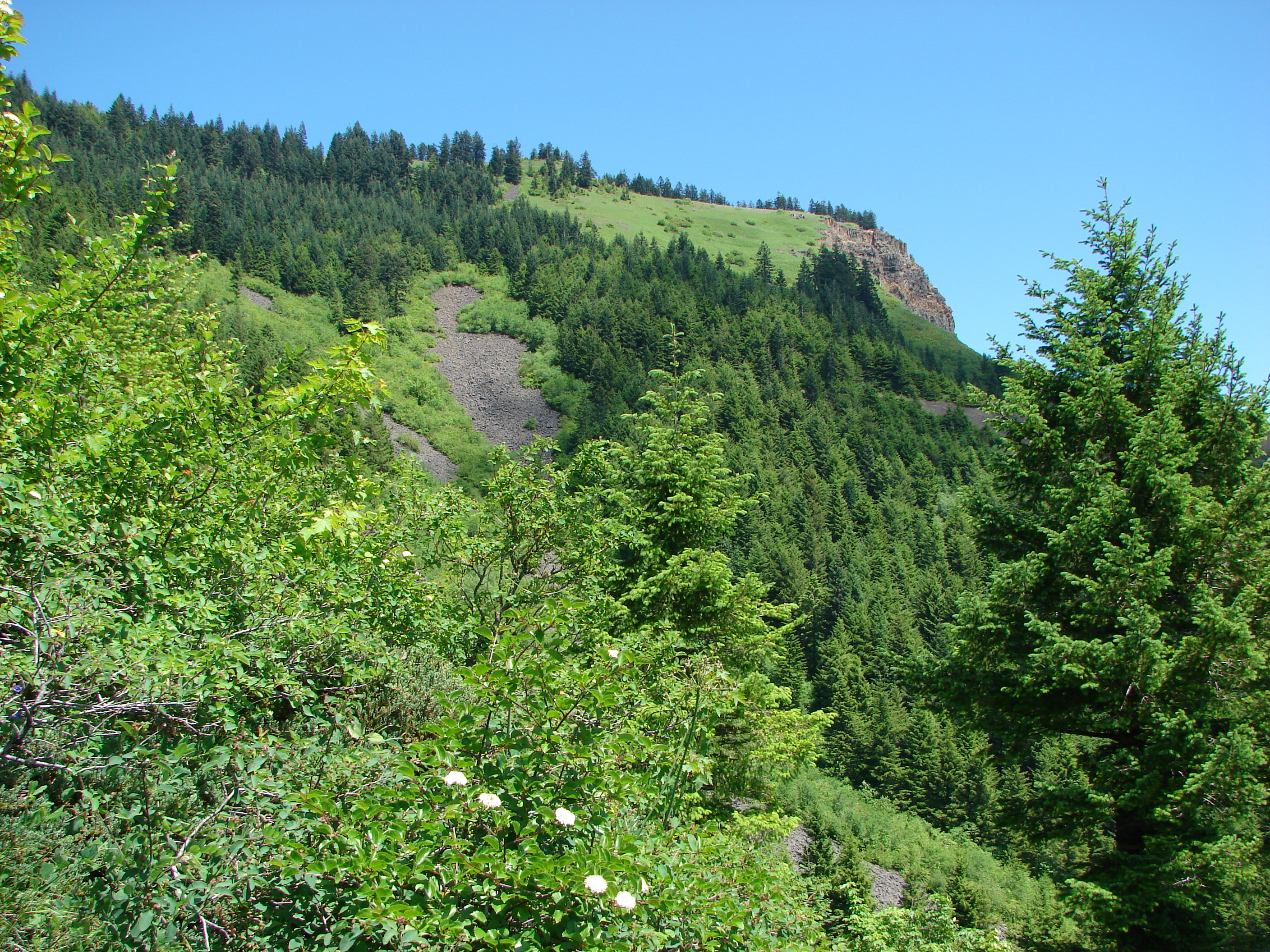
We entered the Trapper Creek Wilderness and paralleled Trapper Creek through a dense forest. If you love old forests and the sound of flowing water this would be a great hike for you. If you are after views and wildflower meadows skip this trail and take the Observation Peak Trail from road 5800 as described in Sullivan’s 100 Hikes book. The trail went up and down occasionally offering glimpses of the creek below. After 2.5 miles the path crossed Hidden Creek and shortly after a pair of signs pointed to Hidden Falls. We decided we needed to check this out so we struck off on the faint trail up a ridge to a nice camping spot. Hidden Falls was below down a steep hillside which Heather and I picked our way down. We were able to make our way to the base of the secluded falls and then had to climb back out of the canyon.
343

From Hidden Falls the Trapper Creek trail began to climb a long series of fairly steep switchbacks. We crossed the creek again after the first set of switchbacks and then launched upward again. A nice viewpoint along the way overlooked Trapper Creek Falls across the valley backed by Observation Peak. The trail eventually leveled out, recrossed Trapper Creek, and then came to a junction with a trail labeled “Shortcut Tr. 129B”. Dominique was all for taking any trail that had the word shortcut in it’s name so we turned up it. I don’t know how much of a shortcut it was, but we were soon at another junction, this time with the Observation Peak Trail.

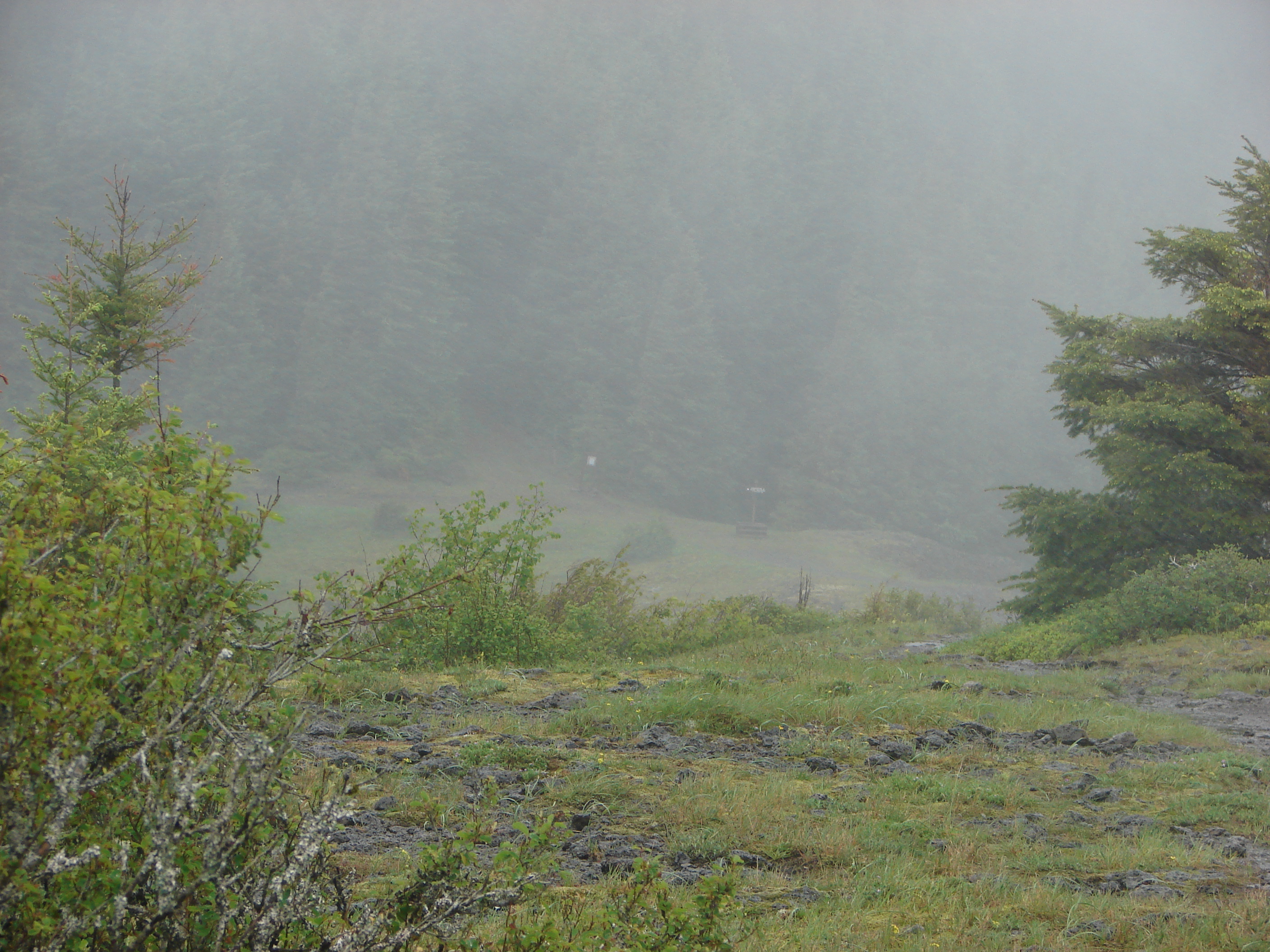
We headed up toward the summit through a forest with large bear grass plumes and many other smaller white flowers. After about a half mile of climbing we reached the lower viewpoint. This first viewpoint was on a rocky outcropping dotted with white cats ear blossoms. It had been a nice day, with blue sunny skies and a occassional breeze that kept it from being too warm but we found that clouds were hanging around the Washington peaks covering each of them to some degree. Never the less the view was impressive and the view from the actual summit promised to be even better. We returned to the trail and continued up another .2 miles to the summit passing bear grass blooms and other various wild flowers. As we approached the summit, Mt. Hood appeared over the right shoulder of Observation Peak with a faint Mt. Jefferson nearly hidden by haze further to the south.

Mt. Adams and the Trapper Creek Wilderness from Observation Peak

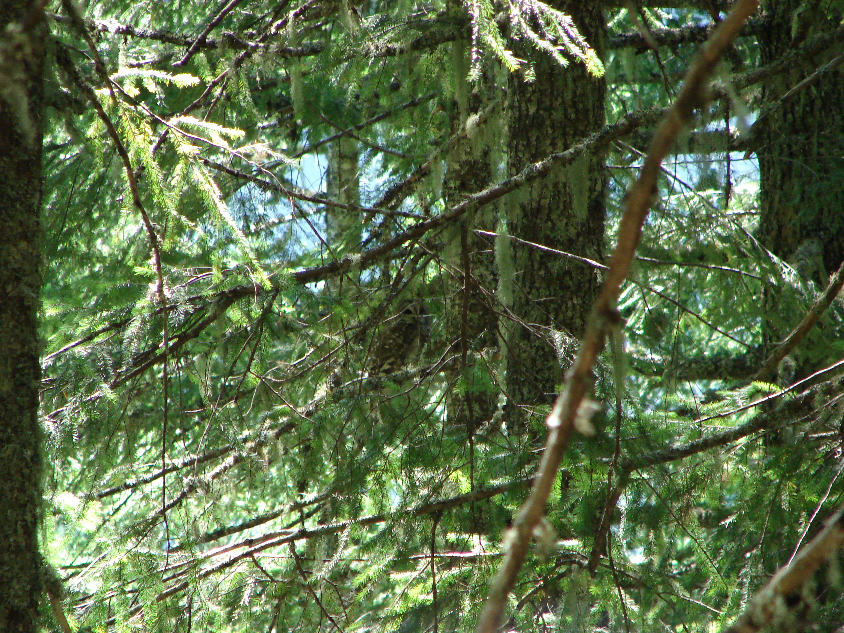
After a short rest we headed back down from the summit and turned right at the trail junction to begin our descent down Howe Ridge. We had a little over 5 miles down this pleasant trail to get back to the car. It gradually descended through the forest crossing numerous small streams and we were able to make good time. We spotted a small snake and later I came around a corner to find myself staring straight at an owl about 10 yards away. When I reached for my camera it flew to a nearby tree but I was able to get
a couple of decent pictures.
474

Our feet were sore and legs tired when we finally reached Trapper Creek and we didn’t care about finding a dry crossing. Our car was almost directly across from us so we just walked into the water and crossed. What was supposed to have been a 13.3 mile hike turned into a 15.8 adventure. Despite a few mosquitoes (much less than our last hike) and Heather’s bruised hand it had been a pretty good day. There was only one way to end a day like this – with pizza 🙂 Happy Trails.

Photos – Facebook https://www.facebook.com/media/set/?set=a.10201538005439185.1073741841.1448521051&type=3
Flickr http://www.flickr.com/photos/9319235@N02/sets/72157634535134225/

Categories
Hiking Silver Star Mountain SW Washington Trip report Washington

Silver Star Mountain

HOT! That certainly describes our recent visit to Silver Star Mountain, but that would be doing this hike a great disservice. Despite the 90 degree temperatures better descriptions would be amazing flowers, great views, and beautiful scenery. Silver Star Mountain is located in Washington State’s Gifford-Pinchot National Forest between Mt. St. Helens and Portland, OR.

I’d been wanting to visit Silver Star for a long time, but the timing hadn’t been right until now. I had seen a number of trip reports which indicated now was a good time to catch many of the wildflowers that fill the meadows and the weather called for clear skies, the perfect combo. There are a number of possible approaches to the 4390′ summit but for our hike we chose to approach from the north via Ed’s Trail.

The drive to the trail head was tedious with the last 9 miles taking a good 45 minutes due to poor road conditions. Our plan was to hike a big loop sampling as much of the area as we could so we knew we had a long day ahead of us. It was already over 60 when we arrived at the parking area at 7:15. The sky was clear and the birds were out in force as we headed up the north flank towards the junction with Ed’s Trail. Mt. St. Helens loomed behind us and as we climbed Mt. Rainier and later Mt. Adams joined the horizon. As we approached the junction with Ed’s Trail Mt. Hood appeared through a gap ahead surrounding us in Cascade peaks.

Mt. St. Helens & Mt. Rainier from the jct with Ed's Trail
Mt. St. Helens & Mt. Rainier from the jct with Ed’s Trail

Already the flower display had been amazing. The variety of flowers was one of the best we’d seen. There was red paintbrush and columbine, pink nootka rose, purple lupine and iris, orange tiger lilies, white beargrass and thimbleberry, and (new to us) yellow lupine. The meadows here are due in large part to the 1902 Yacolt fire which swept over Silver Star Mountain removing the trees and clearing the way for the flowers. I could easily fill this whole trip report attempting to describe the flowers we saw on this day but the hike had other things to offer as well so I will have to let our photos do much of the flower reporting.
056

Ed’s trail was truly scenic as it traversed the NE side of the ridge through wildflower meadows with views of the 4 snowy Cascade peaks. Soon the path passed some rocky areas and passed through a natural rock doorway. Not long after passing through the doorway we scrambled up a short, steep section of the trail as it passed through a rocky slot up to a great viewpoint. A small patch of snow remained surrounded by avalanche lilies.

When Ed’s trail met an old road we took it up to the twin summits of Silver Star mountain. The view from the north summit was a true 360 degree panorama. Mt. St. Helens, Mt. Rainier, and Mt. Adams were joined by snow covered Goat Rocks to the north while Mt. Hood, Mt. Jefferson, and the faint Three Sisters rose to the south. The Columbia River and Portland, OR lay to the SW while the ridges and meadows of Silver Star Mountain surrounded us in every direction.

Washington Cascades form the summit

After leaving the summit we continued on to the Indian Pits trail to visit a series of rock pits used as vision quest sights at one time. More wildflower meadows awaited on this trail which ended at a rocky ridge endge with yet another set of wonderful views. As an added bonus we were serenaded by a resident swallow who appeared to be enjoying the view from the top of the rocks as much as we were. It was really starting to warm up as we left the pits and continued on our loop down an abandoned road past sturgeon rock. The old road was actually lined with trees but it was wide enough to remain in the sunlight.

We made our way down the road to the Tarbell Trail which we then turned right (north) on and momentarily entered the forest. The trees didn’t extend far to our left and we could see that much of the hillside below had been clearcut. It is a sight that I don’t particularly enjoy seeing. The stark contrast of the stumps and piles of slash next to the still standing forest always leaves me imagining what it must have once looked like. We were on a collision course with the cut though and soon emerged to the treeless hillside. One of the first things we noticed were the butterflies. They were everywhere and flitting above a vast array of wildflowers. Even the clearcut couldn’t spoil the areas scenery 🙂
604

The lack of trees did mean we were once again exposed to the sun and for about 2 miles we switchbacked down and across the hillside before again reaching the forest on the other side. We were greeted by the first sound of water on the hike. The source was Coyote Creek and that was where we would find our next destination, Hidden Falls. What a welcome change to the heat Hidden Falls was. A bench near the 92′ cascade gave us a place to rest while we cooled off courtesy of the breeze created by the falls.
653

After another mile and a half on the Tarbell Trail we arrived at the Chinook Trail which would take us up Kloochman Ridge and back to the road we had been on early in the morning. The Chinook trail spent a short time climbing in the forest before emerging in some of the hikes best wildflower meadows. The number and variety of flowers on this ridge trumped all the others we had been through on this day.
747
This was also the steepest trail we’d been on and with the temperatures hitting the 90s we needed all the distraction the flowers could provide.

We eventually made it up Kloochman Ridge and then headed back down the road to our car and the extra water that was stashed in our cooler. This was one of the rare occasion when I actually finished off all the water in my Camelbak (1/4mi from the car). Silver Star Mountain had lived up to all the hype I’d seen in the trip reports. With a little something for everyone it’s an amazing area and I highly recommend exploring any of the areas trails. If you’re a fan of beargrass skip next year since it only blooms every 2nd or 3rd year and this year it was on, or better yet go both years and see the difference. Happy Trails and have a safe 4th of July.

Facebook album https://www.facebook.com/media/set/?set=a.10201492927112255.1073741839.1448521051&type=1
Flickr photos -http://www.flickr.com/photos/9319235@N02/sets/72157634416726411/

Categories
Columbia Gorge North Hiking Trip report Washington

Table Mountain

If at first you don’t succeed, try, try again. After our recent string of cloud obscured views I was determined to break the streak. I had been watching the weather forecast all week and decided everything was lining up perfectly for a return to the Columbia Gorge and another attempt at a view of the Cascades. The nasty weather and the poncho attack on Hamilton Mountain needed to be avenged so for this hike I picked Table Mountain.

Table Mountain is located less than 5 miles east of Hamilton Mountain. It should have been what I was looking at from the saddle when I was sucker punched by the poncho during that hike. Much of Table Mountain collapsed into the Columbia River centuries ago leaving dramatic cliffs on the south face. With an elevation of 3417′ it is nearly 1000′ taller than Hamilton Mountain so the potential for views is great.

We woke up to a beautiful sunny morning but as we approached Portland an ominous cloud hung to the east of the city. The skies all around were blue and we hoped that Table Mountain was far enough to the east to be clear of the cloud. We formulated a plan b just in case when we reached Hamilton Mountain which was once again covered in clouds, but when we arrived at the trail head behind Bonneville Hot Springs the summit of Table Mountain was cloud free. With blue skies to the north and east we decided to give it a try.

The first 2.2 miles of the trail pass through a pretty forest, first on a volunteer created trail, then following an old road up to the Pacific Crest Trail (PCT). This first section was nice but unremarkable although we did come across some ripe salmonberries to sample. After a short walk on the PCT we reached the sign for the loop trail to the summit of Table Mountain. The aptly named Heartbreak Ridge Trail gains 1770′ in 1.5 miles. In order to do this the trail heads up with a vengeance. After 0.6 miles (and 800′ of elevation) the trail arrived at a saddle viewpoint. To my dismay the clouds that had been to the west were now heading east obscuring much of the view and had now covered Table Mountains summit. The trail then dipped down to the base of a 500 yard long rock slide where we spotted our first beargrass bloom of the year (on a hike not from the car).

The trail appears to end at the rock slide but the rocks are the trail. Following poles we scrambled up the rocks to the continuation of the trail. This part proved to be quite fun. Just a few tenths of a mile after reaching the trails continuation we reached the meadows on the summit. An all to familiar view greeted us here. We had come all this way and couldn’t see more than a few hundred feet due to clouds. The meadows were filled with various wildflowers creating a colorful display and many plumes of beargrass stood at attention along the meadows edges.

As we headed south along the summit trail toward the viewpoint at that end a faint window opened in the clouds and there stood Mt. Hood. The clouds had begun to slowly break up and by the time we reached the viewpoint better and better views were opening up.
201
We could now see Mt. Hood and the tip of Mt. Jefferson at times. Below we could see the Bonneville Dam on the Columbia River and the Heartbreak Ridge trail as it crossed the viewpoint saddle. We spent awhile here waiting for the openings and then headed back down the trail to find a spot for lunch.

We chose a spot that offered a view to the north and east in addition to Mt. Hood to the south. As we ate glimpses of Mt. Adams and Mt. Rainier began to appear. We eventually traveled further north on the summit loop to a second viewpoint at that end. There we discovered a beargrass meadow and ever improving views of Mt. Adams, Mt. Rainier, and also the rim of Mt. St. Helens.

Mt. Adams
Mt. Adams

We never quite got a clear view of any of the Washington peaks due to a pesky line of little clouds but after getting our fill of the view we headed down the west ridge. This trail was almost as steep as it made its way down and contained a lot of loose rocks. In addition it traveled close enough to the edge of the ridge that anyone with a fear of heights might really have a hard time. That being said the views from this trail were great. Mt. Hood lay ahead while behind was Table Mountain and the rock slide we had scrambled up.
521
The going was slow but we eventually made it down to the PCT. I had no takers when I asked if anyone wanted to go around again when we reached the Heartbreak ridge junction so we returned to our car satisfied with the days views and ready to plan our next adventure. Happy Trail.

facebook photos: https://www.facebook.com/deryl.yunck/media_set?set=a.10201335132527489.1073741836.1448521051&type=3
way too many flickr photos: https://www.facebook.com/deryl.yunck/media_set?set=a.10201335132527489.1073741836.1448521051&type=3

Categories
Columbia Gorge North Columbia River Gorge South Hiking Trip report Washington

Hamilton Mountain

As the saying goes “You can’t win them all”. Today Heather and I tried our luck on the Washington side of the Columbia Gorge. We traveled to Beacon Rock State Park to tackle Hamilton Mountain. The forecast called for light showers in the morning and a 40 to 50% chance of rain later in the day. As my brother would have said when he was young, “Beep wrong!” It turned out to be the wettest, windiest, cloudiest hike we’ve encountered to date. Despite the poor weather there were still plenty of bright spots on the hike and could tell that on a nicer day this hike would have been spectacular.

The Hamilton Mountain trail first travels to views of a pair of waterfalls. Hardy Falls is the first you can see but the views are partly obscured. Just a little further up the trail is Rodney Falls and it’s Pool of Wind. A side path to the left leads to this a railed viewpoint at the base of the pool in a rock-walled bowl. Rodney Falls crashes down into this pool creating a mist filled wind that blows out of the bowl with good force. The Hamilton Mountain trail crosses Hardy Creek below Rodney Falls on a log bridge and continues on.
054

About a quarter mile from Rodney Falls the trail splits creating a loop option for Hamilton Mountain. We took the right hand fork and started our climb. The trail passed through several openings with wildflower filled meadows. We spotted many different flowers offering a colorful display. The open spaces should have made for some excellent views too but all we could see was the white of clouds all around. Soon the wind picked up and at times nearly blew us over. For almost 2 miles we traversed the wildflower meadows through the wind and rain over the mountain. We finally reached the summit and were greeted with a wall of white so we sallied forth and continued the loop.

This side of the trail proved less windy at first. After three quarters of a mile we came to the edge of a saddle and could see signs on the other end marking our trail junction. We could also see the wind fiercely driving clouds and rain up and over the saddle crossing.
156
There was no turning back now so we headed across. At first I thought it wasn’t going to be as bad as it looked, then I got knocked off balance. By using my poles and leaning into the wind I managed to get the upper hand, but that moment was short lived. My rain poncho decided at this point to launch a surprise attack and I was suddenly engulfed by green waterproof fabric. After some artful flailing (Despite her laughter I am sure that’s how Heather would describe it) I got the poncho off my face and was able to complete the crossing with the thing now on backwards and completely unbuttoned.

At the junction we took an old road and headed down to Hardy Creek and the trail that would finish the loop. On the way down the road we ran into a pair of Black Tailed deer.
165
The two bucks were apparently attempting to climb the road and we all stood staring at each other for some time. They finally turned back down the road and disappeared into the forest and we went on to the creek.

It finally cleared up just a bit as we came within a mile of our car and the Oregon side of the Columbia Gorge made an appearance. The rain also let up long enough for us to change out of our wet clothing and into something more comfortable. We both agreed that we will be trying this one again someday when the weather is better because we could tell it would be worth the return trip. On a clear day Mt. Hood and Mt. Adams would have been visible and the wildflower covered slopes were pretty even in these conditions. Happy Trails (wet or dry).

Soggy pictures on facebook:https://www.facebook.com/media/set/?set=a.10201263541497758.1073741833.1448521051&type=3
Flickr:http://www.flickr.com/photos/9319235@N02/sets/72157633796175026/