Categories
Central Coast Hiking Oregon Oregon Coast Trip report

Cape Lookout State Park – 01/24/2026

While a winter storm was impacting much of the country the Oregon Coast was experiencing clear skies and high in the low 50’s, which was too good to pass up so I headed out for another solo hike. I decided to head out to Cape Lookout State Park to check out the recently reopened North Trail along with the Cape and South Trails. Heather and I had visited the park way back in November 2011 but had not hiked the North Trail that day (post).

A section of the North Trail was closed in December 2024 after a tree fell and damaged the suspension bridge over Cape Creek and as of this post both the Oregon Hikers Field Guide and AllTrails still show the trail as closed, but when I checked the park’s website there was no longer a closure notice for the trail. (There is a notice that the park will be closed starting April 1st for improvements which will likely last into the Summer.) With no closure notice listed on the website I was pretty confident that the trail had been reopened. Worst case scenario would be that there would be notices posted at the trailhead in which case I would still be able to hike the Cape and South Trails allowing me to still get plenty of hiking in.

I made the hour and a half drive from Salem to the Cape Lookout Trailhead which is open from either 7am to 9pm or Dawn to Dusk depending on who you ask. Regardless with first light not being until 7:12am and sunrise at 7:44am I had timed my departure to arrive in between and was ready to set off just before 7:30am.IMG_4079

The trailhead signboard says Dawn to Dusk.

Unsurprisingly I was the first car in the lot and after double checking for any closure notices for the North Trail I started off on the Cape Trail.IMG_4081

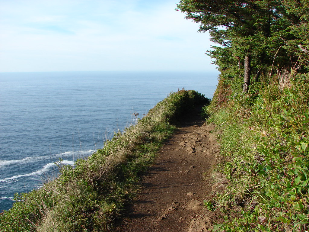
My plan was to hike the Cape Trail out to the end of Cape Lookout first to avoid the crowds that would surely be arriving later. After hiking the Cape Trail I would take the North Trail to the Cape Lookout Day Use Area where Heather and I had parked for our Netarts Spit hike in 2020 (post). Assuming I had anything left in the tank after returning from the North Trail I planned on hiking the South Trail down to the beach for the up-close view of the basalt cliffs of Cape Lookout’s southern side. It’s 2.4 up and down miles to the end of Cape Lookout with occasional views to both the north and south.IMG_4085

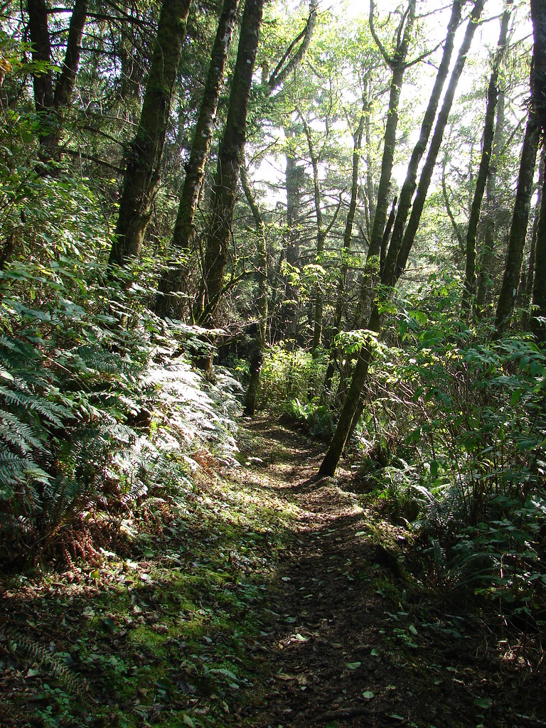
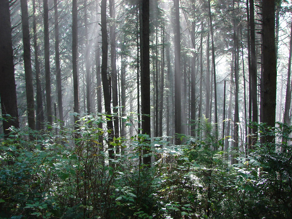
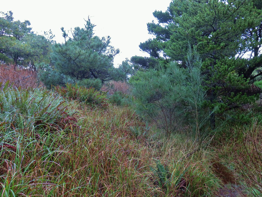
In between views the trail passes through a coastal forest.

IMG_4089

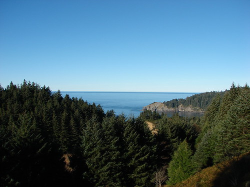
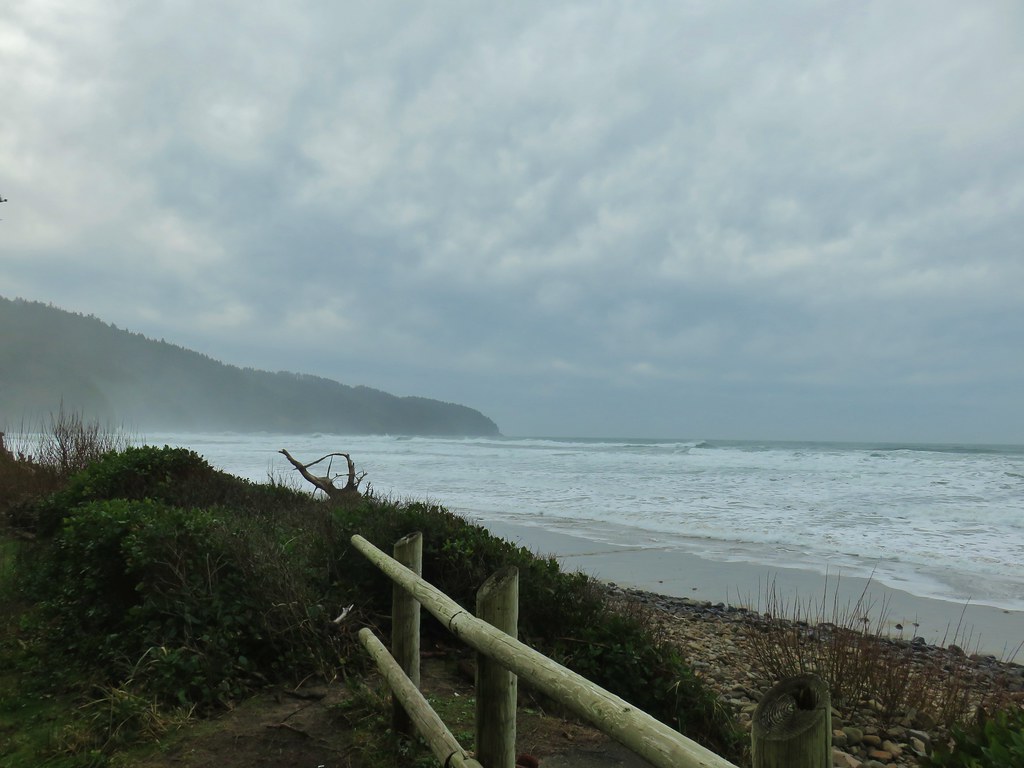
Looking SE toward Sand Lake.

IMG_4093

IMG_4094

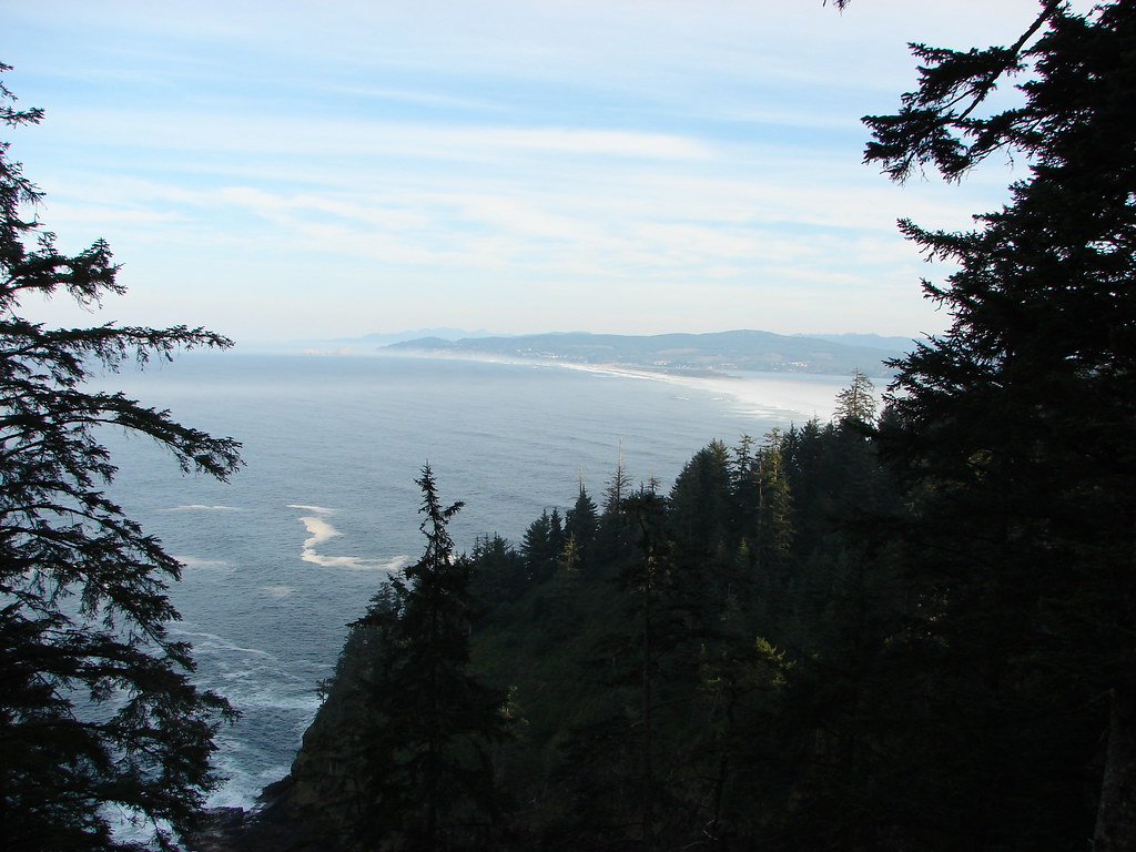
Looking south to Haystack Rock and Cape Kiwanda (post) with Cascade Head further south (post).

IMG_4099

Haystack Rock with the tip of Cape Kiwanda to its left. Cascade Head is next and the headland furthest south is Cape Foulweather.

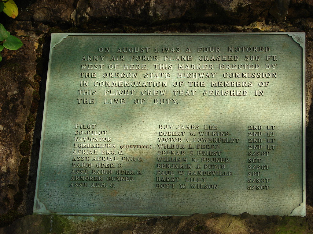
A little over a mile and half in the trail passes a memorial plaque for an Army Air Force plane that crashed nearby claiming the lives of nine members of the ten man crew.IMG_4100

The trail is almost always muddy in spots and downed trees sometimes require less than ideal reroutes of the trail.IMG_4103

IMG_4108

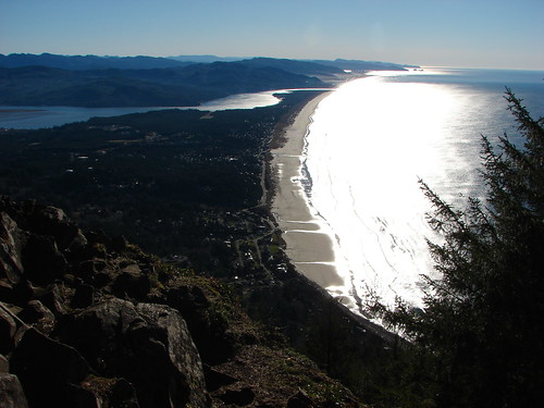
Coming up to the first view to the north.

IMG_4109

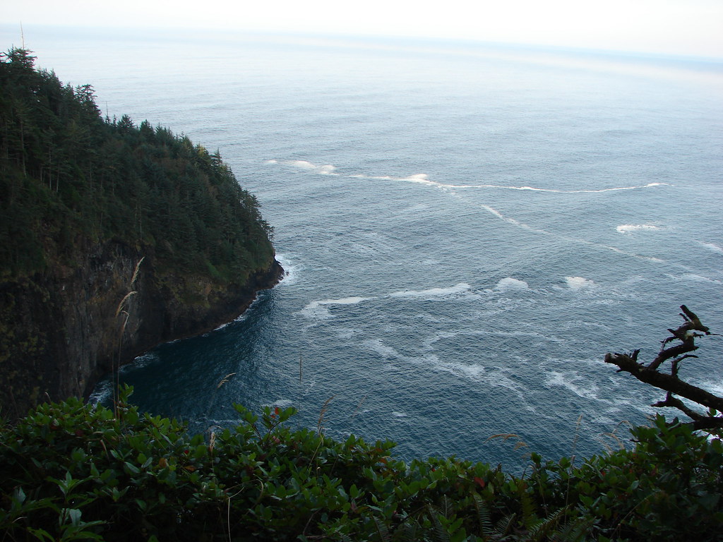
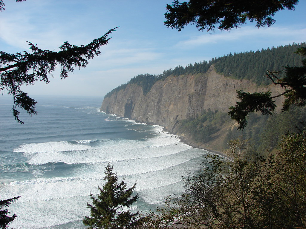
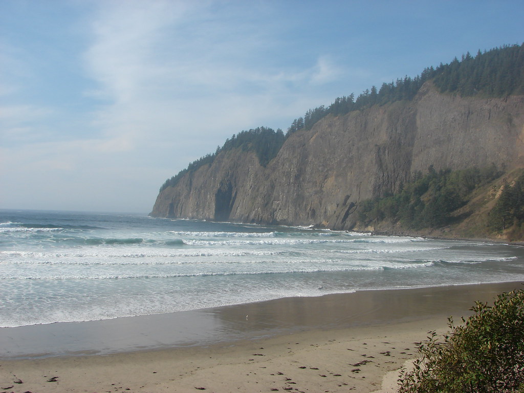
View north along the coast.

IMG_4110

Three Arch Rock across from Oceanside (post) followed by Cape Meares (post), and then Cape Falcon (post). The inland peaks starting with the rounded one of the left are Neahkahnie Mountain (post), Angora Peak, Rock Mountain, West Onion Peak and Onion Peak.

IMG_4116

Wells Cove

IMG_4119

It was close to freezing so the trails weren’t as muddy as they can be on warmer days. The good news was there was no ice to deal with.

IMG_4129

Here comes the sun.

IMG_4130

IMG_4134

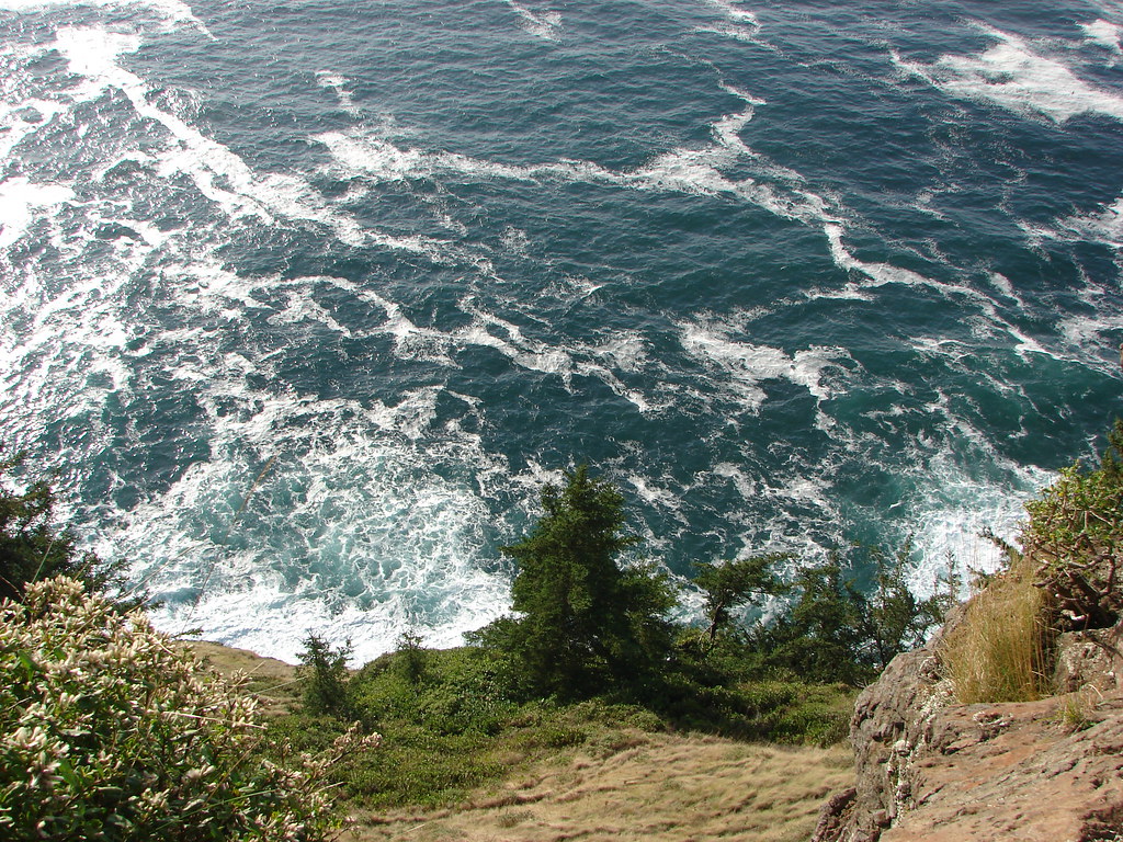
Along this section I heard a blowing sound in the ocean below.

At 400′ above the water I could see something swimming around but couldn’t make out what it was. I had the larger camera that I like to use at the wildlife refuges in my pack, so I pulled it out and started taking pictures. The way it was coming up out of the water and making a blowing sound I mistook it for a small whale, but it turned out to be a sea lion.DSCN7787

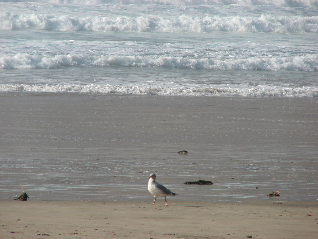
The sea lion was attracting seagulls which began arriving en masse.DSCN7799

The sea lion eventually moved on and so did I.IMG_4139

DSCN7801

Seagulls and cormorants.

IMG_4140

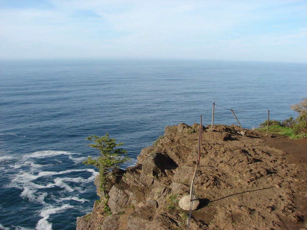
Barrier at the end of Cape Lookout.

There is a small bench and viewpoint at the end of the trail where I paused briefly to appreciate the views.IMG_4141

View south.

IMG_4142

View north.

I headed back toward the trailhead stopping to get a few pictures with the bigger camera now that it was unpacked.DSCN7809

American kestral

DSCN7812

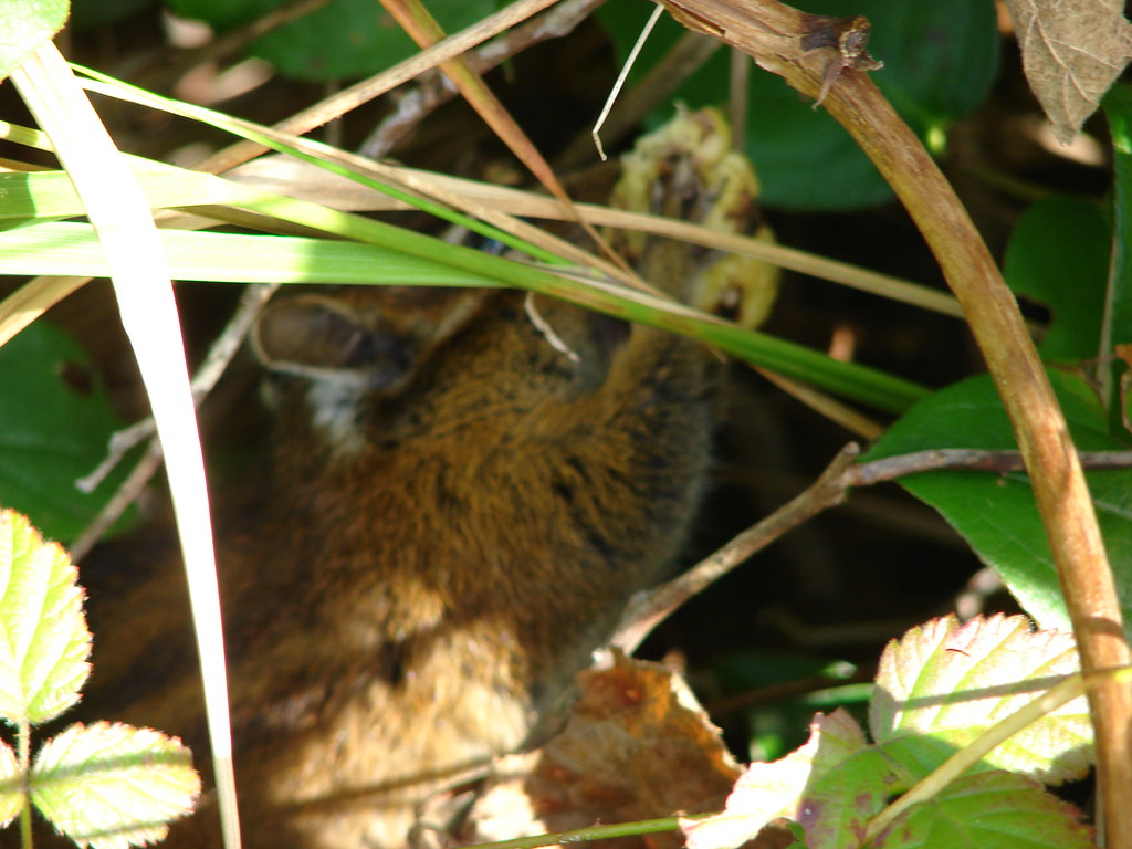
I’m fairly certain this is a ruby crowned kinglet in the salal.

DSCN7820

Hermit thrush

DSCN7824

Three Arch Rocks

DSCN7831

Varied thrush

Back at the trailhead I turned left and headed down the North Trail.IMG_4152

It was clear from the trail tread that this trail hadn’t been used much recently however there were signs of recent trail maintenance. Aside from a few trees that I needed to watch my head going under the trail was clear as it dropped down to the suspension bridge over Cape Creek.IMG_4154

IMG_4156

IMG_4162

There was a lot of blowdown, mostly older, along this section.

IMG_4163

Reenforced trail along this switchback.

IMG_4166

It was 0.8-miles to the bridge with an elevation loss of 550′, but the bridge is worth seeing and would be a worthy turnaround point for a shorter hike.

IMG_4167

IMG_4168

Camp Creek

The trail made a quarter mile climb on the north side of Camp Creek to a signed junction at an old roadbed.IMG_4170

IMG_4172

Sea stack out on the ocean.

IMG_4173

IMG_4174

This junction is where the trail had been closed coming from the day use area.

IMG_4175

I double checked to make sure it wasn’t still signed closed at this end.

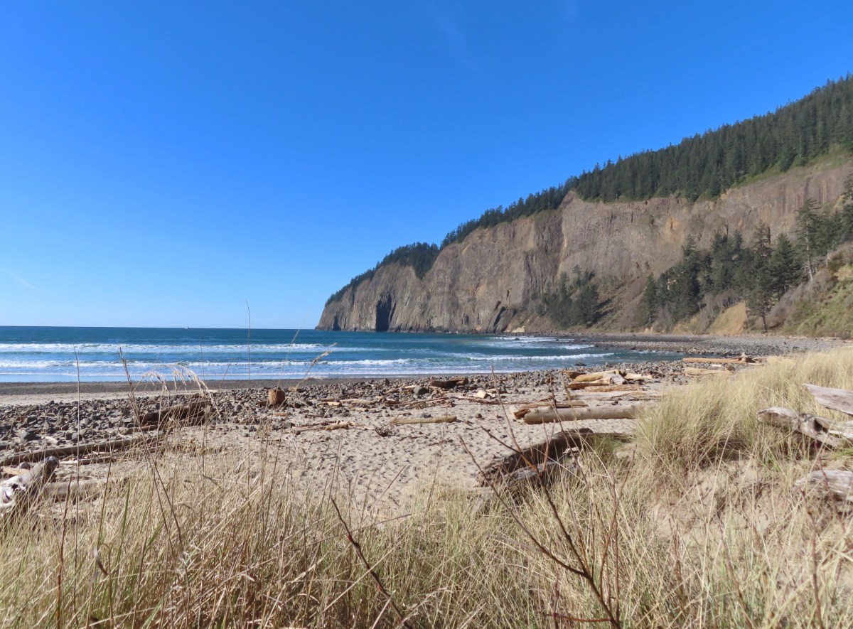
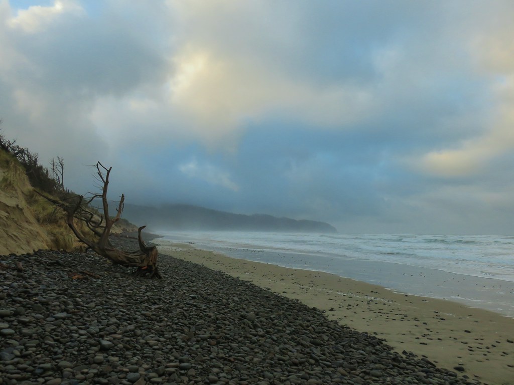
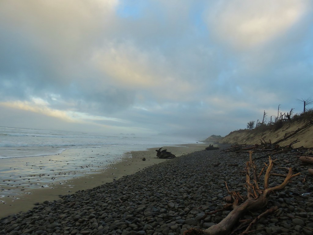
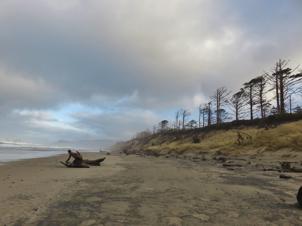
Most of the next 1.2-miles to the day use area followed the old roadbed as it descended to the beach. This section was in good shape except for a short section along a slide approximately a half mile from the day use area.IMG_4176

IMG_4179

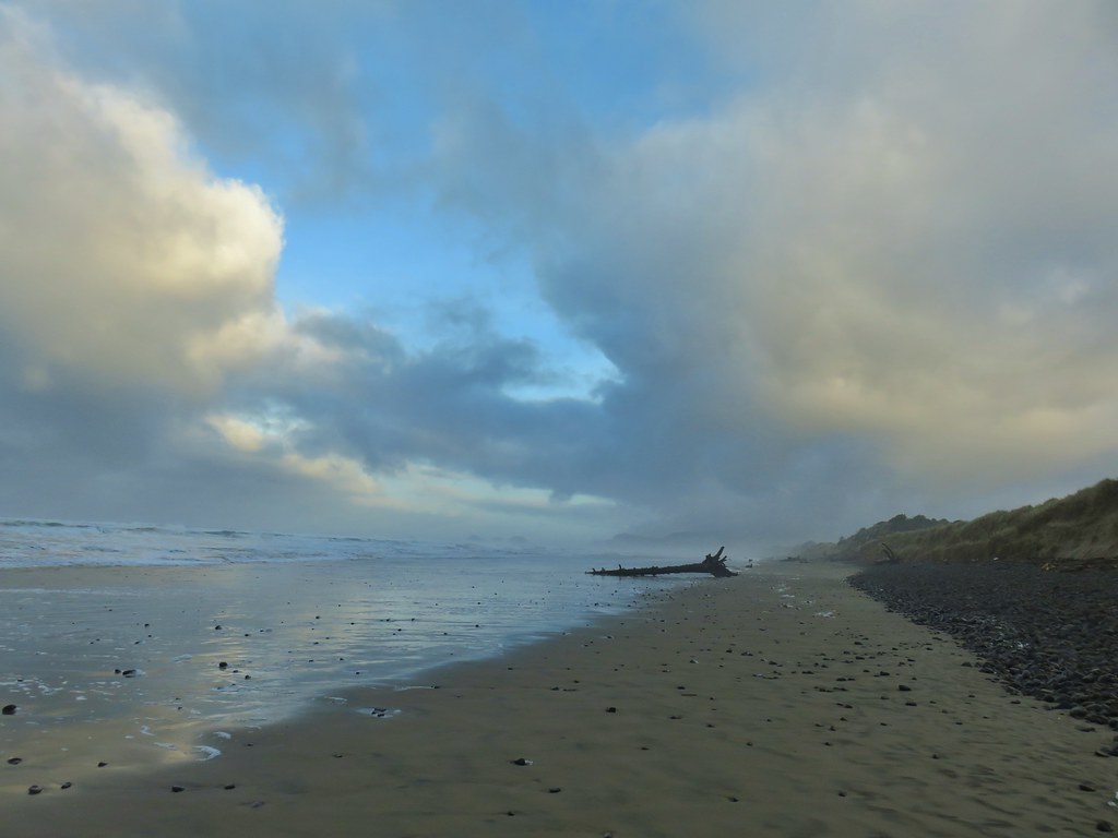
Netarts Spit and Bay.

IMG_4181

A rerouted section of trail near the slide area.

IMG_4183

This small stream appears to be the reason for the slide which is now being funneled over the hillside. On the far side the trail drops steeply down wet rocks next to wire covered rocks.

IMG_4184

Looking down at the continuation of the trail on the far side of the stream.

IMG_4186

Looking back up from the bottom. Coming down this was a lot harder than going back up due to how slick the damp rocks were.

After getting past the slide it was an easy half mile down to the day use area.IMG_4188

IMG_4190

The sign of a good coastal trail is it going through a tree.

IMG_4191

IMG_4197

IMG_4198

Bridge over Jackson Creek.

IMG_4199

Jackson Creek

IMG_4202

The parking lot at the day use area.

I took some time to read some of the interpretive signs/plaques and take a short break at one of the picnic tables before starting back.IMG_4201

Cape Lookout from the day use area.

IMG_4203

IMG_4206

IMG_4207

I made the 2.2-mile, 800′ plus elevation gain return trip to the Cape Lookout Trailhead and decided that I would go ahead and hike down the South Trail as well. That trail started a little under 100 yards from trailhead where it split off from the Cape Trail.IMG_4215

IMG_4216

Turning onto the South Trail.

Like the North Trail the South Trail loses over 800′ to reach the ocean which it does in 1.8-miles.IMG_4217

DSCN7835

Spotted towhee

IMG_4218

Good use of switchbacks keeps the trail from ever being too steep.

Halfway down the trail passes a bench with a nice view of Cape Lookout through the trees.IMG_4220

IMG_4221

IMG_4223

Camp Clark (Scouting America) below the trail to the south.

IMG_4225


Getting closer to the beach.

IMG_4227

Self-heal

IMG_4232

DSCN7843

Columnar basalt on Cape Lookout.

IMG_4234

The view south towards the sun.

When Heather and I visited in 2011 we continued a little to the south so this time I headed north toward Cape Lookout and then found a nice rock to take a seat on.IMG_4236

My view.

DSCN7838

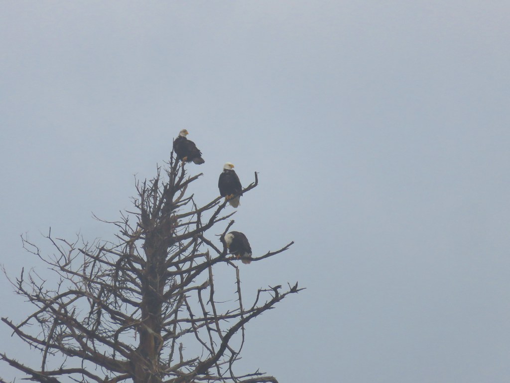
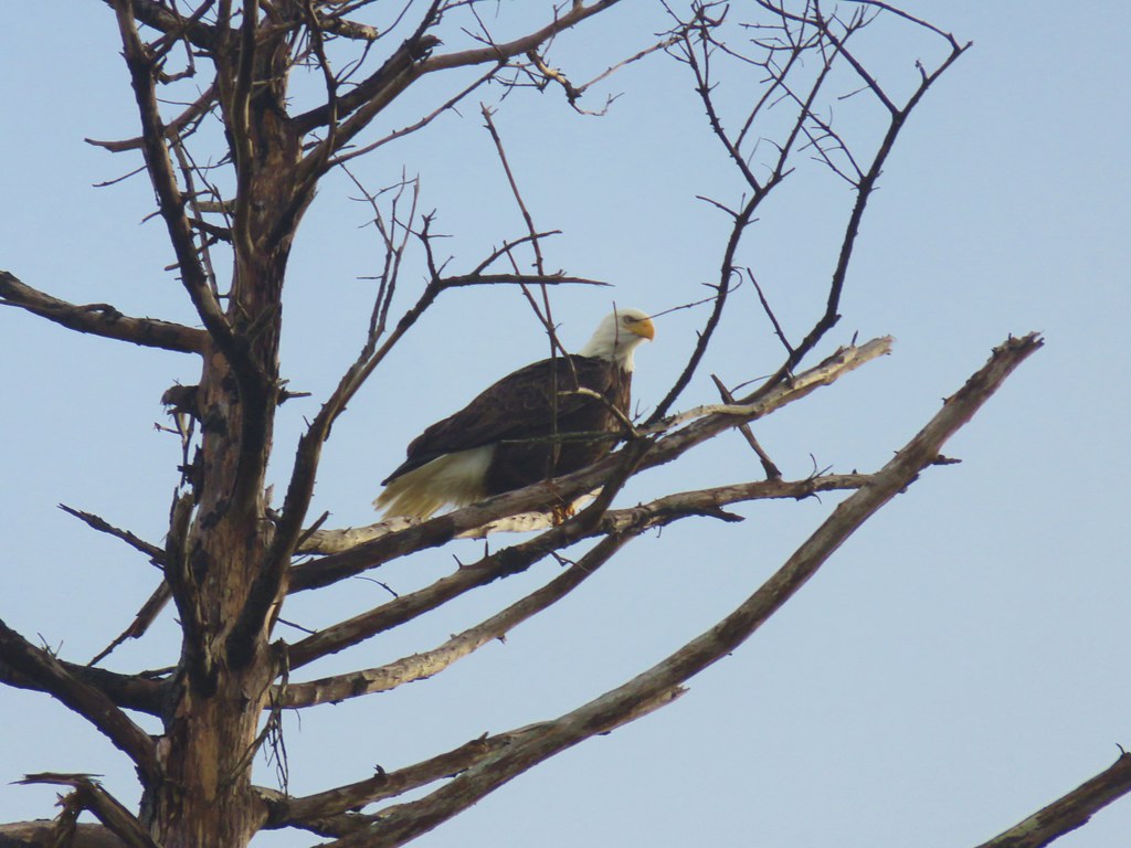
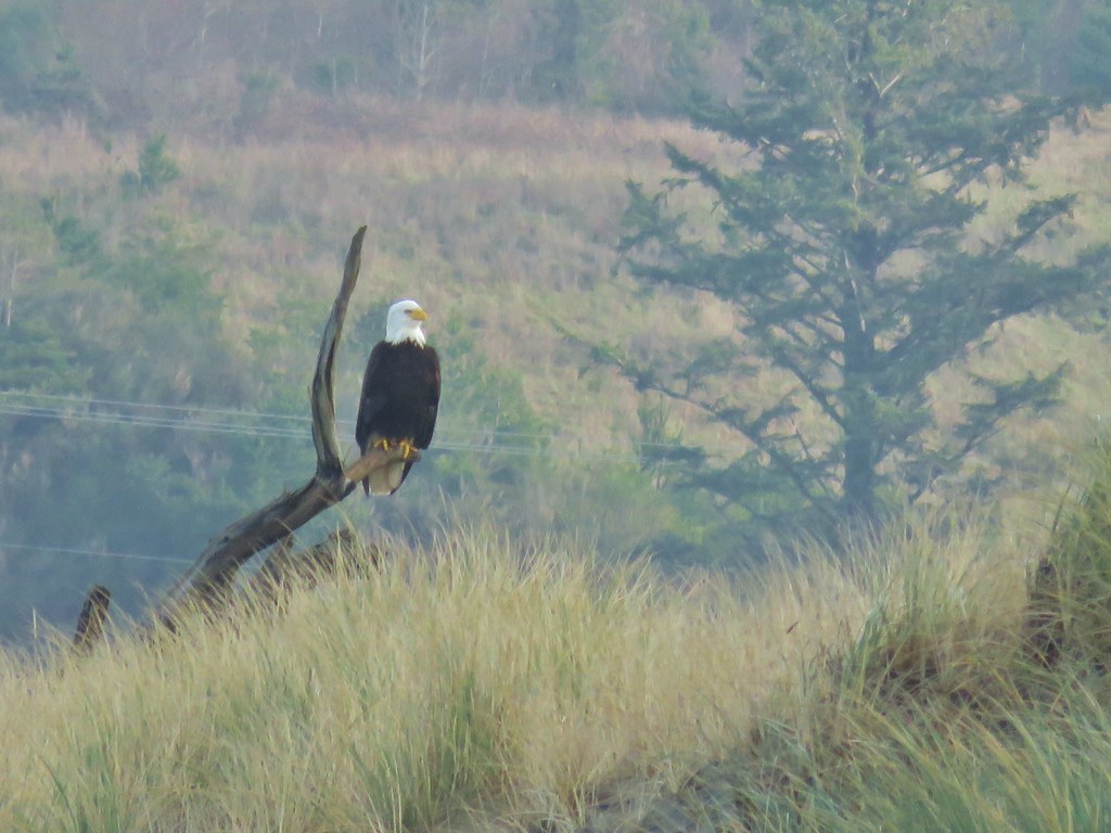
One of three bald eagles that flew over.

After resting and psyching myself up for the climb I headed back.IMG_4242

The trail is marked by a colorful buoys and ropes.

IMG_4243

Today’s hike came in at 13.2-miles with approximately 2000′ of cumulative elevation gain.Screenshot 2026-01-24 152148

Of course, there are plenty of shorter options available, but you could also go further by heading north along Netarts Spit or south along the beach to Sand Lake. If you do visit be prepared for muddy conditions and crowds on the Cape Trail. Having been the first car at the trailhead I didn’t see anyone until I was headed back from the end of the cape. I passed just eight people on the way back, but it wasn’t yet 9:30am when I turned onto the North Trail. I only saw three people on the that trail and then another eight on the South Trail, plus a few more on the beach itself. By the time I was ready to leave at 1:15pm the trailhead was overflowing and cars were parked along the shoulder out to Cape Lookout Road. Score another one for early starts. Happy Trails!

Flickr: Cape Lookout State Park

Categories
Central Coast Hiking Oregon Oregon Coast Trip report

Oceanside, Short Beach, Tillamook Wetlands, and Anderson Hill – 10/28/23

A cold snap arrived in conjunction with the final hike of our official 2023 season leaving us with a decision to make about where to go. One of the great things about living in Western Oregon are the hiking options. We were debating between heading to Government Camp near Mt. Hood to see some of the new snow that the system had brought with it, or to the beach where things would be a little bit warmer. In the end we decided that we weren’t quite ready for a Winter wonderland yet, and highs in the low to mid 50s sounded a little more appealing than highs in the low to mid 30s. The beach it was where we had some unfinished business at Oceanside.

We had attempted to hike the beach at Oceanside earlier in the year on a different multi-stop day (post), but had saved it for the final stop only to find the area so crowded that there was no place to park. We wouldn’t be making that mistake again so this time it was stop number one on the itinerary. We had no issue finding a parking spot this time arriving just as the Moon was disappearing behind Three Arch Rocks.
IMG_1433From left to right: Storm, Finely, and Shag Rocks.

Three Arch Rocks is one of two designated wilderness areas along the Oregon Coast Managed by the Department of Fish and Wildlife as a wildlife refuge the 15-acre wilderness area was the first designated refuge West of the Mississippi and is one of only a few wilderness areas entirely closed to entry by the general public.

From the parking lot we took the stairs down to the beach and headed north toward the Tunnel which leads through Maxwell Point to Tunnel Beach.
IMG_1438Cape Lookout (post) to the south.

IMG_1440Maxwell Point

IMG_1443View from beside Maxwell Point.

IMG_1444The Tunnel was built in 1926.

IMG_1447

IMG_1448

IMG_1454The Tunnel from Tunnel Beach.

IMG_1450Three Arch Rocks from Tunnel Beach.

We hiked North along the beach passing a rocky point to Agate Beach before turning around where that beach ended at a cliff a little more than a third of a mile from the Tunnel.
IMG_1465The end of Tunnel Beach. At higher tide it’s not possible to get around the point here.

IMG_1469Getting closer to the end of Tunnel Beach. This set of ocean rocks are part of the Oregon Islands Wilderness, A string of of over 5,600 rocks, reefs, islets, and islands lying within three miles offshore mirroring almost the entire length of the Oregon coast from Tillamook Head to the California border. Like Three Arch Rocks this wilderness is also closed to the public.

IMG_1484Bald eagle on top of one of the rocks.

IMG_1476Seal

IMG_1477Agate Beach

IMG_1482

IMG_1490Cape Lookout from Agate Beach.

After reaching the cliff we headed back to the Tunnel and then continued South along the beach 2.3-miles to Hodgdon Creek across from Netarts Spit (post).

IMG_1492An assortment of sea birds.

IMG_1497

IMG_1504Maxwell Point and Cape Lookout

IMG_1506

IMG_1508Sun starting to hit the Three Arch Rocks.
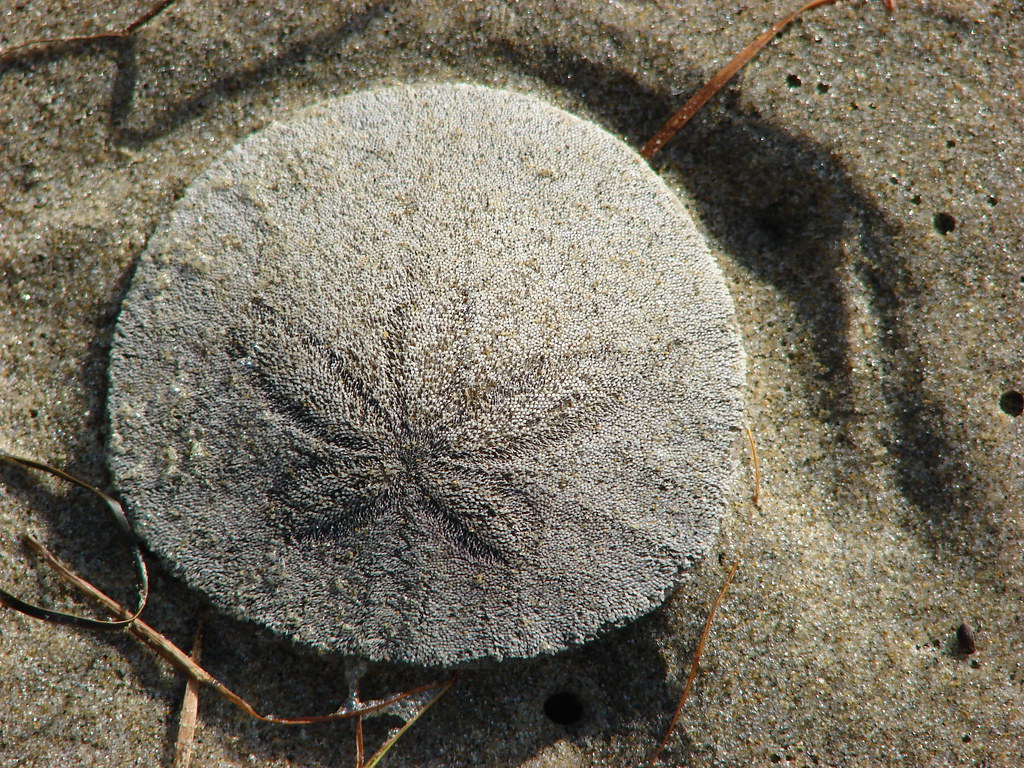
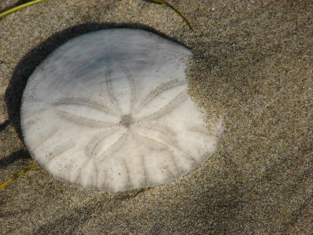
IMG_1512

IMG_1519Sand dollar

IMG_1526

IMG_1531Cormorants. There was a steady stream of flocks of birds heading south along the coastline.

IMG_1543Footbridge over Fall Creek.

IMG_1544Fall Creek

IMG_1570Frosty leaves near Fall Creek.

IMG_1548
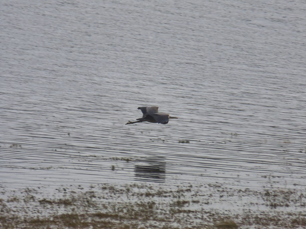
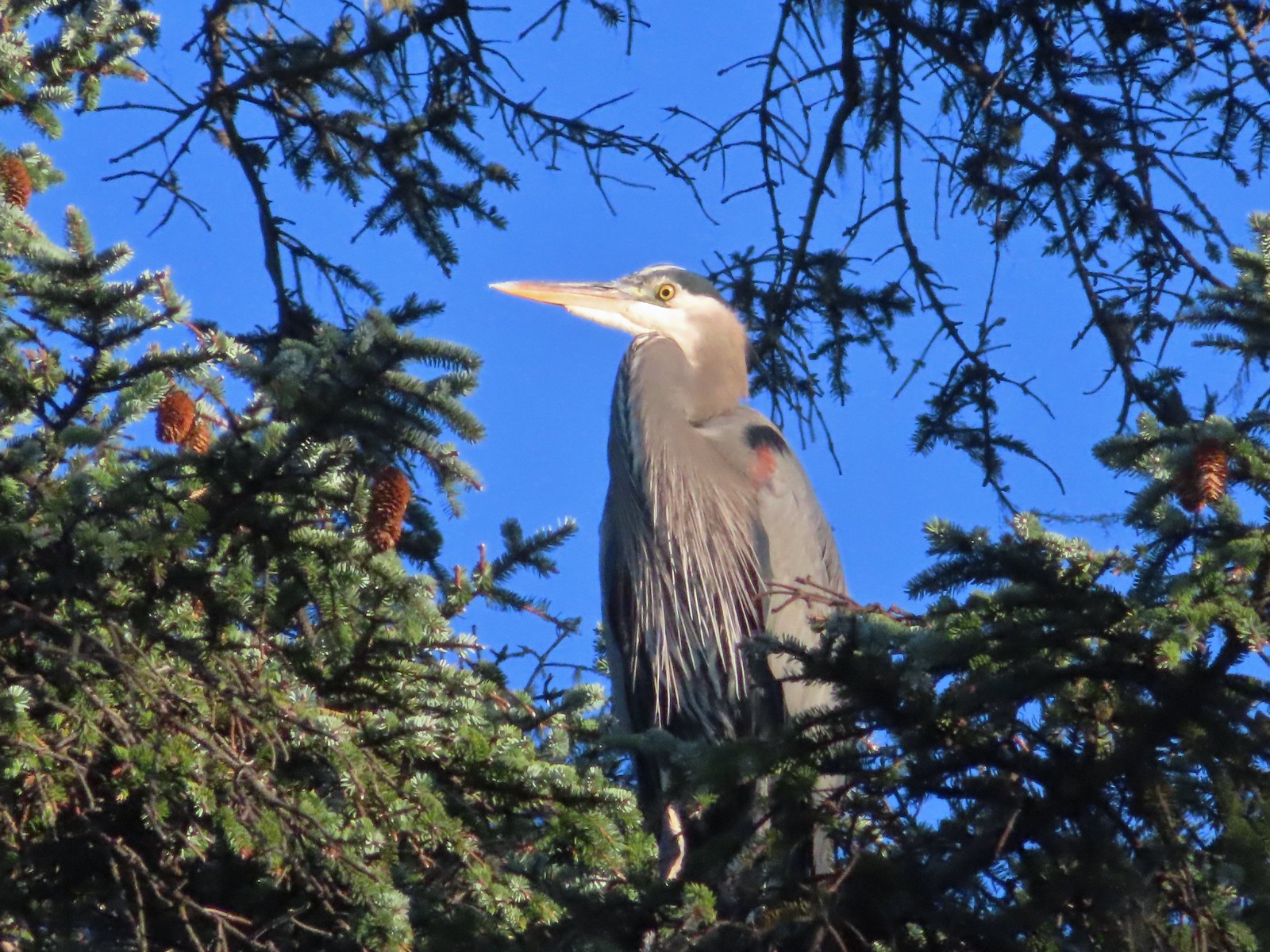
Great blue heron in a tree above Fall Creek.

IMG_1551Happy Camp

IMG_1557Hodgdon Creek

IMG_1555Seagulls and common mergansers near Hodgdon Creek.

IMG_1558Buffleheads

IMG_1562Netarts Spit

IMG_1565Happy Camp from our turn around point.

We returned the way we’d come and then drove North on Cape Meares Loop Road just under a mile and a half to a pullout across from a sign for Short Beach.
IMG_1575Three Arch Rocks and Maxwell Point now in full Sun.

IMG_1579

A local built the staircase leading down to Short Beach and it is about as “Oregon Coast” as a staircase could be.
IMG_1581

IMG_1584

IMG_1590The beach only extends a short distance to the South.

IMG_1588The sea stack and Short Creek Spillway to the North.
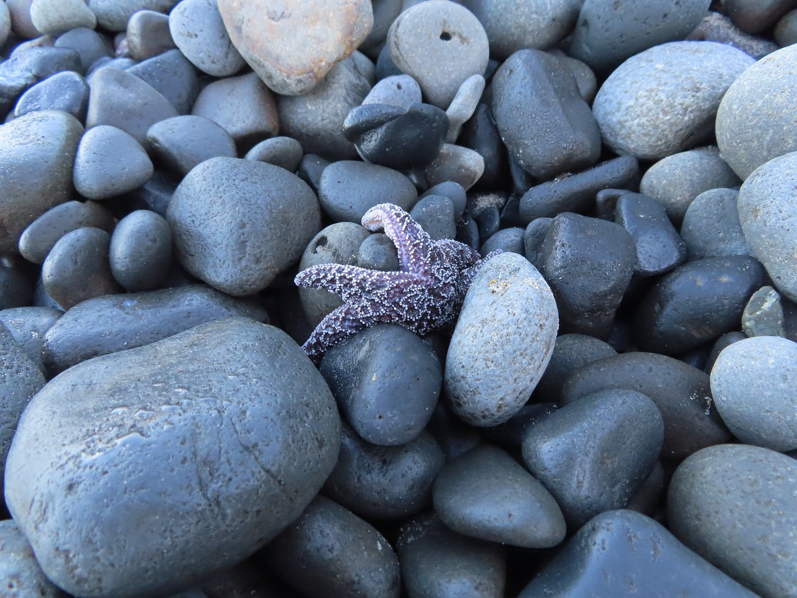
We headed North along the cobblestone beach which isn’t the easiest surface to hike on, especially when they are wet and slightly frosty. On the positive side the cobblestones added some great sounds to the ocean as the waves tossed them about then rolled them over one another as the waves receded.
IMG_1606

IMG_1618Starfish

IMG_1619The sea stack

IMG_1621Cape Meares (post)

IMG_1609I didn’t notice the little waterfall along the cliffs below Cape Mears until I looked at the pictures.
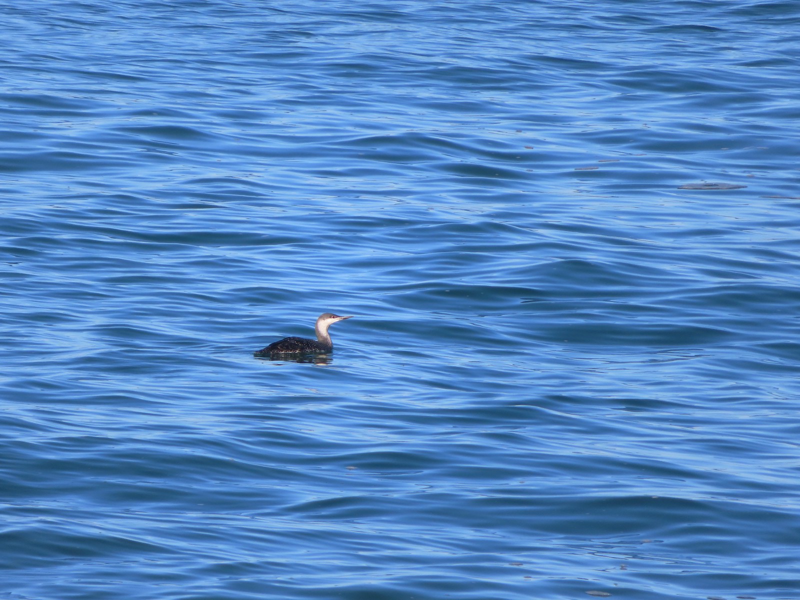
IMG_1625Red-throated loon

A third of a mile from the stairs we reached Larsen Creek Falls.
IMG_1627

IMG_1632

Apparently at low tide it’s possible to reach the cliffs below Cape Meares, but the tide was coming in and it also appeared that some sliding had occurred at some point, so we turned around a tenth of a mile beyond Larsen Creek Falls.
IMG_1641The area ahead in the shade is where things started looking a little sketchy.

IMG_1643

IMG_1659

IMG_1674

These two beach hikes came to a total of 6.6-miles, 5.5 at Oceanside and 1.1 at Short Beach. From Short Beach we drove to Tillamook to try the Tillamook Bay Wetlands hike which I’d found as I was looking through the Oregon Hikers Field Guide. We parked at the Goodspeed Road Trailhead. The field guide entry showed this as a 3.6-mile loop following dikes through wetlands between the Wilson, Trask, and Tillamook Rivers. We were immediately confused due to the field guide mentioning a map and metal gate at the Goodspeed Trailhead but there was neither at the signed parking area.
IMG_1676Apparently there used to be a metal gate here instead of a the rope/chain.

We were pretty sure we’d followed the driving directions though so we stepped over the chain onto the grassy dike and began following it through the wetlands.
IMG_1678

IMG_1682

IMG_1685Bald eagles in the tree tops.

IMG_1683Bald eagles

The map in the field guide showed an elongated loop following what Google Maps and the GPS showed as the continuation of Goodspeed Road to the Wilson River then along that river to the Tillamook River where the route looped back along it then the Trask to Sissek Road. The dike we were on though reached a slough where it turned sharply South.
IMG_1686This is where the dike/path turned South. Our best guess is that there has been additional wetland restoration since the entry in the field guide and some of the dikes that the guide route followed have been removed.

We didn’t come up with our theory about what was going on until after we got home. While we were hiking we kept checking the GPS map/track and comparing it to the map in the field guide. We still weren’t sure if we really had started in the right spot given the lack of a metal gate and map at the trailhead or if we’d missed a turn somewhere. We continued to follow the dike system which looped around and after just over a half mile the GPS showed that we were on Sissek Road (now a grassy dike).
IMG_1689We weren’t getting across that.

IMG_1694Somewhere out that way, beyond the slough, was the Wilson River.

IMG_1699Now heading East toward Sissek Road.

IMG_1704At this point we had left Sissek Road which used to extend straight from Goodspeed Road where the signs and rope/chain is in this photo (ahead to the right at the 90-degree turn).

The dike system brought us to another signed parking area we’d pass on the way to the Goodspeed Road Trailhead. This one is just past a one-lane bridge over Hall Slough.
IMG_1705

At this point we were sure we’d started at the correct trailhead and were now convinced we’d missed a turn somewhere near the start of the hike. First we tried walking a grassy track South from this parking area which brought us to another muddy slough, but not before spotting an egret and a great blue heron.
IMG_1706

IMG_1710

IMG_1713

We backtracked to the parking area and then hiked Goodspeed Road back to the trailhead where I began searching for a different route.
IMG_1714
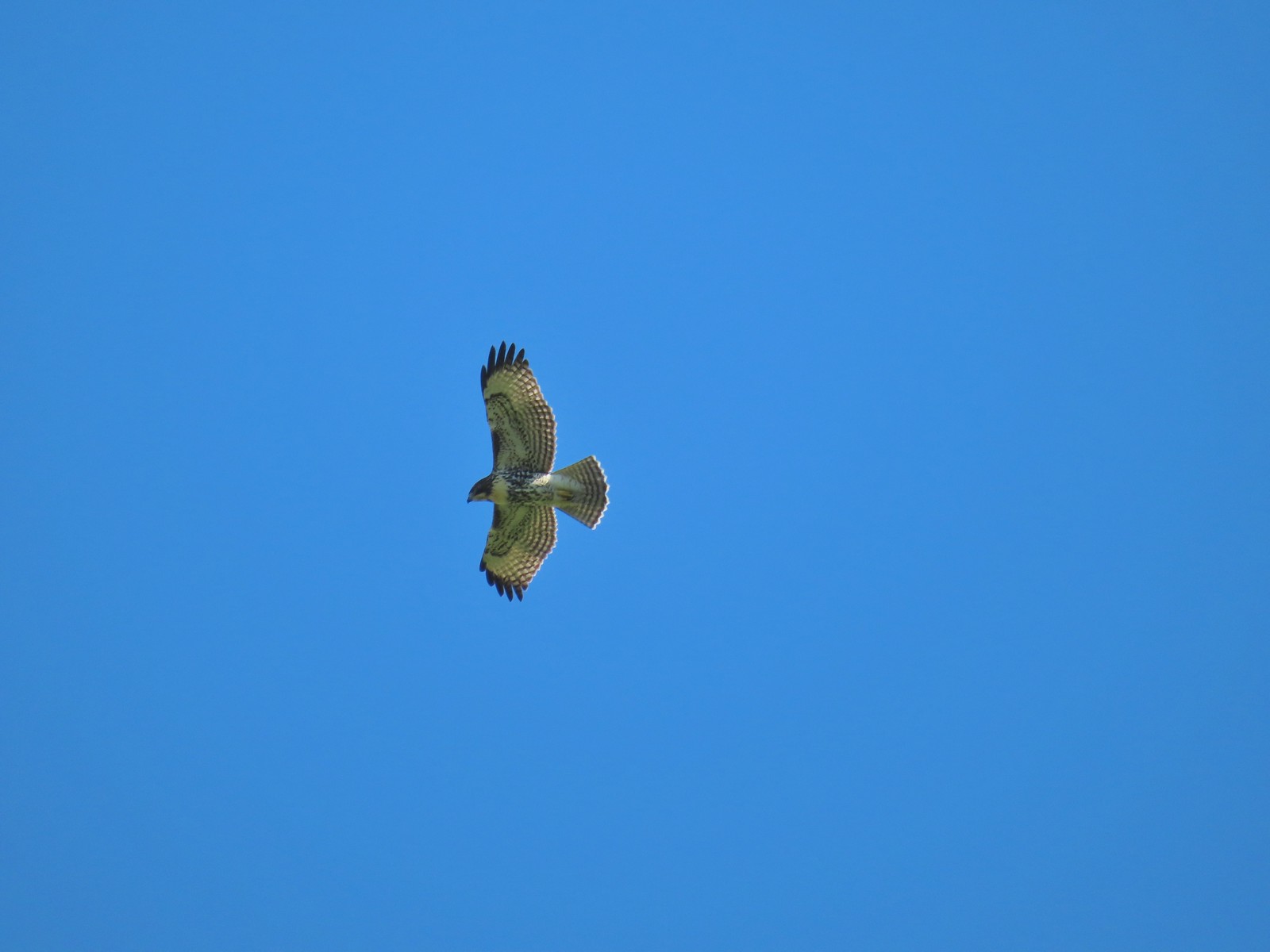
Hawk above Goodspeed Road.

IMG_1677One path led down to Hall Slough ending in mud at it’s bank.

IMG_1716A second path led north on what the GPS showed as a former road but it was too overgrown and flooded to make it far.

We wound up doing just 1.9-miles here including the out-and-back explorations.

It was a fine little hike and we saw a nice little variety of birds, but it was a little disappointing not to be able to see any of the rivers. We had one last stop planned, another short hike I found in the Oregon Hikers Field Guide, the Anderson Hill Loop . The trail begins at Anderson Hill County Park to the right of a metal picnic table.
IMG_1719

IMG_1722

The 1.2-mile reverse lollipop loop gains just 130′ as it climbs to a power line corridor on Anderson Hill. The view from the power lines is of course limited due to the power lines, but the trail was in good shape and the forest was nice making for a decent little outing.
IMG_1727

IMG_1730Junction with the spur trail to the power line corridor.

IMG_1733

IMG_1735

IMG_1736

IMG_1739

IMG_1742

IMG_1745

IMG_1749

IMG_1751Footbridge and stairs leading back up to the picnic table.

The four hikes came to just 9.7-miles and 270′ of cumulative elevation gain and included ocean views, waterfalls, forests, wetlands, and ample wildlife.

It was a beautiful day weather wise and great way to end our season. We’ll scale back our hiking for the next 5-6 months, but we plan on getting out at least once a month until our 2024 season kicks off. Happy Trails!

Flickr: Tillamook Area Hikes

Categories
Central Coast Hiking Oregon Oregon Coast

Netarts Spit – 1/25/2020

We were down to the last weekend of the month so in order to get our monthly hike in we were going to have to deal with whatever weather we were dealt. Heading into Saturday the forecast was for rain everywhere I checked so we decided to stick to our original plan which was to visit a series of lakes in the coastal range. That plan was scrapped on Friday night when I checked the trail conditions and discovered that one of the ones that we’d be on had been closed this month due to heavy storm damage. Plan B had been a nearly 3 hour drive to Reedsport, but a 100% chance of rain didn’t warrant that long of a drive. I looked to our 2021 hikes and decided on Netarts Spit at Cape Lookout State Park which was a more reasonable hour and a half drive away.

We set off just before 6am with all our rain gear and drove to the Cape Lookout Day Use Trailhead where we purchased a $5 parking pass and noted that it was in fact not raining here.
IMG_2116

We suspected it was just a matter of time and put our rain gear on before starting off. One of the issues with last minute hike swaps is that it limits the amount of time we have to read up on the hike. The Netarts Spit hike is featured in two of our books by Matt Reeder (“Off the Beaten Trail” and “PDX Hiking 365”) as well as in the Oregonhikers.org field guide. I had looked at both and noted that while Reeder’s description indicated to hike along the beach the field guide mentioned an inland route for the first portion. After walking down to the beach near a picnic shelter we walked back up to the shelter and followed a path north through some trees.
IMG_2119

IMG_2122

IMG_2123

The view south from this path was dominated by Cape Lookout jutting out into the Pacific. Several waterfalls could be seen on it’s flanks.
IMG_2124

IMG_2125

When we came to another beach access point just before a gated section of the campground we decided to head down to the beach.
IMG_2128

Had I studied the entry in the field guide more thoroughly I would have known that it recommends following the road through the campground to avoid the cobblestones along the beach here.
IMG_2132

The tide was just high enough that in order to stay out of the Ocean we were forced to walk on these rocks and they are not fun. Ankles were rolling and twisting in all sorts of directions as we stumbled along.
IMG_2136Ocean coming right up to the rocks.

When we got our next chance we popped back up off the beach into the campground following a gravel track past some group tent sites.
IMG_2141

We’d already seen one bald eagle fly overhead and here we spotted another one sitting in a tree ahead.
IMG_2146

While watching the eagle a great blue heron flew over.
IMG_2144

Beyond the group tent sites the road was gated and turned into a grassy path with Netarts Bay to the right and dunes to the left.
IMG_2150

IMG_2151

The grassy roadbed soon ended at a stand of trees where a clear trail continued.
IMG_2153

IMG_2154Trail at lower right with a little standing water.

The field guide had mentioned that sections of this trail may have standing water but we weren’t quite prepared for long stretches of calf deep ponds. Heather was smart enough to find a deer path a little higher up on the left side (Which was something the field guide said you might have to do but in my quick reading I hadn’t picked up on that.) I tried sticking to the trail for a bit, but after a while in the water my feet starting getting cold so I joined her. We made the decision to try and follow one of these paths up and over to the beach which we managed to do.
IMG_2155

Then it was just a matter of finding the best spot to drop back down onto the beach, and more cobblestones, yay.
IMG_2156

IMG_2157

Luckily it wasn’t long before we were able to drop onto the sand.
IMG_2167

There was a lot more blue sky than we’d been expecting which was a pleasant surprise. To the north we could see the Three Arch Rocks although a perpetual fog seemed to be hanging over them.
IMG_2172
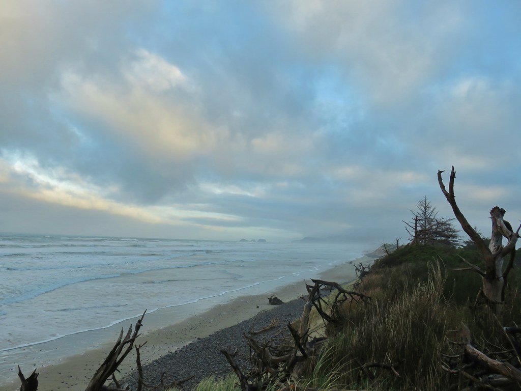
Three Arch Rocks – one of two wilderness areas in Oregon off limits to visitors.

We were able to spend the next 4 miles to the end of the spit on the beach. There were no other people in sight (until the fishing boats in the bay). There were a few seagulls here and there and we saw at least 8 different Bald Eagles counting at least 6 congregated in a short stretch of trees.
IMG_2190

IMG_2174

IMG_2175

IMG_2192

IMG_2200

IMG_2201

IMG_2204

IMG_2207

A final eagle awaited near the end of the spit.
IMG_2212

IMG_2219

We were hoping that by the time we got to the turn around point we’d have a better look at Three Arch Rocks but the view wasn’t much clearer than it had been all morning.
IMG_2221

IMG_2214

IMG_2217

We had stubbornly kept our rain gear on waiting for the forecast to come to fruition, but we stopped here to remove it since we were way too warm. We then made a short loop around the tip of the spit to look at the bay before starting back.
IMG_2222

IMG_2223

One thing that both Reeder and the field guide agreed on was that it was impossible to travel along the bay due to marshy conditions so we started back down the beach.
IMG_2226

The tide was coming in and we noticed that waves were starting to cover the entire beach and forced us up into the dunes a bit where we followed some deer tracks for awhile.
IMG_2227

We spent the majority of the next three and a half miles staying up as high on the dunes as possible which made for some more difficult travel. The grass on the dunes is surprisingly sharp tipped and it was all pointing north so we were walking directly into the points. The thickness of the grass also meant that you couldn’t really tell what the terrain underneath was like so there were plenty of awkward steps, although no falls. I had done that on the beach when I tripped over a small piece of driftwood.
IMG_2233
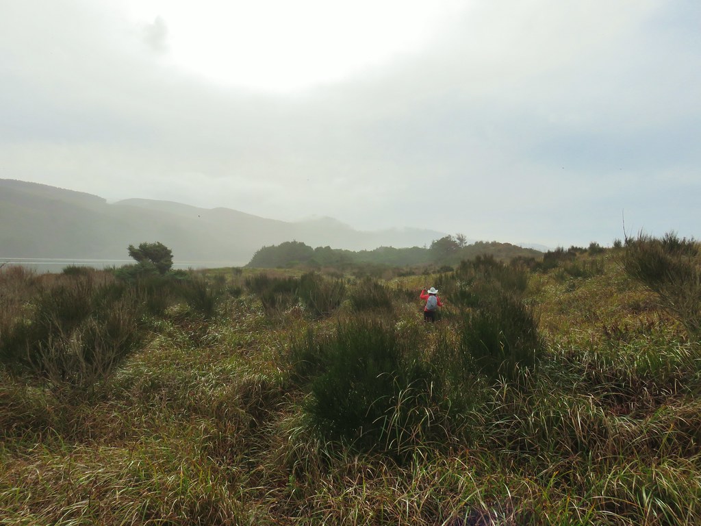
Looking back north from the dune crest.

IMG_2235Looking north at what was to come.

IMG_2230
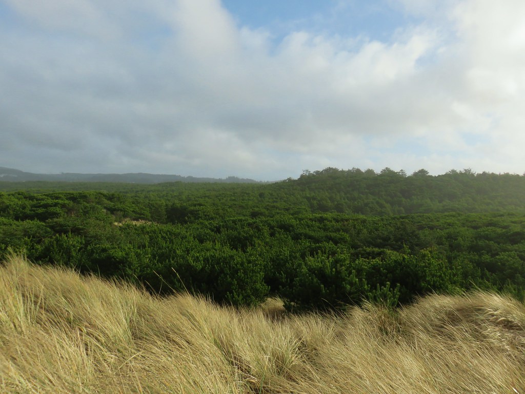
Thick forest between the bay and the dune.

IMG_2236
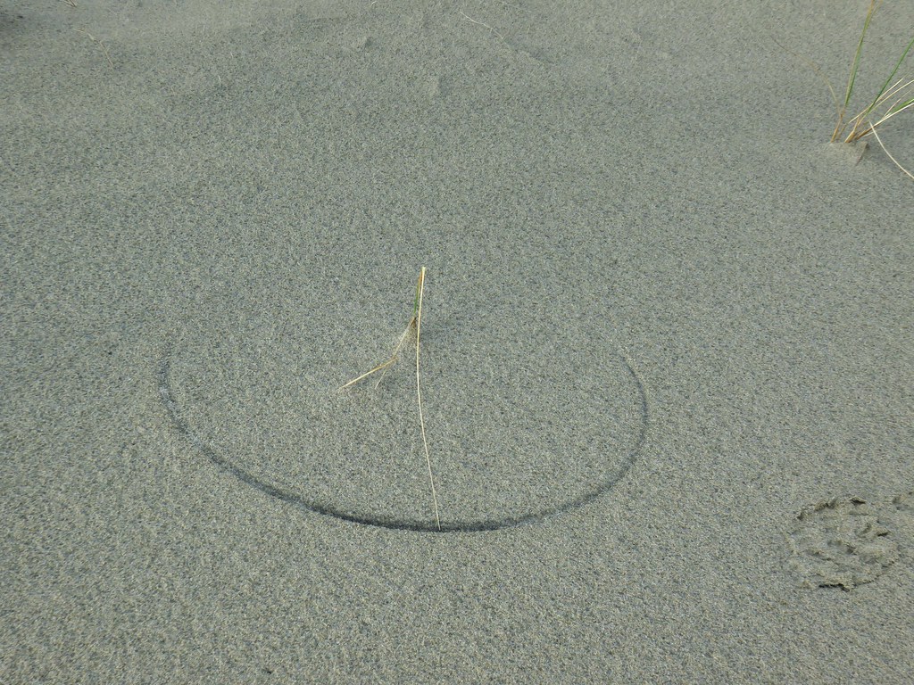
One of several semi-circles created by grass going back and forth.

Being up on the dune did allow for some views of the bay where we spotted birds including surf scooters and great blue herons.
IMG_2238

IMG_2240

IMG_2242

We were forced down onto the backside of the dune as we neared the point where we had crossed over the beach that morning. Here a maze of game trails led in all directions. The trick was attempting to avoid the thorny rose stalks and blackberry bushes as well as thickets of nearly impassable salal.
IMG_2245

We eventually made it back to the submerged trail and grassy track from earlier which we followed back to the campground and then stuck to the paved road as we returned to trail leading between the campground and picnic shelter.
IMG_2255Cape Lookout from the trail to the picnic shelter.

IMG_2257Seagull atop the shelter.

Our GPS put our hike at 11.1 miles which was in line with the field guides 11.2 and a little longer than Reeder’s 10 miles. We both agreed that it may have been the hardest hike we’d done along the coast due to the tricky terrain, although part of it might also be that it had been over a month since our previous hike and we’re a bit out of hiking shape. In any event it felt like an adventure which was nice and the fact that the rainy forecast turned into just a mostly cloudy day with a couple of sun breaks made for a great start to 2020’s hikes. Happy Trails!

Flickr: Netarts Spit

Categories
Central Coast Hiking Oregon Oregon Coast Throwback Thursday Trip report

Throwback Thursday – Cape Lookout

This Throwback Thursday hike took place on our 16th wedding anniversary. To celebrate we headed to Cape Lookout State Park on the Oregon Coast. We parked at the Cape Lookout Trailhead where we had three trails to choose from.

Trail sign in Cape Lookout State Park

The most scenic (and popular) of the three trails is the Cape Trail which we started out on. This nearly 2.5 mile trail follows Cape Lookout to it a viewpoint overlooking the tip of the Cape. The trail starts out on the southern side of Cape Lookout offering a view after .6 miles of Cape Kiwanda and Haystack Rock near Pacific City (post).

The viewpoint is also near the site where a B-17 bomber crashed in 1943.

Memorial plaque along the Cape Trail

The Cape Trail soon crosses the cape to the northern side where Cape Mears (post) and the Three Arch Rocks Wilderness could be seen.

View from the Cape Trail

Storm Rock, Finley Rock, Shag Rock and Seal Rock

We followed the trail around Wells Cove before it returned to the southern side of the cape.

Wells Cove

Wells Cove

Cape Trail

The final stretch of trail offered wide open views down to the Pacific.

View from Cape Lookout

View from Cape Lookout

View from Cape Lookout

It was a busy day on the trail, there had been a few other hikers out as well as several locals along the trail.

Snail

Douglas squirrel

Chipmunk

After resting at the viewpoint we returned to the trailhead and decided to try the South Trail which led 1.8 miles down to the beach. The trail switchbacked down through the forest but offered occasional views of the cliff lined southern face of Cape Lookout.

South Trail

Forest along the South Trail

Cape Lookout

We spotted another local on the way down to the beach.

Snake

We walked along the beach watching for sand dollars for a bit finally sitting down on a log and taking a nice long break as we listened to the ocean and watched more locals as they went about their days.

Cape Lookout

Sand dollar

Sand dollar

Beach south of Cape Lookout

Northern alligator lizard

Seagull

Wolly bear caterpillar

We eventually pulled ourselves away from the hypnotic trance of the Pacific and climbed back up to the trailhead. Other than one woman with her dog that we spotted in the distance we had been the only humans on the beach making it a relaxing way to end the day. Happy Trails!

Flickr: Cape Lookout

Categories
Hiking Northern Coast Oregon Oregon Coast Trip report

Neahkahnie Mountain

Happy New Year! A favorable weather forecast encouraged us to kick off our 2014 hiking year a bit sooner than planned. Just as we had done last year we turned to the Oregon Coast to get things started. While most of the country was dealing with frigid temperatures we were off to Oswald West State Park where a Sun filled day and 50 degree temperatures awaited.

For Heather and I this was our second visit to the park. In June 2012 we hiked out and around Cape Falcon where wild flowers and dramatic views were plentiful. (Pictures from that hike can be seen here: http://www.flickr.com/photos/9319235@N02/sets/72157632953462404/ ) For this trip we were set to explore the southern end of the park and follow the Oregon Coast Trail (OCT) up to the summit of 1631′ Neahkahnie Mountain.
Neahkahnie Mountain from Cape Falcon in 2012
Smugglers Cove

We parked in the large beach access parking area on the east side of Highway 101 where the Short Sand Beach trail begins. This was the same trail we had started on for our previous visit, but after a couple of hundred yards we turned left onto the Old Growth trail. Two tenths of a mile on that trail brought us to a trail junction with restrooms where we forked left on the .1 mile Cedar Crossing trail. This path ended at Necarney Creek where it intersected the .3 mile Necarney Creek trail. (As you can tell there are a lot of short trails in the area.)

At the Necarney Creek trail we had an option. According to the park brochure/trail map if we turned left we would find the .4 mile Necarney Falls trail. I had read a trip report from 2012 that indicated there was some bushwhacking involved in reaching the waterfall but the trail was still shown on the online map so left we went. Soon the Necarney Creek trail bent away from the creek which was where we had expected to find the falls trail, but there were no trail signs and we quickly reached the end of the creek trail at a small parking area. After re checking the park map and verifying the location of the supposed trail we returned to the bend to see if we could find it. There was a faint unmarked path leading toward the creek into the underbrush at the bend which we decided must have been what was left of the trail. It was less than .5 miles to the falls so we decided to make an attempt at reaching them and headed into the brush.

The former trail was virtually gone save for a few short sections here and there. We kept as close to the creek as possible as we made our way under the highway and up the narrow canyon. There were several slides and plenty of downed trees to pick our way around. After crossing a small side stream the canyon narrowed even more and we were forced down to the creek bed. Luckily the water level was low enough that we were able to stay dry by rock hopping until we reached Necarney Falls. The reward was worth the efforts.
Necarney Falls

We retraced our steps (as best as we could) and returned to the maintained trails where we followed the Necarney Creek trail to a foot bridge which crossed the creek and led to the Elk Flats trail.
Suspension bridge over Necarney Creek
We took a quick trip down to Short Sand Beach before for a photo-op before setting off on the Elk Flats trail.
Smugglers Cove
We then followed the 1.3 mile Elk Flats trail through the park passing several nice ocean views before entering a meadow near the Devils Cauldron overlook.
Meadow along the Elk Flats Trail

After taking in the view from the overlook we climbed east through the meadow to yet another small parking area along Hwy 101. Across the highway was the North Neahkahnie Mountain trail. Both the Neahkahnie Mountain and Elk Flats trail are part of the OCT which extends 360 miles from the Washington border to California. Less than 100 miles of the OCT are actual trail though, with the majority of rest of the miles being on beaches and the remainder on the shoulder of Highway 101.

After crossing the highway we quickly began climbing, needing to gain 1200′ in 2 miles of trail. The first section of the trail led up through an open meadow via a series of switchbacks. We guessed the meadow would be full of flowers in Spring and early Summer, but for this hike we were content with the views which extended from Cape Falcon in the north to Cape Mears and Cape Lookout to the south.
Looking up the meadow:
Meadow along the North Neahkahnie Mountain Trail
Cape Falcon from the meadow:
Cape Falcon from the North Neahkahnie Mountain Trail

At the top of the meadow the trail entered an old growth forest where it remained until we were just below the rocky summit. The view from the summit was excellent and the clear skies and lack of a significant breeze made it a perfect spot for lunch.
Entering the forest:
North Neahkahnie Mountain Trail
Summit view:
Nehalem Bay, The Pacific Ocean, Cape Mears, and Cape Lookout
Lunch:
Lunch on Neahkahnie Mountian

After lunch we returned they way we had come (minus the side trip to Necarney Falls 🙂 ). We decided to make one final stop though before leaving the coast. Dominique had not been with us in October when we hiked at Cape Kiwanda in Pacific City, so he had not had the experience of dining at the Pelican Pub. This was as close as our hiking schedule would bring us to Pacific City this year so we took a short detour and stopped in for an early dinner. The food was a good as we’d remembered and we were fortunate enough to be there as the Sun set over the Pacific which was a perfect way to end the first hike of the new year. Happy Trails!

<img src="DSC02702” alt=”” />

The rest of the photos on flickr: http://www.flickr.com/photos/9319235@N02/sets/72157639463787314/ or Facebook: https://www.facebook.com/media/set/?set=a.10203069673009917.1073741867.1448521051&type=1