Categories
High Cascades Hiking Mt. Hood Area Oregon Trip report

Wildcat Mountain

Greetings, I’m back again with another trip report from the Salmon-Huckleberry Wilderness. We were making a second attempt at Wildcat Mountain; which we had tried to do in May but had run into fresh snow on the road to the trail head. I’d seen a trip report on portlandhikers.org from 6/09/13 saying that the trail head was open and that in a couple of weeks the flower show should be going strong.

We were aware that there have been issues in this area with illegal shooting & off highway vehicle operation but the forest service and volunteers have been attempting to limit access and discourage the bad behavior. Evidence of this battle was everywhere on the drive to the trail head. Numerous “No Shooting” signs lined the road and almost every spur road was barricaded to block access. Unfortunately litter (mostly beer cans and empty shell casings) was visible in many areas as well. When we reached the new McIntyer Ridge trail head the parking area was covered in more of the same. It was a shame because the surrounding forest was beautiful.

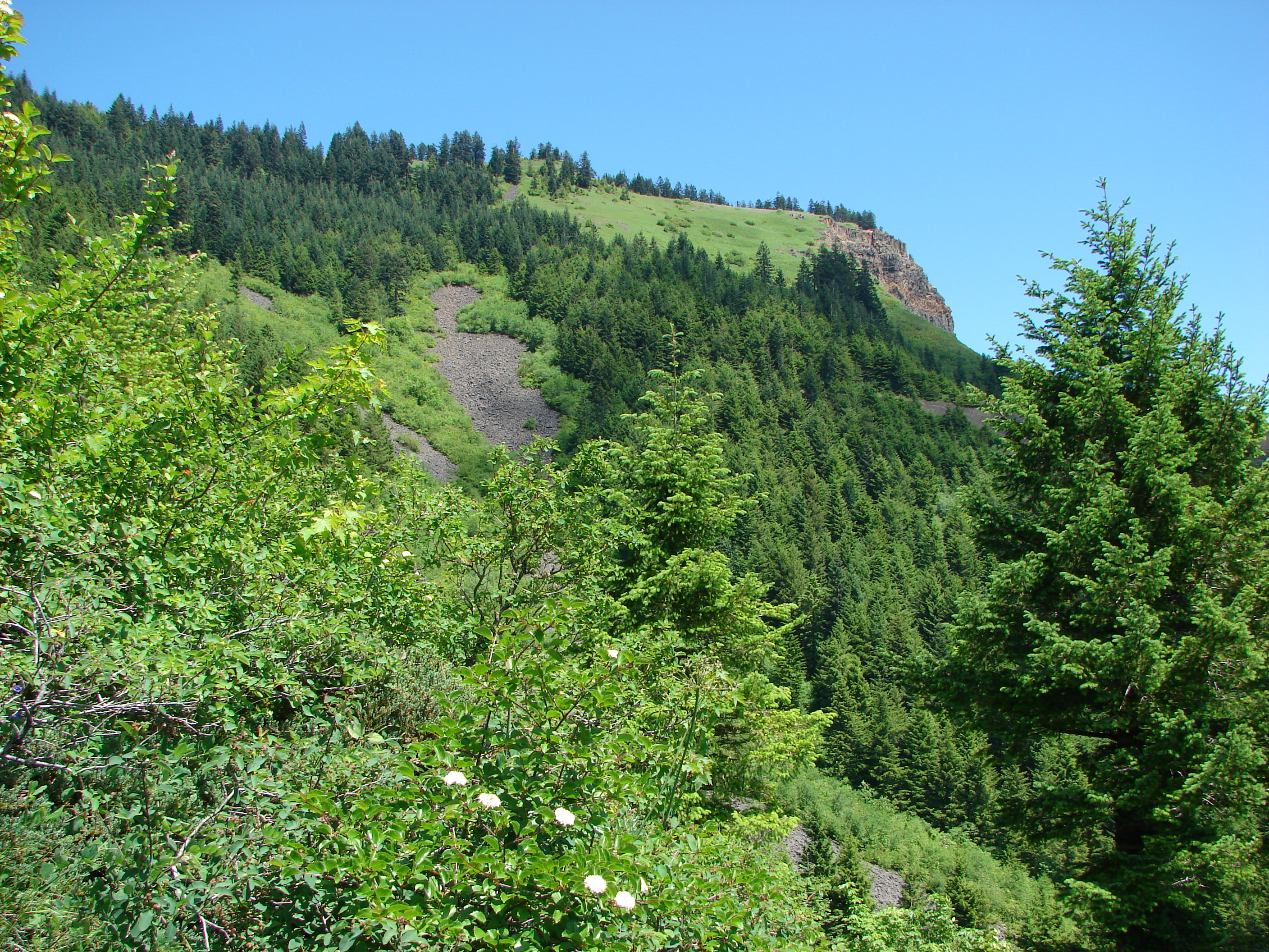
We had a little difficulty finding the correct path due to our not noticing the small temporary trail sign at first. The OHV use was obvious given the width and condition of the trail. We followed this wide path for a mile to an opening which provided the first view of Mt. Hood. Shortly after the opening the tail narrowed leaving the OHV damage behind.

Rhododendrons bloomed in mass along the trail and we spotted several patches of avalanche lilies proving that snow had melted not too long before.

Avalanche lilies
Avalanche lilies

Next the trail entered a meadow of beargrass which was still, for the most part, not in bloom. I hoped that this would not be the case when we reached the next viewpoint in a meadow with a memorial bench.

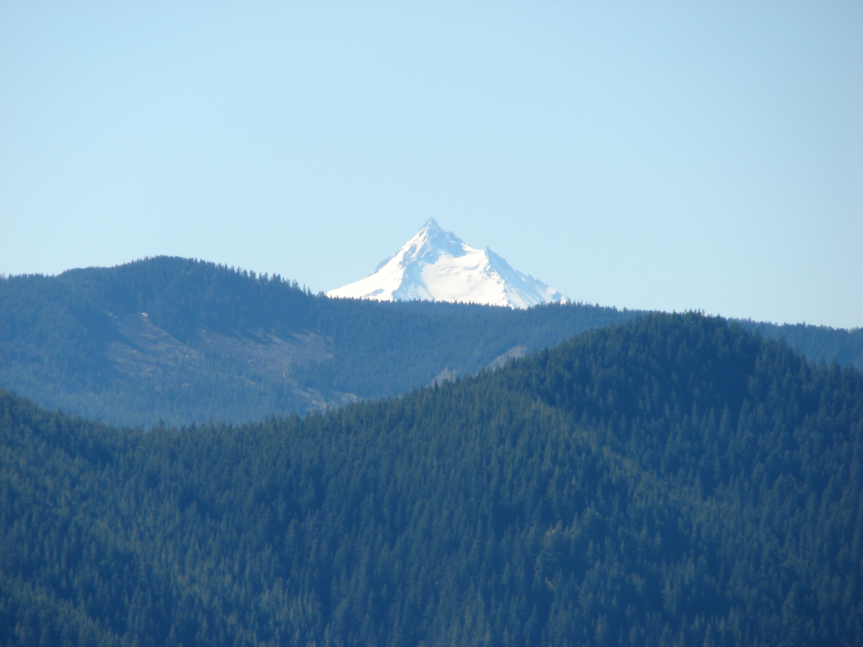
The bench meadow did not disappoint. A good number of beargrass plumes rose up while paintbrush and penstemon added red and purple to the ground. The view of Mt. Hood was great and a pair of hummingbirds zoomed about visiting the flowers. One of them even landed long enough for me to get a couple of pictures.

Mt. Hood from the bench meadow

Continuing along the path we reached a junction with the Douglas Trail and turned SE along it toward Wildcat Mountain. A short side trail led up to the summit where an old lookout tower once stood. In order to get a decent view we had to follow a very faint trail through rhododendrons toward Mt. Hood. When we reached an opening not only did we have a view of Mt. Hood but Mt. Adams and Mt. Rainier now appeared to the NW. After returning to the Douglas trail we continued SE to another viewpoint on a rocky section of the ridge. More wildflowers covered this area and Mt. St. Helens and the top of Mt. Jefferson now joined the views.

Mt. Jefferson from the rock garden

We continued on the Douglas trail to it’s end at the Plaza trail and turned around. Clouds had begun forming around the mountains changing the views on the way back. We stopped again at the bench (I don’t think you could not stop here) where I took a few more pictures.
288
We heard a few gunshots on the way back which sounded like they may have been coming from the Douglas trail head, and learned from a couple of hikers that they had run into a pair of OHVs (illegally) on the trail. We hadn’t heard them, but the presence was easy to see. The trail had been torn up and fresh damage done to several trees and plants along the path.

It’s hard to understand why some people just can’t follow the rules or how they could possibly leave such a mess without regard to anyone or anything else. If you were able to bring it in you can certainly pack it back out. That’s enough of a rant from me 🙂 Despite the depressing state of the trail head and OHV damage it was a great hike with wonderful views. The best thing that could happen to this area is to have more responsible/legal users. Maybe that would discourage the bad seeds and give the area a chance to recover from their damage. Happy (clean) Trails

Categories
Columbia Gorge North Hiking Trip report Washington

Table Mountain

If at first you don’t succeed, try, try again. After our recent string of cloud obscured views I was determined to break the streak. I had been watching the weather forecast all week and decided everything was lining up perfectly for a return to the Columbia Gorge and another attempt at a view of the Cascades. The nasty weather and the poncho attack on Hamilton Mountain needed to be avenged so for this hike I picked Table Mountain.

Table Mountain is located less than 5 miles east of Hamilton Mountain. It should have been what I was looking at from the saddle when I was sucker punched by the poncho during that hike. Much of Table Mountain collapsed into the Columbia River centuries ago leaving dramatic cliffs on the south face. With an elevation of 3417′ it is nearly 1000′ taller than Hamilton Mountain so the potential for views is great.

We woke up to a beautiful sunny morning but as we approached Portland an ominous cloud hung to the east of the city. The skies all around were blue and we hoped that Table Mountain was far enough to the east to be clear of the cloud. We formulated a plan b just in case when we reached Hamilton Mountain which was once again covered in clouds, but when we arrived at the trail head behind Bonneville Hot Springs the summit of Table Mountain was cloud free. With blue skies to the north and east we decided to give it a try.

The first 2.2 miles of the trail pass through a pretty forest, first on a volunteer created trail, then following an old road up to the Pacific Crest Trail (PCT). This first section was nice but unremarkable although we did come across some ripe salmonberries to sample. After a short walk on the PCT we reached the sign for the loop trail to the summit of Table Mountain. The aptly named Heartbreak Ridge Trail gains 1770′ in 1.5 miles. In order to do this the trail heads up with a vengeance. After 0.6 miles (and 800′ of elevation) the trail arrived at a saddle viewpoint. To my dismay the clouds that had been to the west were now heading east obscuring much of the view and had now covered Table Mountains summit. The trail then dipped down to the base of a 500 yard long rock slide where we spotted our first beargrass bloom of the year (on a hike not from the car).

The trail appears to end at the rock slide but the rocks are the trail. Following poles we scrambled up the rocks to the continuation of the trail. This part proved to be quite fun. Just a few tenths of a mile after reaching the trails continuation we reached the meadows on the summit. An all to familiar view greeted us here. We had come all this way and couldn’t see more than a few hundred feet due to clouds. The meadows were filled with various wildflowers creating a colorful display and many plumes of beargrass stood at attention along the meadows edges.

As we headed south along the summit trail toward the viewpoint at that end a faint window opened in the clouds and there stood Mt. Hood. The clouds had begun to slowly break up and by the time we reached the viewpoint better and better views were opening up.
201
We could now see Mt. Hood and the tip of Mt. Jefferson at times. Below we could see the Bonneville Dam on the Columbia River and the Heartbreak Ridge trail as it crossed the viewpoint saddle. We spent awhile here waiting for the openings and then headed back down the trail to find a spot for lunch.

We chose a spot that offered a view to the north and east in addition to Mt. Hood to the south. As we ate glimpses of Mt. Adams and Mt. Rainier began to appear. We eventually traveled further north on the summit loop to a second viewpoint at that end. There we discovered a beargrass meadow and ever improving views of Mt. Adams, Mt. Rainier, and also the rim of Mt. St. Helens.

Mt. Adams
Mt. Adams

We never quite got a clear view of any of the Washington peaks due to a pesky line of little clouds but after getting our fill of the view we headed down the west ridge. This trail was almost as steep as it made its way down and contained a lot of loose rocks. In addition it traveled close enough to the edge of the ridge that anyone with a fear of heights might really have a hard time. That being said the views from this trail were great. Mt. Hood lay ahead while behind was Table Mountain and the rock slide we had scrambled up.
521
The going was slow but we eventually made it down to the PCT. I had no takers when I asked if anyone wanted to go around again when we reached the Heartbreak ridge junction so we returned to our car satisfied with the days views and ready to plan our next adventure. Happy Trail.

facebook photos: https://www.facebook.com/deryl.yunck/media_set?set=a.10201335132527489.1073741836.1448521051&type=3
way too many flickr photos: https://www.facebook.com/deryl.yunck/media_set?set=a.10201335132527489.1073741836.1448521051&type=3