
Our lack of rain unfortunately continued for another week allowing the numerous fires in Oregon and Washington to remain active. To top it off a warm, dry East wind arrived in time for the weekend creating a red flag warning for high fire danger and blowing the smoke from the current fires into Western Oregon. The combination of the smoke and unseasonably high temperatures had me searching for a suitable hike. My Plan A, B, and C hikes were all forecast to be in the smoke (and warmer than I’d prefer in October) then I remembered seeing that Hike Oregon had gone up Mount Washington’s North Ridge back in August using a climbers trail off of the Pacific Crest Trail. I had been interested in that trail ever since hearing about it during the Chemeketans Route Finding course we’d taken and then later passing it on our hike to Mount Washington Meadows in 2017 (post). A quick of check of the forecast there showed clear (but breezy) skies and a high below 60 at the mountain, I was sold.
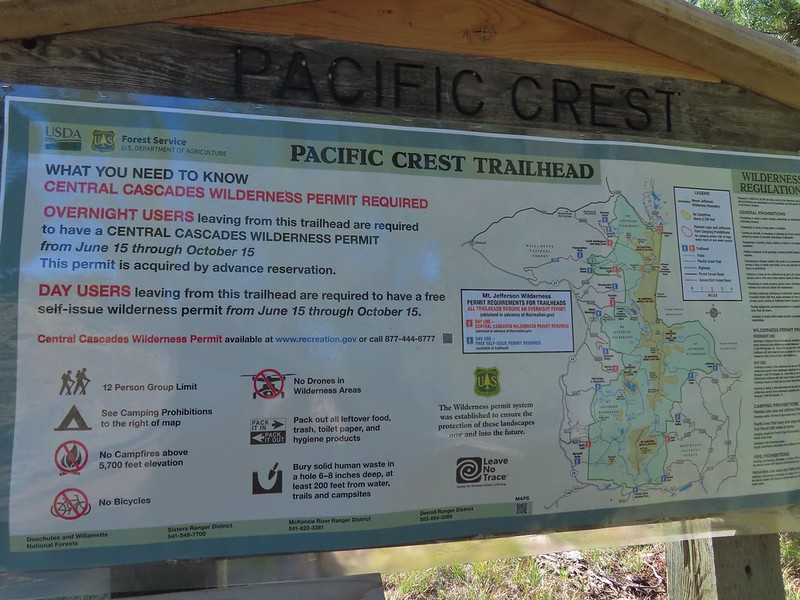
Just as we had done in 2017 I parked at the Pacific Crest Trailhead at Big Lake which at this time does not require a Cascade Wilderness Permit for day-use (one is required for overnight stays).
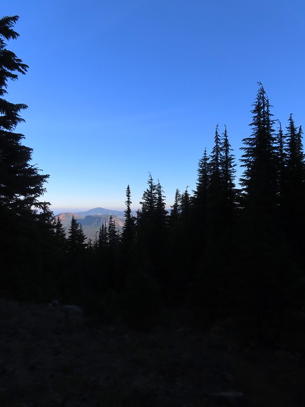
I set off South on the PCT shortly before sunrise and followed it for three miles to a cairn marking the obvious climbers trail.
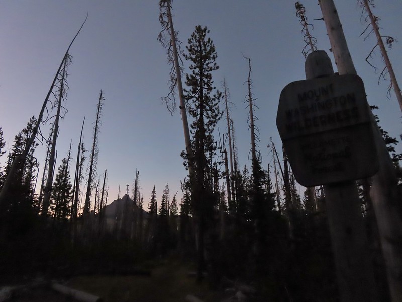 Mount Washington from the Mt. Washington Wilderness boundary just a few hundred feet from the trailhead.
 Three Fingered Jack to the North from the PCT.
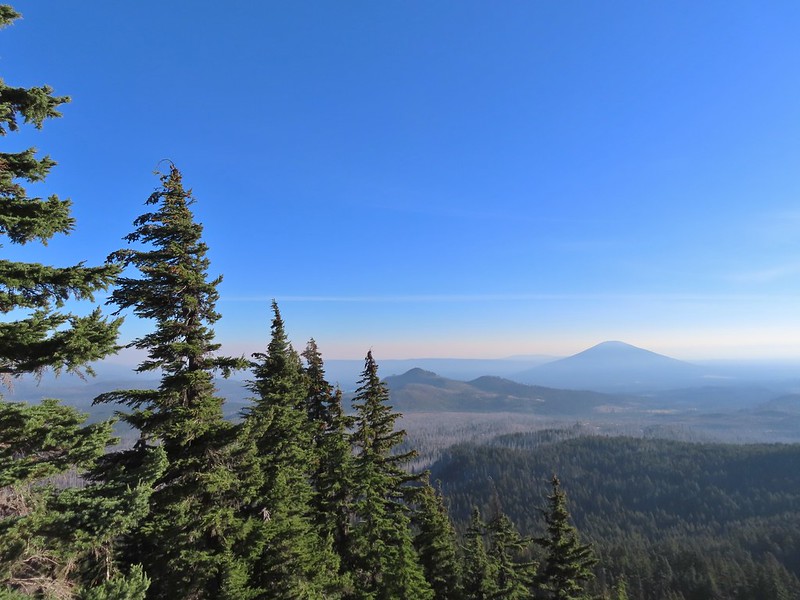
 From left to right – Sand Mountain (post), Hoodoo Butte, and Hayrick Butte.
 Mount Washington
 Sunrise on Hoodoo Butte.
 Sunlight hitting the spire of Mount Washington.
 Hayrick Butte and Three Fingered Jack at sunrise.
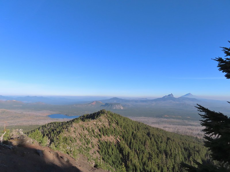
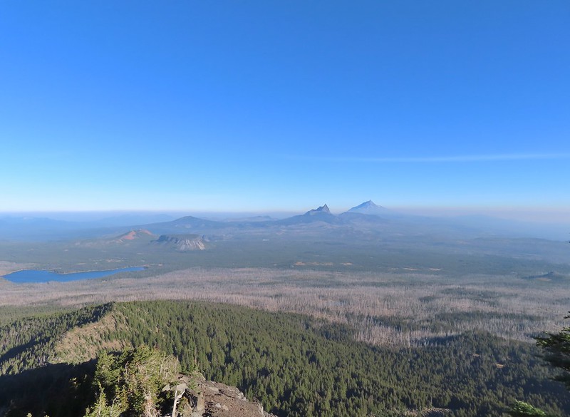
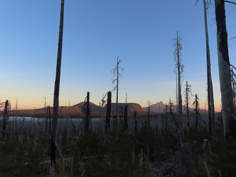 Big Lake, Hoodoo, Hayrick Butte, and Three Fingered Jack.
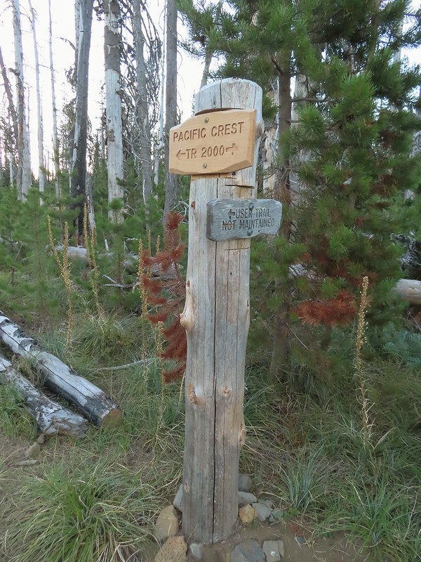 Just over two miles from the trailhead I passed a sign for the non-maintained use trail from the private Big Lake Youth Camp.
 Shortly before reaching the climbers trail the PCT left the 2011 Shadow Lake Fire scar.
 The cairn and climbers trail from the PCT.
I turned left onto this trail which was fairly easy to follow through the trees.
 Huckleberry leaves turning color.


 There were a few logs to navigate and keeping an eye on the tread was helpful.
The trail climbed moderately at first then steepened as it went, with occasional flatter sections before reaching the ridge.

 Maxwell Butte (post) behind Hoodoo and Hayrick Butte.

 Mount Washington

I stopped here for a moment to admire a raptor that was hovering high above the ridge (small black dot in the middle of the photo).
 The only movement that I could see was when it tilted its tail feathers which would catch the sunlight.
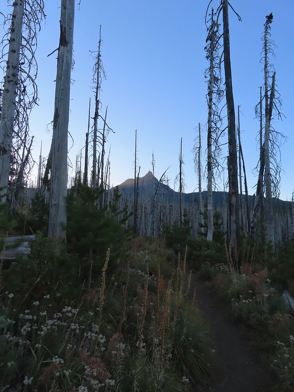
 First view of Mt. Jefferson behind Three Fingered Jack.
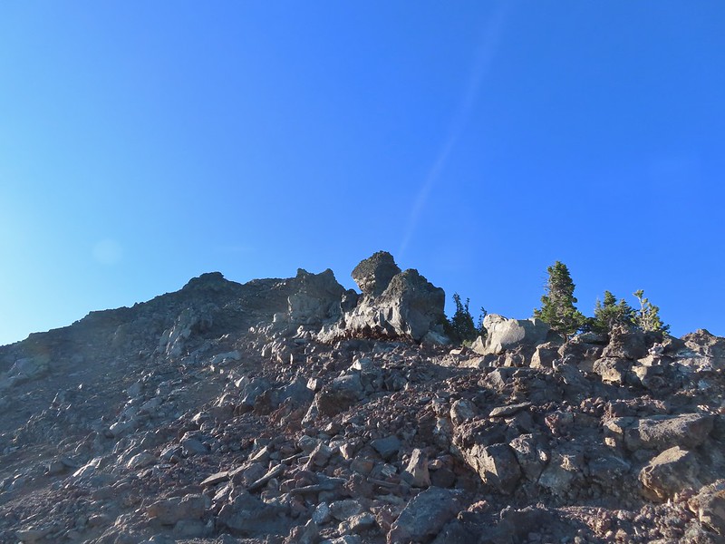
 Coming up on the ridge.
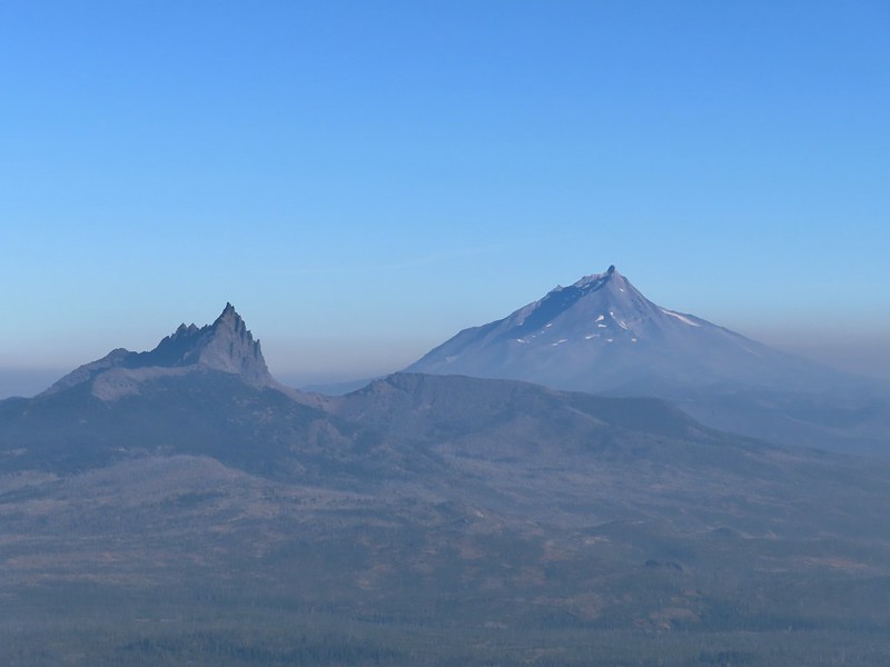
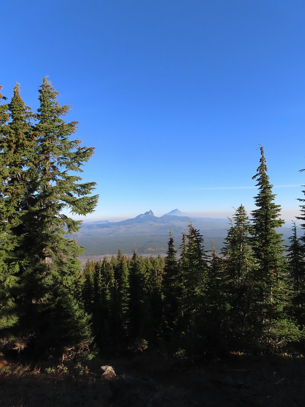 Three Fingered Jack, Mt. Jefferson, and a lot of smoke to the North.
 Cache Mountain and Black Butte (post) to the NE.
Approximately 1.5 miles from the PCT the climbers trail turned North along the ridge toward Mount Washington.
 View along the ridge to Mount Washington.
 That East wind was really noticeable as I made my way along the open ridge crest.
I didn’t have much trouble following the trail for the first three-quarters of mile up the ridge. It was typical Cascade volcanic rock which isn’t the most fun rock to hike through but the views were great.
 Three Fingered Jack and Mt. Jefferson to the left. Green Ridge (post) across the center, and Cache Mountain & Black Butte to the right.
 Big Lake came into view as I climbed.
 One of the steeper sections I went up. The spire is poking up on the right.
 Mount Washington’s shadow.
 View back down the ridge.
 I was hoping to get up and over these rocks where the map showed a more level bench but I wound up reaching a chute where I was unsure of the correct route. The further up I’d gone the more braided the trail became and I may have been too far left. A climber had passed me way back on the PCT but if I had been able to watch him go up here I may have found a better route.
 The chute that turned me back. It’s a bit hidden by the rocks in the foreground but there was no way across that I would have been comfortable with and scrambling up looked way too sketchy for my taste (especially w/o a helmet).
I sat down here and took a brief break to catch my breath and have a snack. I was just over 7100′ in elevation and had been feeling that on the climb up.
 My shadow on the left from my break spot.
 This was the place I’d come up.
 Zoom of Three Fingered Jack and Mt. Jefferson
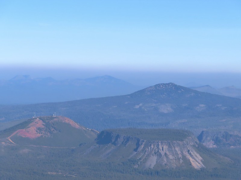 With all the smoke I hadn’t noticed Coffin (flat top) and Bachelor Mountains (post) beyond Hoodoo, Hayrick, and Maxwell Buttes.
After catching my breath I started carefully down, pausing often to admire the view.
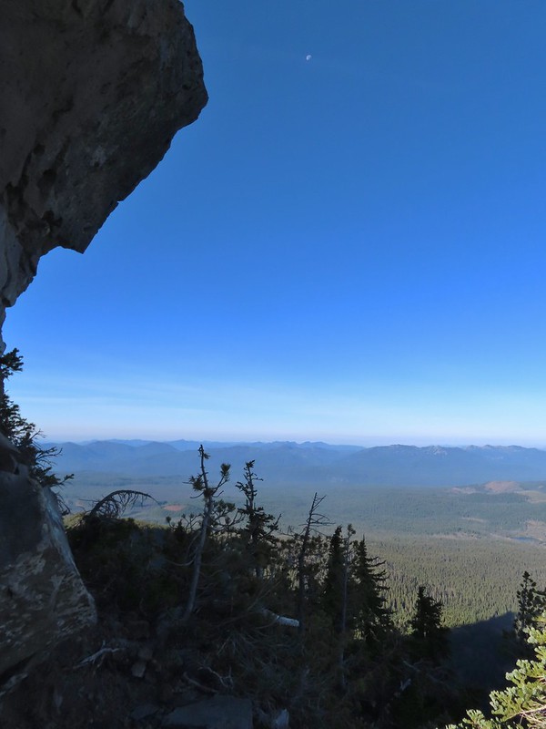 The Moon overhead to the West.
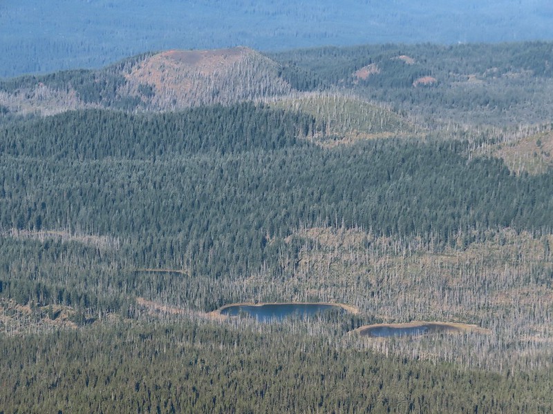 Patjens Lakes (post) in the forest below.
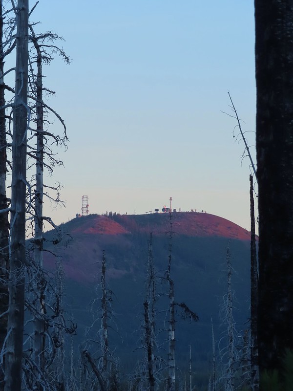
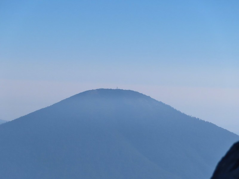 Lookout tower on Black Butte.
 Unfortunate that my timing once again put the Sun directly in line with my view.
I passed three more hikers heading up the ridge on my way down and at one point wound up following a wrong trail too low on the ridge and had to scramble back up to the correct one.
 Using a tree to try and get a better view.
 A framed Mt. Jefferson.
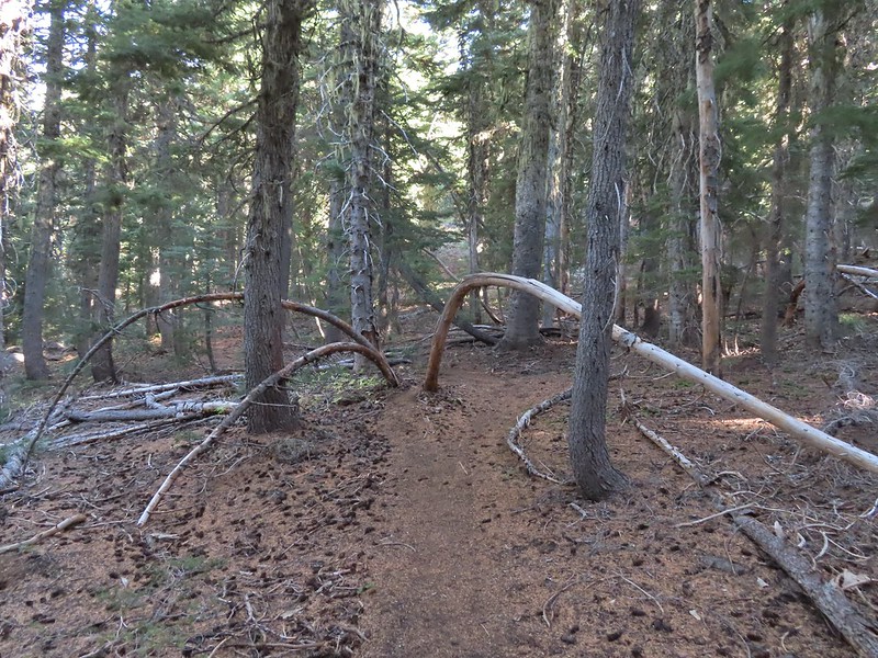 Sometimes it’s the little things, like these bent trees that I really appreciate on a hike.
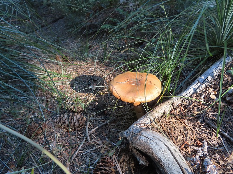 This mushroom casting a shadow was another one.

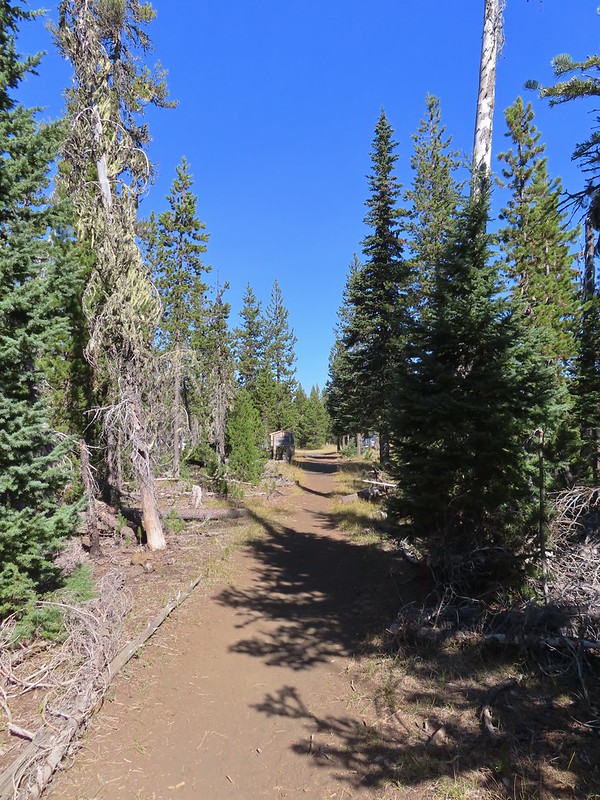
When I got back to the PCT I turned right and hiked the three miles back to the trailhead.

 Looking back at Mount Washington from the PCT.
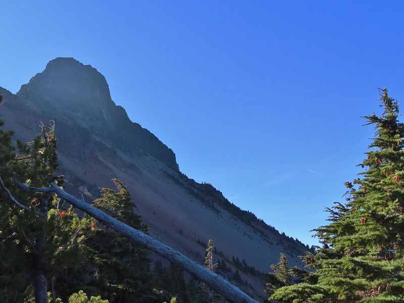
 Three Fingered Jack
 Hoodoo and Hayrick Buttes behind Big Lake.
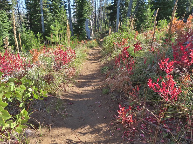 Huckleberry bushes and ferns adding some Fall colors.
 The best Fall colors were near the trailhead.

 The trailhead from the wilderness boundary sign.
This hike came to 10.7 miles with a little over 2700′ of elevation gain. In total I saw 7 hunters, 4 climbers, and two fellow hikers, not bad for a sunny Saturday. It might not be one for those uncomfortable with heights or climbing/descending loose volcanic rock (for those reasons it was a good choice since Heather is still sidelined) but if you don’t mind those things this would be a worthwhile outing.

When I got back to Salem around 2pm it was 90 degrees, in mid-October! The good news is that the high pressure system causing the warm, dry weather is supposed to break up this week with rain to follow. Hopefully it will be enough to put an end to the fires. Happy Trails!
Flickr: Mount Washington North Ridge

4 replies on “Mount Washington North Ridge – 10/15/2022”
I’ve climbed Washington twice via the north ridge and don’t recall any non-technical route to the summit. The easiest is low 5th class on very poor rock. Turning back when you did seems really smart.
[…] Washington (post), Belknap Crater (post), and the Three […]
[…] Fingered Jack to the left behind the Three Pyramids (post) and Mt. Washington (post) on the […]
[…] ridge on the left of Mt. Washington is the North Ridge (post) which is used by mountain […]